River
Arno
241 km from source to mouth · Italy.
 ItalyFlows into Ligurian Sea8th longest in Italy
In numbers
Length
241km
Average flow
100m³/s
Basin
8,247km²
Drop
354m
from 351 m to -3 m
Country
1
The journey
From source to mouth
241 km of river and 68 stops on the way: 40 towns and cities on its banks, dams, bridges and the tributaries that feed it.
- 0 kmMonte Falteronaat 351 m
- 13 kmBibbiena6,394 people
- 30 kmSubbiano3,620 people
- 44 kmPratantico-Indicatore3,067 people
- 45 kmPonte Buriano
- 64 kmCiuffennatributary
- 67 kmMontevarchi24,081 people
- 69 kmTerranuova Bracciolini5,983 people
- 73 kmSan Giovanni Valdarno16,571 people
- 83 kmFigline Valdarno13,287 people
- 87 kmIncisa in Val d'Arno4,566 people
- 95 kmRignano sull'Arno3,343 people
- 95 kmPonte di Rignano
- 105 kmSievetributary
- 105 kmPontassieve9,890 people
- 109 kmSieci3,416 people
- 117 kmBagno a Ripoli5,121 people
- 118 kmPonte di Varlungo
- 119 kmPonte a Ema8,412 people
- 120 kmPonte Giovanni da Verrazzano
- 121 kmCampo di Marte88,588 people
- 121 kmPonte San Niccolò
- 122 kmPonte alle Grazie
- 123 kmPonte VecchioUNESCO World Heritage
- 123 kmPonte Santa Trinita
- 124 kmPonte alla Carraia
- 124 kmPescaia di Santa Rosa
- 124 kmFlorence367,150 people
- 124 kmPonte Amerigo Vespucci
- 125 kmPonte alla Vittoria
- 126 kmPonte della tramvia
- 127 kmPasserella dell'Isolotto
- 129 kmIndian Bridge
- 130 kmGrevetributary
- 130 kmMugnonetributary
- 133 kmAutostrada A1 bridge
- 134 kmSan Donnino5,772 people
- 135 kmSan Mauro3,091 people
- 137 kmSigna12,602 people
- 137 kmLastra a Signa11,504 people
- 143 kmBisenziotributary
- 143 kmOmbrone Pistoiese Rivertributary
- 151 kmPesatributary
- 152 kmMontelupo Fiorentino11,177 people
- 155 kmCapraia e Limite5,920 people
- 155 kmLimite4,530 people
- 159 kmEmpoli34,394 people
- 161 kmSpicchio-Sovigliana8,249 people
- 170 kmSan Miniato Basso26,365 people
- 173 kmFucecchio14,479 people
- 177 kmSanta Croce sull'Arno11,685 people
- 180 kmMontopoli4,019 people
- 181 kmCastelfranco di Sotto8,291 people
- 184 kmSanta Maria a Monte6,438 people
- 192 kmMontecalvoli3,171 people
- 195 kmEratributary
- 195 kmPontedera19,518 people
- 197 kmCalcinaia3,157 people
- 200 kmVicopisano5,593 people
- 202 kmFornacette5,868 people
- 203 kmCascina40,512 people
- 212 kmCalci4,529 people
- 226 kmPonte della Vittoria
- 227 kmPonte della Fortezza
- 227 kmPonte di Mezzo
- 228 kmPisa88,737 people
- 228 kmPonte Solferino
- 230 kmBarbaricina3,600 people
- 241 kmMarina di Pisa4,000 people
- 241 kmLigurian Seaat -3 m
Water level along the river (RiverATLAS; the height is exaggerated). Towns: GeoNames and Wikidata; bridges, dams and tributaries: Wikidata.
Italian river
At the mouth it carries 100 m³/s on average: an Olympic pool every 25 seconds. It drops from 351 m to -3 m, 1.5 m per kilometre on average. Its basin covers 8,247 km², about the size of PR. 2.4 million people live in it. Highest water: from November to January; lowest: from July to September. No large dam holds it back: it is one of the world's free-flowing rivers.
Where to start
- FlorenceLargest city on its banks · 367,150 people
- Florence Airport, Peretola (FLR)Nearest airport with scheduled flights, 5 km from the cityCar hire at FLR airport (Firenze)Discover Cars · Affiliate link↗
- On the water10 ferry piers, marinas, boat rentals and boat ramps along the river (OpenStreetMap)
- From May to SeptemberThe best months to visit
Arno, month by month
Highest water: from November to January
Lowest water: from July to September. Best months to visit: from May to September.
From about 39 m³/s in the lowest month to 250 m³/s in the highest. An estimate: the monthly flow is modelled from the lowest and highest months of WaterGAP (RiverATLAS, 1971–2000) and the rain and snow along the river (WorldClim). Dams change the real rhythm. The chip is the average air temperature; below it, the month's rain.
Plan the trip
Plan the trip: boat trips, a bed by the river, a car
Some links above are affiliate links: if you book through them we may earn a commission, at no extra cost to you. It never changes what the data on this page says.
The basin
Arno: the basin in numbers
9,150 km² of land send their water to this river. This is what lives on it.
- 2.4millionpeople live in the basin
- 261/km²people per km²
- 324maverage altitude of the basin
- 842mmof rain a year (basin average)
- 12.9°Caverage air temperature
- 5%protected areas
- 1.4%covered by lakes
- 0.1km³held in reservoirs
What covers the basin
- 33% Forest
- 36% Cropland
- 37% Pasture
- 14% Towns and cities
RiverATLAS (HydroATLAS v1.0, CC BY 4.0): land cover, people, protected areas, glaciers and dams over the whole basin upstream of the mouth.
Along the river
Arno: what you find on the way
- 40WeirsPescaia del Molino Laura, Pescaia di San Jacopo al Girone, Pescaia di Sant'Andrea a Rovezzano and 37 more
- 8Locks
- 9Waterfalls
- 8Boat rampsscalo fiume arno per canoe and 7 more
- 1Ferry piersMolo di Bandella
- 1MarinasPorto di Pisa Boccadarno
- 2River beachesSpiaggetta, Bagno Amalia
From OpenStreetMap, within 1.8 km of the river. Not mapped is not the same as not there.
Cross-checked with our atlases
Arno in our other atlases
What our sister atlases know about the waterfalls on this river, the lakes it flows through, the beaches at its mouth, the mountains where it rises and the islands off its mouth.
 9beaches at the mouth and on the banksCoastya
 7mountains at the sourcePeakyas
 1island off the mouthIslandyas
Beaches (9)
At the mouth (25 km) and on the banks, by Coastya
- Spiaggia libera per cani11 km away25.2°C
- Spiaggia Lido di Camaiore24 km away25.2°C
- Spiaggia Viareggio21 km away25.2°C
- Cala del Leone25 km away25.0°C
- Spiaggia di Calignaia24 km away25.0°C
- Spiaggia per Cani19 km away25.0°C
- Spiaggia del Felciaio18 km away25.0°C
- La Lecciona18 km away25.2°C
1 more on CoastyaOpen Coastya ↗
Mountains at the source (7)
Within 15 km of the source, by Peakyas
- Pratomagno8.5 km away1,592m
- Croce di Pratomagno8.0 km away1,591m
- Monte Pianellaccio7.7 km away
- Poggio Stefanieri8.1 km away
- Poggio Massa Nera9.7 km away
- Poggio Ginestrino8.2 km away
- Monte Castellonchio13 km away
Islands off the mouth (1)
Within 30 km of the mouth, by Islandyas
- Meloria16 km away
Islandyas is coming soonOpen Islandyas ↗
From space
The source and the mouth, seen from orbit
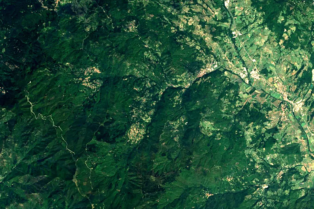
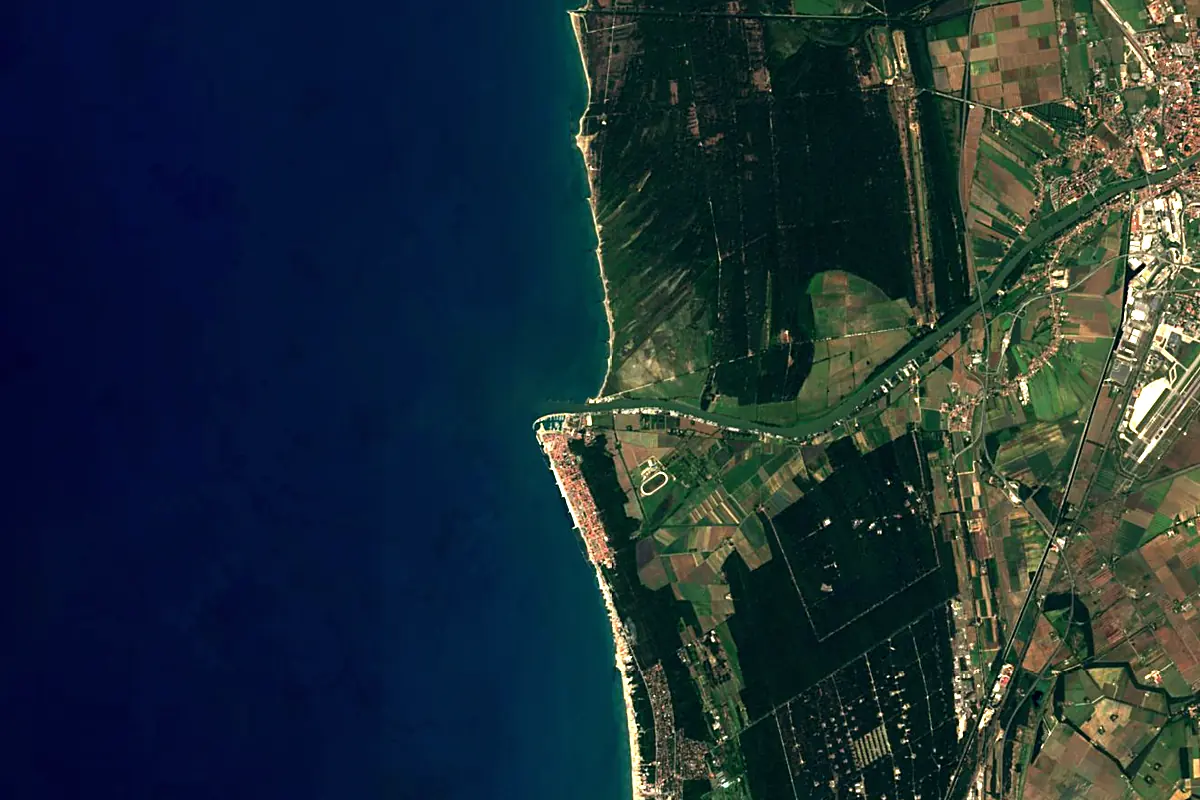
Sentinel-2 cloudless 2016 by EOX IT Services GmbH (contains modified Copernicus Sentinel data 2016), CC BY 4.0. The glowing line is the river as drawn by RiverATLAS.
Photos
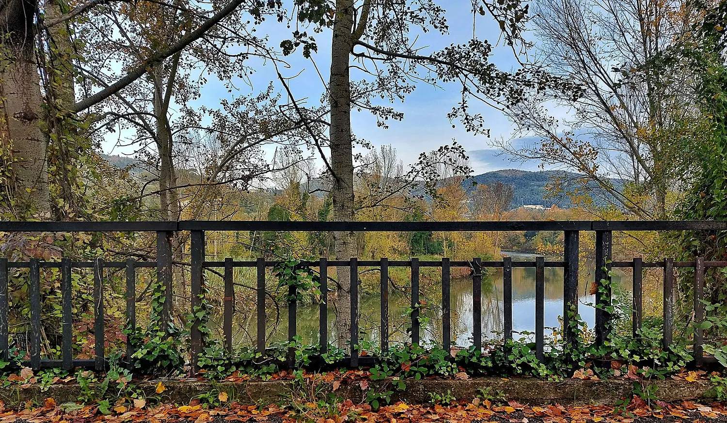
Arno in pictures
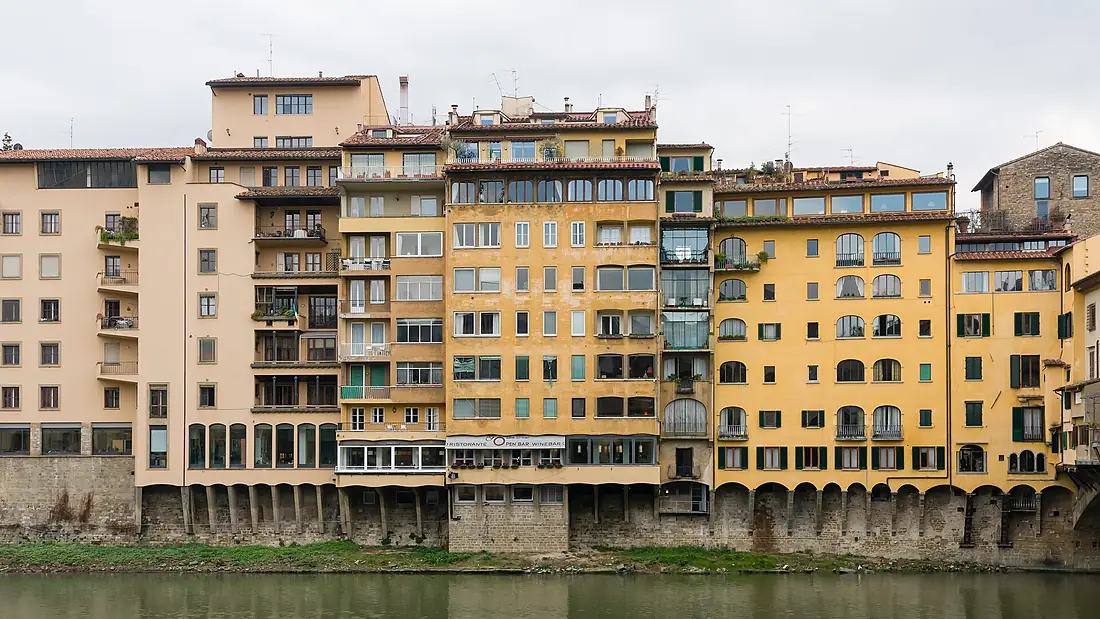
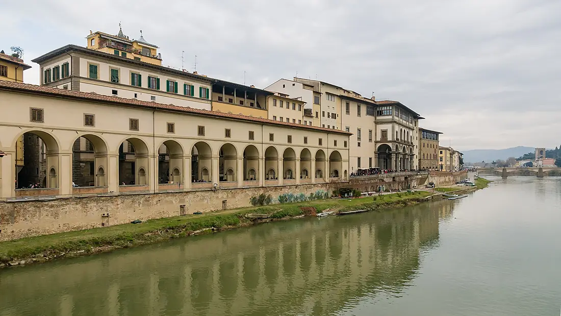
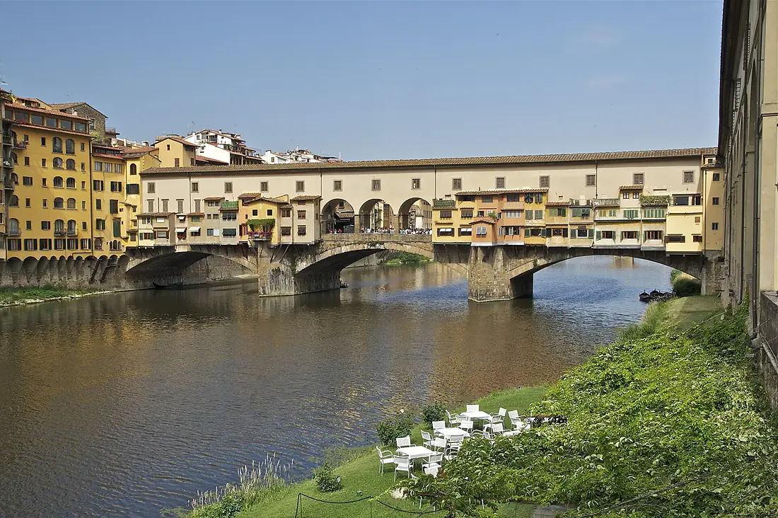
Tributaries
Where it flows, and what flows into it
Tributaries (14)
Also: Sieve, Era, Elsa, Bisenzio, Pesa, Ombrone Pistoiese River, Mugnone, Greve, Ambra, Ciuffenna, Egola, Staggia River, Agna of Pratovalle, Chiassa
 France
Where these numbers come from
| Name, length, places | Wikidata (Q115457) · CC0 |
|---|---|
| Course, profile, basin | RiverATLAS v1.0 (HydroATLAS, Linke et al. 2019) · CC BY 4.0 — followed from the source to the mouth given by Wikidata |
| Flow | WaterGAP (RiverATLAS), 1971–2000 · CC BY 4.0 |
| Climate along the river | WorldClim (RiverATLAS), 1970–2000 · CC BY 4.0 |
| Towns, bridges, dams | Wikidata · CC0; GeoNames · CC BY 4.0 |
| Along the river | © OpenStreetMap contributors · ODbL |
| Images | EOX Sentinel-2 cloudless 2016 · CC BY 4.0; Wikimedia Commons |
| Our other atlases | Coastya, Peakyas, Islandyas — Wikidata · CC0; © OpenStreetMap contributors · ODbL; GeoNames · CC BY 4.0; HydroLAKES · CC BY 4.0; NOAA OISST |
Every source and licence is on the data sources page.
The family
Do you prefer beaches, lakes, mountains, waterfalls, islands, rivers or canyons?
Same idea, other landscapes: field atlases built on open data, month by month, in seven languages.
beaches Find your beach: sea temperature, sun and swimming month by month.Visit
  lakes
lakes Every lake on Earth: water temperature, ice, depth and the shore.Coming soonVisit mountains
 Every summit in 3D: summit weather, the 0 °C line, huts and trails.Visit
  waterfalls
 Every waterfall: height, flow month by month and when it roars.Coming soonVisit islands
 Every island from the sea up: size, sea temperature, ferries and 3D.Coming soonVisit
  rivers
 Every river from source to sea: the journey, the flow and the basin in numbers.You are here
 canyons
 Every canyon cut to scale: depth to the floor, rim and floor temperatures, trails and viewpoints.Coming soonVisit