River
Otra
245 km from source to mouth · Norway.
 NorwayFlows into Skagerrak5th longest in Norway
In numbers
Length
245km
Average flow
150m³/s
Basin
3,740km²
Drop
894m
from 894 m to 0 m
Country
1
The journey
From source to mouth
245 km of river and 49 stops on the way: 2 towns and cities on its banks, dams, bridges and the tributaries that feed it.
- 0 kmBreidvatnat 894 m
- 1 kmBreidvatn6.8 km²
- 11 kmFlatastøylfossen
- 17 kmHartevatn7.0 km²
- 24 kmFossen
- 29 kmVatndalsvatnet14 km²
- 48 kmSollifossen
- 48 kmBotsvatn7.8 km²
- 51 kmBåsiefossane
- 57 kmNystøylfossen
- 59 kmStorestøylsfossen
- 65 kmLundefossen
- 70 kmKallefossen
- 73 kmØyfossen
- 76 kmPrestefossen
- 78 kmHallandsfoss
- 85 kmFlåni1.3 km²
- 86 kmFlårendsfossen
- 87 kmGrindeskarfossen
- 98 kmHagefossen
- 103 kmHeknefossen
- 115 kmHeisfossen
- 122 kmReiårsfossen
- 122 kmReiarfossen
- 122 kmStore Reiårsvatn0.8 km²
- 140 kmRysefossen
- 164 kmByglandsfjorden45 km²
- 166 kmSyrtveitfossane
- 167 kmLislefoss
- 173 kmBirkelandsfossen
- 176 kmFennefossen
- 176 kmFennefoss
- 179 kmHornnes bridge
- 181 kmBreidflå1.9 km²
- 183 kmStorefoss
- 198 kmSoga
- 203 kmKilefjorden7.3 km²
- 208 kmKattefoss
- 209 kmSjøfossane
- 217 kmSteinfossen
- 220 kmPaulen bridge
- 221 kmUrfossen
- 222 kmIkkonfoss
- 226 kmVennesla12,816 people
- 227 kmVenneslafjorden1.7 km²
- 227 kmHallandsfossen
- 242 kmOddernesbrua
- 243 kmChristian Quartbroa
- 243 kmLundsbroa
- 243 kmKristiansand117,237 people
- 245 kmSkagerrakat 0 m
Water level along the river (RiverATLAS; the height is exaggerated). Towns: GeoNames and Wikidata; bridges, dams and tributaries: Wikidata.
River in Agder, Norway
At the mouth it carries 150 m³/s on average: an Olympic pool every 17 seconds. It drops from 894 m to 0 m, 3.6 m per kilometre on average. Its basin covers 3,740 km², about the size of CV. 32,000 people live in it. Highest water, with the snowmelt: from April to May; lowest: from December to March. It is heavily dammed: reservoirs can hold 95% of a year's flow.
Where to start
- KristiansandLargest city on its banks · 117,237 people
- Kristiansand Airport (KRS)Nearest airport with scheduled flights, 8 km from the cityCar hire in KristiansandDiscover Cars · Affiliate link↗
- On the water31 ferry piers, marinas, boat rentals and boat ramps along the river (OpenStreetMap)
- Kayak and canoe6 put-ins and rapids mapped (OpenStreetMap)
- From June to AugustThe best months to visit
Otra, month by month
Highest water: from April to May
Lowest water: from December to March. Melting snow makes up much of its water. Best months to visit: from June to August.
From about 47 m³/s in the lowest month to 380 m³/s in the highest. An estimate: the monthly flow is modelled from the lowest and highest months of WaterGAP (RiverATLAS, 1971–2000) and the rain and snow along the river (WorldClim). Dams change the real rhythm. The chip is the average air temperature; below it, the month's rain.
Plan the trip
Plan the trip: boat trips, a bed by the river, a car
Some links above are affiliate links: if you book through them we may earn a commission, at no extra cost to you. It never changes what the data on this page says.
The basin
Otra: the basin in numbers
3,788 km² of land send their water to this river. This is what lives on it.
- 32,000people live in the basin
- 8/km²people per km²
- 757maverage altitude of the basin
- 1,484mmof rain a year (basin average)
- 2.5°Caverage air temperature
- 26%protected areas
- 7.8%covered by lakes
- 3.9km³held in reservoirs
What covers the basin
- 55% Forest
RiverATLAS (HydroATLAS v1.0, CC BY 4.0): land cover, people, protected areas, glaciers and dams over the whole basin upstream of the mouth.
Along the river
Otra: what you find on the way
- 49WeirsPrestefossen and 48 more
- 2LocksStorstraumen
- 35WaterfallsBreifoss, Sarvsfossen, Sveigefoss and 32 more
- 6RapidsStraumane, Sessene, Soga and 3 more
- 9Boat rampsBjoren Vinteropplag and 8 more
- 6Ferry piersKristiansand, Color Line, Fjord Line and 3 more
- 15MarinasBygland båtforening, Bygland brygge, Byglandsfjord Båtforening and 12 more
- 12River beachesHonnevje, Marhyl, Tangen and 9 more
From OpenStreetMap, within 1.5 km of the river. Not mapped is not the same as not there.
Cross-checked with our atlases
Otra in our other atlases
What our sister atlases know about the waterfalls on this river, the lakes it flows through, the beaches at its mouth, the mountains where it rises and the islands off its mouth.
 32waterfalls on the riverCascadyas
 10lakes on its wayLakeyas
 3beaches at the mouth and on the banksCoastya
 224mountains at the sourcePeakyas
 9islands off the mouthIslandyas
Waterfalls (32)
On the river, by Cascadyas
- Heisfossenkm 104
- Reiårsfossenkm 110
- Fennefossenkm 159
- Fennefosskm 159
- Sogakm 179
- Sjøfossanekm 189
- Urfossenkm 200
- Hallandsfossenkm 206
24 more on CascadyasCascadyas is coming soonOpen Cascadyas ↗
Lakes and reservoirs (10)
Lakes it flows through, by Lakeyas
- Breidvatnkm 16.8km²
- Hartevatnkm 157.0km²
- Vatndalsvatnetkm 2614km²
- Botsvatnkm 437.8km²
- Byglandsfjordenkm 148 · 167 m deep45km²
- Breidflåkm 1641.9km²
- Kilefjordenkm 1847.3km²
- Venneslafjordenkm 2051.7km²
2 more on LakeyasLakeyas is coming soonOpen Lakeyas ↗
Beaches (3)
At the mouth (25 km) and on the banks, by Coastya
- Marvikakm 220 · cove17.6°C
- Hellevika7.2 km away · cove17.6°C
- Laksevika6.7 km away · cove17.6°C
Mountains at the source (224)
Within 15 km of the source, by Peakyas
- Kvannfjølli12 km away · prominence 634 m1,538m
- Gråsteinsnosi12 km away · prominence 150 m1,468m
- Merakknuten7.1 km away1,388m
- Hetta14 km away949m
- Nuten14 km away900m
- Haugen8.9 km away801m
- Kvennhushaugen8.4 km away777m
- Den brende haugen9.1 km away769m
216 more on PeakyasOpen Peakyas ↗
Islands off the mouth (9)
Within 30 km of the mouth, by Islandyas
- Flekkerøy8.3 km away6.2km²
- Odderøya1.2 km away0.7km²
- Justøy21 km away7.9km²
- Bragdøya3.0 km away0.7km²
- Skogsoy29 km away
- Andøya4.2 km away0.6km²
- Dvergsøya4.9 km away0.3km²
- Dybingen2.0 km away
1 more on IslandyasIslandyas is coming soonOpen Islandyas ↗
From space
The source and the mouth, seen from orbit
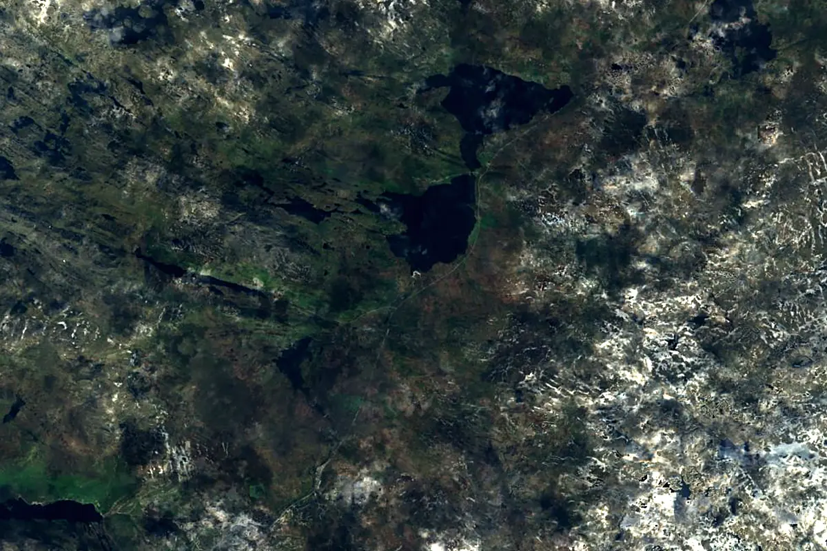
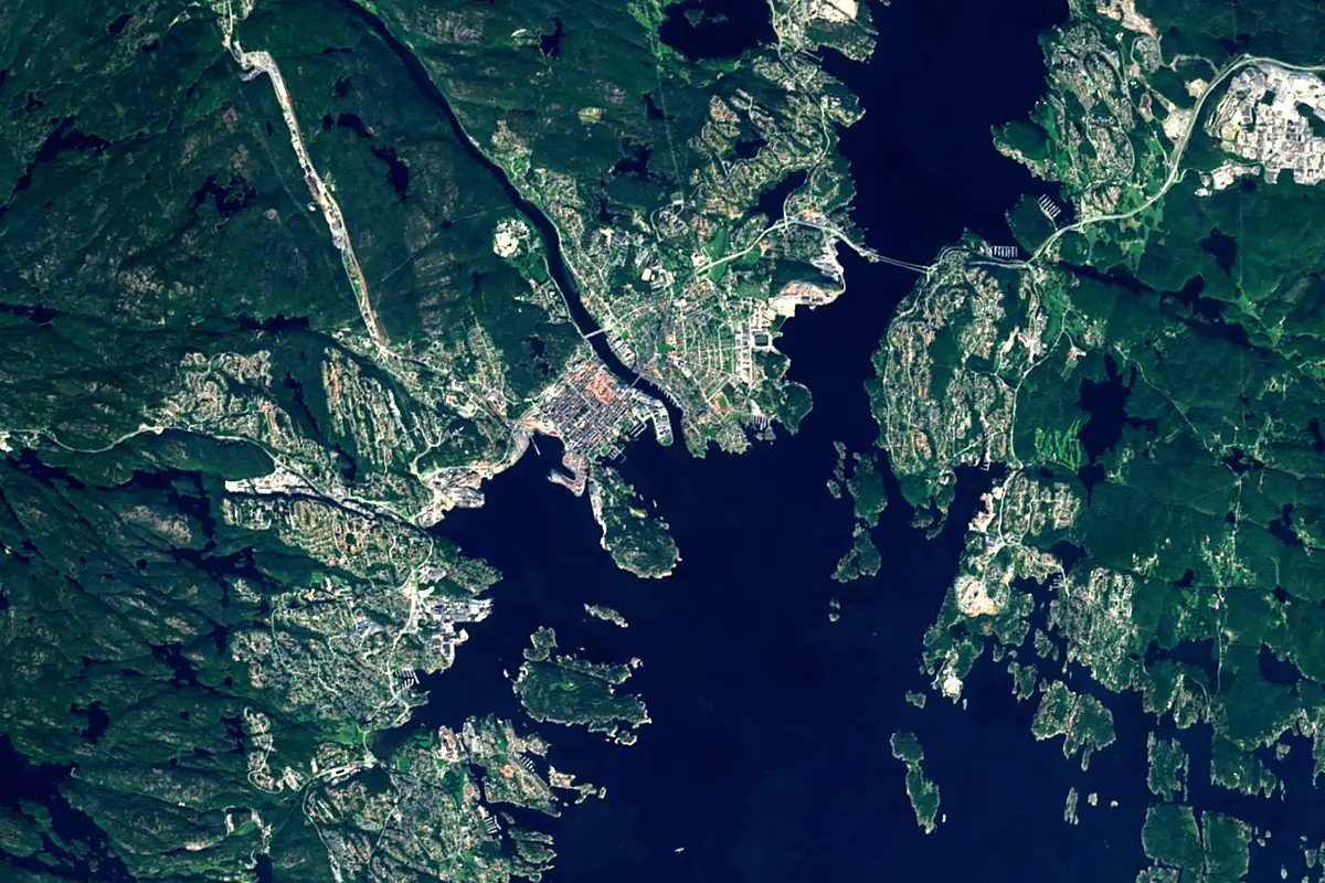
Sentinel-2 cloudless 2016 by EOX IT Services GmbH (contains modified Copernicus Sentinel data 2016), CC BY 4.0. The glowing line is the river as drawn by RiverATLAS.
Photos
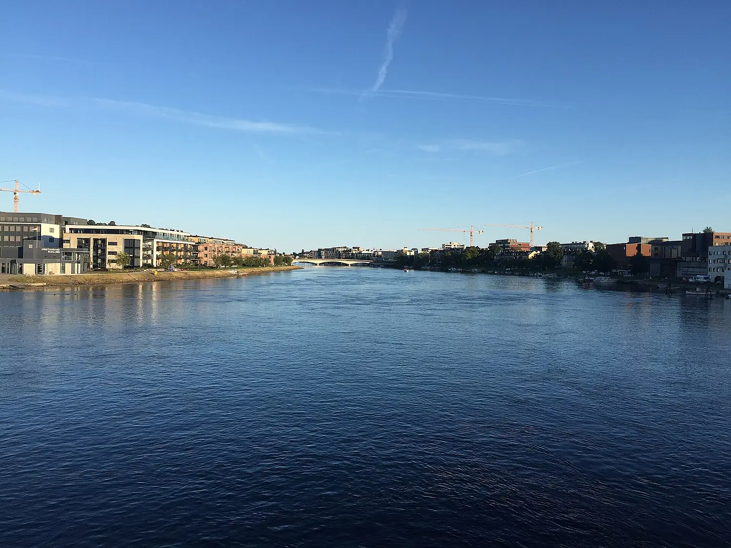
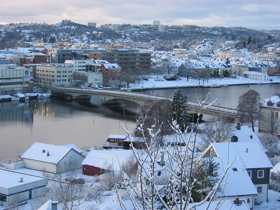
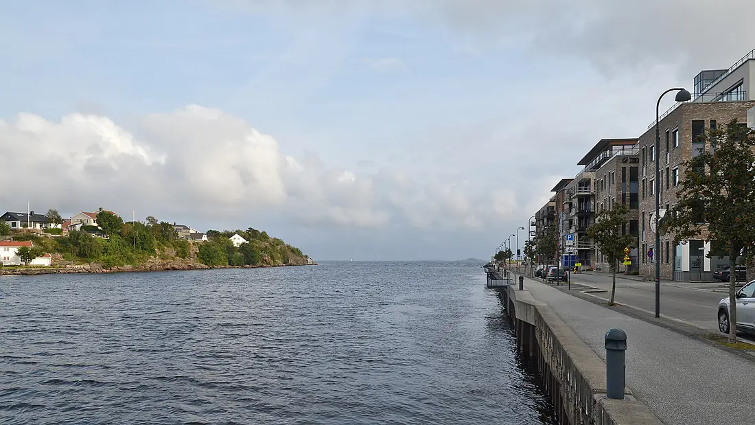
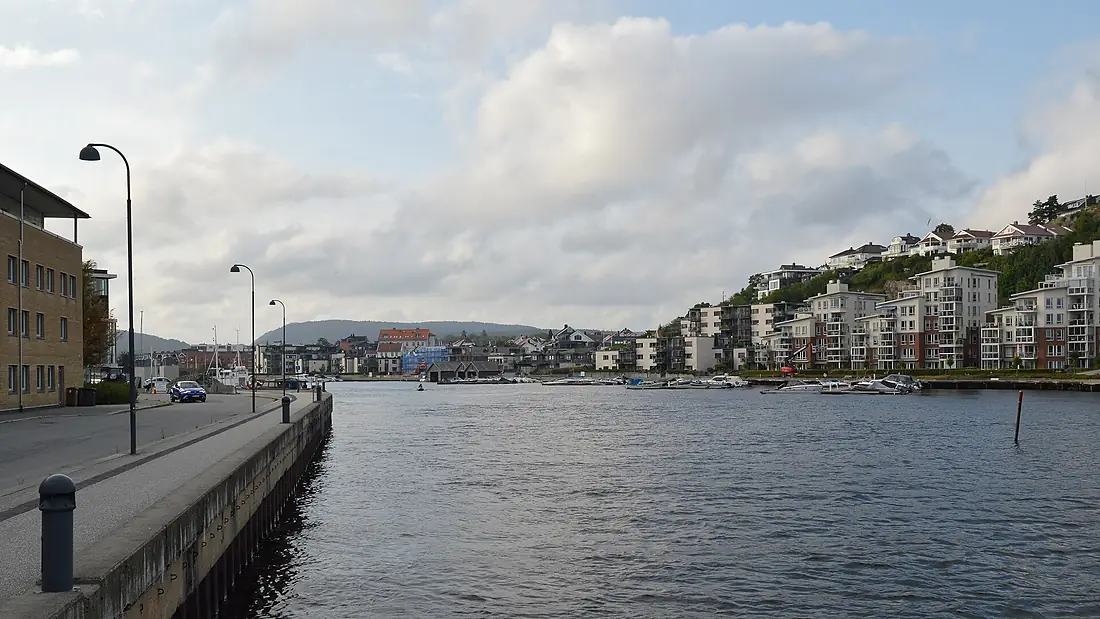
Otra in pictures
Nearby
Rivers nearby
Norway358 km96 m³/s155 km awayGlommaNorway604 km720 m³/s206 km awayGöta älv Sweden95 km570 m³/s230 km awayDrammenselvaNorway48 km310 m³/s218 km awayNissanSweden200 km41 m³/s334 km awayKlarälvenSweden460 km160 m³/s348 km awayGudbrandsdalslågenNorway204 km220 m³/s357 km awayMotala strömSweden100 km100 m³/s483 km away
Where these numbers come from
| Name, length, places | Wikidata (Q642694) · CC0 |
|---|---|
| Course, profile, basin | RiverATLAS v1.0 (HydroATLAS, Linke et al. 2019) · CC BY 4.0 — followed from the source to the mouth given by Wikidata |
| Flow | WaterGAP (RiverATLAS), 1971–2000 · CC BY 4.0 |
| Climate along the river | WorldClim (RiverATLAS), 1970–2000 · CC BY 4.0 |
| Towns, bridges, dams | Wikidata · CC0; GeoNames · CC BY 4.0 |
| Along the river | © OpenStreetMap contributors · ODbL |
| Images | EOX Sentinel-2 cloudless 2016 · CC BY 4.0; Wikimedia Commons |
| Our other atlases | Cascadyas, Lakeyas, Coastya, Peakyas, Islandyas — Wikidata · CC0; © OpenStreetMap contributors · ODbL; GeoNames · CC BY 4.0; HydroLAKES · CC BY 4.0; NOAA OISST |
Every source and licence is on the data sources page.
The family
Do you prefer beaches, lakes, mountains, waterfalls, islands, rivers or canyons?
Same idea, other landscapes: field atlases built on open data, month by month, in seven languages.
beaches Find your beach: sea temperature, sun and swimming month by month.Visit lakes
 Every lake on Earth: water temperature, ice, depth and the shore.Coming soonVisit mountains
 Every summit in 3D: summit weather, the 0 °C line, huts and trails.Visit waterfalls
 Every waterfall: height, flow month by month and when it roars.Coming soonVisit islands
 Every island from the sea up: size, sea temperature, ferries and 3D.Coming soonVisit
  rivers
 Every river from source to sea: the journey, the flow and the basin in numbers.You are here
 canyons
 Every canyon cut to scale: depth to the floor, rim and floor temperatures, trails and viewpoints.Coming soonVisit