River
Penobscot River
563 km from source to mouth · United States.
 United StatesFlows into Gulf of Maine
In numbers
Length
563km
Average flow
1,000m³/s
Basin
22,300km²
Drop
384m
from 383 m to -1 m
Country
1
The journey
From source to mouth
563 km of river and 35 stops on the way: 10 towns and cities on its banks, dams, bridges and the tributaries that feed it.
- 0 kmSourceat 383 m
- 83 kmSeboomook Lake25 km²
- 105 kmLobster Lake13 km²
- 173 kmMud Pond1.8 km²
- 197 kmFrost Pond0.7 km²
- 201 kmChesuncook Lake110 km²
- 205 kmHolbrook Pond0.9 km²
- 221 kmNesowadnehunk Deadwater0.6 km²
- 244 kmFirst Debsconeag Lake1.2 km²
- 249 kmDebsconeag Deadwater2.4 km²
- 273 kmWadleigh Pond0.4 km²
- 284 kmNorth Twin Lake78 km²
- 291 kmMillinocket4,466 people
- 323 kmWest Branch Penobscot Rivertributary
- 334 kmEast Branch Penobscot Rivertributary
- 344 kmMattaseunk Lake3.0 km²
- 378 kmCambolasse Pond0.8 km²
- 383 kmStump Pond0.7 km²
- 385 kmMattanawcook Pond3.2 km²
- 419 kmPiscataquis Rivertributary
- 419 kmHowland1,094 people
- 476 kmOld Town7,624 people
- 480 kmGreat Works Stream1.4 km²
- 488 kmOrono11,183 people
- 509 kmBangor31,753 people
- 509 kmPenobscot River Bridge
- 509 kmBrewer9,672 people
- 510 kmJoshua Chamberlain Bridge
- 510 kmKenduskeag Streamtributary
- 522 kmHampden4,343 people
- 524 kmOrrington3,666 people
- 542 kmWinterport3,817 people
- 554 kmSilver Lake2.3 km²
- 557 kmPenobscot1,136 people
- 557 kmPenobscot Narrows Bridge and Observatory
- 557 kmWaldo–Hancock Bridge
- 563 kmGulf of Maineat -1 m
Water level along the river (RiverATLAS; the height is exaggerated). Towns: GeoNames and Wikidata; bridges, dams and tributaries: Wikidata.
River in the U.S. state of Maine
At the mouth it carries 1,048 m³/s on average: an Olympic pool every 2.4 seconds. It drops from 383 m to -1 m, 0.7 m per kilometre on average. Its basin covers 22,300 km², about the size of BZ. 171,000 people live in it. Highest water: from April to June; lowest: from January to March. Dams and reservoirs hold back a large share of its water (20% of a year's flow).
Where to start
- BangorLargest city on its banks · 31,753 people
- Bangor International Airport (BGR)Nearest airport with scheduled flights, 5 km from the cityCar hire at BGR airport (Bangor)Discover Cars · Affiliate link↗
- On the water39 ferry piers, marinas, boat rentals and boat ramps along the river (OpenStreetMap)
- Kayak and canoe8 put-ins and rapids mapped (OpenStreetMap)
- From June to SeptemberThe best months to visit
Penobscot River, month by month
Highest water: from April to June
Lowest water: from January to March. Freezing months (average below −4 °C): from December to February. Best months to visit: from June to September.
From about 370 m³/s in the lowest month to 650 m³/s in the highest. An estimate: the monthly flow is modelled from the lowest and highest months of WaterGAP (RiverATLAS, 1971–2000) and the rain and snow along the river (WorldClim). Dams change the real rhythm. The chip is the average air temperature; below it, the month's rain.
Plan the trip
Plan the trip: boat trips, a bed by the river, a car
Some links above are affiliate links: if you book through them we may earn a commission, at no extra cost to you. It never changes what the data on this page says.
The basin
Penobscot River: the basin in numbers
21,863 km² of land send their water to this river. This is what lives on it.
- 171,000people live in the basin
- 8/km²people per km²
- 230maverage altitude of the basin
- 1,045mmof rain a year (basin average)
- 4.4°Caverage air temperature
- 5%protected areas
- 4.7%covered by lakes
- 2.9km³held in reservoirs
What covers the basin
- 92% Forest
- 1% Cropland
RiverATLAS (HydroATLAS v1.0, CC BY 4.0): land cover, people, protected areas, glaciers and dams over the whole basin upstream of the mouth.
Along the river
Penobscot River: what you find on the way
- 3Weirs
- 12WaterfallsC and H Pitch, Little Niagara Falls, Big Niagara Falls and 9 more
- 8RapidsRocky Rips, Pine Stream Rapids, Windy Pitch and 5 more
- 37Boat rampsPittston Farm Boat Ramp, Seboomook Dam Boat Ramp, Lobster Stream Launch and 34 more
- 1River beachesBig Omaha Beach
From OpenStreetMap, within 2.0 km of the river. Not mapped is not the same as not there.
Cross-checked with our atlases
Penobscot River in our other atlases
What our sister atlases know about the waterfalls on this river, the lakes it flows through, the beaches at its mouth, the mountains where it rises and the islands off its mouth.
 17lakes on its wayLakeyas
 1beach at the mouth or on the banksCoastya
 6mountains at the sourcePeakyas
Lakes and reservoirs (17)
Lakes it flows through, by Lakeyas
- Seboomook Lakekm 5425km²
- Lobster Lakekm 6913km²
- Mud Pondkm 1131.8km²
- Chesuncook Lakekm 131 · 46 m deep110km²
- North Twin Lakekm 18578km²
- Mattaseunk Lakekm 2253.0km²
- Mattanawcook Pondkm 2523.2km²
- Silver Lakekm 3622.3km²
9 more on LakeyasLakeyas is coming soonOpen Lakeyas ↗
Beaches (1)
At the mouth (25 km) and on the banks, by Coastya
- Spragues Beach22 km away14.6°C
Mountains at the source (6)
Within 15 km of the source, by Peakyas
- Comstock Mountain13 km away
- Seboomook Mountain15 km away
- Elm Pond Mountain14 km away
- Nulhedus Mountain12 km away
- Russell Mountain15 km away
- Truesdale Mountain10 km away
From space
The source and the mouth, seen from orbit
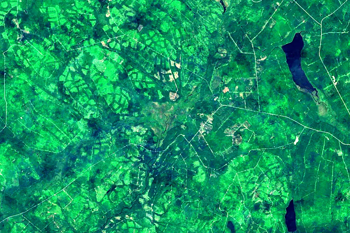
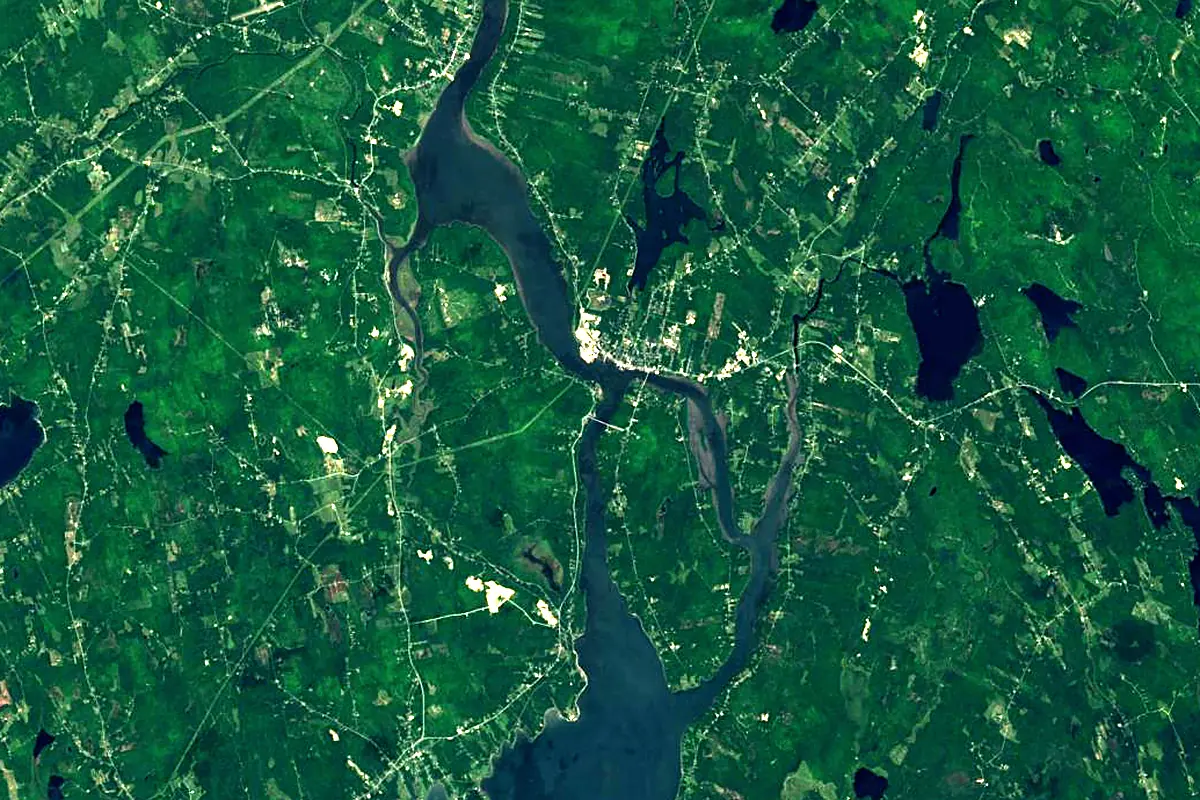
Sentinel-2 cloudless 2016 by EOX IT Services GmbH (contains modified Copernicus Sentinel data 2016), CC BY 4.0. The glowing line is the river as drawn by RiverATLAS.
Photos
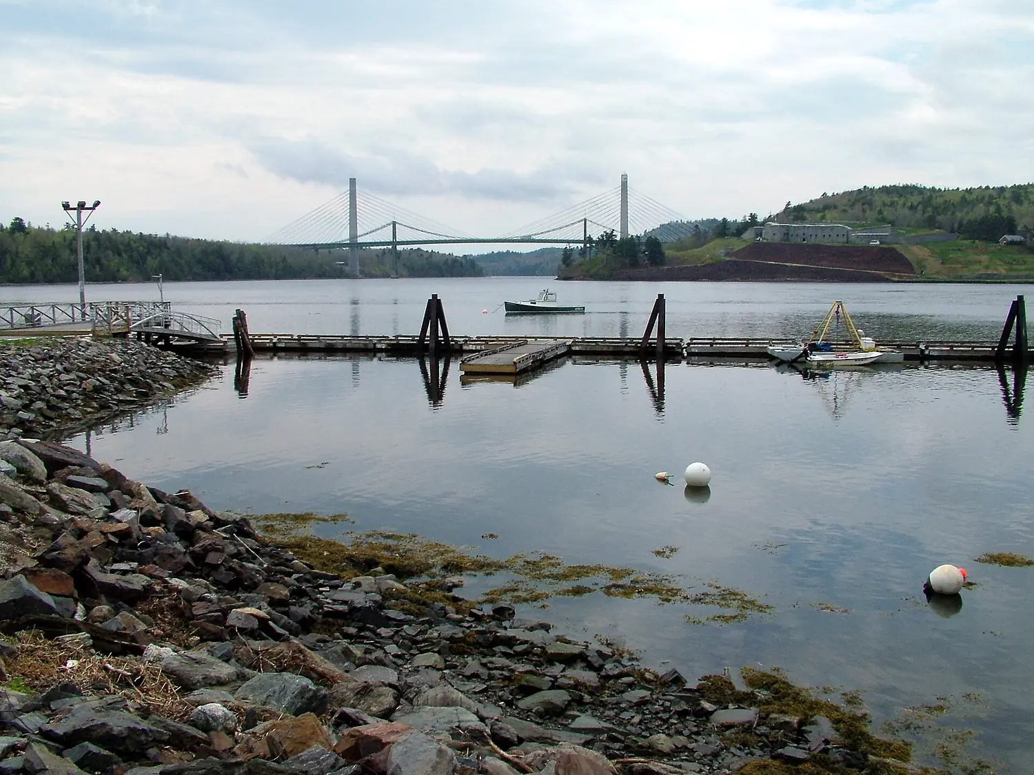
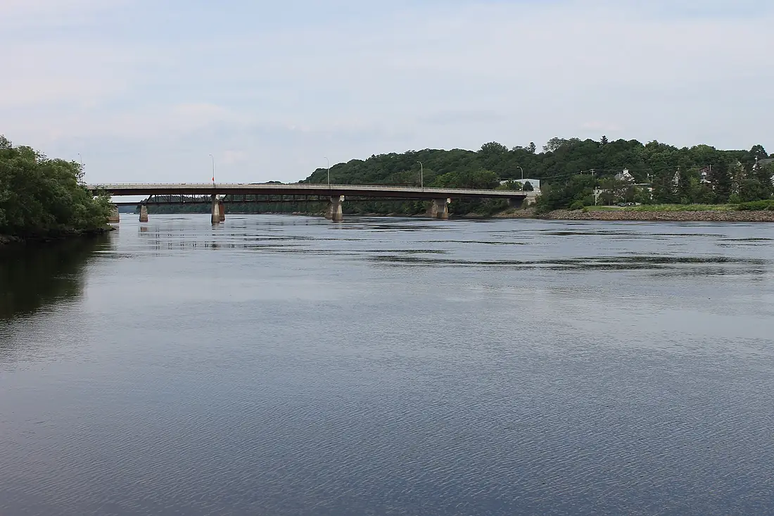
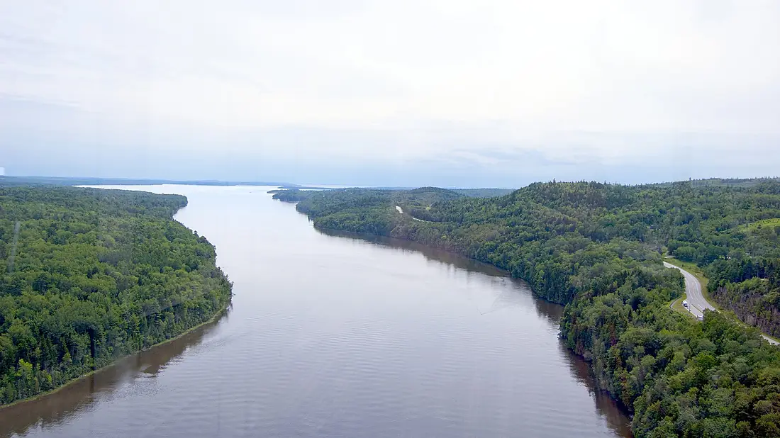
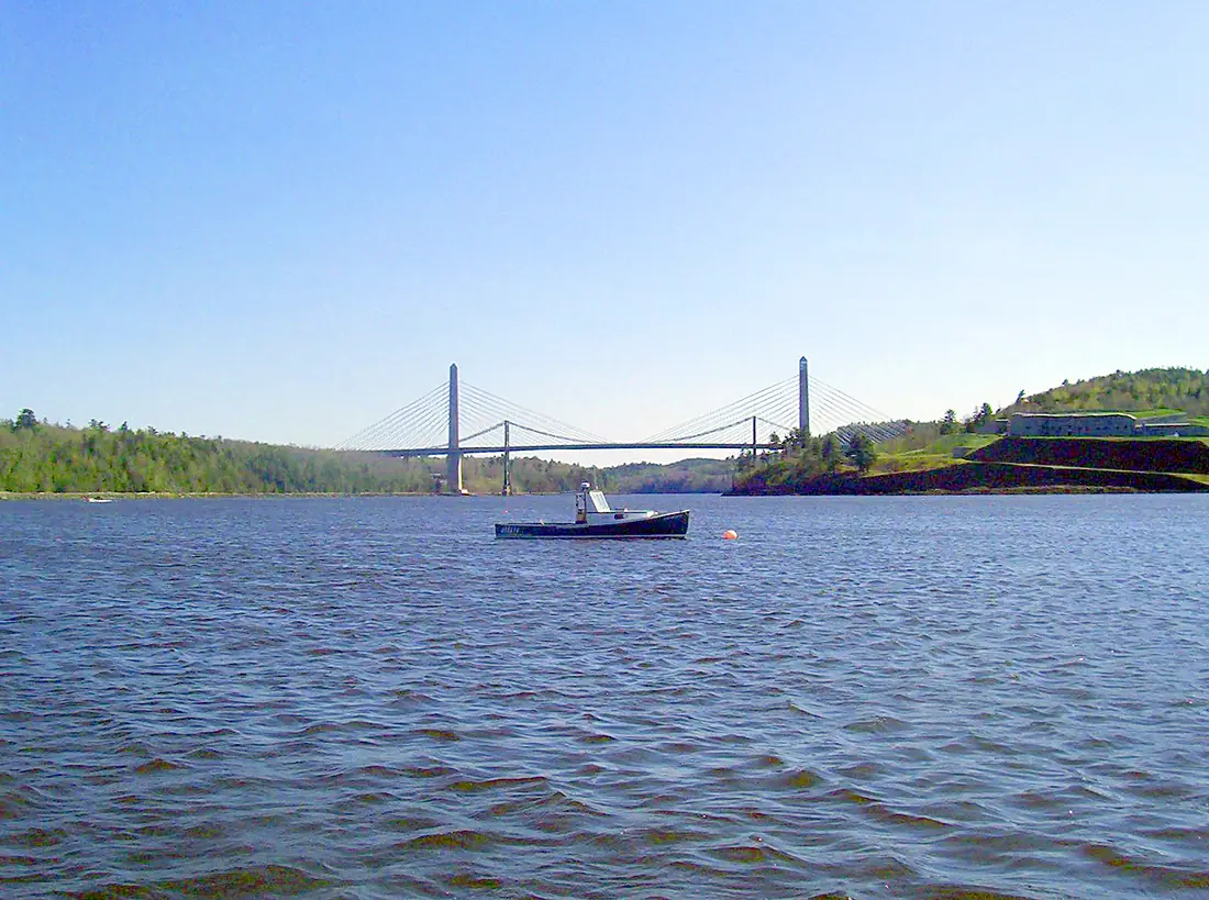
Penobscot River in pictures
Tributaries
Where it flows, and what flows into it
Tributaries (12)
Also: Kenduskeag Stream, Piscataquis River, West Branch Penobscot River, East Branch Penobscot River, Mattawamkeag River, Narramissic River, North Branch Marsh River, Orland River, South Branch Marsh River, Stillwater River, Passadumkeag River, Dead River
Nearby
Rivers nearby
 Canada606 km990 m³/s228 km awayMerrimack RiverUnited States177 km210 m³/s252 km awayCharles RiverUnited States129 km9.0 m³/s304 km awaySaguenay RiverCanada160 km1,500 m³/s404 km awayConnecticut RiverUnited States660 km520 m³/s463 km awayMohawk RiverUnited States240 km220 m³/s441 km away
Where these numbers come from
| Name, length, places | Wikidata (Q945954) · CC0 |
|---|---|
| Course, profile, basin | RiverATLAS v1.0 (HydroATLAS, Linke et al. 2019) · CC BY 4.0 — followed along the river network from the point given by Wikidata |
| Flow | WaterGAP (RiverATLAS), 1971–2000 · CC BY 4.0 |
| Climate along the river | WorldClim (RiverATLAS), 1970–2000 · CC BY 4.0 |
| Towns, bridges, dams | Wikidata · CC0; GeoNames · CC BY 4.0 |
| Along the river | © OpenStreetMap contributors · ODbL |
| Images | EOX Sentinel-2 cloudless 2016 · CC BY 4.0; Wikimedia Commons |
| Our other atlases | Lakeyas, Coastya, Peakyas — Wikidata · CC0; © OpenStreetMap contributors · ODbL; GeoNames · CC BY 4.0; HydroLAKES · CC BY 4.0; NOAA OISST |
Every source and licence is on the data sources page.
The family
Do you prefer beaches, lakes, mountains, waterfalls, islands, rivers or canyons?
Same idea, other landscapes: field atlases built on open data, month by month, in seven languages.
beaches Find your beach: sea temperature, sun and swimming month by month.Visit lakes
 Every lake on Earth: water temperature, ice, depth and the shore.Coming soonVisit mountains
 Every summit in 3D: summit weather, the 0 °C line, huts and trails.Visit
  waterfalls
 Every waterfall: height, flow month by month and when it roars.Coming soonVisit
  islands
 Every island from the sea up: size, sea temperature, ferries and 3D.Coming soonVisit
  rivers
 Every river from source to sea: the journey, the flow and the basin in numbers.You are here
 canyons
 Every canyon cut to scale: depth to the floor, rim and floor temperatures, trails and viewpoints.Coming soonVisit