River
Merrimack River
177 km from source to mouth · United States.
 United StatesFlows into Gulf of Maine
In numbers
Length
177km
Average flow
210m³/s
Basin
12,951km²
Drop
91m
from 90 m to -1 m
Country
1
The journey
From source to mouth
177 km of river and 62 stops on the way: 26 towns and cities on its banks, dams, bridges and the tributaries that feed it.
- 0 kmPemigewasset Riverat 90 m
- 0 kmFranklin8,450 people
- 0 kmPemigewasset Rivertributary
- 0 kmWinnipesaukee Rivertributary
- 15 kmBoscawen3,911 people
- 20 kmContoocook Rivertributary
- 26 kmPenacook Lake1.2 km²
- 30 kmEast Concord42,605 people
- 31 kmTurtle Pond0.7 km²
- 34 kmConcord43,976 people
- 42 kmTurkey Rivertributary
- 44 kmSoucook Rivertributary
- 45 kmPembroke7,461 people
- 46 kmSuncook5,379 people
- 49 kmSuncook Rivertributary
- 50 kmHooksett Falls Bridges
- 50 kmHooksett4,147 people
- 56 kmSouth Hooksett5,418 people
- 62 kmAmoskeag Falls
- 63 kmManchester110,229 people
- 63 kmNotre Dame Bridge (1988)
- 63 kmNotre Dame Bridge (1936)
- 63 kmMcGregor Bridge (1881)
- 63 kmAmoskeag Bridge (1825)
- 79 kmEast Merrimack4,197 people
- 79 kmMerrimack26,726 people
- 82 kmLitchfield8,307 people
- 82 kmSouhegan Rivertributary
- 87 kmPennichuck Brooktributary
- 90 kmNashua87,970 people
- 91 kmHudson7,336 people
- 92 kmNashua Rivertributary
- 99 kmSalmon Brooktributary
- 102 kmTyngsborough Bridge
- 102 kmTyngsboro11,366 people
- 104 kmMascuppic Lake0.8 km²
- 112 kmPawtucket Falls10 m
- 112 kmPawtucket Dam
- 112 kmO'Donnell Memorial Bridge
- 114 kmBeaver Brooktributary
- 114 kmDracut28,831 people
- 114 kmOuellette Bridge
- 115 kmLowell115,554 people
- 115 kmJohn E. Cox Memorial Bridge
- 115 kmConcord Rivertributary
- 132 kmLawrence80,231 people
- 133 kmDuck Bridge
- 134 kmNorth Andover28,222 people
- 134 kmShawsheen Rivertributary
- 134 kmSpicket Rivertributary
- 136 kmLake Cochichewick2.0 km²
- 147 kmHaverhill67,787 people
- 147 kmBasiliere Bridge
- 147 kmHaverhill Bridge
- 151 kmGroveland6,143 people
- 157 kmWest Newbury4,221 people
- 157 kmRocks Village Bridge
- 159 kmMerrimac6,245 people
- 166 kmAmesbury18,313 people
- 167 kmChain Bridge
- 170 kmSalisbury4,869 people
- 171 kmNewburyport17,982 people
- 176 kmPowwow Rivertributary
- 177 kmGulf of Maineat -1 m
Water level along the river (RiverATLAS; the height is exaggerated). Towns: GeoNames and Wikidata; bridges, dams and tributaries: Wikidata.
River in New Hampshire and Massachusetts, United States
At the mouth it carries 214 m³/s on average: an Olympic pool every 12 seconds. It drops from 90 m to -1 m, 0.5 m per kilometre on average. Its basin covers 12,951 km², about the size of BS. 2.0 million people live in it. Highest water: from April to May; lowest: from January to February and August. Dams and reservoirs hold back a large share of its water (16% of a year's flow).
Where to start
- LowellLargest city on its banks · 115,554 people
- Laurence G Hanscom Field (BED)Nearest airport with scheduled flights, 19 km from the cityCar hire at MHT airport (Manchester)Discover Cars · Affiliate link↗
- On the water72 ferry piers, marinas, boat rentals and boat ramps along the river (OpenStreetMap)
- Kayak and canoe3 put-ins and rapids mapped (OpenStreetMap)
- From May to SeptemberThe best months to visit
Merrimack River, month by month
Highest water: from April to May
Lowest water: from January to February and August. Freezing months (average below −4 °C): from January to February. Best months to visit: from May to September.
From about 180 m³/s in the lowest month to 450 m³/s in the highest. An estimate: the monthly flow is modelled from the lowest and highest months of WaterGAP (RiverATLAS, 1971–2000) and the rain and snow along the river (WorldClim). Dams change the real rhythm. The chip is the average air temperature; below it, the month's rain.
Plan the trip
Plan the trip: boat trips, a bed by the river, a car
Some links above are affiliate links: if you book through them we may earn a commission, at no extra cost to you. It never changes what the data on this page says.
The basin
Merrimack River: the basin in numbers
13,016 km² of land send their water to this river. This is what lives on it.
- 2.0millionpeople live in the basin
- 160/km²people per km²
- 241maverage altitude of the basin
- 1,123mmof rain a year (basin average)
- 7.0°Caverage air temperature
- 6%protected areas
- 3.7%covered by lakes
- 1.3km³held in reservoirs
What covers the basin
- 90% Forest
- 3% Cropland
- 1% Pasture
- 12% Towns and cities
RiverATLAS (HydroATLAS v1.0, CC BY 4.0): land cover, people, protected areas, glaciers and dams over the whole basin upstream of the mouth.
Along the river
Merrimack River: what you find on the way
- 11WeirsEastman Falls Dam, Allied Leather Auxiliary Dam, Penacook Lower Falls Diversion and 8 more
- 10LocksNorthern Canal, Lower Locks and 8 more
- 2WaterfallsWildcat Falls, Wamesit Falls
- 3RapidsMitchels Falls
- 60Boat rampsFranklin Public Boat Ramp, Merrimack County Boat Launching Facility, Boscawen Town Park Boat Ramp and 57 more
- 12MarinasKazmiera Marina, Goodwin Creek Marina, Marina at Hatter's Point and 9 more
- 6River beachesRiverland Beach, White Sands Beach, Dog Beach and 3 more
From OpenStreetMap, within 1.9 km of the river. Not mapped is not the same as not there.
Cross-checked with our atlases
Merrimack River in our other atlases
What our sister atlases know about the waterfalls on this river, the lakes it flows through, the beaches at its mouth, the mountains where it rises and the islands off its mouth.
 2waterfalls on the riverCascadyas
 4lakes on its wayLakeyas
 12beaches at the mouth and on the banksCoastya
 33mountains at the sourcePeakyas
 6islands off the mouthIslandyas
Waterfalls (2)
On the river, by Cascadyas
- Amoskeag Fallskm 63
- Pawtucket Fallskm 11410m
Cascadyas is coming soonOpen Cascadyas ↗
Lakes and reservoirs (4)
Lakes it flows through, by Lakeyas
- Penacook Lakekm 271.2km²
- Turtle Pondkm 310.7km²
- Mascuppic Lakekm 1060.8km²
- Lake Cochichewickkm 1382.0km²
Lakeyas is coming soonOpen Lakeyas ↗
Beaches (12)
At the mouth (25 km) and on the banks, by Coastya
- Wingaersheek Beach22 km away18.6°C
- Crane Beach16 km away18.6°C
- Jenress Beach18 km away18.3°C
- Foss Beach22 km away18.1°C
- Front Beach24 km away18.6°C
- Old Garden Beach25 km away18.6°C
- Salisbury Beach5.5 km away18.3°C
- Bass Beach17 km away18.3°C
4 more on CoastyaOpen Coastya ↗
Mountains at the source (33)
Within 15 km of the source, by Peakyas
- Bald Hill8.7 km away
- Bean Hill15 km away
- Taunton Hill11 km away
- The Bulkhead15 km away
- Tucker Mountain11 km away
- Zion Hill9.2 km away
- Brown Hill3.3 km away
- Cilley Hill10 km away
25 more on PeakyasOpen Peakyas ↗
Islands off the mouth (6)
Within 30 km of the mouth, by Islandyas
- Plum Island1.2 km away
- Thacher Island28 km away0.3km²
- Appledore Island24 km away0.9km²
- Star Island23 km away
- Choate Island18 km away
- Badger's Island29 km away
Islandyas is coming soonOpen Islandyas ↗
From space
The source and the mouth, seen from orbit
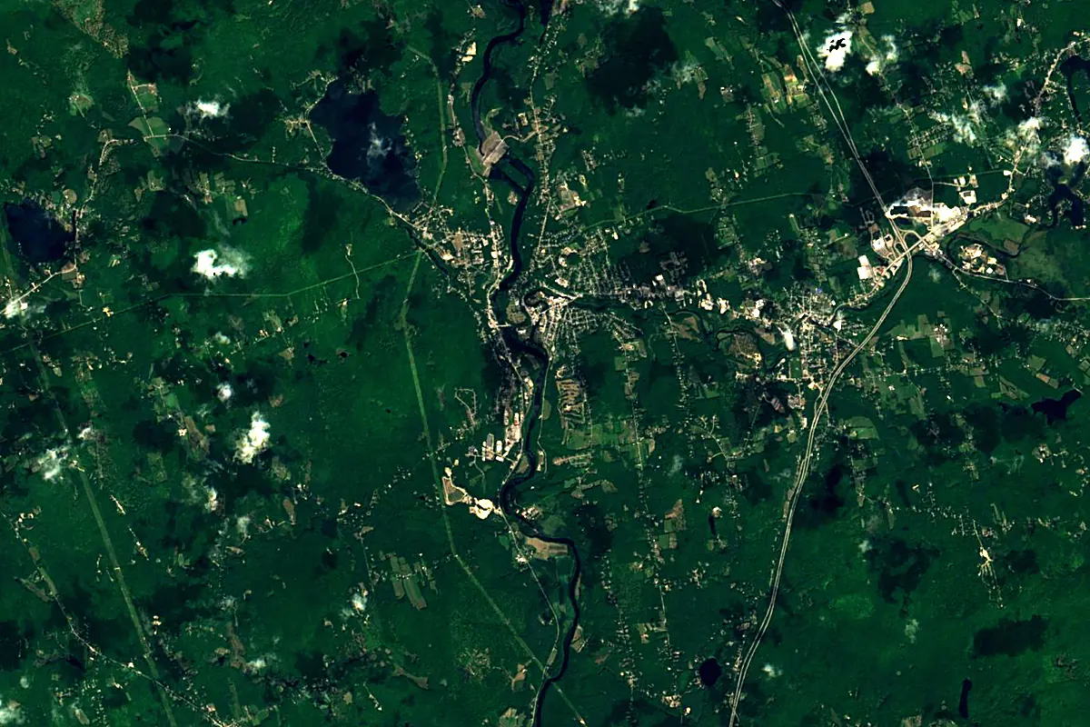
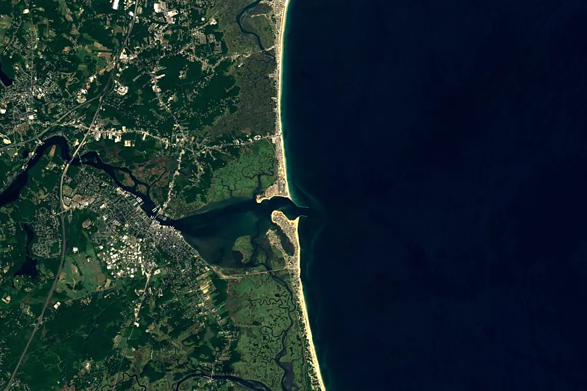
Sentinel-2 cloudless 2016 by EOX IT Services GmbH (contains modified Copernicus Sentinel data 2016), CC BY 4.0. The glowing line is the river as drawn by RiverATLAS.
Photos
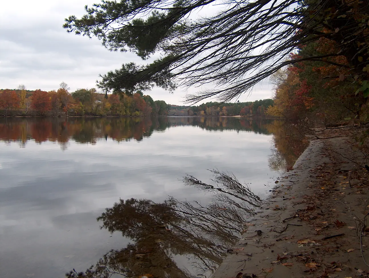
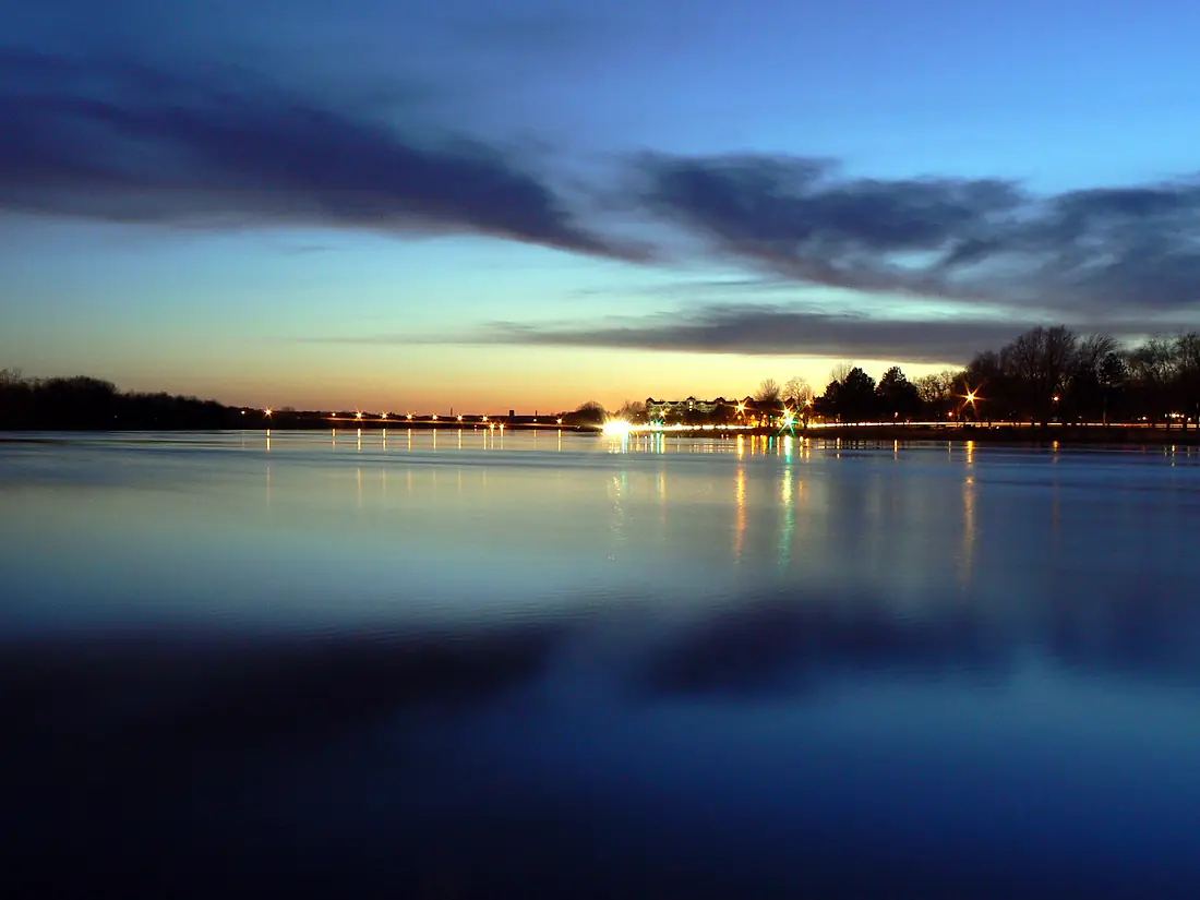
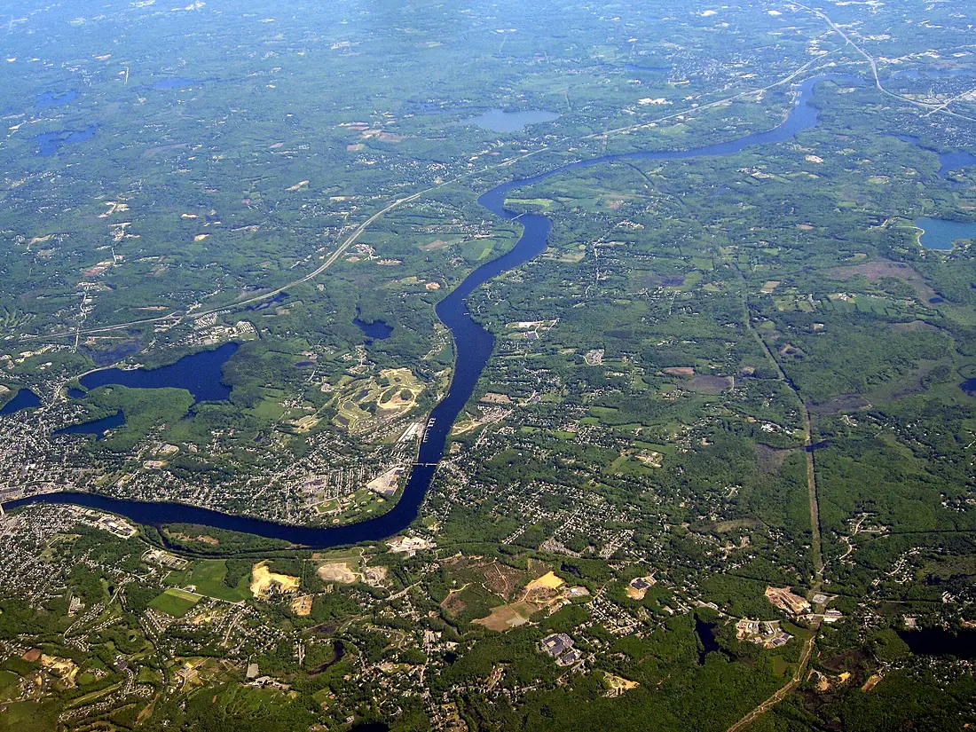
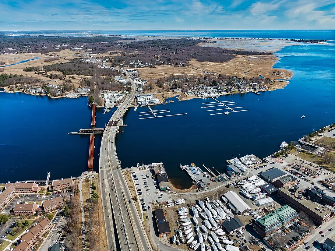
Merrimack River in pictures
Tributaries
Where it flows, and what flows into it
Tributaries (19)
Also: Concord River, Winnipesaukee River, Pemigewasset River, Shawsheen River, Contoocook River, Nashua River, Souhegan River, Beaver Brook, Piscataquog River, Powwow River, Soucook River, Spicket River, Suncook River, Pennichuck Brook, Salmon Brook, Turkey River, Cochichewick River, Little River, Artichoke River
Nearby
Rivers nearby
United States129 km9.0 m³/s54 km awayConnecticut RiverUnited States660 km520 m³/s211 km awayMohawk RiverUnited States240 km220 m³/s235 km awayPenobscot RiverUnited States563 km1,000 m³/s252 km awayHudson RiverUnited States492 km210 m³/s353 km awaySaint John River Canada606 km990 m³/s466 km away
Where these numbers come from
| Name, length, places | Wikidata (Q517787) · CC0 |
|---|---|
| Course, profile, basin | RiverATLAS v1.0 (HydroATLAS, Linke et al. 2019) · CC BY 4.0 — followed from the source to the mouth given by Wikidata |
| Flow | WaterGAP (RiverATLAS), 1971–2000 · CC BY 4.0 |
| Climate along the river | WorldClim (RiverATLAS), 1970–2000 · CC BY 4.0 |
| Towns, bridges, dams | Wikidata · CC0; GeoNames · CC BY 4.0 |
| Along the river | © OpenStreetMap contributors · ODbL |
| Images | EOX Sentinel-2 cloudless 2016 · CC BY 4.0; Wikimedia Commons |
| Our other atlases | Cascadyas, Lakeyas, Coastya, Peakyas, Islandyas — Wikidata · CC0; © OpenStreetMap contributors · ODbL; GeoNames · CC BY 4.0; HydroLAKES · CC BY 4.0; NOAA OISST |
Every source and licence is on the data sources page.
The family
Do you prefer beaches, lakes, mountains, waterfalls, islands, rivers or canyons?
Same idea, other landscapes: field atlases built on open data, month by month, in seven languages.
beaches Find your beach: sea temperature, sun and swimming month by month.Visit lakes
 Every lake on Earth: water temperature, ice, depth and the shore.Coming soonVisit mountains
 Every summit in 3D: summit weather, the 0 °C line, huts and trails.Visit waterfalls
 Every waterfall: height, flow month by month and when it roars.Coming soonVisit islands
 Every island from the sea up: size, sea temperature, ferries and 3D.Coming soonVisit
  rivers
 Every river from source to sea: the journey, the flow and the basin in numbers.You are here
 canyons
 Every canyon cut to scale: depth to the floor, rim and floor temperatures, trails and viewpoints.Coming soonVisit