River
River Tay
193 km from source to mouth · United Kingdom.
 United KingdomFlows into Firth of Tay6th longest in United Kingdom
In numbers
Length
193km
Average flow
170m³/s
Basin
6,216km²
Drop
282m
from 282 m to 0 m
Country
1
The journey
From source to mouth
193 km of river and 66 stops on the way: 7 towns and cities on its banks, dams, bridges and the tributaries that feed it.
- 0 kmCoire Laoighat 282 m
- 9 kmLoch Laidon4.5 km²
- 17 kmLoch Eigheach1.4 km²
- 18 kmEas an Torre Mhoir
- 48 kmLoch Rannoch19 km²
- 56 kmDunalastair Water1.2 km²
- 68 kmKenmore Bridge
- 69 kmTaymouth Castle
- 69 kmChinese Bridge
- 70 kmdesigned landscape at Taymouth Castle
- 70 kmNewhall Bridge, Taymouth Castle
- 75 kmRiver Lyontributary
- 76 kmBolfracks
- 76 kmdesigned landscape at Bolfracks
- 76 kmAberfeldy Footbridge
- 76 kmWade's Bridge
- 76 kmAberfeldy1,986 people
- 80 kmAberfeldy Distillery
- 85 kmLoch Tummel5.4 km²
- 91 kmFalls of Tummel
- 96 kmPitlochry2,880 people
- 98 kmThe Black Spout
- 101 kmPitnacree Bridge
- 108 kmLogierait Viaduct
- 113 kmRiver Tummeltributary
- 115 kmDalguise Viaduct
- 121 kmJubilee Bridge
- 123 kmFalls of the Braan
- 123 kmThe Hermitage
- 123 kmBlack Linn Falls
- 123 kmDunkeld House
- 124 kmdesigned landscape at Dunkeld House
- 126 kmDunkeld1,330 people
- 126 kmDunkeld Bridge
- 128 kmLoch of the Lowes0.7 km²
- 135 kmKemp's Hold
- 135 kmMurthly Castle
- 138 kmVictoria Bridge
- 141 kmRiver Braantributary
- 151 kmMeikleour House
- 152 kmRiver Islatributary
- 152 kmKinclaven Bridge
- 153 kmKinclaven Castle
- 154 kmCargill Viaduct
- 155 kmBallathie House
- 161 kmCampsie Linn
- 161 kmTaymount House
- 163 kmInchbervis Castle
- 164 kmCambusmichael Church
- 164 kmCambusmichael Church graveyard
- 164 kmStanley1,410 people
- 166 kmThistlebridge
- 169 kmLuncarty1,650 people
- 172 kmGold Castle, enclosure 200m SW of Donald's Bank
- 172 kmDestiny Bridge, Perth
- 172 kmCross Tay Link Road bridge
- 173 kmBertha
- 177 kmScone5,030 people
- 179 kmPerth Bridge
- 179 kmPerth47,430 people
- 180 kmQueen's Bridge, Perth
- 180 kmTay Viaduct
- 183 kmFriarton Bridge
- 187 kmKinfauns Castle
- 190 kmElcho Castle
- 193 kmRiver Earntributary
- 193 kmRiver Almondtributary
- 193 kmFirth of Tayat 0 m
Water level along the river (RiverATLAS; the height is exaggerated). Towns: GeoNames and Wikidata; bridges, dams and tributaries: Wikidata.
River in Perth and Kinross, and Stirling, Scotland, UK, flows into the North Sea at the Firth of Tay
At the mouth it carries 170 m³/s on average: an Olympic pool every 15 seconds. It drops from 282 m to 0 m, 1.5 m per kilometre on average. Its basin covers 6,216 km², about the size of PS. 121,000 people live in it. Highest water: from December to January. Its dams hold back little of its water (9.0% of a year's flow).
Where to start
- PerthLargest city on its banks · 47,430 people
- Dundee Airport (DND)Nearest airport with scheduled flights, 26 km from the cityCar hire at EDI airport (Ingliston, Edinburgh)Discover Cars · Affiliate link↗
- On the water4 ferry piers, marinas, boat rentals and boat ramps along the river (OpenStreetMap)
- Kayak and canoe17 put-ins and rapids mapped (OpenStreetMap)
- From June to AugustThe best months to visit
River Tay, month by month
Highest water: from December to January
Best months to visit: from June to August.
From about 81 m³/s in the lowest month to 220 m³/s in the highest. An estimate: the monthly flow is modelled from the lowest and highest months of WaterGAP (RiverATLAS, 1971–2000) and the rain and snow along the river (WorldClim). Dams change the real rhythm. The chip is the average air temperature; below it, the month's rain.
Plan the trip
Plan the trip: boat trips, a bed by the river, a car
Some links above are affiliate links: if you book through them we may earn a commission, at no extra cost to you. It never changes what the data on this page says.
The basin
River Tay: the basin in numbers
5,060 km² of land send their water to this river. This is what lives on it.
- 121,000people live in the basin
- 24/km²people per km²
- 392maverage altitude of the basin
- 1,266mmof rain a year (basin average)
- 6.2°Caverage air temperature
- 45%protected areas
- 2.0%covered by lakes
- 0.4km³held in reservoirs
What covers the basin
- 4% Forest
- 14% Cropland
- 12% Pasture
- 1% Towns and cities
RiverATLAS (HydroATLAS v1.0, CC BY 4.0): land cover, people, protected areas, glaciers and dams over the whole basin upstream of the mouth.
Along the river
River Tay: what you find on the way
- 7WeirsStanley Weir and 6 more
- 26WaterfallsWaterfall on River Tummel, Linn of Tummel, The Black Spout and 23 more
- 13RapidsWeir, Falls of Tummel, Slide and 10 more
- 4Canoe put-insUpper Tummel, Tummel (Lower), SCA Isla Access Point and 1 more
- 3Boat ramps
- 1MarinasLeisure
- 1River beachesPlage
From OpenStreetMap, within 1.6 km of the river. Not mapped is not the same as not there.
Cross-checked with our atlases
River Tay in our other atlases
What our sister atlases know about the waterfalls on this river, the lakes it flows through, the beaches at its mouth, the mountains where it rises and the islands off its mouth.
 7waterfalls on the riverCascadyas
 6lakes on its wayLakeyas
 42mountains at the sourcePeakyas
 1island off the mouthIslandyas
Waterfalls (7)
On the river, by Cascadyas
- Eas an Torre Mhoirkm 12
- Falls of Tummelkm 63
- The Black Spoutkm 69
- Falls of the Braankm 86
- The Hermitagekm 86
- Black Linn Fallskm 86
- Campsie Linnkm 113
Cascadyas is coming soonOpen Cascadyas ↗
Lakes and reservoirs (6)
Lakes it flows through, by Lakeyas
- Loch Laidonkm 64.5km²
- Loch Eigheachkm 121.4km²
- Loch Rannochkm 34 · 134 m deep19km²
- Dunalastair Waterkm 391.2km²
- Loch Tummelkm 605.4km²
- Loch of the Loweskm 900.7km²
Lakeyas is coming soonOpen Lakeyas ↗
Mountains at the source (42)
Within 15 km of the source, by Peakyas
- Meall a' Bhùiridh12 km away · prominence 795 m1,108m
- Beinn Achaladair10 km away · prominence 226 m1,038m
- Beinn a' Chreachain8.8 km away · prominence 650 m1,081m
- Beinn an Dòthaidh13 km away · prominence 249 m1,004m
- Stuchd an Lochain14 km away · prominence 482 m960m
- Stob a' Choire Odhair13 km away · prominence 277 m945m
- Beinn Mhanach12 km away · prominence 315 m953m
- Càrn Dearg14 km away · prominence 218 m941m
34 more on PeakyasOpen Peakyas ↗
Islands off the mouth (1)
Within 30 km of the mouth, by Islandyas
- Mugdrum Island4.9 km away
Islandyas is coming soonOpen Islandyas ↗
From space
The source and the mouth, seen from orbit
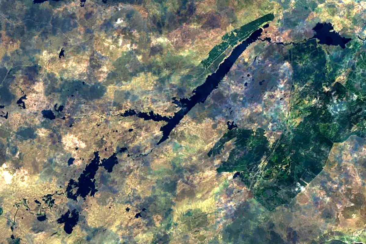
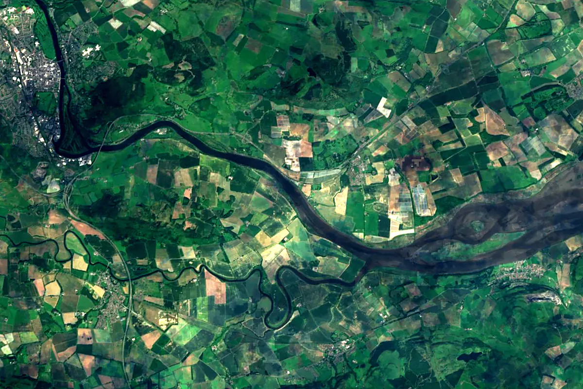
Sentinel-2 cloudless 2016 by EOX IT Services GmbH (contains modified Copernicus Sentinel data 2016), CC BY 4.0. The glowing line is the river as drawn by RiverATLAS.
Tributaries
Where it flows, and what flows into it
Tributaries (8)
Also: River Tummel, River Earn, River Isla, River Dochart, River Almond, River Lyon, River Braan, Craigie Burn
Nearby
Rivers nearby
United Kingdom47 km61 m³/s42 km awayRiver ClydeUnited Kingdom176 km90 m³/s86 km awayRiver TweedUnited Kingdom156 km89 m³/s106 km awayRiver DeeUnited Kingdom154 km44 m³/s116 km awayRiver DonUnited Kingdom131 km21 m³/s118 km awayRiver SpeyUnited Kingdom172 km64 m³/s146 km awayRiver TyneUnited Kingdom100 km63 m³/s192 km awayRiver WearUnited Kingdom96 km21 m³/s203 km awayWhere these numbers come from
| Name, length, places | Wikidata (Q19719) · CC0 |
|---|---|
| Course, profile, basin | RiverATLAS v1.0 (HydroATLAS, Linke et al. 2019) · CC BY 4.0 — followed along the river network from the point given by Wikidata |
| Flow | WaterGAP (RiverATLAS), 1971–2000 · CC BY 4.0 |
| Climate along the river | WorldClim (RiverATLAS), 1970–2000 · CC BY 4.0 |
| Towns, bridges, dams | Wikidata · CC0; GeoNames · CC BY 4.0 |
| Along the river | © OpenStreetMap contributors · ODbL |
| Images | EOX Sentinel-2 cloudless 2016 · CC BY 4.0; Wikimedia Commons |
| Our other atlases | Cascadyas, Lakeyas, Peakyas, Islandyas — Wikidata · CC0; © OpenStreetMap contributors · ODbL; GeoNames · CC BY 4.0; HydroLAKES · CC BY 4.0; NOAA OISST |
Every source and licence is on the data sources page.
The family
Do you prefer beaches, lakes, mountains, waterfalls, islands, rivers or canyons?
Same idea, other landscapes: field atlases built on open data, month by month, in seven languages.
 beaches
 Find your beach: sea temperature, sun and swimming month by month.Visit lakes
 Every lake on Earth: water temperature, ice, depth and the shore.Coming soonVisit mountains
 Every summit in 3D: summit weather, the 0 °C line, huts and trails.Visit waterfalls
 Every waterfall: height, flow month by month and when it roars.Coming soonVisit islands
 Every island from the sea up: size, sea temperature, ferries and 3D.Coming soonVisit
  rivers
 Every river from source to sea: the journey, the flow and the basin in numbers.You are here
 canyons
 Every canyon cut to scale: depth to the floor, rim and floor temperatures, trails and viewpoints.Coming soonVisit