River
River Tweed
156 km from source to mouth · United Kingdom.
 United KingdomFlows into North Sea9th longest in United Kingdom
In numbers
Length
156km
Average flow
89m³/s
Basin
3,900km²
Drop
232m
from 232 m to 0 m
Country
1
The journey
From source to mouth
156 km of river and 68 stops on the way: 16 towns and cities on its banks, dams, bridges and the tributaries that feed it.
- 0 kmTweed's Wellat 232 m
- 0 kmTalla Reservoir1.1 km²
- 12 kmDrumelzier Castle
- 18 kmdesigned landscape at Stobo Castle
- 20 kmStobo Castle
- 31 kmNeidpath Castle
- 32 kmManor Watertributary
- 33 kmPeebles8,940 people
- 33 kmEddleston Watertributary
- 37 kmKailzie Gardens
- 37 kmHorsburgh Castle
- 38 kmHaystoun Burntributary
- 39 kmCardrona910 people
- 41 kmCardrona House
- 45 kmdesigned landscape at Traquair House
- 45 kmTraquair House
- 46 kmInnerleithen3,110 people
- 49 kmLeithen Watertributary
- 49 kmWalkerburn740 people
- 64 kmCaddon Watertributary
- 68 kmEttrick Watertributary
- 72 kmdesigned landscape at Abbotsford House
- 72 kmAbbotsford House
- 73 kmGalashiels10,060 people
- 73 kmTweedbank2,100 people
- 75 kmGala Watertributary
- 76 kmWaverley Hydropathic Hotel
- 76 kmGattonside House
- 78 kmMelrose2,510 people
- 80 kmNewstead256 people
- 83 kmlinear earthwork 300m W of Old Melrose
- 83 kmOld Melrose, St Cuthbert's Chapel & monastery site
- 85 kmdesigned landscape at Dryburgh Abbey
- 86 kmRiver Leadertributary
- 86 kmDryburgh Abbey
- 87 kmSt Boswells1,470 people
- 87 kmDryburgh Abbey House
- 92 kmdesigned landscape at Mertoun
- 92 kmOld Mertoun House, Mertoun House
- 92 kmMertoun House
- 94 kmLittledean Fort
- 94 kmLittledean Tower
- 98 kmRingleyhall
- 99 kmMakerstoun House
- 105 kmRiver Teviottributary
- 106 kmFloors Castle
- 107 kmKelso6,910 people
- 110 kmHendersyde Park
- 115 kmEden Hall
- 119 kmCarham347 people
- 120 kmCarham Hall
- 124 kmColdstream1,930 people
- 128 kmCornhill Castle
- 128 kmLennel House and Garden
- 129 kmOld Parish Church, Lennel
- 132 kmLeet Watertributary
- 134 kmRiver Tilltributary
- 139 kmNorham629 people
- 139 kmNorham Castle
- 141 kmHorndean Church, church and burial ground
- 143 kmHorncliffe403 people
- 145 kmHorncliffe Fort
- 145 kmHorncliffe House
- 145 kmUnion Chain Bridge
- 154 kmBerwick Castle
- 154 kmRoyal Border Bridge
- 155 kmBerwick-upon-Tweed12,043 people
- 156 kmWhiteadder Watertributary
- 156 kmMunicipal Borough of Berwick-upon-Tweed13,075 people
- 156 kmNorth Seaat 0 m
Water level along the river (RiverATLAS; the height is exaggerated). Towns: GeoNames and Wikidata; bridges, dams and tributaries: Wikidata.
River in the Border region in Scotland and northern England, UK, flows into the North Sea at Berwick Upon Tweed
At the mouth it carries 89 m³/s on average: an Olympic pool every 28 seconds. It drops from 232 m to 0 m, 1.5 m per kilometre on average. Its basin covers 3,900 km², about the size of CV. 119,000 people live in it. Highest water: from November to January. Its dams hold back little of its water (2.8% of a year's flow).
Where to start
- Municipal Borough of Berwick-upon-TweedLargest city on its banks · 13,075 people
- Newcastle International Airport (NCL)Nearest airport with scheduled flights, 84 km from the cityCar hire at NCL airport (Newcastle upon Tyne, Tyne and Wear)Discover Cars · Affiliate link↗
- On the water2 ferry piers, marinas, boat rentals and boat ramps along the river (OpenStreetMap)
- Kayak and canoe18 put-ins and rapids mapped (OpenStreetMap)
- From June to AugustThe best months to visit
River Tweed, month by month
Highest water: from November to January
Best months to visit: from June to August.
From about 43 m³/s in the lowest month to 130 m³/s in the highest. An estimate: the monthly flow is modelled from the lowest and highest months of WaterGAP (RiverATLAS, 1971–2000) and the rain and snow along the river (WorldClim). Dams change the real rhythm. The chip is the average air temperature; below it, the month's rain.
Plan the trip
Plan the trip: boat trips, a bed by the river, a car
Some links above are affiliate links: if you book through them we may earn a commission, at no extra cost to you. It never changes what the data on this page says.
The basin
River Tweed: the basin in numbers
4,987 km² of land send their water to this river. This is what lives on it.
- 119,000people live in the basin
- 24/km²people per km²
- 258maverage altitude of the basin
- 941mmof rain a year (basin average)
- 7.2°Caverage air temperature
- 14%protected areas
- 0.2%covered by lakes
- 0.1km³held in reservoirs
What covers the basin
- 5% Forest
- 27% Cropland
- 62% Pasture
- 1% Towns and cities
RiverATLAS (HydroATLAS v1.0, CC BY 4.0): land cover, people, protected areas, glaciers and dams over the whole basin upstream of the mouth.
Along the river
River Tweed: what you find on the way
- 39WeirsMelrose Cauld, Mertoun Cauld, Cobby Weir and 36 more
- 1WaterfallsWooden Linn
- 12RapidsAshiestiel, Yair, Fairnilee and 9 more
- 6Canoe put-insAshiestiel, Leaderfoot Viaduct and 4 more
- 2Boat rampsRNLI
- 4River beachesBlakewell Shad, Davie's Batt, Spittal Beach and 1 more
From OpenStreetMap, within 1.6 km of the river. Not mapped is not the same as not there.
Cross-checked with our atlases
River Tweed in our other atlases
What our sister atlases know about the waterfalls on this river, the lakes it flows through, the beaches at its mouth, the mountains where it rises and the islands off its mouth.
 1lake on its wayLakeyas
 4beaches at the mouth and on the banksCoastya
 32mountains at the sourcePeakyas
 4islands off the mouthIslandyas
Lakes and reservoirs (1)
Lakes it flows through, by Lakeyas
- Talla Reservoirkm 01.1km²
Lakeyas is coming soonOpen Lakeyas ↗
Beaches (4)
At the mouth (25 km) and on the banks, by Coastya
- Cocklawburn Beach4.9 km away14.2°C
- Cheswick Sands6.6 km away14.2°C
- West in Thrile Bay19 km away · cove14.2°C
- Horsecastle Bay18 km away · cove14.2°C
Mountains at the source (32)
Within 15 km of the source, by Peakyas
- White Coomb11 km away · prominence 374 m821m
- Culter Fell6.7 km away · prominence 350 m748m
- Black Law12 km away · prominence 103 m698m
- Andrewhinney Hill14 km away677m
- Crown of Scotland14 km away538m
- Glenwhappen Rig4.2 km away600m
- Annanhead Hill12 km away478m
- Whiteside Hill3.3 km away439m
24 more on PeakyasOpen Peakyas ↗
Islands off the mouth (4)
Within 30 km of the mouth, by Islandyas
- Lindisfarne16 km away4.0km²
- Staple Island28 km away
- Old Law18 km away
- Longstone28 km away
Islandyas is coming soonOpen Islandyas ↗
From space
The source and the mouth, seen from orbit
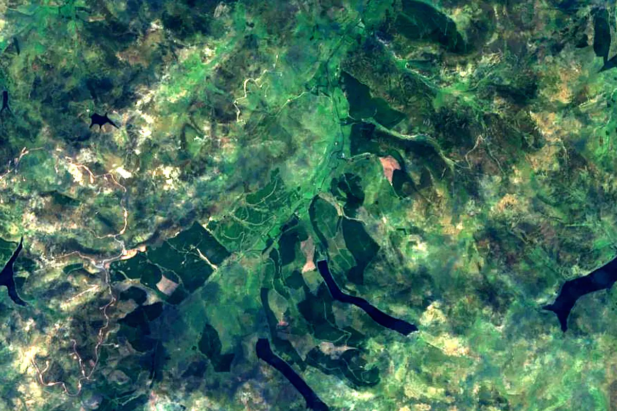
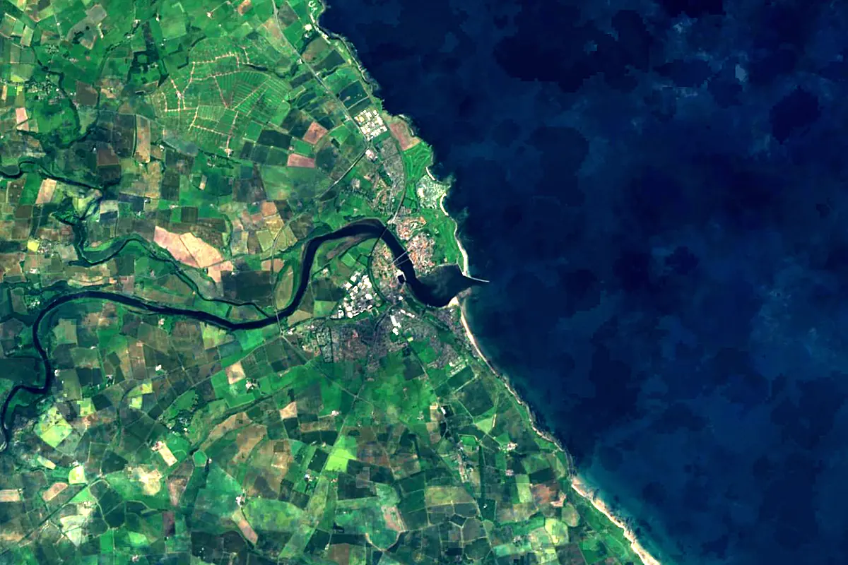
Sentinel-2 cloudless 2016 by EOX IT Services GmbH (contains modified Copernicus Sentinel data 2016), CC BY 4.0. The glowing line is the river as drawn by RiverATLAS.
Photos
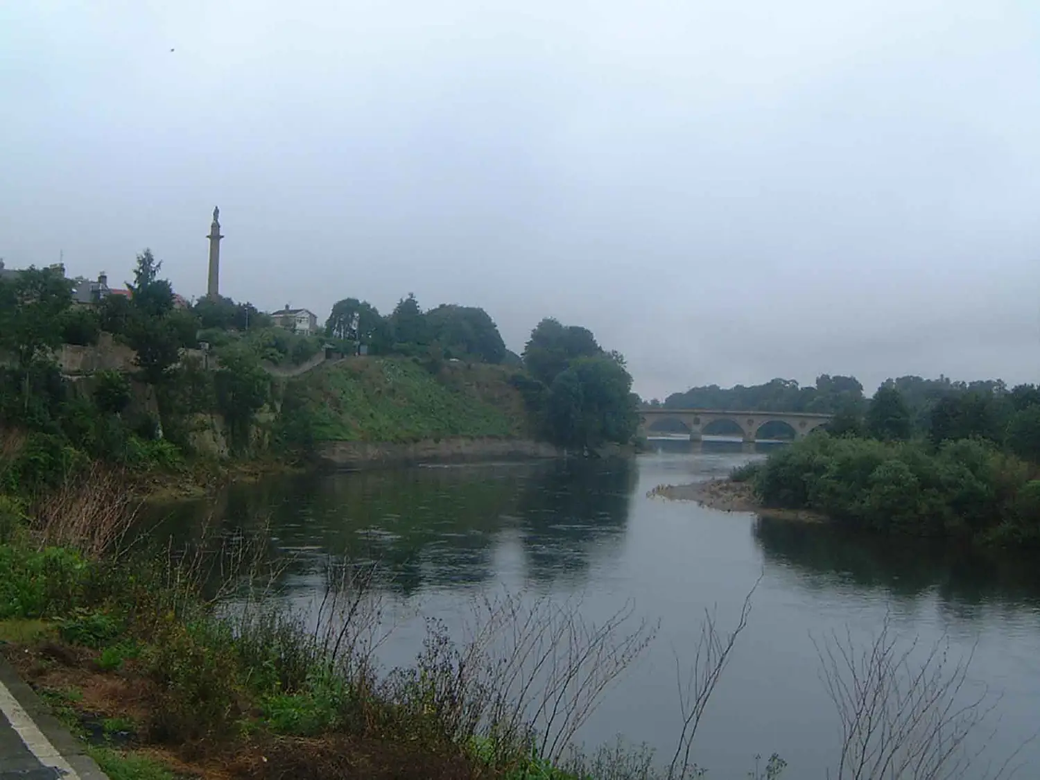
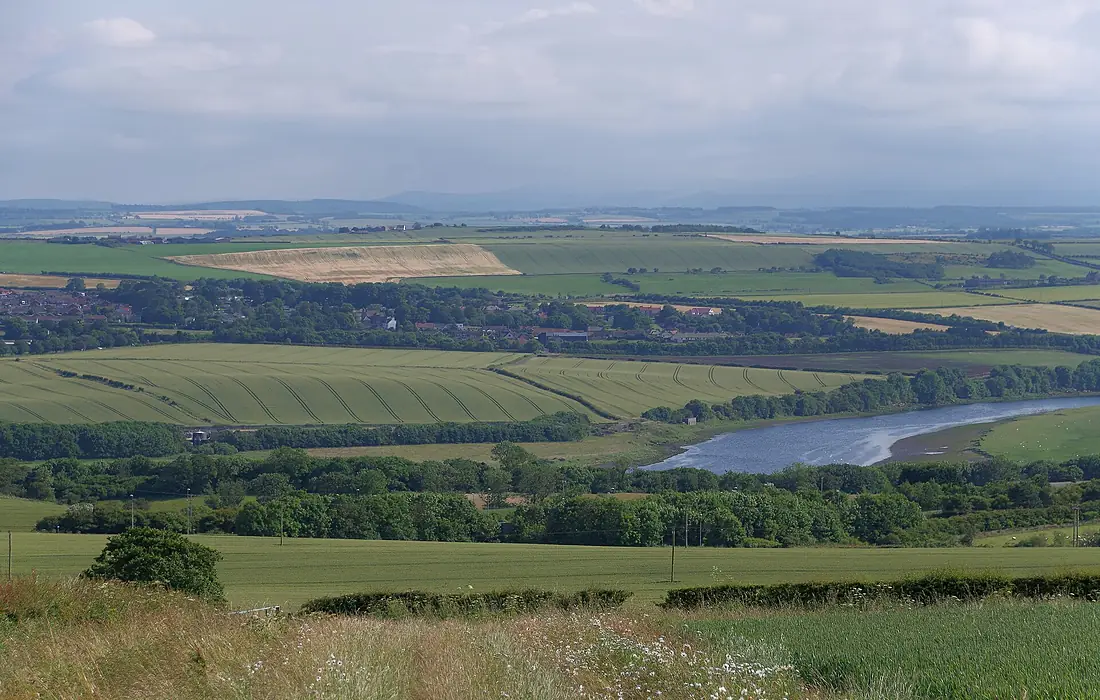
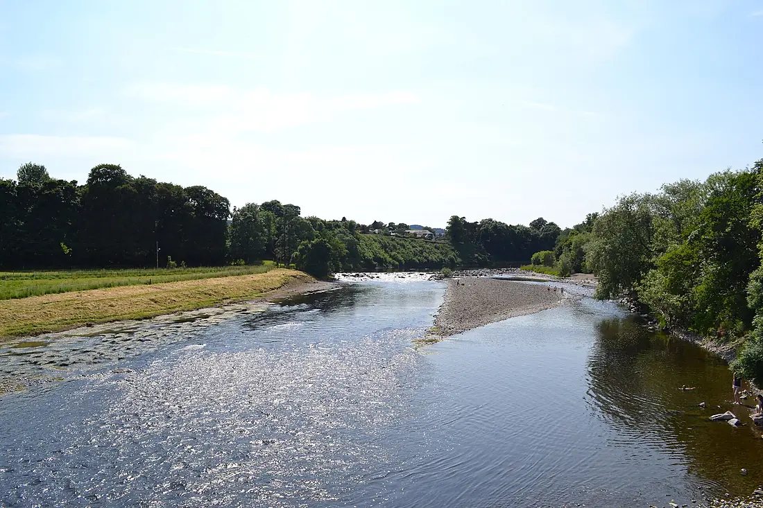
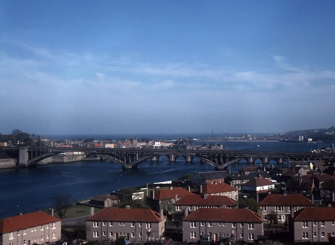
River Tweed in pictures
Tributaries
Where it flows, and what flows into it
Tributaries (20)
Also: River Teviot, Ettrick Water, Leithen Water, River Till, Gala Water, Lyne Water, Whiteadder Water, Eddleston Water, Fruid Water, Caddon Water, River Leader, Talla Water, Biggar Water, Breamish, Eden Water, Manor Water, Quair Water, Leet Water, Hearthstane Burn, Haystoun Burn
Nearby
Rivers nearby
United Kingdom100 km63 m³/s91 km awayRiver TayUnited Kingdom193 km170 m³/s106 km awayRiver WearUnited Kingdom96 km21 m³/s102 km awayRiver ForthUnited Kingdom47 km61 m³/s119 km awayRiver ClydeUnited Kingdom176 km90 m³/s155 km awayRiver TeesUnited Kingdom137 km34 m³/s140 km awayRiver DeeUnited Kingdom154 km44 m³/s154 km awayRiver DonUnited Kingdom131 km21 m³/s157 km awayWhere these numbers come from
| Name, length, places | Wikidata (Q503262) · CC0 |
|---|---|
| Course, profile, basin | RiverATLAS v1.0 (HydroATLAS, Linke et al. 2019) · CC BY 4.0 — followed along the river network from the point given by Wikidata |
| Flow | WaterGAP (RiverATLAS), 1971–2000 · CC BY 4.0 |
| Climate along the river | WorldClim (RiverATLAS), 1970–2000 · CC BY 4.0 |
| Towns, bridges, dams | Wikidata · CC0; GeoNames · CC BY 4.0 |
| Along the river | © OpenStreetMap contributors · ODbL |
| Images | EOX Sentinel-2 cloudless 2016 · CC BY 4.0; Wikimedia Commons |
| Our other atlases | Lakeyas, Coastya, Peakyas, Islandyas — Wikidata · CC0; © OpenStreetMap contributors · ODbL; GeoNames · CC BY 4.0; HydroLAKES · CC BY 4.0; NOAA OISST |
Every source and licence is on the data sources page.
The family
Do you prefer beaches, lakes, mountains, waterfalls, islands, rivers or canyons?
Same idea, other landscapes: field atlases built on open data, month by month, in seven languages.
beaches Find your beach: sea temperature, sun and swimming month by month.Visit lakes
 Every lake on Earth: water temperature, ice, depth and the shore.Coming soonVisit mountains
 Every summit in 3D: summit weather, the 0 °C line, huts and trails.Visit
  waterfalls
 Every waterfall: height, flow month by month and when it roars.Coming soonVisit islands
 Every island from the sea up: size, sea temperature, ferries and 3D.Coming soonVisit
  rivers
 Every river from source to sea: the journey, the flow and the basin in numbers.You are here
 canyons
 Every canyon cut to scale: depth to the floor, rim and floor temperatures, trails and viewpoints.Coming soonVisit