River
Tapajós River
1,930 km from source to mouth · Brazil.
 BrazilFlows into Amazon River8th longest in Brazil
In numbers
Length
1,930km
Average flow
13,000m³/s
Basin
487,000km²
Drop
631m
from 632 m to 1 m
Country
1
The journey
From source to mouth
1,930 km of river and 24 stops on the way: 6 towns and cities on its banks, dams, bridges and the tributaries that feed it.
- 0 kmSourceat 632 m
- 547 kmJuruena10,149 people
- 604 kmCachoeira Meia Carga
- 608 kmCachoeira Figueira
- 612 kmCachoeira Dois Irmãos
- 706 kmCachoeira do Rebojo
- 742 kmCachoeira São João da Barra
- 744 kmCachoeira São Carlos
- 750 kmSalto Augusto
- 773 kmCachoeira Tocarizal
- 789 kmCachoeira das Furnas
- 790 kmCachoeira das Onças
- 977 kmJuruena Rivertributary
- 977 kmTeles Pires Rivertributary
- 995 kmCururu Rivertributary
- 1,089 kmCachoeira do Chacarão
- 1,173 kmJacareacanga24,042 people
- 1,433 kmJamanxim Rivertributary
- 1,469 kmSão Luiz do Tapajós Dam
- 1,471 kmCachoeira Quatá Grande
- 1,519 kmItaituba135,369 people
- 1,597 kmFordlândia1,176 people
- 1,629 kmAveiro16,404 people
- 1,785 kmArapiuns Rivertributary
- 1,809 kmSantarém360,871 people
- 1,930 kmAmazon Riverat 1 m
Water level along the river (RiverATLAS; the height is exaggerated). Towns: GeoNames and Wikidata; bridges, dams and tributaries: Wikidata.
River in Pará, Brazil
At the mouth it carries 13,000 m³/s on average: 5.2 Olympic pools every second. It drops from 632 m to 1 m, 0.3 m per kilometre on average. Its basin covers 487,000 km², about the size of TM. 1.0 million people live in it. Highest water: from February to April; lowest: from July to October. No large dam holds it back: it is one of the world's free-flowing rivers.
Where to start
- SantarémLargest city on its banks · 360,871 people
- Santarém - Maestro Wilson Fonseca International Airport (STM)Nearest airport with scheduled flights, 10 km from the cityCar hire in SantaremDiscover Cars · Affiliate link↗
- On the water9 ferry piers, marinas, boat rentals and boat ramps along the river (OpenStreetMap)
- Kayak and canoe2 put-ins and rapids mapped (OpenStreetMap)
- From June to AugustThe best months to visit
Tapajós River, month by month
Highest water: from February to April
Lowest water: from July to October. Best months to visit: from June to August.
From about 5,500 m³/s in the lowest month to 37,300 m³/s in the highest. An estimate: the monthly flow is modelled from the lowest and highest months of WaterGAP (RiverATLAS, 1971–2000) and the rain and snow along the river (WorldClim). Dams change the real rhythm. The chip is the average air temperature; below it, the month's rain.
Plan the trip
Plan the trip: boat trips, a bed by the river, a car
Some links above are affiliate links: if you book through them we may earn a commission, at no extra cost to you. It never changes what the data on this page says.
The basin
Tapajós River: the basin in numbers
494,231 km² of land send their water to this river. This is what lives on it.
- 1.0millionpeople live in the basin
- 2/km²people per km²
- 305maverage altitude of the basin
- 2,117mmof rain a year (basin average)
- 25.2°Caverage air temperature
- 36%protected areas
What covers the basin
- 76% Forest
- 3% Cropland
- 8% Pasture
RiverATLAS (HydroATLAS v1.0, CC BY 4.0): land cover, people, protected areas, glaciers and dams over the whole basin upstream of the mouth.
Along the river
Tapajós River: what you find on the way
- 9WaterfallsCachoeira do Desastre, Salto Augusto and 7 more
- 2RapidsCorredeira Travessão do Pesqueirinha, Corredeira da Entrada
- 1Boat ramps
- 8Ferry piersTerminal Hidroviário Almir Gabriel, Terminal Hidroviário, Balsa Itaituba and 5 more
- 7River beachesPraia da Maloquinha, Praia do Paraná-Mirim, Praia do Ver o Rio and 4 more
From OpenStreetMap, within 2.8 km of the river. Not mapped is not the same as not there.
Cross-checked with our atlases
Tapajós River in our other atlases
What our sister atlases know about the waterfalls on this river, the lakes it flows through, the beaches at its mouth, the mountains where it rises and the islands off its mouth.
 12waterfalls on the riverCascadyas
Waterfalls (12)
On the river, by Cascadyas
- Cachoeira Meia Cargakm 586
- Cachoeira Figueirakm 590
- Cachoeira Dois Irmãoskm 594
- Cachoeira do Rebojokm 685
- Cachoeira São João da Barrakm 720
- Cachoeira São Carloskm 722
- Cachoeira Tocarizalkm 750
- Cachoeira das Onçaskm 767
4 more on CascadyasCascadyas is coming soonOpen Cascadyas ↗
From space
The source and the mouth, seen from orbit
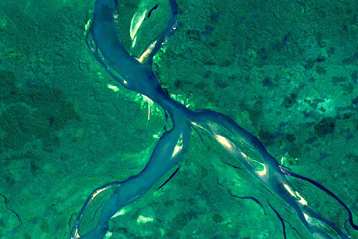
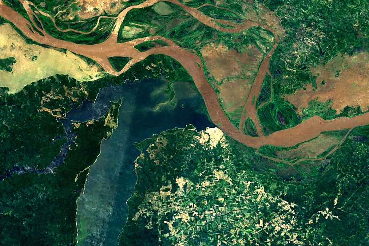
Sentinel-2 cloudless 2016 by EOX IT Services GmbH (contains modified Copernicus Sentinel data 2016), CC BY 4.0. The glowing line is the river as drawn by RiverATLAS.
Photos
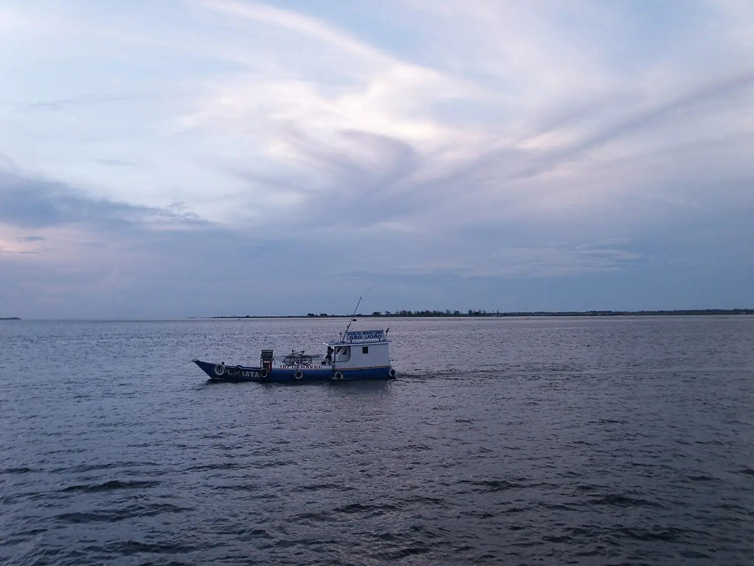
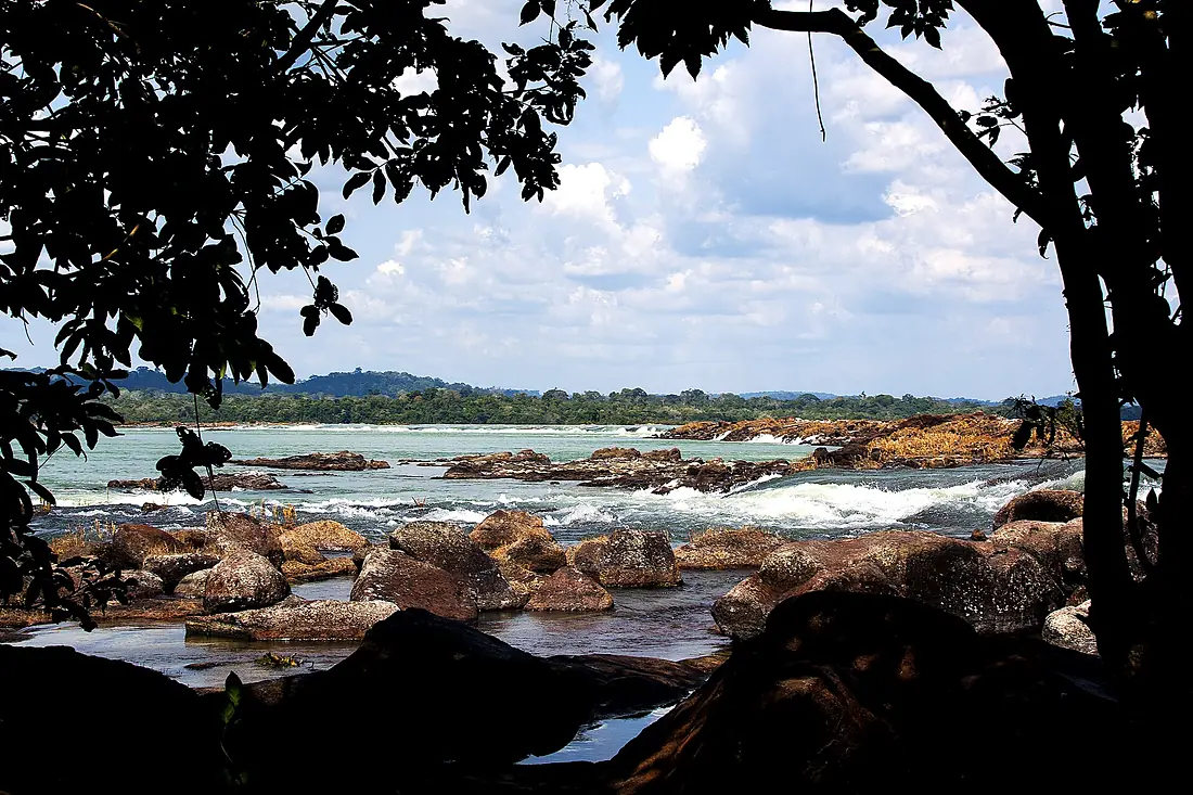
Tapajós River in pictures
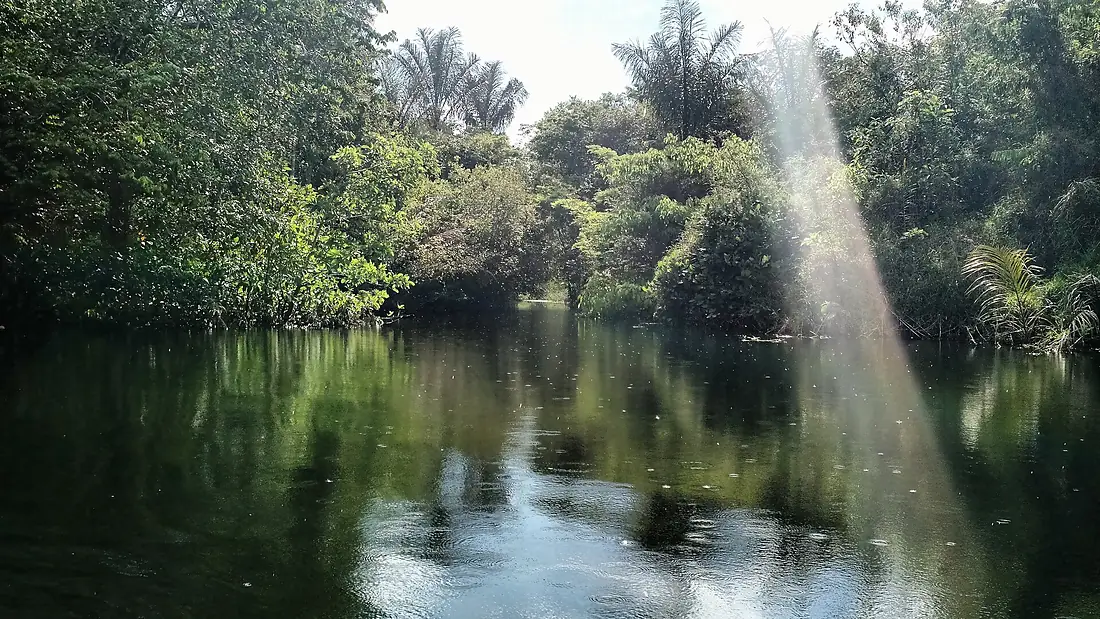
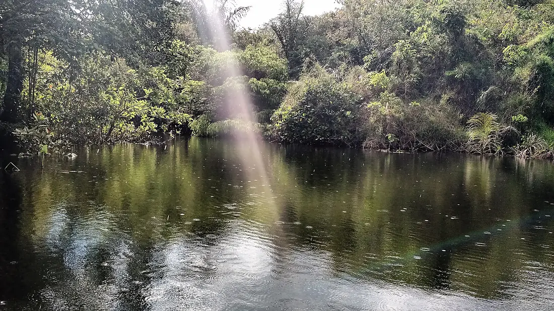
Tributaries
Where it flows, and what flows into it
It flows into
Amazon RiverBrazil6,400 km209,000 m³/sTributaries (11)
Brazil1,370 km4,000 m³/sjoins at km 948Juruena RiverBrazil960 km4,500 m³/sjoins at km 948Also: Jamanxim River, Arapiuns River, Cururu River, Crepori River, Das Tropas River, Andirá River, Cupari River, Curupara River, Pacu River
In the same basin
Brazil2,250 km30,000 m³/sMadeira RiverBrazil1,450 km31,200 m³/sMarañón River Peru1,737 km16,700 m³/sUcayali RiverPeru1,460 km12,600 m³/sJapurá RiverBrazil2,820 km13,900 m³/sXingu RiverBrazil1,640 km9,700 m³/sMamoré RiverBrazil1,930 km11,600 m³/sJuruá RiverBrazil3,100 km4,800 m³/sPutumayo RiverBrazil1,610 km7,000 m³/sPurus RiverBrazil2,960 km8.4 m³/s
Where these numbers come from
| Name, length, places | Wikidata (Q752674) · CC0 |
|---|---|
| Course, profile, basin | RiverATLAS v1.0 (HydroATLAS, Linke et al. 2019) · CC BY 4.0 — followed from the source to the mouth given by Wikidata |
| Flow | WaterGAP (RiverATLAS), 1971–2000 · CC BY 4.0 |
| Climate along the river | WorldClim (RiverATLAS), 1970–2000 · CC BY 4.0 |
| Towns, bridges, dams | Wikidata · CC0; GeoNames · CC BY 4.0 |
| Along the river | © OpenStreetMap contributors · ODbL |
| Images | EOX Sentinel-2 cloudless 2016 · CC BY 4.0; Wikimedia Commons |
| Our other atlases | Cascadyas — Wikidata · CC0; © OpenStreetMap contributors · ODbL; GeoNames · CC BY 4.0; HydroLAKES · CC BY 4.0; NOAA OISST |
Every source and licence is on the data sources page.
The family
Do you prefer beaches, lakes, mountains, waterfalls, islands, rivers or canyons?
Same idea, other landscapes: field atlases built on open data, month by month, in seven languages.
 beaches
 Find your beach: sea temperature, sun and swimming month by month.Visit
  lakes
lakes Every lake on Earth: water temperature, ice, depth and the shore.Coming soonVisit
  mountains
 Every summit in 3D: summit weather, the 0 °C line, huts and trails.Visit waterfalls
 Every waterfall: height, flow month by month and when it roars.Coming soonVisit
  islands
 Every island from the sea up: size, sea temperature, ferries and 3D.Coming soonVisit
  rivers
 Every river from source to sea: the journey, the flow and the basin in numbers.You are here
 canyons
 Every canyon cut to scale: depth to the floor, rim and floor temperatures, trails and viewpoints.Coming soonVisit