River
Amazon River
6,400 km from source to mouth · Brazil, Peru and Colombia.
 Brazil, Peru and ColombiaFlows into Atlantic Ocean1st longest in Brazil
In numbers
Length
6,400km
Average flow
209,000m³/s
Basin
7,050,000km²
Drop
3,927m
from 3,927 m to 0 m
Countries
3
The journey
From source to mouth
6,400 km of river and 68 stops on the way: 24 towns and cities on its banks, dams, bridges and the tributaries that feed it.
- 0 kmMarañón Riverat 3,927 m
- 0 kmLake Patarcocha2.1 km²
- 15 kmLauricocha Lake6.4 km²
- 27 kmYanacancha23,175 people
- 1,760 kmLaguna San Jacinto0.4 km²
- 1,836 kmMarañón Rivertributary
- 1,836 kmUcayali Rivertributary
- 1,977 kmIquitos377,609 people
- 1,978 kmItaya Rivertributary
- 1,980 kmNanay Rivertributary
- 2,062 kmNapo Rivertributary
- 2,251 kmLaguna Yuri0.9 km²
- 2,461 kmPuerto Nariño9,744 people
- 2,543 kmLeticia55,691 people
- 2,545 kmTabatinga67,182 people
- 2,555 kmJavary Rivertributary
- 2,837 kmJandiatuba Rivertributary
- 2,970 kmPutumayo Rivertributary
- 2,975 kmSanto Antônio do Içá21,243 people
- 3,011 kmTonantins18,897 people
- 3,099 kmLago Ipixuna0.4 km²
- 3,192 kmLago Favónio0.4 km²
- 3,194 kmJutai Rivertributary
- 3,359 kmFonte Boa16,060 people
- 3,413 kmJuruá Rivertributary
- 3,614 kmJapurá Rivertributary
- 3,615 kmAlvarães16,670 people
- 3,637 kmLake Tefé253 km²
- 3,686 kmLago Caiambé26 km²
- 3,732 kmLago Taruá18 km²
- 3,937 kmLago do Boto0.9 km²
- 3,942 kmLago Ajurá2.2 km²
- 3,944 kmLago do Amaxari0.3 km²
- 4,028 kmLago Miuá35 km²
- 4,050 kmCodajás29,168 people
- 4,126 kmAnori17,932 people
- 4,167 kmAnamã9,962 people
- 4,284 kmLago Cabaliana147 km²
- 4,288 kmManacapuru111,751 people
- 4,351 kmIranduba49,011 people
- 4,371 kmLago Preto0.4 km²
- 4,401 kmSolimõestributary
- 4,401 kmManaus2,303,732 people
- 4,405 kmRio Negrotributary
- 4,524 kmPreto da Eva Rivertributary
- 4,575 kmMadeira Rivertributary
- 4,629 kmItacoatiara103,598 people
- 4,664 kmUrucurituba23,945 people
- 4,691 kmLago Pasto Grande0.4 km²
- 4,700 kmLago Saracá366 km²
- 4,701 kmUrubu Rivertributary
- 4,706 kmLago Caetano2.8 km²
- 4,706 kmLago do Pecedonio2.0 km²
- 4,938 kmParintins96,372 people
- 5,021 kmLago Uruá358 km²
- 5,051 kmJuruti58,960 people
- 5,139 kmTrombetas Rivertributary
- 5,153 kmÓbidos52,306 people
- 5,228 kmLago Grande do Curuai945 km²
- 5,299 kmTapajós Rivertributary
- 5,306 kmSantarém360,871 people
- 5,355 kmLago Grande de Monte Alegre409 km²
- 5,397 kmCuruá Una Rivertributary
- 5,454 kmMaicuru Rivertributary
- 5,529 kmPrainha45,354 people
- 5,652 kmParu Rivertributary
- 5,665 kmAlmeirim34,076 people
- 5,770 kmXingu Rivertributary
- 5,802 kmGurupá33,755 people
- 6,400 kmAtlantic Oceanat 0 m
Water level along the river (RiverATLAS; the height is exaggerated). Towns: GeoNames and Wikidata; bridges, dams and tributaries: Wikidata.
River in South America
At the mouth it carries 209,000 m³/s on average: 84 Olympic pools every second. It drops from 3,927 m to 0 m, 0.6 m per kilometre on average. Its basin covers 7,050,000 km², about the size of AU. 29.7 million people live in it. Highest water: from March to May. No large dam holds it back: it is one of the world's free-flowing rivers.
Where to start
- ManausLargest city on its banks · 2,303,732 people
- Eduardo Gomes International Airport (MAO)Nearest airport with scheduled flights, 10 km from the cityCar hire at MAO airport (Manaus)Discover Cars · Affiliate link↗
- On the water96 ferry piers, marinas, boat rentals and boat ramps along the river (OpenStreetMap)
- From July to SeptemberThe best months to visit
Amazon River, month by month
Highest water: from March to May
Best months to visit: from July to September.
From about 125,400 m³/s in the lowest month to 290,300 m³/s in the highest. An estimate: the monthly flow is modelled from the lowest and highest months of WaterGAP (RiverATLAS, 1971–2000) and the rain and snow along the river (WorldClim). Dams change the real rhythm. The chip is the average air temperature; below it, the month's rain.
Plan the trip
Plan the trip: boat trips, a bed by the river, a car
Some links above are affiliate links: if you book through them we may earn a commission, at no extra cost to you. It never changes what the data on this page says.
The basin
Amazon River: the basin in numbers
5,912,761 km² of land send their water to this river. This is what lives on it.
- 29.7millionpeople live in the basin
- 5/km²people per km²
- 437maverage altitude of the basin
- 2,154mmof rain a year (basin average)
- 24.6°Caverage air temperature
- 42%protected areas
- 0.4%covered by lakes
- 23km³held in reservoirs
What covers the basin
- 80% Forest
- 2% Cropland
- 9% Pasture
RiverATLAS (HydroATLAS v1.0, CC BY 4.0): land cover, people, protected areas, glaciers and dams over the whole basin upstream of the mouth.
Along the river
Amazon River: what you find on the way
- 2Waterfalls
- 3Boat ramps
- 92Ferry piersPuerto principal de Nauta, Puerto Pesquero Artesanal, Puerto Henry and 89 more
- 1MarinasPuerto Santa Rosa
- 9River beachesIsla Ronda, Praia de São Francisco do Tonantins, Praia de Tonantins and 6 more
From OpenStreetMap, within 3.5 km of the river. Not mapped is not the same as not there.
Cross-checked with our atlases
Amazon River in our other atlases
What our sister atlases know about the waterfalls on this river, the lakes it flows through, the beaches at its mouth, the mountains where it rises and the islands off its mouth.
 22lakes on its wayLakeyas
Lakes and reservoirs (22)
Lakes it flows through, by Lakeyas
- Lauricocha Lakekm 126.4km²
- Lake Tefékm 2,925253km²
- Lago Caiambékm 2,96426km²
- Lago Cabalianakm 3,445147km²
- Lago Saracákm 3,779366km²
- Lago Uruákm 4,038358km²
- Lago Grande do Curuaikm 4,204945km²
- Lago Grande de Monte Alegrekm 4,306409km²
14 more on LakeyasLakeyas is coming soonOpen Lakeyas ↗
From space
The source and the mouth, seen from orbit
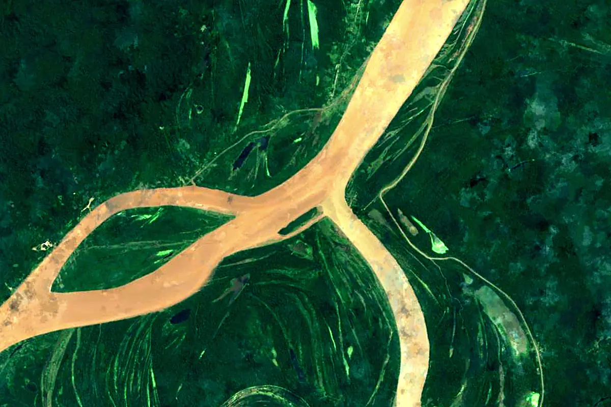
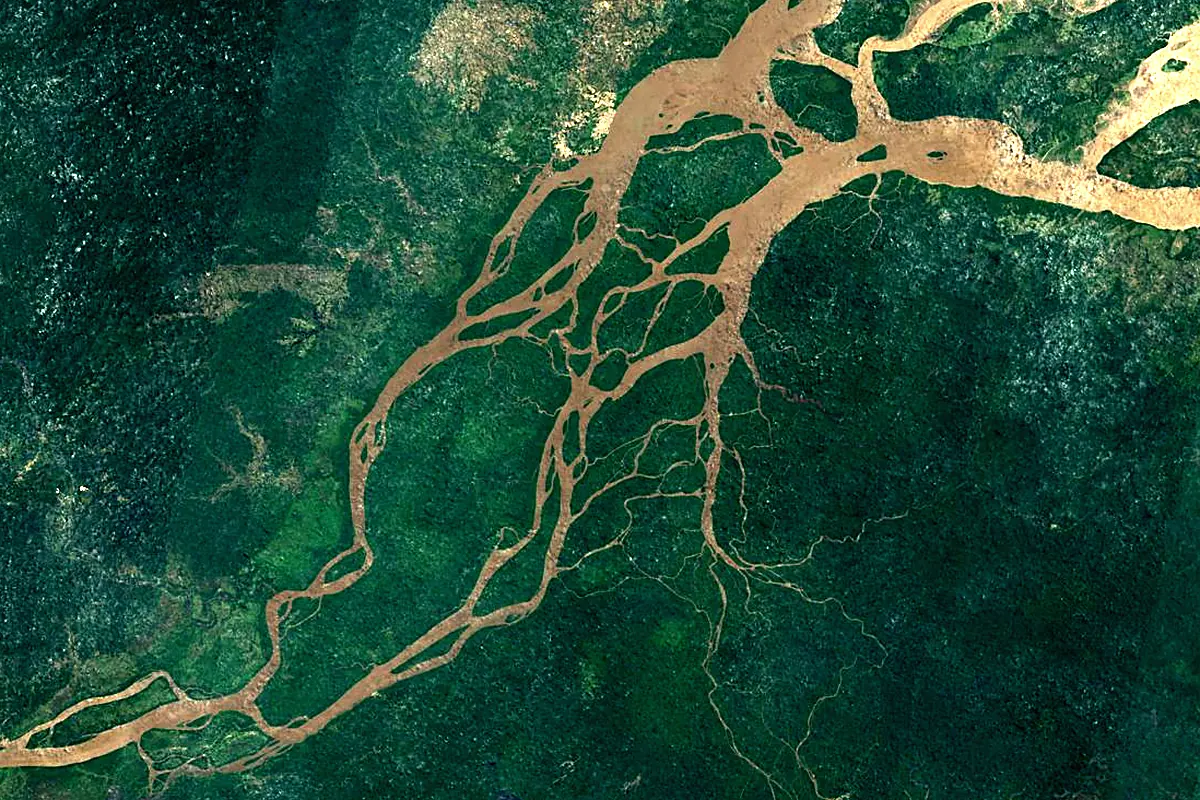
Sentinel-2 cloudless 2016 by EOX IT Services GmbH (contains modified Copernicus Sentinel data 2016), CC BY 4.0. The glowing line is the river as drawn by RiverATLAS.
Photos
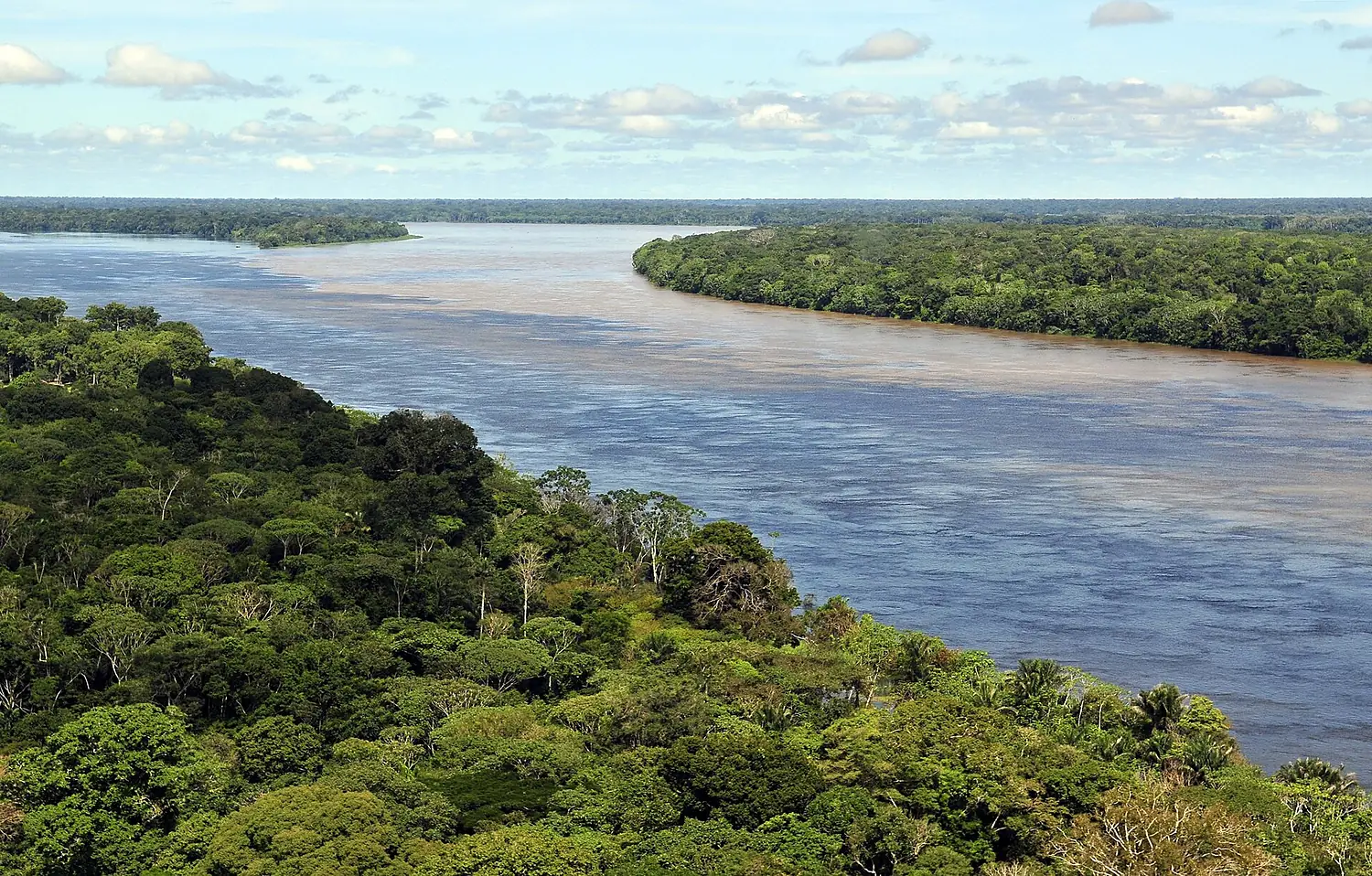
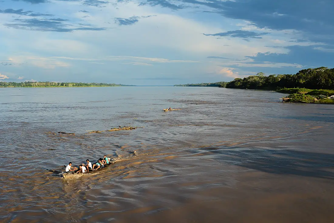
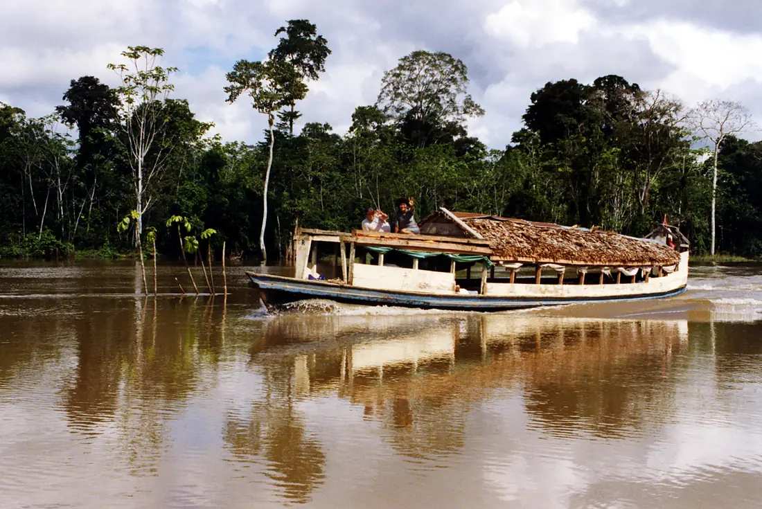
Amazon River in pictures
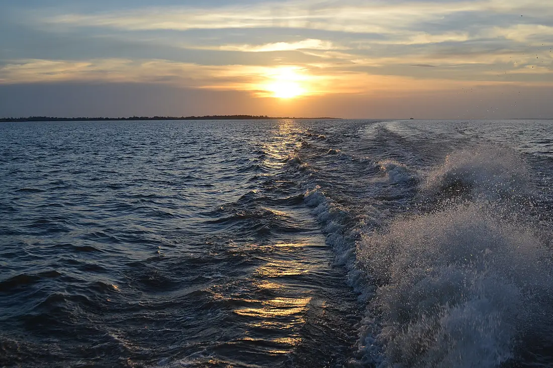
Tributaries
Where it flows, and what flows into it
Tributaries (56)
Brazil3,100 km4,800 m³/sjoins at km 2,745Japurá RiverBrazil2,820 km13,900 m³/sjoins at km 2,906Rio NegroBrazil2,250 km30,000 m³/sjoins at km 3,542Tapajós RiverBrazil1,930 km13,000 m³/sjoins at km 4,262Marañón RiverPeru1,737 km16,700 m³/sjoins at km 1,476Xingu RiverBrazil1,640 km9,700 m³/sjoins at km 4,640Putumayo RiverBrazil1,610 km7,000 m³/sjoins at km 2,388SolimõesBrazil1,600 km100,000 m³/sjoins at km 3,539Ucayali RiverPeru1,460 km12,600 m³/sjoins at km 1,476Madeira RiverBrazil1,450 km31,200 m³/sjoins at km 3,679Jutai RiverBrazil1,200 km2,400 m³/sjoins at km 2,569Napo RiverPeru1,130 km7,100 m³/sjoins at km 1,658Also: Trombetas River, Nanay River, Paru River, Nhamundá River, Matapi River, Urubu River, Uatumã River, Pedreira River, Curuá Una River, Jandiatuba River, Taraíra River, Guarijuba River, Itaya River, Preto da Eva River, Vila Nova River, Jacaré River, Macacoari River, Maicuru River, Maracá River, Cajari River, Cana Brava River, Curuá River, Manacapuru River, Piorini River
In the same basin
Brazil1,930 km11,600 m³/sPurus RiverBrazil2,960 km8.4 m³/sBeni River Bolivia1,100 km8.9 m³/sHuallaga RiverPeru1,080 km3,800 m³/sMadre de Dios RiverBolivia1,060 km4.9 m³/sGuaporé RiverBrazil1,210 km1.5 m³/sCasiquiare canal
 Venezuela326 km2,400 m³/sApurímac RiverPeru850 km2,100 m³/sUrubamba RiverPeru725 km2,200 m³/sTeles Pires RiverBrazil1,370 km4,000 m³/s
Where these numbers come from
| Name, length, places | Wikidata (Q3783) · CC0 |
|---|---|
| Course, profile, basin | RiverATLAS v1.0 (HydroATLAS, Linke et al. 2019) · CC BY 4.0 — followed from the source to the mouth given by Wikidata |
| Flow | WaterGAP (RiverATLAS), 1971–2000 · CC BY 4.0 |
| Climate along the river | WorldClim (RiverATLAS), 1970–2000 · CC BY 4.0 |
| Towns, bridges, dams | Wikidata · CC0; GeoNames · CC BY 4.0 |
| Along the river | © OpenStreetMap contributors · ODbL |
| Images | EOX Sentinel-2 cloudless 2016 · CC BY 4.0; Wikimedia Commons |
| Our other atlases | Lakeyas — Wikidata · CC0; © OpenStreetMap contributors · ODbL; GeoNames · CC BY 4.0; HydroLAKES · CC BY 4.0; NOAA OISST |
Every source and licence is on the data sources page.
The family
Do you prefer beaches, lakes, mountains, waterfalls, islands, rivers or canyons?
Same idea, other landscapes: field atlases built on open data, month by month, in seven languages.
 beaches
 Find your beach: sea temperature, sun and swimming month by month.Visit lakes
 Every lake on Earth: water temperature, ice, depth and the shore.Coming soonVisit
  mountains
 Every summit in 3D: summit weather, the 0 °C line, huts and trails.Visit
  waterfalls
 Every waterfall: height, flow month by month and when it roars.Coming soonVisit
  islands
 Every island from the sea up: size, sea temperature, ferries and 3D.Coming soonVisit
  rivers
 Every river from source to sea: the journey, the flow and the basin in numbers.You are here
 canyons
 Every canyon cut to scale: depth to the floor, rim and floor temperatures, trails and viewpoints.Coming soonVisit