River
Vilaine
218 km from source to mouth · France.
 FranceFlows into Atlantic Ocean
In numbers
Length
218km
Average flow
80m³/s
Basin
10,995km²
Drop
56m
from 55 m to -1 m
Country
1
The journey
From source to mouth
218 km of river and 68 stops on the way: 58 towns and cities on its banks, dams, bridges and the tributaries that feed it.
- 0 kmJuvignéat 55 m
- 0 kmJuvigné1,327 people
- 0 kmLa Croixille629 people
- 0 kmBourgon616 people
- 3 kmLa Chapelle-Erbrée717 people
- 5 kmSaint-M'Hervé1,354 people
- 6 kmErbrée1,703 people
- 10 kmBalazé2,162 people
- 14 kmVitré19,365 people
- 18 kmPocé-les-Bois1,312 people
- 24 kmCornillé961 people
- 24 kmSaint-Aubin-des-Landes917 people
- 25 kmValièretributary
- 31 kmSaint-Jean-sur-Vilaine1,375 people
- 34 kmSaint-Didier2,022 people
- 36 kmChâteaubourg7,533 people
- 43 kmServon-sur-Vilaine4,152 people
- 46 kmBrécé2,232 people
- 50 kmNoyal-sur-Vilaine6,269 people
- 52 kmAcigné6,874 people
- 57 kmThorigné-Fouillard8,667 people
- 60 kmCesson-Sévigné18,761 people
- 63 kmChantepie7,560 people
- 69 kmRennes230,890 people
- 69 kmIlletributary
- 70 kmSaint-Jacques-de-la-Lande13,800 people
- 74 kmVezin-le-Coquet6,471 people
- 76 kmLe Rheu9,839 people
- 82 kmChavagne4,709 people
- 84 kmMeutributary
- 84 kmFlûmetributary
- 84 kmBruz19,683 people
- 88 kmGoven4,359 people
- 94 kmSeichetributary
- 94 kmGuichen9,412 people
- 95 kmLaillé5,225 people
- 101 kmBourg-des-Comptes3,411 people
- 105 kmSemnontributary
- 106 kmPléchâtel2,833 people
- 108 kmSaint-Senoux1,863 people
- 110 kmSaint-Malo-de-Phily1,081 people
- 121 kmGuipry-Messac7,354 people
- 136 kmSainte-Anne-sur-Vilaine1,035 people
- 137 kmLangon1,423 people
- 139 kmChèretributary
- 139 kmPierric1,010 people
- 146 kmGuémené-Penfao5,243 people
- 148 kmMassérac665 people
- 149 kmLa Chapelle-de-Brain1,114 people
- 150 kmDontributary
- 156 kmSainte-Marie2,247 people
- 158 kmAvessac2,452 people
- 166 kmSaint-Nicolas-de-Redon3,311 people
- 167 kmRedon9,542 people
- 169 kmAllaire3,955 people
- 169 kmOusttributary
- 173 kmFégréac2,243 people
- 175 kmRieux2,856 people
- 177 kmIsactributary
- 178 kmThéhillac611 people
- 178 kmSaint-Dolay2,645 people
- 188 kmBéganne1,493 people
- 197 kmPéaule2,929 people
- 199 kmMarzan2,684 people
- 200 kmNivillac4,951 people
- 202 kmLa Roche-Bernard746 people
- 208 kmArzal1,846 people
- 210 kmFérel3,499 people
- 214 kmCamoël1,183 people
- 218 kmAtlantic Oceanat -1 m
Water level along the river (RiverATLAS; the height is exaggerated). Towns: GeoNames and Wikidata; bridges, dams and tributaries: Wikidata.
River in France
At the mouth it carries 80 m³/s on average: an Olympic pool every 31 seconds. It drops from 55 m to -1 m, 0.3 m per kilometre on average. Its basin covers 10,995 km², about the size of JM. 1.1 million people live in it. Highest water: from December to February; lowest: from July to August. No large dam holds it back: it is one of the world's free-flowing rivers.
Where to start
- RennesLargest city on its banks · 230,890 people
- Rennes-Saint-Jacques Airport (RNS)Nearest airport with scheduled flights, 6 km from the cityCar hire at RNS airport (Saint-Jacques-de-la-Lande, Ille-et-Vilaine)Discover Cars · Affiliate link↗
- On the water58 ferry piers, marinas, boat rentals and boat ramps along the river (OpenStreetMap)
- From May to SeptemberThe best months to visit
Vilaine, month by month
Highest water: from December to February
Lowest water: from July to August. Best months to visit: from May to September.
From about 38 m³/s in the lowest month to 320 m³/s in the highest. An estimate: the monthly flow is modelled from the lowest and highest months of WaterGAP (RiverATLAS, 1971–2000) and the rain and snow along the river (WorldClim). Dams change the real rhythm. The chip is the average air temperature; below it, the month's rain.
Plan the trip
Plan the trip: boat trips, a bed by the river, a car
Some links above are affiliate links: if you book through them we may earn a commission, at no extra cost to you. It never changes what the data on this page says.
The basin
Vilaine: the basin in numbers
10,459 km² of land send their water to this river. This is what lives on it.
- 1.1millionpeople live in the basin
- 101/km²people per km²
- 81maverage altitude of the basin
- 773mmof rain a year (basin average)
- 11.1°Caverage air temperature
- 0.2%covered by lakes
What covers the basin
- 2% Forest
- 66% Cropland
- 13% Pasture
- 3% Towns and cities
RiverATLAS (HydroATLAS v1.0, CC BY 4.0): land cover, people, protected areas, glaciers and dams over the whole basin upstream of the mouth.
Along the river
Vilaine: what you find on the way
- 69WeirsDéversoir de la Barbotière, Barrage d'Arzal and 67 more
- 58LocksLa Vilaine, Canal d'Ille-et-Rance, Canal de Cicé and 55 more
- 42Boat rampsCale de Pont-Réan and 41 more
- 7MarinasPort de plaisance de Guipry-Messac, Port de plaisance de Redon, Capitainerie du port de Foleux and 4 more
- 2River beachesPlage d'Apigné, Plage de Men-Armor
From OpenStreetMap, within 1.8 km of the river. Not mapped is not the same as not there.
Cross-checked with our atlases
Vilaine in our other atlases
What our sister atlases know about the waterfalls on this river, the lakes it flows through, the beaches at its mouth, the mountains where it rises and the islands off its mouth.
 8beaches at the mouth and on the banksCoastya
 19islands off the mouthIslandyas
Beaches (8)
At the mouth (25 km) and on the banks, by Coastya
- Plage Suscinio21 km away18.2°C
- Plage Beg Lann22 km away18.2°C
- plage de Montsarrac23 km away18.2°C
- plage de la Villeneuve24 km away18.2°C
- Anse de Belmont16 km away · cove18.2°C
- Crique de Kervelys16 km away · cove18.2°C
- Anse de Camaret2.9 km away · cove18.2°C
- Ans de Port-Mânes16 km away · cove18.2°C
Islands off the mouth (19)
Within 30 km of the mouth, by Islandyas
- Île d'Arz28 km away2.7km²
- Boëdic28 km away
- île Dumet16 km away
- Île Tascon23 km away
- île de Boëd27 km away
- île Ilur27 km away0.4km²
- Pladic Island24 km away
- île Bailleron24 km away
11 more on IslandyasIslandyas is coming soonOpen Islandyas ↗
From space
The source and the mouth, seen from orbit
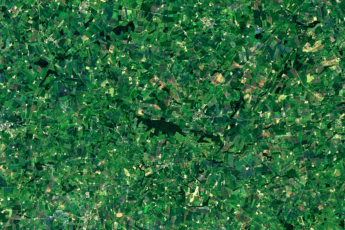
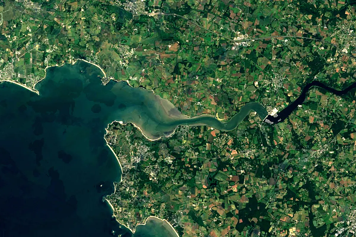
Sentinel-2 cloudless 2016 by EOX IT Services GmbH (contains modified Copernicus Sentinel data 2016), CC BY 4.0. The glowing line is the river as drawn by RiverATLAS.
Photos
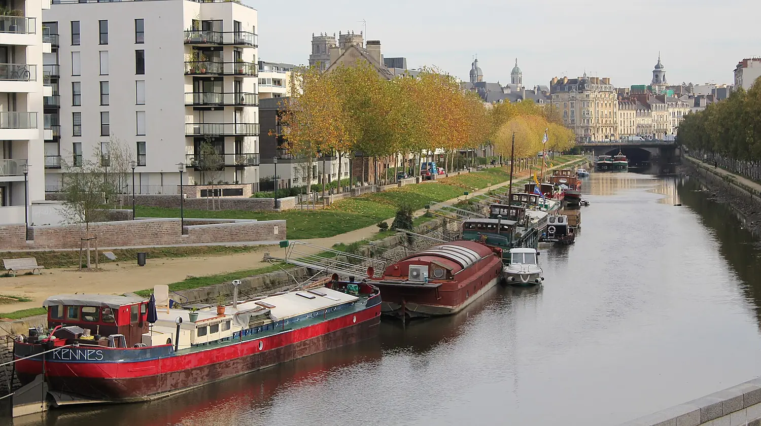
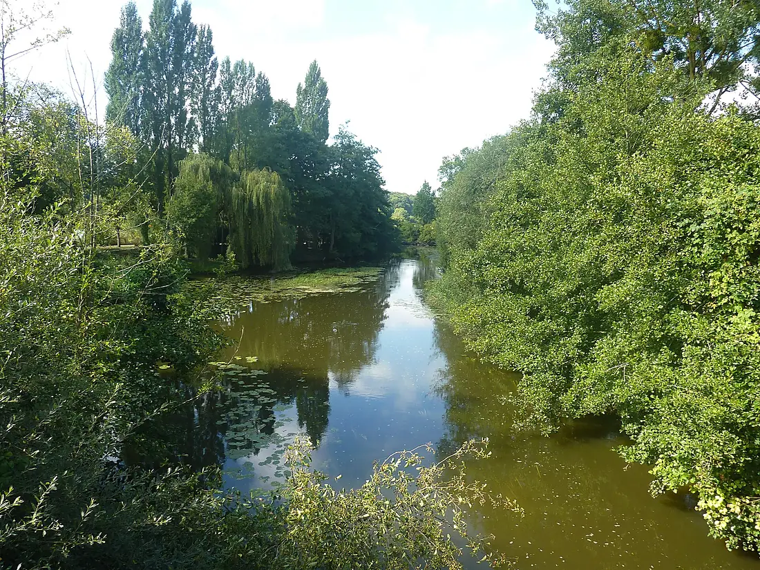
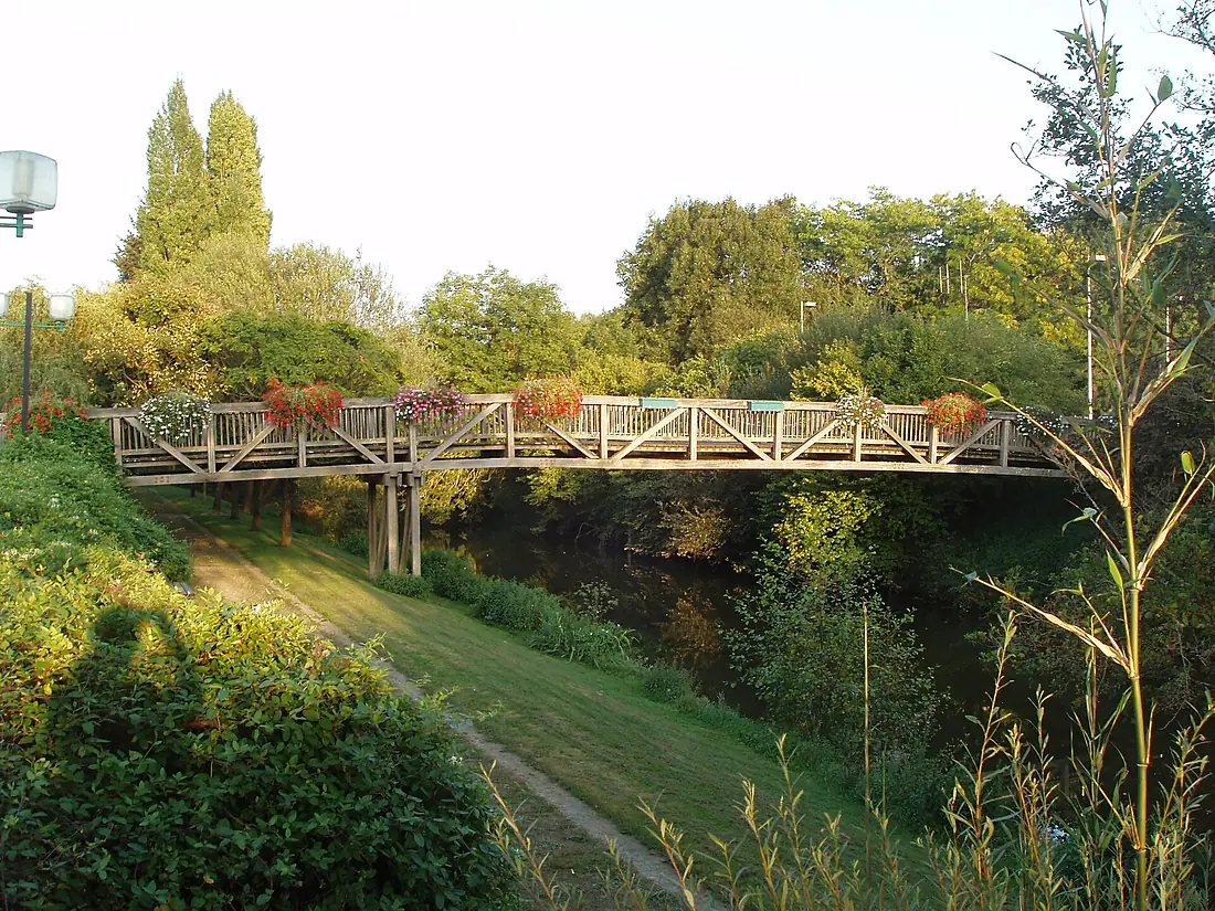
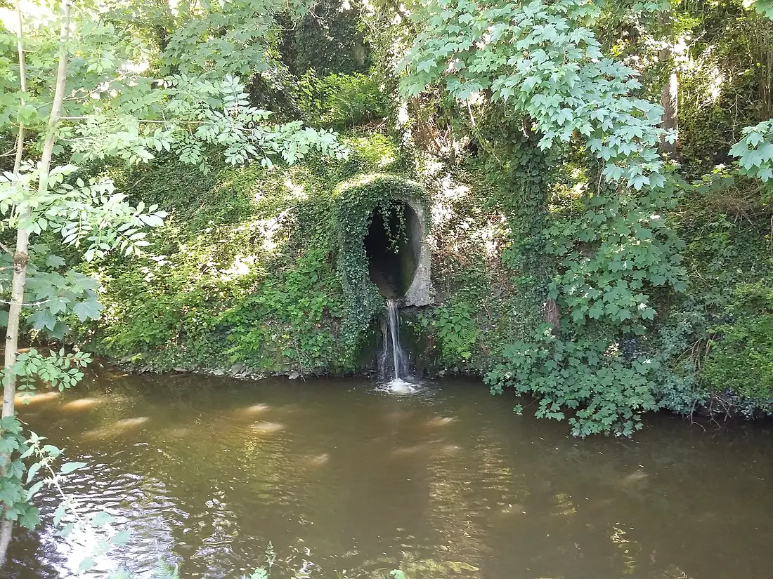
Vilaine in pictures
Tributaries
Where it flows, and what flows into it
Tributaries (17)
Also: Ille, Oust, Chère, Don, Semnon, Seiche, Meu, Isac, Cantache, Veuvre, Flûme, Canut de Renac, Blosne, Ruisseau de Trévélo, Valière, Canut, Vernouzet
Nearby
Rivers nearby
Where these numbers come from
| Name, length, places | Wikidata (Q842462) · CC0 |
|---|---|
| Course, profile, basin | RiverATLAS v1.0 (HydroATLAS, Linke et al. 2019) · CC BY 4.0 — followed from the source to the mouth given by Wikidata |
| Flow | WaterGAP (RiverATLAS), 1971–2000 · CC BY 4.0 |
| Climate along the river | WorldClim (RiverATLAS), 1970–2000 · CC BY 4.0 |
| Towns, bridges, dams | Wikidata · CC0; GeoNames · CC BY 4.0 |
| Along the river | © OpenStreetMap contributors · ODbL |
| Images | EOX Sentinel-2 cloudless 2016 · CC BY 4.0; Wikimedia Commons |
| Our other atlases | Coastya, Islandyas — Wikidata · CC0; © OpenStreetMap contributors · ODbL; GeoNames · CC BY 4.0; HydroLAKES · CC BY 4.0; NOAA OISST |
Every source and licence is on the data sources page.
The family
Do you prefer beaches, lakes, mountains, waterfalls, islands, rivers or canyons?
Same idea, other landscapes: field atlases built on open data, month by month, in seven languages.
beaches Find your beach: sea temperature, sun and swimming month by month.Visit
  lakes
lakes Every lake on Earth: water temperature, ice, depth and the shore.Coming soonVisit
  mountains
 Every summit in 3D: summit weather, the 0 °C line, huts and trails.Visit
  waterfalls
 Every waterfall: height, flow month by month and when it roars.Coming soonVisit islands
 Every island from the sea up: size, sea temperature, ferries and 3D.Coming soonVisit
  rivers
 Every river from source to sea: the journey, the flow and the basin in numbers.You are here
 canyons
 Every canyon cut to scale: depth to the floor, rim and floor temperatures, trails and viewpoints.Coming soonVisit