River
Loire
1,006 km from source to mouth · France.
 FranceFlows into Loire estuary1st longest in France
In numbers
Length
1,006km
Average flow
840m³/s
Basin
117,356km²
Drop
999m
from 973 m to -26 m
Country
1
The journey
From source to mouth
1,006 km of river and 68 stops on the way: 22 towns and cities on its banks, dams, bridges and the tributaries that feed it.
- 0 kmSaint-Martialat 973 m
- 6 kmLac d'Issarlès0.6 km²
- 30 kmCascade de la Beaume27 m
- 51 kmBornetributary
- 92 kmRameltributary
- 93 kmLignon du Velaytributary
- 98 kmAncetributary
- 111 kmAurec-sur-Loire6,164 people
- 123 kmSaint-Étienne173,136 people
- 125 kmLac de Grangent2.3 km²
- 150 kmCoisetributary
- 158 kmToranchetributary
- 167 kmLignon du Foreztributary
- 179 kmAixtributary
- 204 kmLac de Villerest4.0 km²
- 210 kmRoanne35,409 people
- 212 kmRhinstributary
- 227 kmSornintributary
- 266 kmArconcetributary
- 275 kmVouzancetributary
- 275 kmArrouxtributary
- 285 kmLoddestributary
- 295 kmBesbretributary
- 305 kmSommetributary
- 342 kmArontributary
- 348 kmAcolintributary
- 374 kmNièvretributary
- 374 kmNevers33,085 people
- 382 kmAlliertributary
- 399 kmAuboistributary
- 423 kmMazoutributary
- 445 kmCosne-Cours-sur-Loire9,733 people
- 460 kmVrilletributary
- 480 kmTrézéetributary
- 489 kmGien13,459 people
- 499 kmAquiaulnetributary
- 564 kmOrléans116,357 people
- 592 kmMauvestributary
- 602 kmArdouxtributary
- 628 kmBlois47,219 people
- 640 kmBeuvrontributary
- 665 kmAmboise12,937 people
- 670 kmAmassetributary
- 677 kmRommetributary
- 684 kmRiver Cissetributary
- 690 kmTours139,259 people
- 691 kmSaint-Cyr-sur-Loire17,029 people
- 704 kmChoisilletributary
- 710 kmChertributary
- 710 kmBresmetributary
- 717 kmRoumertributary
- 747 kmIndre Rivertributary
- 747 kmViennetributary
- 747 kmConfluence BeachUNESCO World Heritage
- 748 kmThe Loire Valley between Sully-sur-Loire and ChalonnesUNESCO World Heritage
- 761 kmSaumur26,241 people
- 763 kmThouettributary
- 801 kmAuthiontributary
- 810 kmMaine-et-Loire833,776 people
- 825 kmLayontributary
- 862 kmAncenis7,510 people
- 892 kmSainte-Luce-sur-Loire16,400 people
- 894 kmBasse-Goulaine9,679 people
- 897 kmSaint-Sébastien-sur-Loire28,596 people
- 899 kmNantes327,734 people
- 901 kmRezé43,556 people
- 906 kmBouguenais20,530 people
- 909 kmSaint-Herblain50,973 people
- 915 kmCouëron24,103 people
- 1,006 kmLoire estuaryat -26 m
Water level along the river (RiverATLAS; the height is exaggerated). Towns: GeoNames and Wikidata; bridges, dams and tributaries: Wikidata.
Longest river in France
At the mouth it carries 835 m³/s on average: an Olympic pool every 3.0 seconds. It drops from 973 m to -26 m, 1.0 m per kilometre on average. Its basin covers 117,356 km², about the size of MW. 8.2 million people live in it. Highest water: from December to February. Its dams hold back little of its water (2.4% of a year's flow).
Where to start
- Maine-et-LoireLargest city on its banks · 833,776 people
- Nantes Atlantique Airport (NTE)Nearest airport with scheduled flights, 83 km from the cityCar hire at NTE airport (Nantes)Discover Cars · Affiliate link↗
- On the water302 ferry piers, marinas, boat rentals and boat ramps along the river (OpenStreetMap)
- Kayak and canoe6 put-ins and rapids mapped (OpenStreetMap)
- From May to SeptemberThe best months to visit
Loire, month by month
Highest water: from December to February
Best months to visit: from May to September.
From about 340 m³/s in the lowest month to 1,600 m³/s in the highest. An estimate: the monthly flow is modelled from the lowest and highest months of WaterGAP (RiverATLAS, 1971–2000) and the rain and snow along the river (WorldClim). Dams change the real rhythm. The chip is the average air temperature; below it, the month's rain.
Plan the trip
Plan the trip: boat trips, a bed by the river, a car
Some links above are affiliate links: if you book through them we may earn a commission, at no extra cost to you. It never changes what the data on this page says.
The basin
Loire: the basin in numbers
116,722 km² of land send their water to this river. This is what lives on it.
- 8.2millionpeople live in the basin
- 71/km²people per km²
- 284maverage altitude of the basin
- 751mmof rain a year (basin average)
- 10.5°Caverage air temperature
- 14%protected areas
- 0.2%covered by lakes
- 0.8km³held in reservoirs
What covers the basin
- 16% Forest
- 38% Cropland
- 22% Pasture
- 3% Towns and cities
RiverATLAS (HydroATLAS v1.0, CC BY 4.0): land cover, people, protected areas, glaciers and dams over the whole basin upstream of the mouth.
Along the river
Loire: what you find on the way
- 143WeirsDéversoir de Thaleine, Barrage de Saint-Leger des Vignes, Déversoir de la Cognardière and 140 more
- 215LocksCanal de Roanne à Digoin, Ancien Canal de Roanne à Digoin, Ecluse Chambilly #6 and 212 more
- 6WaterfallsCascade de la Beaume, Cascade de la Louade and 4 more
- 2RapidsLes Trois Fourches
- 4Canoe put-insEmbarquement Pont de Lignon and 3 more
- 201Boat rampsPoint d'embarquement et de débarquement isolé de canoë kayak, Port du Camping, Cale à Pilon and 198 more
- 17Ferry piersÎle Charlemagne - Base de Loisirs, Cabinet Vert, Quai du Châtelet and 14 more
- 62MarinasPort de Bully, Port de la Caille, Port de Roanne and 59 more
- 17River beachesPerreux, Nevers Plage, Madagascar and 14 more
From OpenStreetMap, within 2.4 km of the river. Not mapped is not the same as not there.
Cross-checked with our atlases
Loire in our other atlases
What our sister atlases know about the waterfalls on this river, the lakes it flows through, the beaches at its mouth, the mountains where it rises and the islands off its mouth.
 1waterfall on the riverCascadyas
 3lakes on its wayLakeyas
 8beaches at the mouth and on the banksCoastya
 52mountains at the sourcePeakyas
 2islands off the mouthIslandyas
Waterfalls (1)
On the river, by Cascadyas
- Cascade de la Beaumekm 2827m
Cascadyas is coming soonOpen Cascadyas ↗
Lakes and reservoirs (3)
Lakes it flows through, by Lakeyas
- Lac d'Issarlèskm 6 · 138 m deep0.6km²
- Lac de Grangentkm 1162.3km²
- Lac de Villerestkm 1904.0km²
Lakeyas is coming soonOpen Lakeyas ↗
Beaches (8)
At the mouth (25 km) and on the banks, by Coastya
- Plage de la Boutinardière22 km away18.5°C
- Plage de la Birochère22 km away18.5°C
- Plage de la Courance23 km away18.5°C
- Plage de la Source22 km away18.5°C
- Plage de la Noëveillard23 km away18.5°C
- Bonne Anse21 km away · cove18.5°C
- Anse de Trébézy22 km away · cove18.5°C
- Anse de Portcé21 km away · cove18.5°C
Mountains at the source (52)
Within 15 km of the source, by Peakyas
- Mont Gerbier de Jonc0.4 km away1,551m
- Mount Mézenc7.9 km away1,753m
- Mont d'Alambre9.8 km away1,691m
- Suc de Taupernas4.6 km away1,609m
- Suc de Montfol4.7 km away1,594m
- Rocher Tourte9.9 km away1,535m
- Les Coux2.7 km away1,531m
- Suc de Sara3.5 km away1,521m
44 more on PeakyasOpen Peakyas ↗
Islands off the mouth (2)
Within 30 km of the mouth, by Islandyas
- Île de Fédrun20 km away
- île de la Pierre Percée29 km away
Islandyas is coming soonOpen Islandyas ↗
From space
The source and the mouth, seen from orbit
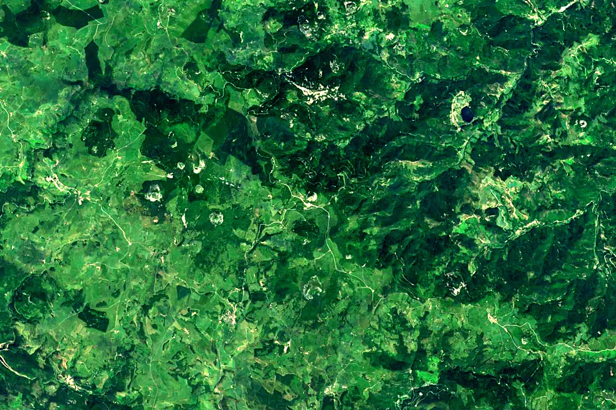
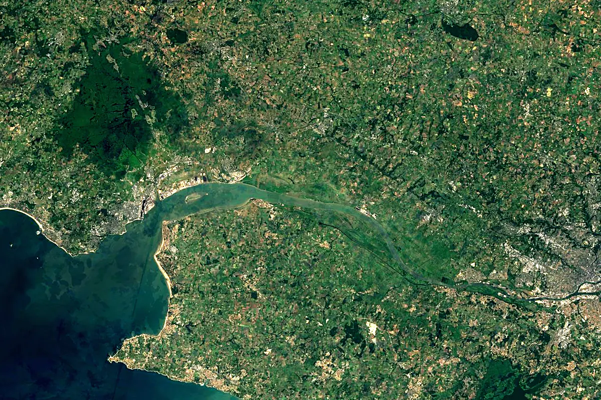
Sentinel-2 cloudless 2016 by EOX IT Services GmbH (contains modified Copernicus Sentinel data 2016), CC BY 4.0. The glowing line is the river as drawn by RiverATLAS.
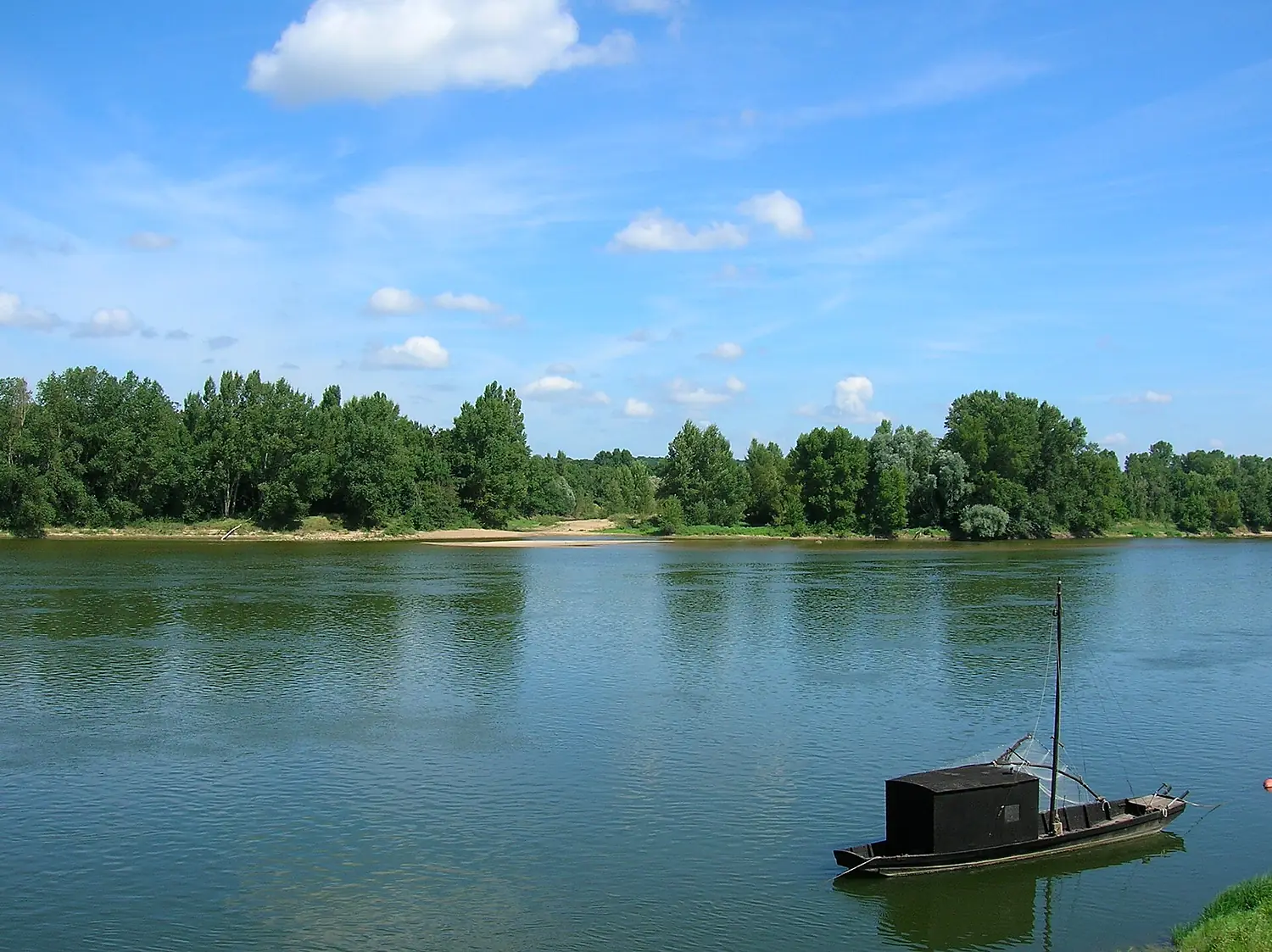
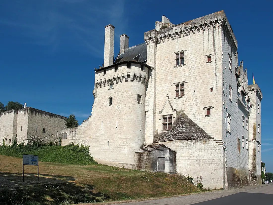
Photos
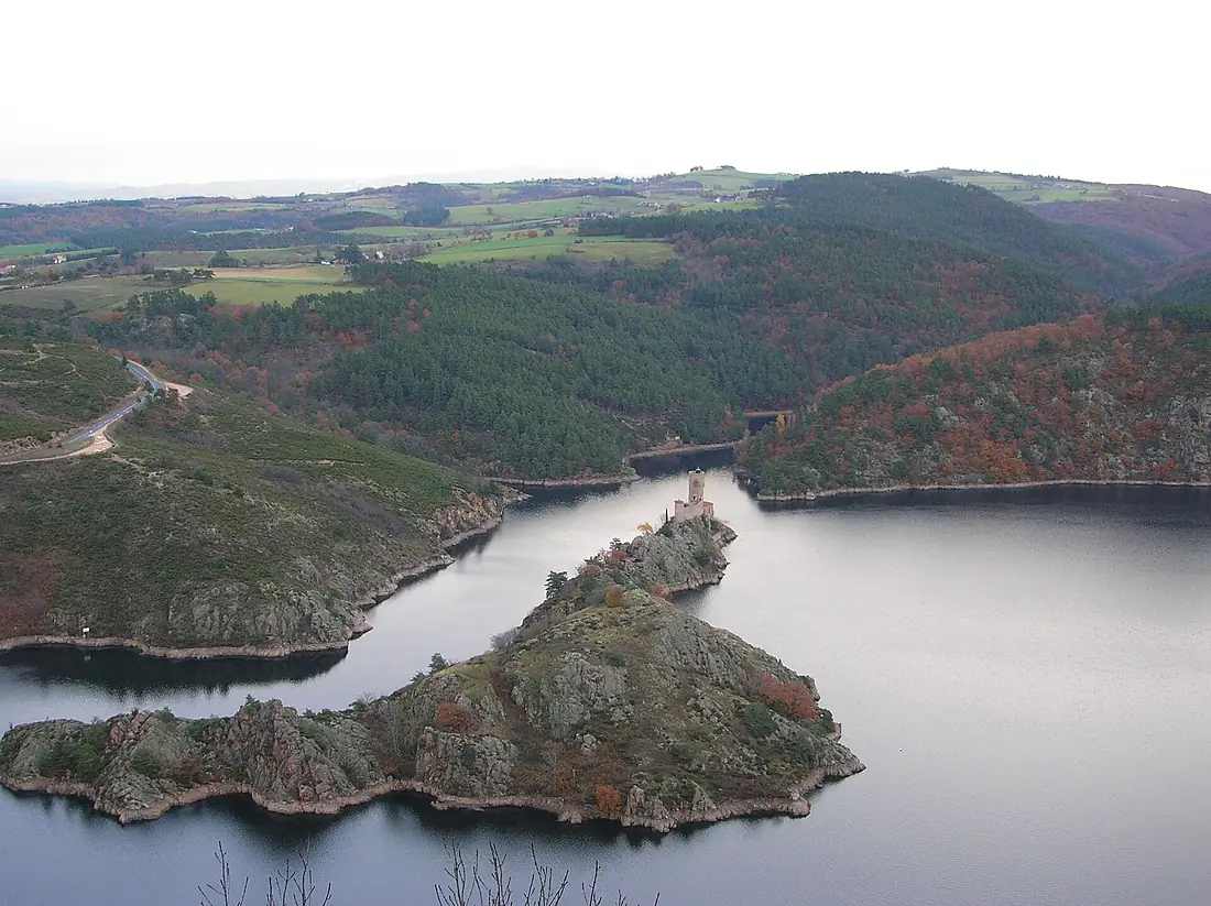
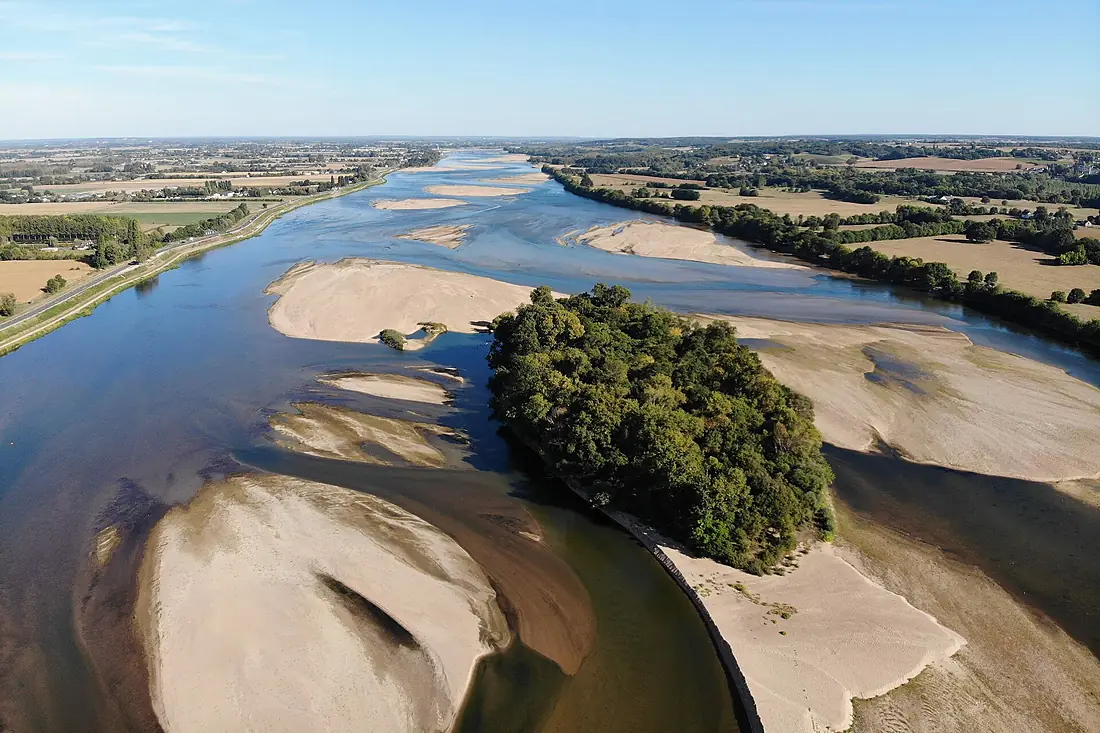
Loire in pictures
Tributaries
Where it flows, and what flows into it
Tributaries (93)
France421 km150 m³/sjoins at km 356VienneFrance372 km210 m³/sjoins at km 697CherFrance365 km96 m³/sjoins at km 662Indre RiverFrance280 km19 m³/sjoins at km 697Sèvre NantaiseFrance142 km9.5 m³/sjoins at km 842ArrouxFrance132 km34 m³/sjoins at km 257Also: Maine, Erdre, Loiret, Besbre, Nièvre, Beuvron, Thouet, Acolin, Aron, River Cisse, Furan, Layon, Authion, Èvre, Acheneau, Arconce, Ance, Arzon, Lignon du Forez, Brivet, Coise, Vauvise, Loise, Divatte
Nearby
Rivers nearby
France218 km80 m³/s43 km awaySèvre NantaiseFrance142 km9.5 m³/s32 km awaySartheFrance314 km82 m³/s107 km awayLoirFrance317 km32 m³/s112 km awayMayenneFrance202 km50 m³/s107 km awayBlavetFrance149 km27 m³/s113 km awayVienneFrance372 km210 m³/s155 km awaySèvre NiortaiseFrance158 km44 m³/s127 km awayWhere these numbers come from
| Name, length, places | Wikidata (Q1469) · CC0 |
|---|---|
| Course, profile, basin | RiverATLAS v1.0 (HydroATLAS, Linke et al. 2019) · CC BY 4.0 — followed from the source to the mouth given by Wikidata |
| Flow | WaterGAP (RiverATLAS), 1971–2000 · CC BY 4.0 |
| Climate along the river | WorldClim (RiverATLAS), 1970–2000 · CC BY 4.0 |
| Towns, bridges, dams | Wikidata · CC0; GeoNames · CC BY 4.0 |
| Along the river | © OpenStreetMap contributors · ODbL |
| Images | EOX Sentinel-2 cloudless 2016 · CC BY 4.0; Wikimedia Commons |
| Our other atlases | Cascadyas, Lakeyas, Coastya, Peakyas, Islandyas — Wikidata · CC0; © OpenStreetMap contributors · ODbL; GeoNames · CC BY 4.0; HydroLAKES · CC BY 4.0; NOAA OISST |
Every source and licence is on the data sources page.
The family
Do you prefer beaches, lakes, mountains, waterfalls, islands, rivers or canyons?
Same idea, other landscapes: field atlases built on open data, month by month, in seven languages.
beaches Find your beach: sea temperature, sun and swimming month by month.Visit lakes
 Every lake on Earth: water temperature, ice, depth and the shore.Coming soonVisit mountains
 Every summit in 3D: summit weather, the 0 °C line, huts and trails.Visit waterfalls
 Every waterfall: height, flow month by month and when it roars.Coming soonVisit islands
 Every island from the sea up: size, sea temperature, ferries and 3D.Coming soonVisit
  rivers
 Every river from source to sea: the journey, the flow and the basin in numbers.You are here
 canyons
 Every canyon cut to scale: depth to the floor, rim and floor temperatures, trails and viewpoints.Coming soonVisit