River
Arve
108 km from source to mouth · Switzerland and France.
 Switzerland and FranceFlows into Rhône6th longest in Switzerland
In numbers
Length
108km
Average flow
78m³/s
Basin
2,060km²
Drop
472m
from 841 m to 369 m
Countries
2
The journey
From source to mouth
108 km of river and 44 stops on the way: 30 towns and cities on its banks, dams, bridges and the tributaries that feed it.
- 0 kmTête de Balmeat 841 m
- 5 kmSalvan1,127 people
- 8 kmVernayaz1,612 people
- 12 kmEvionnaz1,001 people
- 17 kmSaint-Maurice3,701 people
- 19 kmBex5,956 people
- 22 kmMonthey17,777 people
- 23 kmCollombey5,926 people
- 27 kmVionnaz1,719 people
- 28 kmAigle10,134 people
- 32 kmVouvry3,296 people
- 84 kmMessery1,593 people
- 88 kmChens-sur-Léman1,408 people
- 90 kmCoppet2,124 people
- 93 kmAnières2,706 people
- 94 kmVersoix11,467 people
- 94 kmCorsier1,699 people
- 97 kmBellevue3,674 people
- 97 kmSeymaztributary
- 100 kmAnnemasse37,628 people
- 101 kmChêne-Bougeries10,487 people
- 101 kmGaillard11,423 people
- 101 kmPont de Vessy
- 101 kmSiern bridge
- 101 kmVeyrier12,085 people
- 101 kmPont des Artisanes
- 101 kmForontributary
- 101 kmGeneva209,061 people
- 101 kmLake Geneva572 km²
- 103 kmPasserelle de l'École-de-Médecine
- 103 kmHans Wilsdorf Bridge
- 103 kmBridge Le Pont de Carouge
- 103 kmPont de la Fontenette
- 103 kmPont des Acacias
- 103 kmPont du Val d'Arve
- 103 kmCarouge19,344 people
- 103 kmPont de Saint-Georges sur l'Arve
- 103 kmPasserelle du Bois-de-la-Bâtie
- 105 kmLancy27,291 people
- 105 kmOnex17,302 people
- 106 kmConfignon3,425 people
- 106 kmBernex9,759 people
- 108 kmVernier30,086 people
- 108 kmMeyrin19,772 people
- 108 kmLes Avanchets5,730 people
- 108 kmRhôneat 369 m
Water level along the river (RiverATLAS; the height is exaggerated). Towns: GeoNames and Wikidata; bridges, dams and tributaries: Wikidata.
River in France and Switzerland, tributary of the Rhône
At the mouth it carries 78 m³/s on average: an Olympic pool every 32 seconds. It drops from 841 m to 369 m, 4.4 m per kilometre on average. Its basin covers 2,060 km², about the size of MU. 1.7 million people live in it. Highest water: from December to February. Dams and reservoirs hold back a large share of its water (11% of a year's flow).
Where to start
- GenevaLargest city on its banks · 209,061 people
- Geneva International Airport (GVA)Nearest airport with scheduled flights, 5 km from the cityCar hire at GVA airport (Geneva)Discover Cars · Affiliate link↗
- On the water83 ferry piers, marinas, boat rentals and boat ramps along the river (OpenStreetMap)
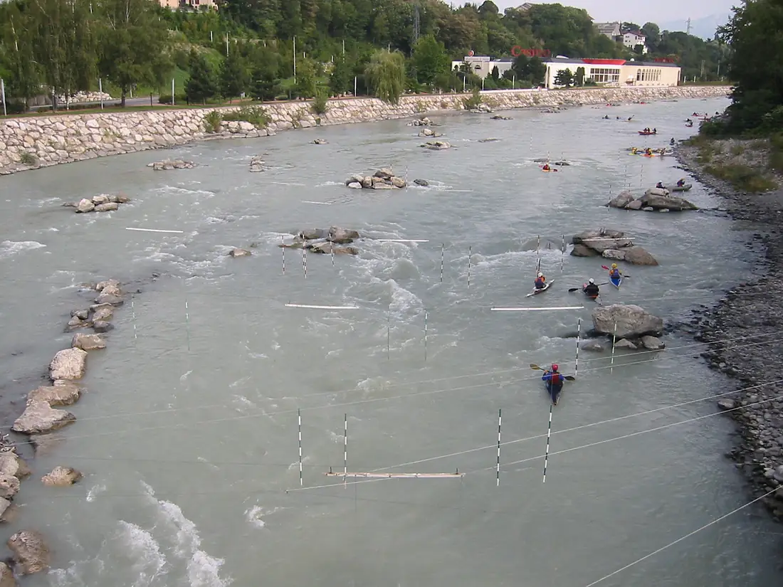
- Kayak and canoe1 put-ins and rapids mapped (OpenStreetMap)
- From May to SeptemberThe best months to visit
Arve, month by month
Highest water: from December to February
Best months to visit: from May to September.
From about 190 m³/s in the lowest month to 470 m³/s in the highest. An estimate: the monthly flow is modelled from the lowest and highest months of WaterGAP (RiverATLAS, 1971–2000) and the rain and snow along the river (WorldClim). Dams change the real rhythm. The chip is the average air temperature; below it, the month's rain.
Plan the trip
Plan the trip: boat trips, a bed by the river, a car
Some links above are affiliate links: if you book through them we may earn a commission, at no extra cost to you. It never changes what the data on this page says.
The basin
Arve: the basin in numbers
10,045 km² of land send their water to this river. This is what lives on it.
- 1.7millionpeople live in the basin
- 184/km²people per km²
- 1,580maverage altitude of the basin
- 1,458mmof rain a year (basin average)
- 3.9°Caverage air temperature
- 10%protected areas
- 5.8%covered by lakes
- 7%glaciers
- 9%permafrost
- 1.1km³held in reservoirs
What covers the basin
- 52% Forest
- 8% Cropland
- 17% Pasture
- 10% Towns and cities
- 7% Ice
RiverATLAS (HydroATLAS v1.0, CC BY 4.0): land cover, people, protected areas, glaciers and dams over the whole basin upstream of the mouth.
Along the river
Arve: what you find on the way
- 27WeirsBarrage de l'aménagement hydroélectrique de Lavey (VD) and 26 more
- 4WaterfallsPissevache, Cascade de Dailley, Waterfall of the Cave of fairies and 1 more
- 1Canoe put-ins
- 23Boat rampsJetée de l'Etire and 22 more
- 28Ferry piersLe Bouveret, Yvoire, Nernier and 25 more
- 29MarinasPort des Pêcheurs d'Yvoire, Port de Nernier, Port de Messery and 26 more
- 26River beachesPlage du Bouveret, Plage de la Garite, Pointe de Promenthoux and 23 more
From OpenStreetMap, within 1.8 km of the river. Not mapped is not the same as not there.
Cross-checked with our atlases
Arve in our other atlases
What our sister atlases know about the waterfalls on this river, the lakes it flows through, the beaches at its mouth, the mountains where it rises and the islands off its mouth.
 1lake on its wayLakeyas
 197mountains at the sourcePeakyas
Lakes and reservoirs (1)
Lakes it flows through, by Lakeyas
- Lake Genevakm 120 · 309 m deep572km²
Lakeyas is coming soonOpen Lakeyas ↗
Mountains at the source (197)
Within 15 km of the source, by Peakyas
- Aiguille Verte10 km away · prominence 689 m4,122m
- Mont Dolent13 km away · prominence 330 m3,820m
- Aiguille d'Argentière8.4 km away · prominence 470 m3,898m
- Aiguille du Dru10 km away3,754m
- Les Droites11 km away · prominence 204 m4,000m
- Aiguille de Triolet13 km away · prominence 301 m3,870m
- Aiguille du Chardonnet6.9 km away · prominence 503 m3,824m
- Grande Rocheuse10 km away · prominence 52 m4,102m
189 more on PeakyasOpen Peakyas ↗
From space
The source and the mouth, seen from orbit
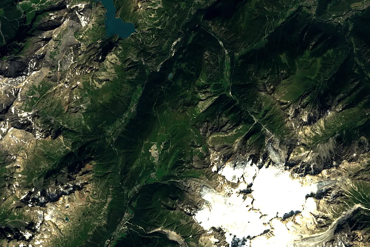
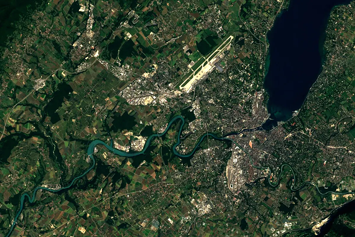
Sentinel-2 cloudless 2016 by EOX IT Services GmbH (contains modified Copernicus Sentinel data 2016), CC BY 4.0. The glowing line is the river as drawn by RiverATLAS.
Photos
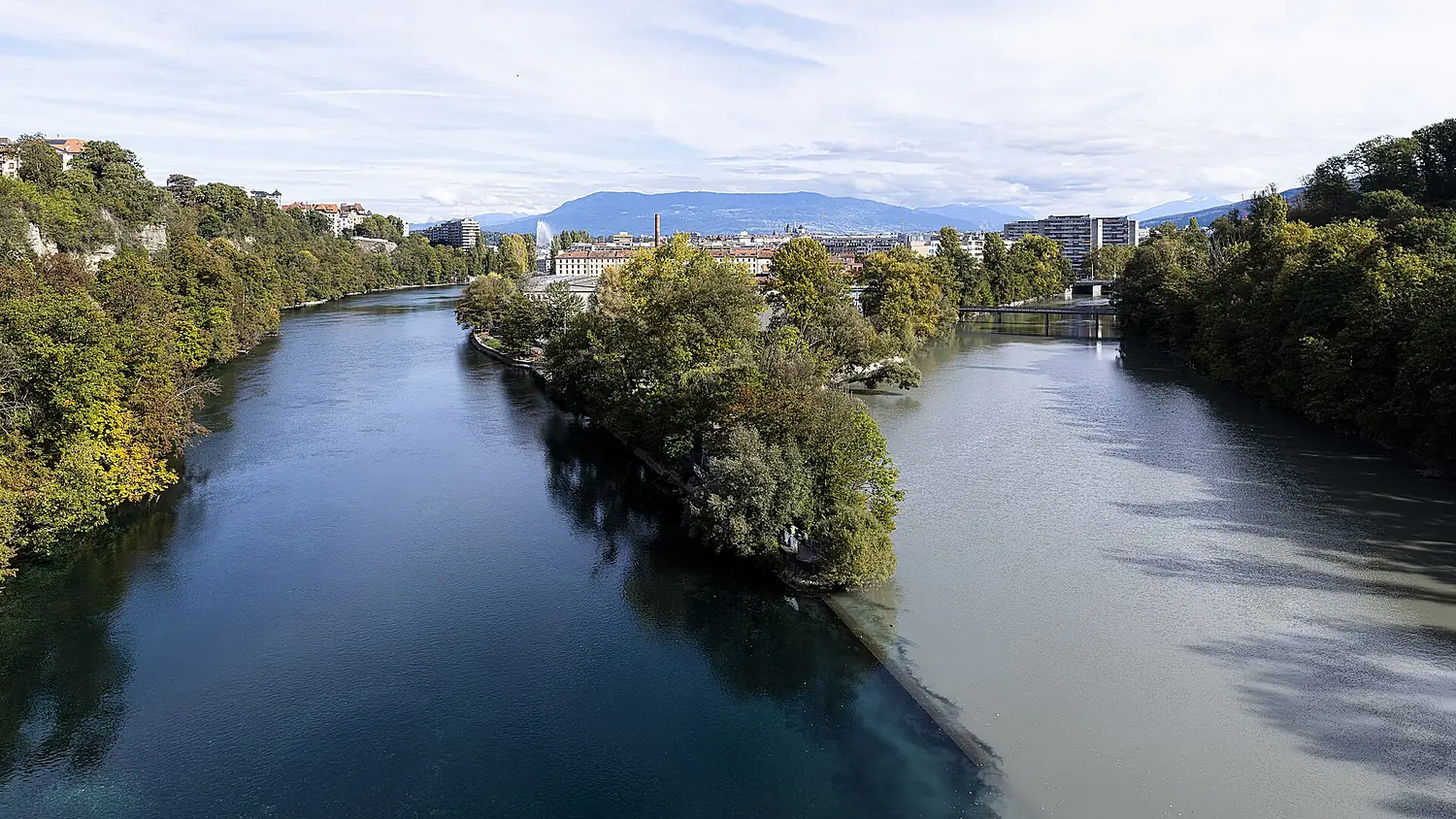
Arve in pictures
Tributaries
Where it flows, and what flows into it
It flows into
RhôneFrance812 km1,800 m³/sTributaries (8)
Also: Menoge, Aire river, Borne, Giffre, Diosaz, Foron, Seymaz, Torrent de la Griaz
Nearby
Rivers nearby
Where these numbers come from
| Name, length, places | Wikidata (Q633819) · CC0 |
|---|---|
| Course, profile, basin | RiverATLAS v1.0 (HydroATLAS, Linke et al. 2019) · CC BY 4.0 — followed from the source to the mouth given by Wikidata |
| Flow | WaterGAP (RiverATLAS), 1971–2000 · CC BY 4.0 |
| Climate along the river | WorldClim (RiverATLAS), 1970–2000 · CC BY 4.0 |
| Towns, bridges, dams | Wikidata · CC0; GeoNames · CC BY 4.0 |
| Along the river | © OpenStreetMap contributors · ODbL |
| Images | EOX Sentinel-2 cloudless 2016 · CC BY 4.0; Wikimedia Commons |
| Our other atlases | Lakeyas, Peakyas — Wikidata · CC0; © OpenStreetMap contributors · ODbL; GeoNames · CC BY 4.0; HydroLAKES · CC BY 4.0; NOAA OISST |
Every source and licence is on the data sources page.
The family
Do you prefer beaches, lakes, mountains, waterfalls, islands, rivers or canyons?
Same idea, other landscapes: field atlases built on open data, month by month, in seven languages.
 beaches
 Find your beach: sea temperature, sun and swimming month by month.Visit lakes
 Every lake on Earth: water temperature, ice, depth and the shore.Coming soonVisit mountains
 Every summit in 3D: summit weather, the 0 °C line, huts and trails.Visit
  waterfalls
 Every waterfall: height, flow month by month and when it roars.Coming soonVisit
  islands
 Every island from the sea up: size, sea temperature, ferries and 3D.Coming soonVisit
  rivers
 Every river from source to sea: the journey, the flow and the basin in numbers.You are here
 canyons
 Every canyon cut to scale: depth to the floor, rim and floor temperatures, trails and viewpoints.Coming soonVisit