River
Saône
480 km from source to mouth · France.
 FranceFlows into Rhône8th longest in France
In numbers
Length
480km
Average flow
470m³/s
Basin
29,950km²
Drop
139m
from 302 m to 163 m
Country
1
The journey
From source to mouth
480 km of river and 68 stops on the way: 42 towns and cities on its banks, dams, bridges and the tributaries that feed it.
- 0 kmVioménilat 302 m
- 49 kmCôneytributary
- 60 kmAmancetributary
- 78 kmLanterne rivertributary
- 86 kmDurgeontributary
- 125 kmGourgeonnetributary
- 125 kmRomainetributary
- 139 kmSalontributary
- 157 kmGray5,365 people
- 182 kmOgnontributary
- 186 kmBèzetributary
- 186 kmVingeannetributary
- 208 kmAuxonne7,581 people
- 222 kmTilletributary
- 228 kmLosne1,720 people
- 232 kmOuchetributary
- 232 kmVougetributary
- 254 kmSeurre2,352 people
- 275 kmDheunetributary
- 275 kmDoubstributary
- 301 kmSaint-Marcel6,211 people
- 303 kmChalon-sur-Saône45,102 people
- 304 kmSaint-Rémy6,410 people
- 325 kmGrosnetributary
- 337 kmTournus5,701 people
- 343 kmSeilletributary
- 343 kmSermoyer670 people
- 350 kmArbigny462 people
- 351 kmSaint-Bénigne1,359 people
- 353 kmReyssouzetributary
- 353 kmPont-de-Vaux2,204 people
- 359 kmBoz513 people
- 359 kmMougetributary
- 362 kmAsnières-sur-Saône78 people
- 369 kmFeillens3,411 people
- 371 kmReplonges3,956 people
- 373 kmSaint-Laurent-sur-Saône1,810 people
- 373 kmMâcon35,177 people
- 376 kmVeyletributary
- 378 kmGrièges1,910 people
- 382 kmCrêches-sur-Saône3,198 people
- 383 kmCormoranche-sur-Saône1,179 people
- 389 kmLa Chapelle-de-Guinchay4,018 people
- 393 kmThoissey1,626 people
- 394 kmSaint-Didier-sur-Chalaronne2,934 people
- 398 kmChalaronnetributary
- 400 kmGenouilleux701 people
- 402 kmGuéreins1,512 people
- 407 kmMontmerle-sur-Saône3,799 people
- 409 kmVauxonnetributary
- 409 kmLurcy406 people
- 410 kmMessimy-sur-Saône1,338 people
- 416 kmFareins2,533 people
- 416 kmArnas4,601 people
- 418 kmBeauregard872 people
- 419 kmVillefranche-sur-Saône36,172 people
- 420 kmJassans-Riottier6,247 people
- 420 kmNizerandtributary
- 426 kmMorgontributary
- 426 kmAzerguestributary
- 427 kmSaint-Bernard1,590 people
- 432 kmTrévoux7,013 people
- 434 kmFormanstributary
- 436 kmReyrieux5,358 people
- 438 kmMassieux2,843 people
- 451 kmCollonges-au-Mont-d'Or4,669 people
- 455 kmCaluire-et-Cuire43,597 people
- 462 kmLyon519,127 people
- 463 kmLyon 03102,725 people
- 480 kmRhôneat 163 m
Water level along the river (RiverATLAS; the height is exaggerated). Towns: GeoNames and Wikidata; bridges, dams and tributaries: Wikidata.
River of France
At the mouth it carries 473 m³/s on average: an Olympic pool every 5.3 seconds. It drops from 302 m to 163 m, 0.3 m per kilometre on average. Its basin covers 29,950 km², about the size of AM. 6.3 million people live in it. Highest water: from November to February. Its dams hold back little of its water (5.4% of a year's flow).
Where to start
- LyonLargest city on its banks · 519,127 people
- Lyon Saint-Exupéry Airport (LYS)Nearest airport with scheduled flights, 20 km from the cityCar hire at LYS airport (Colombier-Saugnieu, Rhône)Discover Cars · Affiliate link↗
- On the water223 ferry piers, marinas, boat rentals and boat ramps along the river (OpenStreetMap)
- From May to SeptemberThe best months to visit
Saône, month by month
Highest water: from November to February
Best months to visit: from May to September.
From about 690 m³/s in the lowest month to 1,400 m³/s in the highest. An estimate: the monthly flow is modelled from the lowest and highest months of WaterGAP (RiverATLAS, 1971–2000) and the rain and snow along the river (WorldClim). Dams change the real rhythm. The chip is the average air temperature; below it, the month's rain.
Plan the trip
Plan the trip: boat trips, a bed by the river, a car
Some links above are affiliate links: if you book through them we may earn a commission, at no extra cost to you. It never changes what the data on this page says.
The basin
Saône: the basin in numbers
49,421 km² of land send their water to this river. This is what lives on it.
- 6.3millionpeople live in the basin
- 132/km²people per km²
- 668maverage altitude of the basin
- 1,054mmof rain a year (basin average)
- 8.5°Caverage air temperature
- 10%protected areas
- 1.5%covered by lakes
- 2%glaciers
- 2%permafrost
- 1.9km³held in reservoirs
What covers the basin
- 40% Forest
- 20% Cropland
- 24% Pasture
- 6% Towns and cities
- 2% Ice
RiverATLAS (HydroATLAS v1.0, CC BY 4.0): land cover, people, protected areas, glaciers and dams over the whole basin upstream of the mouth.
Along the river
Saône: what you find on the way
- 63WeirsBarrage d'Ormoy, Barrage de Cendrecourt, Barrage de Montureux-les-Baulay and 60 more
- 141LocksCanal des Vosges and 140 more
- 1Waterfalls
- 154Boat rampsMise a l'eau Mise à l'eau, Mise a l'eau Mise à l'eau Float-tube, Mise a l'eau Cale de mise à l'eau and 151 more
- 8Ferry piersVaise Industrie, Vaise, Subsistances and 5 more
- 51MarinasHalte Fluviale d'Uzemain, Mooring place, Halte Nautique d'Harsault and 48 more
- 1River beachesPlage du Colombier
From OpenStreetMap, within 2.2 km of the river. Not mapped is not the same as not there.
Cross-checked with our atlases
Saône in our other atlases
What our sister atlases know about the waterfalls on this river, the lakes it flows through, the beaches at its mouth, the mountains where it rises and the islands off its mouth.
 1mountain at the sourcePeakyas
Mountains at the source (1)
Within 15 km of the source, by Peakyas
- Haut de Dimont15 km away · prominence 39 m453m
From space
The source and the mouth, seen from orbit
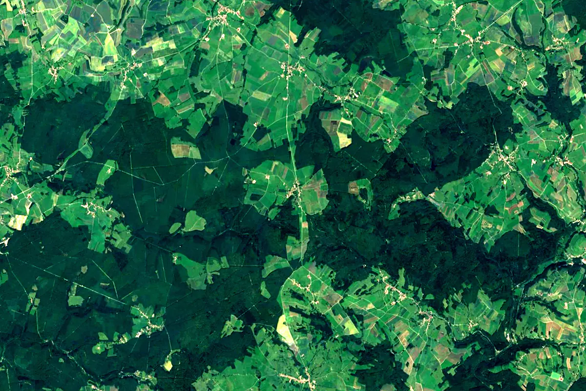
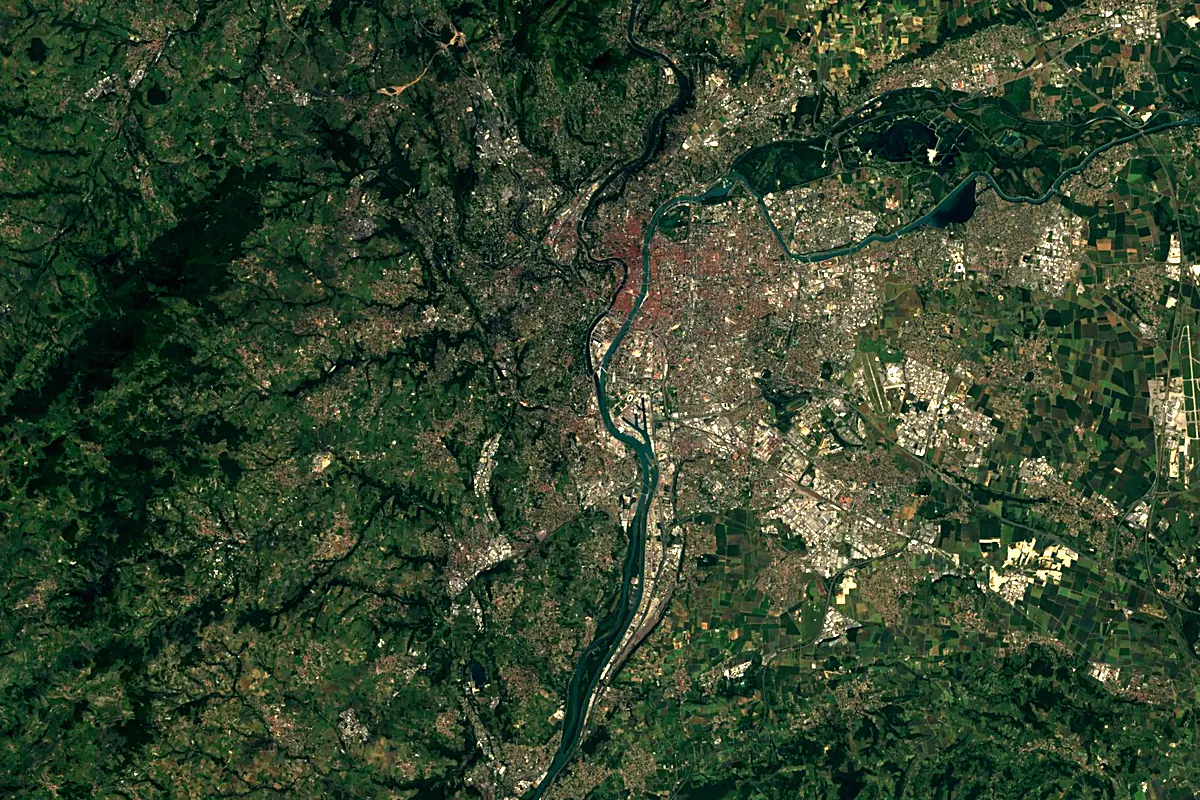
Sentinel-2 cloudless 2016 by EOX IT Services GmbH (contains modified Copernicus Sentinel data 2016), CC BY 4.0. The glowing line is the river as drawn by RiverATLAS.
Photos
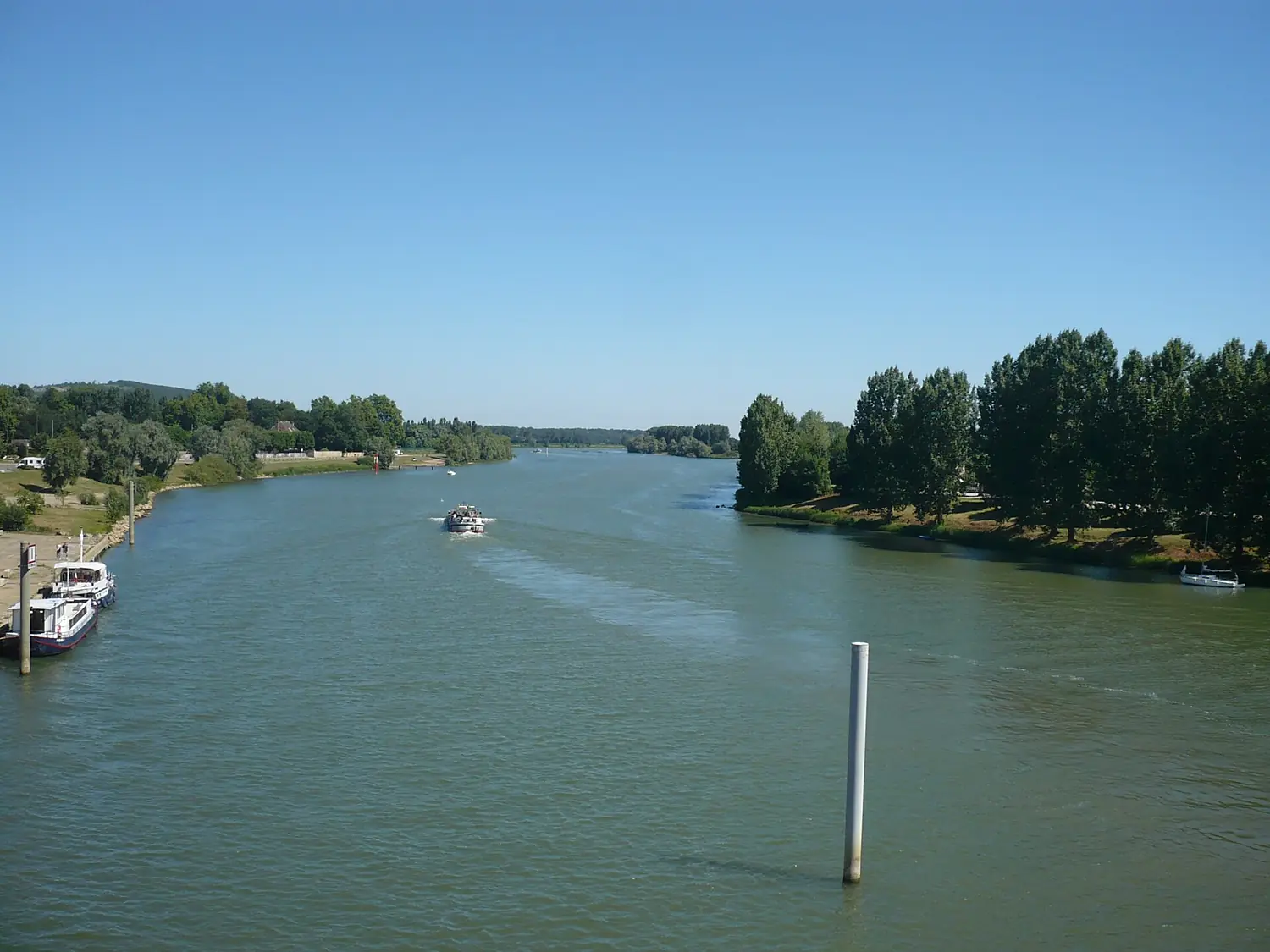
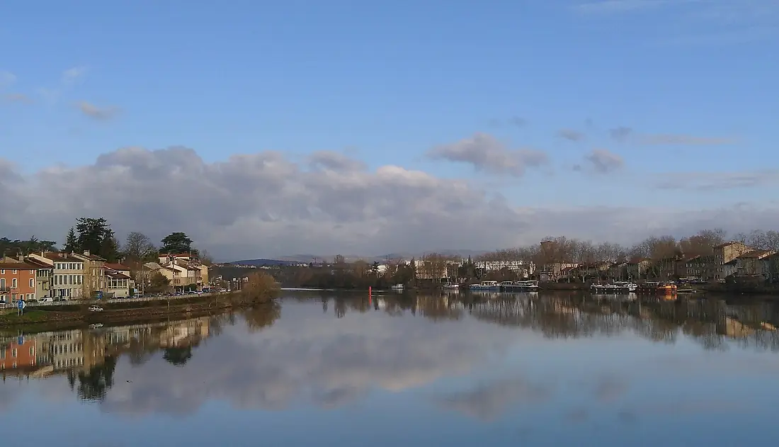
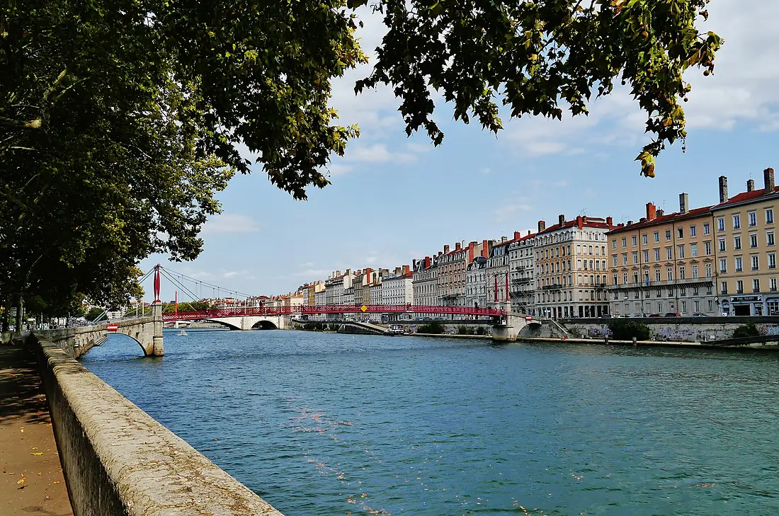
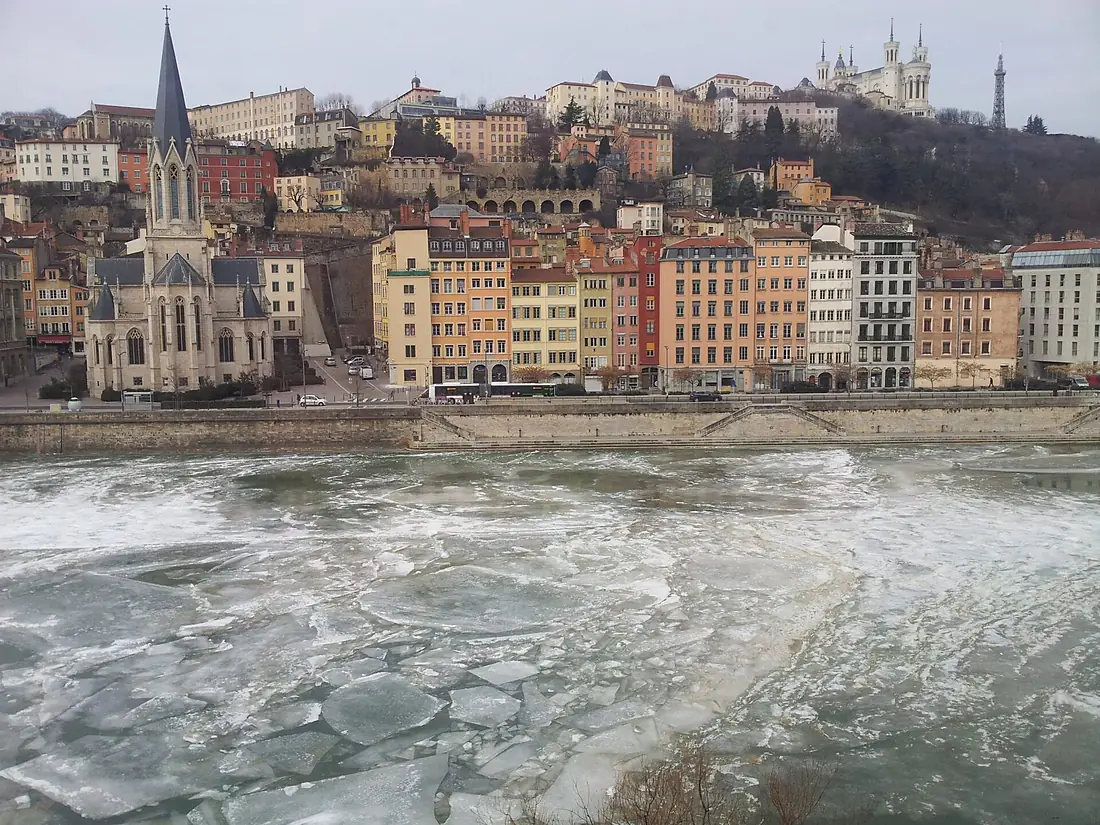
Saône in pictures
Tributaries
Where it flows, and what flows into it
It flows into
RhôneFrance812 km1,800 m³/sTributaries (41)
Also: Tille, Seille, Ouche, Grosne, Vingeanne, Azergues, Chalaronne, Côney, Veyle, Reyssouze, Amance, Dheune, Bèze, Lanterne river, Apance, Durgeon, Ardière, Salon, Ougeotte, Romaine, Morthe, Ourche, Formans, Corne
 Switzerland
Nearby
Rivers nearby
Where these numbers come from
| Name, length, places | Wikidata (Q187834) · CC0 |
|---|---|
| Course, profile, basin | RiverATLAS v1.0 (HydroATLAS, Linke et al. 2019) · CC BY 4.0 — followed from the source to the mouth given by Wikidata |
| Flow | WaterGAP (RiverATLAS), 1971–2000 · CC BY 4.0 |
| Climate along the river | WorldClim (RiverATLAS), 1970–2000 · CC BY 4.0 |
| Towns, bridges, dams | Wikidata · CC0; GeoNames · CC BY 4.0 |
| Along the river | © OpenStreetMap contributors · ODbL |
| Images | EOX Sentinel-2 cloudless 2016 · CC BY 4.0; Wikimedia Commons |
| Our other atlases | Peakyas — Wikidata · CC0; © OpenStreetMap contributors · ODbL; GeoNames · CC BY 4.0; HydroLAKES · CC BY 4.0; NOAA OISST |
Every source and licence is on the data sources page.
The family
Do you prefer beaches, lakes, mountains, waterfalls, islands, rivers or canyons?
Same idea, other landscapes: field atlases built on open data, month by month, in seven languages.
 beaches
 Find your beach: sea temperature, sun and swimming month by month.Visit
  lakes
lakes Every lake on Earth: water temperature, ice, depth and the shore.Coming soonVisit mountains
 Every summit in 3D: summit weather, the 0 °C line, huts and trails.Visit
  waterfalls
 Every waterfall: height, flow month by month and when it roars.Coming soonVisit
  islands
 Every island from the sea up: size, sea temperature, ferries and 3D.Coming soonVisit
  rivers
 Every river from source to sea: the journey, the flow and the basin in numbers.You are here
 canyons
 Every canyon cut to scale: depth to the floor, rim and floor temperatures, trails and viewpoints.Coming soonVisit