River
Rhône
812 km from source to mouth · France and Switzerland.

 France and SwitzerlandFlows into Mediterranean Sea2nd longest in France
In numbers
Length
812km
Average flow
1,800m³/s
Basin
98,000km²
Drop
1,352m
from 1,351 m to -1 m
Countries
2
The journey
From source to mouth
812 km of river and 68 stops on the way: 49 towns and cities on its banks, dams, bridges and the tributaries that feed it.
- 0 kmRhone Glacierat 1,351 m
- 39 kmSaltinatributary
- 40 kmBrig-Glis13,109 people
- 43 kmMundbachtributary
- 50 kmVispatributary
- 72 kmIllgrabentributary
- 80 kmRaspilletributary
- 80 kmNavizencetributary
- 80 kmSierre17,829 people
- 93 kmLiennetributary
- 93 kmBorgnetributary
- 93 kmMorgetributary
- 97 kmSion37,154 people
- 125 kmMartigny22,247 people
- 127 kmDrancetributary
- 146 kmMonthey17,777 people
- 153 kmAigle11,752 people
- 239 kmLake Geneva572 km²
- 239 kmGeneva209,061 people
- 241 kmLancy37,259 people
- 243 kmVernier34,774 people
- 243 kmOnex18,977 people
- 246 kmArvetributary
- 256 kmChallex1,632 people
- 277 kmBellegarde-sur-Valserine11,965 people
- 281 kmBilliat713 people
- 288 kmCascade du Pain de sucre de Surjoux
- 294 kmLes Ussestributary
- 299 kmFiertributary
- 301 kmAnglefort1,174 people
- 309 kmCuloz3,416 people
- 313 kmLac du Bourget43 km²
- 331 kmBrens1,123 people
- 372 kmBriord1,119 people
- 388 kmLagnieu7,411 people
- 406 kmLoyettes3,554 people
- 417 kmBalan3,077 people
- 424 kmMeyzieu36,687 people
- 426 kmBeynost5,198 people
- 428 kmSaint-Maurice-de-Beynost4,332 people
- 430 kmMiribel10,395 people
- 432 kmLac des Eaux Bleues3.1 km²
- 433 kmVaulx-en-Velin53,069 people
- 433 kmDécines-Charpieu29,877 people
- 435 kmRillieux-la-Pape31,389 people
- 438 kmVilleurbanne163,684 people
- 440 kmCaluire-et-Cuire43,597 people
- 442 kmLyon519,127 people
- 443 kmLyon 03102,725 people
- 448 kmOullins38,168 people
- 465 kmGivors21,379 people
- 476 kmVienne31,778 people
- 539 kmTournon-sur-Rhône11,279 people
- 555 kmBourg-lès-Valence19,992 people
- 557 kmGuilherand-Granges11,235 people
- 557 kmValence64,458 people
- 607 kmMontélimar40,595 people
- 628 kmPierrelatte13,756 people
- 630 kmBourg-Saint-Andéol7,661 people
- 643 kmPont-Saint-Esprit10,958 people
- 669 kmOrange29,706 people
- 681 kmSorgues19,006 people
- 686 kmVilleneuve-lès-Avignon13,148 people
- 687 kmpont Saint-BénézetUNESCO World Heritage
- 687 kmAvignon92,188 people
- 713 kmBeaucaire15,692 people
- 714 kmTarascon15,396 people
- 729 kmArles51,811 people
- 735 kmCamargue
- 812 kmMediterranean Seaat -1 m
Water level along the river (RiverATLAS; the height is exaggerated). Towns: GeoNames and Wikidata; bridges, dams and tributaries: Wikidata.
River in Switzerland and France
At the mouth it carries 1,780 m³/s on average: an Olympic pool every 1.4 seconds. It drops from 1,351 m to -1 m, 1.7 m per kilometre on average. Its basin covers 98,000 km², about the size of KR. 10.4 million people live in it. Highest water: from November to February. Dams and reservoirs hold back a large share of its water (10% of a year's flow).
Where to start
- LyonLargest city on its banks · 519,127 people
- Lyon Saint-Exupéry Airport (LYS)Nearest airport with scheduled flights, 20 km from the cityCar hire at LYS airport (Colombier-Saugnieu, Rhône)Discover Cars · Affiliate link↗
- On the water379 ferry piers, marinas, boat rentals and boat ramps along the river (OpenStreetMap)
- Kayak and canoe13 put-ins and rapids mapped (OpenStreetMap)
- From May to SeptemberThe best months to visit
Rhône, month by month
Highest water: from November to February
Best months to visit: from May to September.
From about 860 m³/s in the lowest month to 2,200 m³/s in the highest. An estimate: the monthly flow is modelled from the lowest and highest months of WaterGAP (RiverATLAS, 1971–2000) and the rain and snow along the river (WorldClim). Dams change the real rhythm. The chip is the average air temperature; below it, the month's rain.
Plan the trip
Plan the trip: boat trips, a bed by the river, a car
Some links above are affiliate links: if you book through them we may earn a commission, at no extra cost to you. It never changes what the data on this page says.
The basin
Rhône: the basin in numbers
95,894 km² of land send their water to this river. This is what lives on it.
- 10.4millionpeople live in the basin
- 111/km²people per km²
- 786maverage altitude of the basin
- 1,016mmof rain a year (basin average)
- 8.6°Caverage air temperature
- 22%protected areas
- 0.9%covered by lakes
- 1%glaciers
- 1%permafrost
- 5.5km³held in reservoirs
What covers the basin
- 46% Forest
- 19% Cropland
- 21% Pasture
- 5% Towns and cities
- 1% Ice
RiverATLAS (HydroATLAS v1.0, CC BY 4.0): land cover, people, protected areas, glaciers and dams over the whole basin upstream of the mouth.
Along the river
Rhône: what you find on the way
- 173WeirsDam, Barrage de l'aménagement hydroélectrique de Lavey (VD), Seuil de Lucey and 170 more
- 69LocksLe Rhône - Dérivation de Chautagne, Bras de Barrage de Savières, Le Rhône - Canal de La Feyssine and 66 more
- 60WaterfallsJolischlucht, Tschingel, Wasserfall Turtmann and 57 more
- 4RapidsVague de Miribel, Hawaii-sur-Rhône and 2 more
- 9Canoe put-ins
- 251Boat rampsJetée de l'Etire, Port Saint Jean, Mise à l'eau de la gare and 248 more
- 43Ferry piersLe Bouveret, Yvoire, Nernier and 40 more
- 71MarinasPort des Pêcheurs d'Yvoire, Port de Nernier, Port des Aberiaux and 68 more
- 44River beachesPlage du Bouveret, Plage de la Garite, Pointe de Promenthoux and 41 more
From OpenStreetMap, within 2.4 km of the river. Not mapped is not the same as not there.
Cross-checked with our atlases
Rhône in our other atlases
What our sister atlases know about the waterfalls on this river, the lakes it flows through, the beaches at its mouth, the mountains where it rises and the islands off its mouth.
 1waterfall on the riverCascadyas
 3lakes on its wayLakeyas
 16beaches at the mouth and on the banksCoastya
 221mountains at the sourcePeakyas
Waterfalls (1)
On the river, by Cascadyas
- Cascade du Pain de sucre de Surjouxkm 278
Cascadyas is coming soonOpen Cascadyas ↗
Lakes and reservoirs (3)
Lakes it flows through, by Lakeyas
- Lake Genevakm 231 · 309 m deep572km²
- Lac du Bourgetkm 302 · 145 m deep43km²
- Lac des Eaux Bleueskm 418 · 7 m deep3.1km²
Lakeyas is coming soonOpen Lakeyas ↗
Beaches (16)
At the mouth (25 km) and on the banks, by Coastya
- Plage de Piemanson4.1 km away22.2°C
- Plage de Sainte-Croix22 km away22.3°C
- Plage Napoléon6.6 km away22.2°C
- Plage de Beauduc17 km away22.1°C
- Plage des Laurons18 km away22.3°C
- Anse de Canal-Vieil15 km away · cove22.2°C
- Anse de Lavéra16 km away · cove22.3°C
- Anse d'Auguette16 km away · cove22.3°C
8 more on CoastyaOpen Coastya ↗
Mountains at the source (221)
Within 15 km of the source, by Peakyas
- Dammastock8.3 km away · prominence 1,467 m3,630m
- Galenstock5.1 km away · prominence 252 m3,586m
- Eggstock9.1 km away3,555m
- Schneestock8.7 km away · prominence 38 m3,608m
- Sustenhorn15 km away · prominence 423 m3,503m
- Hinter Tierberg12 km away · prominence 185 m3,445m
- Tiefenstock6.7 km away · prominence 90 m3,515m
- Gwächtenhorn13 km away · prominence 218 m3,420m
213 more on PeakyasOpen Peakyas ↗
From space
The source and the mouth, seen from orbit
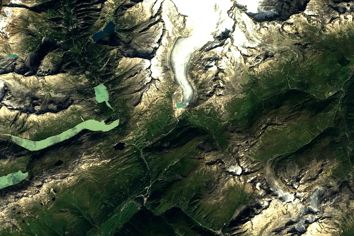
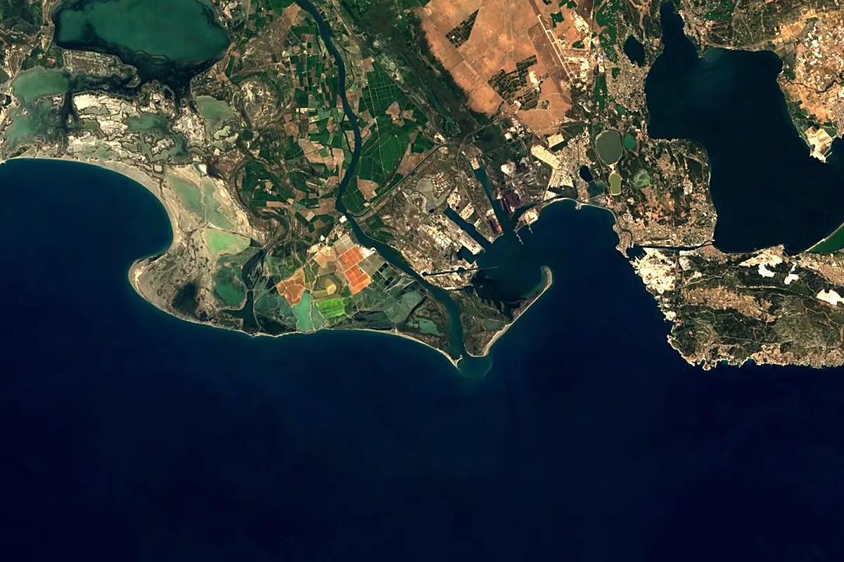
Sentinel-2 cloudless 2016 by EOX IT Services GmbH (contains modified Copernicus Sentinel data 2016), CC BY 4.0. The glowing line is the river as drawn by RiverATLAS.
Photos
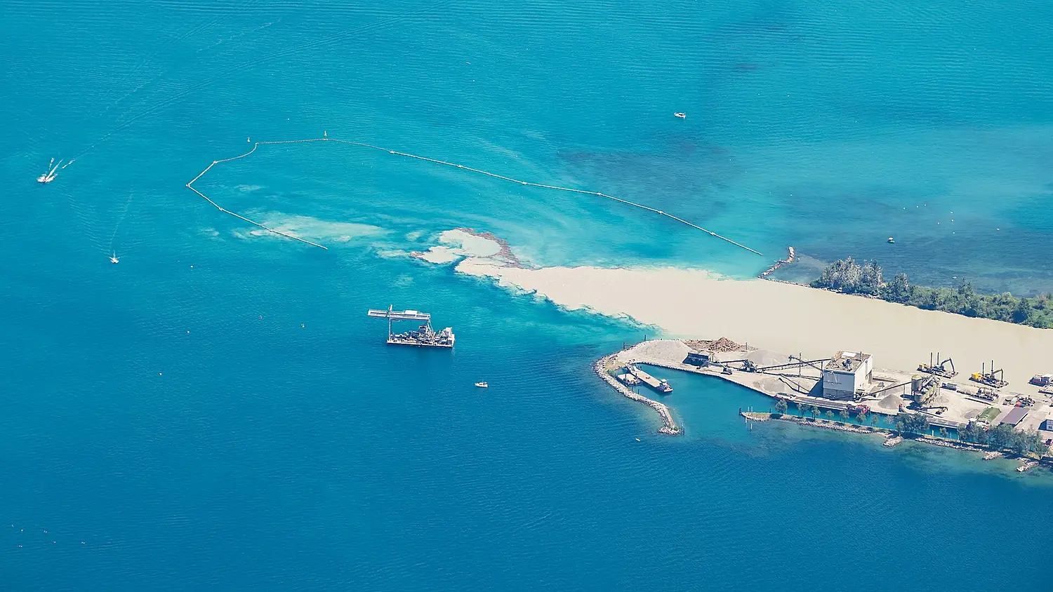
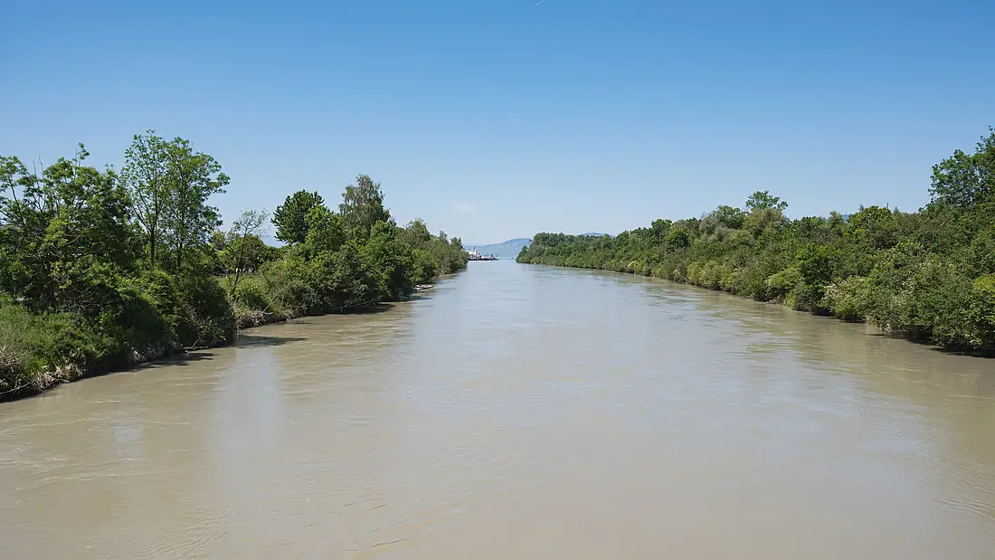
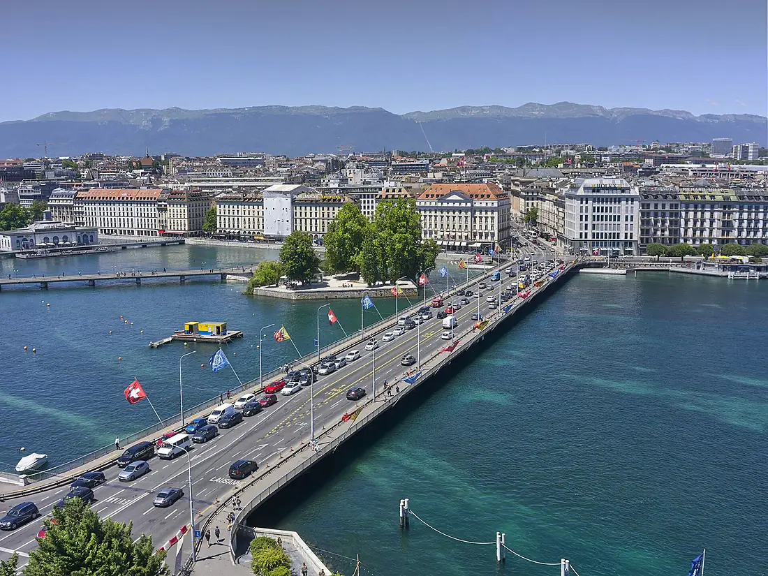
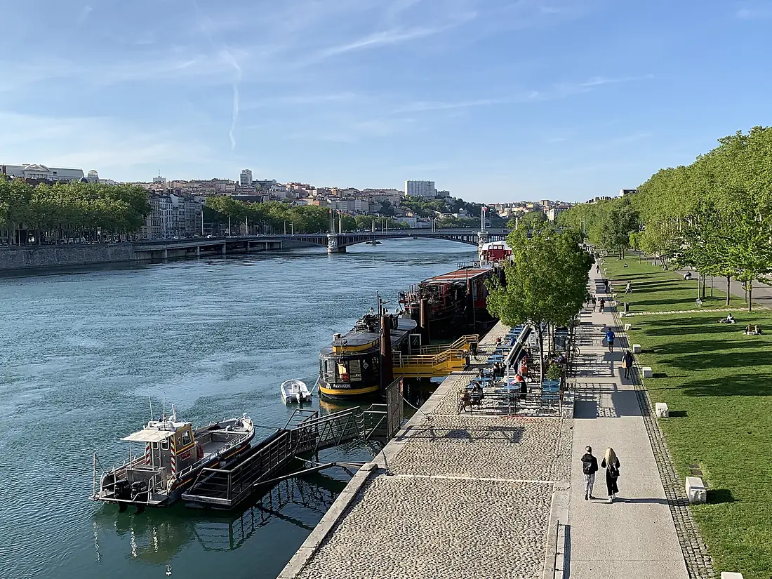
Rhône in pictures
Tributaries
Where it flows, and what flows into it
Tributaries (95)
France480 km470 m³/sjoins at km 433DuranceFrance324 km180 m³/sjoins at km 670IsèreFrance286 km360 m³/sjoins at km 533AinFrance190 km120 m³/sjoins at km 397GardonFrance127 km32 m³/sjoins at km 684ArdècheFrance125 km65 m³/sjoins at km 623DrômeFrance111 km20 m³/sjoins at km 562ArveSwitzerland108 km78 m³/sjoins at km 237Also: Ouvèze, Drance, Aigues, Vispa, Massa, Cèze, Fier, Borgne, Allondon, Eyrieux, Lonza, Galaure, Guiers, Valserine, Navizence, Bourbre, Doux, Trient, Salanfe, Grande Eau, Lizerne, Gier, Séran, Saltina
Nearby
Rivers nearby
Where these numbers come from
| Name, length, places | Wikidata (Q602) · CC0 |
|---|---|
| Course, profile, basin | RiverATLAS v1.0 (HydroATLAS, Linke et al. 2019) · CC BY 4.0 — followed from the source to the mouth given by Wikidata |
| Flow | WaterGAP (RiverATLAS), 1971–2000 · CC BY 4.0 |
| Climate along the river | WorldClim (RiverATLAS), 1970–2000 · CC BY 4.0 |
| Towns, bridges, dams | Wikidata · CC0; GeoNames · CC BY 4.0 |
| Along the river | © OpenStreetMap contributors · ODbL |
| Images | EOX Sentinel-2 cloudless 2016 · CC BY 4.0; Wikimedia Commons |
| Our other atlases | Cascadyas, Lakeyas, Coastya, Peakyas — Wikidata · CC0; © OpenStreetMap contributors · ODbL; GeoNames · CC BY 4.0; HydroLAKES · CC BY 4.0; NOAA OISST |
Every source and licence is on the data sources page.
The family
Do you prefer beaches, lakes, mountains, waterfalls, islands, rivers or canyons?
Same idea, other landscapes: field atlases built on open data, month by month, in seven languages.
beaches Find your beach: sea temperature, sun and swimming month by month.Visit lakes
 Every lake on Earth: water temperature, ice, depth and the shore.Coming soonVisit mountains
 Every summit in 3D: summit weather, the 0 °C line, huts and trails.Visit waterfalls
 Every waterfall: height, flow month by month and when it roars.Coming soonVisit
  islands
 Every island from the sea up: size, sea temperature, ferries and 3D.Coming soonVisit
  rivers
 Every river from source to sea: the journey, the flow and the basin in numbers.You are here
 canyons
 Every canyon cut to scale: depth to the floor, rim and floor temperatures, trails and viewpoints.Coming soonVisit