River
Isère
286 km from source to mouth · France.
 FranceFlows into Rhône
In numbers
Length
286km
Average flow
360m³/s
Basin
11,800km²
Drop
1,661m
from 1,771 m to 110 m
Country
1
The journey
From source to mouth
286 km of river and 68 stops on the way: 59 towns and cities on its banks, dams, bridges and the tributaries that feed it.
- 0 kmSources de l'Isère Glacierat 1,771 m
- 1 kmVal-d'Isère1,567 people
- 36 kmcascade Saint-Benoît
- 49 kmBissorte Lake1.0 km²
- 103 kmLa Léchère2,538 people
- 104 kmLa Bâthie2,176 people
- 106 kmArlytributary
- 106 kmGilly-sur-Isère3,149 people
- 109 kmAiton1,874 people
- 117 kmSaint-Pierre-d'Albigny4,217 people
- 120 kmArctributary
- 128 kmMontmélian4,024 people
- 134 kmChapareillan3,065 people
- 136 kmBrédatributary
- 136 kmPontcharra7,350 people
- 137 kmBarraux2,016 people
- 140 kmLa Buissière827 people
- 143 kmLe Cheylas2,389 people
- 144 kmSaint-Vincent-de-Mercuze1,532 people
- 147 kmGoncelin2,400 people
- 147 kmLe Touvet3,116 people
- 151 kmLa Terrasse2,470 people
- 152 kmLumbin2,164 people
- 157 kmCrolles8,609 people
- 158 kmBernin3,334 people
- 161 kmVillard-Bonnot7,509 people
- 163 kmSaint-Nazaire-les-Eymes3,016 people
- 164 kmSaint-Ismier7,165 people
- 166 kmLe Versoud4,900 people
- 168 kmDomène6,835 people
- 170 kmMontbonnot-Saint-Martin5,698 people
- 172 kmGières7,376 people
- 174 kmMeylan18,770 people
- 177 kmSaint-Martin-d'Hères37,695 people
- 178 kmLa Tronche6,424 people
- 179 kmGrenoble156,140 people
- 180 kmSaint-Martin-le-Vinoux6,078 people
- 180 kmRuisseau de la Vencetributary
- 184 kmSassenage11,646 people
- 186 kmDractributary
- 186 kmSaint-Égrève17,986 people
- 188 kmFontanil-Cornillon3,404 people
- 188 kmFurontributary
- 189 kmNoyarey2,365 people
- 192 kmVeurey-Voroize1,427 people
- 194 kmVoreppe9,922 people
- 203 kmTullins7,624 people
- 203 kmSaint-Quentin-sur-Isère1,466 people
- 215 kmL'Albenc1,255 people
- 216 kmVinay4,438 people
- 219 kmBeaulieu635 people
- 225 kmSaint-Sauveur2,127 people
- 229 kmSaint-Romans1,897 people
- 232 kmChatte2,518 people
- 235 kmSaint-Hilaire-du-Rosier2,004 people
- 239 kmSaint-Nazaire-en-Royans826 people
- 240 kmBournetributary
- 240 kmLa Baume-d'Hostun592 people
- 244 kmSaint-Lattier1,486 people
- 246 kmEymeux1,097 people
- 251 kmSaint-Paul-lès-Romans1,916 people
- 253 kmBeauregard-Baret905 people
- 254 kmChatuzange-le-Goubet6,523 people
- 259 kmRomans-sur-Isère33,464 people
- 260 kmBourg-de-Péage9,921 people
- 274 kmChâteauneuf-sur-Isère4,281 people
- 275 kmBeaumont-Monteux1,394 people
- 280 kmLa Roche-de-Glun3,569 people
- 280 kmPont-de-l'Isère3,681 people
- 286 kmRhôneat 110 m
Water level along the river (RiverATLAS; the height is exaggerated). Towns: GeoNames and Wikidata; bridges, dams and tributaries: Wikidata.
River in south-eastern France
At the mouth it carries 360 m³/s on average: an Olympic pool every 6.9 seconds. It drops from 1,771 m to 110 m, 5.8 m per kilometre on average. Its basin covers 11,800 km², about the size of QA. 1.0 million people live in it. Highest water: from November to February. Dams and reservoirs hold back a large share of its water (21% of a year's flow).
Where to start
- GrenobleLargest city on its banks · 156,140 people
- Grenoble Alpes Isère Airport (GNB)Nearest airport with scheduled flights, 37 km from the cityCar hire at GNB airport (Grenoble)Discover Cars · Affiliate link↗
- On the water17 ferry piers, marinas, boat rentals and boat ramps along the river (OpenStreetMap)
- Kayak and canoe1 put-ins and rapids mapped (OpenStreetMap)
- From May to SeptemberThe best months to visit
Isère, month by month
Highest water: from November to February
Best months to visit: from May to September.
From about 60 m³/s in the lowest month to 370 m³/s in the highest. An estimate: the monthly flow is modelled from the lowest and highest months of WaterGAP (RiverATLAS, 1971–2000) and the rain and snow along the river (WorldClim). Dams change the real rhythm. The chip is the average air temperature; below it, the month's rain.
Plan the trip
Plan the trip: boat trips, a bed by the river, a car
Some links above are affiliate links: if you book through them we may earn a commission, at no extra cost to you. It never changes what the data on this page says.
The basin
Isère: the basin in numbers
11,737 km² of land send their water to this river. This is what lives on it.
- 1.0millionpeople live in the basin
- 88/km²people per km²
- 1,452maverage altitude of the basin
- 1,252mmof rain a year (basin average)
- 5.4°Caverage air temperature
- 46%protected areas
- 0.2%covered by lakes
- 2%glaciers
- 3%permafrost
- 1.2km³held in reservoirs
What covers the basin
- 63% Forest
- 6% Cropland
- 17% Pasture
- 4% Towns and cities
- 2% Ice
RiverATLAS (HydroATLAS v1.0, CC BY 4.0): land cover, people, protected areas, glaciers and dams over the whole basin upstream of the mouth.
Along the river
Isère: what you find on the way
- 71WeirsAncien barrage de Saint-Julien, Seuil Berriat, Seuil ILL and 68 more
- 4LocksCanal de Bourg-lès-Valence and 3 more
- 57WaterfallsCascade de Glace, Cascade des Échos, Cascade du Merderel and 54 more
- 1Canoe put-insLanslebourg
- 13Boat ramps
- 2Ferry piersLa Sône, Saint-Nazaire-en-Royans
- 4River beaches
From OpenStreetMap, within 1.8 km of the river. Not mapped is not the same as not there.
Cross-checked with our atlases
Isère in our other atlases
What our sister atlases know about the waterfalls on this river, the lakes it flows through, the beaches at its mouth, the mountains where it rises and the islands off its mouth.
 1waterfall on the riverCascadyas
 1lake on its wayLakeyas
 60mountains at the sourcePeakyas
Waterfalls (1)
On the river, by Cascadyas
- cascade Saint-Benoîtkm 37
Cascadyas is coming soonOpen Cascadyas ↗
Lakes and reservoirs (1)
Lakes it flows through, by Lakeyas
- Bissorte Lakekm 501.0km²
Lakeyas is coming soonOpen Lakeyas ↗
Mountains at the source (60)
Within 15 km of the source, by Peakyas
- Aiguille de la Grande Sassière9.8 km away · prominence 792 m3,751m
- Uia di Ciamarella14 km away · prominence 664 m3,676m
- Levanna7.3 km away · prominence 541 m3,619m
- Ciarforon13 km away3,642m
- Tsanteleina5.2 km away · prominence 500 m3,602m
- Albaron12 km away3,637m
- Grande Rousse13 km away3,607m
- Grande Aiguille Rousse2.0 km away · prominence 391 m3,482m
52 more on PeakyasOpen Peakyas ↗
From space
The source and the mouth, seen from orbit
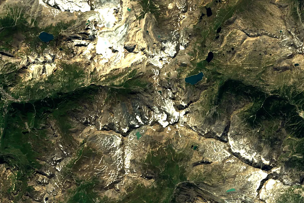
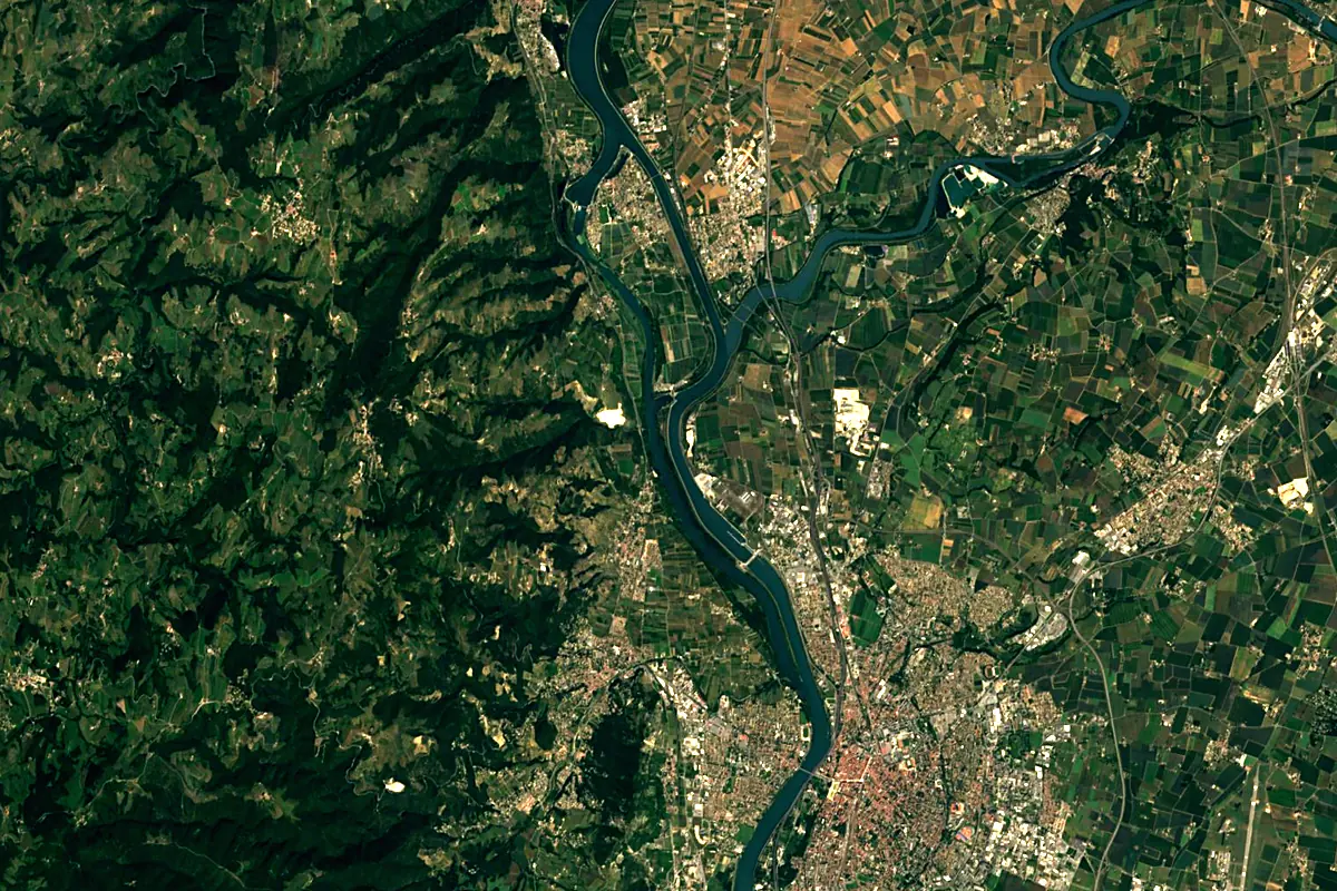
Sentinel-2 cloudless 2016 by EOX IT Services GmbH (contains modified Copernicus Sentinel data 2016), CC BY 4.0. The glowing line is the river as drawn by RiverATLAS.
Photos
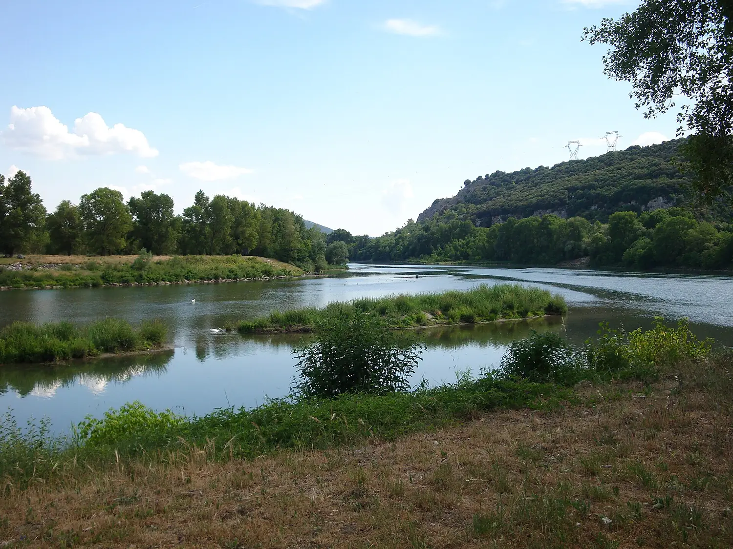
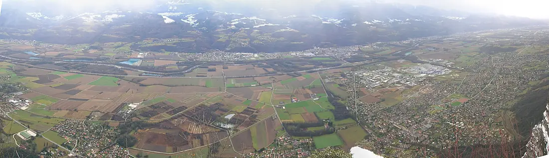
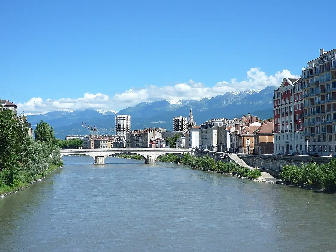
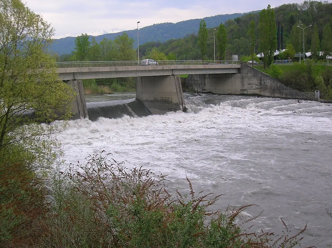
Isère in pictures
Tributaries
Where it flows, and what flows into it
It flows into
RhôneFrance812 km1,800 m³/sTributaries (14)
Also: Arly, Bourne, Bréda, Morge, Doron de Bozel, Herbasse, Gelon, Ruisseau de la Vence, Furon, Eau Rousse, Morel, Ruisseau la Cumane
 Switzerland
Where these numbers come from
| Name, length, places | Wikidata (Q201341) · CC0 |
|---|---|
| Course, profile, basin | RiverATLAS v1.0 (HydroATLAS, Linke et al. 2019) · CC BY 4.0 — followed from the source to the mouth given by Wikidata |
| Flow | WaterGAP (RiverATLAS), 1971–2000 · CC BY 4.0 |
| Climate along the river | WorldClim (RiverATLAS), 1970–2000 · CC BY 4.0 |
| Towns, bridges, dams | Wikidata · CC0; GeoNames · CC BY 4.0 |
| Along the river | © OpenStreetMap contributors · ODbL |
| Images | EOX Sentinel-2 cloudless 2016 · CC BY 4.0; Wikimedia Commons |
| Our other atlases | Cascadyas, Lakeyas, Peakyas — Wikidata · CC0; © OpenStreetMap contributors · ODbL; GeoNames · CC BY 4.0; HydroLAKES · CC BY 4.0; NOAA OISST |
Every source and licence is on the data sources page.
The family
Do you prefer beaches, lakes, mountains, waterfalls, islands, rivers or canyons?
Same idea, other landscapes: field atlases built on open data, month by month, in seven languages.
 beaches
 Find your beach: sea temperature, sun and swimming month by month.Visit lakes
 Every lake on Earth: water temperature, ice, depth and the shore.Coming soonVisit mountains
 Every summit in 3D: summit weather, the 0 °C line, huts and trails.Visit waterfalls
 Every waterfall: height, flow month by month and when it roars.Coming soonVisit
  islands
 Every island from the sea up: size, sea temperature, ferries and 3D.Coming soonVisit
  rivers
 Every river from source to sea: the journey, the flow and the basin in numbers.You are here
 canyons
 Every canyon cut to scale: depth to the floor, rim and floor temperatures, trails and viewpoints.Coming soonVisit