River
Cuyahoga River
137 km from source to mouth · United States.
 United StatesFlows into St. Lawrence River
In numbers
Length
137km
Average flow
29m³/s
Basin
2,950km²
Drop
164m
from 336 m to 172 m
Country
1
The journey
From source to mouth
137 km of river and 48 stops on the way: 14 towns and cities on its banks, dams, bridges and the tributaries that feed it.
- 0 kmWest Branch Cuyahoga Riverat 336 m
- 0 kmBurton1,461 people
- 5 kmBurton Lake0.3 km²
- 7 kmLaDue Reservoir5.6 km²
- 26 kmMantua1,021 people
- 46 kmLake George2.9 km²
- 51 kmKent29,810 people
- 60 kmMunroe Falls5,019 people
- 61 kmStow34,797 people
- 62 kmSilver Lake2,523 people
- 62 kmCrystal Lake0.3 km²
- 66 kmCuyahoga Falls49,146 people
- 95 kmBlue Hen Falls
- 98 kmJaite Company Railroad Bridge
- 103 kmBrandywine Creektributary
- 103 kmStation Road Bridge
- 104 kmBrecksville-Northfield High Level Bridge
- 111 kmIndependence7,135 people
- 113 kmValley View2,012 people
- 117 kmValley View Bridge
- 118 kmGarfield Heights28,097 people
- 123 kmBrooklyn Heights1,543 people
- 124 kmNewburgh Heights2,096 people
- 128 kmClark-Fulton18,185 people
- 129 kmClark Avenue Bridge
- 130 kmWheeling and Lake Erie Railroad Bridge (Cleveland)
- 131 kmB&O Railroad Bridge No. 460
- 131 kmNSR Cuyahoga River Bridge (Cleveland)
- 131 kmJefferson Avenue Bascule Bridge
- 133 kmWest 3rd Street Bridge
- 133 kmGeorge V. Voinovich Bridges
- 133 kmInnerbelt Bridge
- 133 kmNickel Plate Cuyahoga River Bridge
- 133 kmHope Memorial Bridge
- 134 kmColumbus Road Bridge (fourth structure)
- 134 kmColumbus Road Bridge
- 134 kmColumbus Road Bridge (third structure)
- 134 kmEagle Avenue Bridge
- 134 kmCuyahoga Viaduct
- 134 kmCarter Road Bridge
- 134 kmCleveland372,624 people
- 134 kmNew York Central Railroad Bridge (Cleveland)
- 134 kmFlats Industrial Railroad Lift Bridge
- 135 kmDetroit–Superior Bridge
- 135 kmCenter Street Bridge
- 135 kmB&O Railroad Bridge No. 463 (1906)
- 135 kmB&O Railroad Bridge No. 463
- 135 kmMain Avenue Bridge
- 136 kmCuyahoga River Bridge 1
- 137 kmSt. Lawrence Riverat 172 m
Water level along the river (RiverATLAS; the height is exaggerated). Towns: GeoNames and Wikidata; bridges, dams and tributaries: Wikidata.
River in Ohio, United States
At the mouth it carries 29 m³/s on average: an Olympic pool every 86 seconds. It drops from 336 m to 172 m, 1.2 m per kilometre on average. Its basin covers 2,950 km², about the size of LU. 1.1 million people live in it. Highest water: March; lowest: from December to February and August. Its dams hold back little of its water (8.0% of a year's flow).
Where to start
- ClevelandLargest city on its banks · 372,624 people
- Cleveland Hopkins International Airport (CLE)Nearest airport with scheduled flights, 16 km from the cityCar hire at CLE airport (Cleveland)Discover Cars · Affiliate link↗
- On the water22 ferry piers, marinas, boat rentals and boat ramps along the river (OpenStreetMap)
- From May to SeptemberThe best months to visit
Cuyahoga River, month by month
Highest water: March
Lowest water: from December to February and August. Best months to visit: from May to September.
From about 13 m³/s in the lowest month to 89 m³/s in the highest. An estimate: the monthly flow is modelled from the lowest and highest months of WaterGAP (RiverATLAS, 1971–2000) and the rain and snow along the river (WorldClim). Dams change the real rhythm. The chip is the average air temperature; below it, the month's rain.
Plan the trip
Plan the trip: boat trips, a bed by the river, a car
Some links above are affiliate links: if you book through them we may earn a commission, at no extra cost to you. It never changes what the data on this page says.
The basin
Cuyahoga River: the basin in numbers
2,284 km² of land send their water to this river. This is what lives on it.
- 1.1millionpeople live in the basin
- 493/km²people per km²
- 323maverage altitude of the basin
- 980mmof rain a year (basin average)
- 9.4°Caverage air temperature
- 5%protected areas
- 1.2%covered by lakes
- 0.1km³held in reservoirs
What covers the basin
- 42% Forest
- 12% Cropland
- 2% Pasture
- 41% Towns and cities
RiverATLAS (HydroATLAS v1.0, CC BY 4.0): land cover, people, protected areas, glaciers and dams over the whole basin upstream of the mouth.
Along the river
Cuyahoga River: what you find on the way
- 6Weirs
- 9LocksLock 24 (Remnants), Lock 25 (Remnants), Lock 28 and 6 more
- 10WaterfallsTip Top Falls, Hidden Crystal Falls, Blue Hen Falls and 7 more
- 9Boat rampsCanoe/Kayak Launch, Middlebury Road River Access, boat launch and 6 more
- 6Ferry piersBrewDog Cleveland Outpost, Collision Bend Brewing Company, West Bank Dock and 3 more
- 7MarinasOlde River Yacht Club, Channel Park Marina, Rock & Dock Marina and 4 more
From OpenStreetMap, within 1.4 km of the river. Not mapped is not the same as not there.
Cross-checked with our atlases
Cuyahoga River in our other atlases
What our sister atlases know about the waterfalls on this river, the lakes it flows through, the beaches at its mouth, the mountains where it rises and the islands off its mouth.
 1waterfall on the riverCascadyas
 4lakes on its wayLakeyas
 5mountains at the sourcePeakyas
Waterfalls (1)
On the river, by Cascadyas
- Blue Hen Fallskm 81
Cascadyas is coming soonOpen Cascadyas ↗
Lakes and reservoirs (4)
Lakes it flows through, by Lakeyas
- Burton Lakekm 40.3km²
- LaDue Reservoirkm 65.6km²
- Lake Georgekm 392.9km²
- Crystal Lakekm 530.3km²
Lakeyas is coming soonOpen Lakeyas ↗
Mountains at the source (5)
Within 15 km of the source, by Peakyas
- Derthick Hill15 km away
- McConougheys Hill13 km away
- Sand Hill14 km away
- Sugarloaf6.0 km away
- Welsh Hill6.8 km away
From space
The source and the mouth, seen from orbit
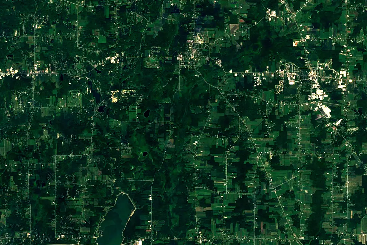
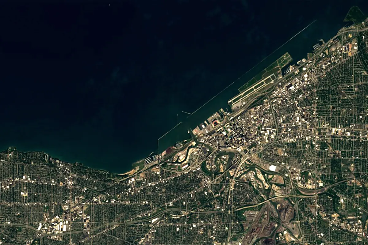
Sentinel-2 cloudless 2016 by EOX IT Services GmbH (contains modified Copernicus Sentinel data 2016), CC BY 4.0. The glowing line is the river as drawn by RiverATLAS.
Photos
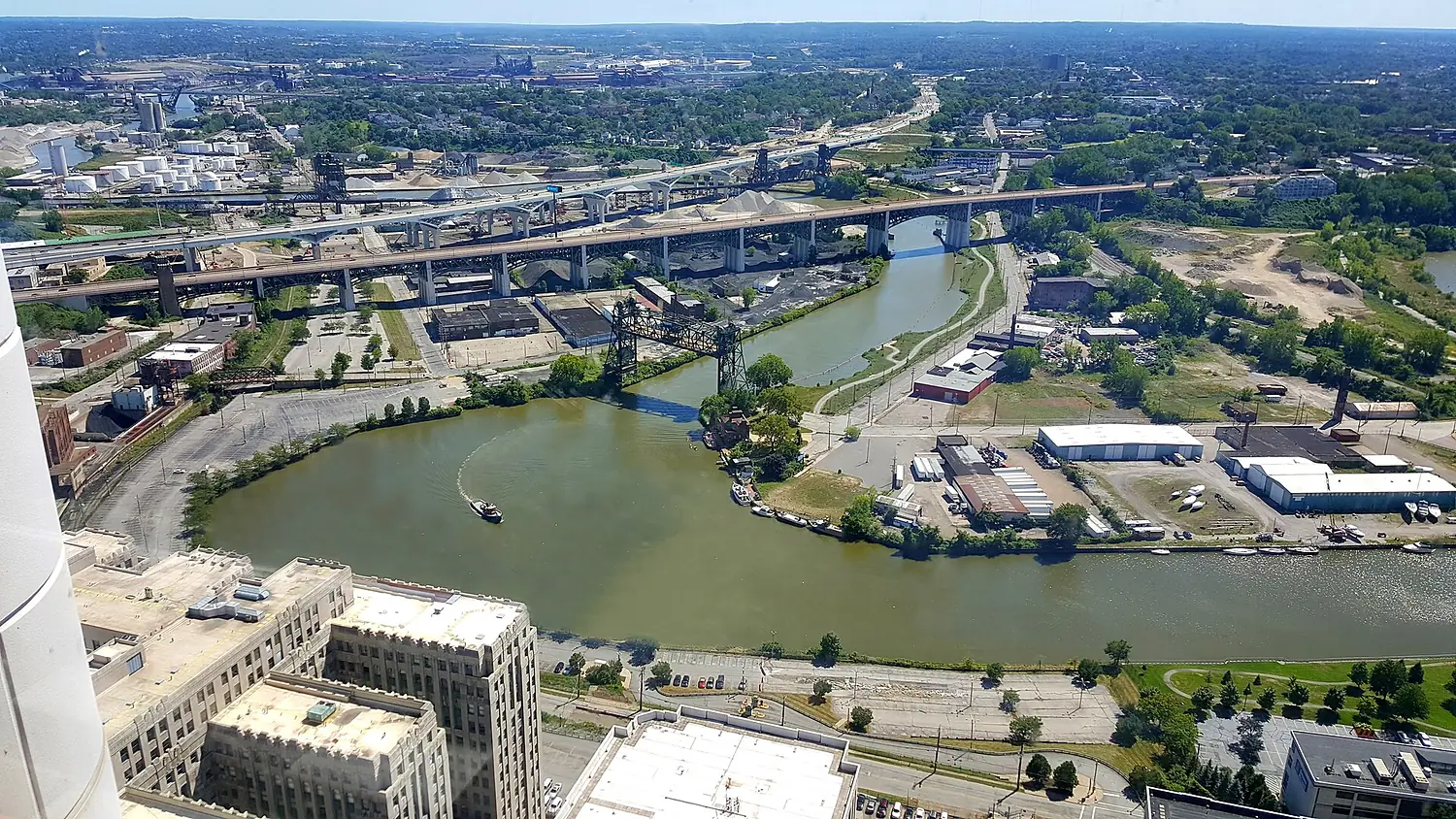
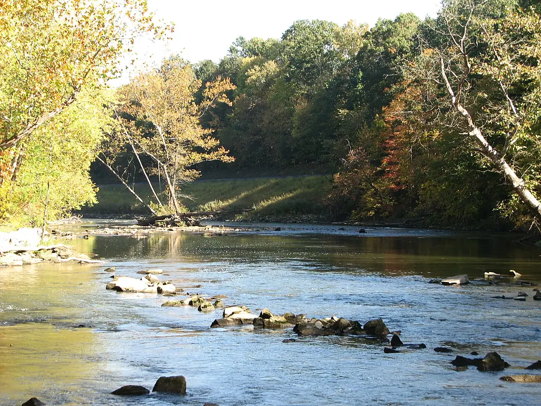
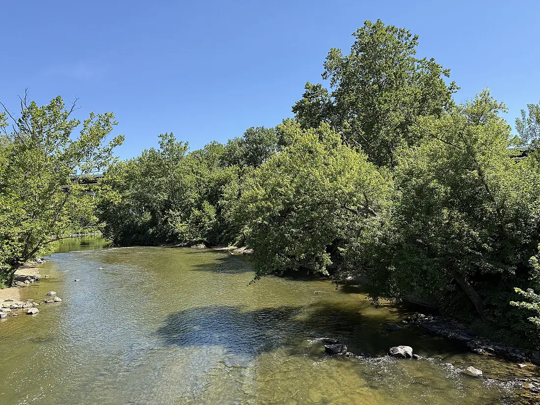
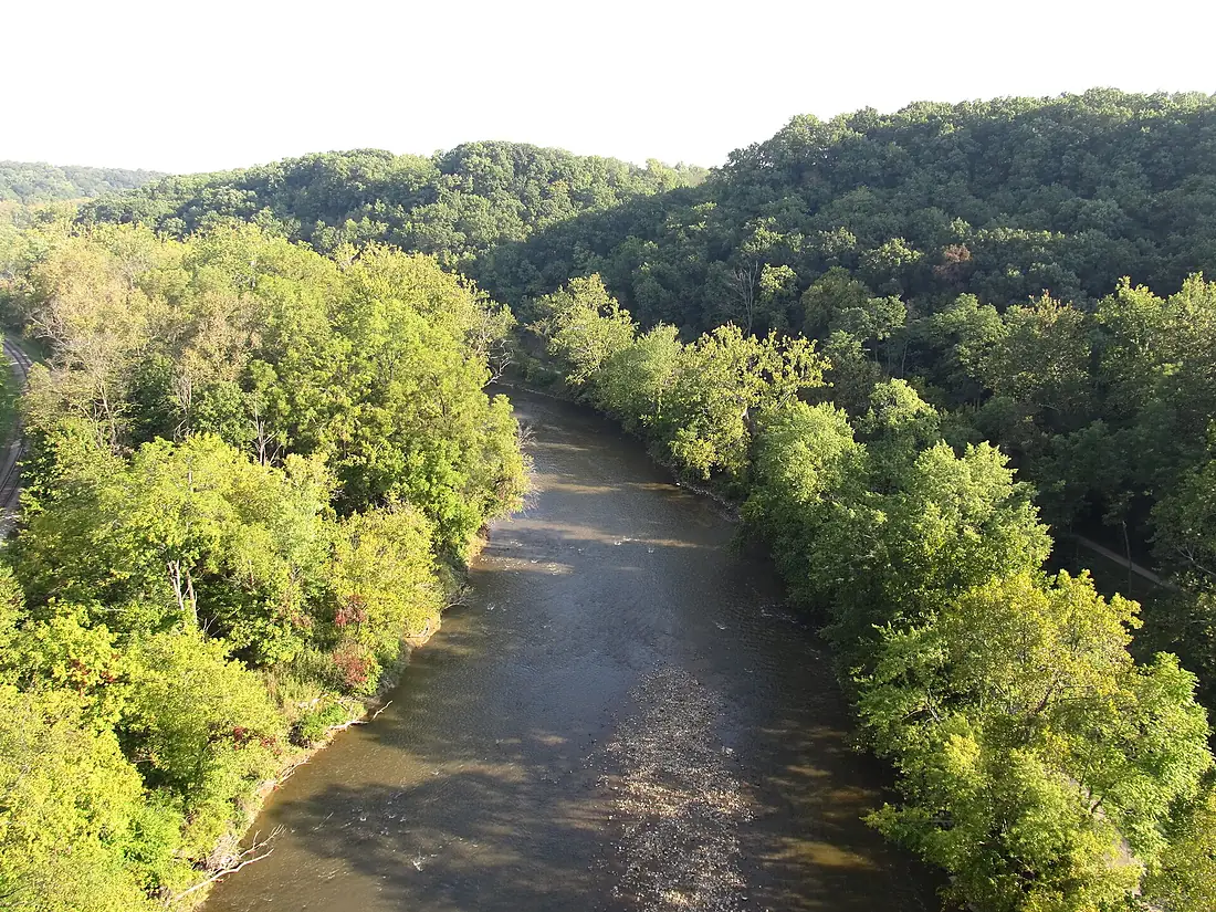
Cuyahoga River in pictures
Tributaries
Where it flows, and what flows into it
Tributaries (5)
Also: Brandywine Creek, Little Cuyahoga River, Tinkers Creek, Sand Run, Big Creek
Nearby
Rivers nearby
United States45 km5.3 m³/s133 km awaySt. Clair RiverUnited States65 km5,200 m³/s138 km awayAllegheny RiverUnited States523 km560 m³/s185 km awayMonongahela RiverUnited States209 km360 m³/s185 km awayNiagara River Canada53 km5.8 m³/s293 km awayKanawha RiverUnited States156 km430 m³/s299 km awayScioto RiverUnited States372 km190 m³/s328 km awayShenandoah RiverUnited States241 km85 m³/s416 km away
Where these numbers come from
| Name, length, places | Wikidata (Q1146724) · CC0 |
|---|---|
| Course, profile, basin | RiverATLAS v1.0 (HydroATLAS, Linke et al. 2019) · CC BY 4.0 — followed from the source to the mouth given by Wikidata |
| Flow | WaterGAP (RiverATLAS), 1971–2000 · CC BY 4.0 |
| Climate along the river | WorldClim (RiverATLAS), 1970–2000 · CC BY 4.0 |
| Towns, bridges, dams | Wikidata · CC0; GeoNames · CC BY 4.0 |
| Along the river | © OpenStreetMap contributors · ODbL |
| Images | EOX Sentinel-2 cloudless 2016 · CC BY 4.0; Wikimedia Commons |
| Our other atlases | Cascadyas, Lakeyas, Peakyas — Wikidata · CC0; © OpenStreetMap contributors · ODbL; GeoNames · CC BY 4.0; HydroLAKES · CC BY 4.0; NOAA OISST |
Every source and licence is on the data sources page.
The family
Do you prefer beaches, lakes, mountains, waterfalls, islands, rivers or canyons?
Same idea, other landscapes: field atlases built on open data, month by month, in seven languages.
 beaches
 Find your beach: sea temperature, sun and swimming month by month.Visit lakes
 Every lake on Earth: water temperature, ice, depth and the shore.Coming soonVisit mountains
 Every summit in 3D: summit weather, the 0 °C line, huts and trails.Visit waterfalls
 Every waterfall: height, flow month by month and when it roars.Coming soonVisit
  islands
 Every island from the sea up: size, sea temperature, ferries and 3D.Coming soonVisit
  rivers
 Every river from source to sea: the journey, the flow and the basin in numbers.You are here
 canyons
 Every canyon cut to scale: depth to the floor, rim and floor temperatures, trails and viewpoints.Coming soonVisit