River
Allegheny River
523 km from source to mouth · United States.
 United StatesFlows into Ohio River
In numbers
Length
523km
Average flow
560m³/s
Basin
29,992km²
Drop
291m
from 507 m to 216 m
Country
1
The journey
From source to mouth
523 km of river and 68 stops on the way: 30 towns and cities on its banks, dams, bridges and the tributaries that feed it.
- 0 kmAllegheny Mountainsat 507 m
- 5 kmCoudersport2,381 people
- 81 kmOlean13,937 people
- 118 kmSalamanca5,929 people
- 142 kmQuaker Lake1.1 km²
- 175 kmAllegheny Reservoir41 km²
- 191 kmWarren9,404 people
- 196 kmConewango Creektributary
- 228 kmTidioute626 people
- 229 kmTidioute Bridge
- 254 kmTionesta428 people
- 255 kmTionesta Creektributary
- 275 kmPithole Creektributary
- 289 kmOil City Pennsylvania Railroad Bridge
- 290 kmOil City9,613 people
- 290 kmOil Creektributary
- 303 kmFrench Creektributary
- 303 kmFranklin6,077 people
- 360 kmEmlenton614 people
- 361 kmEmlenton Bridge
- 366 kmFoxburg181 people
- 366 kmFoxburg Bridge
- 369 kmClarion Rivertributary
- 395 kmSergeant Carl F. Curran II Bridge
- 396 kmEast Brady818 people
- 427 kmMahoning Creektributary
- 436 kmKittanning3,921 people
- 437 kmKittanning Citizens Bridge
- 439 kmJudge J. Frank Graff Bridge
- 442 kmFord City2,859 people
- 462 kmKiskiminetas Rivertributary
- 462 kmFreeport Rail Bridge
- 465 kmDonald R. Lobaugh Bridge
- 472 kmNatrona Heights10,927 people
- 475 kmBrackenridge3,211 people
- 477 kmGeorge D. Stuart Bridge
- 477 kmTarentum4,462 people
- 480 kmArnold4,772 people
- 482 kmNew Kensington12,170 people
- 483 kmLower Burrell11,761 people
- 486 kmSpringdale3,400 people
- 487 kmCheswick1,672 people
- 490 kmBessemer & Lake Erie Railroad Bridge
- 493 kmOakmont6,758 people
- 494 kmFox Chapel5,383 people
- 495 kmVerona2,492 people
- 495 kmPenn Hills44,610 people
- 497 kmBlawnox1,454 people
- 502 kmBrilliant Branch Railroad Bridge
- 503 kmHighland Park Bridge
- 503 kmOld Highland Park Bridge
- 504 kmSharpsburg3,398 people
- 505 kmSenator Robert D. Fleming Bridge
- 506 kmEtna3,401 people
- 508 kmMillvale3,376 people
- 509 kmPine Creektributary
- 509 kmWashington Crossing Bridge
- 510 km33rd Street Railroad Bridge
- 510 km31st Street Bridge
- 512 kmDavid McCullough Bridge
- 512 kmVeterans Bridge
- 512 kmAllegheny Aqueduct
- 512 kmFort Wayne Railroad Bridge
- 513 kmRachel Carson Bridge
- 513 kmAndy Warhol Bridge
- 513 kmRoberto Clemente Bridge
- 513 kmPittsburgh302,971 people
- 514 kmFort Duquesne Bridge
- 514 kmManchester Bridge
- 523 kmOhio Riverat 216 m
Water level along the river (RiverATLAS; the height is exaggerated). Towns: GeoNames and Wikidata; bridges, dams and tributaries: Wikidata.
River in western Pennsylvania and New York, United States
At the mouth it carries 559 m³/s on average: an Olympic pool every 4.5 seconds. It drops from 507 m to 216 m, 0.6 m per kilometre on average. Its basin covers 29,992 km², about the size of AM. 1.4 million people live in it. Highest water: from April to May; lowest: from January to February. Dams and reservoirs hold back a large share of its water (13% of a year's flow).
Where to start
- PittsburghLargest city on its banks · 302,971 people
- Pittsburgh International Airport (PIT)Nearest airport with scheduled flights, 20 km from the cityCar hire at PIT airport (Pittsburgh)Discover Cars · Affiliate link↗
- On the water80 ferry piers, marinas, boat rentals and boat ramps along the river (OpenStreetMap)
- Kayak and canoe18 put-ins and rapids mapped (OpenStreetMap)
- From May to SeptemberThe best months to visit
Allegheny River, month by month
Highest water: from April to May
Lowest water: from January to February. Freezing months (average below −4 °C): January. Best months to visit: from May to September.
From about 230 m³/s in the lowest month to 2,200 m³/s in the highest. An estimate: the monthly flow is modelled from the lowest and highest months of WaterGAP (RiverATLAS, 1971–2000) and the rain and snow along the river (WorldClim). Dams change the real rhythm. The chip is the average air temperature; below it, the month's rain.
Plan the trip
Plan the trip: boat trips, a bed by the river, a car
Some links above are affiliate links: if you book through them we may earn a commission, at no extra cost to you. It never changes what the data on this page says.
The basin
Allegheny River: the basin in numbers
30,247 km² of land send their water to this river. This is what lives on it.
- 1.4millionpeople live in the basin
- 47/km²people per km²
- 491maverage altitude of the basin
- 1,116mmof rain a year (basin average)
- 7.8°Caverage air temperature
- 1%protected areas
- 0.6%covered by lakes
- 2.4km³held in reservoirs
What covers the basin
- 91% Forest
- 12% Cropland
- 3% Pasture
- 2% Towns and cities
RiverATLAS (HydroATLAS v1.0, CC BY 4.0): land cover, people, protected areas, glaciers and dams over the whole basin upstream of the mouth.
Along the river
Allegheny River: what you find on the way
- 14WeirsQuaker Run Dam, Dam No. 9, Dam No. 8 and 11 more
- 8LocksLock Canal No. 9, Lock Canal No. 8, Lock Canal No. 7 and 5 more
- 2WaterfallsPotters Falls, Freedom Falls
- 1RapidsBucktooth Rapids
- 17Canoe put-insTarentum Access, Springdale Access, Deer Creek Access and 14 more
- 74Boat rampsAllegany State Park Boat Launch, Onoville Marina Park Boat Launch, Boat Launch and 71 more
- 5MarinasOnoville Marina Park, Wolf Run Marina, Aspinwall Marina and 2 more
- 1River beachesKinzua Beach
From OpenStreetMap, within 2.1 km of the river. Not mapped is not the same as not there.
Cross-checked with our atlases
Allegheny River in our other atlases
What our sister atlases know about the waterfalls on this river, the lakes it flows through, the beaches at its mouth, the mountains where it rises and the islands off its mouth.
 2lakes on its wayLakeyas
 9mountains at the sourcePeakyas
Lakes and reservoirs (2)
Lakes it flows through, by Lakeyas
- Quaker Lakekm 1341.1km²
- Allegheny Reservoirkm 16541km²
Lakeyas is coming soonOpen Lakeyas ↗
Mountains at the source (9)
Within 15 km of the source, by Peakyas
- Greenman Hill12 km away
- Bailey Hill13 km away
- Carmer Hill8.1 km away
- Cobb Hill0.4 km away
- Ford Hill6.4 km away
- Lyon Hill9.8 km away
- Rag Hill6.0 km away
- Sweden Hill7.8 km away
1 more on PeakyasOpen Peakyas ↗
From space
The source and the mouth, seen from orbit
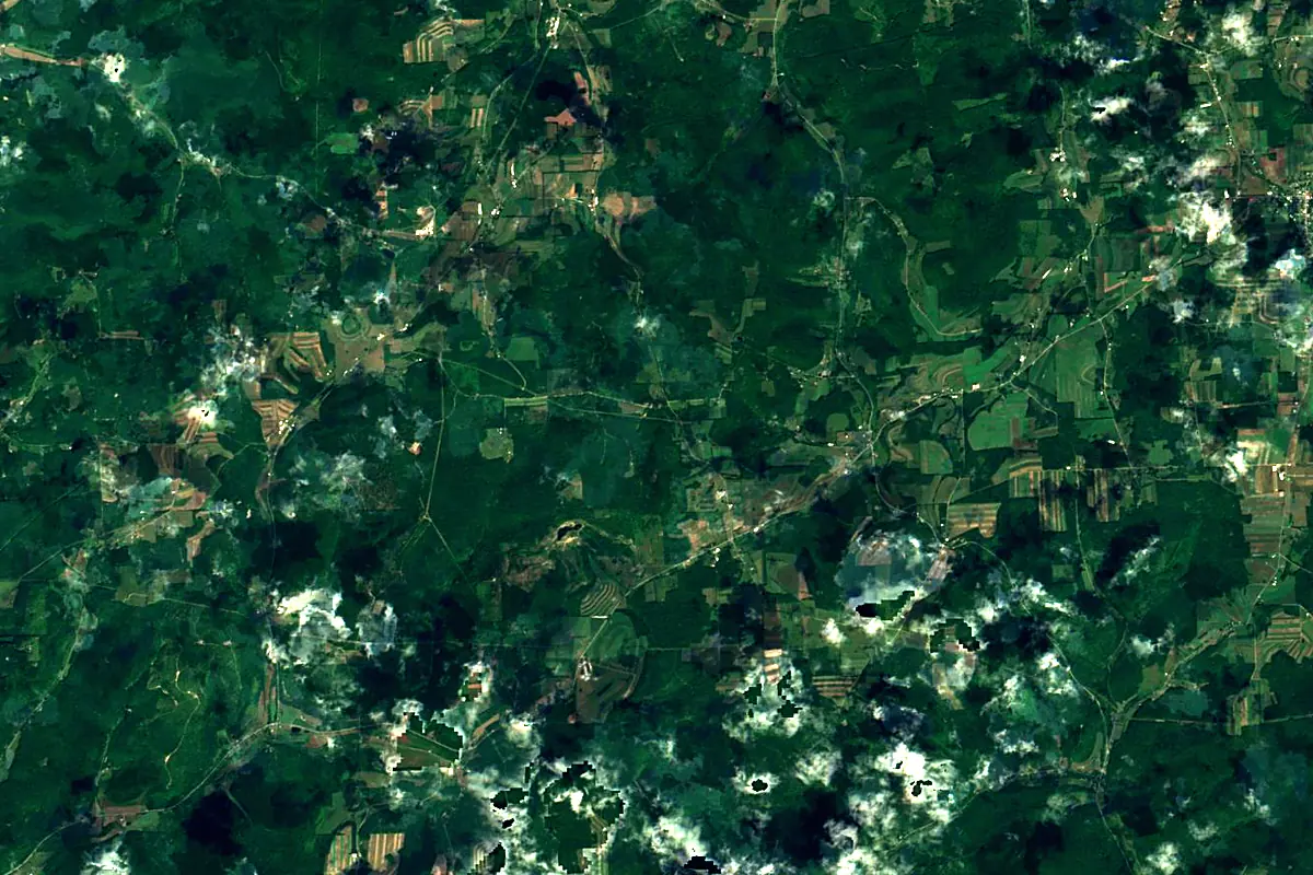
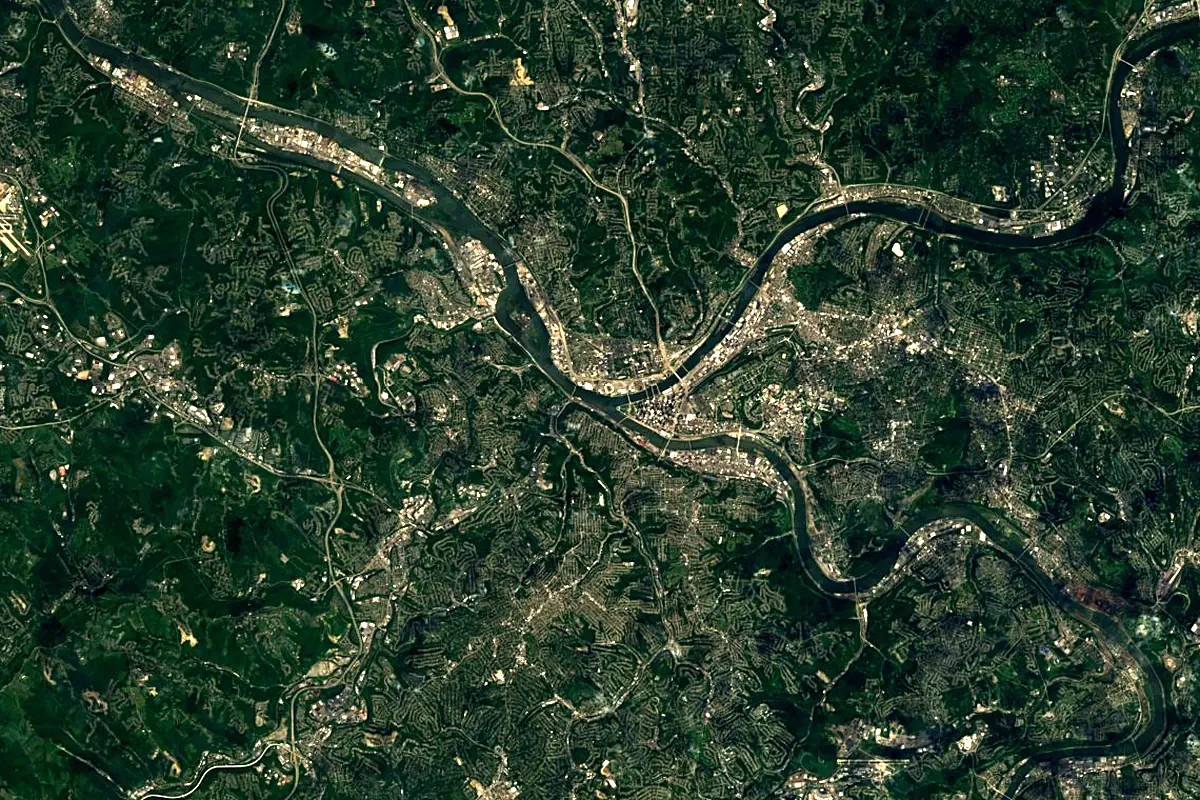
Sentinel-2 cloudless 2016 by EOX IT Services GmbH (contains modified Copernicus Sentinel data 2016), CC BY 4.0. The glowing line is the river as drawn by RiverATLAS.
Photos
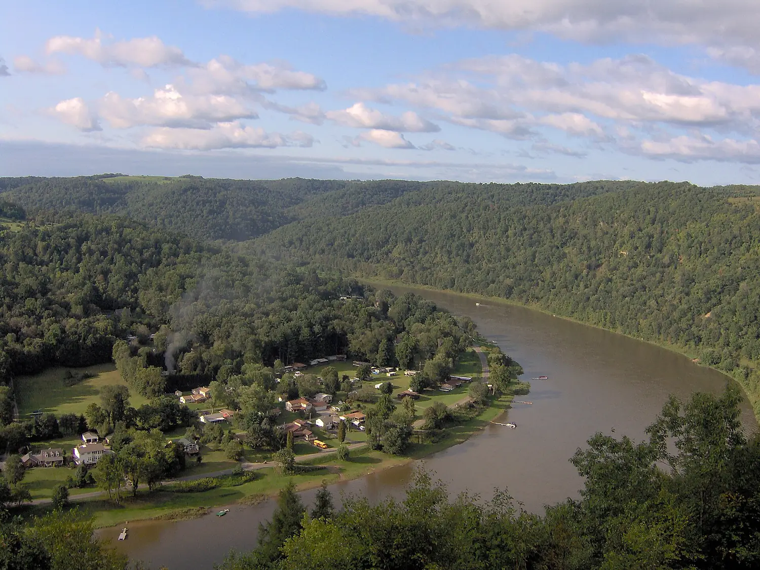
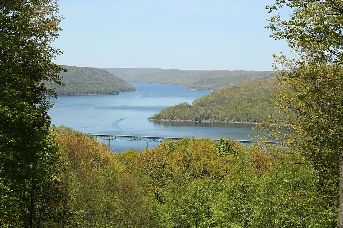
Allegheny River in pictures
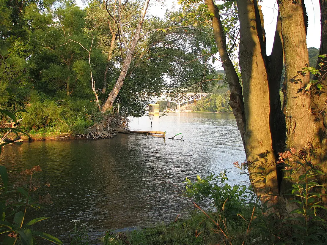
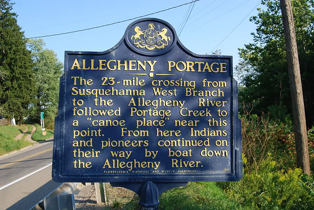
Tributaries
Where it flows, and what flows into it
It flows into
Ohio RiverUnited States1,579 km8,000 m³/sTributaries (28)
Also: French Creek, Clarion River, Conewango Creek, Kiskiminetas River, Oil Creek, Tionesta Creek, Mahoning Creek, Pine Creek, Redbank Creek, Brokenstraw Creek, Pithole Creek, Kinzua Creek, Buffalo Creek, Bull Creek, Chartiers Run, Cowanshannock Creek, Crooked Creek, Deer Creek, East Sandy Creek, Girtys Run, Plum Creek, Potato Creek, Pucketa Creek, Rachel Carson Run
In the same basin
United States3,766 km12,700 m³/sMissouri RiverUnited States3,726 km2,500 m³/sArkansas RiverUnited States2,364 km240 m³/sTennessee RiverUnited States1,049 km2,000 m³/sRed RiverUnited States2,189 km1,900 m³/sYellowstone RiverUnited States1,114 km390 m³/sPlatte RiverUnited States500 km200 m³/sCanadian RiverUnited States1,458 km200 m³/sIllinois RiverUnited States432 km660 m³/sCumberland RiverUnited States1,107 km860 m³/sNearby
Rivers nearby
United States209 km360 m³/s0 km awayCuyahoga RiverUnited States137 km29 m³/s185 km awayShenandoah RiverUnited States241 km85 m³/s232 km awayKanawha RiverUnited States156 km430 m³/s255 km awayNiagara River Canada53 km5.8 m³/s325 km awayDetroit RiverUnited States45 km5.3 m³/s316 km awaySusquehanna RiverUnited States715 km1,100 m³/s348 km awaySt. Clair RiverUnited States65 km5,200 m³/s320 km away
Where these numbers come from
| Name, length, places | Wikidata (Q686021) · CC0 |
|---|---|
| Course, profile, basin | RiverATLAS v1.0 (HydroATLAS, Linke et al. 2019) · CC BY 4.0 — followed from the source to the mouth given by Wikidata |
| Flow | WaterGAP (RiverATLAS), 1971–2000 · CC BY 4.0 |
| Climate along the river | WorldClim (RiverATLAS), 1970–2000 · CC BY 4.0 |
| Towns, bridges, dams | Wikidata · CC0; GeoNames · CC BY 4.0 |
| Along the river | © OpenStreetMap contributors · ODbL |
| Images | EOX Sentinel-2 cloudless 2016 · CC BY 4.0; Wikimedia Commons |
| Our other atlases | Lakeyas, Peakyas — Wikidata · CC0; © OpenStreetMap contributors · ODbL; GeoNames · CC BY 4.0; HydroLAKES · CC BY 4.0; NOAA OISST |
Every source and licence is on the data sources page.
The family
Do you prefer beaches, lakes, mountains, waterfalls, islands, rivers or canyons?
Same idea, other landscapes: field atlases built on open data, month by month, in seven languages.
 beaches
 Find your beach: sea temperature, sun and swimming month by month.Visit lakes
 Every lake on Earth: water temperature, ice, depth and the shore.Coming soonVisit mountains
 Every summit in 3D: summit weather, the 0 °C line, huts and trails.Visit
  waterfalls
 Every waterfall: height, flow month by month and when it roars.Coming soonVisit
  islands
 Every island from the sea up: size, sea temperature, ferries and 3D.Coming soonVisit
  rivers
 Every river from source to sea: the journey, the flow and the basin in numbers.You are here
 canyons
 Every canyon cut to scale: depth to the floor, rim and floor temperatures, trails and viewpoints.Coming soonVisit