River
Illinois River
432 km from source to mouth · United States.
 United StatesFlows into Mississippi River
In numbers
Length
432km
Average flow
660m³/s
Basin
104,000km²
Drop
24m
from 150 m to 126 m
Country
1
The journey
From source to mouth
432 km of river and 68 stops on the way: 38 towns and cities on its banks, dams, bridges and the tributaries that feed it.
- 0 kmSourceat 150 m
- 0 kmDes Plaines Rivertributary
- 0 kmKankakee Rivertributary
- 14 kmMorris14,163 people
- 15 kmMorris Bridge
- 30 kmSeneca Rail Bridge
- 31 kmSeneca2,353 people
- 40 kmMarseilles4,845 people
- 41 kmMarseilles Bridge
- 52 kmOttawa18,840 people
- 52 kmVeterans Memorial Bridge
- 53 kmOttawa Rail Bridge
- 55 kmNaplate412 people
- 56 kmFox Rivertributary
- 68 kmUtica Bridge
- 71 kmDeer Park3,192 people
- 72 kmOglesby3,647 people
- 72 kmVermilion Rivertributary
- 74 kmLaSalle Rail Bridge
- 74 kmLa Salle9,609 people
- 75 kmShippingsport Bridge
- 78 kmPeru9,896 people
- 86 kmSpring Valley5,314 people
- 95 kmDepue Lake1.2 km²
- 101 kmHennepin769 people
- 108 kmBig Bureau Creektributary
- 120 kmHenry2,320 people
- 130 kmLacon Bridge
- 130 kmLacon1,878 people
- 143 kmChillicothe6,128 people
- 149 kmRome1,604 people
- 154 kmSpring Bay474 people
- 163 kmPeoria Heights5,979 people
- 165 kmMcClugage Bridge
- 168 kmEast Peoria22,484 people
- 169 kmNorth Peoria113,004 people
- 170 kmPeoria Lake59 km²
- 170 kmMurray Baker Bridge
- 170 kmPeoria113,150 people
- 172 kmWest Peoria4,418 people
- 176 kmCreve Coeur5,272 people
- 177 kmShade-Lohmann Bridge
- 178 kmBartonville6,382 people
- 185 kmPekin31,731 people
- 190 kmHollis Township1,829 people
- 191 kmMackinaw Rivertributary
- 196 kmKingston Mines266 people
- 216 kmPond Lily Lake11 km²
- 223 kmLiverpool94 people
- 235 kmSpoon Rivertributary
- 236 kmHavana2,963 people
- 236 kmScott Wike Lucas Bridge
- 249 kmBath279 people
- 250 kmSwan Lake5.3 km²
- 252 kmAnderson Lake5.1 km²
- 268 kmChain Lake7.7 km²
- 271 kmBrowning117 people
- 285 kmBeardstown5,951 people
- 286 kmSangamon Rivertributary
- 292 kmLa Moine Rivertributary
- 310 kmMeredosia Lake5.8 km²
- 312 kmMeredosia826 people
- 312 kmMeredosia Bridge
- 320 kmNaples100 people
- 327 kmValley City14 people
- 336 kmFlorence17 people
- 372 kmKampsville310 people
- 388 kmCalhoun County4,437 people
- 388 kmHardin801 people
- 432 kmMississippi Riverat 126 m
Water level along the river (RiverATLAS; the height is exaggerated). Towns: GeoNames and Wikidata; bridges, dams and tributaries: Wikidata.
Illinois tributary of the Mississippi River in the United States
At the mouth it carries 657 m³/s on average: an Olympic pool every 3.8 seconds. It drops from 150 m to 126 m, 0.1 m per kilometre on average. Its basin covers 104,000 km², about the size of IS. 6.9 million people live in it. Highest water: from April to May; lowest: from January to February. Its dams hold back little of its water (4.4% of a year's flow).
Where to start
- PeoriaLargest city on its banks · 113,150 people
- General Wayne A. Downing Peoria International Airport (PIA)Nearest airport with scheduled flights, 9 km from the cityCar hire at PIA airport (Peoria)Discover Cars · Affiliate link↗
- On the water138 ferry piers, marinas, boat rentals and boat ramps along the river (OpenStreetMap)
- From May to SeptemberThe best months to visit
Illinois River, month by month
Highest water: from April to May
Lowest water: from January to February. Freezing months (average below −4 °C): January. Best months to visit: from May to September.
From about 420 m³/s in the lowest month to 2,000 m³/s in the highest. An estimate: the monthly flow is modelled from the lowest and highest months of WaterGAP (RiverATLAS, 1971–2000) and the rain and snow along the river (WorldClim). Dams change the real rhythm. The chip is the average air temperature; below it, the month's rain.
Plan the trip
Plan the trip: boat trips, a bed by the river, a car
Some links above are affiliate links: if you book through them we may earn a commission, at no extra cost to you. It never changes what the data on this page says.
The basin
Illinois River: the basin in numbers
73,123 km² of land send their water to this river. This is what lives on it.
- 6.9millionpeople live in the basin
- 97/km²people per km²
- 205maverage altitude of the basin
- 938mmof rain a year (basin average)
- 10.3°Caverage air temperature
- 1%protected areas
- 0.7%covered by lakes
- 1.2km³held in reservoirs
What covers the basin
- 11% Forest
- 69% Cropland
- 4% Pasture
- 7% Towns and cities
RiverATLAS (HydroATLAS v1.0, CC BY 4.0): land cover, people, protected areas, glaciers and dams over the whole basin upstream of the mouth.
Along the river
Illinois River: what you find on the way
- 8WeirsIce Chute, Peoria Dam, La Grange Dam and 5 more
- 16LocksDresden Island Lock Canal, Illinois River, Ice Chute and 13 more
- 140WaterfallsOttawa Canyon Waterfall, Wildcat Canyon Waterfall, Saint Louis Canyon Waterfall and 137 more
- 115Boat rampsHenry Marina, Lacon Public Access, Chillicothe Access Area and 112 more
- 7Ferry piersKampsville Ferry, Brussels Ferry (South Dock), Brussels Ferry (North Dock) and 4 more
- 16MarinasSpring Brook Marina, Henry Marina, Lacon Marina and 13 more
From OpenStreetMap, within 2.3 km of the river. Not mapped is not the same as not there.
Cross-checked with our atlases
Illinois River in our other atlases
What our sister atlases know about the waterfalls on this river, the lakes it flows through, the beaches at its mouth, the mountains where it rises and the islands off its mouth.
 7lakes on its wayLakeyas
Lakes and reservoirs (7)
Lakes it flows through, by Lakeyas
- Depue Lakekm 1011.2km²
- Peoria Lakekm 17959km²
- Pond Lily Lakekm 22811km²
- Swan Lakekm 2645.3km²
- Anderson Lakekm 2655.1km²
- Chain Lakekm 2827.7km²
- Meredosia Lakekm 3275.8km²
Lakeyas is coming soonOpen Lakeyas ↗
From space
The source and the mouth, seen from orbit
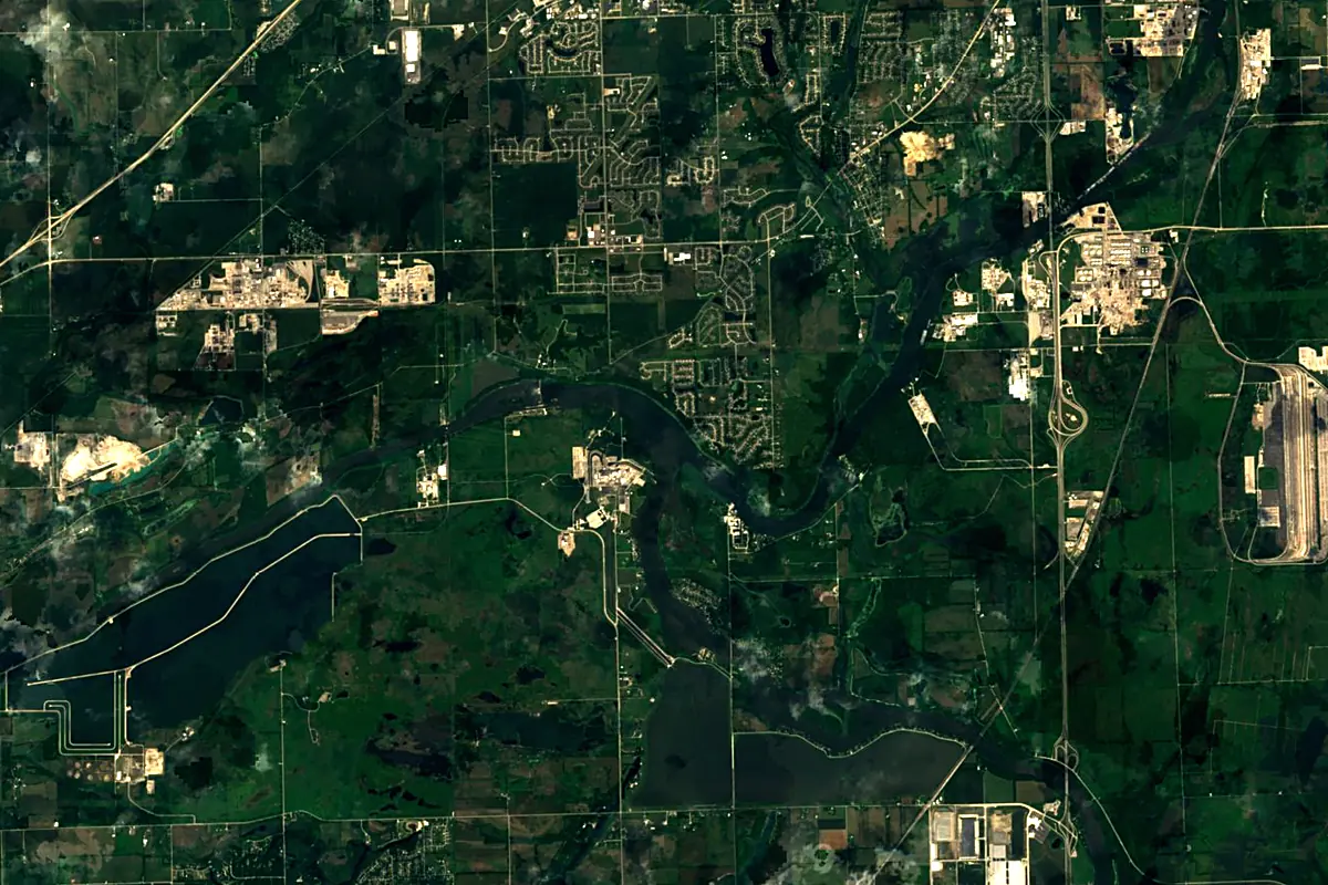
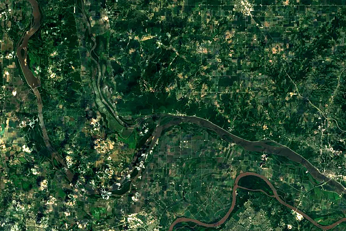
Sentinel-2 cloudless 2016 by EOX IT Services GmbH (contains modified Copernicus Sentinel data 2016), CC BY 4.0. The glowing line is the river as drawn by RiverATLAS.
Photos
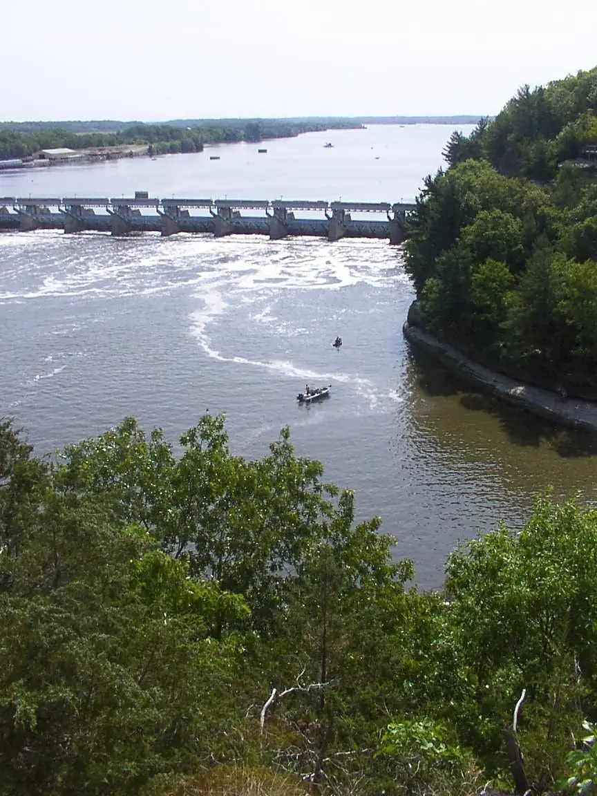
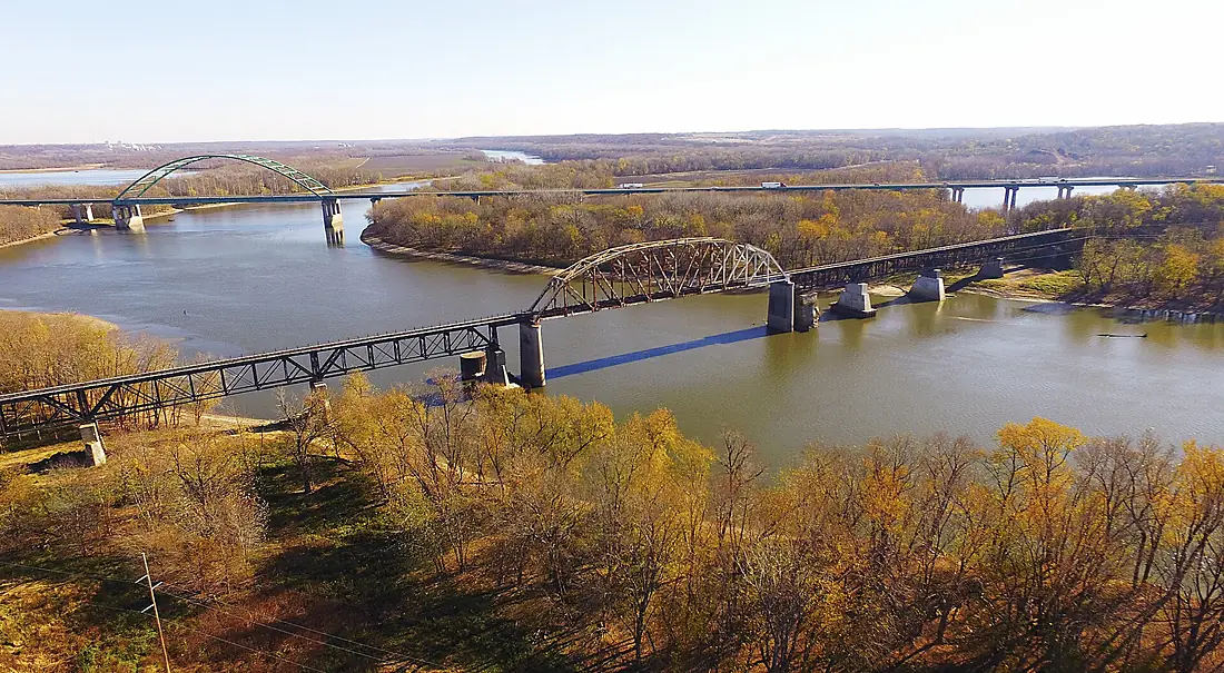
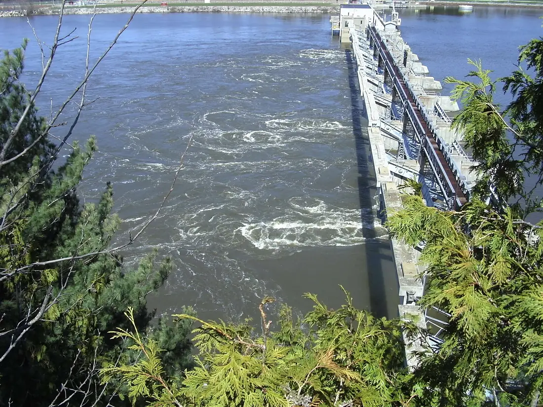
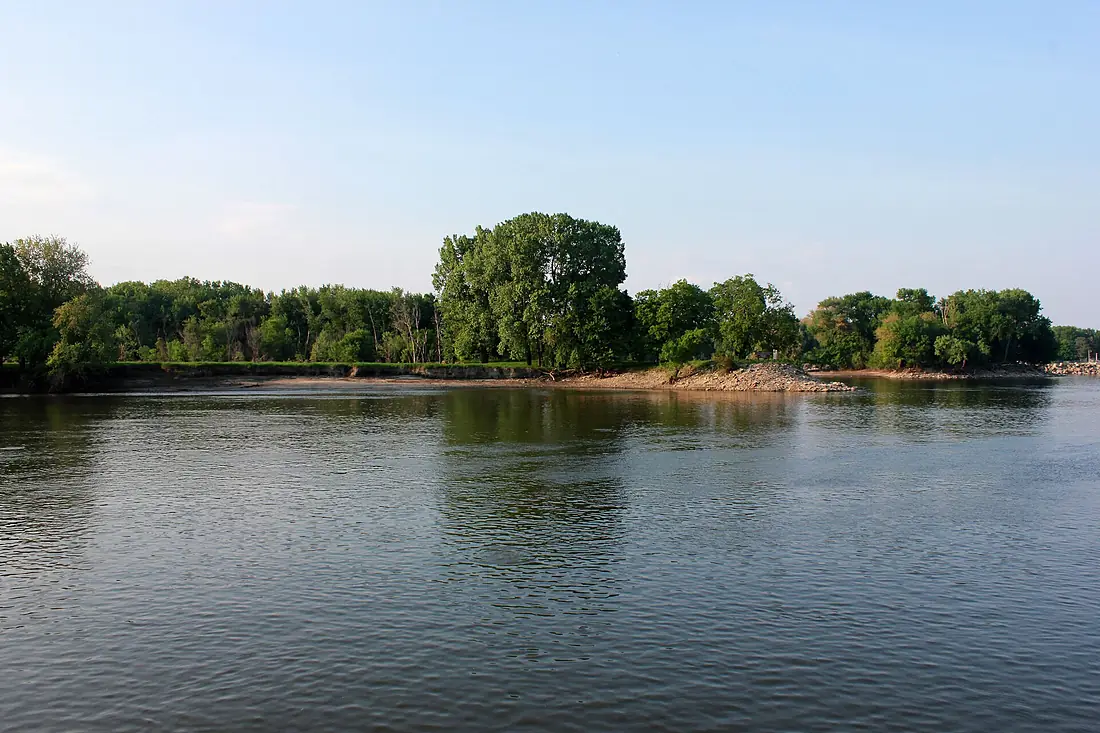
Illinois River in pictures
Tributaries
Where it flows, and what flows into it
It flows into
Mississippi RiverUnited States3,766 km12,700 m³/sTributaries (13)
Also: Kankakee River, Des Plaines River, Sangamon River, Fox River, La Moine River, Mackinaw River, Spoon River, Vermilion River, Big Bureau Creek, Macoupin Creek, Mazon River, Little Vermilion River, Kickapoo Creek
In the same basin
United States3,726 km2,500 m³/sOhio RiverUnited States1,579 km8,000 m³/sArkansas RiverUnited States2,364 km240 m³/sTennessee RiverUnited States1,049 km2,000 m³/sRed RiverUnited States2,189 km1,900 m³/sYellowstone RiverUnited States1,114 km390 m³/sPlatte RiverUnited States500 km200 m³/sCanadian RiverUnited States1,458 km200 m³/sAllegheny RiverUnited States523 km560 m³/sCumberland RiverUnited States1,107 km860 m³/sNearby
Rivers nearby
United States3,726 km2,500 m³/s34 km awayOsage RiverUnited States444 km310 m³/s133 km awayDes Moines RiverUnited States845 km250 m³/s177 km awayOhio RiverUnited States1,579 km8,000 m³/s249 km awayTennessee RiverUnited States1,049 km2,000 m³/s267 km awayWabash RiverUnited States960 km1,000 m³/s249 km awayCumberland RiverUnited States1,107 km860 m³/s271 km awayIowa RiverUnited States520 km280 m³/s249 km awayWhere these numbers come from
| Name, length, places | Wikidata (Q8321) · CC0 |
|---|---|
| Course, profile, basin | RiverATLAS v1.0 (HydroATLAS, Linke et al. 2019) · CC BY 4.0 — followed from the source to the mouth given by Wikidata |
| Flow | WaterGAP (RiverATLAS), 1971–2000 · CC BY 4.0 |
| Climate along the river | WorldClim (RiverATLAS), 1970–2000 · CC BY 4.0 |
| Towns, bridges, dams | Wikidata · CC0; GeoNames · CC BY 4.0 |
| Along the river | © OpenStreetMap contributors · ODbL |
| Images | EOX Sentinel-2 cloudless 2016 · CC BY 4.0; Wikimedia Commons |
| Our other atlases | Lakeyas — Wikidata · CC0; © OpenStreetMap contributors · ODbL; GeoNames · CC BY 4.0; HydroLAKES · CC BY 4.0; NOAA OISST |
Every source and licence is on the data sources page.
The family
Do you prefer beaches, lakes, mountains, waterfalls, islands, rivers or canyons?
Same idea, other landscapes: field atlases built on open data, month by month, in seven languages.
 beaches
 Find your beach: sea temperature, sun and swimming month by month.Visit lakes
 Every lake on Earth: water temperature, ice, depth and the shore.Coming soonVisit
  mountains
 Every summit in 3D: summit weather, the 0 °C line, huts and trails.Visit
  waterfalls
 Every waterfall: height, flow month by month and when it roars.Coming soonVisit
  islands
 Every island from the sea up: size, sea temperature, ferries and 3D.Coming soonVisit
  rivers
 Every river from source to sea: the journey, the flow and the basin in numbers.You are here
 canyons
 Every canyon cut to scale: depth to the floor, rim and floor temperatures, trails and viewpoints.Coming soonVisit