River
Tennessee River
1,049 km from source to mouth · United States.
 United StatesFlows into Ohio River
In numbers
Length
1,049km
Average flow
2,000m³/s
Basin
104,000km²
Drop
156m
from 250 m to 94 m
Country
1
The journey
From source to mouth
1,049 km of river and 57 stops on the way: 14 towns and cities on its banks, dams, bridges and the tributaries that feed it.
- 0 kmHolston Riverat 250 m
- 4 kmHolston Rivertributary
- 4 kmFrench Broad Rivertributary
- 9 kmJames C. Ford Memorial Bridge
- 10 kmGay Street Bridge
- 11 kmKnoxville190,740 people
- 11 kmHenley Street Bridge
- 14 kmJames E. "Buck" Karnes Bridge
- 35 kmLittle Rivertributary
- 51 kmFarragut21,919 people
- 71 kmTellico Reservoir100 km²
- 72 kmLenoir City9,091 people
- 76 kmLittle Tennessee Rivertributary
- 123 kmClinch Rivertributary
- 216 kmHiwassee Rivertributary
- 217 kmTennessee Highway 60 Bridge
- 262 kmWatts Bar Lake111 km²
- 263 kmWilkes T. Thrasher Bridge
- 263 kmTenbridge
- 265 kmC.B. Robinson Bridge
- 267 kmRed Bank11,769 people
- 270 kmEast Chattanooga154,024 people
- 271 kmChattanooga181,099 people
- 273 kmVeterans Memorial Bridge
- 273 kmWalnut Street Bridge
- 274 kmMarket Street Bridge
- 274 kmP. R. Olgiati Bridge
- 290 kmSignal Mountain8,528 people
- 337 kmNickajack Lake39 km²
- 347 kmShelby Reinhart Bridge
- 354 kmBridgeport Lift Bridge
- 354 kmBridgeport Swing Bridge
- 400 kmComer Bridge
- 444 kmGuntersville8,385 people
- 456 kmGuntersville Lake167 km²
- 478 kmFlint Rivertributary
- 482 kmClement C. Clay Bridge
- 526 kmBeaver Lake6.2 km²
- 527 kmCaptain William J. Hudson "Steamboat Bill" Memorial Bridges
- 527 kmDecatur55,437 people
- 528 kmNorfolk Southern Tennessee River Bridge
- 560 kmElk Rivertributary
- 574 kmCottonwood Pond155 km²
- 599 kmWilson Lake58 km²
- 601 kmEast Florence35,733 people
- 603 kmMemphis & Charleston Railroad Bridge
- 603 kmFlorence40,026 people
- 607 kmSheffield9,108 people
- 610 kmTuscumbia Landing Site
- 610 kmTuscumbia8,474 people
- 683 kmPickwick Lake156 km²
- 794 kmAlvin C. York Bridge
- 833 kmDuck Rivertributary
- 901 kmBig Sandy Rivertributary
- 969 kmLake Barkley255 km²
- 971 kmKentucky Lake575 km²
- 972 kmIC Tennessee River Bridge (Gilbertsville, Kentucky)
- 1,005 kmPaducah24,864 people
- 1,049 kmOhio Riverat 94 m
Water level along the river (RiverATLAS; the height is exaggerated). Towns: GeoNames and Wikidata; bridges, dams and tributaries: Wikidata.
River in the southeastern United States
At the mouth it carries 1,998 m³/s on average: an Olympic pool every 1.3 seconds. It drops from 250 m to 94 m, 0.1 m per kilometre on average. Its basin covers 104,000 km², about the size of IS. 29.3 million people live in it. Highest water: from February to April. Dams and reservoirs hold back a large share of its water (27% of a year's flow).
Where to start
- KnoxvilleLargest city on its banks · 190,740 people
- McGhee Tyson Airport (TYS)Nearest airport with scheduled flights, 18 km from the cityCar hire at TYS airport (Knoxville/Maryville)Discover Cars · Affiliate link↗
- On the water412 ferry piers, marinas, boat rentals and boat ramps along the river (OpenStreetMap)
- Kayak and canoe13 put-ins and rapids mapped (OpenStreetMap)
- April, June and from August to OctoberThe best months to visit
Tennessee River, month by month
Highest water: from February to April
Best months to visit: April, June and from August to October.
From about 3,400 m³/s in the lowest month to 15,800 m³/s in the highest. An estimate: the monthly flow is modelled from the lowest and highest months of WaterGAP (RiverATLAS, 1971–2000) and the rain and snow along the river (WorldClim). Dams change the real rhythm. The chip is the average air temperature; below it, the month's rain.
Plan the trip
Plan the trip: boat trips, a bed by the river, a car
Some links above are affiliate links: if you book through them we may earn a commission, at no extra cost to you. It never changes what the data on this page says.
The basin
Tennessee River: the basin in numbers
524,459 km² of land send their water to this river. This is what lives on it.
- 29.3millionpeople live in the basin
- 57/km²people per km²
- 350maverage altitude of the basin
- 1,178mmof rain a year (basin average)
- 11.7°Caverage air temperature
- 3%protected areas
- 0.8%covered by lakes
- 66km³held in reservoirs
What covers the basin
- 60% Forest
- 32% Cropland
- 5% Pasture
- 4% Towns and cities
RiverATLAS (HydroATLAS v1.0, CC BY 4.0): land cover, people, protected areas, glaciers and dams over the whole basin upstream of the mouth.
Along the river
Tennessee River: what you find on the way
- 5Weirs
- 21LocksFort Loudoun Lock and Dam, Tennessee River, Watts Bar Lock and Dam and 18 more
- 3WaterfallsRainbow Falls 40, Julia Falls 95, Blowing Wind Falls
- 12RapidsPennyroyal Shoals, Paint Rock Shoals, Mill Shoals and 9 more
- 1Canoe put-ins
- 333Boat rampsAbandon Boat Launch, Blythe Ferry Boat Ramp, Bear Branch Boat Launch and 330 more
- 4Ferry piersThe Southern Belle and 3 more
- 72MarinasVolunteer Landing Marina, Caney Creek Marina, Marina Store/Gas Station and 69 more
- 6River beachesChester Frost Park Beach, Harrison Bay Park Beach, Booker T. Washington Park Beach and 3 more
From OpenStreetMap, within 2.8 km of the river. Not mapped is not the same as not there.
Cross-checked with our atlases
Tennessee River in our other atlases
What our sister atlases know about the waterfalls on this river, the lakes it flows through, the beaches at its mouth, the mountains where it rises and the islands off its mouth.
 10lakes on its wayLakeyas
 36mountains at the sourcePeakyas
Lakes and reservoirs (10)
Lakes it flows through, by Lakeyas
- Tellico Reservoirkm 69100km²
- Watts Bar Lakekm 257111km²
- Guntersville Lakekm 447167km²
- Cottonwood Pondkm 563155km²
- Wilson Lakekm 58758km²
- Pickwick Lakekm 670156km²
- Lake Barkleykm 951255km²
- Kentucky Lakekm 953575km²
2 more on LakeyasLakeyas is coming soonOpen Lakeyas ↗
Mountains at the source (36)
Within 15 km of the source, by Peakyas
- Mary Hill7.8 km away361m
- Barber Hill10 km away
- Betsy Mountain9.1 km away
- Bowman Mountain8.1 km away
- Brickyard Mountain12 km away
- Brown Mountain5.7 km away
- Buzzard Hill8.5 km away
- Case Mountain9.7 km away
28 more on PeakyasOpen Peakyas ↗
From space
The source and the mouth, seen from orbit
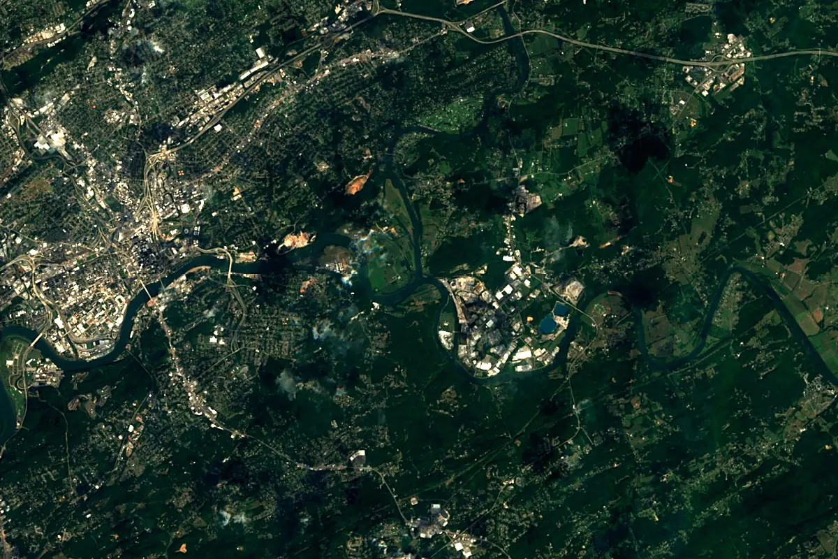
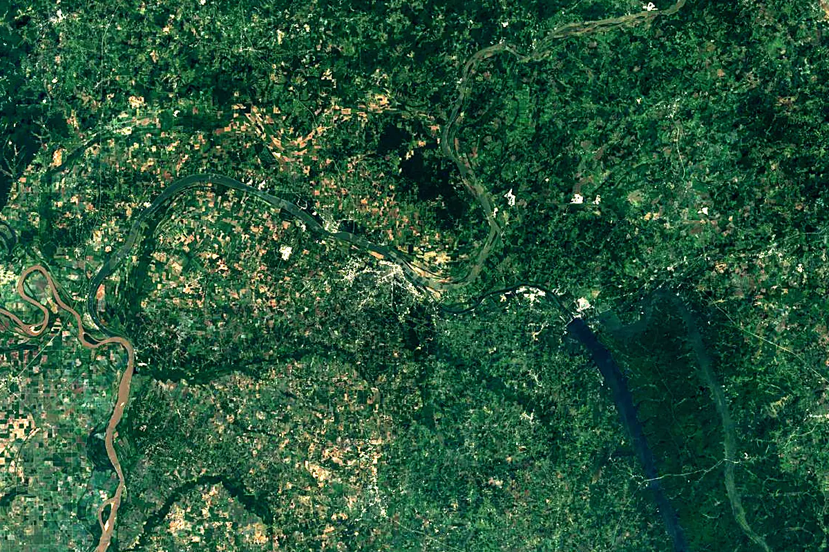
Sentinel-2 cloudless 2016 by EOX IT Services GmbH (contains modified Copernicus Sentinel data 2016), CC BY 4.0. The glowing line is the river as drawn by RiverATLAS.
Photos
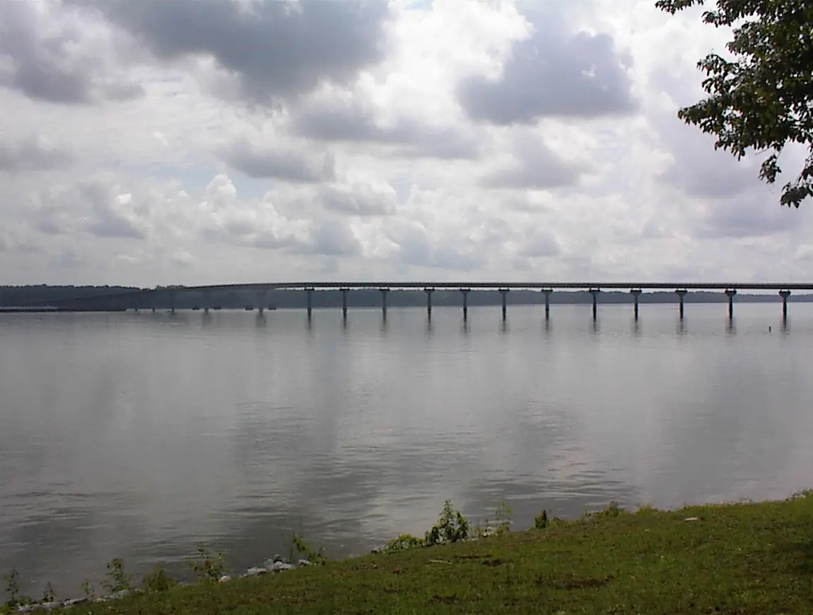
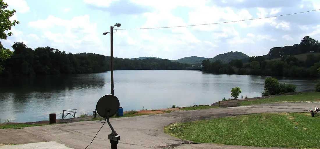
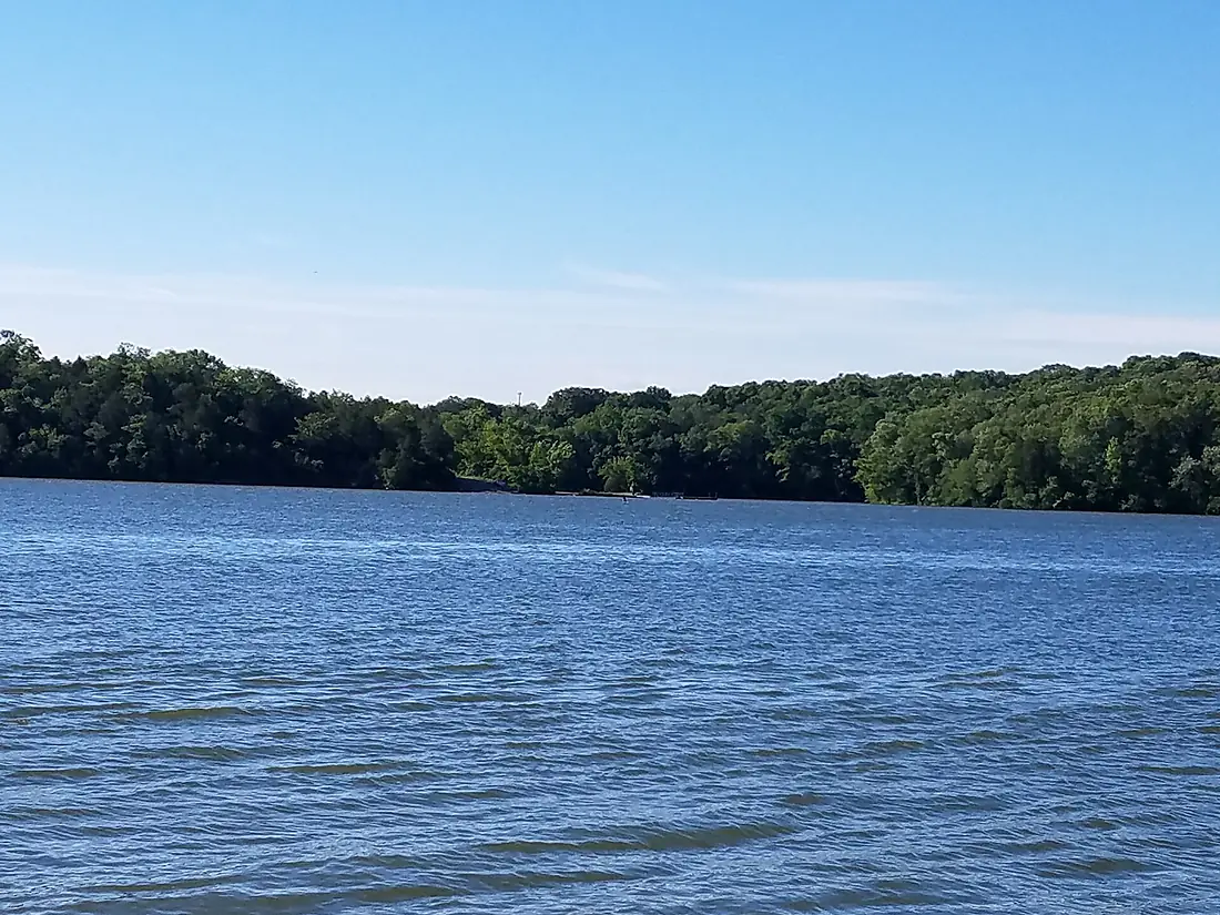
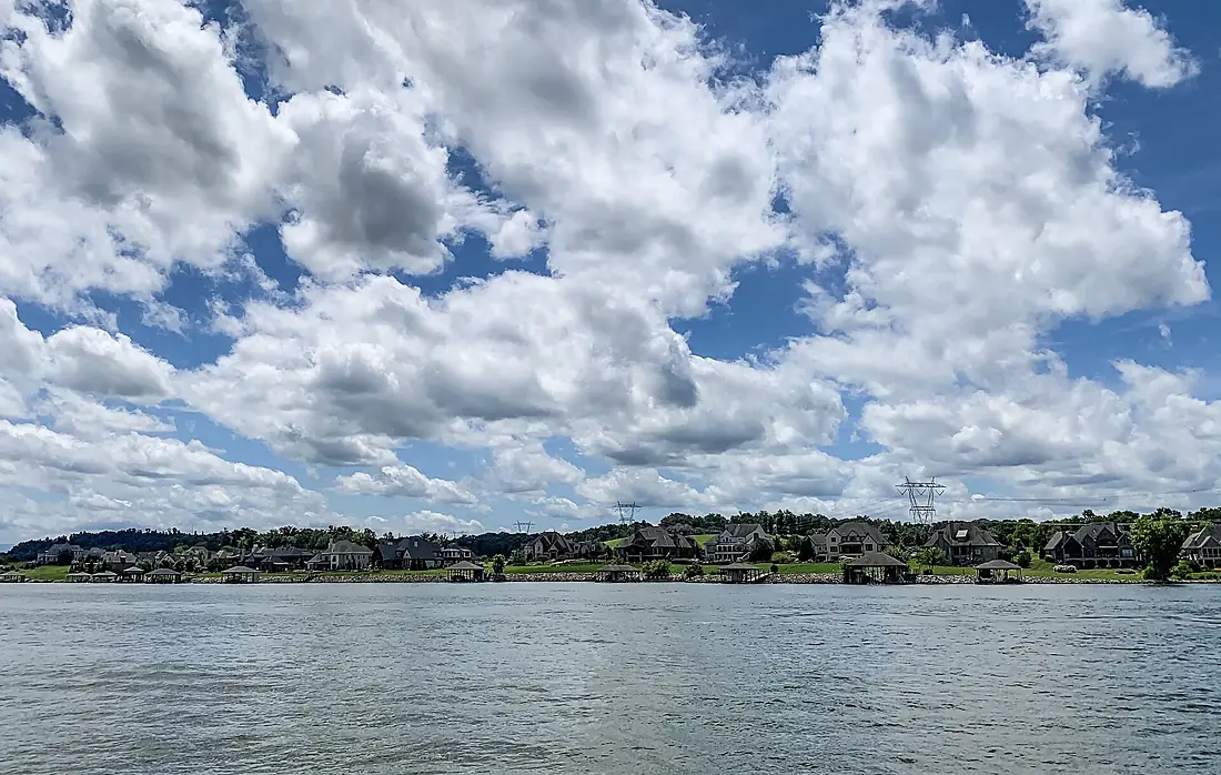
Tennessee River in pictures
Tributaries
Where it flows, and what flows into it
It flows into
Ohio RiverUnited States1,579 km8,000 m³/sTributaries (19)
Also: Clinch River, Little Tennessee River, French Broad River, Holston River, Duck River, Hiwassee River, Elk River, Big Sandy River, Little River, Sequatchie River, Flint River, Cypress Creek, Clarks River, Paint Rock River, White Oak Creek, Bear Creek, South Chickamauga Creek, Short Creek, Indian Creek
In the same basin
United States3,766 km12,700 m³/sMissouri RiverUnited States3,726 km2,500 m³/sArkansas RiverUnited States2,364 km240 m³/sRed RiverUnited States2,189 km1,900 m³/sYellowstone RiverUnited States1,114 km390 m³/sPlatte RiverUnited States500 km200 m³/sCanadian RiverUnited States1,458 km200 m³/sIllinois RiverUnited States432 km660 m³/sAllegheny RiverUnited States523 km560 m³/sCumberland RiverUnited States1,107 km860 m³/sNearby
Rivers nearby
United States1,107 km860 m³/s13 km awayWabash RiverUnited States960 km1,000 m³/s90 km awayMissouri RiverUnited States3,726 km2,500 m³/s235 km awayIllinois RiverUnited States432 km660 m³/s267 km awayKentucky RiverUnited States417 km280 m³/s347 km awaySt. Francis RiverUnited States686 km400 m³/s328 km awayOsage RiverUnited States444 km310 m³/s340 km awayArkansas RiverUnited States2,364 km240 m³/s433 km awayWhere these numbers come from
| Name, length, places | Wikidata (Q193737) · CC0 |
|---|---|
| Course, profile, basin | RiverATLAS v1.0 (HydroATLAS, Linke et al. 2019) · CC BY 4.0 — followed from the source to the mouth given by Wikidata |
| Flow | WaterGAP (RiverATLAS), 1971–2000 · CC BY 4.0 |
| Climate along the river | WorldClim (RiverATLAS), 1970–2000 · CC BY 4.0 |
| Towns, bridges, dams | Wikidata · CC0; GeoNames · CC BY 4.0 |
| Along the river | © OpenStreetMap contributors · ODbL |
| Images | EOX Sentinel-2 cloudless 2016 · CC BY 4.0; Wikimedia Commons |
| Our other atlases | Lakeyas, Peakyas — Wikidata · CC0; © OpenStreetMap contributors · ODbL; GeoNames · CC BY 4.0; HydroLAKES · CC BY 4.0; NOAA OISST |
Every source and licence is on the data sources page.
The family
Do you prefer beaches, lakes, mountains, waterfalls, islands, rivers or canyons?
Same idea, other landscapes: field atlases built on open data, month by month, in seven languages.
 beaches
 Find your beach: sea temperature, sun and swimming month by month.Visit lakes
 Every lake on Earth: water temperature, ice, depth and the shore.Coming soonVisit mountains
 Every summit in 3D: summit weather, the 0 °C line, huts and trails.Visit
  waterfalls
 Every waterfall: height, flow month by month and when it roars.Coming soonVisit
  islands
 Every island from the sea up: size, sea temperature, ferries and 3D.Coming soonVisit
  rivers
 Every river from source to sea: the journey, the flow and the basin in numbers.You are here
 canyons
 Every canyon cut to scale: depth to the floor, rim and floor temperatures, trails and viewpoints.Coming soonVisit