River
Arkansas River
2,364 km from source to mouth · United States.
 United StatesFlows into Mississippi River4th longest in United States
In numbers
Length
2,364km
Average flow
240m³/s
Basin
505,000km²
Drop
2,874m
from 2,908 m to 34 m
Country
1
The journey
From source to mouth
2,364 km of river and 68 stops on the way: 29 towns and cities on its banks, dams, bridges and the tributaries that feed it.
- 0 kmTennessee Creekat 2,908 m
- 3 kmTurquoise Lake6.4 km²
- 23 kmTwin Lakes Reservoir5.8 km²
- 31 kmClear Creek Reservoir1.3 km²
- 118 kmHoward852 people
- 185 kmCañon City17,141 people
- 187 kmLincoln Park3,934 people
- 190 kmBrookside236 people
- 197 kmFlorence3,822 people
- 205 kmPenrose3,685 people
- 238 kmPueblo West33,086 people
- 239 kmPueblo Reservoir16 km²
- 249 kmPueblo111,876 people
- 254 kmFountain Creektributary
- 265 kmSaint Charles Rivertributary
- 286 kmHuerfano Rivertributary
- 308 kmFowler1,253 people
- 315 kmApishapa Rivertributary
- 395 kmPurgatoire Rivertributary
- 417 kmJohn Martin Reservoir44 km²
- 448 kmLamar7,687 people
- 463 kmBig Sandy Creektributary
- 620 kmGarden City27,005 people
- 706 kmDodge City27,912 people
- 824 kmPawnee Rivertributary
- 953 kmHutchinson41,569 people
- 1,028 kmWichita396,119 people
- 1,028 kmLittle Arkansas Rivertributary
- 1,049 kmDerby23,509 people
- 1,080 kmNinnescah Rivertributary
- 1,119 kmArkansas City11,974 people
- 1,127 kmWalnut Rivertributary
- 1,183 kmKaw Lake59 km²
- 1,198 kmPonca City24,758 people
- 1,209 kmSalt Fork Arkansas Rivertributary
- 1,246 kmSooner Lake21 km²
- 1,368 kmCimarron Rivertributary
- 1,369 kmKeystone Lake80 km²
- 1,395 kmTulsa413,066 people
- 1,410 kmJenks20,740 people
- 1,422 kmBixby24,657 people
- 1,500 kmVerdigris Rivertributary
- 1,501 kmNeosho Rivertributary
- 1,539 kmGreenleaf Lake3.3 km²
- 1,559 kmIllinois Rivertributary
- 1,567 kmCanadian Rivertributary
- 1,594 kmRobert S. Kerr Reservoir135 km²
- 1,638 kmPoteau Rivertributary
- 1,651 kmVan Buren23,081 people
- 1,659 kmFort Smith89,142 people
- 1,697 kmMulberry Rivertributary
- 1,720 kmOzark3,542 people
- 1,804 kmLake Dardanelle94 km²
- 1,839 kmPetit Jean Rivertributary
- 1,907 kmFourche La Fave Rivertributary
- 1,920 kmLake Maumelle35 km²
- 1,924 kmMaumelle19,251 people
- 1,942 kmNorth Little Rock64,591 people
- 1,942 kmLittle Rock202,591 people
- 2,017 kmPine Bluff41,253 people
- 2,017 kmVaugine Township41,374 people
- 2,020 kmJefferson County67,260 people
- 2,034 kmAtkins Lake0.5 km²
- 2,071 kmHannaberry Lake0.8 km²
- 2,085 kmBayou Metotributary
- 2,094 kmEchubby Lake0.3 km²
- 2,097 kmSilver Lake0.6 km²
- 2,103 kmArkansas Post
- 2,111 kmLake Dumond0.3 km²
- 2,364 kmMississippi Riverat 34 m
Water level along the river (RiverATLAS; the height is exaggerated). Towns: GeoNames and Wikidata; bridges, dams and tributaries: Wikidata.
Major tributary of the Mississippi River, United States
At the mouth it carries 240 m³/s on average: an Olympic pool every 10 seconds. It drops from 2,908 m to 34 m, 1.2 m per kilometre on average. Its basin covers 505,000 km², about the size of ES. 7.1 million people live in it. Highest water: from May to July. It is heavily dammed: reservoirs can hold 85% of a year's flow.
Where to start
- TulsaLargest city on its banks · 413,066 people
- Tulsa International Airport (TUL)Nearest airport with scheduled flights, 11 km from the cityCar hire in TulsaDiscover Cars · Affiliate link↗
- On the water146 ferry piers, marinas, boat rentals and boat ramps along the river (OpenStreetMap)
- Kayak and canoe14 put-ins and rapids mapped (OpenStreetMap)
- April, June and from August to OctoberThe best months to visit
Arkansas River, month by month
Highest water: from May to July
Best months to visit: April, June and from August to October.
From about 590 m³/s in the lowest month to 2,200 m³/s in the highest. An estimate: the monthly flow is modelled from the lowest and highest months of WaterGAP (RiverATLAS, 1971–2000) and the rain and snow along the river (WorldClim). Dams change the real rhythm. The chip is the average air temperature; below it, the month's rain.
Plan the trip
Plan the trip: boat trips, a bed by the river, a car
Some links above are affiliate links: if you book through them we may earn a commission, at no extra cost to you. It never changes what the data on this page says.
The basin
Arkansas River: the basin in numbers
409,027 km² of land send their water to this river. This is what lives on it.
- 7.1millionpeople live in the basin
- 18/km²people per km²
- 874maverage altitude of the basin
- 686mmof rain a year (basin average)
- 12.9°Caverage air temperature
- 2%protected areas
- 0.6%covered by lakes
- 35km³held in reservoirs
What covers the basin
- 18% Forest
- 35% Cropland
- 39% Pasture
- 1% Towns and cities
RiverATLAS (HydroATLAS v1.0, CC BY 4.0): land cover, people, protected areas, glaciers and dams over the whole basin upstream of the mouth.
Along the river
Arkansas River: what you find on the way
- 61WeirsOtero Canal Diversion, Zink Dam and 59 more
- 38LocksWebbers Falls Lock and Dam, Arkansas River, Robert S. Kerr Lock and Dam and 35 more
- 4WaterfallsTwin Falls and 3 more
- 14RapidsCanyon Doors, Pinball, Zoom Flume and 11 more
- 140Boat rampsHecla Junction, Stone Bridge Takeout, Trading Post River Access and 137 more
- 5MarinasPioneer Cove Marina, Greenleaf Marina & Grill, Rockwater Marina and 2 more
- 3River beachesLake Ponca Beach, Willow Beach, Lake Dardanelle Beach and Swimming Area
From OpenStreetMap, within 2.8 km of the river. Not mapped is not the same as not there.
Cross-checked with our atlases
Arkansas River in our other atlases
What our sister atlases know about the waterfalls on this river, the lakes it flows through, the beaches at its mouth, the mountains where it rises and the islands off its mouth.
 17lakes on its wayLakeyas
 39mountains at the sourcePeakyas
Lakes and reservoirs (17)
Lakes it flows through, by Lakeyas
- Twin Lakes Reservoirkm 225.8km²
- John Martin Reservoirkm 39544km²
- Kaw Lakekm 1,11959km²
- Sooner Lakekm 1,17921km²
- Keystone Lakekm 1,29580km²
- Robert S. Kerr Reservoirkm 1,507135km²
- Lake Dardanellekm 1,70694km²
- Lake Maumellekm 1,81635km²
9 more on LakeyasLakeyas is coming soonOpen Lakeyas ↗
Mountains at the source (39)
Within 15 km of the source, by Peakyas
- Mount Massive14 km away · prominence 604 m4,395m
- Dyer Mountain14 km away · prominence 145 m4,225m
- Mount Sheridan15 km away
- Bald Eagle Mountain7.8 km away
- Ball Mountain11 km away
- Breece Hill9.4 km away
- Buckeye Peak12 km away
- Canterbury Hill7.2 km away
31 more on PeakyasOpen Peakyas ↗
From space
The source and the mouth, seen from orbit
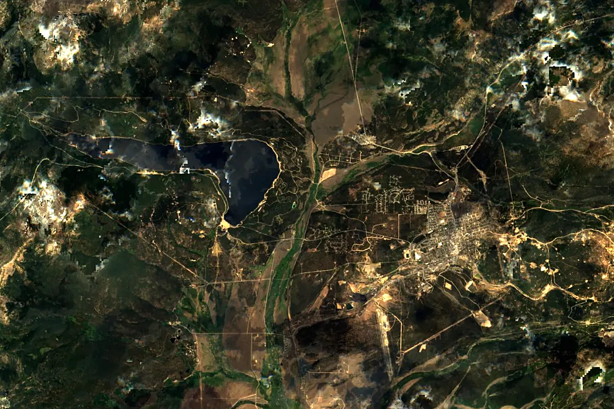
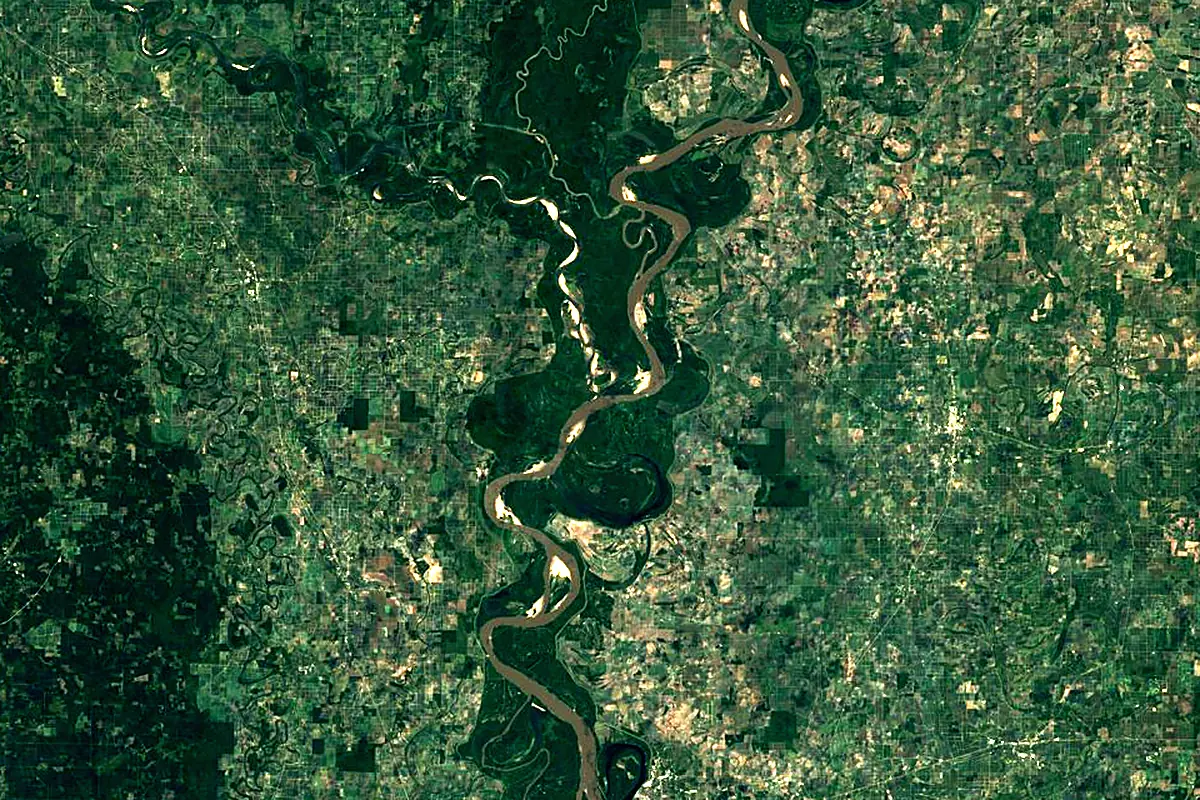
Sentinel-2 cloudless 2016 by EOX IT Services GmbH (contains modified Copernicus Sentinel data 2016), CC BY 4.0. The glowing line is the river as drawn by RiverATLAS.
Photos
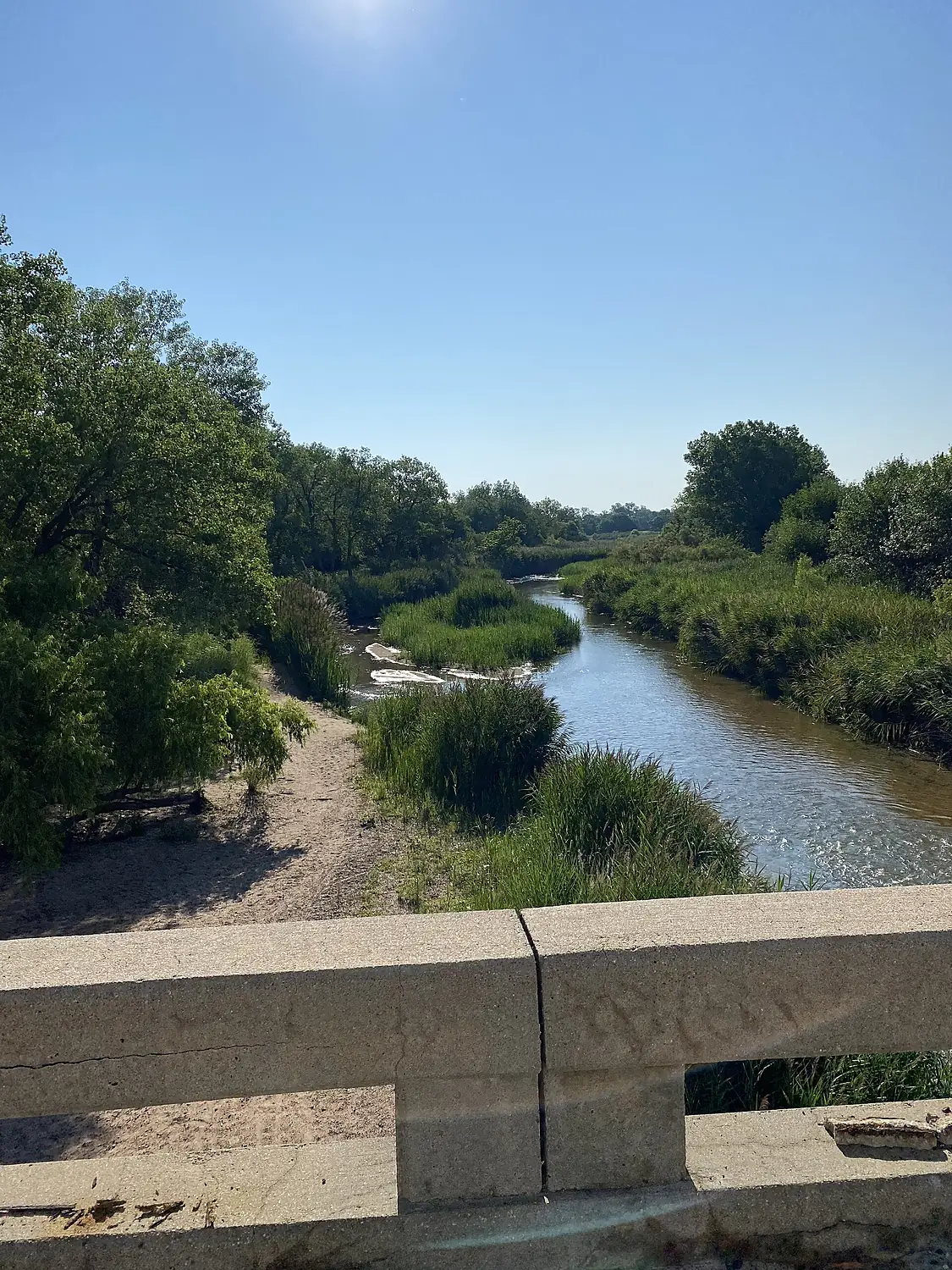
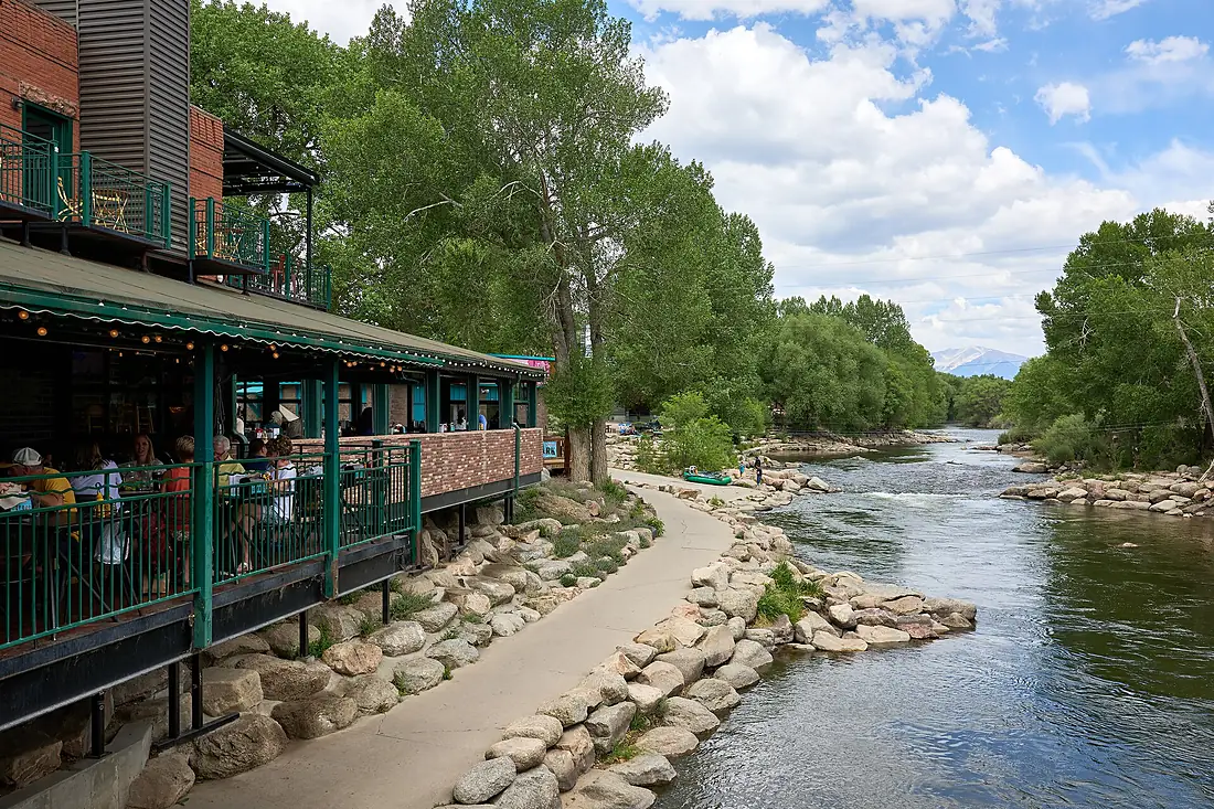
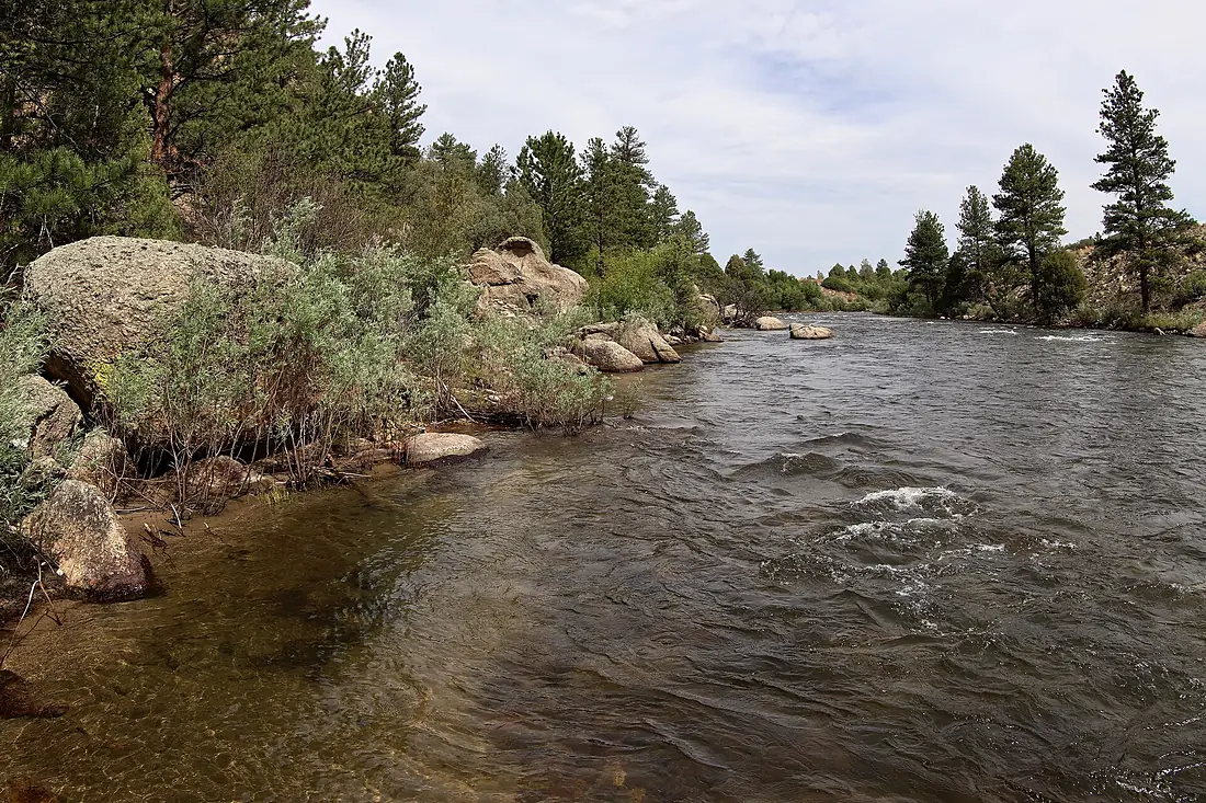
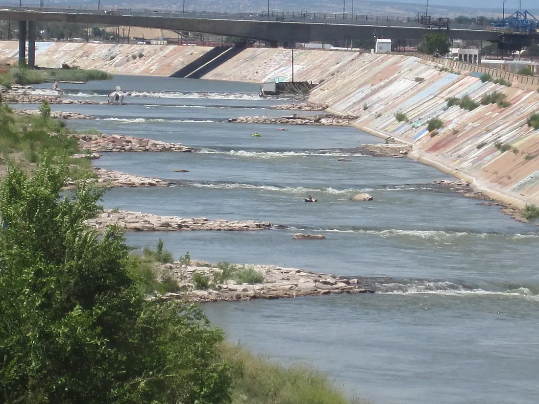
Arkansas River in pictures
Tributaries
Where it flows, and what flows into it
It flows into
Mississippi RiverUnited States3,766 km12,700 m³/sTributaries (35)
United States1,458 km200 m³/sjoins at km 1,482Cimarron RiverUnited States1,123 km1,100 m³/sjoins at km 1,293Neosho RiverUnited States745 km280 m³/sjoins at km 1,420Also: Verdigris River, Salt Fork Arkansas River, Big Sandy Creek, Poteau River, Walnut River, Ninnescah River, Purgatoire River, Apishapa River, Huerfano River, Little Arkansas River, Fourche La Fave River, Illinois River, Pawnee River, Saint Charles River, Bayou Meto, Fountain Creek, Mulberry River, Petit Jean River, Big Piney Creek, Chalk Creek, Chico Creek, Cow Creek, East Fork Arkansas River, Horse Creek
In the same basin
United States3,726 km2,500 m³/sOhio RiverUnited States1,579 km8,000 m³/sTennessee RiverUnited States1,049 km2,000 m³/sRed RiverUnited States2,189 km1,900 m³/sYellowstone RiverUnited States1,114 km390 m³/sPlatte RiverUnited States500 km200 m³/sIllinois RiverUnited States432 km660 m³/sAllegheny RiverUnited States523 km560 m³/sCumberland RiverUnited States1,107 km860 m³/sWabash RiverUnited States960 km1,000 m³/sNearby
Rivers nearby
United States1,162 km740 m³/s21 km awaySt. Francis RiverUnited States686 km400 m³/s106 km awayRed RiverUnited States2,189 km1,900 m³/s311 km awayOhio RiverUnited States1,579 km8,000 m³/s400 km awayCanadian RiverUnited States1,458 km200 m³/s403 km awayTennessee RiverUnited States1,049 km2,000 m³/s433 km awayAlabama RiverUnited States640 km950 m³/s417 km awayCumberland RiverUnited States1,107 km860 m³/s444 km awayWhere these numbers come from
| Name, length, places | Wikidata (Q8319) · CC0 |
|---|---|
| Course, profile, basin | RiverATLAS v1.0 (HydroATLAS, Linke et al. 2019) · CC BY 4.0 — followed from the source to the mouth given by Wikidata |
| Flow | WaterGAP (RiverATLAS), 1971–2000 · CC BY 4.0 |
| Climate along the river | WorldClim (RiverATLAS), 1970–2000 · CC BY 4.0 |
| Towns, bridges, dams | Wikidata · CC0; GeoNames · CC BY 4.0 |
| Along the river | © OpenStreetMap contributors · ODbL |
| Images | EOX Sentinel-2 cloudless 2016 · CC BY 4.0; Wikimedia Commons |
| Our other atlases | Lakeyas, Peakyas — Wikidata · CC0; © OpenStreetMap contributors · ODbL; GeoNames · CC BY 4.0; HydroLAKES · CC BY 4.0; NOAA OISST |
Every source and licence is on the data sources page.
The family
Do you prefer beaches, lakes, mountains, waterfalls, islands, rivers or canyons?
Same idea, other landscapes: field atlases built on open data, month by month, in seven languages.
 beaches
 Find your beach: sea temperature, sun and swimming month by month.Visit lakes
 Every lake on Earth: water temperature, ice, depth and the shore.Coming soonVisit mountains
 Every summit in 3D: summit weather, the 0 °C line, huts and trails.Visit
  waterfalls
 Every waterfall: height, flow month by month and when it roars.Coming soonVisit
  islands
 Every island from the sea up: size, sea temperature, ferries and 3D.Coming soonVisit
  rivers
 Every river from source to sea: the journey, the flow and the basin in numbers.You are here
 canyons
 Every canyon cut to scale: depth to the floor, rim and floor temperatures, trails and viewpoints.Coming soonVisit