River
Leine
281 km from source to mouth · Germany.
 GermanyFlows into Aller
In numbers
Length
281km
Average flow
53m³/s
Basin
6,512km²
Drop
220m
from 241 m to 21 m
Country
1
The journey
From source to mouth
281 km of river and 68 stops on the way: 46 towns and cities on its banks, dams, bridges and the tributaries that feed it.
- 0 kmLeinefelde-Worbisat 241 m
- 0 kmGeislede Wasserfall
- 1 kmHeilbad Heiligenstadt17,230 people
- 29 kmGemeinde Friedland10,568 people
- 29 kmFriedland12,607 people
- 42 kmGartetributary
- 42 kmRosdorf11,840 people
- 47 kmGöttingen130,521 people
- 56 kmBovenden13,964 people
- 63 kmNörten-Hardenberg8,514 people
- 76 kmNortheim30,894 people
- 80 kmNortheim Lake District0.3 km²
- 81 kmRhumetributary
- 93 kmIlmetributary
- 102 kmKreiensen7,359 people
- 114 kmGandetributary
- 115 kmFreden3,428 people
- 127 kmAlfeld19,138 people
- 144 kmGronau5,444 people
- 151 kmElze9,582 people
- 157 kmSaaletributary
- 159 kmNordstemmen13,148 people
- 164 kmCalenberger Brücke (Schulenburg)
- 172 kmSarstedt18,718 people
- 175 kmInnerstetributary
- 182 kmLaatzen41,838 people
- 182 kmTriple arch bridge in Grasdorf
- 188 kmWülfel4,436 people
- 189 kmEinsiedlerbrücke
- 190 kmDöhren13,563 people
- 192 kmGroßer Ricklinger Teich0.3 km²
- 192 kmSchwienbrücke
- 192 kmRicklingen13,120 people
- 193 kmOberricklingen10,610 people
- 193 kmMaschsee0.9 km²
- 193 kmBult3,209 people
- 193 kmPapageienbrücke
- 194 kmSüdstadt41,393 people
- 195 kmBella-Vista-Brücke (Hannover)
- 195 kmLinden-Süd9,960 people
- 195 kmFriederikenbrücke über den Klickmühlenarm
- 196 kmHannover515,140 people
- 196 kmLeintorbrücke
- 196 kmHanover522,803 people
- 196 kmMitte11,710 people
- 196 kmSommerbrücke
- 196 kmLinden38,284 people
- 196 kmLeibnizufer
- 196 kmCalenberger Neustadt7,738 people
- 196 kmMartin-Neuffer-Brücke
- 196 kmOststadt14,011 people
- 197 kmLinden-Mitte12,183 people
- 197 kmLinden-Nord16,125 people
- 198 kmNordstadt17,429 people
- 198 kmHainholz7,512 people
- 200 kmDavenstedt10,666 people
- 200 kmLimmer6,965 people
- 200 kmLeinewehr Herrenhausen
- 201 kmHerrenhausen8,607 people
- 201 kmBurg3,717 people
- 202 kmAhlem11,167 people
- 203 kmLeinhausen3,592 people
- 205 kmStöcken12,973 people
- 208 kmMarienwerder2,479 people
- 210 kmAuf der Horst7,050 people
- 211 kmSeelze34,364 people
- 213 kmGarbsen60,007 people
- 236 kmNeustadt am Rübenberge44,668 people
- 273 kmSchwarmstedt5,159 people
- 281 kmAllerat 21 m
Water level along the river (RiverATLAS; the height is exaggerated). Towns: GeoNames and Wikidata; bridges, dams and tributaries: Wikidata.
River in Germany, tributary of the river Aller
At the mouth it carries 53 m³/s on average: an Olympic pool every 47 seconds. It drops from 241 m to 21 m, 0.8 m per kilometre on average. Its basin covers 6,512 km², about the size of PS. 1.6 million people live in it. Highest water: from December to February. Its dams hold back little of its water (6.0% of a year's flow).
Where to start
- HanoverLargest city on its banks · 522,803 people
- Hannover Airport (HAJ)Nearest airport with scheduled flights, 10 km from the cityCar hire at HAJ airport (Hannover)Discover Cars · Affiliate link↗
- On the water38 ferry piers, marinas, boat rentals and boat ramps along the river (OpenStreetMap)
- Kayak and canoe32 put-ins and rapids mapped (OpenStreetMap)
- From June to SeptemberThe best months to visit
Leine, month by month
Highest water: from December to February
Best months to visit: from June to September.
From about 30 m³/s in the lowest month to 130 m³/s in the highest. An estimate: the monthly flow is modelled from the lowest and highest months of WaterGAP (RiverATLAS, 1971–2000) and the rain and snow along the river (WorldClim). Dams change the real rhythm. The chip is the average air temperature; below it, the month's rain.
Plan the trip
Plan the trip: boat trips, a bed by the river, a car
Some links above are affiliate links: if you book through them we may earn a commission, at no extra cost to you. It never changes what the data on this page says.
The basin
Leine: the basin in numbers
6,552 km² of land send their water to this river. This is what lives on it.
- 1.6millionpeople live in the basin
- 241/km²people per km²
- 203maverage altitude of the basin
- 748mmof rain a year (basin average)
- 8.2°Caverage air temperature
- 40%protected areas
- 0.2%covered by lakes
- 0.1km³held in reservoirs
What covers the basin
- 16% Forest
- 45% Cropland
- 7% Pasture
- 12% Towns and cities
RiverATLAS (HydroATLAS v1.0, CC BY 4.0): land cover, people, protected areas, glaciers and dams over the whole basin upstream of the mouth.
Along the river
Leine: what you find on the way
- 88WeirsWehr Arenshausen, Leinewehr, Lenigwehr and 85 more
- 7LocksErnst-August-Kanal, Stichkanal Hannover-Linden, Schleuse Hademsdorf and 4 more
- 8WaterfallsScheuche, Sohlgleite, Fredener Wasserfall and 5 more
- 6Rapids
- 26Canoe put-insEinsetzstelle Kanu Schneller Graben, Einsetzstelle Kanu Leine, Einsetzstelle Kanu beidseitig and 23 more
- 8Boat rampsSlip-Anlage Garbsen and 7 more
- 8Ferry piersStrandbad / Südufer, Quelle, Ostanleger / Altenbekener Damm and 5 more
- 17MarinasHafen Northeimer Segelclub e.V., Bootsanlegestelle Giftener See, Yachtschule Hannover and 14 more
- 1River beachesMasch Lake Bathing Beach
From OpenStreetMap, within 1.7 km of the river. Not mapped is not the same as not there.
Cross-checked with our atlases
Leine in our other atlases
What our sister atlases know about the waterfalls on this river, the lakes it flows through, the beaches at its mouth, the mountains where it rises and the islands off its mouth.
 1waterfall on the riverCascadyas
 3lakes on its wayLakeyas
 107mountains at the sourcePeakyas
Waterfalls (1)
On the river, by Cascadyas
- Geislede Wasserfallkm 0
Cascadyas is coming soonOpen Cascadyas ↗
Lakes and reservoirs (3)
Lakes it flows through, by Lakeyas
- Northeim Lake Districtkm 600.3km²
- Großer Ricklinger Teichkm 1420.3km²
- Maschseekm 1430.9km²
Lakeyas is coming soonOpen Lakeyas ↗
Mountains at the source (107)
Within 15 km of the source, by Peakyas
- Birkenberg11 km away · prominence 195 m533m
- Ohmberg12 km away529m
- Sonnenstein13 km away · prominence 97 m486m
- Warte-Berg12 km away516m
- Hockelrain5.3 km away515m
- Hasenburg13 km away · prominence 164 m487m
- Krantberg14 km away456m
- Iberg (Heiligenstadt)13 km away453m
99 more on PeakyasOpen Peakyas ↗
From space
The source and the mouth, seen from orbit
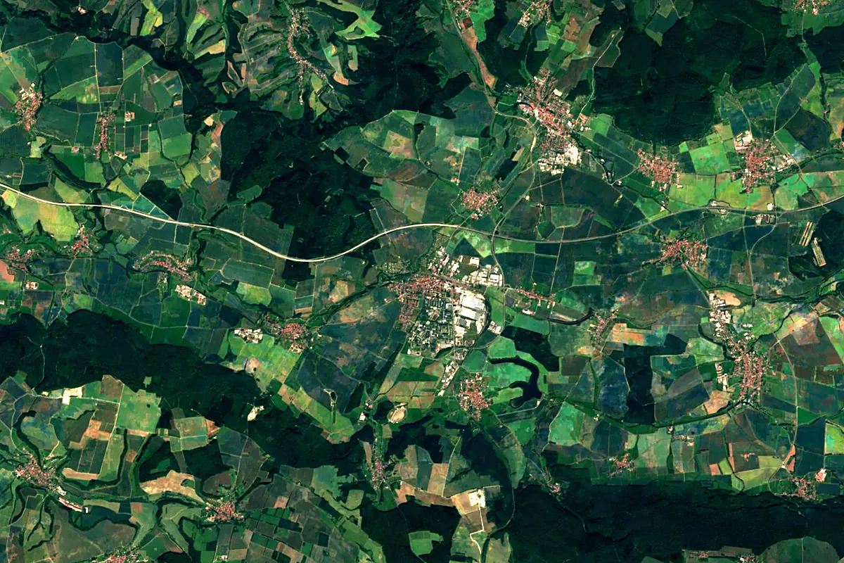
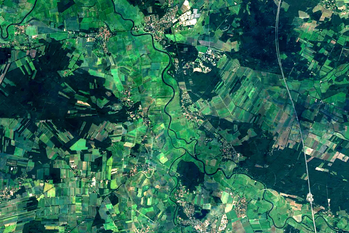
Sentinel-2 cloudless 2016 by EOX IT Services GmbH (contains modified Copernicus Sentinel data 2016), CC BY 4.0. The glowing line is the river as drawn by RiverATLAS.
Photos
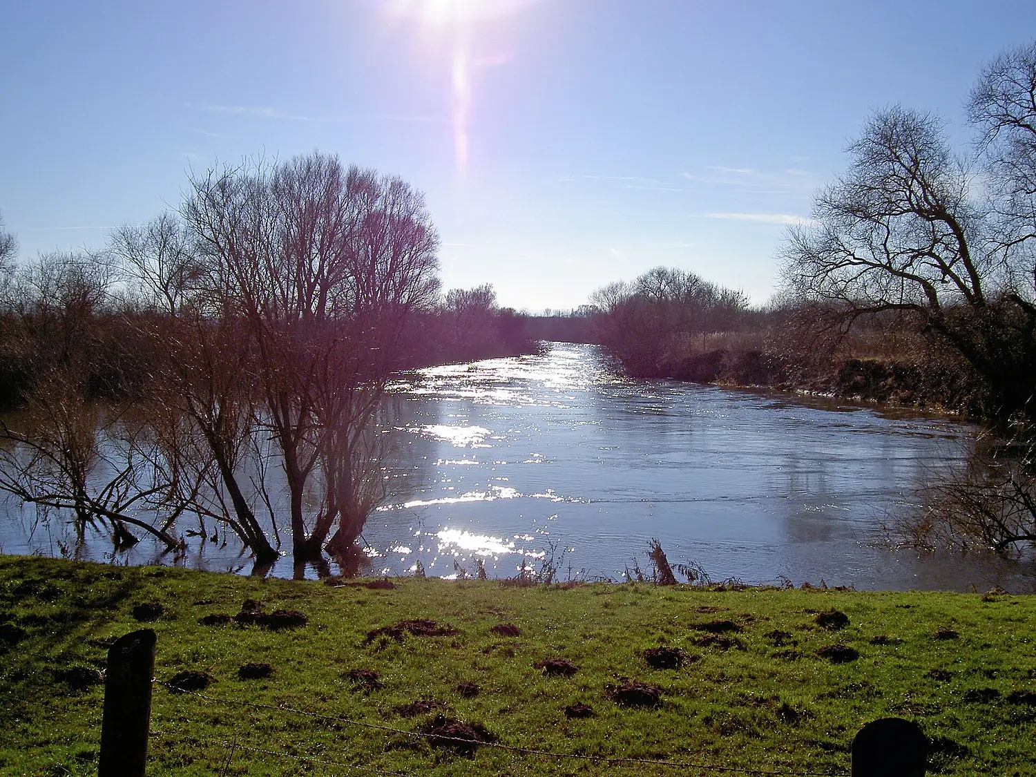
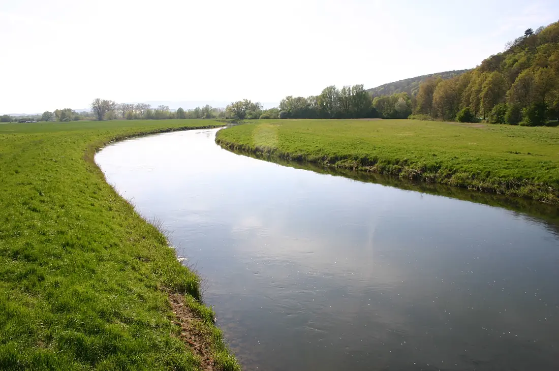
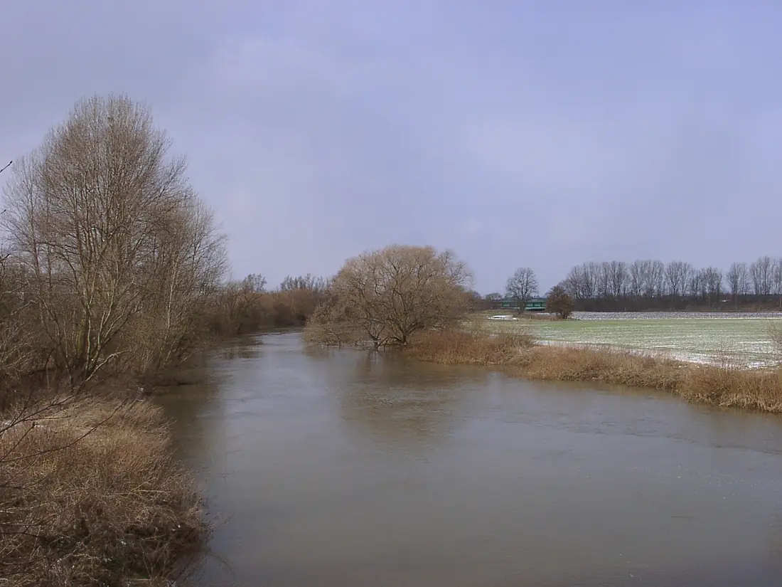
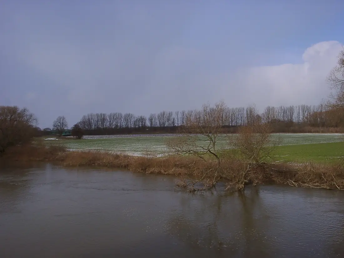
Leine in pictures
Tributaries
Where it flows, and what flows into it
It flows into
AllerGermany263 km120 m³/sTributaries (18)
Also: Innerste, Rhume, Ilme, Ihme, Garte, Haller, Westaue, Espolde, Geislede, Grone, Aue, Saale, Gande, Beeke, Alte Leine, Auter, Despe, Stöckener Bach
Nearby
Rivers nearby
Where these numbers come from
| Name, length, places | Wikidata (Q161051) · CC0 |
|---|---|
| Course, profile, basin | RiverATLAS v1.0 (HydroATLAS, Linke et al. 2019) · CC BY 4.0 — followed from the source to the mouth given by Wikidata |
| Flow | WaterGAP (RiverATLAS), 1971–2000 · CC BY 4.0 |
| Climate along the river | WorldClim (RiverATLAS), 1970–2000 · CC BY 4.0 |
| Towns, bridges, dams | Wikidata · CC0; GeoNames · CC BY 4.0 |
| Along the river | © OpenStreetMap contributors · ODbL |
| Images | EOX Sentinel-2 cloudless 2016 · CC BY 4.0; Wikimedia Commons |
| Our other atlases | Cascadyas, Lakeyas, Peakyas — Wikidata · CC0; © OpenStreetMap contributors · ODbL; GeoNames · CC BY 4.0; HydroLAKES · CC BY 4.0; NOAA OISST |
Every source and licence is on the data sources page.
The family
Do you prefer beaches, lakes, mountains, waterfalls, islands, rivers or canyons?
Same idea, other landscapes: field atlases built on open data, month by month, in seven languages.
 beaches
 Find your beach: sea temperature, sun and swimming month by month.Visit lakes
 Every lake on Earth: water temperature, ice, depth and the shore.Coming soonVisit mountains
 Every summit in 3D: summit weather, the 0 °C line, huts and trails.Visit waterfalls
 Every waterfall: height, flow month by month and when it roars.Coming soonVisit
  islands
 Every island from the sea up: size, sea temperature, ferries and 3D.Coming soonVisit
  rivers
 Every river from source to sea: the journey, the flow and the basin in numbers.You are here
 canyons
 Every canyon cut to scale: depth to the floor, rim and floor temperatures, trails and viewpoints.Coming soonVisit