River
Weser
451 km from source to mouth · Germany.
 GermanyFlows into North Sea4th longest in Germany
In numbers
Length
451km
Average flow
330m³/s
Basin
47,960km²
Drop
126m
from 123 m to -3 m
Country
1
The journey
From source to mouth
451 km of river and 68 stops on the way: 31 towns and cities on its banks, dams, bridges and the tributaries that feed it.
- 0 kmWerraat 123 m
- 14 kmHann. Münden23,367 people
- 14 kmHannoversch Münden25,073 people
- 14 kmWerratributary
- 14 kmFuldatributary
- 69 kmDiemeltributary
- 70 kmBeverungen12,595 people
- 70 kmLauenförde2,390 people
- 81 kmNethetributary
- 83 kmHöxter27,908 people
- 95 kmHolzminden18,921 people
- 100 kmBevern4,363 people
- 126 kmBodenwerder6,187 people
- 134 kmLennetributary
- 145 kmEmmertributary
- 151 kmHummetributary
- 152 kmHameln58,666 people
- 160 kmHameltributary
- 165 kmHessisch Oldendorf20,129 people
- 180 kmRinteln25,602 people
- 183 kmHelenensee0.3 km²
- 201 kmKalletributary
- 201 kmVlotho18,286 people
- 208 kmBad Oeynhausen49,513 people
- 208 kmWerretributary
- 215 kmPorta Westfalica36,502 people
- 220 kmMinden83,598 people
- 233 kmPetershagen barrage
- 234 kmPetershagen27,090 people
- 235 kmBückeburger Auetributary
- 251 kmGehletributary
- 264 kmStolzenau7,473 people
- 275 kmLandesbergen barrage
- 284 kmGroße Auetributary
- 288 kmSteinhuder Meerbachtributary
- 289 kmNienburg32,629 people
- 292 kmMarklohe4,396 people
- 299 kmDrakenburg barrage
- 322 kmBückener Mühlenbachtributary
- 332 kmDörverden9,710 people
- 333 kmDörverden barrage
- 350 kmAllertributary
- 353 kmLangwedel14,755 people
- 354 kmLangwedel barrage
- 367 kmAchim32,870 people
- 369 kmThedinghausen4,727 people
- 384 kmWeyhe31,004 people
- 392 kmWeserwehr
- 393 kmNeue Weser0.6 km²
- 397 kmBremen588,413 people
- 403 kmMolenfeuer Überseehafen Süd
- 409 kmBurglesum34,667 people
- 413 kmBlumenthaler Auetributary
- 413 kmOchtumtributary
- 418 kmVegesack38,010 people
- 418 kmSchönebecker Auetributary
- 418 kmLemwerder7,125 people
- 424 kmBlumenthal33,571 people
- 426 kmLighthouse Warflether Sand
- 433 kmElsfleth9,310 people
- 443 kmGroßerpater range rear light
- 443 kmHarriersand range front light
- 444 kmHarriersand range rear light
- 445 kmBrake (Unterweser)16,150 people
- 445 kmGroßerpater range front light
- 446 kmDreptetributary
- 446 kmHuntetributary
- 446 kmLunetributary
- 446 kmGroßensiel range front
- 451 kmNorth Seaat -3 m
Water level along the river (RiverATLAS; the height is exaggerated). Towns: GeoNames and Wikidata; bridges, dams and tributaries: Wikidata.
River in north-western Germany
At the mouth it carries 327 m³/s on average: an Olympic pool every 7.6 seconds. It drops from 123 m to -3 m, 0.3 m per kilometre on average. Its basin covers 47,960 km², about the size of DO. 8.5 million people live in it. Highest water: from December to February. Its dams hold back little of its water (3.0% of a year's flow).
Where to start
- BremenLargest city on its banks · 588,413 people
- Bremen Airport (BRE)Nearest airport with scheduled flights, 3 km from the cityCar hire at BRE airport (Bremen)Discover Cars · Affiliate link↗
- On the water294 ferry piers, marinas, boat rentals and boat ramps along the river (OpenStreetMap)
- Kayak and canoe12 put-ins and rapids mapped (OpenStreetMap)
- From June to SeptemberThe best months to visit
Weser, month by month
Highest water: from December to February
Best months to visit: from June to September.
From about 190 m³/s in the lowest month to 870 m³/s in the highest. An estimate: the monthly flow is modelled from the lowest and highest months of WaterGAP (RiverATLAS, 1971–2000) and the rain and snow along the river (WorldClim). Dams change the real rhythm. The chip is the average air temperature; below it, the month's rain.
Plan the trip
Plan the trip: boat trips, a bed by the river, a car
Some links above are affiliate links: if you book through them we may earn a commission, at no extra cost to you. It never changes what the data on this page says.
The basin
Weser: the basin in numbers
44,775 km² of land send their water to this river. This is what lives on it.
- 8.5millionpeople live in the basin
- 191/km²people per km²
- 197maverage altitude of the basin
- 740mmof rain a year (basin average)
- 8.3°Caverage air temperature
- 33%protected areas
- 0.3%covered by lakes
- 0.4km³held in reservoirs
What covers the basin
- 20% Forest
- 35% Cropland
- 12% Pasture
- 10% Towns and cities
RiverATLAS (HydroATLAS v1.0, CC BY 4.0): land cover, people, protected areas, glaciers and dams over the whole basin upstream of the mouth.
Along the river
Weser: what you find on the way
- 106WeirsHamelner Wehr, Staustufe Schlüsselburg, Staustufe Landesbergen and 103 more
- 29LocksWerra, Fulda, Schleuse Hameln and 26 more
- 5WaterfallsPoltertreppe and 4 more
- 1Rapids
- 11Canoe put-insZella, Kanu-Einsetzstelle and 9 more
- 147Boat rampsSlipanlage Yachtclub Hann Münden, Slipanlage Campingplatz Oedelsheim, Slip Rampe des MSC Weser Diemel and 144 more
- 60Ferry piersSchifffahrtslinie MS Weserstein, Schiffsanleger für Weser und Fulda, Fähre Veckerhagen and 57 more
- 81MarinasMSC Weser-Diemel, Bad Karlshafen Barockhafen, WSA Hafen Höxter and 78 more
- 10River beachesBadestelle Axelsee, Bodega Beach Club, Weserstrand and 7 more
From OpenStreetMap, within 2.2 km of the river. Not mapped is not the same as not there.
Cross-checked with our atlases
Weser in our other atlases
What our sister atlases know about the waterfalls on this river, the lakes it flows through, the beaches at its mouth, the mountains where it rises and the islands off its mouth.
 2lakes on its wayLakeyas
 74mountains at the sourcePeakyas
Lakes and reservoirs (2)
Lakes it flows through, by Lakeyas
- Helenenseekm 1640.3km²
- Neue Weserkm 3530.6km²
Lakeyas is coming soonOpen Lakeyas ↗
Mountains at the source (74)
Within 15 km of the source, by Peakyas
- Hoher Hagen10 km away492m
- Haferberg13 km away580m
- Staufenberg11 km away · prominence 220 m472m
- Junkernkopf8.1 km away453m
- Gahrenberg5.8 km away472m
- Totenberg12 km away408m
- Brackenberg7.0 km away461m
- Ahlberg10 km away395m
66 more on PeakyasOpen Peakyas ↗
From space
The source and the mouth, seen from orbit
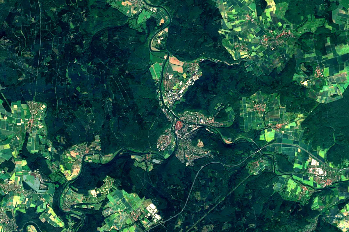
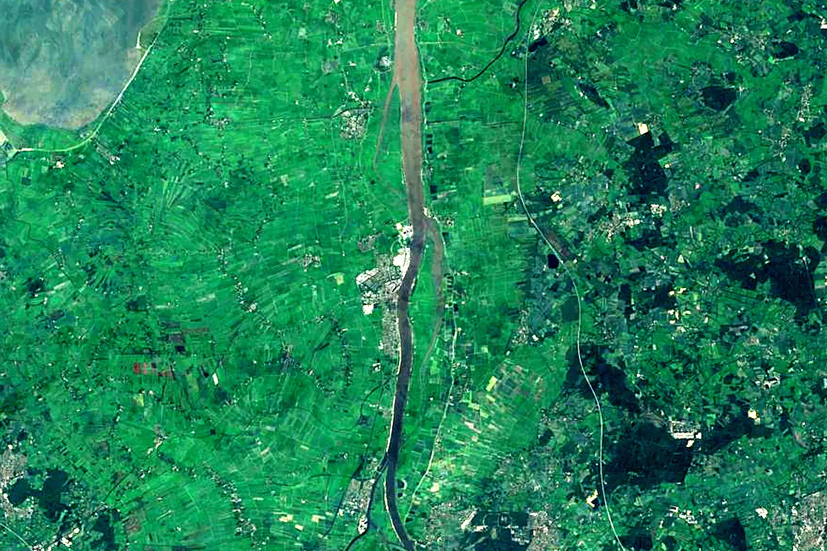
Sentinel-2 cloudless 2016 by EOX IT Services GmbH (contains modified Copernicus Sentinel data 2016), CC BY 4.0. The glowing line is the river as drawn by RiverATLAS.
Photos
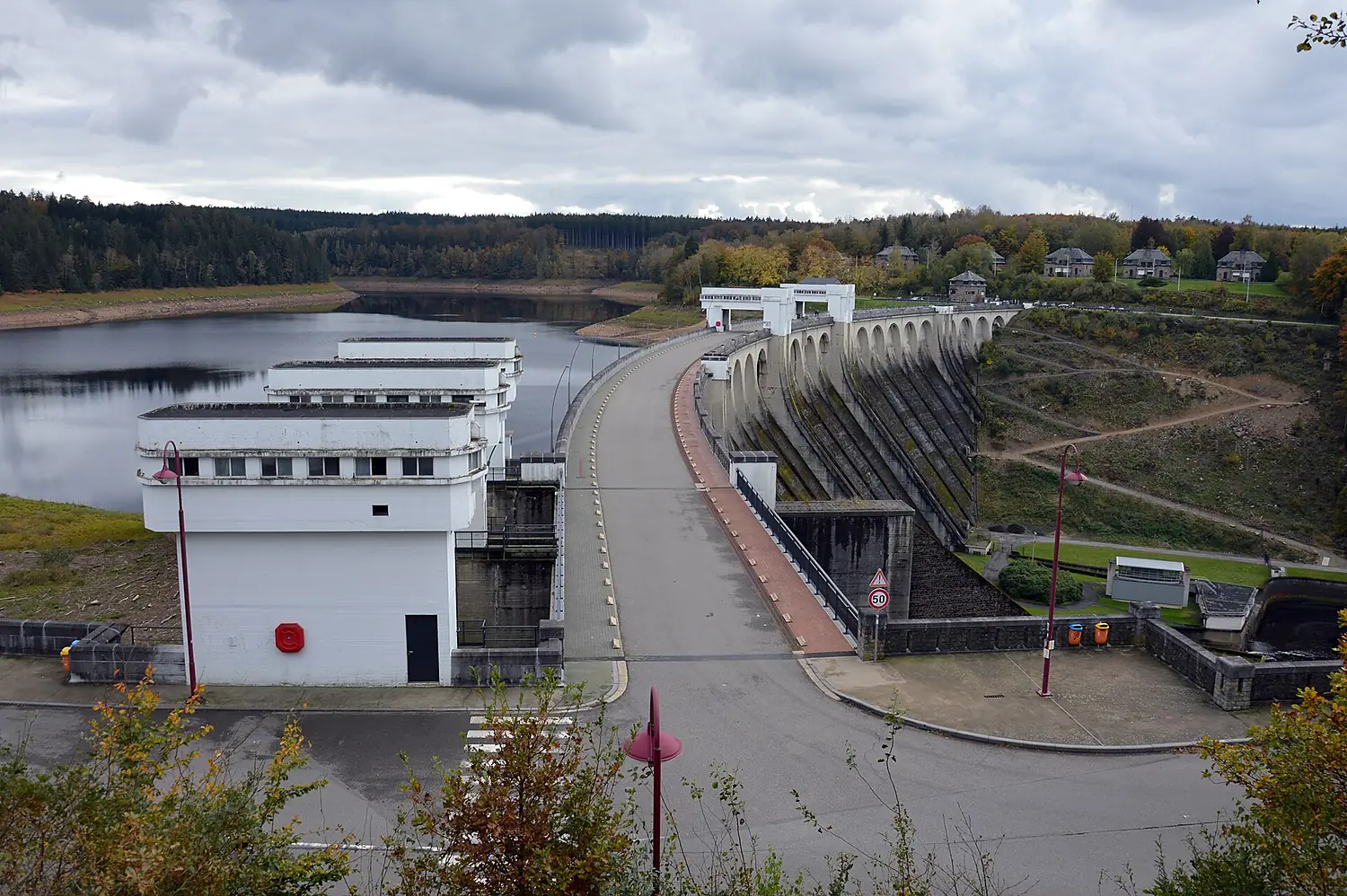
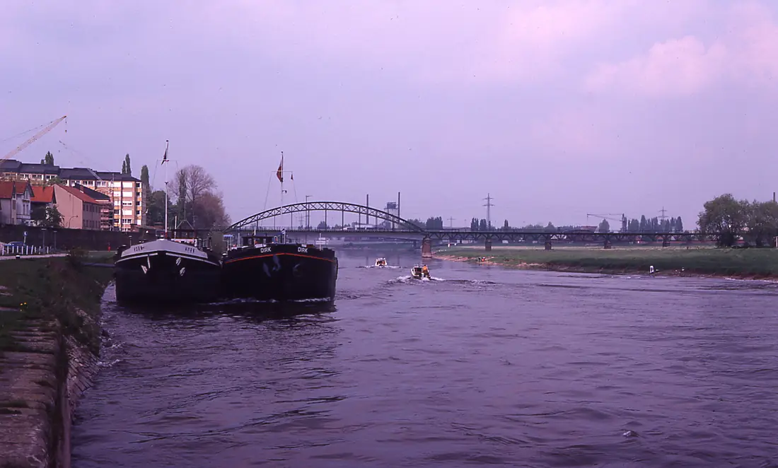
Weser in pictures
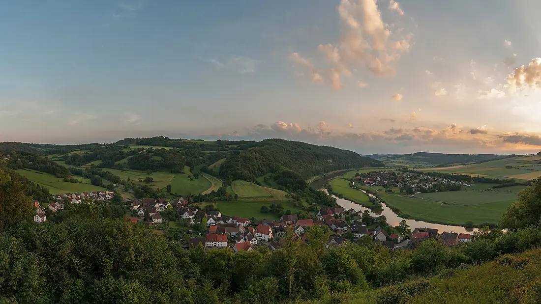
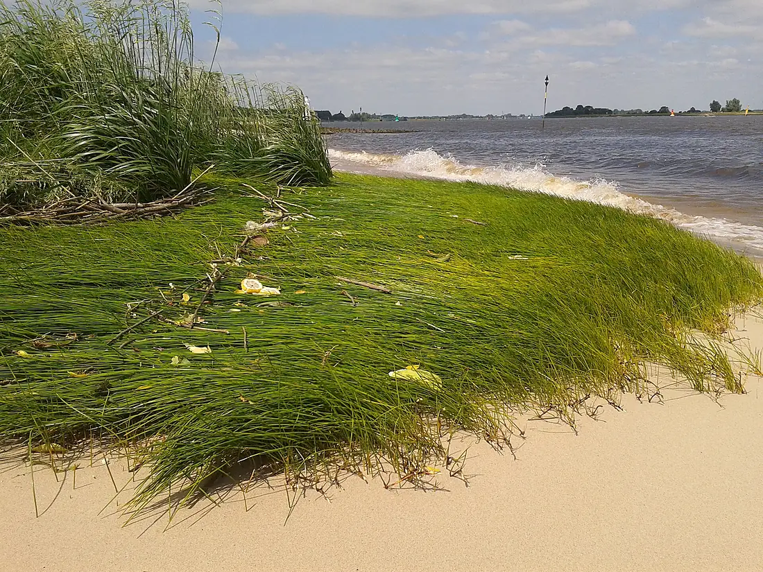
Tributaries
Where it flows, and what flows into it
Tributaries (57)
Germany292 km51 m³/sjoins at km 13AllerGermany263 km120 m³/sjoins at km 315FuldaGermany218 km67 m³/sjoins at km 13HunteGermany189 km450 m³/sjoins at km 401Also: Diemel, Lesum, Werre, Steinhuder Meerbach, Geeste, Emmer, Bückeburger Aue, Nethe, Nieme, Schede, Große Aue, Ochtum, Lenne, Hamel, Drepte, Schwülme, Lune, Gehle, Ösper, Eiter, Humme, Forellenbach, Borstenbach, Exter
In the same basin
Nearby
Rivers nearby
Where these numbers come from
| Name, length, places | Wikidata (Q1650) · CC0 |
|---|---|
| Course, profile, basin | RiverATLAS v1.0 (HydroATLAS, Linke et al. 2019) · CC BY 4.0 — followed from the source to the mouth given by Wikidata |
| Flow | WaterGAP (RiverATLAS), 1971–2000 · CC BY 4.0 |
| Climate along the river | WorldClim (RiverATLAS), 1970–2000 · CC BY 4.0 |
| Towns, bridges, dams | Wikidata · CC0; GeoNames · CC BY 4.0 |
| Along the river | © OpenStreetMap contributors · ODbL |
| Images | EOX Sentinel-2 cloudless 2016 · CC BY 4.0; Wikimedia Commons |
| Our other atlases | Lakeyas, Peakyas — Wikidata · CC0; © OpenStreetMap contributors · ODbL; GeoNames · CC BY 4.0; HydroLAKES · CC BY 4.0; NOAA OISST |
Every source and licence is on the data sources page.
The family
Do you prefer beaches, lakes, mountains, waterfalls, islands, rivers or canyons?
Same idea, other landscapes: field atlases built on open data, month by month, in seven languages.
 beaches
 Find your beach: sea temperature, sun and swimming month by month.Visit lakes
 Every lake on Earth: water temperature, ice, depth and the shore.Coming soonVisit mountains
 Every summit in 3D: summit weather, the 0 °C line, huts and trails.Visit
  waterfalls
 Every waterfall: height, flow month by month and when it roars.Coming soonVisit
  islands
 Every island from the sea up: size, sea temperature, ferries and 3D.Coming soonVisit
  rivers
 Every river from source to sea: the journey, the flow and the basin in numbers.You are here
 canyons
 Every canyon cut to scale: depth to the floor, rim and floor temperatures, trails and viewpoints.Coming soonVisit