River
Segura
325 km from source to mouth · Spain.
 SpainFlows into Mediterranean Sea5th longest in Spain
In numbers
Length
325km
Average flow
26m³/s
Basin
19,525km²
Drop
811m
from 811 m to 0 m
Country
1
The journey
From source to mouth
325 km of river and 42 stops on the way: 29 towns and cities on its banks, dams, bridges and the tributaries that feed it.
- 0 kmFuente Seguraat 811 m
- 50 kmTobarra7,884 people
- 99 kmCamarillas Reservoir1.7 km²
- 127 kmCalasparra10,178 people
- 130 kmAlhárabetributary
- 130 kmArgostributary
- 143 kmPantano de Quipar1.2 km²
- 144 kmQuípartributary
- 172 kmCieza34,889 people
- 177 kmAbarán13,030 people
- 178 kmPuente Viejo, Abarán
- 185 kmBlanca6,054 people
- 204 kmArchena18,202 people
- 214 kmCeuti10,174 people
- 214 kmLorquí6,293 people
- 219 kmAlguazas7,725 people
- 220 kmMulatributary
- 222 kmMolina de Segura64,065 people
- 225 kmLas Torres de Cotillas21,062 people
- 233 kmJavalí Nuevo3,230 people
- 234 kmAlcantarilla41,084 people
- 235 kmPuente de la Pólvora
- 235 kmLa Ñora3,949 people
- 245 kmPasarela del Malecón
- 245 kmPasarela Jorge Manrique, Murcia
- 245 kmPuente de los Peligros
- 245 kmMurcia471,982 people
- 246 kmPuente Nuevo
- 249 kmZarandona7,020 people
- 249 kmPuente Tocinos12,529 people
- 254 kmBeniaján11,233 people
- 260 kmAlquerías3,890 people
- 267 kmBeniel10,933 people
- 277 kmOrihuela84,560 people
- 286 kmBigastro5,770 people
- 294 kmBenejúzar5,295 people
- 295 kmRafal3,659 people
- 300 kmAlmoradí22,965 people
- 308 kmBenijofar3,467 people
- 311 kmRojales20,510 people
- 311 kmAzud of Rojales
- 311 kmCiudad Quesada11,622 people
- 320 kmGuardamar del Segura16,329 people
- 325 kmMediterranean Seaat 0 m
Water level along the river (RiverATLAS; the height is exaggerated). Towns: GeoNames and Wikidata; bridges, dams and tributaries: Wikidata.
River in Spain
At the mouth it carries 26 m³/s on average: an Olympic pool every 95 seconds. It drops from 811 m to 0 m, 2.5 m per kilometre on average. Its basin covers 19,525 km², about the size of SI. 1.5 million people live in it. Highest water: December; lowest: from July to September. It is heavily dammed: reservoirs can hold 146% of a year's flow.
Where to start
- MurciaLargest city on its banks · 471,982 people
- Region of Murcia International Airport (RMU)Nearest airport with scheduled flights, 20 km from the cityCar hire at RMU airport (Corvera)Discover Cars · Affiliate link↗
- On the water2 ferry piers, marinas, boat rentals and boat ramps along the river (OpenStreetMap)
- From April to June, September and NovemberThe best months to visit
Segura, month by month
Highest water: December
Lowest water: from July to September. Best months to visit: from April to June, September and November.
From about 4.0 m³/s in the lowest month to 57 m³/s in the highest. An estimate: the monthly flow is modelled from the lowest and highest months of WaterGAP (RiverATLAS, 1971–2000) and the rain and snow along the river (WorldClim). Dams change the real rhythm. The chip is the average air temperature; below it, the month's rain.
Plan the trip
Plan the trip: boat trips, a bed by the river, a car
Some links above are affiliate links: if you book through them we may earn a commission, at no extra cost to you. It never changes what the data on this page says.
The basin
Segura: the basin in numbers
16,598 km² of land send their water to this river. This is what lives on it.
- 1.5millionpeople live in the basin
- 88/km²people per km²
- 687maverage altitude of the basin
- 407mmof rain a year (basin average)
- 14.7°Caverage air temperature
- 10%protected areas
- 0.2%covered by lakes
- 1.1km³held in reservoirs
What covers the basin
- 12% Forest
- 42% Cropland
- 10% Pasture
- 5% Towns and cities
RiverATLAS (HydroATLAS v1.0, CC BY 4.0): land cover, people, protected areas, glaciers and dams over the whole basin upstream of the mouth.
Along the river
Segura: what you find on the way
- 22WeirsContraparada, Azud and 20 more
- 5Waterfalls
- 2MarinasEmbarcadero, Port Esportiu Marina de les Dunes
- 9River beachesPoza Del Gorgotón, Zona de Baño "El Arenal", Zona de Baño "Las Escanales" and 6 more
From OpenStreetMap, within 1.9 km of the river. Not mapped is not the same as not there.
Cross-checked with our atlases
Segura in our other atlases
What our sister atlases know about the waterfalls on this river, the lakes it flows through, the beaches at its mouth, the mountains where it rises and the islands off its mouth.
 2lakes on its wayLakeyas
 27beaches at the mouth and on the banksCoastya
 3mountains at the sourcePeakyas
 1island off the mouthIslandyas
Lakes and reservoirs (2)
Lakes it flows through, by Lakeyas
- Camarillas Reservoirkm 681.7km²
- Pantano de Quiparkm 971.2km²
Lakeyas is coming soonOpen Lakeyas ↗
Beaches (27)
At the mouth (25 km) and on the banks, by Coastya
- Playa de la Glea25 km away26.1°C
- Playa Cesped La Veleta18 km away26.1°C
- Playa de Los Naufragos16 km away26.1°C
- Playa del Saladar22 km away26.2°C
- Calas de Santiago Bernabeu12 km away26.2°C
- Playa Santa Pola11 km away26.2°C
- Moncayo7.1 km away26.2°C
- Playa de Cabo Roig23 km away26.1°C
19 more on CoastyaOpen Coastya ↗
Mountains at the source (3)
Within 15 km of the source, by Peakyas
- Peña del Castillo8.1 km away1,107m
- Roble10 km away
- Sierra de San Juan14 km away
Islands off the mouth (1)
Within 30 km of the mouth, by Islandyas
- Tabarca16 km away0.3km²
Islandyas is coming soonOpen Islandyas ↗
From space
The source and the mouth, seen from orbit
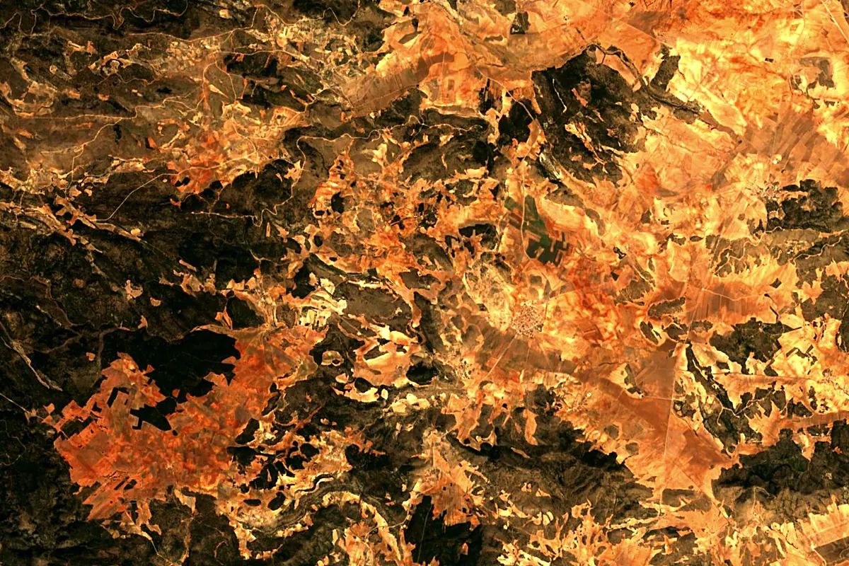
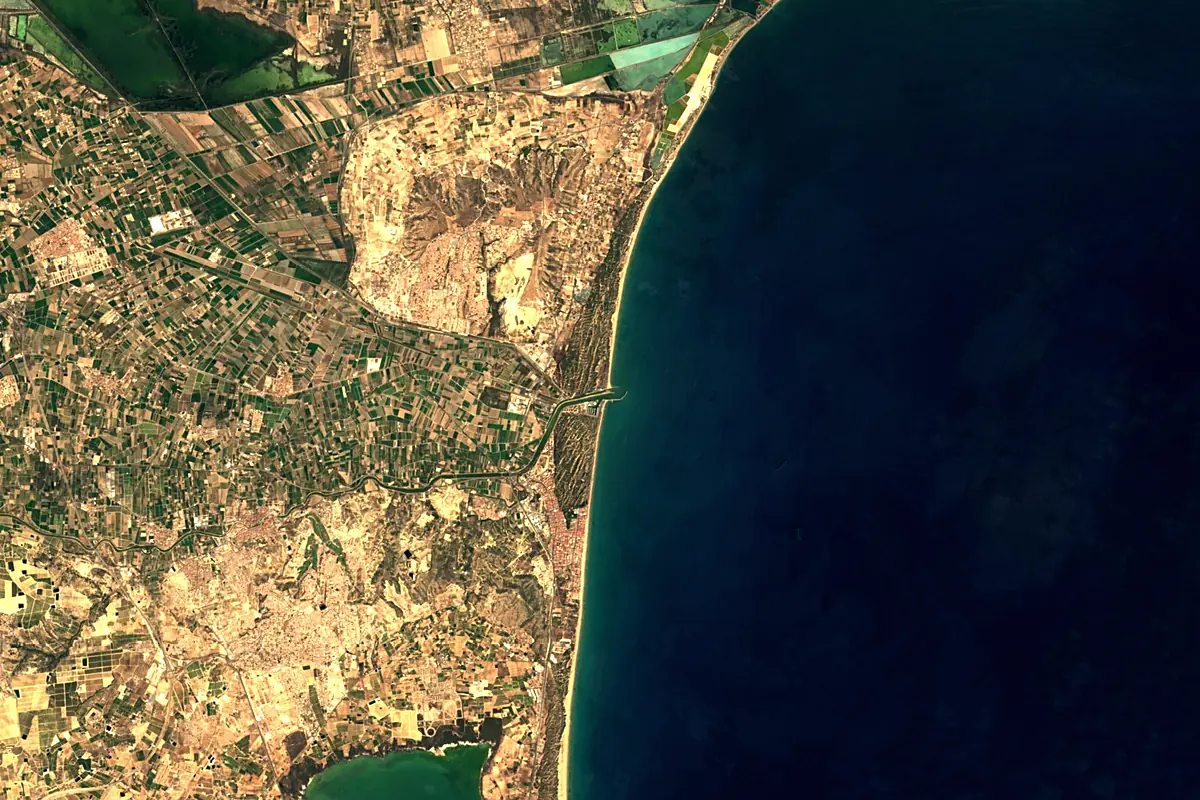
Sentinel-2 cloudless 2016 by EOX IT Services GmbH (contains modified Copernicus Sentinel data 2016), CC BY 4.0. The glowing line is the river as drawn by RiverATLAS.
Photos
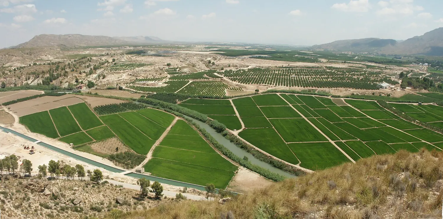
Segura in pictures
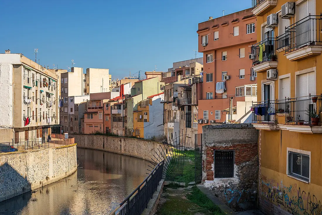
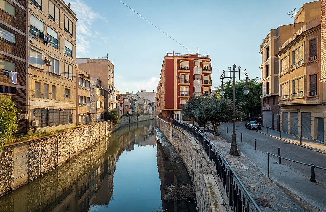
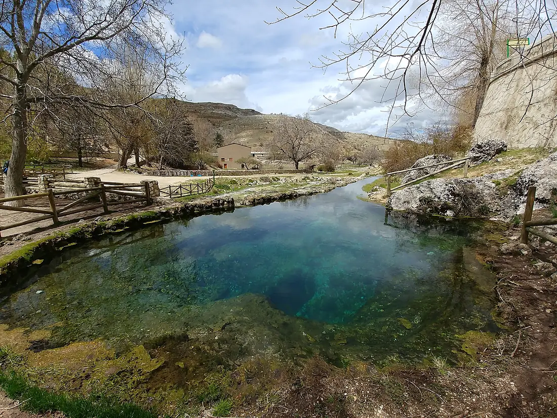
Tributaries
Where it flows, and what flows into it
Tributaries (10)
Also: Guadalentín, Mula, Mundo, Alhárabe, Argos, Taibilla, Quípar, Río Tus, Zumeta, Madera
Nearby
Rivers nearby
 Algeria
 Morocco
Where these numbers come from
| Name, length, places | Wikidata (Q18612) · CC0 |
|---|---|
| Course, profile, basin | RiverATLAS v1.0 (HydroATLAS, Linke et al. 2019) · CC BY 4.0 — followed along the river network from the point given by Wikidata |
| Flow | WaterGAP (RiverATLAS), 1971–2000 · CC BY 4.0 |
| Climate along the river | WorldClim (RiverATLAS), 1970–2000 · CC BY 4.0 |
| Towns, bridges, dams | Wikidata · CC0; GeoNames · CC BY 4.0 |
| Along the river | © OpenStreetMap contributors · ODbL |
| Images | EOX Sentinel-2 cloudless 2016 · CC BY 4.0; Wikimedia Commons |
| Our other atlases | Lakeyas, Coastya, Peakyas, Islandyas — Wikidata · CC0; © OpenStreetMap contributors · ODbL; GeoNames · CC BY 4.0; HydroLAKES · CC BY 4.0; NOAA OISST |
Every source and licence is on the data sources page.
The family
Do you prefer beaches, lakes, mountains, waterfalls, islands, rivers or canyons?
Same idea, other landscapes: field atlases built on open data, month by month, in seven languages.
beaches Find your beach: sea temperature, sun and swimming month by month.Visit lakes
 Every lake on Earth: water temperature, ice, depth and the shore.Coming soonVisit mountains
 Every summit in 3D: summit weather, the 0 °C line, huts and trails.Visit
  waterfalls
 Every waterfall: height, flow month by month and when it roars.Coming soonVisit islands
 Every island from the sea up: size, sea temperature, ferries and 3D.Coming soonVisit
  rivers
 Every river from source to sea: the journey, the flow and the basin in numbers.You are here
 canyons
 Every canyon cut to scale: depth to the floor, rim and floor temperatures, trails and viewpoints.Coming soonVisit