River
Yamuna
1,376 km from source to mouth · India.
 IndiaFlows into Ganges5th longest in India
In numbers
Length
1,376km
Average flow
3,500m³/s
Basin
351,000km²
Drop
3,517m
from 3,589 m to 72 m
Country
1
The journey
From source to mouth
1,376 km of river and 58 stops on the way: 46 towns and cities on its banks, dams, bridges and the tributaries that feed it.
- 0 kmSourceat 3,589 m
- 136 kmTons Rivertributary
- 137 kmVikāsnagar13,055 people
- 141 kmHarbatpur9,478 people
- 150 kmPāonta Sāhib25,183 people
- 308 kmChhaprauli19,224 people
- 340 kmBāghpat41,766 people
- 358 kmIbrāhīmpur10,614 people
- 359 kmBurāri146,190 people
- 364 kmKamal Pur Majra Burari43,086 people
- 364 kmJharoda Mazra Burāri22,878 people
- 365 kmBaqiabad14,429 people
- 366 kmSādatpur Gujran97,641 people
- 366 kmKarāwalnagar224,281 people
- 366 kmMustafābād127,167 people
- 366 kmDayal Pur20,589 people
- 366 kmZiauddin Pur68,993 people
- 367 kmKhajoori Khas76,640 people
- 367 kmMir Pur Turk19,098 people
- 367 kmYamuna Vihar10,000 people
- 368 kmSignature Bridge
- 373 kmDelhi11,034,555 people
- 373 kmJāfarābād54,601 people
- 378 kmNew Delhi249,998 people
- 381 kmGharonda Neemka Bangar37,876 people
- 383 kmChilla Soroda Bāngar83,217 people
- 384 kmChilla Saroda Khadar11,743 people
- 386 kmNoida293,908 people
- 388 kmSaidabad10,168 people
- 390 kmAli27,169 people
- 391 kmMolārband91,402 people
- 392 kmJaitpur59,330 people
- 393 kmMīthepur69,837 people
- 395 kmTilpat20,514 people
- 474 kmHasanpur11,569 people
- 547 kmVrindāvan60,195 people
- 559 kmMathura330,511 people
- 559 kmKans Quila
- 568 kmBād14,559 people
- 571 kmMahāban9,514 people
- 583 kmBaldev10,536 people
- 589 kmFarah9,236 people
- 601 kmKeetham Lake0.5 km²
- 650 kmChini Ka Rauza
- 651 kmAgra1,430,055 people
- 651 kmAgra FortUNESCO World Heritage
- 653 kmTaj MahalUNESCO World Heritage
- 708 kmFīrozābād306,409 people
- 720 kmFatehābād21,957 people
- 883 kmChambal Rivertributary
- 891 kmSindh Rivertributary
- 973 kmKālpi44,339 people
- 1,037 kmHamīrpur34,144 people
- 1,046 kmBetwa Rivertributary
- 1,098 kmKen Rivertributary
- 1,203 kmRājāpur13,962 people
- 1,291 kmPrayagraj5,954,391 people
- 1,292 kmNew Yamuna Bridge
- 1,294 kmJhūsi16,642 people
- 1,376 kmGangesat 72 m
Water level along the river (RiverATLAS; the height is exaggerated). Towns: GeoNames and Wikidata; bridges, dams and tributaries: Wikidata.
River in India
At the mouth it carries 3,480 m³/s on average: 1.4 Olympic pools every second. It drops from 3,589 m to 72 m, 2.6 m per kilometre on average. Its basin covers 351,000 km², about the size of DE. 153 million people live in it. Highest water: from September to October; lowest: from February to May. Dams and reservoirs hold back a large share of its water (27% of a year's flow).
Where to start
- DelhiLargest city on its banks · 11,034,555 people
- Indira Gandhi International Airport (DEL)Nearest airport with scheduled flights, 17 km from the cityCar hire at DEL airport (New Delhi)Discover Cars · Affiliate link↗
- On the water2 ferry piers, marinas, boat rentals and boat ramps along the river (OpenStreetMap)
- From November to MarchThe best months to visit
Yamuna, month by month
Highest water: from September to October
Lowest water: from February to May. Best months to visit: from November to March.
From about 220 m³/s in the lowest month to 8,600 m³/s in the highest. An estimate: the monthly flow is modelled from the lowest and highest months of WaterGAP (RiverATLAS, 1971–2000) and the rain and snow along the river (WorldClim). Dams change the real rhythm. The chip is the average air temperature; below it, the month's rain.
Plan the trip
Plan the trip: boat trips, a bed by the river, a car
Some links above are affiliate links: if you book through them we may earn a commission, at no extra cost to you. It never changes what the data on this page says.
The basin
Yamuna: the basin in numbers
346,499 km² of land send their water to this river. This is what lives on it.
- 153millionpeople live in the basin
- 443/km²people per km²
- 386maverage altitude of the basin
- 864mmof rain a year (basin average)
- 25.1°Caverage air temperature
- 3%protected areas
- 0.5%covered by lakes
- 18km³held in reservoirs
What covers the basin
- 14% Forest
- 61% Cropland
- 6% Pasture
- 8% Towns and cities
RiverATLAS (HydroATLAS v1.0, CC BY 4.0): land cover, people, protected areas, glaciers and dams over the whole basin upstream of the mouth.
Along the river
Yamuna: what you find on the way
- 20Weirs
- 4Waterfalls
- 1Boat ramps
- 3River beachesYamuna Ghat, Balkeshwar Ghat, DASHASWAMEDH GHAT
From OpenStreetMap, within 2.7 km of the river. Not mapped is not the same as not there.
Cross-checked with our atlases
Yamuna in our other atlases
What our sister atlases know about the waterfalls on this river, the lakes it flows through, the beaches at its mouth, the mountains where it rises and the islands off its mouth.
 1lake on its wayLakeyas
 3mountains at the sourcePeakyas
Lakes and reservoirs (1)
Lakes it flows through, by Lakeyas
- Keetham Lakekm 6440.5km²
Lakeyas is coming soonOpen Lakeyas ↗
Mountains at the source (3)
Within 15 km of the source, by Peakyas
- Bandarpunch8.6 km away6,316m
- Kalanag11 km away6,387m
- Swargarohini9.0 km away6,252m
From space
The source and the mouth, seen from orbit
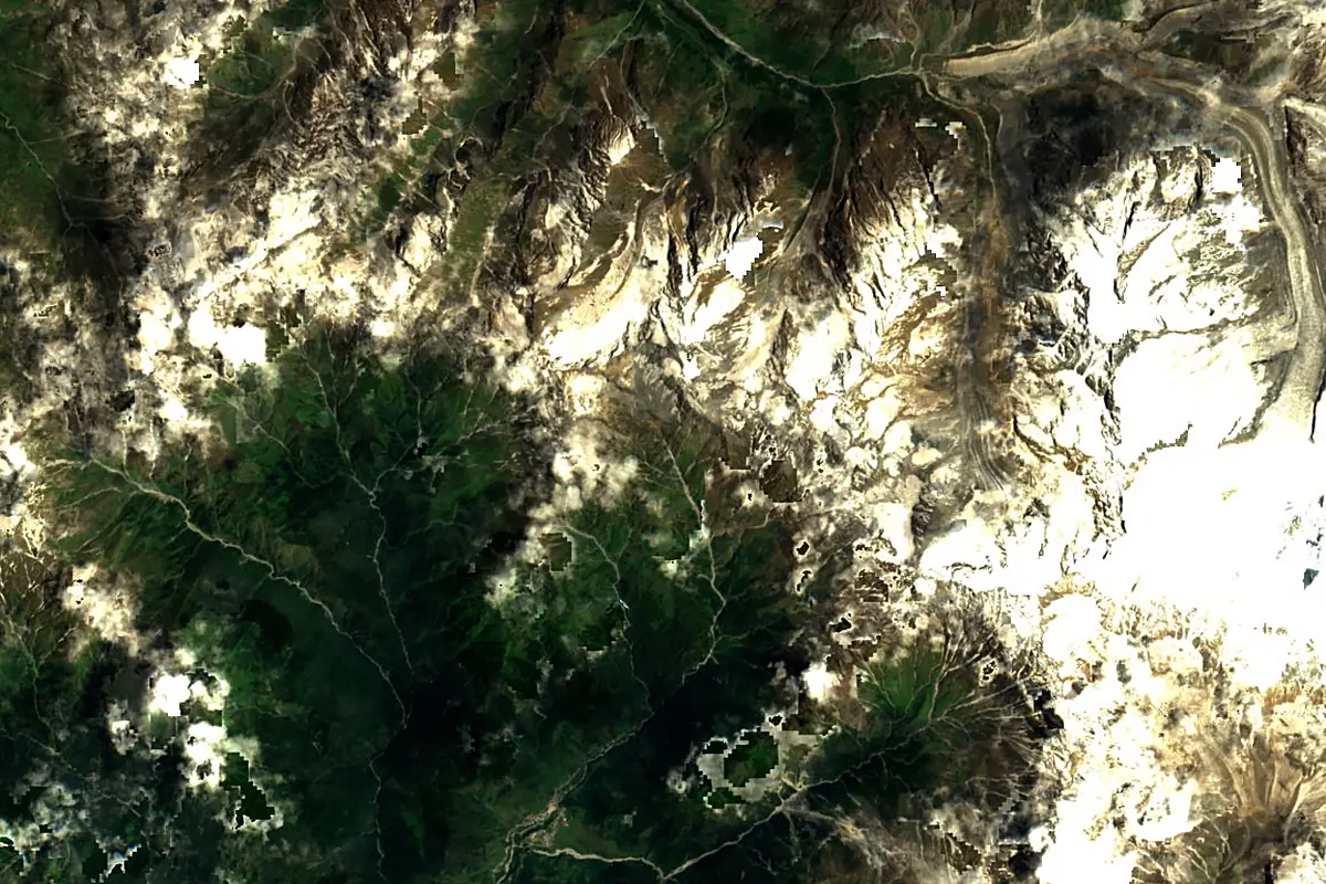
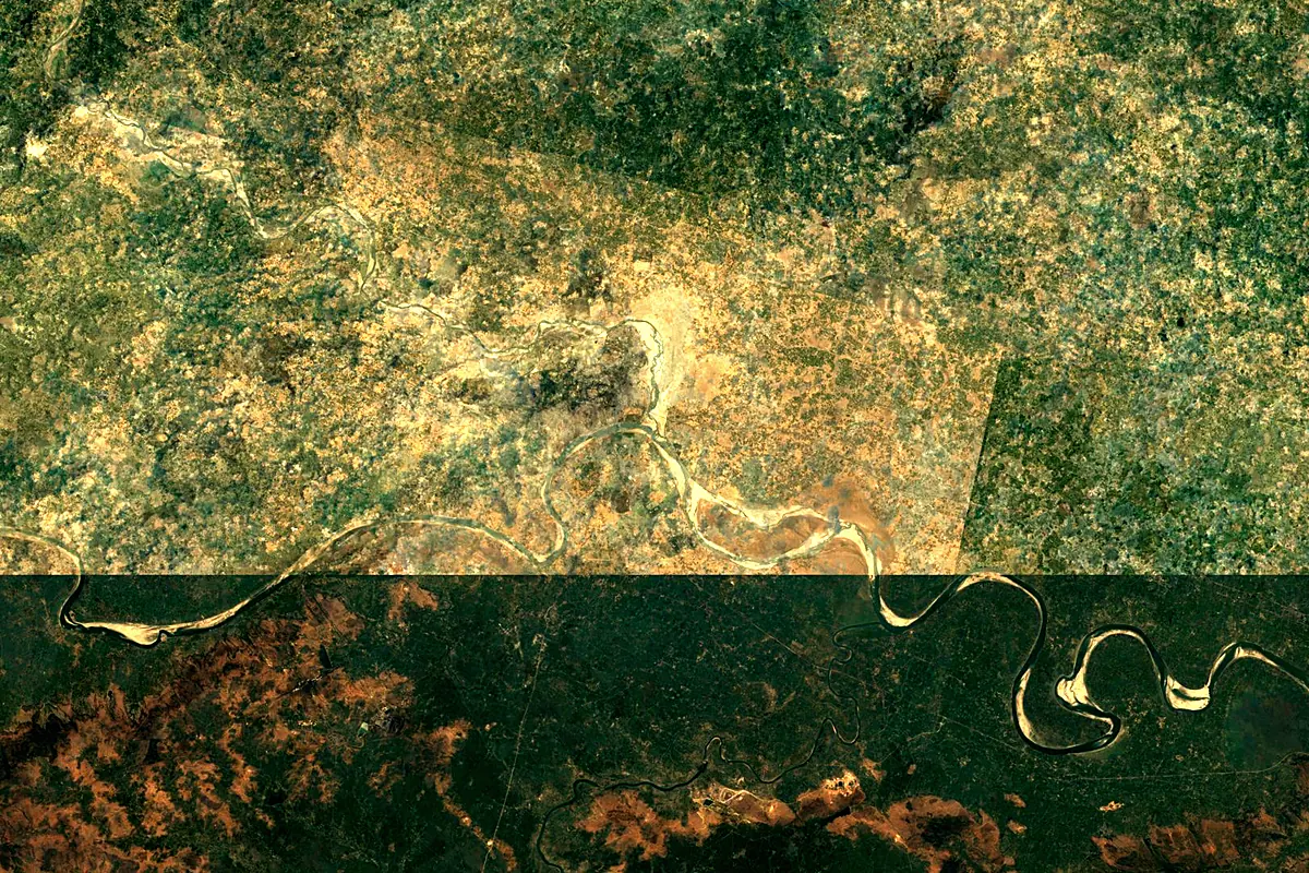
Sentinel-2 cloudless 2016 by EOX IT Services GmbH (contains modified Copernicus Sentinel data 2016), CC BY 4.0. The glowing line is the river as drawn by RiverATLAS.
Photos
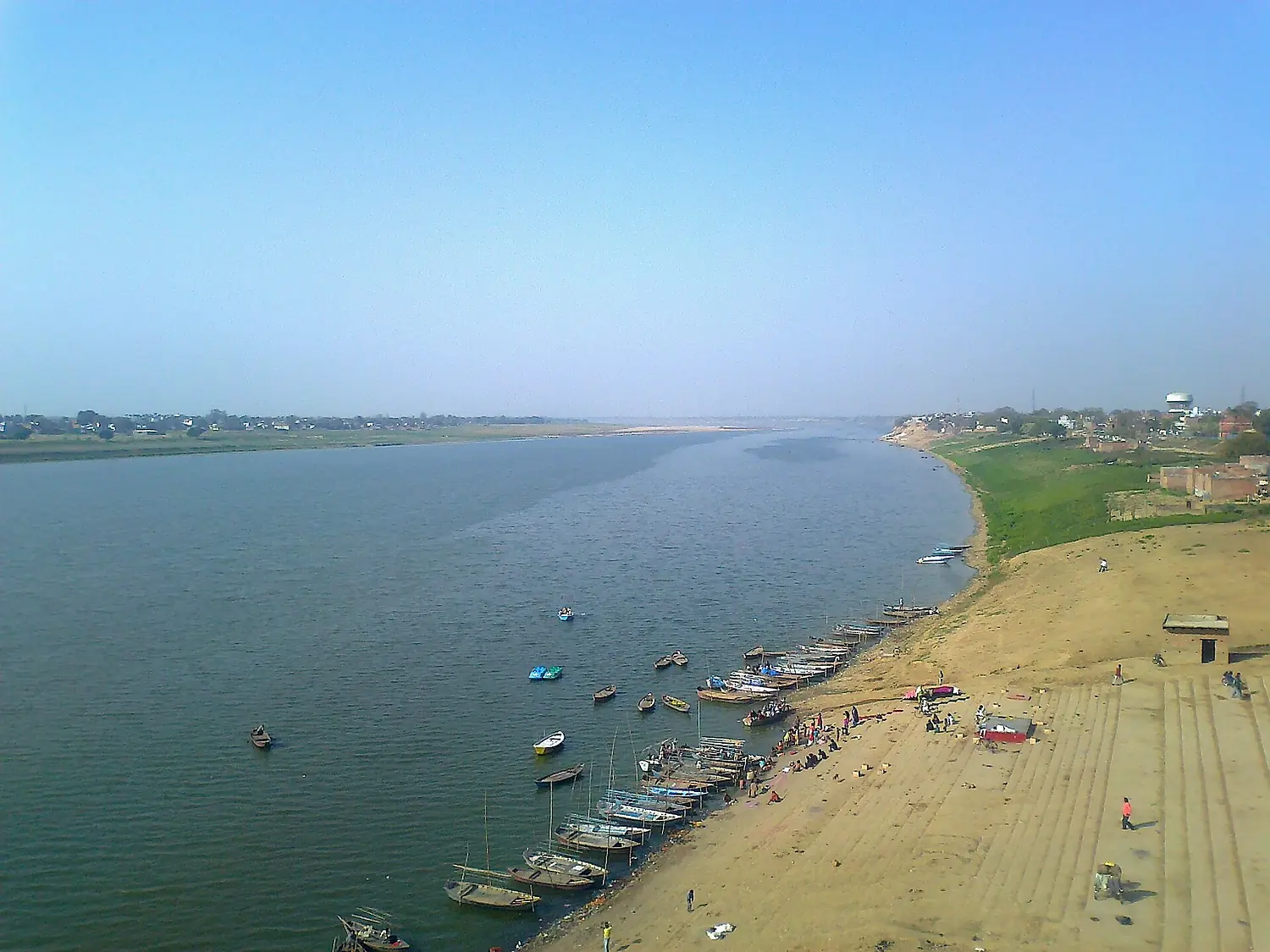
Yamuna in pictures
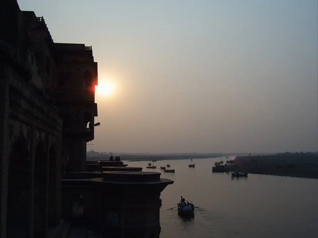
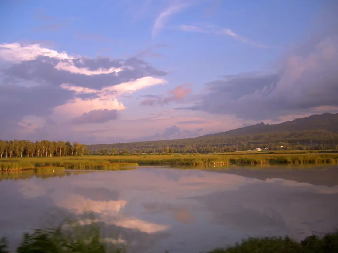
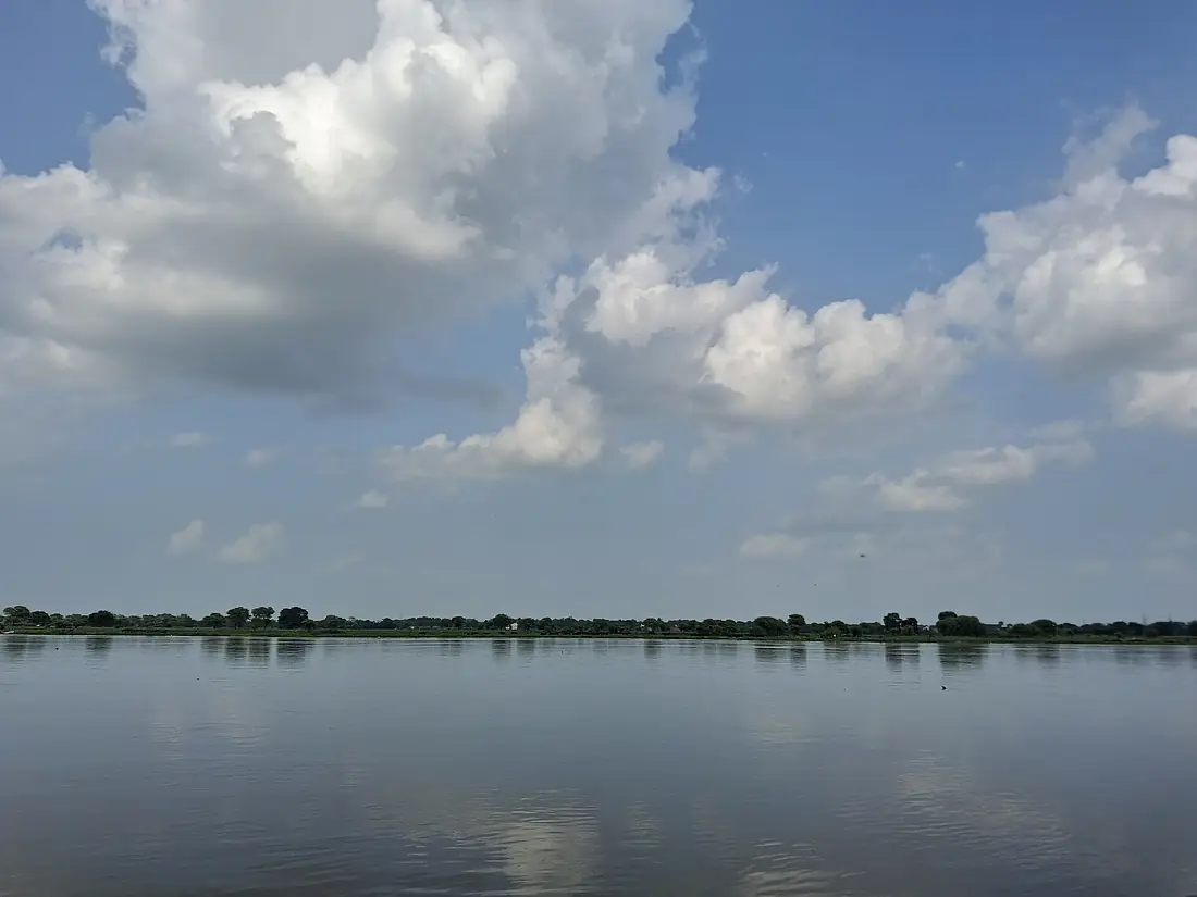
Tributaries
Where it flows, and what flows into it
It flows into
GangesIndia2,525 km12,000 m³/sTributaries (12)
Also: Hindon River, Ken River, Tons River, Sindh River, Banganga River, Sahibi River, Dohan river, Najafgarh drain, Krishnavati river, Indori river
In the same basin
India2,900 km19,500 m³/sPadma River Bangladesh120 km32,000 m³/sGandaki RiverIndia630 km1,800 m³/sJamuna RiverBangladesh245 km20,100 m³/sGhaghara RiverIndia1,080 km3,300 m³/sTeesta RiverBangladesh470 km1,300 m³/sGomti RiverIndia900 km230 m³/sKosi RiverIndia729 km2,300 m³/sSon RiverIndia780 km1,200 m³/sBhagirathi RiverIndia205 km260 m³/s
Nearby
Rivers nearby
India900 km230 m³/s101 km awayBetwa RiverIndia590 km500 m³/s175 km awayWest Rapti RiverIndia600 km580 m³/s203 km awaySharda RiverIndia350 km2,300 m³/s218 km awayGhaghara RiverIndia1,080 km3,300 m³/s281 km awayChambal RiverIndia960 km600 m³/s289 km awayRamgangaIndia600 km940 m³/s276 km awayGandaki RiverIndia630 km1,800 m³/s332 km awayWhere these numbers come from
| Name, length, places | Wikidata (Q132726) · CC0 |
|---|---|
| Course, profile, basin | RiverATLAS v1.0 (HydroATLAS, Linke et al. 2019) · CC BY 4.0 — followed from the source to the mouth given by Wikidata |
| Flow | WaterGAP (RiverATLAS), 1971–2000 · CC BY 4.0 |
| Climate along the river | WorldClim (RiverATLAS), 1970–2000 · CC BY 4.0 |
| Towns, bridges, dams | Wikidata · CC0; GeoNames · CC BY 4.0 |
| Along the river | © OpenStreetMap contributors · ODbL |
| Images | EOX Sentinel-2 cloudless 2016 · CC BY 4.0; Wikimedia Commons |
| Our other atlases | Lakeyas, Peakyas — Wikidata · CC0; © OpenStreetMap contributors · ODbL; GeoNames · CC BY 4.0; HydroLAKES · CC BY 4.0; NOAA OISST |
Every source and licence is on the data sources page.
The family
Do you prefer beaches, lakes, mountains, waterfalls, islands, rivers or canyons?
Same idea, other landscapes: field atlases built on open data, month by month, in seven languages.
 beaches
 Find your beach: sea temperature, sun and swimming month by month.Visit lakes
 Every lake on Earth: water temperature, ice, depth and the shore.Coming soonVisit mountains
 Every summit in 3D: summit weather, the 0 °C line, huts and trails.Visit
  waterfalls
 Every waterfall: height, flow month by month and when it roars.Coming soonVisit
  islands
 Every island from the sea up: size, sea temperature, ferries and 3D.Coming soonVisit
  rivers
 Every river from source to sea: the journey, the flow and the basin in numbers.You are here
 canyons
 Every canyon cut to scale: depth to the floor, rim and floor temperatures, trails and viewpoints.Coming soonVisit