River
Ganges
2,525 km from source to mouth · India.
 IndiaFlows into Bay of Bengal2nd longest in India
In numbers
Length
2,525km
Average flow
12,000m³/s
Basin
1,060,000km²
Drop
468m
from 466 m to -2 m
Country
1
The journey
From source to mouth
2,525 km of river and 68 stops on the way: 52 towns and cities on its banks, dams, bridges and the tributaries that feed it.
- 0 kmGangotri Glacierat 466 m
- 7 kmAlaknanda Rivertributary
- 7 kmBhagirathi Rivertributary
- 60 kmRishīkesh66,390 people
- 60 kmRishikesh70,499 people
- 65 kmBirbhaddar13,058 people
- 86 kmHaridwar186,079 people
- 253 kmGarhmuktesar37,043 people
- 312 kmAnūpshahr25,306 people
- 330 kmBabrāla16,670 people
- 336 kmNaraura22,432 people
- 499 kmShamsābād25,266 people
- 528 kmFarrukhābād241,152 people
- 533 kmFatehgarh14,847 people
- 545 kmKamalganj16,222 people
- 580 kmRamgangatributary
- 690 kmKanpur4,581,268 people
- 692 kmKanpur Cantonment108,534 people
- 697 kmJājmau652,831 people
- 948 kmJhūsi16,642 people
- 949 kmPrayagraj5,954,391 people
- 951 kmYamunatributary
- 987 kmSirsā12,608 people
- 1,087 kmMirzapur-cum-Vindhyachal234,871 people
- 1,087 kmMirzāpur220,029 people
- 1,115 kmKachhwa15,381 people
- 1,139 kmChunār36,459 people
- 1,167 kmRāmnagar44,277 people
- 1,173 kmVaranasi1,198,491 people
- 1,177 kmVaruna Rivertributary
- 1,223 kmSaidpur22,904 people
- 1,269 kmZamānia32,008 people
- 1,292 kmGhazīpur103,095 people
- 1,309 kmMuhammadābād33,186 people
- 1,331 kmKarmanasa Rivertributary
- 1,344 kmBuxar102,861 people
- 1,443 kmGhaghara Rivertributary
- 1,471 kmSon Rivertributary
- 1,486 kmDighwāra32,741 people
- 1,510 kmSonepur37,776 people
- 1,516 kmGandaktributary
- 1,516 kmGandaki Rivertributary
- 1,516 kmPatna1,684,222 people
- 1,519 kmMahatma Gandhi Setu
- 1,525 kmPunpun Rivertributary
- 1,553 kmMahnar Bazar48,293 people
- 1,582 kmBārh61,470 people
- 1,607 kmTeghra56,234 people
- 1,613 kmBāruni84,888 people
- 1,613 kmBarauni71,660 people
- 1,618 kmBihāt67,952 people
- 1,619 kmMālhīpur12,439 people
- 1,682 kmMunger213,303 people
- 1,722 kmBariārpur14,595 people
- 1,740 kmSultānganj52,892 people
- 1,781 kmSabaur12,575 people
- 1,803 kmColgong33,700 people
- 1,821 kmKosi Rivertributary
- 1,869 kmManihāri26,629 people
- 1,917 kmRājmahal22,514 people
- 1,956 kmFarakka21,834 people
- 1,958 kmFarakka Barrage
- 1,973 kmDhuliān77,070 people
- 2,027 kmLālgola28,442 people
- 2,035 kmMahananda Rivertributary
- 2,073 kmRajshahi763,580 people
- 2,152 kmBherāmāra38,159 people
- 2,373 kmChāndpur203,000 people
- 2,373 kmPadma Rivertributary
- 2,525 kmBay of Bengalat -2 m
Water level along the river (RiverATLAS; the height is exaggerated). Towns: GeoNames and Wikidata; bridges, dams and tributaries: Wikidata.
Major river in India
At the mouth it carries 12,000 m³/s on average: 4.8 Olympic pools every second. It drops from 466 m to -2 m, 0.2 m per kilometre on average. Its basin covers 1,060,000 km², about the size of MR. 634 million people live in it. Highest water: September; lowest: from February to May. Its dams hold back little of its water (6.2% of a year's flow).
Where to start
- PrayagrajLargest city on its banks · 5,954,391 people
- Prayagraj Airport (IXD)Nearest airport with scheduled flights, 12 km from the cityCar hire at AGR airport (Agra)Discover Cars · Affiliate link↗
- On the water49 ferry piers, marinas, boat rentals and boat ramps along the river (OpenStreetMap)
- Kayak and canoe7 put-ins and rapids mapped (OpenStreetMap)
- From November to MarchThe best months to visit
Ganges, month by month
Highest water: September
Lowest water: from February to May. Best months to visit: from November to March.
From about 6,800 m³/s in the lowest month to 100,300 m³/s in the highest. An estimate: the monthly flow is modelled from the lowest and highest months of WaterGAP (RiverATLAS, 1971–2000) and the rain and snow along the river (WorldClim). Dams change the real rhythm. The chip is the average air temperature; below it, the month's rain.
Plan the trip
Plan the trip: boat trips, a bed by the river, a car
Some links above are affiliate links: if you book through them we may earn a commission, at no extra cost to you. It never changes what the data on this page says.
The basin
Ganges: the basin in numbers
1,574,223 km² of land send their water to this river. This is what lives on it.
- 634millionpeople live in the basin
- 407/km²people per km²
- 1,567maverage altitude of the basin
- 1,199mmof rain a year (basin average)
- 17.5°Caverage air temperature
- 10%protected areas
- 0.4%covered by lakes
- 2%glaciers
- 7%permafrost
- 79km³held in reservoirs
What covers the basin
- 17% Forest
- 39% Cropland
- 13% Pasture
- 6% Towns and cities
- 2% Ice
RiverATLAS (HydroATLAS v1.0, CC BY 4.0): land cover, people, protected areas, glaciers and dams over the whole basin upstream of the mouth.
Along the river
Ganges: what you find on the way
- 18Weirs
- 3Locks
- 10WaterfallsPatna Waterfalls, Neer Gahr Waterfall, Secret Waterfall and 7 more
- 6RapidsThe Wall, Three Blind Mice, Crossfire and 3 more
- 1Canoe put-ins
- 2Boat ramps
- 47Ferry piersRamnagar, Dasaswamedh Ghat, Talaimari Balur Ghat,Rajshahi and 44 more
- 2River beachesNeem Beach, DASHASWAMEDH GHAT
From OpenStreetMap, within 3.1 km of the river. Not mapped is not the same as not there.
From space
The source and the mouth, seen from orbit
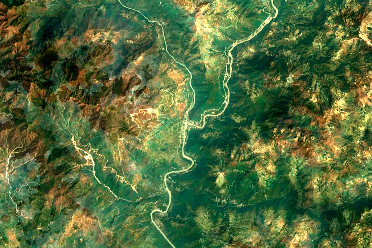
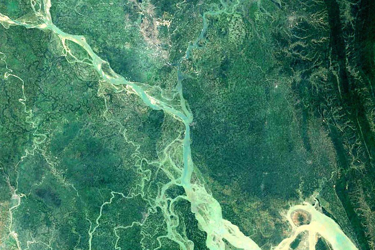
Sentinel-2 cloudless 2016 by EOX IT Services GmbH (contains modified Copernicus Sentinel data 2016), CC BY 4.0. The glowing line is the river as drawn by RiverATLAS.
Photos
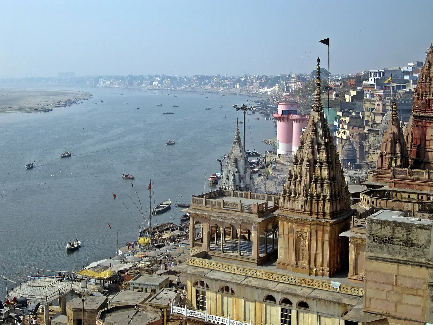
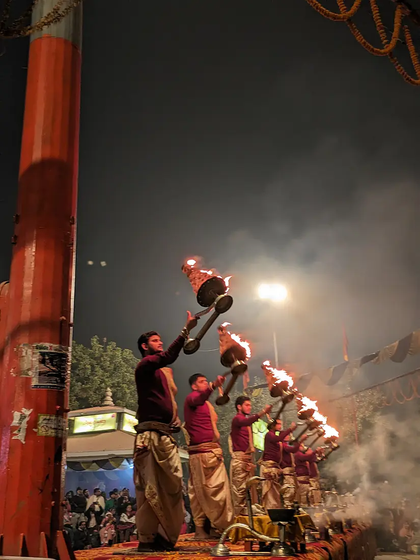
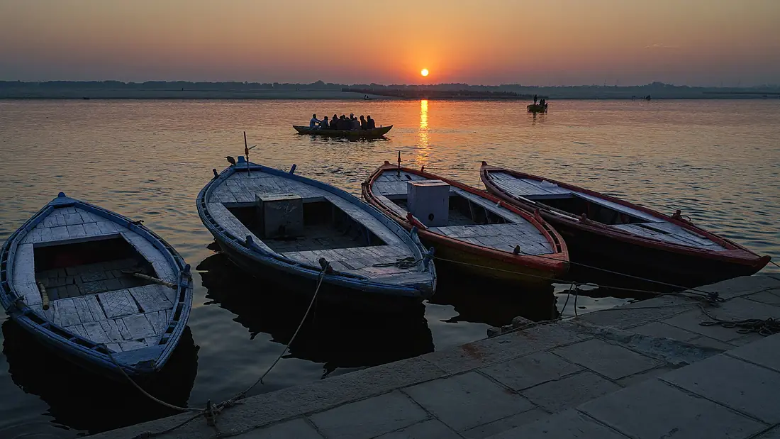
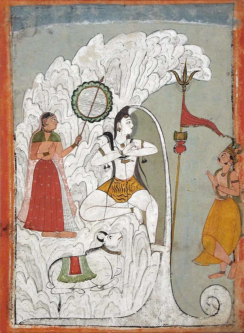
Ganges in pictures
Tributaries
Where it flows, and what flows into it
Tributaries (24)
India2,900 km19,500 m³/sYarlung Tsangpo River China2,840 km2,900 m³/sYamunaIndia1,376 km3,500 m³/sjoins at km 854Ghaghara RiverIndia1,080 km3,300 m³/sjoins at km 1,296Gomti RiverIndia900 km230 m³/sSon RiverIndia780 km1,200 m³/sjoins at km 1,321Kosi RiverIndia729 km2,300 m³/sjoins at km 1,636Gandaki RiverIndia630 km1,800 m³/sjoins at km 1,361RamgangaIndia600 km940 m³/sjoins at km 521Mahananda RiverIndia360 km390 m³/sjoins at km 1,828Bhagirathi RiverIndia205 km260 m³/sjoins at km 6Alaknanda RiverIndia190 km320 m³/sjoins at km 6
Also: Tamsa River, Sarayu, Burhi Gandak River, Tons River, Varuna River, Karmanasa River, Punpun River, Assi River, Gandak, Kiul River, Rāmgangā River
In the same basin
India960 km600 m³/sJamuna River Bangladesh245 km20,100 m³/sTeesta RiverBangladesh470 km1,300 m³/sManas RiverIndia400 km500 m³/sSankosh RiverIndia320 km5,400 m³/sBetwa RiverIndia590 km500 m³/sArun RiverChina530 km1,300 m³/sSharda RiverIndia350 km2,300 m³/sWest Rapti RiverIndia600 km580 m³/sTrishuli River
 Nepal163 km1,000 m³/s
Nearby
Rivers nearby
Bangladesh120 km32,000 m³/s0 km awayJamuna RiverBangladesh245 km20,100 m³/s110 km awayTeesta RiverBangladesh470 km1,300 m³/s267 km awayDamodar RiverIndia592 km680 m³/s278 km awayBrahmaputra RiverIndia2,900 km19,500 m³/s350 km awayMahananda RiverIndia360 km390 m³/s273 km awaySankosh RiverIndia320 km5,400 m³/s317 km awayManas RiverIndia400 km500 m³/s333 km awayWhere these numbers come from
| Name, length, places | Wikidata (Q5089) · CC0 |
|---|---|
| Course, profile, basin | RiverATLAS v1.0 (HydroATLAS, Linke et al. 2019) · CC BY 4.0 — followed from the source to the mouth given by Wikidata |
| Flow | WaterGAP (RiverATLAS), 1971–2000 · CC BY 4.0 |
| Climate along the river | WorldClim (RiverATLAS), 1970–2000 · CC BY 4.0 |
| Towns, bridges, dams | Wikidata · CC0; GeoNames · CC BY 4.0 |
| Along the river | © OpenStreetMap contributors · ODbL |
| Images | EOX Sentinel-2 cloudless 2016 · CC BY 4.0; Wikimedia Commons |
Every source and licence is on the data sources page.
The family
Do you prefer beaches, lakes, mountains, waterfalls, islands, rivers or canyons?
Same idea, other landscapes: field atlases built on open data, month by month, in seven languages.
 beaches
 Find your beach: sea temperature, sun and swimming month by month.Visit
  lakes
lakes Every lake on Earth: water temperature, ice, depth and the shore.Coming soonVisit
  mountains
 Every summit in 3D: summit weather, the 0 °C line, huts and trails.Visit
  waterfalls
 Every waterfall: height, flow month by month and when it roars.Coming soonVisit
  islands
 Every island from the sea up: size, sea temperature, ferries and 3D.Coming soonVisit
  rivers
 Every river from source to sea: the journey, the flow and the basin in numbers.You are here
 canyons
 Every canyon cut to scale: depth to the floor, rim and floor temperatures, trails and viewpoints.Coming soonVisit