River
Aisne
356 km from source to mouth · France.
 FranceFlows into Oise
In numbers
Length
356km
Average flow
63m³/s
Basin
7,700km²
Drop
123m
from 155 m to 32 m
Country
1
The journey
From source to mouth
356 km of river and 68 stops on the way: 60 towns and cities on its banks, dams, bridges and the tributaries that feed it.
- 0 kmRembercourt-Sommaisneat 155 m
- 7 kmÉtang de Belval0.7 km²
- 35 kmSainte-Menehould4,146 people
- 72 kmAutry93 people
- 85 kmAiretributary
- 93 kmChallerange417 people
- 106 kmFalaise346 people
- 111 kmVouziers3,825 people
- 114 kmBallay242 people
- 116 kmVandy204 people
- 136 kmAttigny1,094 people
- 137 kmRuisseau de Saint-Lamberttributary
- 143 kmFoivretributary
- 146 kmAmagne814 people
- 149 kmAmbly-Fleury132 people
- 159 kmBiermes316 people
- 161 kmSault-lès-Rethel1,900 people
- 163 kmRethel7,444 people
- 166 kmRuisseau de Saulcestributary
- 166 kmAcy-Romance479 people
- 170 kmBarby389 people
- 178 kmChâteau-Porcien1,285 people
- 180 kmCondé-lès-Herpy218 people
- 189 kmBlanzy-la-Salonnaise378 people
- 197 kmAsfeld1,082 people
- 202 kmAvaux520 people
- 206 kmÉvergnicourt522 people
- 207 kmRetournetributary
- 207 kmBrienne-sur-Aisne277 people
- 208 kmNeufchâtel-sur-Aisne424 people
- 215 kmVariscourt217 people
- 221 kmCondé-sur-Suippe357 people
- 222 kmSuippetributary
- 225 kmJuvincourt-et-Damary604 people
- 227 kmBerry-au-Bac722 people
- 235 kmPontavert605 people
- 241 kmConcevreux256 people
- 243 kmCuiry-lès-Chaudardes84 people
- 247 kmMaizy392 people
- 249 kmBeaurieux794 people
- 251 kmCuissy-et-Geny72 people
- 257 kmBourg-et-Comin809 people
- 264 kmSoupir272 people
- 267 kmChavonne214 people
- 267 kmPresles-et-Boves320 people
- 273 kmVailly-sur-Aisne2,050 people
- 273 kmChassemy895 people
- 278 kmCondé-sur-Aisne352 people
- 279 kmVesletributary
- 282 kmMissy-sur-Aisne625 people
- 283 kmSermoise340 people
- 283 kmCiry-Salsogne882 people
- 288 kmAcy1,004 people
- 289 kmVenizel1,324 people
- 292 kmBucy-le-Long1,947 people
- 293 kmVilleneuve-Saint-Germain2,616 people
- 297 kmSoissons28,046 people
- 299 kmCuffies1,733 people
- 301 kmPasly1,100 people
- 304 kmPommiers726 people
- 308 kmPernant682 people
- 312 kmFontenoy483 people
- 319 kmBerny-Rivière631 people
- 321 kmVic-sur-Aisne1,608 people
- 325 kmMontigny-Lengrain674 people
- 329 kmAttichy1,857 people
- 350 kmChoisy-au-Bac3,449 people
- 353 kmCompiègne40,761 people
- 353 kmClairoix2,208 people
- 356 kmOiseat 32 m
Water level along the river (RiverATLAS; the height is exaggerated). Towns: GeoNames and Wikidata; bridges, dams and tributaries: Wikidata.
River in France, tributary of the Oise
At the mouth it carries 63 m³/s on average: an Olympic pool every 40 seconds. It drops from 155 m to 32 m, 0.3 m per kilometre on average. Its basin covers 7,700 km², about the size of PR. 520,000 people live in it. Highest water: from December to February. No large dam holds it back: it is one of the world's free-flowing rivers.
Where to start
- CompiègneLargest city on its banks · 40,761 people
- Charles de Gaulle International Airport (CDG)Nearest airport with scheduled flights, 49 km from the cityCar hire at CDG airport (Paris)Discover Cars · Affiliate link↗
- On the water14 ferry piers, marinas, boat rentals and boat ramps along the river (OpenStreetMap)
- From May to SeptemberThe best months to visit
Aisne, month by month
Highest water: from December to February
Best months to visit: from May to September.
From about 20 m³/s in the lowest month to 94 m³/s in the highest. An estimate: the monthly flow is modelled from the lowest and highest months of WaterGAP (RiverATLAS, 1971–2000) and the rain and snow along the river (WorldClim). Dams change the real rhythm. The chip is the average air temperature; below it, the month's rain.
Plan the trip
Plan the trip: boat trips, a bed by the river, a car
Some links above are affiliate links: if you book through them we may earn a commission, at no extra cost to you. It never changes what the data on this page says.
The basin
Aisne: the basin in numbers
7,892 km² of land send their water to this river. This is what lives on it.
- 520,000people live in the basin
- 66/km²people per km²
- 148maverage altitude of the basin
- 715mmof rain a year (basin average)
- 9.8°Caverage air temperature
- 3%protected areas
- 0.1%covered by lakes
What covers the basin
- 9% Forest
- 55% Cropland
- 11% Pasture
- 2% Towns and cities
RiverATLAS (HydroATLAS v1.0, CC BY 4.0): land cover, people, protected areas, glaciers and dams over the whole basin upstream of the mouth.
Along the river
Aisne: what you find on the way
- 20WeirsCentrale Hydro-Éléctrique and 19 more
- 121LocksCanal de Vouziers, Canal des Ardennes, Canal Latéral à l'Aisne and 118 more
- 1Waterfalls
- 4Boat ramps
- 9MarinasHalte Nautique d'Attigny, Halte Nautique de Rethel, Halte Nautique de Sapigneul and 6 more
From OpenStreetMap, within 1.7 km of the river. Not mapped is not the same as not there.
Cross-checked with our atlases
Aisne in our other atlases
What our sister atlases know about the waterfalls on this river, the lakes it flows through, the beaches at its mouth, the mountains where it rises and the islands off its mouth.
 1lake on its wayLakeyas
Lakes and reservoirs (1)
Lakes it flows through, by Lakeyas
- Étang de Belvalkm 50.7km²
Lakeyas is coming soonOpen Lakeyas ↗
From space
The source and the mouth, seen from orbit
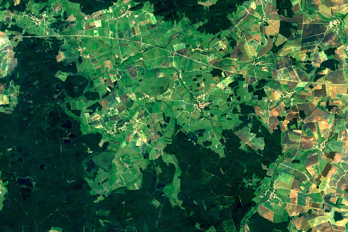
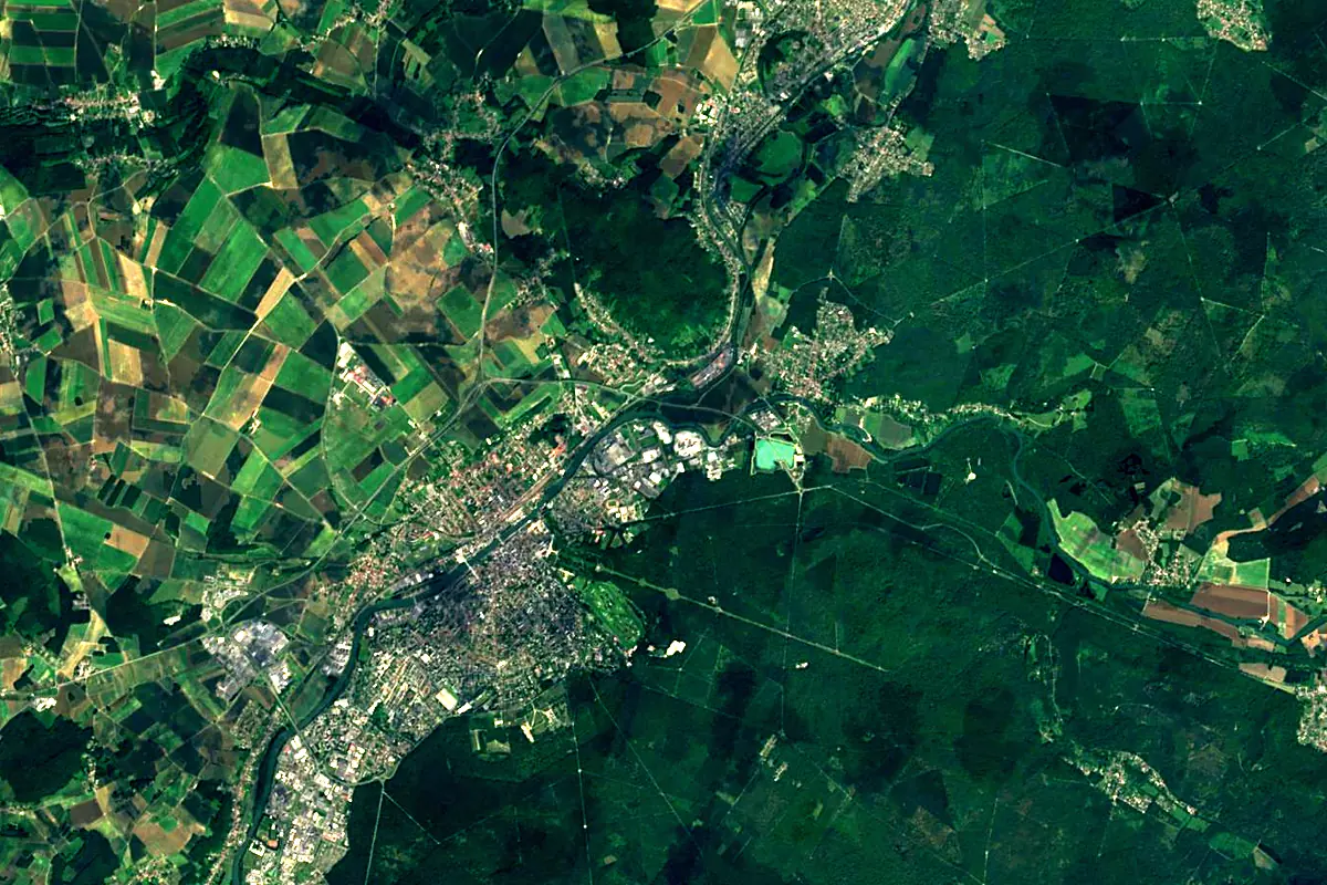
Sentinel-2 cloudless 2016 by EOX IT Services GmbH (contains modified Copernicus Sentinel data 2016), CC BY 4.0. The glowing line is the river as drawn by RiverATLAS.
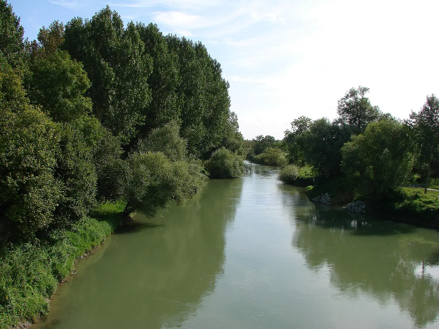
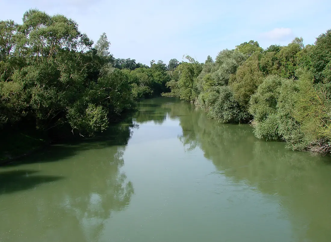
Photos
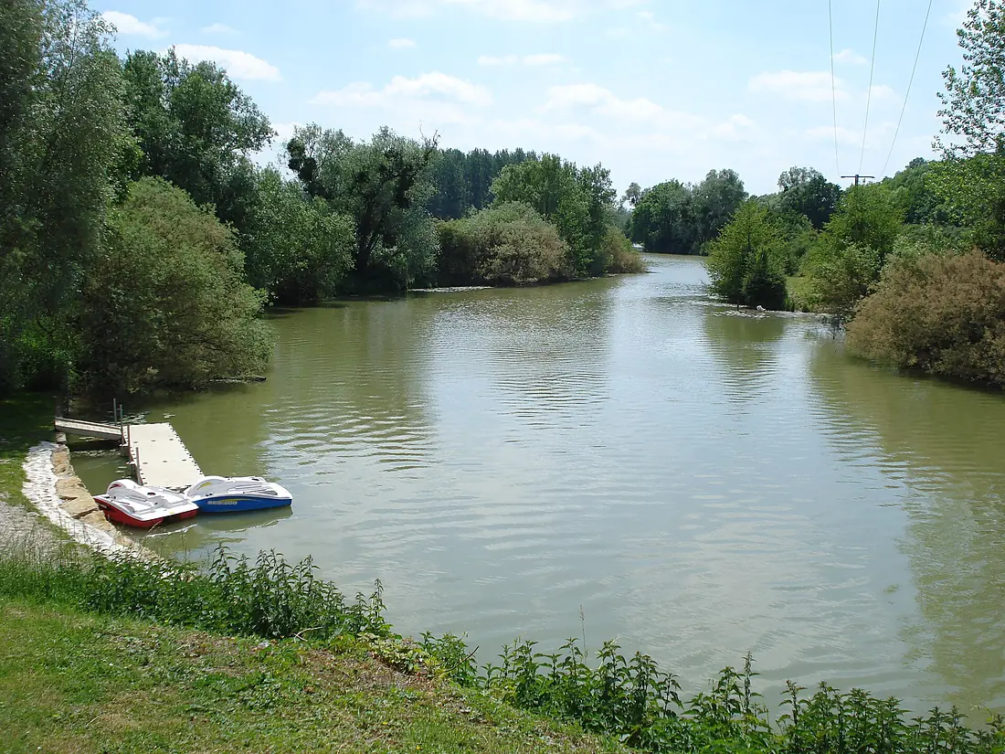
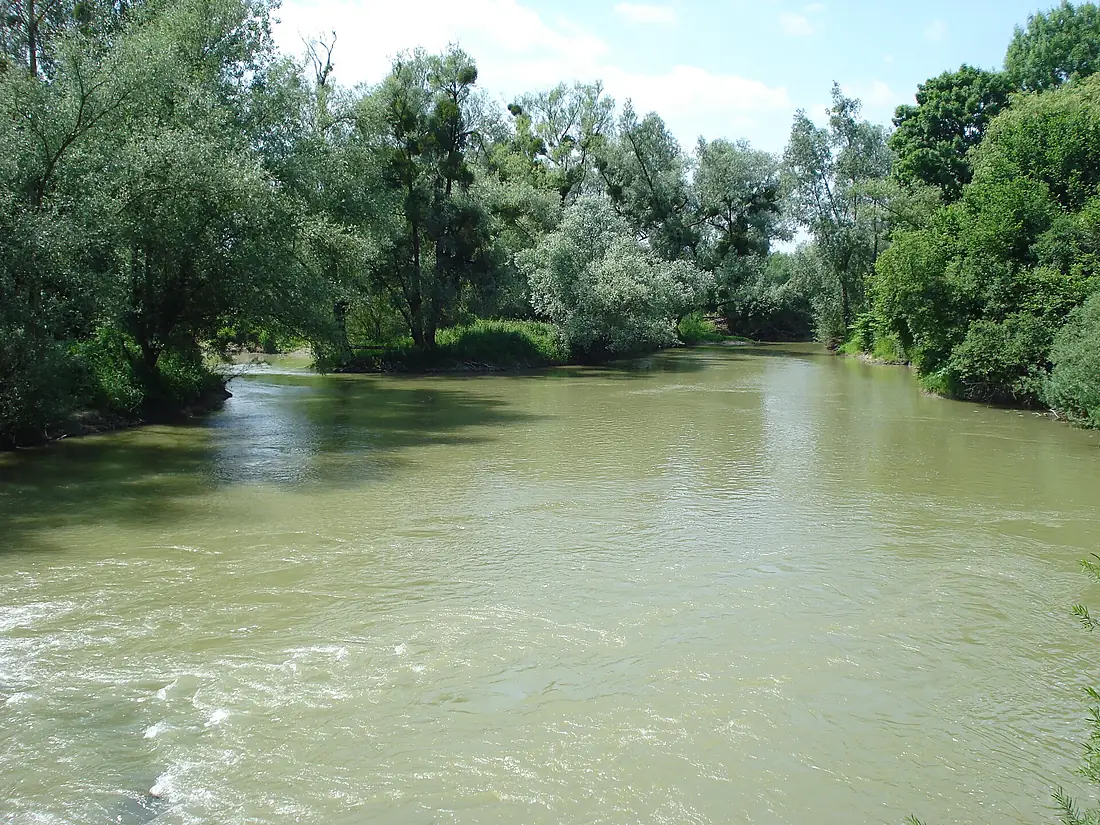
Aisne in pictures
Tributaries
Where it flows, and what flows into it
It flows into
OiseFrance341 km110 m³/sTributaries (20)
Also: Vesle, Aire, Suippe, Auve, Tourbe, Retourne, Biesme, Crise, Vaux, Ante, Bionne, Rû de Retz, Dormoise, Miette, Ruisseau de Saulces, Ruisseau de Saint-Lambert, Foivre, Fournelle, Rû d'Hozien, Rû de Vandy
Nearby
Rivers nearby
Where these numbers come from
| Name, length, places | Wikidata (Q41962) · CC0 |
|---|---|
| Course, profile, basin | RiverATLAS v1.0 (HydroATLAS, Linke et al. 2019) · CC BY 4.0 — followed along the river network from the point given by Wikidata |
| Flow | WaterGAP (RiverATLAS), 1971–2000 · CC BY 4.0 |
| Climate along the river | WorldClim (RiverATLAS), 1970–2000 · CC BY 4.0 |
| Towns, bridges, dams | Wikidata · CC0; GeoNames · CC BY 4.0 |
| Along the river | © OpenStreetMap contributors · ODbL |
| Images | EOX Sentinel-2 cloudless 2016 · CC BY 4.0; Wikimedia Commons |
| Our other atlases | Lakeyas — Wikidata · CC0; © OpenStreetMap contributors · ODbL; GeoNames · CC BY 4.0; HydroLAKES · CC BY 4.0; NOAA OISST |
Every source and licence is on the data sources page.
The family
Do you prefer beaches, lakes, mountains, waterfalls, islands, rivers or canyons?
Same idea, other landscapes: field atlases built on open data, month by month, in seven languages.
 beaches
 Find your beach: sea temperature, sun and swimming month by month.Visit lakes
 Every lake on Earth: water temperature, ice, depth and the shore.Coming soonVisit
  mountains
 Every summit in 3D: summit weather, the 0 °C line, huts and trails.Visit
  waterfalls
 Every waterfall: height, flow month by month and when it roars.Coming soonVisit
  islands
 Every island from the sea up: size, sea temperature, ferries and 3D.Coming soonVisit
  rivers
 Every river from source to sea: the journey, the flow and the basin in numbers.You are here
 canyons
 Every canyon cut to scale: depth to the floor, rim and floor temperatures, trails and viewpoints.Coming soonVisit