River
Marne
514 km from source to mouth · France.
 FranceFlows into Seine5th longest in France
In numbers
Length
514km
Average flow
100m³/s
Basin
12,800km²
Drop
290m
from 321 m to 31 m
Country
1
The journey
From source to mouth
514 km of river and 68 stops on the way: 55 towns and cities on its banks, dams, bridges and the tributaries that feed it.
- 0 kmMarne River springat 321 m
- 0 kmLangres7,421 people
- 39 kmChaumont20,827 people
- 104 kmRongeanttributary
- 129 kmAncerville2,569 people
- 134 kmSaint-Dizier22,858 people
- 161 kmLake Der-Chantecoq39 km²
- 161 kmBlaisetributary
- 180 kmIssontributary
- 181 kmVitry-le-François10,996 people
- 184 kmSaulxtributary
- 222 kmChâlons-en-Champagne42,971 people
- 226 kmFagnières4,858 people
- 241 kmSomme-Soudetributary
- 264 kmÉpernay22,174 people
- 296 kmSemoignetributary
- 303 kmTrélou-sur-Marne952 people
- 311 kmBarzy-sur-Marne380 people
- 317 kmSurmelintributary
- 326 kmChierry1,195 people
- 327 kmBrasles1,788 people
- 329 kmChâteau-Thierry15,097 people
- 331 kmEssômes-sur-Marne2,691 people
- 336 kmAzy-sur-Marne369 people
- 339 kmChézy-sur-Marne1,296 people
- 343 kmNogent-l'Artaud2,134 people
- 346 kmCharly-sur-Marne2,594 people
- 354 kmCrouttes-sur-Marne591 people
- 372 kmLa Ferté-sous-Jouarre10,254 people
- 394 kmOurcqtributary
- 415 kmNanteuil-lès-Meaux7,308 people
- 417 kmMeaux56,905 people
- 427 kmEsbly6,072 people
- 433 kmGrand Morintributary
- 440 kmAnnet-sur-Marne3,408 people
- 448 kmChessy7,771 people
- 449 kmMontévrain15,687 people
- 452 kmThorigny-sur-Marne10,440 people
- 452 kmLagny-sur-Marne21,461 people
- 455 kmSaint-Thibault-des-Vignes6,831 people
- 458 kmVaires-sur-Marne13,931 people
- 460 kmMarne La Vallée318,325 people
- 460 kmTorcy22,810 people
- 461 kmNoisiel16,053 people
- 463 kmChamps-sur-Marne27,451 people
- 465 kmGournay-sur-Marne7,320 people
- 466 kmChelles54,620 people
- 469 kmNoisy-le-Grand72,978 people
- 471 kmNeuilly-sur-Marne39,800 people
- 472 kmNeuilly-Plaisance21,941 people
- 473 kmLe Perreux-sur-Marne35,260 people
- 473 kmBry-sur-Marne18,503 people
- 478 kmNogent-sur-Marne32,455 people
- 480 kmJoinville-le-Pont20,525 people
- 482 kmPetit Morintributary
- 484 kmChampigny-sur-Marne78,072 people
- 486 kmChennevières-sur-Marne18,710 people
- 488 kmSucy-en-Brie27,764 people
- 490 kmBonneuil-sur-Marne18,270 people
- 491 kmCréteil93,397 people
- 492 kmLac de Créteil0.3 km²
- 493 kmSaint-Maur-des-Fossés76,572 people
- 497 kmMaisons-Alfort56,799 people
- 497 kmAlfortville45,531 people
- 498 kmSaint-Maurice14,506 people
- 498 kmParis 12e Arrondissement140,311 people
- 500 kmCharenton-le-Pont28,830 people
- 500 kmIvry-sur-Seine65,064 people
- 500 kmMorbrastributary
- 514 kmSeineat 31 m
Water level along the river (RiverATLAS; the height is exaggerated). Towns: GeoNames and Wikidata; bridges, dams and tributaries: Wikidata.
River in France
At the mouth it carries 100 m³/s on average: an Olympic pool every 25 seconds. It drops from 321 m to 31 m, 0.6 m per kilometre on average. Its basin covers 12,800 km², about the size of BS. 2.2 million people live in it. Highest water: from December to February. Dams and reservoirs hold back a large share of its water (13% of a year's flow).
Where to start
- Marne La ValléeLargest city on its banks · 318,325 people
- Charles de Gaulle International Airport (CDG)Nearest airport with scheduled flights, 20 km from the cityCar hire at CDG airport (Paris)Discover Cars · Affiliate link↗
- On the water98 ferry piers, marinas, boat rentals and boat ramps along the river (OpenStreetMap)
- Kayak and canoe4 put-ins and rapids mapped (OpenStreetMap)
- From May to SeptemberThe best months to visit
Marne, month by month
Highest water: from December to February
Best months to visit: from May to September.
From about 33 m³/s in the lowest month to 150 m³/s in the highest. An estimate: the monthly flow is modelled from the lowest and highest months of WaterGAP (RiverATLAS, 1971–2000) and the rain and snow along the river (WorldClim). Dams change the real rhythm. The chip is the average air temperature; below it, the month's rain.
Plan the trip
Plan the trip: boat trips, a bed by the river, a car
Some links above are affiliate links: if you book through them we may earn a commission, at no extra cost to you. It never changes what the data on this page says.
The basin
Marne: the basin in numbers
12,783 km² of land send their water to this river. This is what lives on it.
- 2.2millionpeople live in the basin
- 172/km²people per km²
- 204maverage altitude of the basin
- 691mmof rain a year (basin average)
- 9.8°Caverage air temperature
- 3%protected areas
- 0.4%covered by lakes
- 0.4km³held in reservoirs
What covers the basin
- 10% Forest
- 55% Cropland
- 8% Pasture
- 6% Towns and cities
RiverATLAS (HydroATLAS v1.0, CC BY 4.0): land cover, people, protected areas, glaciers and dams over the whole basin upstream of the mouth.
Along the river
Marne: what you find on the way
- 71WeirsBarrage de Valcourt, Cassure de Sapignicourt, Barrage d'Isles-les-Meldeuses and 68 more
- 311LocksCanal Entre Champagne et Bourgogne, Écluse de Vesaignes, Écluse de Marnay and 308 more
- 8WaterfallsCascade de la Tuffière, Freebooter Falls, Cascades de Cristal and 5 more
- 4Rapids
- 46Boat rampsRampe de Mise à l'Eau, Cale sainte catherine and 44 more
- 10Ferry piersPasseurs de Marne - Gournay-sur-Marne, Passeurs de Marne - Noisy-le-Grand, Passeurs de Marne - Neuilly-Plaisance and 7 more
- 35MarinasHalte Nautique de Humes Jorquenay, Halte Nautique de Rolampont, Port de plaisance de Chaumont and 32 more
- 5River beachesMeaux plage, Plage Nord, Plage Sud and 2 more
From OpenStreetMap, within 1.9 km of the river. Not mapped is not the same as not there.
Cross-checked with our atlases
Marne in our other atlases
What our sister atlases know about the waterfalls on this river, the lakes it flows through, the beaches at its mouth, the mountains where it rises and the islands off its mouth.
 2lakes on its wayLakeyas
 1mountain at the sourcePeakyas
Lakes and reservoirs (2)
Lakes it flows through, by Lakeyas
- Lake Der-Chantecoqkm 129 · 18 m deep39km²
- Lac de Créteilkm 3960.3km²
Lakeyas is coming soonOpen Lakeyas ↗
Mountains at the source (1)
Within 15 km of the source, by Peakyas
- Haut de Baissey12 km away523m
From space
The source and the mouth, seen from orbit
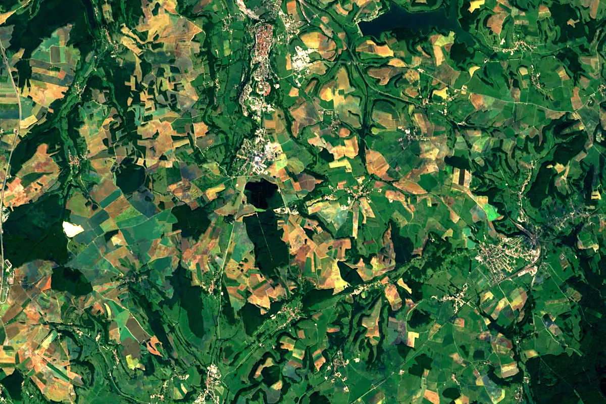
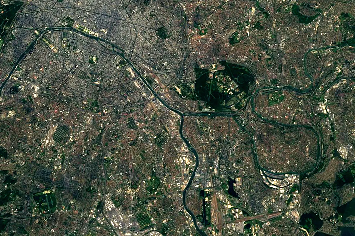
Sentinel-2 cloudless 2016 by EOX IT Services GmbH (contains modified Copernicus Sentinel data 2016), CC BY 4.0. The glowing line is the river as drawn by RiverATLAS.
Photos
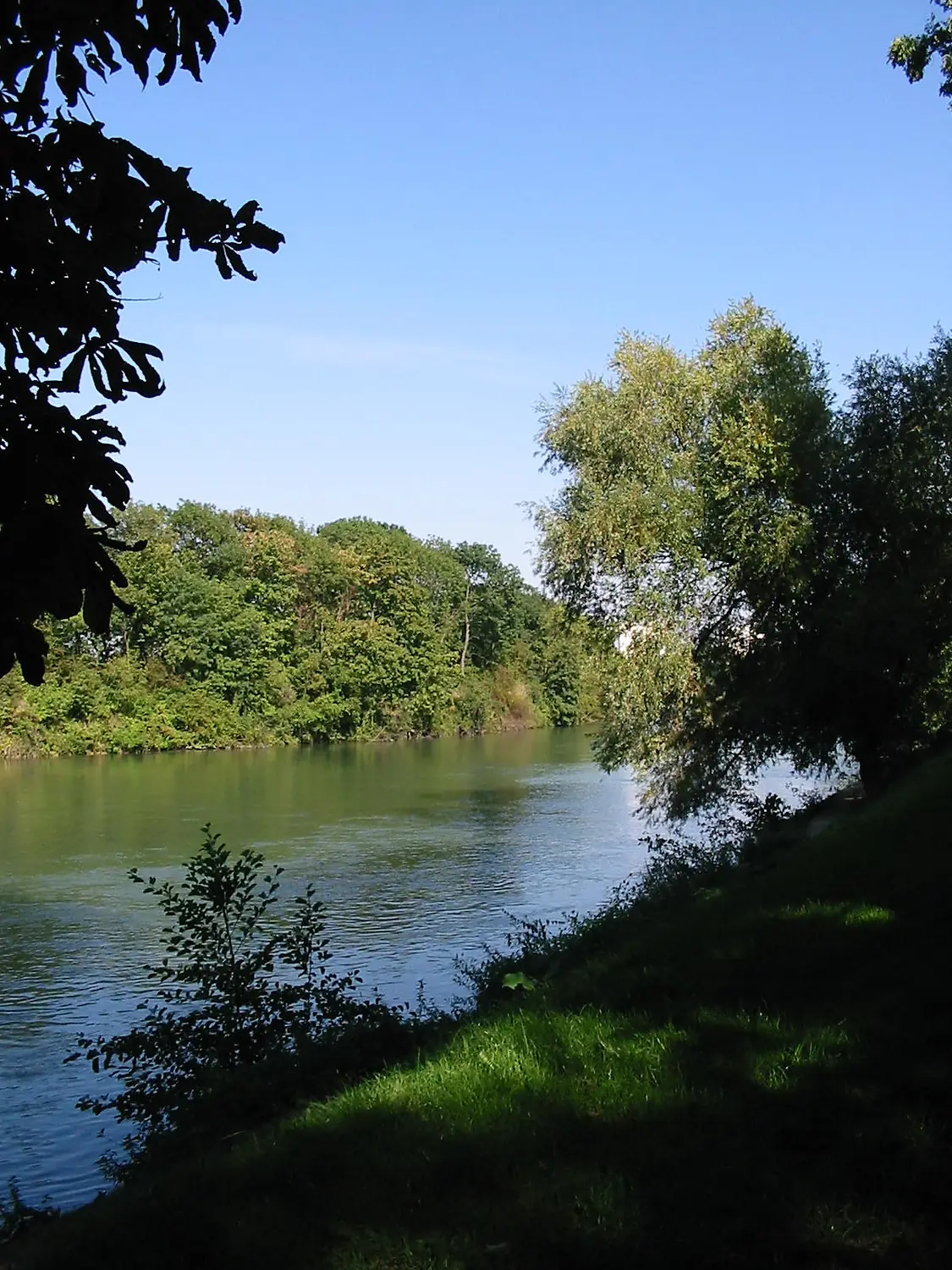
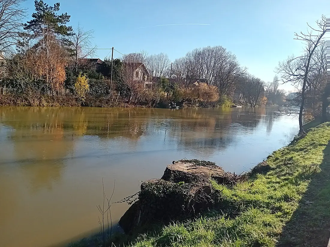
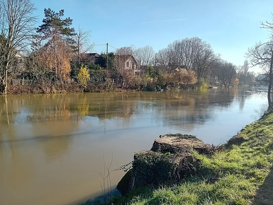
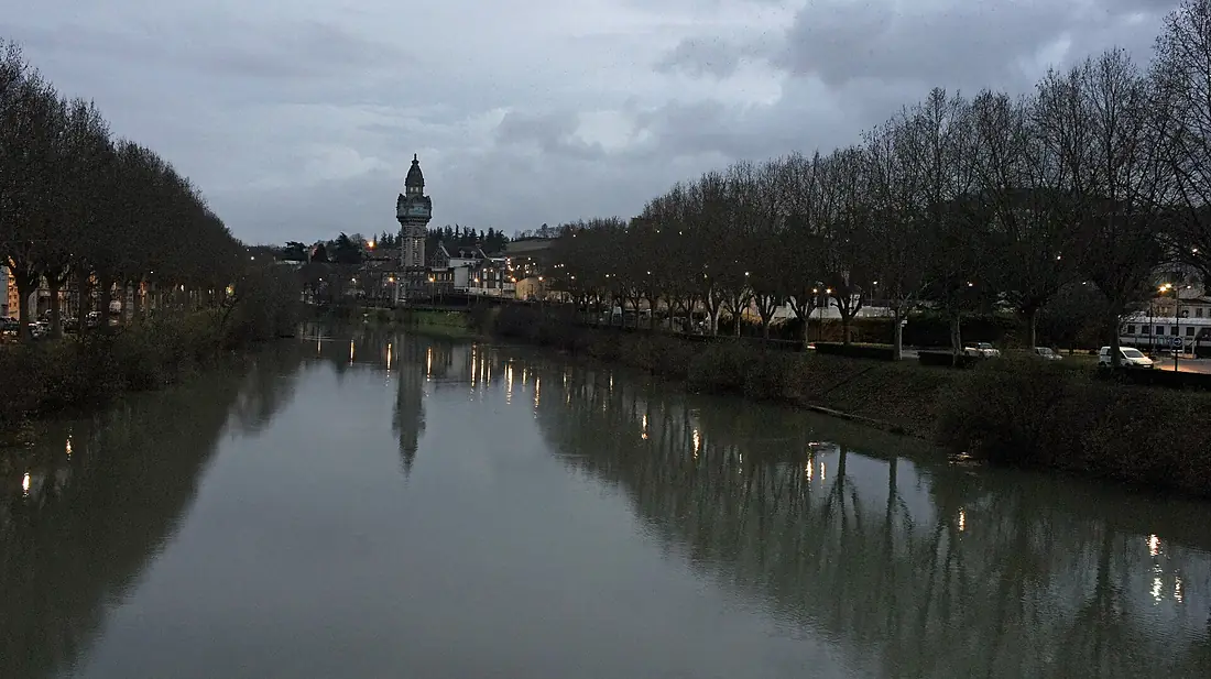
Marne in pictures
Tributaries
Where it flows, and what flows into it
It flows into
SeineFrance777 km500 m³/sTributaries (25)
Also: Ourcq, Grand Morin, Saulx, Petit Morin, Blaise, Rognon, Suize, Fion, Somme-Soude, Beuvronne, Coole, Surmelin, Livre, Rongeant, Thérouanne, Guenelle, Ruisseau Orconté, Isson, Les Tarnauds, Morbras, Semoigne, Traire, Flagot, Ruisseau le Dolloir
Where these numbers come from
| Name, length, places | Wikidata (Q41983) · CC0 |
|---|---|
| Course, profile, basin | RiverATLAS v1.0 (HydroATLAS, Linke et al. 2019) · CC BY 4.0 — followed from the source to the mouth given by Wikidata |
| Flow | WaterGAP (RiverATLAS), 1971–2000 · CC BY 4.0 |
| Climate along the river | WorldClim (RiverATLAS), 1970–2000 · CC BY 4.0 |
| Towns, bridges, dams | Wikidata · CC0; GeoNames · CC BY 4.0 |
| Along the river | © OpenStreetMap contributors · ODbL |
| Images | EOX Sentinel-2 cloudless 2016 · CC BY 4.0; Wikimedia Commons |
| Our other atlases | Lakeyas, Peakyas — Wikidata · CC0; © OpenStreetMap contributors · ODbL; GeoNames · CC BY 4.0; HydroLAKES · CC BY 4.0; NOAA OISST |
Every source and licence is on the data sources page.
The family
Do you prefer beaches, lakes, mountains, waterfalls, islands, rivers or canyons?
Same idea, other landscapes: field atlases built on open data, month by month, in seven languages.
 beaches
 Find your beach: sea temperature, sun and swimming month by month.Visit lakes
 Every lake on Earth: water temperature, ice, depth and the shore.Coming soonVisit mountains
 Every summit in 3D: summit weather, the 0 °C line, huts and trails.Visit
  waterfalls
 Every waterfall: height, flow month by month and when it roars.Coming soonVisit
  islands
 Every island from the sea up: size, sea temperature, ferries and 3D.Coming soonVisit
  rivers
 Every river from source to sea: the journey, the flow and the basin in numbers.You are here
 canyons
 Every canyon cut to scale: depth to the floor, rim and floor temperatures, trails and viewpoints.Coming soonVisit