River
Eure
229 km from source to mouth · France.
 FranceFlows into Seine
In numbers
Length
229km
Average flow
26m³/s
Basin
5,935km²
Drop
187m
from 187 m to 0 m
Country
1
The journey
From source to mouth
229 km of river and 68 stops on the way: 60 towns and cities on its banks, dams, bridges and the tributaries that feed it.
- 0 kmLongny les Villagesat 187 m
- 3 kmBelhomert-Guéhouville810 people
- 14 kmPontgouin1,110 people
- 21 kmChuisnes1,126 people
- 24 kmCourville-sur-Eure2,791 people
- 33 kmSaint-Luperce1,005 people
- 38 kmSaint-Georges-sur-Eure2,797 people
- 44 kmFontenay-sur-Eure1,206 people
- 48 kmThivars1,119 people
- 53 kmMorancez1,935 people
- 55 kmBarjouville1,742 people
- 57 kmLuisant6,945 people
- 58 kmLe Coudray4,038 people
- 61 kmChartres38,324 people
- 64 kmCouanontributary
- 64 kmLèves5,685 people
- 65 kmChamphol3,643 people
- 70 kmSaint-Prest2,115 people
- 72 kmBerchères-Saint-Germain905 people
- 73 kmJouy1,988 people
- 79 kmSaint-Piat1,120 people
- 82 kmVoisetributary
- 85 kmMaintenon4,494 people
- 86 kmPierres2,788 people
- 90 kmVilliers-le-Morhier1,351 people
- 94 kmCoulombs1,363 people
- 95 kmNogent-le-Roi4,021 people
- 99 kmChaudon1,688 people
- 99 kmMaltornetributary
- 102 kmVillemeux-sur-Eure1,780 people
- 109 kmPlan d'eau de Mézières-Écluzelles0.7 km²
- 110 kmMézières-en-Drouais1,059 people
- 111 kmLuray1,566 people
- 112 kmSainte-Gemme-Moronval1,114 people
- 113 kmCherisy1,842 people
- 116 kmAbondant2,434 people
- 116 kmBlaisetributary
- 120 kmAvretributary
- 121 kmSaint-Georges-Motel880 people
- 127 kmMarcilly-sur-Eure1,607 people
- 129 kmSorel-Moussel1,758 people
- 130 kmCroth1,416 people
- 136 kmAnet2,721 people
- 136 kmÉzy-sur-Eure3,644 people
- 140 kmVesgretributary
- 141 kmLa Chaussée-d'Ivry1,321 people
- 141 kmIvry-la-Bataille2,609 people
- 146 kmGarennes-sur-Eure1,996 people
- 147 kmBueil1,642 people
- 153 kmBreuilpont1,201 people
- 161 kmPacy-sur-Eure5,027 people
- 165 kmMénilles1,708 people
- 168 kmHoulbec-Cocherel1,280 people
- 174 kmFontaine-sous-Jouy849 people
- 174 kmChambray391 people
- 177 kmAutheuil-Authouillet941 people
- 189 kmHeudreville-sur-Eure1,065 people
- 191 kmItontributary
- 193 kmAcquigny1,733 people
- 196 kmPinterville813 people
- 199 kmLouviers18,705 people
- 201 kmIncarville1,353 people
- 205 kmLe Vaudreuil3,624 people
- 208 kmVal-de-Reuil13,245 people
- 210 kmLéry1,975 people
- 215 kmLes Damps1,322 people
- 216 kmPont-de-l'Arche4,133 people
- 222 kmCriquebeuf-sur-Seine1,549 people
- 228 kmSaint-Pierre-lès-Elbeuf8,306 people
- 229 kmSeineat 0 m
Water level along the river (RiverATLAS; the height is exaggerated). Towns: GeoNames and Wikidata; bridges, dams and tributaries: Wikidata.
River in France
At the mouth it carries 26 m³/s on average: an Olympic pool every 95 seconds. It drops from 187 m to 0 m, 0.8 m per kilometre on average. Its basin covers 5,935 km², about the size of PS. 15.6 million people live in it. Highest water: from December to February. Its dams hold back little of its water (5.7% of a year's flow).
Where to start
- ChartresLargest city on its banks · 38,324 people
- Paris-Orly Airport (ORY)Nearest airport with scheduled flights, 71 km from the cityCar hire at ORY airport (Paris)Discover Cars · Affiliate link↗
- On the water20 ferry piers, marinas, boat rentals and boat ramps along the river (OpenStreetMap)
- Kayak and canoe1 put-ins and rapids mapped (OpenStreetMap)
- From May to SeptemberThe best months to visit
Eure, month by month
Highest water: from December to February
Best months to visit: from May to September.
From about 180 m³/s in the lowest month to 830 m³/s in the highest. An estimate: the monthly flow is modelled from the lowest and highest months of WaterGAP (RiverATLAS, 1971–2000) and the rain and snow along the river (WorldClim). Dams change the real rhythm. The chip is the average air temperature; below it, the month's rain.
Plan the trip
Plan the trip: boat trips, a bed by the river, a car
Some links above are affiliate links: if you book through them we may earn a commission, at no extra cost to you. It never changes what the data on this page says.
The basin
Eure: the basin in numbers
71,366 km² of land send their water to this river. This is what lives on it.
- 15.6millionpeople live in the basin
- 219/km²people per km²
- 175maverage altitude of the basin
- 690mmof rain a year (basin average)
- 10.1°Caverage air temperature
- 9%protected areas
- 0.3%covered by lakes
- 0.9km³held in reservoirs
What covers the basin
- 10% Forest
- 51% Cropland
- 9% Pasture
- 6% Towns and cities
RiverATLAS (HydroATLAS v1.0, CC BY 4.0): land cover, people, protected areas, glaciers and dams over the whole basin upstream of the mouth.
Along the river
Eure: what you find on the way
- 31Weirs
- 4Locks
- 2Waterfalls
- 1Rapids
- 17Boat rampspar impasse du lavoir hecourt, Accès par Gadencourt, mise à l'eau rue du courtois and 14 more
- 1Marinas
From OpenStreetMap, within 2.3 km of the river. Not mapped is not the same as not there.
Cross-checked with our atlases
Eure in our other atlases
What our sister atlases know about the waterfalls on this river, the lakes it flows through, the beaches at its mouth, the mountains where it rises and the islands off its mouth.
 1lake on its wayLakeyas
Lakes and reservoirs (1)
Lakes it flows through, by Lakeyas
- Plan d'eau de Mézières-Écluzelleskm 920.7km²
Lakeyas is coming soonOpen Lakeyas ↗
From space
The source and the mouth, seen from orbit
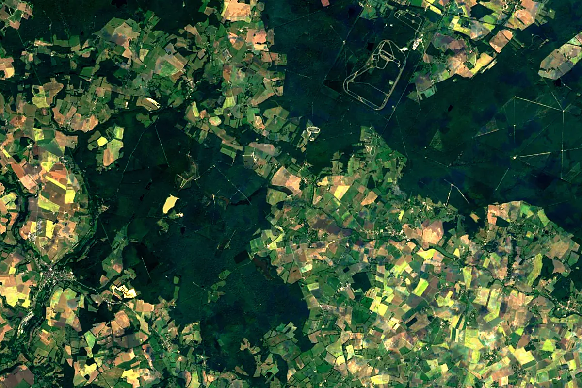
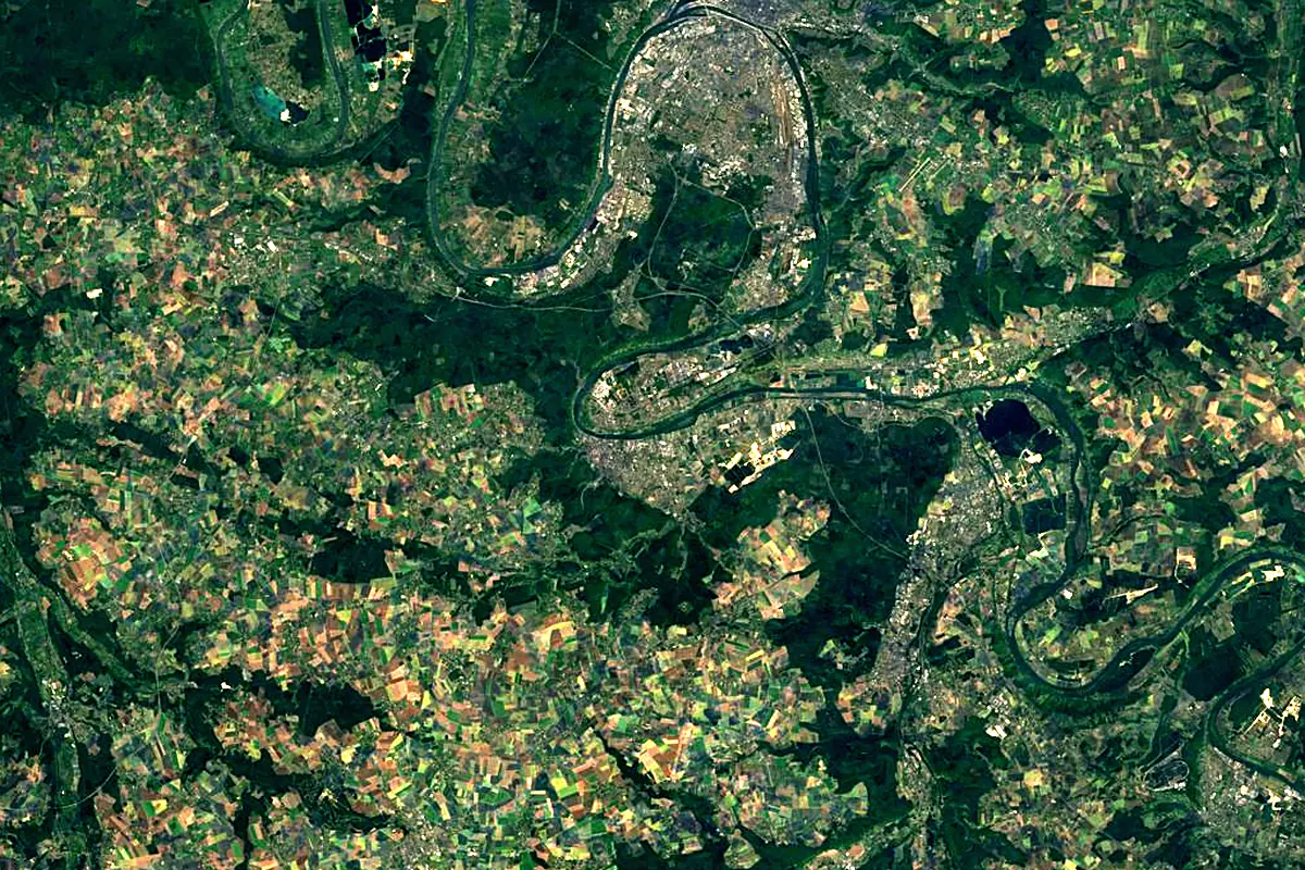
Sentinel-2 cloudless 2016 by EOX IT Services GmbH (contains modified Copernicus Sentinel data 2016), CC BY 4.0. The glowing line is the river as drawn by RiverATLAS.
Photos
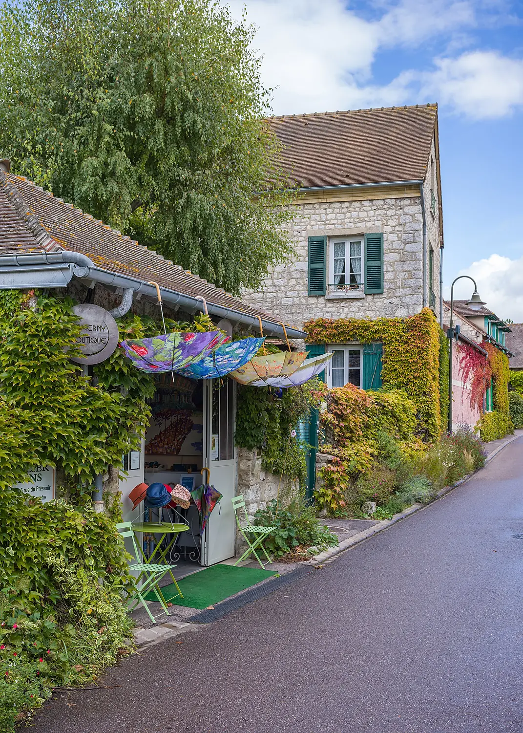
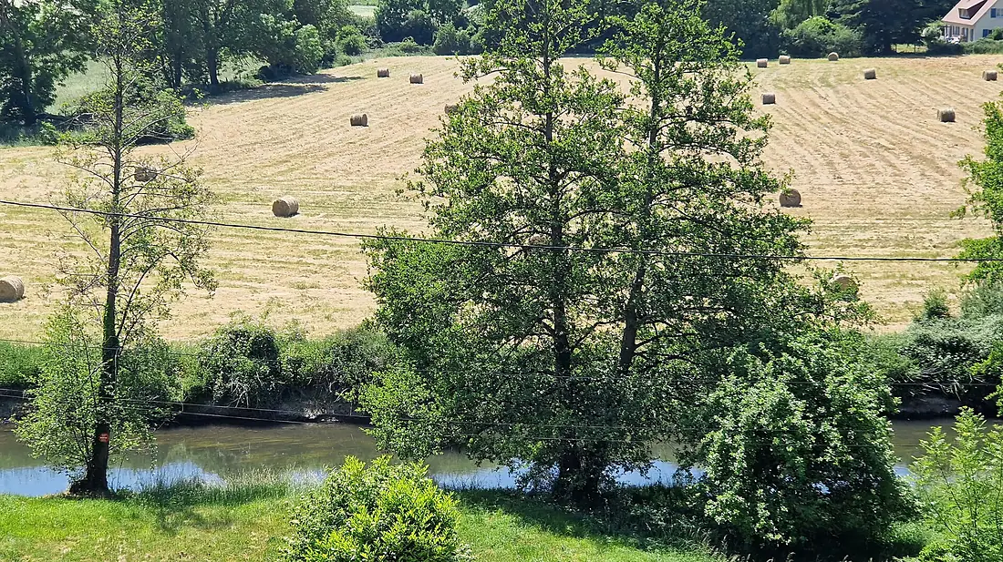
Eure in pictures
Tributaries
Where it flows, and what flows into it
It flows into
SeineFrance777 km500 m³/sTributaries (8)
Also: Iton, Avre, Drouette, Blaise, Vesgre, Voise, Maltorne, Couanon
Nearby
Rivers nearby
Where these numbers come from
| Name, length, places | Wikidata (Q23798) · CC0 |
|---|---|
| Course, profile, basin | RiverATLAS v1.0 (HydroATLAS, Linke et al. 2019) · CC BY 4.0 — followed from the source to the mouth given by Wikidata |
| Flow | WaterGAP (RiverATLAS), 1971–2000 · CC BY 4.0 |
| Climate along the river | WorldClim (RiverATLAS), 1970–2000 · CC BY 4.0 |
| Towns, bridges, dams | Wikidata · CC0; GeoNames · CC BY 4.0 |
| Along the river | © OpenStreetMap contributors · ODbL |
| Images | EOX Sentinel-2 cloudless 2016 · CC BY 4.0; Wikimedia Commons |
| Our other atlases | Lakeyas — Wikidata · CC0; © OpenStreetMap contributors · ODbL; GeoNames · CC BY 4.0; HydroLAKES · CC BY 4.0; NOAA OISST |
Every source and licence is on the data sources page.
The family
Do you prefer beaches, lakes, mountains, waterfalls, islands, rivers or canyons?
Same idea, other landscapes: field atlases built on open data, month by month, in seven languages.
 beaches
 Find your beach: sea temperature, sun and swimming month by month.Visit lakes
 Every lake on Earth: water temperature, ice, depth and the shore.Coming soonVisit
  mountains
 Every summit in 3D: summit weather, the 0 °C line, huts and trails.Visit
  waterfalls
 Every waterfall: height, flow month by month and when it roars.Coming soonVisit
  islands
 Every island from the sea up: size, sea temperature, ferries and 3D.Coming soonVisit
  rivers
 Every river from source to sea: the journey, the flow and the basin in numbers.You are here
 canyons
 Every canyon cut to scale: depth to the floor, rim and floor temperatures, trails and viewpoints.Coming soonVisit