River
Oise
341 km from source to mouth · France and Belgium.

 France and BelgiumFlows into Seine
In numbers
Length
341km
Average flow
110m³/s
Basin
16,667km²
Drop
176m
from 194 m to 18 m
Countries
2
The journey
From source to mouth
341 km of river and 68 stops on the way: 58 towns and cities on its banks, dams, bridges and the tributaries that feed it.
- 0 kmCalestienneat 194 m
- 9 kmHirson8,469 people
- 16 kmAnor3,099 people
- 16 kmMondrepuis1,028 people
- 34 kmÉtréaupont839 people
- 34 kmThontributary
- 68 kmGuise4,490 people
- 73 kmLesquielles-Saint-Germain754 people
- 91 kmBernot431 people
- 93 kmMont-d'Origny839 people
- 94 kmOrigny-Sainte-Benoite1,587 people
- 96 kmThenelles541 people
- 102 kmRibemont1,931 people
- 112 kmAlaincourt517 people
- 114 kmMoÿ-de-l'Aisne994 people
- 114 kmBrissy-Hamégicourt653 people
- 123 kmAchery584 people
- 126 kmSerretributary
- 127 kmDanizy609 people
- 129 kmLa Fère2,796 people
- 131 kmBeautor2,579 people
- 137 kmTergnier13,045 people
- 140 kmAmigny-Rouy707 people
- 140 kmCondren674 people
- 144 kmViry-Noureuil1,651 people
- 147 kmChauny11,596 people
- 148 kmSinceny2,005 people
- 150 kmBichancourt979 people
- 153 kmAbbécourt518 people
- 154 kmAilettetributary
- 158 kmQuierzy428 people
- 176 kmVersetributary
- 176 kmNoyon12,971 people
- 198 kmThourotte4,463 people
- 203 kmChoisy-au-Bac3,449 people
- 206 kmAisnetributary
- 207 kmArondetributary
- 210 kmMargny-lès-Compiègne8,677 people
- 210 kmCompiègne40,761 people
- 222 kmLacroix-Saint-Ouen5,415 people
- 228 kmAutomnetributary
- 229 kmVerberie3,898 people
- 242 kmPont-Sainte-Maxence12,361 people
- 255 kmVillers-Saint-Paul6,480 people
- 257 kmBrêchetributary
- 258 kmNogent-sur-Oise21,907 people
- 259 kmCreil36,301 people
- 262 kmMontataire14,257 people
- 264 kmThéraintributary
- 268 kmSaint-Leu-d'Esserent4,638 people
- 270 kmGouvieux8,867 people
- 272 kmNonettetributary
- 283 kmAsnières-sur-Oise3,127 people
- 290 kmBeaumont-sur-Oise10,232 people
- 290 kmPersan14,359 people
- 294 kmChampagne-sur-Oise5,036 people
- 299 kmL'Isle-Adam12,493 people
- 304 kmMériel5,347 people
- 307 kmMéry-sur-Oise9,983 people
- 308 kmAuvers-sur-Oise6,863 people
- 316 kmPontoise31,970 people
- 317 kmSaint-Ouen-l'Aumône25,578 people
- 321 kmÉragny-sur-Oise18,436 people
- 324 kmCergy-Pontoise204,228 people
- 325 kmCergy70,906 people
- 325 kmVauréal16,079 people
- 327 kmJouy-le-Moutier17,854 people
- 331 kmConflans-Sainte-Honorine36,958 people
- 334 kmAndrésy13,834 people
- 341 kmSeineat 18 m
Water level along the river (RiverATLAS; the height is exaggerated). Towns: GeoNames and Wikidata; bridges, dams and tributaries: Wikidata.
River in Belgium and France
At the mouth it carries 110 m³/s on average: an Olympic pool every 23 seconds. It drops from 194 m to 18 m, 0.5 m per kilometre on average. Its basin covers 16,667 km², about the size of SZ. 14.0 million people live in it. Highest water: from December to February. Its dams hold back little of its water (6.9% of a year's flow).
Where to start
- Cergy-PontoiseLargest city on its banks · 204,228 people
- Charles de Gaulle International Airport (CDG)Nearest airport with scheduled flights, 36 km from the cityCar hire at CDG airport (Paris)Discover Cars · Affiliate link↗
- On the water32 ferry piers, marinas, boat rentals and boat ramps along the river (OpenStreetMap)
- From May to SeptemberThe best months to visit
Oise, month by month
Highest water: from December to February
Best months to visit: from May to September.
From about 150 m³/s in the lowest month to 690 m³/s in the highest. An estimate: the monthly flow is modelled from the lowest and highest months of WaterGAP (RiverATLAS, 1971–2000) and the rain and snow along the river (WorldClim). Dams change the real rhythm. The chip is the average air temperature; below it, the month's rain.
Plan the trip
Plan the trip: boat trips, a bed by the river, a car
Some links above are affiliate links: if you book through them we may earn a commission, at no extra cost to you. It never changes what the data on this page says.
The basin
Oise: the basin in numbers
61,326 km² of land send their water to this river. This is what lives on it.
- 14.0millionpeople live in the basin
- 228/km²people per km²
- 181maverage altitude of the basin
- 696mmof rain a year (basin average)
- 10.1°Caverage air temperature
- 9%protected areas
- 0.3%covered by lakes
- 0.9km³held in reservoirs
What covers the basin
- 11% Forest
- 51% Cropland
- 9% Pasture
- 6% Towns and cities
RiverATLAS (HydroATLAS v1.0, CC BY 4.0): land cover, people, protected areas, glaciers and dams over the whole basin upstream of the mouth.
Along the river
Oise: what you find on the way
- 45WeirsBarrage de Tupigny, Barrage de Venette, Barrage de Sarron and 42 more
- 175LocksCanal de la Sambre à l’Oise, Canal de Saint-Quentin, Canal Latéral à l'Oise and 172 more
- 1WaterfallsCascade de Blangy
- 16Boat ramps
- 4Ferry piersEmbarcation de l'île Nancy and 3 more
- 11MarinasHalte Fluviale Alfred Leroux à Chauny, Halte fluviale Alfred-Leroux, Port de Compiègne and 8 more
From OpenStreetMap, within 2.3 km of the river. Not mapped is not the same as not there.
From space
The source and the mouth, seen from orbit
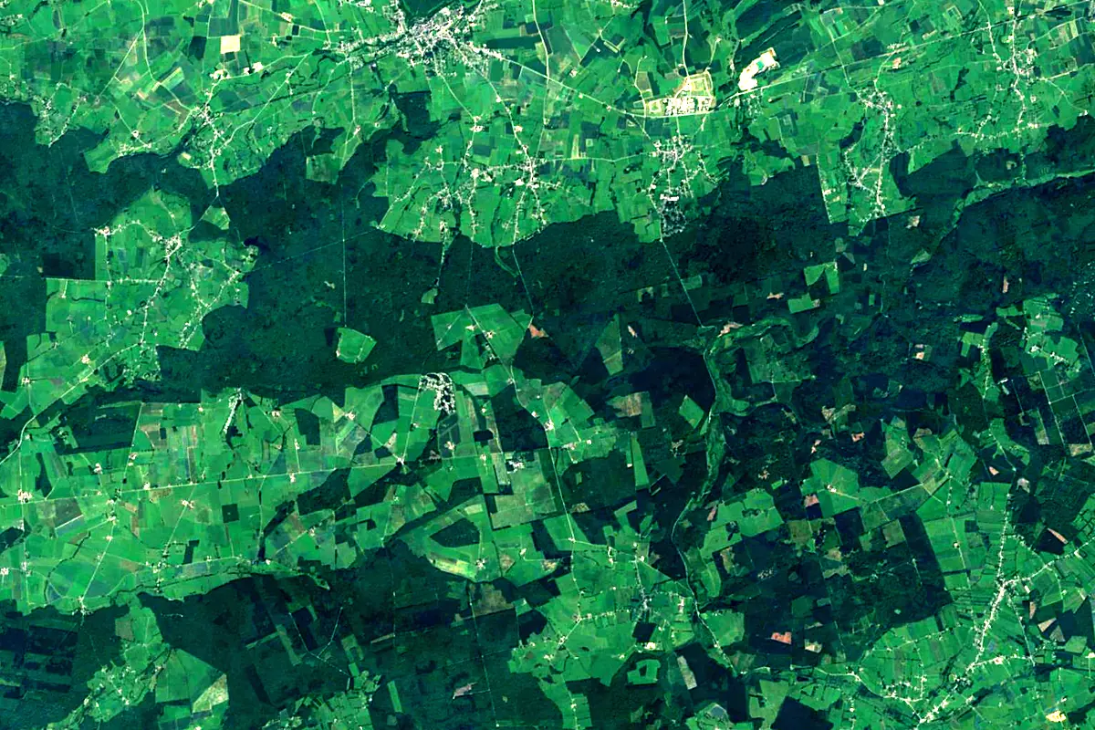
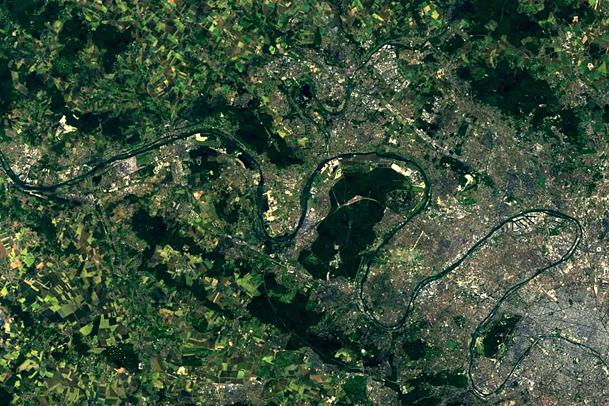
Sentinel-2 cloudless 2016 by EOX IT Services GmbH (contains modified Copernicus Sentinel data 2016), CC BY 4.0. The glowing line is the river as drawn by RiverATLAS.
Photos
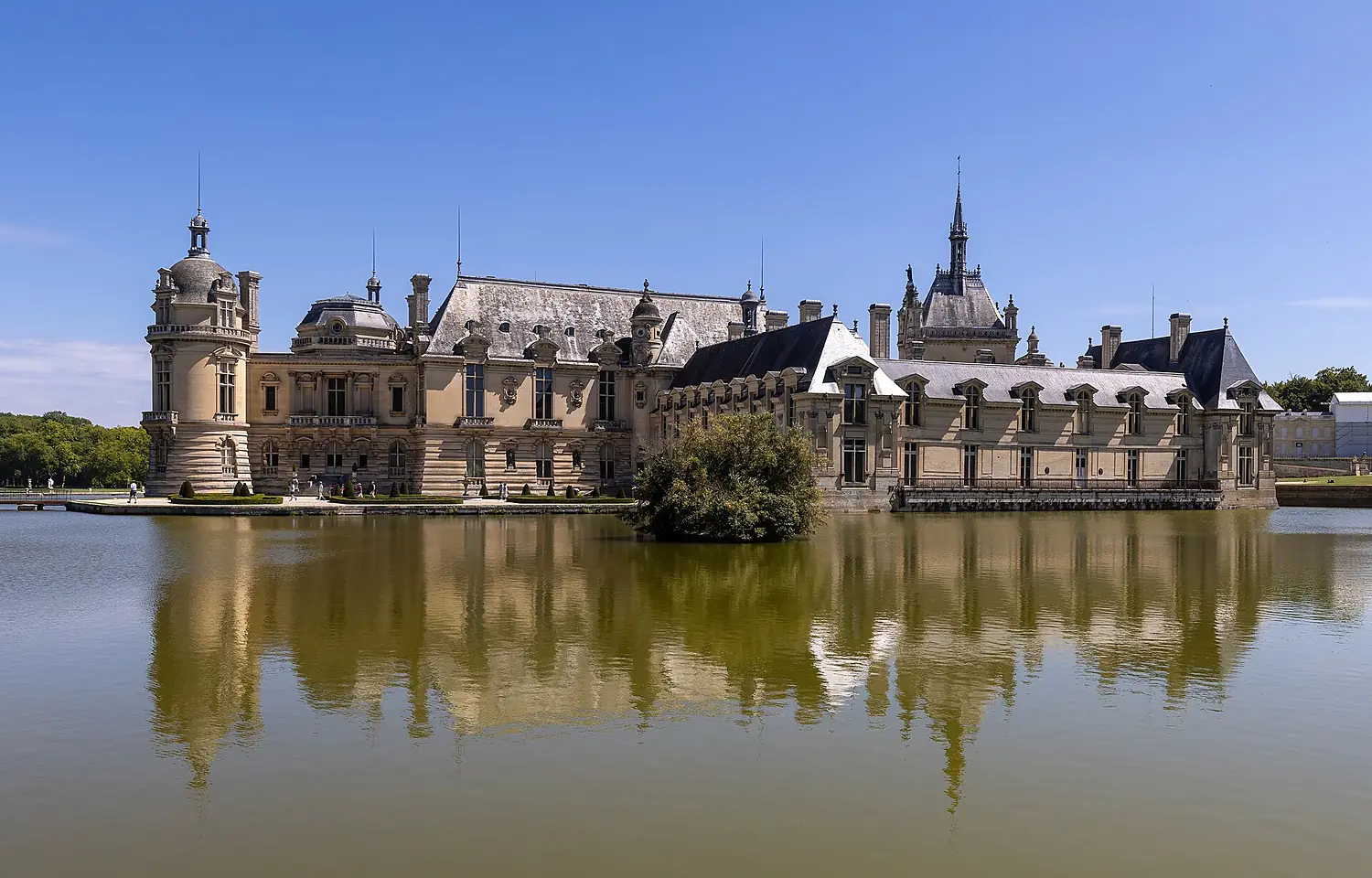
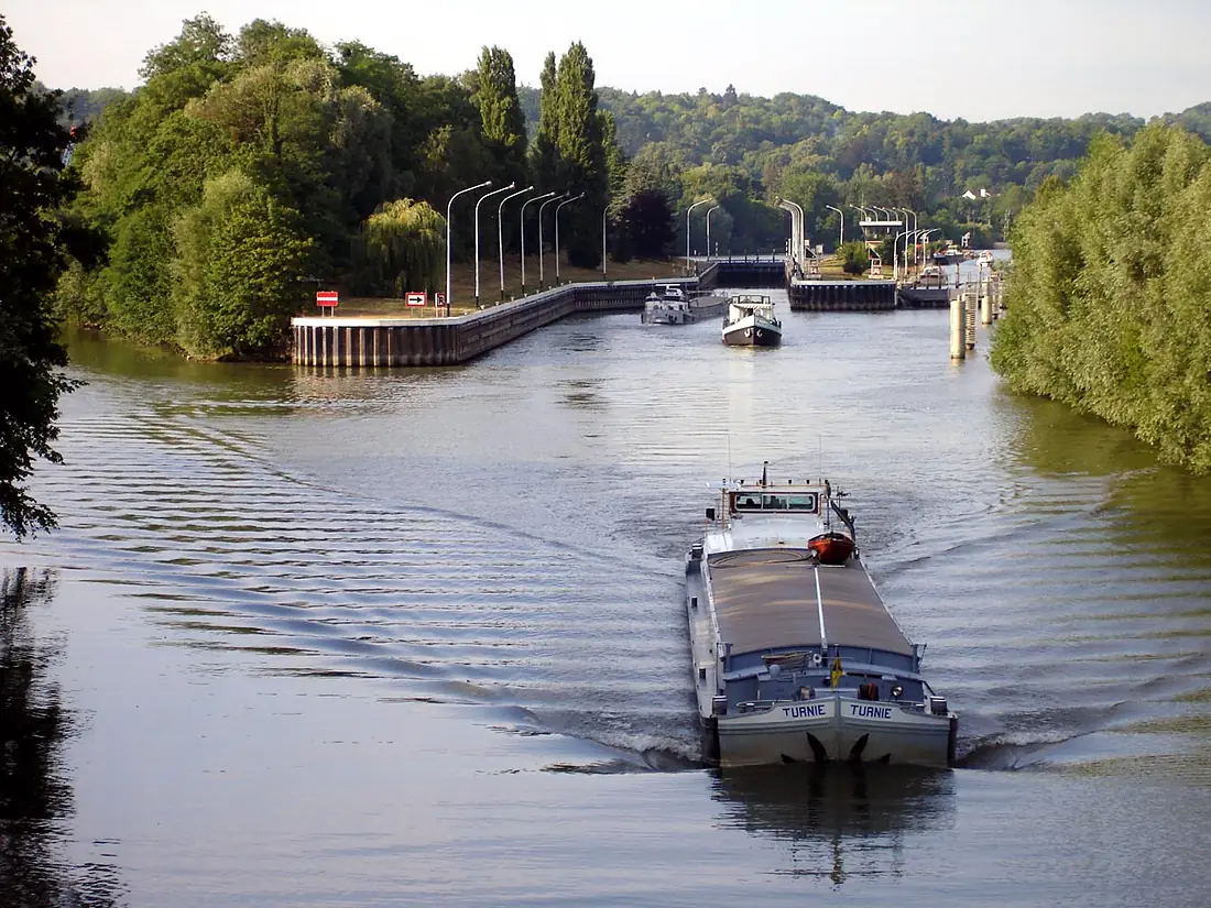
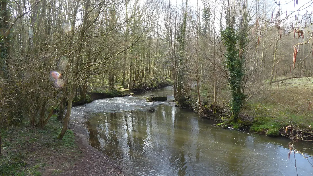
Oise in pictures
Tributaries
Where it flows, and what flows into it
It flows into
SeineFrance777 km500 m³/sTributaries (20)
Also: Thérain, Ailette, Nonette, Serre, Automne, Thon, Esches, Aronde, Brêche, Gland, Sausseron, Noirieu, Thève, Matz, Viosne, Divette, Verse, ru de Liesse, Ruisseau d’Anor
Where these numbers come from
| Name, length, places | Wikidata (Q200231) · CC0 |
|---|---|
| Course, profile, basin | RiverATLAS v1.0 (HydroATLAS, Linke et al. 2019) · CC BY 4.0 — followed from the source to the mouth given by Wikidata |
| Flow | WaterGAP (RiverATLAS), 1971–2000 · CC BY 4.0 |
| Climate along the river | WorldClim (RiverATLAS), 1970–2000 · CC BY 4.0 |
| Towns, bridges, dams | Wikidata · CC0; GeoNames · CC BY 4.0 |
| Along the river | © OpenStreetMap contributors · ODbL |
| Images | EOX Sentinel-2 cloudless 2016 · CC BY 4.0; Wikimedia Commons |
Every source and licence is on the data sources page.
The family
Do you prefer beaches, lakes, mountains, waterfalls, islands, rivers or canyons?
Same idea, other landscapes: field atlases built on open data, month by month, in seven languages.
 beaches
 Find your beach: sea temperature, sun and swimming month by month.Visit
  lakes
lakes Every lake on Earth: water temperature, ice, depth and the shore.Coming soonVisit
  mountains
 Every summit in 3D: summit weather, the 0 °C line, huts and trails.Visit
  waterfalls
 Every waterfall: height, flow month by month and when it roars.Coming soonVisit
  islands
 Every island from the sea up: size, sea temperature, ferries and 3D.Coming soonVisit
  rivers
 Every river from source to sea: the journey, the flow and the basin in numbers.You are here
 canyons
 Every canyon cut to scale: depth to the floor, rim and floor temperatures, trails and viewpoints.Coming soonVisit