River
Mulde
147 km from source to mouth · Germany.
 GermanyFlows into Elbe
In numbers
Length
147km
Average flow
65m³/s
Basin
7,400km²
Drop
92m
from 140 m to 48 m
Country
1
The journey
From source to mouth
147 km of river and 61 stops on the way: 26 towns and cities on its banks, dams, bridges and the tributaries that feed it.
- 0 kmFreiberger Muldeat 140 m
- 0 kmColditz8,209 people
- 3 kmZschadrass3,763 people
- 6 kmSermuth600 people
- 8 kmFreiberger Muldetributary
- 8 kmZwickau Muldetributary
- 9 kmViadukt Kössern
- 11 kmStraßenbrücke Kössern
- 15 kmGroßbothen3,602 people
- 19 kmRabenstein Bridge
- 19 kmHängebrücke Grimma
- 20 kmGrimma27,554 people
- 21 kmPöppelmannbrücke
- 21 kmMuldebrücke Grimma
- 26 kmMuldebrücke Golzern
- 27 kmMulde bridge Nerchau
- 29 kmNerchau4,073 people
- 32 kmMulde bridge Trebsen
- 32 kmTrebsen4,244 people
- 35 kmMutzschener Watertributary
- 43 kmWurzen16,159 people
- 43 kmMulde road bridge Wurzen
- 43 kmBennewitz5,211 people
- 49 kmWasserbrücke Canitz
- 53 kmThallwitz3,894 people
- 58 kmMuldebrücke Eilenburg
- 59 kmMulde bridge from 1999 at Eilenburg
- 59 kmMulde bridge from 1913 at Eilenburg
- 59 kmEilenburg16,539 people
- 61 kmLossatributary
- 66 kmZschepplin3,373 people
- 73 kmLaußig2,082 people
- 82 kmBad Düben7,717 people
- 82 kmMuldebrücke Bad Düben
- 82 kmStream Gaging Station
- 82 kmDüben Castle
- 84 kmSlagheap Rotes Ufer
- 85 kmRotes Ufer
- 95 kmLöbnitz2,216 people
- 99 kmmulde lake bridge at Pouch
- 100 kmPouch1,675 people
- 105 kmBitterfeld-Wolfen36,592 people
- 108 kmFriedersdorf2,028 people
- 109 kmMulde road bridge Friedersdorf
- 111 kmGreppin2,840 people
- 112 kmMuldenstein2,197 people
- 116 kmJeßnitz3,667 people
- 117 kmBobbau1,697 people
- 120 kmRaguhn3,732 people
- 132 kmA 9 Mulde highway bridge
- 133 kmsouthern Tiergarten Mulde bridge Dessau
- 134 kmHalber Mond am Entenfang
- 135 kmSchwarzer See
- 135 kmTrockenhegersee
- 137 kmTannenheger bridge
- 138 kmTiergarten bridge, Dessau
- 138 kmDessau-Roßlau75,035 people
- 138 kmDessauUNESCO World Heritage
- 139 kmPeace bridge
- 140 kmMulde railway bridge Dessau–Wörlitz
- 142 kmHunting bridge Dessau
- 145 kmRoßlau12,183 people
- 147 kmElbeat 48 m
Water level along the river (RiverATLAS; the height is exaggerated). Towns: GeoNames and Wikidata; bridges, dams and tributaries: Wikidata.
River in Saxony and Saxony-Anhalt, Germany
At the mouth it carries 65 m³/s on average: an Olympic pool every 38 seconds. It drops from 140 m to 48 m, 0.6 m per kilometre on average. Its basin covers 7,400 km², about the size of PR. 1.5 million people live in it. Highest water: February and April. Dams and reservoirs hold back a large share of its water (18% of a year's flow).
Where to start
- DessauLargest city on its banks · 83,616 people
- Leipzig/Halle Airport (LEJ)Nearest airport with scheduled flights, 46 km from the cityCar hire at LEJ airport (Schkeuditz)Discover Cars · Affiliate link↗
- On the water48 ferry piers, marinas, boat rentals and boat ramps along the river (OpenStreetMap)
- Kayak and canoe6 put-ins and rapids mapped (OpenStreetMap)
- From May to SeptemberThe best months to visit
Mulde, month by month
Highest water: February and April
Best months to visit: from May to September.
From about 31 m³/s in the lowest month to 140 m³/s in the highest. An estimate: the monthly flow is modelled from the lowest and highest months of WaterGAP (RiverATLAS, 1971–2000) and the rain and snow along the river (WorldClim). Dams change the real rhythm. The chip is the average air temperature; below it, the month's rain.
Plan the trip
Plan the trip: boat trips, a bed by the river, a car
Some links above are affiliate links: if you book through them we may earn a commission, at no extra cost to you. It never changes what the data on this page says.
The basin
Mulde: the basin in numbers
7,133 km² of land send their water to this river. This is what lives on it.
- 1.5millionpeople live in the basin
- 210/km²people per km²
- 392maverage altitude of the basin
- 643mmof rain a year (basin average)
- 7.4°Caverage air temperature
- 30%protected areas
- 0.5%covered by lakes
- 0.3km³held in reservoirs
What covers the basin
- 27% Forest
- 40% Cropland
- 12% Pasture
- 12% Towns and cities
RiverATLAS (HydroATLAS v1.0, CC BY 4.0): land cover, people, protected areas, glaciers and dams over the whole basin upstream of the mouth.
Along the river
Mulde: what you find on the way
- 40WeirsSchöpfwerk, Grimmaer Wehr, Golzerner Wehr and 37 more
- 1Locks
- 6Canoe put-insWurzen, Ruderclub Eilenburg and 4 more
- 25Boat rampsSchlauchboot Ein-/Aussatzstelle, Bahren, Neichen and 22 more
- 10Ferry piersPersonenfähre, Höfgen, Kloster Nimbschen and 7 more
- 10MarinasSeesportverein Albin Köbis Grimma e.V., Marina Bitterfelder Stadthafen, Marina Bernsteinsee and 7 more
- 2River beachesBadestrand, Stillinge
From OpenStreetMap, within 1.7 km of the river. Not mapped is not the same as not there.
Cross-checked with our atlases
Mulde in our other atlases
What our sister atlases know about the waterfalls on this river, the lakes it flows through, the beaches at its mouth, the mountains where it rises and the islands off its mouth.
 46mountains at the sourcePeakyas
Mountains at the source (46)
Within 15 km of the source, by Peakyas
- Rochlitzer Berg15 km away353m
- Butterberg8.5 km away226m
- Steinhübel3.0 km away223m
- Bockberg im Klosterholz6.8 km away198m
- Totenberg7.3 km away183m
- Eichberg5.8 km away180m
- Ruhm-Berg11 km away169m
- Schieferberg6.8 km away
38 more on PeakyasOpen Peakyas ↗
From space
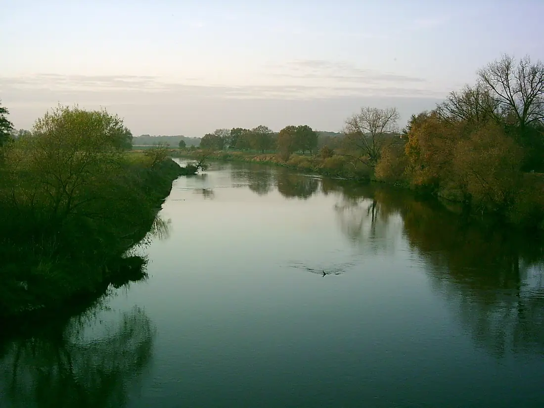
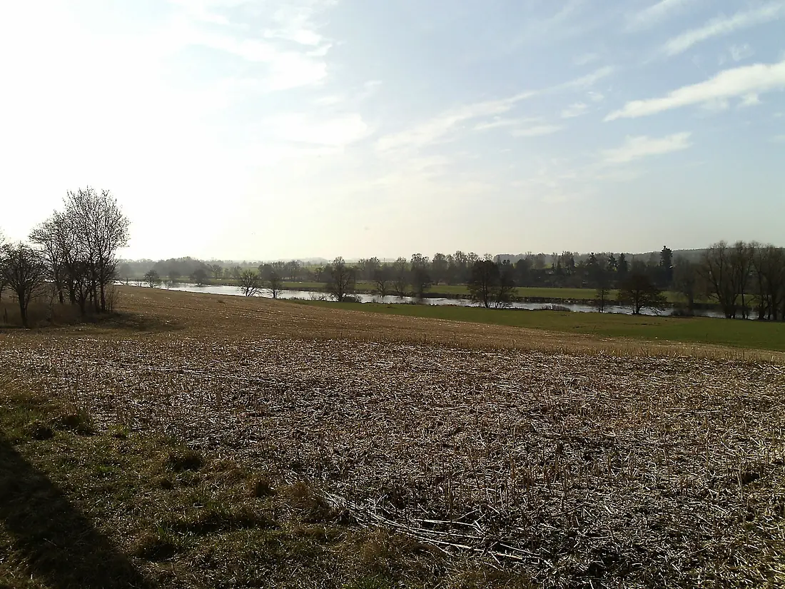
The source and the mouth, seen from orbit
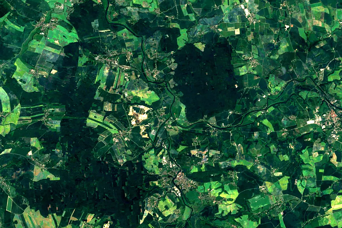
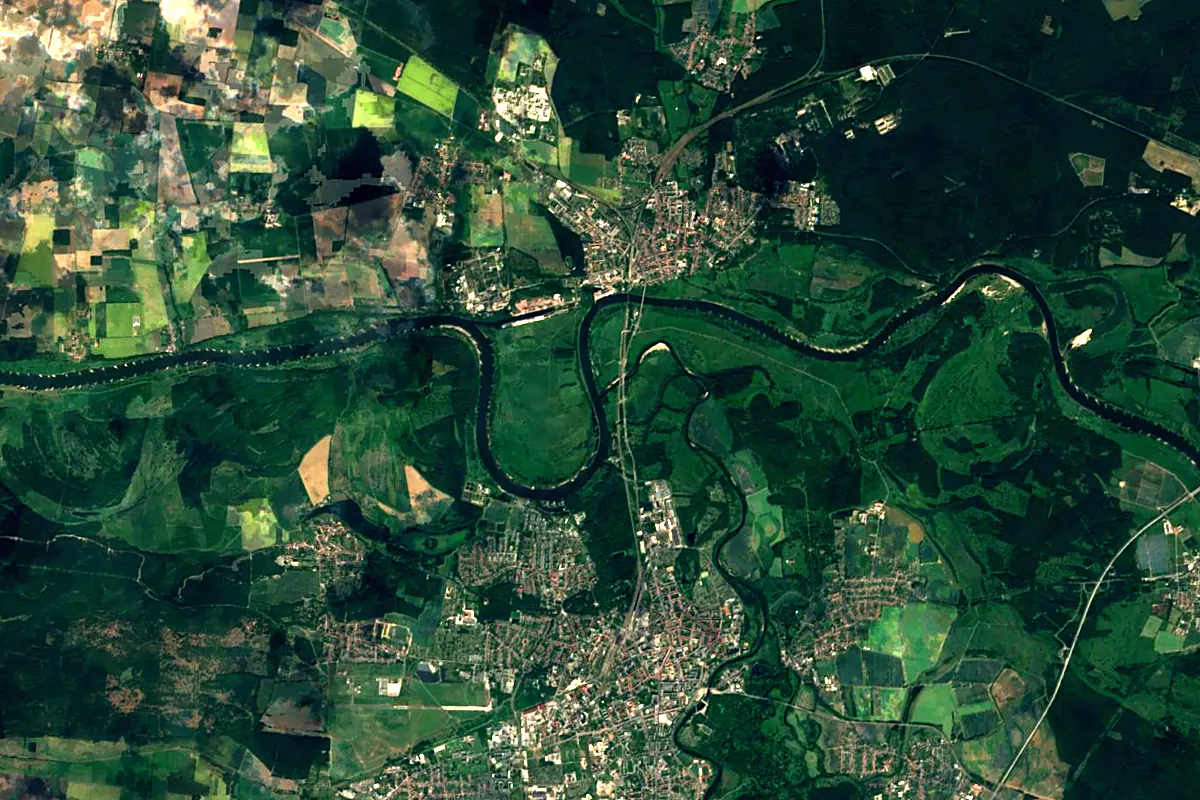
Sentinel-2 cloudless 2016 by EOX IT Services GmbH (contains modified Copernicus Sentinel data 2016), CC BY 4.0. The glowing line is the river as drawn by RiverATLAS.
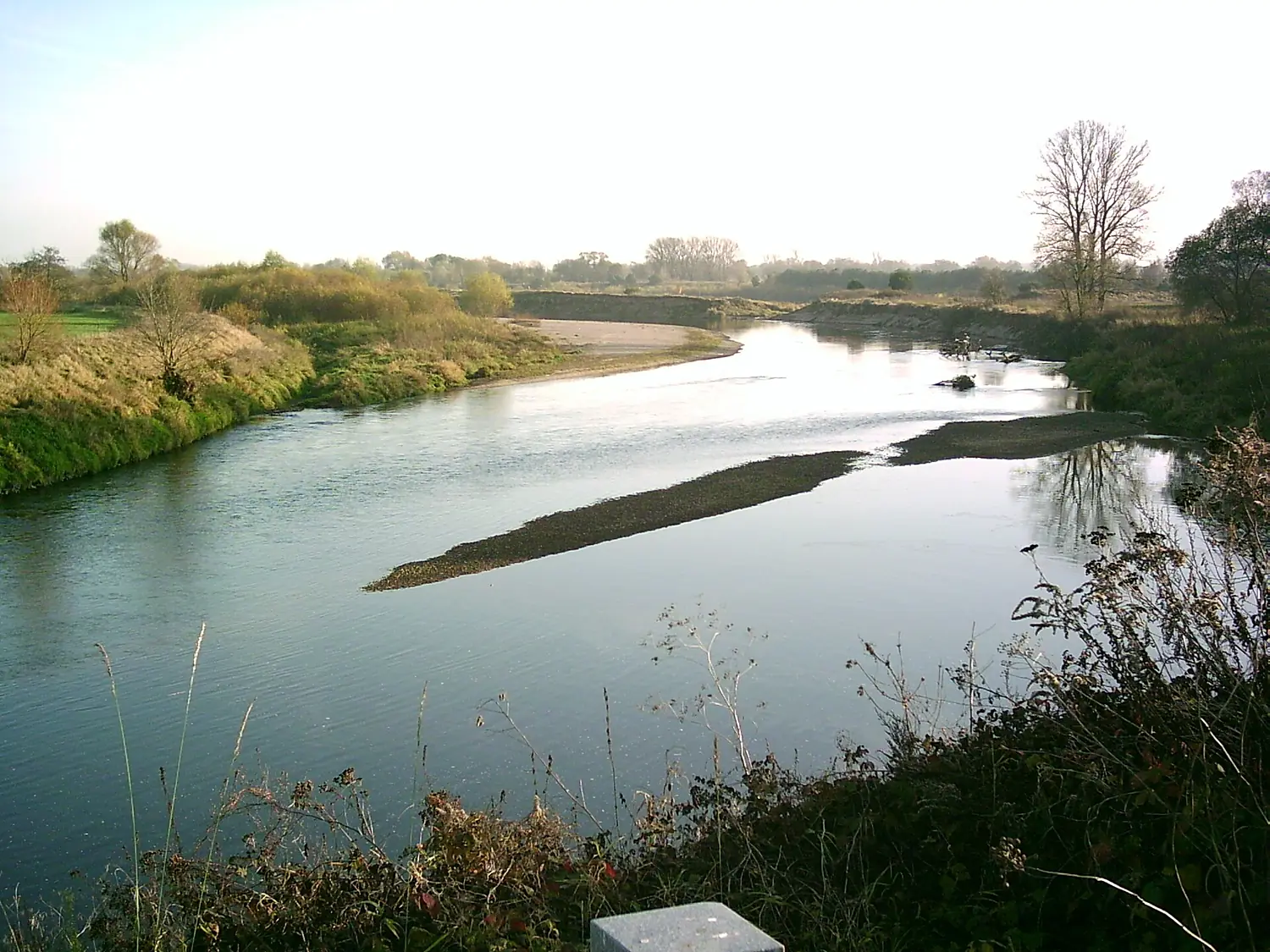
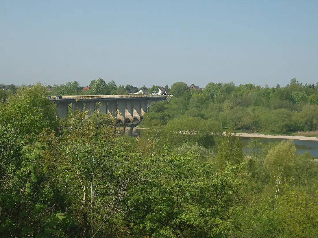
Tributaries
Where it flows, and what flows into it
Tributaries (5)
Also: Freiberger Mulde, Zwickau Mulde, Lossa, Schwarzbach, Mutzschener Water
 Czechia
Nearby
Rivers nearby
Germany413 km120 m³/s27 km awayBlack ElsterGermany179 km350 m³/s42 km awayWeisse ElsterGermany257 km100 m³/s52 km awaySpreeGermany382 km36 m³/s100 km awayHavelGermany325 km89 m³/s113 km awayUnstrutGermany192 km4.6 m³/s83 km awayWarta Poland808 km200 m³/s177 km awayGeraGermany85 km54 m³/s122 km away
Where these numbers come from
| Name, length, places | Wikidata (Q1680) · CC0 |
|---|---|
| Course, profile, basin | RiverATLAS v1.0 (HydroATLAS, Linke et al. 2019) · CC BY 4.0 — followed from the source to the mouth given by Wikidata |
| Flow | WaterGAP (RiverATLAS), 1971–2000 · CC BY 4.0 |
| Climate along the river | WorldClim (RiverATLAS), 1970–2000 · CC BY 4.0 |
| Towns, bridges, dams | Wikidata · CC0; GeoNames · CC BY 4.0 |
| Along the river | © OpenStreetMap contributors · ODbL |
| Images | EOX Sentinel-2 cloudless 2016 · CC BY 4.0; Wikimedia Commons |
| Our other atlases | Peakyas — Wikidata · CC0; © OpenStreetMap contributors · ODbL; GeoNames · CC BY 4.0; HydroLAKES · CC BY 4.0; NOAA OISST |
Every source and licence is on the data sources page.
The family
Do you prefer beaches, lakes, mountains, waterfalls, islands, rivers or canyons?
Same idea, other landscapes: field atlases built on open data, month by month, in seven languages.
 beaches
 Find your beach: sea temperature, sun and swimming month by month.Visit
  lakes
lakes Every lake on Earth: water temperature, ice, depth and the shore.Coming soonVisit mountains
 Every summit in 3D: summit weather, the 0 °C line, huts and trails.Visit
  waterfalls
 Every waterfall: height, flow month by month and when it roars.Coming soonVisit
  islands
 Every island from the sea up: size, sea temperature, ferries and 3D.Coming soonVisit
  rivers
 Every river from source to sea: the journey, the flow and the basin in numbers.You are here
 canyons
 Every canyon cut to scale: depth to the floor, rim and floor temperatures, trails and viewpoints.Coming soonVisit