River
Ohře
247 km from source to mouth · Czechia and Germany.
 Czechia and GermanyFlows into Elbe2nd longest in Czechia
In numbers
Length
247km
Average flow
38m³/s
Basin
5,614km²
Drop
306m
from 451 m to 145 m
Countries
2
The journey
From source to mouth
247 km of river and 67 stops on the way: 15 towns and cities on its banks, dams, bridges and the tributaries that feed it.
- 0 kmFichtel Mountainsat 451 m
- 0 kmMarktleuthen railway viaduct
- 14 kmSelbbachtributary
- 15 kmRöslautributary
- 25 kmÚdolní nádrž Skalka1.7 km²
- 26 kmWooden covered bridge in Cheb
- 27 kmCheb32,808 people
- 28 kmRailway bridge over the Ohře in Cheb
- 31 kmSlatinný potoktributary
- 39 kmJesenice Reservoir6.0 km²
- 40 kmSázektributary
- 40 kmWondrebtributary
- 40 kmFleißenbachtributary
- 45 kmLiboctributary
- 46 kmKynšperk nad Ohří4,527 people
- 60 kmLibavatributary
- 62 kmSokolov21,908 people
- 62 kmBridge of Kraslická street over the Ohře in Sokolov
- 62 kmSvatavatributary
- 66 kmTěšovický vodopád2 m
- 67 kmbridge of D6 highway over the Ohře near Sokolov
- 72 kmKaiser Ferdinand Bridge
- 72 kmroad bridge in Loket
- 72 kmLoket3,050 people
- 73 kmLoket - dolní jez
- 85 kmTuhnický jez
- 85 kmTuhnický most
- 85 kmRolavatributary
- 86 kmPlynárenská lávka
- 87 kmCheb bridge
- 87 kmKarlovy Vary49,073 people
- 87 kmTeplátributary
- 100 kmLučinsko - svatoborské vodopády
- 100 kmHorní Svatoborský vodopád2 m
- 103 kmKyselka841 people
- 103 kmKyselka - železniční most
- 105 kmRadošov715 people
- 105 kmRadošovský most
- 105 kmRadošovské vodopády
- 107 kmBridge over the Ohře in Velichov
- 112 kmBystřicetributary
- 129 kmKlášterec nad Ohří13,980 people
- 135 kmPrunéřovský potoktributary
- 137 kmKadaň18,090 people
- 138 kmSteinkopfův mlýn
- 140 kmweir Želina
- 153 kmNechranice Reservoir11 km²
- 166 kmChain bridge
- 168 kmŽatec18,984 people
- 174 kmBlšankatributary
- 174 kmSaaz Hop Landscape
- 184 kmHasinatributary
- 185 kmBridge of Husova street over the Ohře in Postoloprty
- 185 kmInundation bridge in Postoloprty
- 185 kmPostoloprty4,924 people
- 190 kmChomutovkatributary
- 193 kmmost Veslařů
- 193 kmLouny18,068 people
- 194 kmRailway bridge over the Ohře in Louny
- 206 kmWatermill in Pátek (Peruc)
- 217 kmLibochovice3,627 people
- 221 kmRosovkatributary
- 232 kmWatermill in Doksany
- 237 kmČepeltributary
- 237 kmBohušovice nad Ohří2,415 people
- 240 kmPosádkový pšeničný mlýn
- 240 kmPosádkový žitný mlýn
- 244 kmLitoměřice24,489 people
- 247 kmElbeat 145 m
Water level along the river (RiverATLAS; the height is exaggerated). Towns: GeoNames and Wikidata; bridges, dams and tributaries: Wikidata.
River in Germany and the Czech Republic
At the mouth it carries 38 m³/s on average: an Olympic pool every 66 seconds. It drops from 451 m to 145 m, 1.2 m per kilometre on average. Its basin covers 5,614 km², about the size of BN. 5.8 million people live in it. Highest water: from March to May; lowest: from December to February. Dams and reservoirs hold back a large share of its water (24% of a year's flow).
Where to start
- Karlovy VaryLargest city on its banks · 49,073 people
- Karlovy Vary Airport (KLV)Nearest airport with scheduled flights, 4 km from the cityCar hire at PRG airport (Prague)Discover Cars · Affiliate link↗
- On the water14 ferry piers, marinas, boat rentals and boat ramps along the river (OpenStreetMap)
- Kayak and canoe1 put-ins and rapids mapped (OpenStreetMap)
- From June to SeptemberThe best months to visit
Ohře, month by month
Highest water: from March to May
Lowest water: from December to February. Best months to visit: from June to September.
From about 150 m³/s in the lowest month to 650 m³/s in the highest. An estimate: the monthly flow is modelled from the lowest and highest months of WaterGAP (RiverATLAS, 1971–2000) and the rain and snow along the river (WorldClim). Dams change the real rhythm. The chip is the average air temperature; below it, the month's rain.
Plan the trip
Plan the trip: boat trips, a bed by the river, a car
Some links above are affiliate links: if you book through them we may earn a commission, at no extra cost to you. It never changes what the data on this page says.
The basin
Ohře: the basin in numbers
48,130 km² of land send their water to this river. This is what lives on it.
- 5.8millionpeople live in the basin
- 120/km²people per km²
- 476maverage altitude of the basin
- 670mmof rain a year (basin average)
- 7.2°Caverage air temperature
- 15%protected areas
- 0.6%covered by lakes
- 2.2km³held in reservoirs
What covers the basin
- 41% Forest
- 37% Cropland
- 12% Pasture
- 5% Towns and cities
RiverATLAS (HydroATLAS v1.0, CC BY 4.0): land cover, people, protected areas, glaciers and dams over the whole basin upstream of the mouth.
Along the river
Ohře: what you find on the way
- 168WeirsJez Kynšperk nad Ohří, Tuhnice, Vakový jez and 165 more
- 3WaterfallsUmělý vodopád, Loketské kaskády, Radošovské vodopády
- 1Canoe put-ins
- 2Boat ramps
- 4Ferry piersLitoměřice, přístav, Litoměřice, Přístaviště Lodní náměstí and 2 more
- 1MarinasYacht-klub Lovosice
From OpenStreetMap, within 2.2 km of the river. Not mapped is not the same as not there.
Cross-checked with our atlases
Ohře in our other atlases
What our sister atlases know about the waterfalls on this river, the lakes it flows through, the beaches at its mouth, the mountains where it rises and the islands off its mouth.
 4waterfalls on the riverCascadyas
 3lakes on its wayLakeyas
 47mountains at the sourcePeakyas
Waterfalls (4)
On the river, by Cascadyas
- Těšovický vodopádkm 602m
- Lučinsko - svatoborské vodopádykm 90
- Horní Svatoborský vodopádkm 902m
- Radošovské vodopádykm 94
Cascadyas is coming soonOpen Cascadyas ↗
Lakes and reservoirs (3)
Lakes it flows through, by Lakeyas
- Údolní nádrž Skalkakm 22 · 14 m deep1.7km²
- Jesenice Reservoirkm 35 · 18 m deep6.0km²
- Nechranice Reservoirkm 138 · 46 m deep11km²
Lakeyas is coming soonOpen Lakeyas ↗
Mountains at the source (47)
Within 15 km of the source, by Peakyas
- Kapellenberg11 km away759m
- Steinberg13 km away705m
- Kohlberg6.5 km away633m
- Ruheberg11 km away692m
- Wappenstein14 km away672m
- Zelená hora5.8 km away641m
- Wartberg9.0 km away628m
- Lindenberg5.6 km away643m
39 more on PeakyasOpen Peakyas ↗
From space
The source and the mouth, seen from orbit
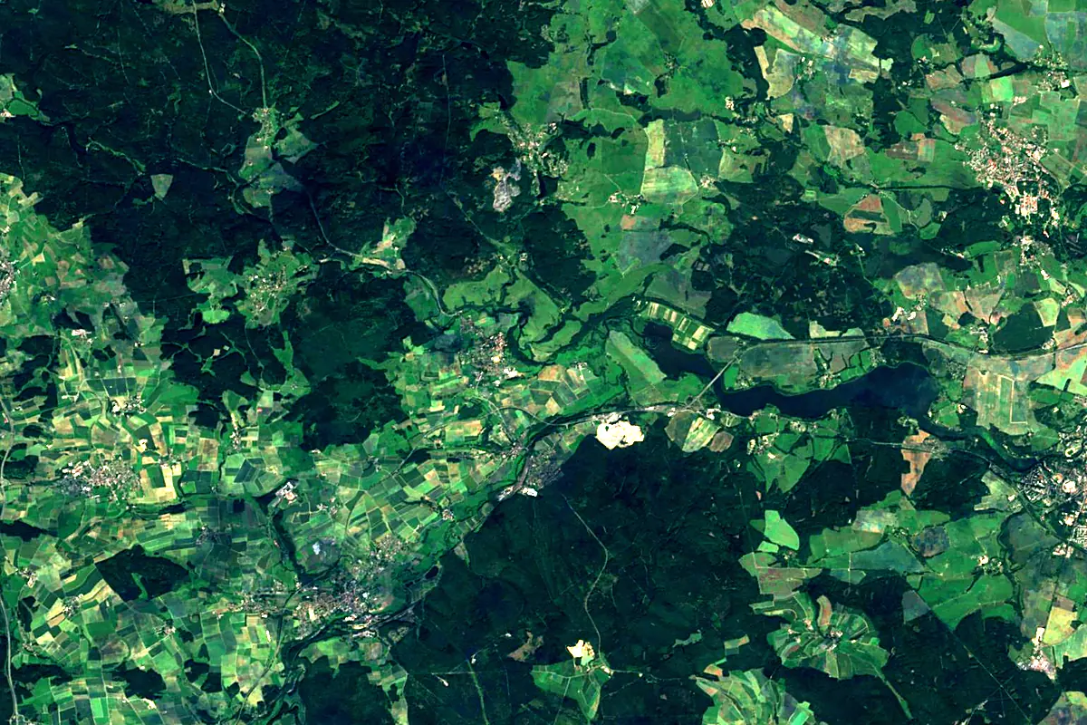
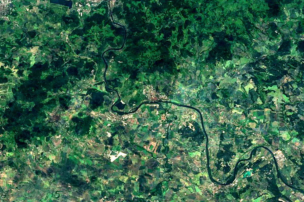
Sentinel-2 cloudless 2016 by EOX IT Services GmbH (contains modified Copernicus Sentinel data 2016), CC BY 4.0. The glowing line is the river as drawn by RiverATLAS.
Photos
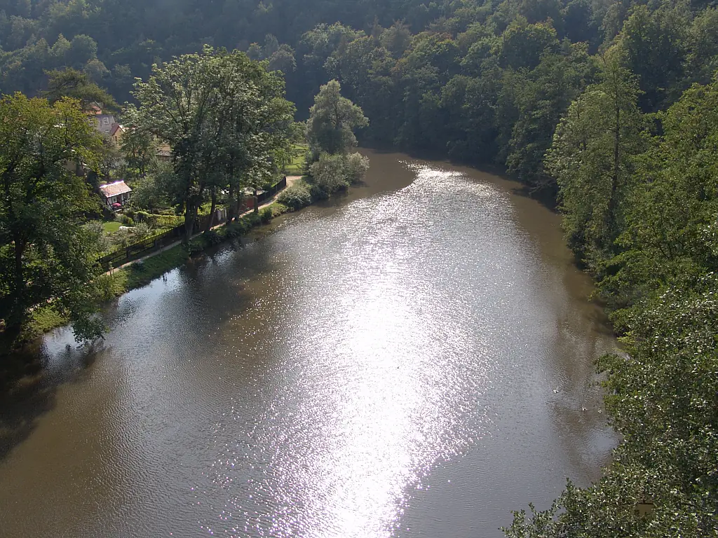
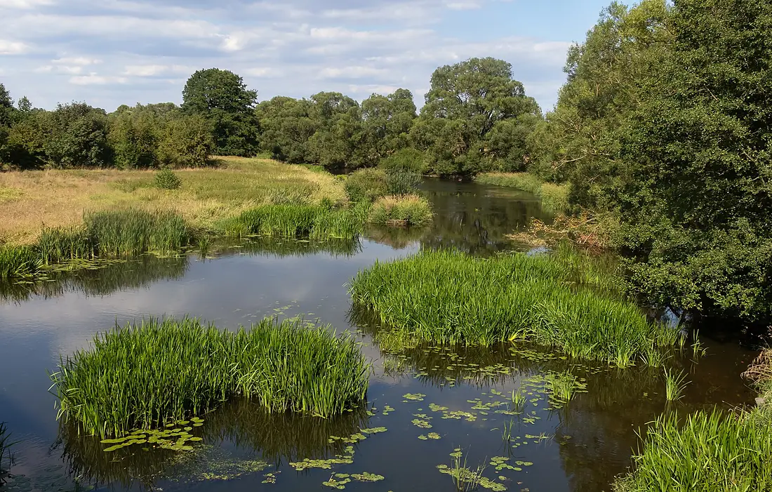
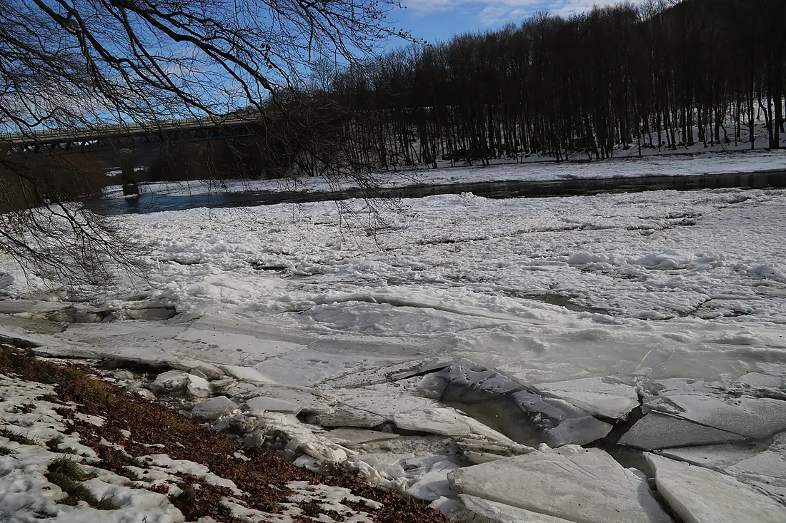
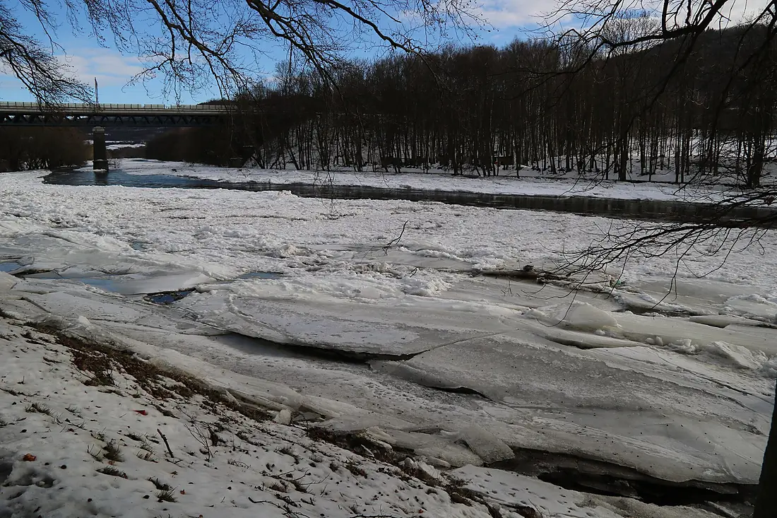
Ohře in pictures
Tributaries
Where it flows, and what flows into it
Tributaries (57)
Also: Teplá, Wondreb, Rolava, Blšanka, Chomutovka, Liboc, Svatava, Fleißenbach, Bystřice, Selbbach, Röslau, Prunéřovský potok, Rosovka, Liboc, Hasina, Čepel, Sázek, Podmileský potok, Libava, Lomnice, Slatinný potok, Libský potok, Silberbach, Chodovský potok
Nearby
Rivers nearby
Czechia430 km150 m³/s30 km awayJizeraCzechia167 km100 m³/s56 km awayBerounkaCzechia139 km150 m³/s62 km awaySázavaCzechia226 km25 m³/s74 km awayOtavaCzechia112 km26 m³/s121 km awayLužniceCzechia208 km20 m³/s145 km awayLusatian NysaGermany254 km30 m³/s183 km awayBóbr Poland272 km44 m³/s182 km away
Where these numbers come from
| Name, length, places | Wikidata (Q155045) · CC0 |
|---|---|
| Course, profile, basin | RiverATLAS v1.0 (HydroATLAS, Linke et al. 2019) · CC BY 4.0 — followed from the source to the mouth given by Wikidata |
| Flow | WaterGAP (RiverATLAS), 1971–2000 · CC BY 4.0 |
| Climate along the river | WorldClim (RiverATLAS), 1970–2000 · CC BY 4.0 |
| Towns, bridges, dams | Wikidata · CC0; GeoNames · CC BY 4.0 |
| Along the river | © OpenStreetMap contributors · ODbL |
| Images | EOX Sentinel-2 cloudless 2016 · CC BY 4.0; Wikimedia Commons |
| Our other atlases | Cascadyas, Lakeyas, Peakyas — Wikidata · CC0; © OpenStreetMap contributors · ODbL; GeoNames · CC BY 4.0; HydroLAKES · CC BY 4.0; NOAA OISST |
Every source and licence is on the data sources page.
The family
Do you prefer beaches, lakes, mountains, waterfalls, islands, rivers or canyons?
Same idea, other landscapes: field atlases built on open data, month by month, in seven languages.
 beaches
 Find your beach: sea temperature, sun and swimming month by month.Visit lakes
 Every lake on Earth: water temperature, ice, depth and the shore.Coming soonVisit mountains
 Every summit in 3D: summit weather, the 0 °C line, huts and trails.Visit waterfalls
 Every waterfall: height, flow month by month and when it roars.Coming soonVisit
  islands
 Every island from the sea up: size, sea temperature, ferries and 3D.Coming soonVisit
  rivers
 Every river from source to sea: the journey, the flow and the basin in numbers.You are here
 canyons
 Every canyon cut to scale: depth to the floor, rim and floor temperatures, trails and viewpoints.Coming soonVisit