River
Berounka
139 km from source to mouth · Czechia.
 CzechiaFlows into Vltava8th longest in Czechia
In numbers
Length
139km
Average flow
150m³/s
Basin
8,855km²
Drop
111m
from 301 m to 190 m
Country
1
The journey
From source to mouth
139 km of river and 68 stops on the way: 25 towns and cities on its banks, dams, bridges and the tributaries that feed it.
- 0 kmRadbuzaat 301 m
- 0 kmŠťáhlavy2,894 people
- 1 kmTymákov1,075 people
- 1 kmStarý Plzenec5,403 people
- 10 kmPlzeň187,928 people
- 10 kmPilsen187,863 people
- 12 kmRadbuzatributary
- 12 kmMžetributary
- 12 kmÚslavatributary
- 13 kmfootbridge over the Berounka under Pecihrádek
- 15 kmZruč-Senec3,494 people
- 17 kmBukovecký vodopád2 m
- 20 kmDolanský most
- 21 kmDýšina2,112 people
- 21 kmChrást1,925 people
- 24 kmKlabavatributary
- 25 kmLužnické kaskády
- 26 kmKříšský vodopád
- 27 kmVodopád Dírka3 m
- 28 kmDarovský vodopád
- 30 kmVodopády Kašpara Šternberka2 m
- 33 kmOlešenské vodopády2 m
- 37 kmLibštejnský vodopád4 m
- 40 kmVodopády Boreckého potoka
- 40 kmTřemošnátributary
- 40 kmStřelatributary
- 41 kmLoužecký vodopád6 m
- 43 kmKozojedský vodopád3 m
- 45 kmBujesilské kaskády2 m
- 46 kmvodopády u Radnického potoka
- 50 kmMlýn U Nováků
- 51 kmKrašovské vodopády3 m
- 51 kmBaborův vodopád3 m
- 52 kmTřímanský vodopád2 m
- 55 kmvodopády Radubice
- 61 kmVodopády Na Čůráčkách
- 68 kmKaráskův vodopád2 m
- 69 kmTýřovské vodopády2 m
- 70 kmZbirožský potoktributary
- 79 kmVodopády Klučné
- 80 kmRoztoky1,048 people
- 80 kmRoztocké vodopády
- 80 kmRakovnický potoktributary
- 88 kmKlíčava water reservoir0.4 km²
- 89 kmKlíčavatributary
- 98 kmNižbor2,133 people
- 101 kmStradonické vodopády2 m
- 103 kmHýskov2,042 people
- 107 kmBeroun21,521 people
- 109 kmTetínský vodopád
- 111 kmLoděnicetributary
- 111 kmLitavkatributary
- 113 kmVodopád v Císařské rokli2 m
- 121 kmRovina363 people
- 121 kmŘevnice3,584 people
- 122 kmLety1,701 people
- 124 kmDobřichovice3,821 people
- 127 kmVšenory1,684 people
- 130 kmVrané nad Vltavou2,704 people
- 130 kmVrané Reservoir0.8 km²
- 131 kmČernošice7,712 people
- 135 kmRadotín8,462 people
- 136 kmZbraslav9,759 people
- 138 kmRadotín Viaduct
- 138 kmLahovice381 people
- 138 kmLahovice Bridge
- 139 kmModřany33,574 people
- 139 kmHodkovičky3,584 people
- 139 kmVelká Chuchle2,371 people
- 139 kmVltavaat 190 m
Water level along the river (RiverATLAS; the height is exaggerated). Towns: GeoNames and Wikidata; bridges, dams and tributaries: Wikidata.
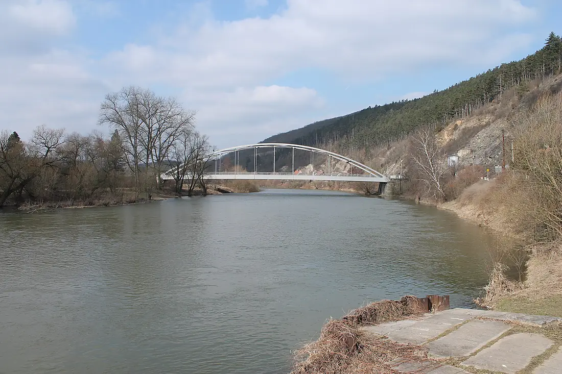
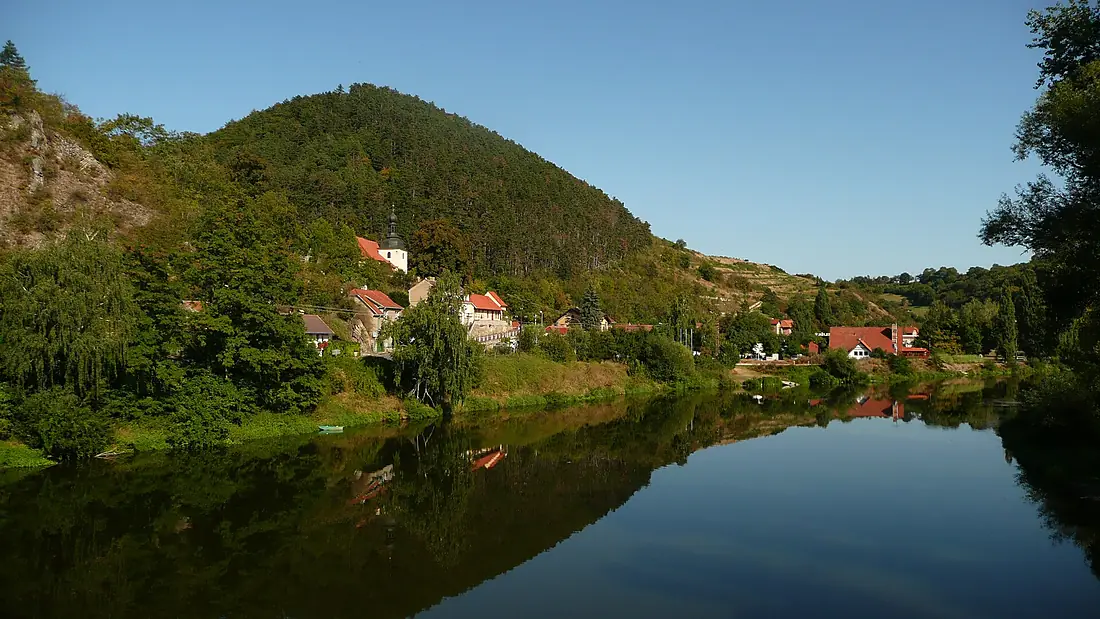
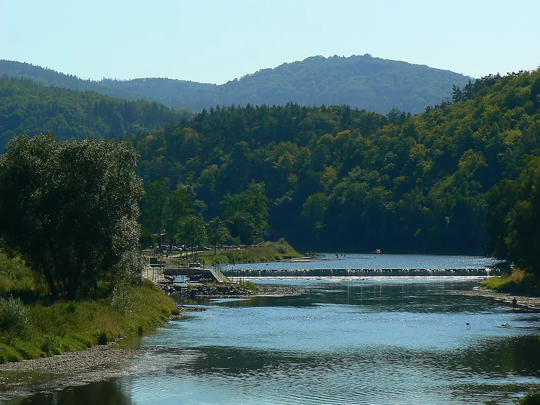
River in the Czech Republic
At the mouth it carries 153 m³/s on average: an Olympic pool every 16 seconds. It drops from 301 m to 190 m, 0.8 m per kilometre on average. Its basin covers 8,855 km², about the size of PR. 2.1 million people live in it. Highest water: from March to May; lowest: from December to February. Dams and reservoirs hold back a large share of its water (36% of a year's flow).
Where to start
- PlzeňLargest city on its banks · 187,928 people
- Karlovy Vary Airport (KLV)Nearest airport with scheduled flights, 61 km from the cityCar hire at PRG airport (Prague)Discover Cars · Affiliate link↗
- On the water29 ferry piers, marinas, boat rentals and boat ramps along the river (OpenStreetMap)
- Kayak and canoe18 put-ins and rapids mapped (OpenStreetMap)
- From May to SeptemberThe best months to visit
Berounka, month by month
Highest water: from March to May
Lowest water: from December to February. Best months to visit: from May to September.
From about 77 m³/s in the lowest month to 350 m³/s in the highest. An estimate: the monthly flow is modelled from the lowest and highest months of WaterGAP (RiverATLAS, 1971–2000) and the rain and snow along the river (WorldClim). Dams change the real rhythm. The chip is the average air temperature; below it, the month's rain.
Plan the trip
Plan the trip: boat trips, a bed by the river, a car
Some links above are affiliate links: if you book through them we may earn a commission, at no extra cost to you. It never changes what the data on this page says.
The basin
Berounka: the basin in numbers
26,591 km² of land send their water to this river. This is what lives on it.
- 2.1millionpeople live in the basin
- 78/km²people per km²
- 534maverage altitude of the basin
- 718mmof rain a year (basin average)
- 7.1°Caverage air temperature
- 15%protected areas
- 0.8%covered by lakes
- 1.7km³held in reservoirs
What covers the basin
- 46% Forest
- 33% Cropland
- 13% Pasture
- 3% Towns and cities
RiverATLAS (HydroATLAS v1.0, CC BY 4.0): land cover, people, protected areas, glaciers and dams over the whole basin upstream of the mouth.
Along the river
Berounka: what you find on the way
- 96WeirsKoterov, Božkov, Doudlevce and 93 more
- 1Locks
- 11WaterfallsVodpodád Dírka, Kozojedský vodopád, Skryjský vodopád and 8 more
- 1Rapids
- 17Canoe put-ins
- 7Boat ramps
- 11Ferry piersPřívoz Nadryby, Přívoz v Darové, Branovský luh and 8 more
- 4MarinasJK Plzeň, Ostende and 2 more
- 8River beachesMěstská plovárna Plzeň, Pláž Tůně, Jezerooo and 5 more
From OpenStreetMap, within 2.1 km of the river. Not mapped is not the same as not there.
Cross-checked with our atlases
Berounka in our other atlases
What our sister atlases know about the waterfalls on this river, the lakes it flows through, the beaches at its mouth, the mountains where it rises and the islands off its mouth.
 25waterfalls on the riverCascadyas
 2lakes on its wayLakeyas
 17mountains at the sourcePeakyas
Waterfalls (25)
On the river, by Cascadyas
- Vodopád Dírkakm 273m
- Libštejnský vodopádkm 374m
- Loužecký vodopádkm 416m
- Kozojedský vodopádkm 433m
- Krašovské vodopádykm 513m
- Baborův vodopádkm 523m
- Týřovské vodopádykm 702m
- Tetínský vodopádkm 110
17 more on CascadyasCascadyas is coming soonOpen Cascadyas ↗
Lakes and reservoirs (2)
Lakes it flows through, by Lakeyas
- Klíčava water reservoirkm 880.4km²
- Vrané Reservoirkm 130 · 10 m deep0.8km²
Lakeyas is coming soonOpen Lakeyas ↗
Mountains at the source (17)
Within 15 km of the source, by Peakyas
- Radyně9.7 km away567m
- Krkavec6.5 km away504m
- Vršíček12 km away436m
- Jelení vrch12 km away · prominence 146 m523m
- Chlum3.2 km away416m
- Holý vrch (Plzeň)5.3 km away411m
- Čilina11 km away
- Červený vrch14 km away
9 more on PeakyasOpen Peakyas ↗
From space
The source and the mouth, seen from orbit
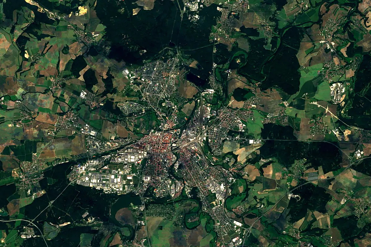
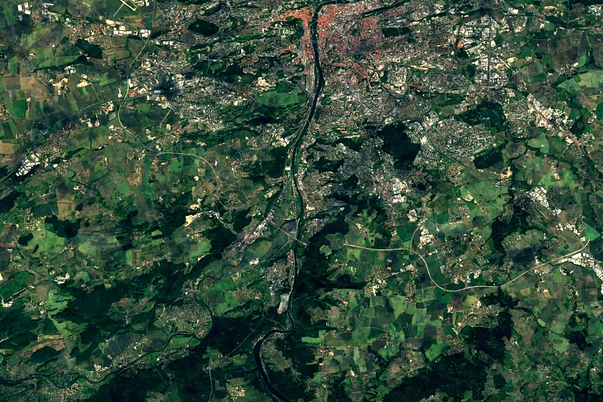
Sentinel-2 cloudless 2016 by EOX IT Services GmbH (contains modified Copernicus Sentinel data 2016), CC BY 4.0. The glowing line is the river as drawn by RiverATLAS.
Tributaries
Where it flows, and what flows into it
It flows into
VltavaCzechia430 km150 m³/sTributaries (24)
Also: Radbuza, Mže, Litavka, Úslava, Střela, Klabava, Rakovnický potok, Loděnice, Třemošná, Klíčava, Vůznice, Zbirožský potok, Bubovický potok, Javornice, Všenorský potok, Radotínský potok, Klučná, Svinařský potok, Tyterský potok, Skryjský potok, Karlický potok, Habrový potok, Olešenský potok, Švarcava
 Germany
Nearby
Rivers nearby
 Austria
Where these numbers come from
| Name, length, places | Wikidata (Q827033) · CC0 |
|---|---|
| Course, profile, basin | RiverATLAS v1.0 (HydroATLAS, Linke et al. 2019) · CC BY 4.0 — followed from the source to the mouth given by Wikidata |
| Flow | WaterGAP (RiverATLAS), 1971–2000 · CC BY 4.0 |
| Climate along the river | WorldClim (RiverATLAS), 1970–2000 · CC BY 4.0 |
| Towns, bridges, dams | Wikidata · CC0; GeoNames · CC BY 4.0 |
| Along the river | © OpenStreetMap contributors · ODbL |
| Images | EOX Sentinel-2 cloudless 2016 · CC BY 4.0; Wikimedia Commons |
| Our other atlases | Cascadyas, Lakeyas, Peakyas — Wikidata · CC0; © OpenStreetMap contributors · ODbL; GeoNames · CC BY 4.0; HydroLAKES · CC BY 4.0; NOAA OISST |
Every source and licence is on the data sources page.
The family
Do you prefer beaches, lakes, mountains, waterfalls, islands, rivers or canyons?
Same idea, other landscapes: field atlases built on open data, month by month, in seven languages.
 beaches
 Find your beach: sea temperature, sun and swimming month by month.Visit lakes
 Every lake on Earth: water temperature, ice, depth and the shore.Coming soonVisit mountains
 Every summit in 3D: summit weather, the 0 °C line, huts and trails.Visit waterfalls
 Every waterfall: height, flow month by month and when it roars.Coming soonVisit
  islands
 Every island from the sea up: size, sea temperature, ferries and 3D.Coming soonVisit
  rivers
 Every river from source to sea: the journey, the flow and the basin in numbers.You are here
 canyons
 Every canyon cut to scale: depth to the floor, rim and floor temperatures, trails and viewpoints.Coming soonVisit