River
Lužnice
208 km from source to mouth · Czechia and Austria.
 Czechia and AustriaFlows into Vltava4th longest in Czechia
In numbers
Length
208km
Average flow
20m³/s
Basin
4,235km²
Drop
243m
from 600 m to 357 m
Countries
2
The journey
From source to mouth
208 km of river and 68 stops on the way: 14 towns and cities on its banks, dams, bridges and the tributaries that feed it.
- 0 kmSource of Lužniceat 600 m
- 13 kmWeitra1,599 people
- 28 kmNÖ-Naturdenkmal GD-140 Storchenwiesen und Auwaldzellen Großdietmanns
- 29 kmČeské Velenice3,479 people
- 30 kmGmünd4,674 people
- 31 kmNÖ-Naturdenkmal GD-142 Storchenwiesen und Auwaldzellen Gmünd
- 32 kmweir
- 56 kmSuchdol nad Lužnicí3,659 people
- 60 kmCep I0.4 km²
- 65 kmJez Pilař
- 65 kmCep1.2 km²
- 66 kmDračicetributary
- 81 kmKoštěnický potoktributary
- 83 kmInundation bridge over the Lužnice in Stará Hlína
- 83 kmBridge of road I/34 over the Lužnice in Stará Hlína
- 84 kmStará Hlína228 people
- 91 kmBridge over the Lužnice in Lužnice
- 94 kmPotěšil0.6 km²
- 94 kmKlec0.5 km²
- 97 kmLomnice nad Lužnicí1,660 people
- 111 kmVlkovská pískovna0.5 km²
- 113 kmVeselí nad Lužnicí6,534 people
- 113 kmKlapkový
- 114 kmNežárkatributary
- 120 kmDráchov Weir
- 122 kmČejnov
- 124 kmFootbridge over the Lužnice in Soběslav
- 124 kmSoběslav7,308 people
- 125 kmČernovický potoktributary
- 125 kmSteiniger
- 127 kmŠpačkův mlýn
- 145 kmBridge over the Lužnice in Planá nad Lužnicí
- 145 kmPlaná nad Lužnicí4,614 people
- 151 kmSezimovo Ústí7,420 people
- 151 kmChotovinský potoktributary
- 155 kmRailway bridge in Tábor
- 156 kmPřibík weir
- 156 kmJordánský waterfall
- 157 kmTábor34,356 people
- 157 kmČelkovický most
- 157 kmweir Veselý
- 158 kmŠvehlův most
- 158 kmPokorný
- 160 kmBenešův
- 160 kmVětrovské kaskády2 m
- 160 kmVodopád u Harachovky3 m
- 161 kmVodopád pod Chlumem2 m
- 162 kmKvěchův mill
- 163 kmKaskády pod Kamennými poli
- 163 kmMatoušovský
- 165 kmVodopád pod Hlavinami4 m
- 165 kmVlásenický vodopád
- 166 kmDražičkovské vodopády2 m
- 169 kmPříběnické vodopády4 m
- 171 kmBečický vodopád2 m
- 175 kmKaskády u Řetězového mostu3 m
- 175 kmStádlec588 people
- 176 kmStádlec Suspension Bridge
- 187 kmbridge over the Lužnice in Hutě
- 191 kmPod Libuší waterfall6 m
- 192 kmBechyně Bridge
- 193 kmBechyně4,815 people
- 193 kmZářečský most
- 194 kmSmutnátributary
- 202 kmBridge in Koloděje nad Lužnicí
- 207 kmTýn nad Vltavou8,296 people
- 207 kmŽidova strouhatributary
- 207 kmBilinský potoktributary
- 207 kmWater reservoir Kořensko0.5 km²
- 208 kmVltavaat 357 m
Water level along the river (RiverATLAS; the height is exaggerated). Towns: GeoNames and Wikidata; bridges, dams and tributaries: Wikidata.
River in Czech Republic and Austria
At the mouth it carries 20 m³/s on average: an Olympic pool every 122 seconds. It drops from 600 m to 357 m, 1.2 m per kilometre on average. Its basin covers 4,235 km², about the size of CV. 259,000 people live in it. Highest water: March; lowest: from December to February. No large dam holds it back: it is one of the world's free-flowing rivers.
Where to start
- TáborLargest city on its banks · 34,356 people
- České Budějovice South Bohemian Airport (JCL)Nearest airport with scheduled flights, 54 km from the cityCar hire at PRG airport (Prague)Discover Cars · Affiliate link↗
- On the water3 ferry piers, marinas, boat rentals and boat ramps along the river (OpenStreetMap)
- Kayak and canoe1 put-ins and rapids mapped (OpenStreetMap)
- From May to SeptemberThe best months to visit
Lužnice, month by month
Highest water: March
Lowest water: from December to February. Best months to visit: from May to September.
From about 12 m³/s in the lowest month to 43 m³/s in the highest. An estimate: the monthly flow is modelled from the lowest and highest months of WaterGAP (RiverATLAS, 1971–2000) and the rain and snow along the river (WorldClim). Dams change the real rhythm. The chip is the average air temperature; below it, the month's rain.
Plan the trip
Plan the trip: boat trips, a bed by the river, a car
Some links above are affiliate links: if you book through them we may earn a commission, at no extra cost to you. It never changes what the data on this page says.
The basin
Lužnice: the basin in numbers
4,223 km² of land send their water to this river. This is what lives on it.
- 259,000people live in the basin
- 62/km²people per km²
- 526maverage altitude of the basin
- 719mmof rain a year (basin average)
- 7.4°Caverage air temperature
- 17%protected areas
- 1.5%covered by lakes
What covers the basin
- 53% Forest
- 28% Cropland
- 12% Pasture
- 2% Towns and cities
RiverATLAS (HydroATLAS v1.0, CC BY 4.0): land cover, people, protected areas, glaciers and dams over the whole basin upstream of the mouth.
Along the river
Lužnice: what you find on the way
- 84WeirsTušť, Pilař, Tájek and 81 more
- 1LocksKořensko
- 3WaterfallsJordánský vodopád, Vlásenický vodopád
- 1Canoe put-insSuchdol nad Lužnicí
- 2River beachesGmünder Strandbad, Sokolská plovárna
From OpenStreetMap, within 1.6 km of the river. Not mapped is not the same as not there.
Cross-checked with our atlases
Lužnice in our other atlases
What our sister atlases know about the waterfalls on this river, the lakes it flows through, the beaches at its mouth, the mountains where it rises and the islands off its mouth.
 12waterfalls on the riverCascadyas
 6lakes on its wayLakeyas
 23mountains at the sourcePeakyas
Waterfalls (12)
On the river, by Cascadyas
- Jordánský waterfallkm 110
- Větrovské kaskádykm 1132m
- Vodopád u Harachovkykm 1133m
- Vodopád pod Hlavinamikm 1164m
- Příběnické vodopádykm 1194m
- Bečický vodopádkm 1202m
- Kaskády u Řetězového mostukm 1233m
- Pod Libuší waterfallkm 1346m
4 more on CascadyasCascadyas is coming soonOpen Cascadyas ↗
Lakes and reservoirs (6)
Lakes it flows through, by Lakeyas
- Cep Ikm 420.4km²
- Cepkm 461.2km²
- Potěšilkm 660.6km²
- Kleckm 660.5km²
- Vlkovská pískovnakm 780.5km²
- Water reservoir Kořenskokm 1460.5km²
Lakeyas is coming soonOpen Lakeyas ↗
Mountains at the source (23)
Within 15 km of the source, by Peakyas
- Viehberg9.3 km away · prominence 456 m1,112m
- Tischberg1.4 km away · prominence 156 m1,063m
- Nebelstein9.1 km away · prominence 150 m1,017m
- Kamenec5.1 km away · prominence 156 m1,073m
- Vysoká13 km away · prominence 210 m1,034m
- Myslivna5.7 km away · prominence 123 m1,040m
- Brockenberg9.2 km away1,053m
- Sepplberg3.4 km away1,004m
15 more on PeakyasOpen Peakyas ↗
From space
The source and the mouth, seen from orbit
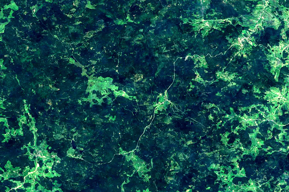
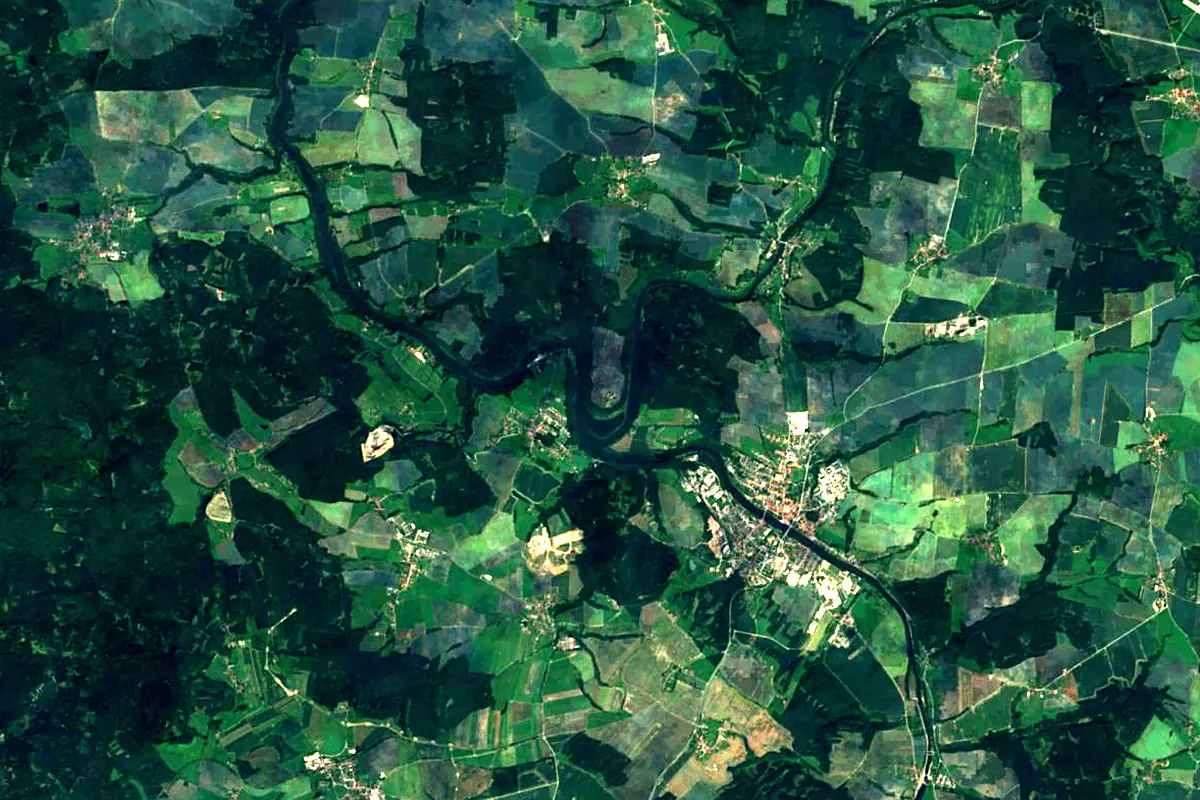
Sentinel-2 cloudless 2016 by EOX IT Services GmbH (contains modified Copernicus Sentinel data 2016), CC BY 4.0. The glowing line is the river as drawn by RiverATLAS.
Photos
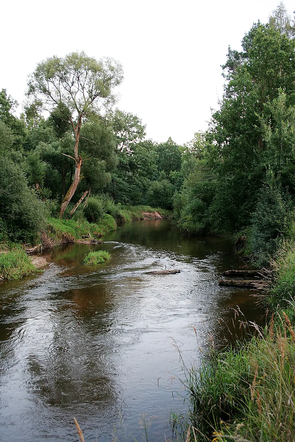
Lužnice in pictures
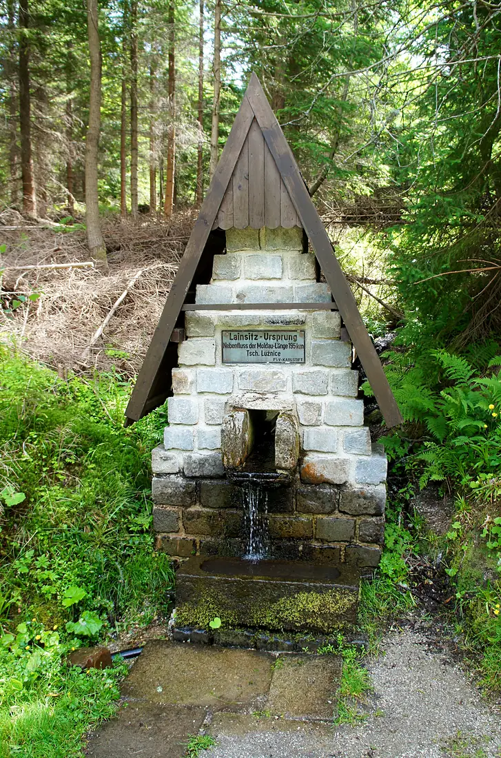
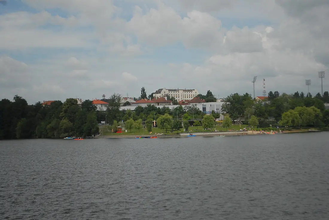
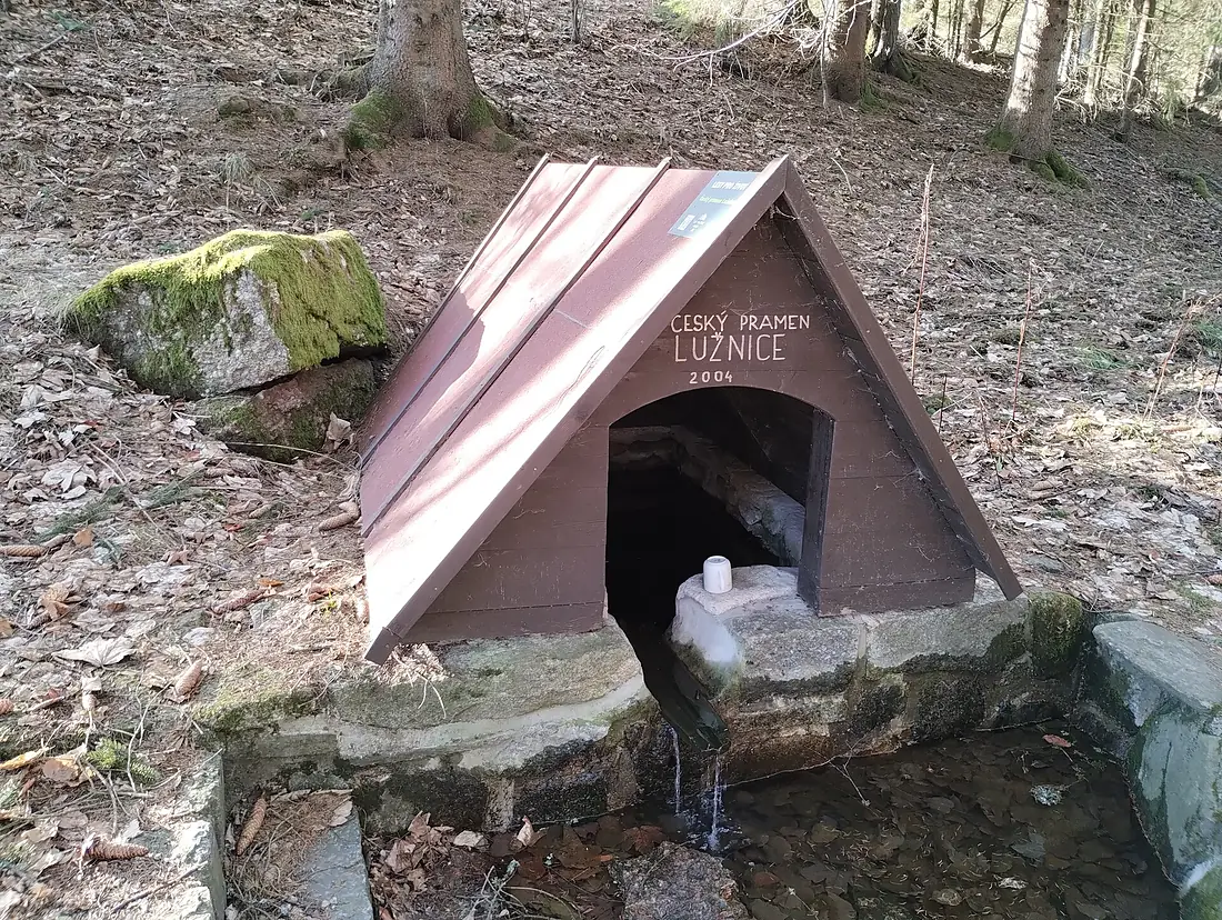
Tributaries
Where it flows, and what flows into it
It flows into
VltavaCzechia430 km150 m³/sTributaries (16)
Also: Nežárka, Smutná, Dračice, Židova strouha, Braunaubach, Koštěnický potok, Chotovinský potok, Černovický potok, Bilinský potok, Pilský potok, Bechyňský potok, Dírenský potok, Všechlapský potok, Košínský potok, Oltyňský potok, Větrovský potok
 Germany
Nearby
Rivers nearby
Where these numbers come from
| Name, length, places | Wikidata (Q279943) · CC0 |
|---|---|
| Course, profile, basin | RiverATLAS v1.0 (HydroATLAS, Linke et al. 2019) · CC BY 4.0 — followed from the source to the mouth given by Wikidata |
| Flow | WaterGAP (RiverATLAS), 1971–2000 · CC BY 4.0 |
| Climate along the river | WorldClim (RiverATLAS), 1970–2000 · CC BY 4.0 |
| Towns, bridges, dams | Wikidata · CC0; GeoNames · CC BY 4.0 |
| Along the river | © OpenStreetMap contributors · ODbL |
| Images | EOX Sentinel-2 cloudless 2016 · CC BY 4.0; Wikimedia Commons |
| Our other atlases | Cascadyas, Lakeyas, Peakyas — Wikidata · CC0; © OpenStreetMap contributors · ODbL; GeoNames · CC BY 4.0; HydroLAKES · CC BY 4.0; NOAA OISST |
Every source and licence is on the data sources page.
The family
Do you prefer beaches, lakes, mountains, waterfalls, islands, rivers or canyons?
Same idea, other landscapes: field atlases built on open data, month by month, in seven languages.
 beaches
 Find your beach: sea temperature, sun and swimming month by month.Visit lakes
 Every lake on Earth: water temperature, ice, depth and the shore.Coming soonVisit mountains
 Every summit in 3D: summit weather, the 0 °C line, huts and trails.Visit waterfalls
 Every waterfall: height, flow month by month and when it roars.Coming soonVisit
  islands
 Every island from the sea up: size, sea temperature, ferries and 3D.Coming soonVisit
  rivers
 Every river from source to sea: the journey, the flow and the basin in numbers.You are here
 canyons
 Every canyon cut to scale: depth to the floor, rim and floor temperatures, trails and viewpoints.Coming soonVisit