River
Isar
292 km from source to mouth · Germany and Austria.

 Germany and AustriaFlows into Danube
In numbers
Length
292km
Average flow
170m³/s
Basin
8,370km²
Drop
709m
from 1,019 m to 310 m
Countries
2
The journey
From source to mouth
292 km of river and 68 stops on the way: 37 towns and cities on its banks, dams, bridges and the tributaries that feed it.
- 0 kmSourceat 1,019 m
- 11 kmMittenwald8,557 people
- 18 kmBarmsee0.6 km²
- 46 kmSeeachetributary
- 46 kmSylvensteinsee1.7 km²
- 55 kmJachentributary
- 60 kmLenggries10,176 people
- 66 kmWackersberg3,463 people
- 68 kmGaißach3,028 people
- 70 kmBad Tölz17,434 people
- 86 kmGeretsried23,364 people
- 89 kmRottachtributary
- 95 kmWolfratshausen17,191 people
- 98 kmIcking3,586 people
- 98 kmIckinger Wehr
- 100 kmLoisachtributary
- 105 kmSchäftlarn5,281 people
- 108 kmStraßlach-Dingharting3,250 people
- 110 kmIsarstauwehr
- 112 kmGrünwald10,836 people
- 114 kmPullach im Isartal8,589 people
- 117 kmGroßhesseloher Brücke
- 118 kmGutshof Menterschwaige
- 118 kmLola Montez House
- 122 kmFlaucher Gasthaus
- 122 kmSendling41,002 people
- 123 kmWittelsbacherbrücke
- 125 kmCornelius bridge
- 125 kmLudwig bridge Munich
- 125 kmMunich1,505,036 people
- 126 kmMaximilian Bridge
- 126 kmLehel7,178 people
- 127 kmLuitpoldbrücke Munich
- 127 kmWasserfall Schwabinger Bach in München
- 128 kmMax-Joseph Bridge
- 129 kmBogenhausen77,542 people
- 131 kmOberföhring13,179 people
- 132 kmUnterer Wehrbachtributary
- 132 kmSchwabinger Bachtributary
- 135 kmUnterföhring11,729 people
- 135 kmFeringasee0.3 km²
- 139 kmIsmaning18,038 people
- 141 kmGarching17,656 people
- 151 kmMintraching2,000 people
- 151 kmSchörgenbachtributary
- 155 kmPullinger Weiher0.3 km²
- 162 kmFreising48,953 people
- 172 kmLangenbach3,755 people
- 173 kmMoosachtributary
- 182 kmMoosburg an der Isar20,107 people
- 183 kmMoosburg17,363 people
- 189 kmBruckberg5,071 people
- 190 kmAusgleichweiher1.3 km²
- 191 kmSempttributary
- 191 kmAmpertributary
- 191 kmIsar-Stromschnelle Sieben Rippen bei Bruckbergerau
- 197 kmEching3,516 people
- 197 kmEchinger Stausee0.8 km²
- 199 kmTiefenbach3,501 people
- 204 kmKumhausen4,812 people
- 206 kmLandshut71,922 people
- 211 kmErgolding11,438 people
- 223 kmNiederaichbach3,602 people
- 225 kmWörth an der Isar3,275 people
- 227 kmWörther See0.4 km²
- 233 kmLoiching3,506 people
- 238 kmDingolfing9,167 people
- 256 kmLandau an der Isar14,776 people
- 278 kmPlattling8,366 people
- 292 kmDanubeat 310 m
Water level along the river (RiverATLAS; the height is exaggerated). Towns: GeoNames and Wikidata; bridges, dams and tributaries: Wikidata.
River in Tyrol, Austria and Bavaria, Germany
At the mouth it carries 174 m³/s on average: an Olympic pool every 14 seconds. It drops from 1,019 m to 310 m, 2.4 m per kilometre on average. Its basin covers 8,370 km², about the size of PR. 3.1 million people live in it. Highest water: from March to May; lowest: from December to February. Its dams hold back little of its water (2.2% of a year's flow).
Where to start
- MunichLargest city on its banks · 1,505,036 people
- Munich Airport (MUC)Nearest airport with scheduled flights, 29 km from the cityCar hire at MUC airport (Munich)Discover Cars · Affiliate link↗
- On the water37 ferry piers, marinas, boat rentals and boat ramps along the river (OpenStreetMap)
- Kayak and canoe43 put-ins and rapids mapped (OpenStreetMap)
- From June to SeptemberThe best months to visit
Isar, month by month
Highest water: from March to May
Lowest water: from December to February. Best months to visit: from June to September.
From about 120 m³/s in the lowest month to 260 m³/s in the highest. An estimate: the monthly flow is modelled from the lowest and highest months of WaterGAP (RiverATLAS, 1971–2000) and the rain and snow along the river (WorldClim). Dams change the real rhythm. The chip is the average air temperature; below it, the month's rain.
Plan the trip
Plan the trip: boat trips, a bed by the river, a car
Some links above are affiliate links: if you book through them we may earn a commission, at no extra cost to you. It never changes what the data on this page says.
The basin
Isar: the basin in numbers
9,103 km² of land send their water to this river. This is what lives on it.
- 3.1millionpeople live in the basin
- 339/km²people per km²
- 735maverage altitude of the basin
- 948mmof rain a year (basin average)
- 7.2°Caverage air temperature
- 30%protected areas
- 1.9%covered by lakes
- 0.1km³held in reservoirs
What covers the basin
- 51% Forest
- 28% Cropland
- 17% Pasture
- 13% Towns and cities
RiverATLAS (HydroATLAS v1.0, CC BY 4.0): land cover, people, protected areas, glaciers and dams over the whole basin upstream of the mouth.
Along the river
Isar: what you find on the way
- 199WeirsVorsperre, Wehr Fleck (Winkl), Kastenmühlwehr and 196 more
- 6LocksÜberlauf and 5 more
- 38WaterfallsLeutaschklamm Wasserfall, Lainbach-Wasserfall, Kleiner Wasserfall and 35 more
- 39RapidsIsarburg, Isarwelle Plattling and 37 more
- 4Canoe put-insDKV Referenzstrecke WW-I, Marzling and 2 more
- 34Boat rampsKanustation, Floßlände Isar, Ausstiegsstelle and 31 more
- 1MarinasSchutzhafen Deggendorf
- 2River beachesKiesstrand an der Brudermühlbrücke
From OpenStreetMap, within 1.8 km of the river. Not mapped is not the same as not there.
Cross-checked with our atlases
Isar in our other atlases
What our sister atlases know about the waterfalls on this river, the lakes it flows through, the beaches at its mouth, the mountains where it rises and the islands off its mouth.
 2waterfalls on the riverCascadyas
 7lakes on its wayLakeyas
 159mountains at the sourcePeakyas
Waterfalls (2)
On the river, by Cascadyas
- Wasserfall Schwabinger Bach in Münchenkm 118
- Isar-Stromschnelle Sieben Rippen bei Bruckbergeraukm 178
Cascadyas is coming soonOpen Cascadyas ↗
Lakes and reservoirs (7)
Lakes it flows through, by Lakeyas
- Barmseekm 170.6km²
- Sylvensteinseekm 431.7km²
- Feringaseekm 1250.3km²
- Pullinger Weiherkm 1440.3km²
- Ausgleichweiherkm 1771.3km²
- Echinger Stauseekm 1840.8km²
- Wörther Seekm 2110.4km²
Lakeyas is coming soonOpen Lakeyas ↗
Mountains at the source (159)
Within 15 km of the source, by Peakyas
- Birkkarspitze4.5 km away · prominence 1,564 m2,749m
- Kaltwasserkarspitze4.6 km away2,733m
- Großer Bettelwurf9.1 km away2,726m
- Nordkette9.4 km away2,637m
- Mittlere Ödkarspitze4.3 km away2,745m
- Grosser Lafatscher4.7 km away2,696m
- Große Seekarspitze3.5 km away2,677m
- Hintere Bachofenspitze4.0 km away2,668m
151 more on PeakyasOpen Peakyas ↗
From space
The source and the mouth, seen from orbit
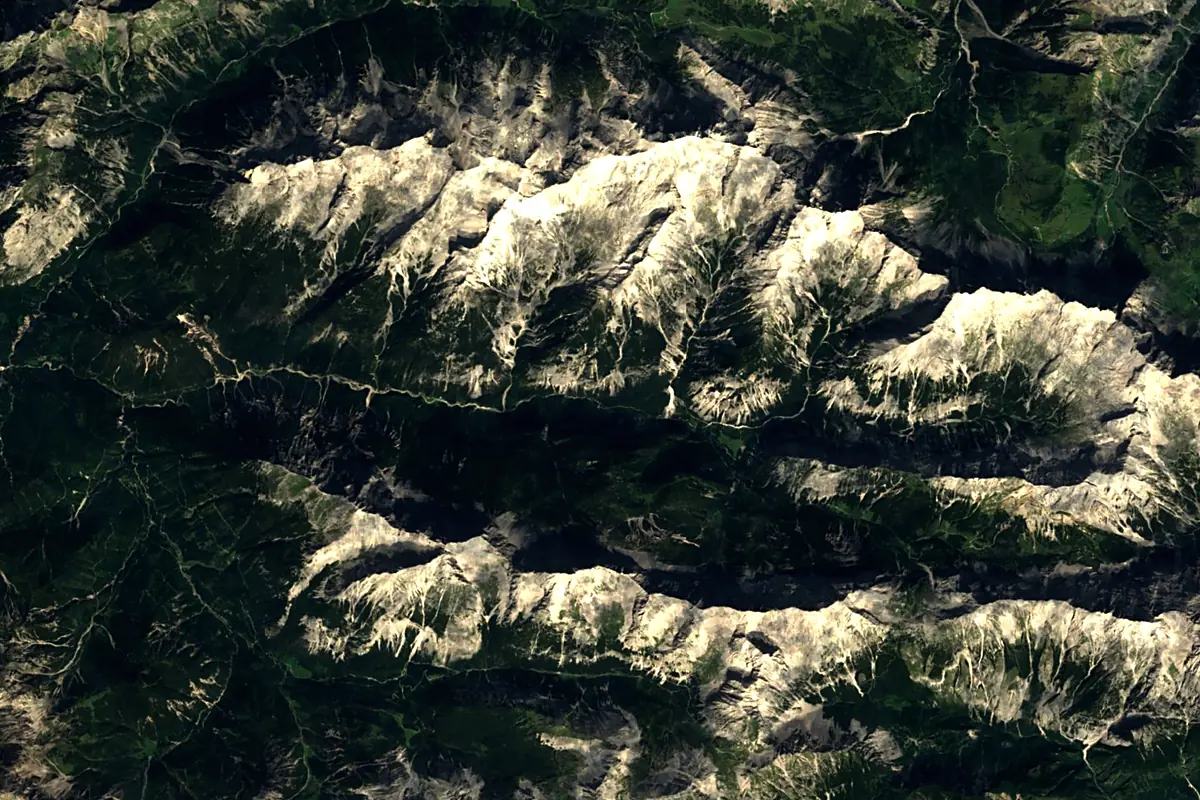
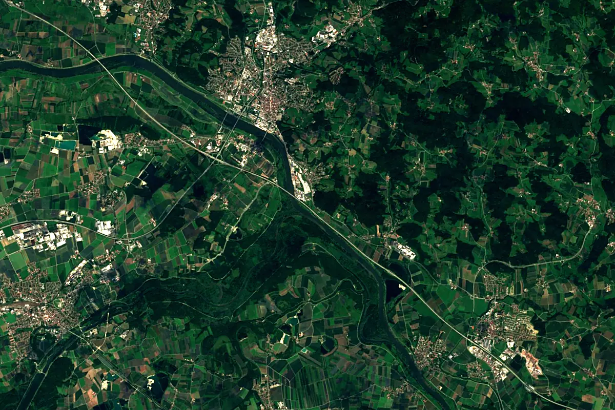
Sentinel-2 cloudless 2016 by EOX IT Services GmbH (contains modified Copernicus Sentinel data 2016), CC BY 4.0. The glowing line is the river as drawn by RiverATLAS.
Photos
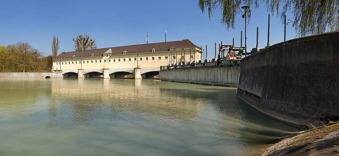
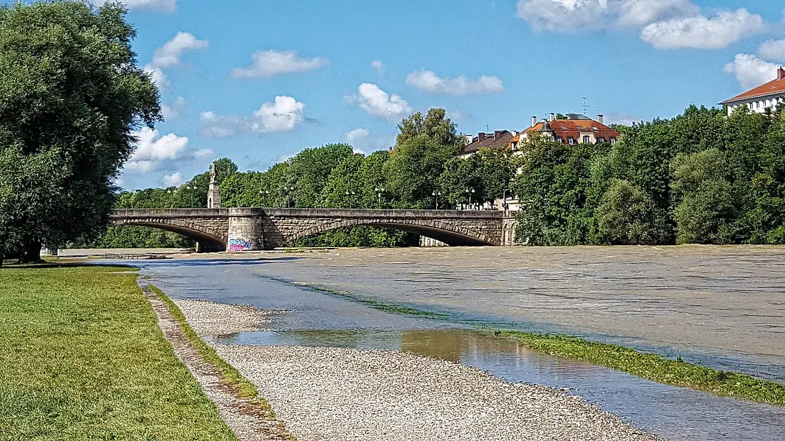
Isar in pictures
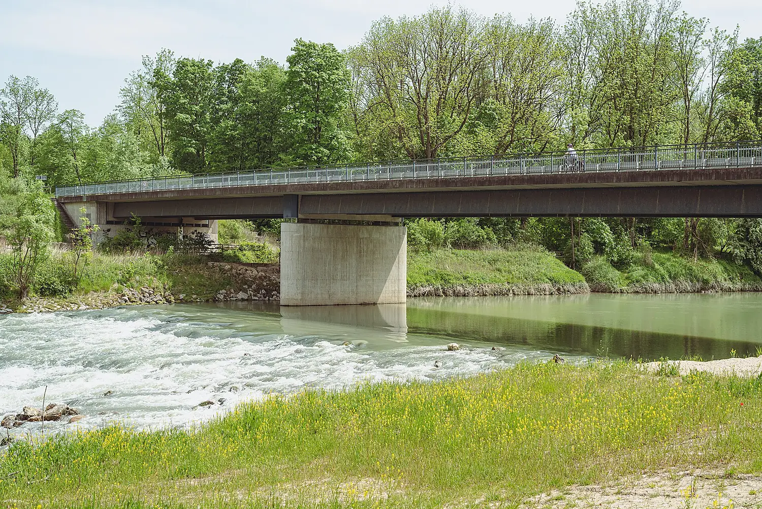
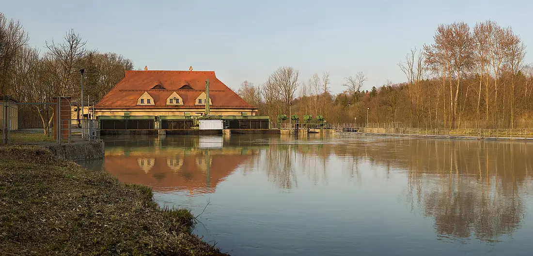
Tributaries
Where it flows, and what flows into it
It flows into
Danube Romania2,850 km5,400 m³/s
Tributaries (23)
Also: Eisbach, Rißbach, Moosach, Jachen, Leutascher Ache, Schwabinger Bach, Auer Mühlbach, Sempt, Seeache, Gleirschbach, Seebach, Brunnbach, Schörgenbach, Dürrach, Kleine Isar, Rottach, Unterer Wehrbach, Goldach, Garchinger Mühlbach, Mühlbach, Gießenbach
 Serbia
 Croatia
 Moldova
 Hungary
Nearby
Rivers nearby
Where these numbers come from
| Name, length, places | Wikidata (Q106588) · CC0 |
|---|---|
| Course, profile, basin | RiverATLAS v1.0 (HydroATLAS, Linke et al. 2019) · CC BY 4.0 — followed from the source to the mouth given by Wikidata |
| Flow | WaterGAP (RiverATLAS), 1971–2000 · CC BY 4.0 |
| Climate along the river | WorldClim (RiverATLAS), 1970–2000 · CC BY 4.0 |
| Towns, bridges, dams | Wikidata · CC0; GeoNames · CC BY 4.0 |
| Along the river | © OpenStreetMap contributors · ODbL |
| Images | EOX Sentinel-2 cloudless 2016 · CC BY 4.0; Wikimedia Commons |
| Our other atlases | Cascadyas, Lakeyas, Peakyas — Wikidata · CC0; © OpenStreetMap contributors · ODbL; GeoNames · CC BY 4.0; HydroLAKES · CC BY 4.0; NOAA OISST |
Every source and licence is on the data sources page.
The family
Do you prefer beaches, lakes, mountains, waterfalls, islands, rivers or canyons?
Same idea, other landscapes: field atlases built on open data, month by month, in seven languages.
 beaches
 Find your beach: sea temperature, sun and swimming month by month.Visit lakes
 Every lake on Earth: water temperature, ice, depth and the shore.Coming soonVisit mountains
 Every summit in 3D: summit weather, the 0 °C line, huts and trails.Visit waterfalls
 Every waterfall: height, flow month by month and when it roars.Coming soonVisit
  islands
 Every island from the sea up: size, sea temperature, ferries and 3D.Coming soonVisit
  rivers
 Every river from source to sea: the journey, the flow and the basin in numbers.You are here
 canyons
 Every canyon cut to scale: depth to the floor, rim and floor temperatures, trails and viewpoints.Coming soonVisit