River
Drava
720 km from source to mouth · 5 countries.
 Croatia, Slovenia, Hungary, Italy and AustriaFlows into Danube1st longest in Croatia
In numbers
Length
720km
Average flow
620m³/s
Basin
40,400km²
Drop
1,111m
from 1,188 m to 77 m
Countries
5
The journey
From source to mouth
720 km of river and 52 stops on the way: 12 towns and cities on its banks, dams, bridges and the tributaries that feed it.
- 0 kmInnichenat 1,188 m
- 41 kmLienz11,572 people
- 45 kmDebantbachtributary
- 46 kmIseltributary
- 49 kmFrauenbach Wasserfall
- 100 kmMölltributary
- 110 kmSpittal an der Drau12,880 people
- 126 kmLiesertributary
- 146 kmVillach65,127 people
- 146 kmVillach-Innere Stadt8,189 people
- 149 kmGailtributary
- 177 kmFeistritzer Stausee3.3 km²
- 184 kmEisenbahnbrücke Ferlacher Stausee
- 187 kmFerlacher Stausee2.8 km²
- 202 kmStausee Annabrücke2.6 km²
- 206 kmVellachtributary
- 211 kmDrava bridge Stein
- 214 kmGurktributary
- 214 kmKlopeiner See1.0 km²
- 228 kmVölkermarkter Stausee8.3 km²
- 238 kmJauntalbrücke
- 238 kmFeistritztributary
- 254 kmLavanttributary
- 260 kmMežatributary
- 271 kmLake Dravograd1.0 km²
- 308 kmLobnica (Drava)
- 320 kmMaribor114,301 people
- 321 kmOld Bridge
- 321 kmTown centre, Maribor
- 322 kmDouble-Storey Bridge
- 349 kmPtuj17,880 people
- 350 kmPuh Bridge
- 354 kmLake Ptuj4.3 km²
- 356 kmDravinjatributary
- 366 kmPesnicatributary
- 380 kmLake Ormož2.3 km²
- 398 kmVaraždin36,187 people
- 406 kmLake Varaždin9.8 km²
- 427 kmLake Dubrava16 km²
- 431 kmBednjatributary
- 450 kmŠoderica1.2 km²
- 452 kmMurtributary
- 514 kmRinya-pataktributary
- 518 kmBarcs9,454 people
- 546 kmČađavicatributary
- 634 kmKarašicatributary
- 645 kmGornji grad (Osijek)16,520 people
- 645 kmPedestrian bridge
- 646 kmSuleiman Bridge
- 646 kmTvrđa10,277 people
- 646 kmOsijek75,535 people
- 646 kmFranjo Tuđman Bridge
- 648 kmDonji grad11,020 people
- 720 kmDanubeat 77 m
Water level along the river (RiverATLAS; the height is exaggerated). Towns: GeoNames and Wikidata; bridges, dams and tributaries: Wikidata.
River in Italy, Austria, Slovenia, Croatia and Hungary
At the mouth it carries 620 m³/s on average: an Olympic pool every 4.0 seconds. It drops from 1,188 m to 77 m, 1.5 m per kilometre on average. Its basin covers 40,400 km², about the size of CH. 3.1 million people live in it. Highest water: from July to August and from November to December. Its dams hold back little of its water (3.8% of a year's flow).
Where to start
- MariborLargest city on its banks · 114,301 people
- Maribor Edvard Rusjan Airport (MBX)Nearest airport with scheduled flights, 9 km from the cityCar hire at GRZ airport (Feldkirchen bei Graz)Discover Cars · Affiliate link↗
- On the water70 ferry piers, marinas, boat rentals and boat ramps along the river (OpenStreetMap)
- Kayak and canoe21 put-ins and rapids mapped (OpenStreetMap)
- From May to SeptemberThe best months to visit
Drava, month by month
Highest water: from July to August and from November to December
Best months to visit: from May to September.
From about 230 m³/s in the lowest month to 960 m³/s in the highest. An estimate: the monthly flow is modelled from the lowest and highest months of WaterGAP (RiverATLAS, 1971–2000) and the rain and snow along the river (WorldClim). Dams change the real rhythm. The chip is the average air temperature; below it, the month's rain.
Plan the trip
Plan the trip: boat trips, a bed by the river, a car
Some links above are affiliate links: if you book through them we may earn a commission, at no extra cost to you. It never changes what the data on this page says.
The basin
Drava: the basin in numbers
40,250 km² of land send their water to this river. This is what lives on it.
- 3.1millionpeople live in the basin
- 77/km²people per km²
- 758maverage altitude of the basin
- 1,017mmof rain a year (basin average)
- 7.0°Caverage air temperature
- 21%protected areas
- 0.4%covered by lakes
- 1%permafrost
- 0.6km³held in reservoirs
What covers the basin
- 67% Forest
- 21% Cropland
- 20% Pasture
- 3% Towns and cities
RiverATLAS (HydroATLAS v1.0, CC BY 4.0): land cover, people, protected areas, glaciers and dams over the whole basin upstream of the mouth.
Along the river
Drava: what you find on the way
- 187WeirsWehranlage St. Martin, Globokarjeva žaga and 185 more
- 4Locks
- 24WaterfallsFrauenbach Wasserfall, Silberfall Wasserfall, Lieser - Drau Wasserfall and 21 more
- 16RapidsDolomitenwelle, Dolomitenmannstufe and 14 more
- 5Canoe put-ins
- 34Boat rampsSlipanlage Hafen Dragositschach, Slipanlage Sankt Oswald, Marina Prelog and 31 more
- 12Ferry piersVelden, Santa Lucia Velden, Osijek Zoo and 9 more
- 19MarinasSchmalzl, Dragositschach, Sankt Oswald and 16 more
- 11River beachesFreier Seezugang Badeplatz „Bank im See“, Strandbad Egg, Drava bathing spot and 8 more
From OpenStreetMap, within 2.2 km of the river. Not mapped is not the same as not there.
Cross-checked with our atlases
Drava in our other atlases
What our sister atlases know about the waterfalls on this river, the lakes it flows through, the beaches at its mouth, the mountains where it rises and the islands off its mouth.
 2waterfalls on the riverCascadyas
 11lakes on its wayLakeyas
 53mountains at the sourcePeakyas
Waterfalls (2)
On the river, by Cascadyas
- Frauenbach Wasserfallkm 49
- Lobnica (Drava)km 308
Cascadyas is coming soonOpen Cascadyas ↗
Lakes and reservoirs (11)
Lakes it flows through, by Lakeyas
- Feistritzer Stauseekm 1773.3km²
- Klopeiner Seekm 214 · 48 m deep1.0km²
- Völkermarkter Stauseekm 2288.3km²
- Lake Ptujkm 3544.3km²
- Lake Ormožkm 3802.3km²
- Lake Varaždinkm 4069.8km²
- Lake Dubravakm 42716km²
- Šodericakm 450 · 20 m deep1.2km²
3 more on LakeyasLakeyas is coming soonOpen Lakeyas ↗
Mountains at the source (53)
Within 15 km of the source, by Peakyas
- Dolomites14 km away3,343m
- Hohe Gaisl14 km away · prominence 1,133 m3,146m
- Dreischusterspitze7.7 km away · prominence 1,393 m3,145m
- Zwölferkofel14 km away · prominence 713 m3,094m
- Elferkofel14 km away · prominence 661 m3,092m
- Birkenkofel4.5 km away · prominence 391 m2,922m
- Sextener Rotwand13 km away · prominence 248 m2,965m
- Monte Popera15 km away · prominence 166 m3,046m
45 more on PeakyasOpen Peakyas ↗
From space
The source and the mouth, seen from orbit
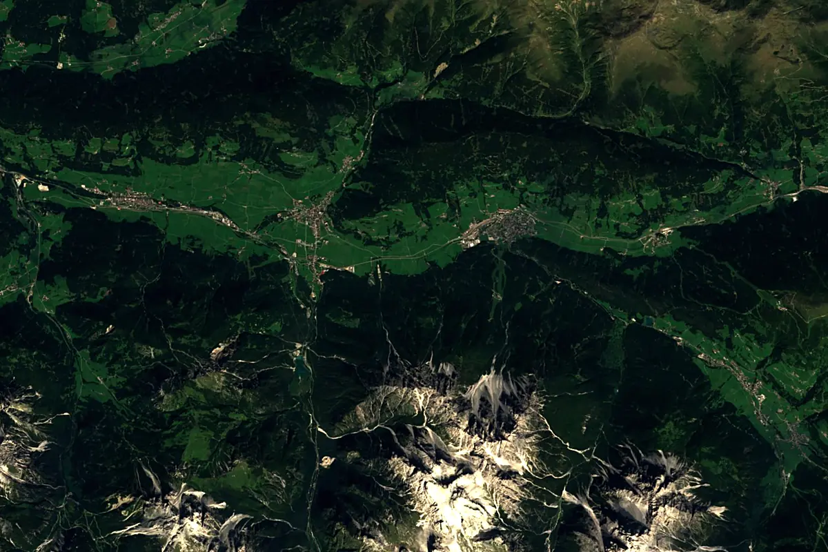
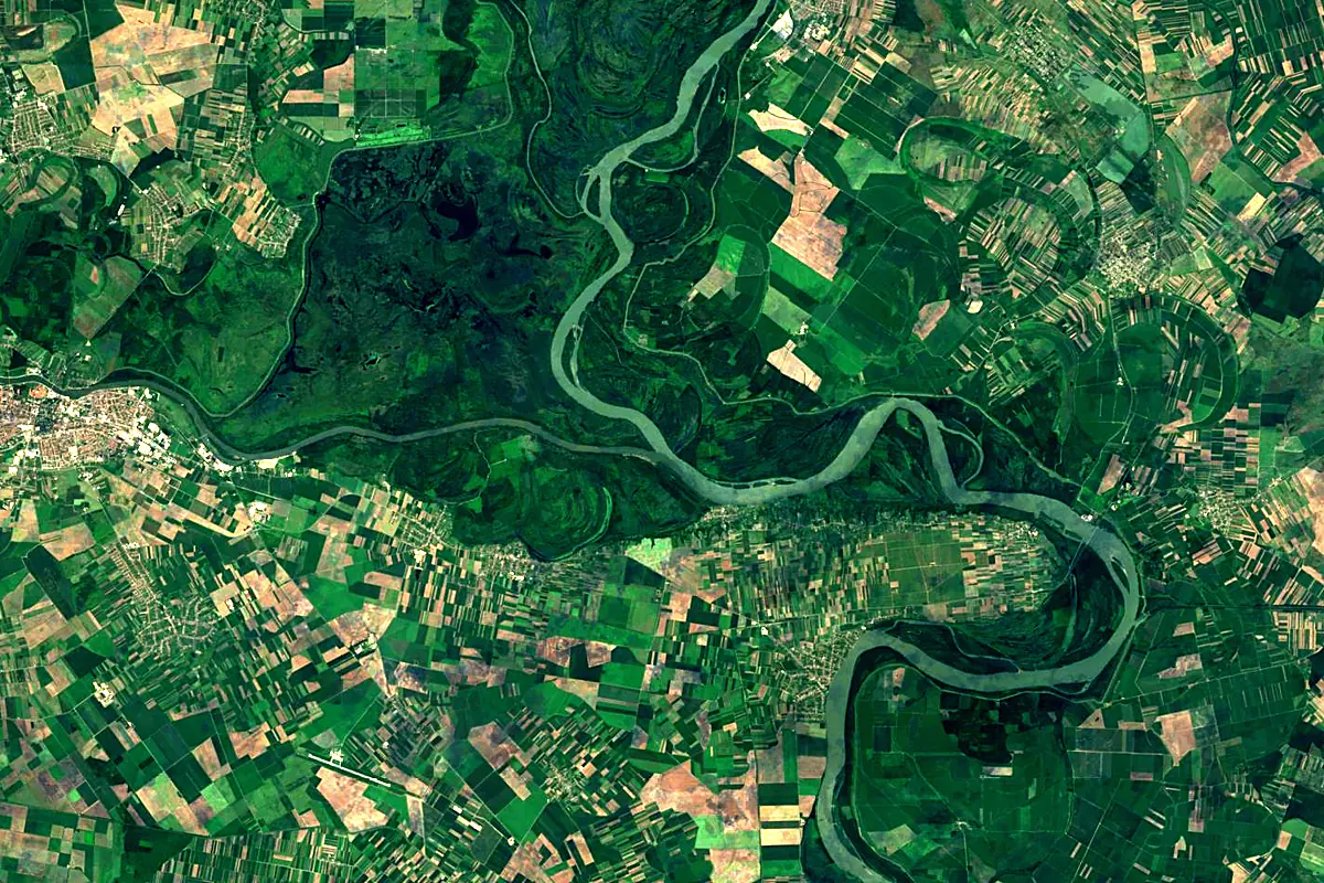
Sentinel-2 cloudless 2016 by EOX IT Services GmbH (contains modified Copernicus Sentinel data 2016), CC BY 4.0. The glowing line is the river as drawn by RiverATLAS.
Photos
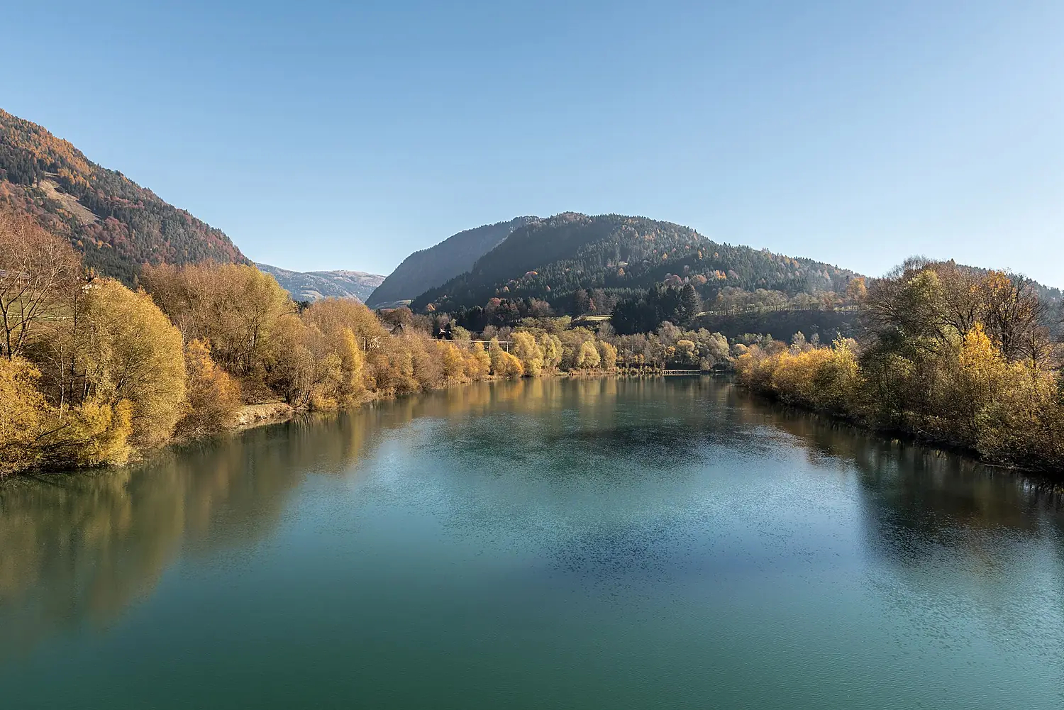
Drava in pictures
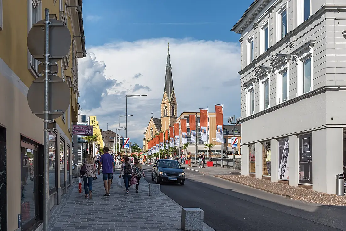
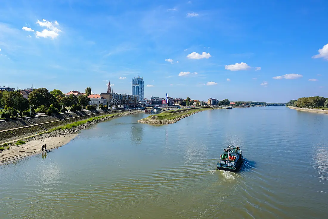
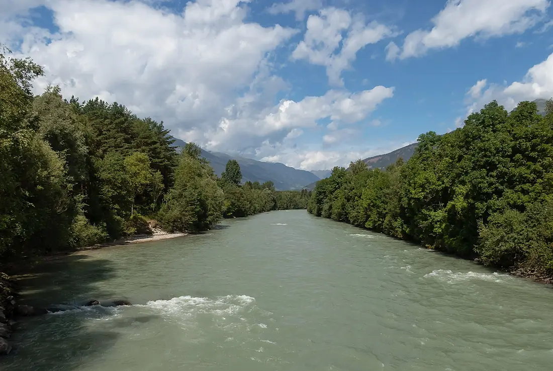
Tributaries
Where it flows, and what flows into it
It flows into
Danube Romania2,850 km5,400 m³/s
Tributaries (51)
Also: Gurk, Dravinja, Meža, Pesnica, Lavant, Bednja, Möll, Karašica, Isel, Rinya-patak, Gailbach, Lieser, Sextner Bach, Debantbach, Vellach, Loiblbach, Thaler Bach, Villgratenbach, Kristeinbach, Čađavica, Seebach, Galitzenbach, Feistritz, Fekete-víz
 Germany
 Moldova
Nearby
Rivers nearby
 Bosnia and Herzegovina282 km140 m³/s64 km awayDrina
 Serbia346 km120 m³/s77 km awayTiszaSerbia966 km800 m³/s115 km awaySavaSerbia945 km1,700 m³/s144 km awayMureș RiverHungary803 km160 m³/s120 km awayBosutSerbia186 km17 m³/s76 km awayVrbasBosnia and Herzegovina240 km33 m³/s120 km awayBega RiverRomania256 km13 m³/s115 km away
Where these numbers come from
| Name, length, places | Wikidata (Q171009) · CC0 |
|---|---|
| Course, profile, basin | RiverATLAS v1.0 (HydroATLAS, Linke et al. 2019) · CC BY 4.0 — followed from the source to the mouth given by Wikidata |
| Flow | WaterGAP (RiverATLAS), 1971–2000 · CC BY 4.0 |
| Climate along the river | WorldClim (RiverATLAS), 1970–2000 · CC BY 4.0 |
| Towns, bridges, dams | Wikidata · CC0; GeoNames · CC BY 4.0 |
| Along the river | © OpenStreetMap contributors · ODbL |
| Images | EOX Sentinel-2 cloudless 2016 · CC BY 4.0; Wikimedia Commons |
| Our other atlases | Cascadyas, Lakeyas, Peakyas — Wikidata · CC0; © OpenStreetMap contributors · ODbL; GeoNames · CC BY 4.0; HydroLAKES · CC BY 4.0; NOAA OISST |
Every source and licence is on the data sources page.
The family
Do you prefer beaches, lakes, mountains, waterfalls, islands, rivers or canyons?
Same idea, other landscapes: field atlases built on open data, month by month, in seven languages.
 beaches
 Find your beach: sea temperature, sun and swimming month by month.Visit lakes
 Every lake on Earth: water temperature, ice, depth and the shore.Coming soonVisit mountains
 Every summit in 3D: summit weather, the 0 °C line, huts and trails.Visit waterfalls
 Every waterfall: height, flow month by month and when it roars.Coming soonVisit
  islands
 Every island from the sea up: size, sea temperature, ferries and 3D.Coming soonVisit
  rivers
 Every river from source to sea: the journey, the flow and the basin in numbers.You are here
 canyons
 Every canyon cut to scale: depth to the floor, rim and floor temperatures, trails and viewpoints.Coming soonVisit