River
Inn
517 km from source to mouth · Germany, Switzerland and Austria.


 Germany, Switzerland and AustriaFlows into Danube3rd longest in Germany
In numbers
Length
517km
Average flow
740m³/s
Basin
25,700km²
Drop
1,497m
from 1,790 m to 293 m
Countries
3
The journey
From source to mouth
517 km of river and 68 stops on the way: 39 towns and cities on its banks, dams, bridges and the tributaries that feed it.
- 0 kmLunghinseeat 1,790 m
- 0 kmLake Silvaplana2.3 km²
- 2 kmLej Nair (Surlej)0.4 km²
- 5 kmSt. Moritz4,994 people
- 5 kmLake St. Moritz0.6 km²
- 10 kmSamedan2,924 people
- 37 kmSpöltributary
- 63 kmScuol4,591 people
- 91 kmSchergenbachtributary
- 109 kmFaggetributary
- 111 kmPitzetributary
- 119 kmLandeck7,725 people
- 138 kmImst11,183 people
- 147 kmÖtztaler Achetributary
- 168 kmTelfs16,046 people
- 183 kmZirl8,110 people
- 191 kmMelachtributary
- 197 kmInnsbruck132,499 people
- 198 kmSilltributary
- 207 kmHall in Tirol14,771 people
- 212 kmVoldertalbachtributary
- 214 kmWattens8,010 people
- 218 kmWeerbachtributary
- 223 kmVomperbachtributary
- 226 kmSchwaz13,810 people
- 235 kmJenbach7,120 people
- 242 kmZillertributary
- 261 kmWörgl13,811 people
- 263 kmBrixentaler Achetributary
- 276 kmKufstein19,126 people
- 279 kmKiefersfelden6,443 people
- 286 kmOberaudorf5,128 people
- 297 kmBrannenburg6,584 people
- 302 kmRaubling10,862 people
- 304 kmRohrdorf5,835 people
- 309 kmStephanskirchen10,695 people
- 311 kmRosenheim65,808 people
- 314 kmMangfalltributary
- 314 kmRohrdorfer Achentributary
- 315 kmHofstätter See0.5 km²
- 326 kmRott am Inn4,104 people
- 330 kmAtteltributary
- 336 kmWasserburg am Inn12,371 people
- 341 kmSoyensee0.4 km²
- 370 kmKraiburg4,001 people
- 372 kmWaldkraiburg25,851 people
- 386 kmMühldorf am Inn22,624 people
- 392 kmTöging am Inn9,574 people
- 396 kmWinhöring4,910 people
- 399 kmAltötting12,980 people
- 399 kmNeuötting8,983 people
- 400 kmMörnbachtributary
- 400 kmIsentributary
- 415 kmMarktl2,784 people
- 419 kmAlztributary
- 424 kmSalzachtributary
- 434 kmSimbach am Inn10,311 people
- 434 kmBraunau am Inn17,095 people
- 437 kmEnknachtributary
- 437 kmMattigtributary
- 461 kmBad Füssing8,062 people
- 463 kmPocking16,296 people
- 467 kmHartbachtributary
- 477 kmSchärding5,253 people
- 477 kmRotttributary
- 478 kmNeuhaus am Inn3,433 people
- 479 kmPramtributary
- 483 kmNeuburg am Inn4,473 people
- 492 kmPassau53,523 people
- 517 kmDanubeat 293 m
Water level along the river (RiverATLAS; the height is exaggerated). Towns: GeoNames and Wikidata; bridges, dams and tributaries: Wikidata.
River in Switzerland, Austria and Germany, a right tributary of the Danube
At the mouth it carries 740 m³/s on average: an Olympic pool every 3.4 seconds. It drops from 1,790 m to 293 m, 2.9 m per kilometre on average. Its basin covers 25,700 km², about the size of MK. 2.4 million people live in it. Highest water: from March to May; lowest: from December to February. Its dams hold back little of its water (4.3% of a year's flow).
Where to start
- InnsbruckLargest city on its banks · 132,499 people
- Innsbruck Airport (INN)Nearest airport with scheduled flights, 4 km from the cityCar hire at INN airport (Innsbruck)Discover Cars · Affiliate link↗
- On the water55 ferry piers, marinas, boat rentals and boat ramps along the river (OpenStreetMap)
- Kayak and canoe79 put-ins and rapids mapped (OpenStreetMap)
- From June to SeptemberThe best months to visit
Inn, month by month
Highest water: from March to May
Lowest water: from December to February. Best months to visit: from June to September.
From about 260 m³/s in the lowest month to 1,200 m³/s in the highest. An estimate: the monthly flow is modelled from the lowest and highest months of WaterGAP (RiverATLAS, 1971–2000) and the rain and snow along the river (WorldClim). Dams change the real rhythm. The chip is the average air temperature; below it, the month's rain.
Plan the trip
Plan the trip: boat trips, a bed by the river, a car
Some links above are affiliate links: if you book through them we may earn a commission, at no extra cost to you. It never changes what the data on this page says.
The basin
Inn: the basin in numbers
25,921 km² of land send their water to this river. This is what lives on it.
- 2.4millionpeople live in the basin
- 92/km²people per km²
- 1,257maverage altitude of the basin
- 1,146mmof rain a year (basin average)
- 4.6°Caverage air temperature
- 21%protected areas
- 0.6%covered by lakes
- 5%permafrost
- 0.9km³held in reservoirs
What covers the basin
- 65% Forest
- 9% Cropland
- 28% Pasture
- 4% Towns and cities
RiverATLAS (HydroATLAS v1.0, CC BY 4.0): land cover, people, protected areas, glaciers and dams over the whole basin upstream of the mouth.
Along the river
Inn: what you find on the way
- 343WeirsWehranlage Ovella (GKI), Kraftwerk Stiller Bach Wehranlage, Rückhaltebecken Köterbach and 340 more
- 1LocksEinlauf Perjener Waal
- 80WaterfallsSagl d'Arpiglia, Gletschermühle, Assafall and 77 more
- 32RapidsBobsleigh, Bockschlitz, Himmelsgucker and 29 more
- 47Canoe put-insBootseinsetzstelle and 46 more
- 40Boat rampsInnspitz and 39 more
- 9Ferry piersFährstelle Kiefersfelden, Fährstelle Ebbs, Innfähre and 6 more
- 6MarinasLöschweier, 1. ISC Suben, L4 and 3 more
- 6River beachesAirport Reef, FKK Happingerau See, Innstrand and 3 more
From OpenStreetMap, within 2.0 km of the river. Not mapped is not the same as not there.
Cross-checked with our atlases
Inn in our other atlases
What our sister atlases know about the waterfalls on this river, the lakes it flows through, the beaches at its mouth, the mountains where it rises and the islands off its mouth.
 5lakes on its wayLakeyas
 209mountains at the sourcePeakyas
Lakes and reservoirs (5)
Lakes it flows through, by Lakeyas
- Lake Silvaplanakm 0 · 77 m deep2.3km²
- Lej Nair (Surlej)km 20.4km²
- Lake St. Moritzkm 5 · 44 m deep0.6km²
- Hofstätter Seekm 3120.5km²
- Soyenseekm 3370.4km²
Lakeyas is coming soonOpen Lakeyas ↗
Mountains at the source (209)
Within 15 km of the source, by Peakyas
- Piz Corvatsch12 km away · prominence 383 m3,451m
- Pizzo Badile14 km away · prominence 262 m3,308m
- Piz Platta11 km away · prominence 1,108 m3,392m
- Pizzo Cengalo14 km away · prominence 620 m3,369m
- Cima di Castello12 km away · prominence 388 m3,379m
- Piz Glüschaint14 km away · prominence 341 m3,594m
- Piz Calderas14 km away · prominence 1,085 m3,397m
- Piz Julier11 km away · prominence 489 m3,380m
201 more on PeakyasOpen Peakyas ↗
From space
The source and the mouth, seen from orbit
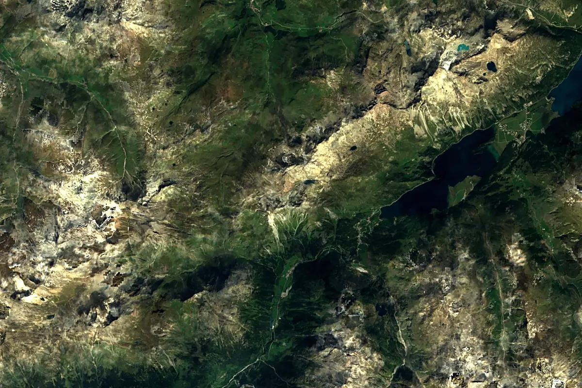
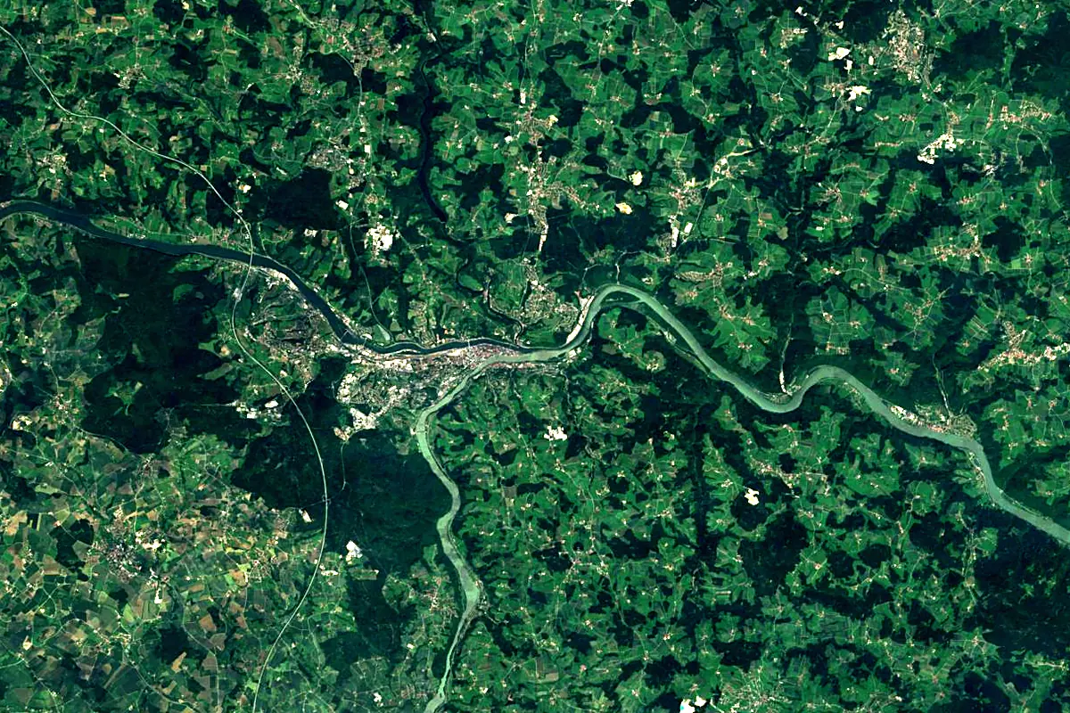
Sentinel-2 cloudless 2016 by EOX IT Services GmbH (contains modified Copernicus Sentinel data 2016), CC BY 4.0. The glowing line is the river as drawn by RiverATLAS.
Photos
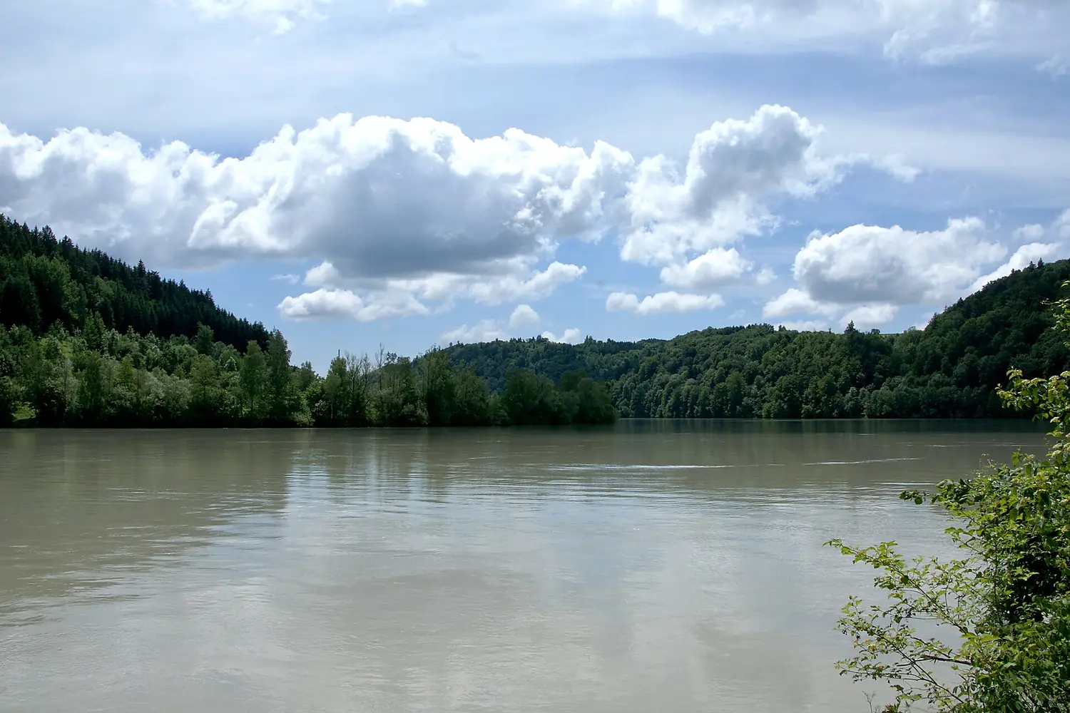
Inn in pictures
Tributaries
Where it flows, and what flows into it
It flows into
Danube Romania2,850 km5,400 m³/s
Tributaries (64)
Also: Sill, Mangfall, Rott, Ziller, Ötztaler Ache, Spöl, Sanna, Pitze, Isen, Brandenberger Ache, Melach, Flaz, Brixentaler Ache, Gurglbach, Kieferbach, Attel, Vomperbach, Antiesen, Fagge, Clemgia, Wildschönauer Ache, Wattenbach, Hartbach, Sims
 Serbia
 Croatia
 Moldova
 Hungary
Nearby
Rivers nearby
 Czechia
Where these numbers come from
| Name, length, places | Wikidata (Q14369) · CC0 |
|---|---|
| Course, profile, basin | RiverATLAS v1.0 (HydroATLAS, Linke et al. 2019) · CC BY 4.0 — followed from the source to the mouth given by Wikidata |
| Flow | WaterGAP (RiverATLAS), 1971–2000 · CC BY 4.0 |
| Climate along the river | WorldClim (RiverATLAS), 1970–2000 · CC BY 4.0 |
| Towns, bridges, dams | Wikidata · CC0; GeoNames · CC BY 4.0 |
| Along the river | © OpenStreetMap contributors · ODbL |
| Images | EOX Sentinel-2 cloudless 2016 · CC BY 4.0; Wikimedia Commons |
| Our other atlases | Lakeyas, Peakyas — Wikidata · CC0; © OpenStreetMap contributors · ODbL; GeoNames · CC BY 4.0; HydroLAKES · CC BY 4.0; NOAA OISST |
Every source and licence is on the data sources page.
The family
Do you prefer beaches, lakes, mountains, waterfalls, islands, rivers or canyons?
Same idea, other landscapes: field atlases built on open data, month by month, in seven languages.
 beaches
 Find your beach: sea temperature, sun and swimming month by month.Visit lakes
 Every lake on Earth: water temperature, ice, depth and the shore.Coming soonVisit mountains
 Every summit in 3D: summit weather, the 0 °C line, huts and trails.Visit
  waterfalls
 Every waterfall: height, flow month by month and when it roars.Coming soonVisit
  islands
 Every island from the sea up: size, sea temperature, ferries and 3D.Coming soonVisit
  rivers
 Every river from source to sea: the journey, the flow and the basin in numbers.You are here
 canyons
 Every canyon cut to scale: depth to the floor, rim and floor temperatures, trails and viewpoints.Coming soonVisit