River
Mureș River
803 km from source to mouth · Hungary and Romania.
 Hungary and RomaniaFlows into Tisza1st longest in Hungary
In numbers
Length
803km
Average flow
160m³/s
Basin
30,000km²
Drop
675m
from 749 m to 74 m
Countries
2
The journey
From source to mouth
803 km of river and 45 stops on the way: 18 towns and cities on its banks, dams, bridges and the tributaries that feed it.
- 0 kmSourceat 749 m
- 55 kmTopliţa12,609 people
- 111 kmSebeș River (Mureș)tributary
- 133 kmGurghiu Rivertributary
- 136 kmReghin-Sat35,490 people
- 173 kmTârgu Mureş212,752 people
- 181 kmPocloș Rivertributary
- 187 kmNiraj Rivertributary
- 209 kmIernut9,343 people
- 216 kmLechința Rivertributary
- 236 kmLuduş17,165 people
- 236 kmPârâul de Câmpietributary
- 262 kmArieș Rivertributary
- 269 kmOcna Mureş15,316 people
- 282 kmMirăslău Rivertributary
- 290 kmAiud Rivertributary
- 292 kmAiud28,341 people
- 312 kmTârnava Rivertributary
- 327 kmAmpoi Rivertributary
- 327 kmGalda Rivertributary
- 329 kmAlba Iulia64,227 people
- 337 kmSebeș Rivertributary
- 362 kmCugir Rivertributary
- 376 kmGeoagiu Rivertributary
- 379 kmOrăștie Rivertributary
- 396 kmStreitributary
- 398 kmSimeria13,827 people
- 404 kmCerna Rivertributary
- 410 kmDeva67,802 people
- 455 kmDobra Rivertributary
- 459 kmAbuceatributary
- 493 kmTroaș Rivertributary
- 517 kmJulița Rivertributary
- 525 kmGrosul Rivertributary
- 543 kmConop Rivertributary
- 563 kmLipova11,041 people
- 566 kmȘoimoș Rivertributary
- 603 kmVladimirescu10,451 people
- 611 kmArad169,065 people
- 613 kmTrajan bridge in Arad
- 642 kmPecica12,804 people
- 685 kmNădlac8,067 people
- 712 kmIer Rivertributary
- 718 kmMakó25,135 people
- 752 kmÚjszeged25,300 people
- 752 kmSzeged160,766 people
- 803 kmTiszaat 74 m
Water level along the river (RiverATLAS; the height is exaggerated). Towns: GeoNames and Wikidata; bridges, dams and tributaries: Wikidata.
River in Eastern Europe
At the mouth it carries 155 m³/s on average: an Olympic pool every 16 seconds. It drops from 749 m to 74 m, 0.8 m per kilometre on average. Its basin covers 30,000 km², about the size of AM. 11.1 million people live in it. Highest water: from May to August. Its dams hold back little of its water (7.3% of a year's flow).
Where to start
- Târgu MureşLargest city on its banks · 212,752 people
- Târgu Mureş Transilvania International Airport (TGM)Nearest airport with scheduled flights, 14 km from the cityCar hire at CLJ airport (Cluj-Napoca)Discover Cars · Affiliate link↗
- On the water39 ferry piers, marinas, boat rentals and boat ramps along the river (OpenStreetMap)
- Kayak and canoe1 put-ins and rapids mapped (OpenStreetMap)
- From May to SeptemberThe best months to visit
Mureș River, month by month
Highest water: from May to August
Best months to visit: from May to September.
From about 370 m³/s in the lowest month to 2,000 m³/s in the highest. An estimate: the monthly flow is modelled from the lowest and highest months of WaterGAP (RiverATLAS, 1971–2000) and the rain and snow along the river (WorldClim). Dams change the real rhythm. The chip is the average air temperature; below it, the month's rain.
Plan the trip
Plan the trip: boat trips, a bed by the river, a car
Some links above are affiliate links: if you book through them we may earn a commission, at no extra cost to you. It never changes what the data on this page says.
The basin
Mureș River: the basin in numbers
138,662 km² of land send their water to this river. This is what lives on it.
- 11.1millionpeople live in the basin
- 81/km²people per km²
- 383maverage altitude of the basin
- 655mmof rain a year (basin average)
- 8.8°Caverage air temperature
- 9%protected areas
- 0.3%covered by lakes
- 2.1km³held in reservoirs
What covers the basin
- 39% Forest
- 36% Cropland
- 22% Pasture
- 3% Towns and cities
RiverATLAS (HydroATLAS v1.0, CC BY 4.0): land cover, people, protected areas, glaciers and dams over the whole basin upstream of the mouth.
Along the river
Mureș River: what you find on the way
- 12Weirs
- 1Locks
- 1WaterfallsCascada Mezotermală Toplița
- 1Canoe put-ins
- 13Boat rampsTobogan and 12 more
- 20Ferry piersVaporaș Stelar and 19 more
- 4MarinasDebarcader, Szeged-Tápé téli kikötő, Foka Ökokikötő Hajó- és Kajak-kenu kölcsönző and 1 more
- 4River beachesPeriam Port, Maros Kalandpart Makó, Sárga and 1 more
From OpenStreetMap, within 2.5 km of the river. Not mapped is not the same as not there.
Cross-checked with our atlases
Mureș River in our other atlases
What our sister atlases know about the waterfalls on this river, the lakes it flows through, the beaches at its mouth, the mountains where it rises and the islands off its mouth.
 4mountains at the sourcePeakyas
Mountains at the source (4)
Within 15 km of the source, by Peakyas
- Hășmaș Mountains14 km away1,792m
- Poienii9.4 km away1,229m
- Răchitiș4.2 km away948m
- Fagul Ascuțit4.9 km away893m
From space
The source and the mouth, seen from orbit
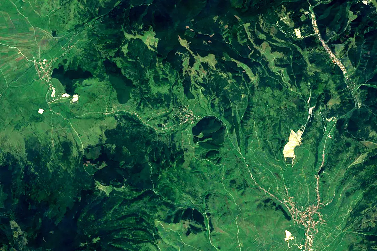
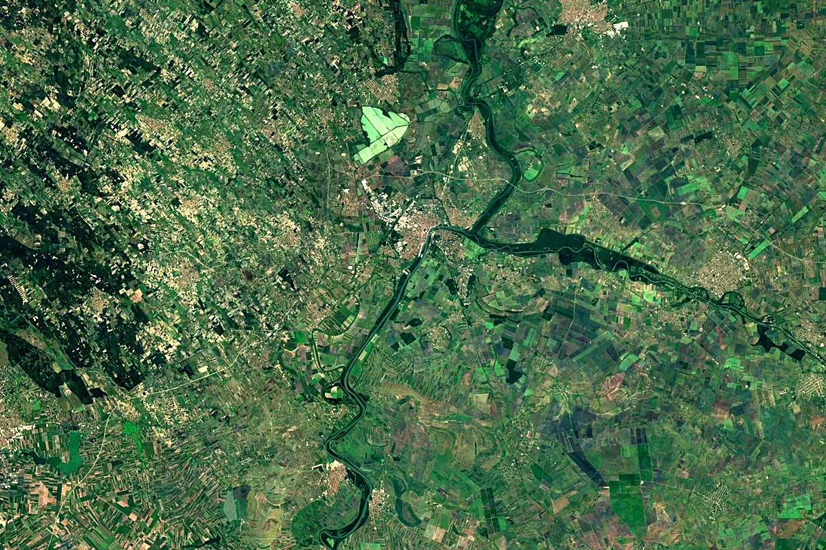
Sentinel-2 cloudless 2016 by EOX IT Services GmbH (contains modified Copernicus Sentinel data 2016), CC BY 4.0. The glowing line is the river as drawn by RiverATLAS.
Photos
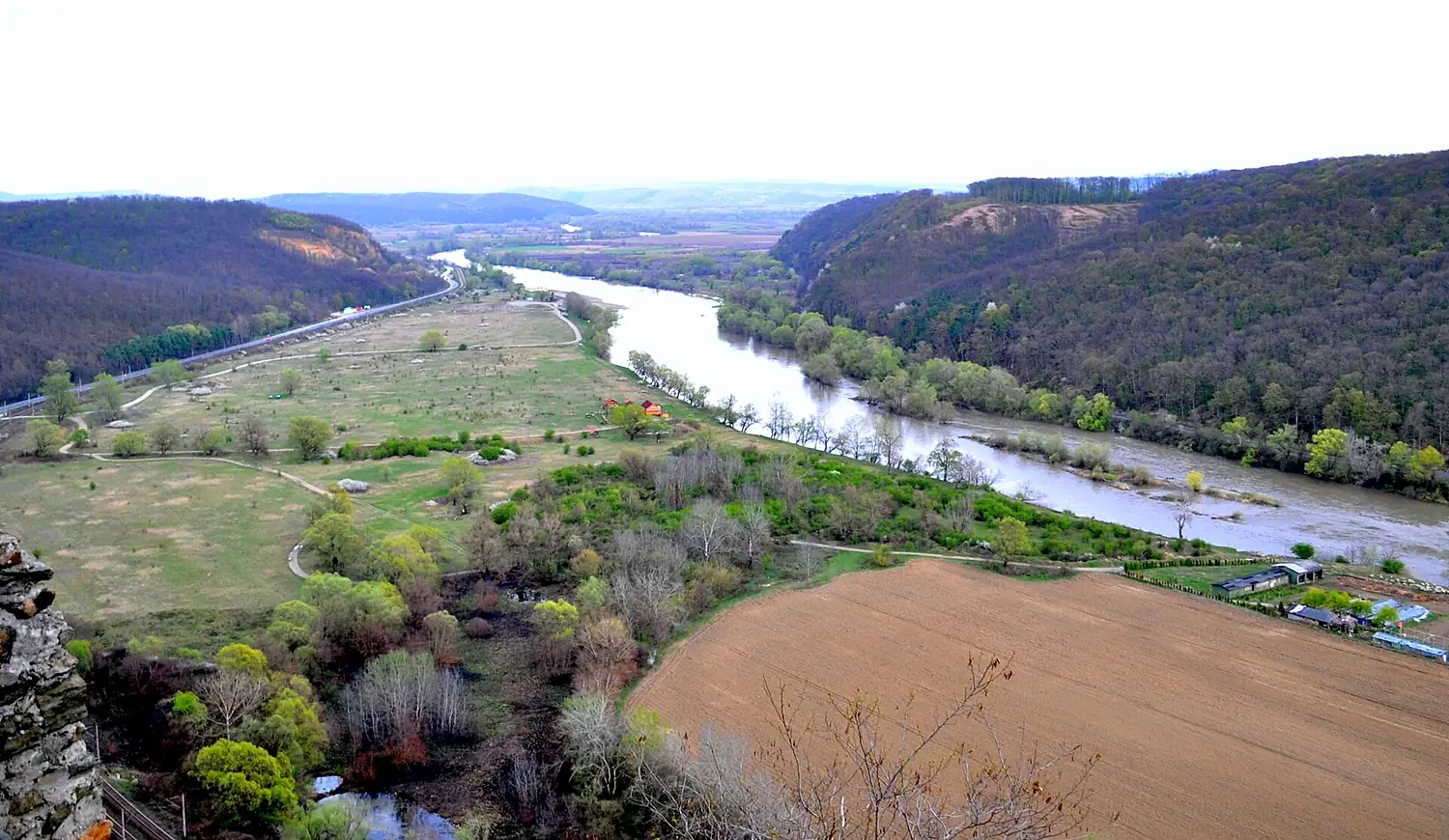
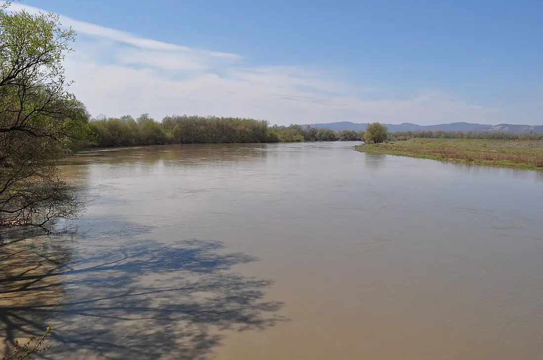
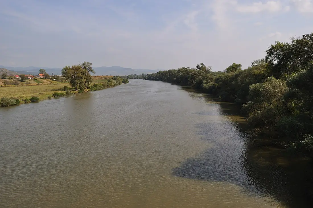
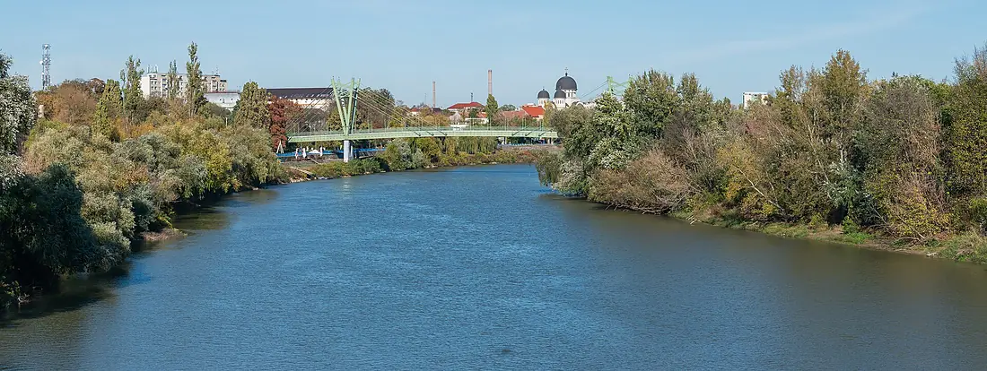
Mureș River in pictures
Tributaries
Where it flows, and what flows into it
It flows into
Tisza Serbia966 km800 m³/s
Tributaries (139)
Also: Arieș River, Târnava River, Strei, Ampoi River, Cerna River, Niraj River, Sebeș River, Geoagiu River, Gurghiu River, Abucea, Geoagiu River, Luț River, Conop River, Mirăslău River, Aiud River, Cugir River, Pocloș River, Lechința River, Pârâul de Câmpie, Valea Goblii River, Gârbova River, Bârzava Stream, Băcăinți River, Cladova River
 Germany
 Moldova
 Austria
Nearby
Rivers nearby
Hungary93 km21 m³/s55 km awayDrava Croatia720 km620 m³/s120 km awaySavaSerbia945 km1,700 m³/s156 km awayCrișul Alb RiverHungary236 km24 m³/s99 km awayCrișul Repede RiverHungary209 km19 m³/s100 km awayBega RiverRomania256 km13 m³/s116 km awayDrinaSerbia346 km120 m³/s159 km awayBarcău RiverHungary134 km6.1 m³/s107 km away
Where these numbers come from
| Name, length, places | Wikidata (Q207493) · CC0 |
|---|---|
| Course, profile, basin | RiverATLAS v1.0 (HydroATLAS, Linke et al. 2019) · CC BY 4.0 — followed from the source to the mouth given by Wikidata |
| Flow | WaterGAP (RiverATLAS), 1971–2000 · CC BY 4.0 |
| Climate along the river | WorldClim (RiverATLAS), 1970–2000 · CC BY 4.0 |
| Towns, bridges, dams | Wikidata · CC0; GeoNames · CC BY 4.0 |
| Along the river | © OpenStreetMap contributors · ODbL |
| Images | EOX Sentinel-2 cloudless 2016 · CC BY 4.0; Wikimedia Commons |
| Our other atlases | Peakyas — Wikidata · CC0; © OpenStreetMap contributors · ODbL; GeoNames · CC BY 4.0; HydroLAKES · CC BY 4.0; NOAA OISST |
Every source and licence is on the data sources page.
The family
Do you prefer beaches, lakes, mountains, waterfalls, islands, rivers or canyons?
Same idea, other landscapes: field atlases built on open data, month by month, in seven languages.
 beaches
 Find your beach: sea temperature, sun and swimming month by month.Visit
  lakes
lakes Every lake on Earth: water temperature, ice, depth and the shore.Coming soonVisit mountains
 Every summit in 3D: summit weather, the 0 °C line, huts and trails.Visit
  waterfalls
 Every waterfall: height, flow month by month and when it roars.Coming soonVisit
  islands
 Every island from the sea up: size, sea temperature, ferries and 3D.Coming soonVisit
  rivers
 Every river from source to sea: the journey, the flow and the basin in numbers.You are here
 canyons
 Every canyon cut to scale: depth to the floor, rim and floor temperatures, trails and viewpoints.Coming soonVisit