River
Tisza
966 km from source to mouth · 5 countries.
 Serbia, Ukraine, Slovakia, Romania and HungaryFlows into Danube1st longest in Serbia
In numbers
Length
966km
Average flow
800m³/s
Basin
153,200km²
Drop
406m
from 474 m to 68 m
Countries
5
The journey
From source to mouth
966 km of river and 68 stops on the way: 30 towns and cities on its banks, dams, bridges and the tributaries that feed it.
- 0 kmRakhivat 474 m
- 5 kmBila Tysatributary
- 5 kmChorna Tysatributary
- 9 kmRakhiv15,621 people
- 12 kmKamianyi Waterfall2 m
- 16 kmTarnychyn Waterfall6 m
- 30 kmVișeu Rivertributary
- 35 kmPolonsko-Kuziiskyi Waterfall2 m
- 39 kmLuh1,985 people
- 39 kmKosivska Rivertributary
- 43 kmVelykyy Bychkiv9,255 people
- 55 kmSighetu Marmației32,793 people
- 55 kmSolotvyno8,632 people
- 56 kmSighetu Marmaţiei40,653 people
- 59 kmIza Rivertributary
- 69 kmHrushovo8,500 people
- 80 kmTeresvatributary
- 86 kmTyachiv9,019 people
- 94 kmBushtyno8,444 people
- 97 kmTereblyatributary
- 99 kmVyshkovo8,243 people
- 118 kmKhust28,039 people
- 126 kmRikatributary
- 131 kmKorolevo10,385 people
- 141 kmVynohradiv25,317 people
- 165 kmBatartributary
- 183 kmBadalovo1,594 people
- 184 kmTur Rivertributary
- 216 kmSomeștributary
- 219 kmVásárosnamény9,310 people
- 224 kmCrasnatributary
- 258 kmTiszaszentmárton–Solovka Railway Bridge
- 268 kmChop8,626 people
- 303 kmFrancis II Rákóczi Bridge at Cigánd and Tiszakanyár
- 359 kmBodrogtributary
- 359 kmQueen Elisabeth bridge
- 364 kmPap-tó0.7 km²
- 404 kmTiszadobi Pontonhíd
- 414 kmSajótributary
- 415 kmTiszaújváros17,295 people
- 437 kmHalastó0.4 km²
- 473 kmTiszafüred10,872 people
- 503 kmLake Tisza119 km²
- 505 kmRoad-rail bridge at Kisköre
- 572 kmOttoman bridge in Szolnok
- 573 kmZagyvatributary
- 573 kmSzolnok71,285 people
- 573 kmTiszavirág bridge
- 622 kmTiszakécske11,745 people
- 661 kmCsongrád18,580 people
- 665 kmKörös Rivertributary
- 671 kmSzentes27,898 people
- 719 kmAlgyő5,364 people
- 735 kmÚjszeged25,300 people
- 735 kmOld town bridge
- 735 kmSzeged160,766 people
- 736 kmSzegedi vasúti Tisza-híd
- 739 kmMureș Rivertributary
- 761 kmKanjiža10,200 people
- 765 kmNovi Kneževac8,166 people
- 772 kmKörös-értributary
- 784 kmSenta20,302 people
- 805 kmAranca Rivertributary
- 821 kmBačko Petrovo Selo8,959 people
- 824 kmČiktributary
- 837 kmBečej25,774 people
- 872 kmJegričkatributary
- 896 kmBelo jezero9.8 km²
- 904 kmBega Rivertributary
- 966 kmDanubeat 68 m
Water level along the river (RiverATLAS; the height is exaggerated). Towns: GeoNames and Wikidata; bridges, dams and tributaries: Wikidata.
River in Europe
At the mouth it carries 796 m³/s on average: an Olympic pool every 3.1 seconds. It drops from 474 m to 68 m, 0.4 m per kilometre on average. Its basin covers 153,200 km², about the size of BD. 12.6 million people live in it. Highest water: from February to March and May. Its dams hold back little of its water (7.1% of a year's flow).
Where to start
- SzegedLargest city on its banks · 160,766 people
- Arad International Airport (ARW)Nearest airport with scheduled flights, 86 km from the cityCar hire at TSR airport (Timişoara)Discover Cars · Affiliate link↗
- On the water109 ferry piers, marinas, boat rentals and boat ramps along the river (OpenStreetMap)
- Kayak and canoe1 put-ins and rapids mapped (OpenStreetMap)
- From May to SeptemberThe best months to visit
Tisza, month by month
Highest water: from February to March and May
Best months to visit: from May to September.
From about 410 m³/s in the lowest month to 2,100 m³/s in the highest. An estimate: the monthly flow is modelled from the lowest and highest months of WaterGAP (RiverATLAS, 1971–2000) and the rain and snow along the river (WorldClim). Dams change the real rhythm. The chip is the average air temperature; below it, the month's rain.
Plan the trip
Plan the trip: boat trips, a bed by the river, a car
Some links above are affiliate links: if you book through them we may earn a commission, at no extra cost to you. It never changes what the data on this page says.
The basin
Tisza: the basin in numbers
154,073 km² of land send their water to this river. This is what lives on it.
- 12.6millionpeople live in the basin
- 82/km²people per km²
- 355maverage altitude of the basin
- 648mmof rain a year (basin average)
- 9.0°Caverage air temperature
- 8%protected areas
- 0.3%covered by lakes
- 2.1km³held in reservoirs
What covers the basin
- 36% Forest
- 39% Cropland
- 21% Pasture
- 3% Towns and cities
RiverATLAS (HydroATLAS v1.0, CC BY 4.0): land cover, people, protected areas, glaciers and dams over the whole basin upstream of the mouth.
Along the river
Tisza: what you find on the way
- 43WeirsBukógát, Lónyay-főcsatorna torkolati műtárgy, Töltő-ürítő műtárgy and 40 more
- 12LocksTisza and 11 more
- 8Waterfalls
- 1Canoe put-ins
- 28Boat rampsSzabics-kikötő sólya, Kossuth Lajos utca and 26 more
- 44Ferry piersBodrogzug Komp, Dinnyéshát-Tiszaderzs kerékpáros komp, Tisza Komp, Mindszent and 41 more
- 32MarinasVárosi kikötő, Balneum kikötő, Albatrosz kikötő and 29 more
- 20River beachesTiszai szabadstrand, Panyolai strand, Ibrányi szabadstrand and 17 more
From OpenStreetMap, within 2.5 km of the river. Not mapped is not the same as not there.
Cross-checked with our atlases
Tisza in our other atlases
What our sister atlases know about the waterfalls on this river, the lakes it flows through, the beaches at its mouth, the mountains where it rises and the islands off its mouth.
 3waterfalls on the riverCascadyas
 4lakes on its wayLakeyas
 11mountains at the sourcePeakyas
Waterfalls (3)
On the river, by Cascadyas
- Kamianyi Waterfallkm 112m
- Tarnychyn Waterfallkm 166m
- Polonsko-Kuziiskyi Waterfallkm 332m
Cascadyas is coming soonOpen Cascadyas ↗
Lakes and reservoirs (4)
Lakes it flows through, by Lakeyas
- Pap-tókm 3470.7km²
- Halastókm 4170.4km²
- Lake Tiszakm 479 · 17 m deep119km²
- Belo jezerokm 855 · 2 m deep9.8km²
Lakeyas is coming soonOpen Lakeyas ↗
Mountains at the source (11)
Within 15 km of the source, by Peakyas
- Mount Sheshul12 km away1,726m
- Berlebashka13 km away1,734m
- Kobyla12 km away
- Hora Petros14 km away
- Hora Butyn11 km away
- Hora Lysyna12 km away
- Hora Stara12 km away
- Gora Dumen'3.5 km away
3 more on PeakyasOpen Peakyas ↗
From space
The source and the mouth, seen from orbit
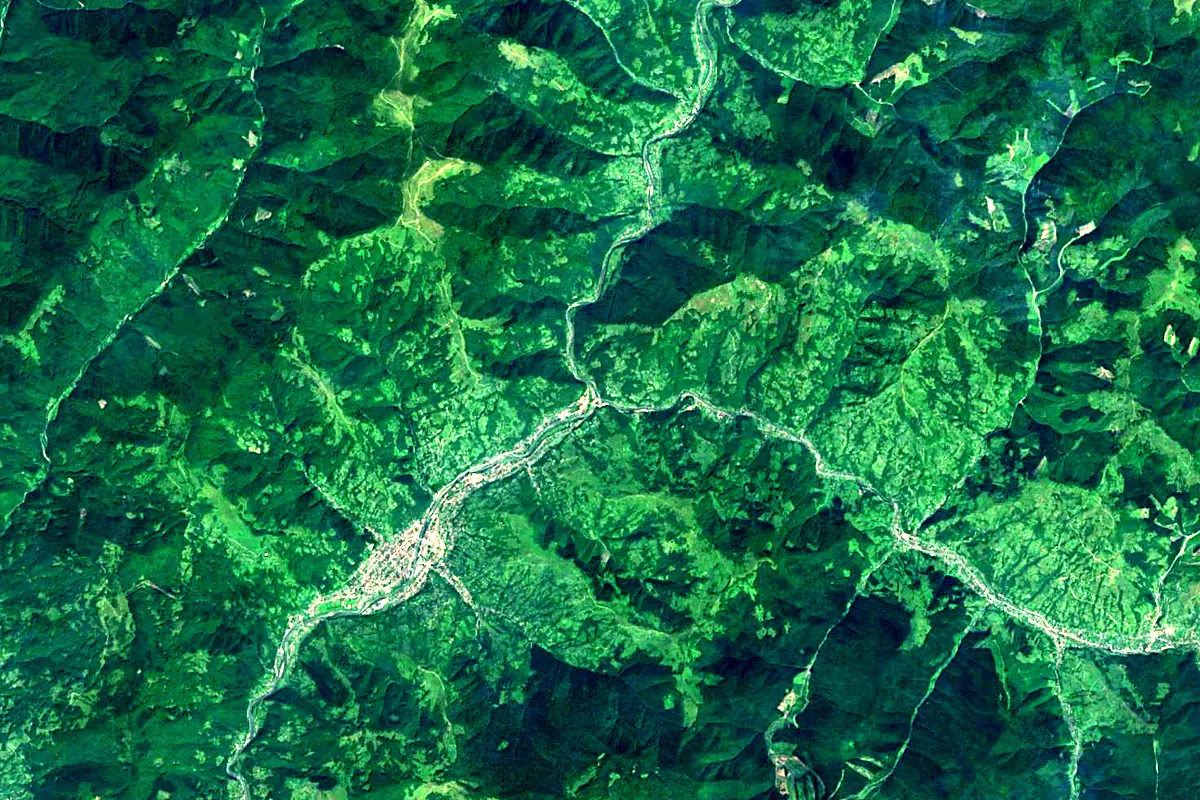
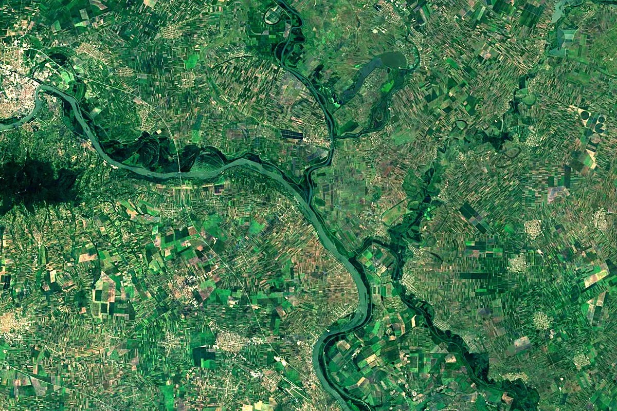
Sentinel-2 cloudless 2016 by EOX IT Services GmbH (contains modified Copernicus Sentinel data 2016), CC BY 4.0. The glowing line is the river as drawn by RiverATLAS.
Photos
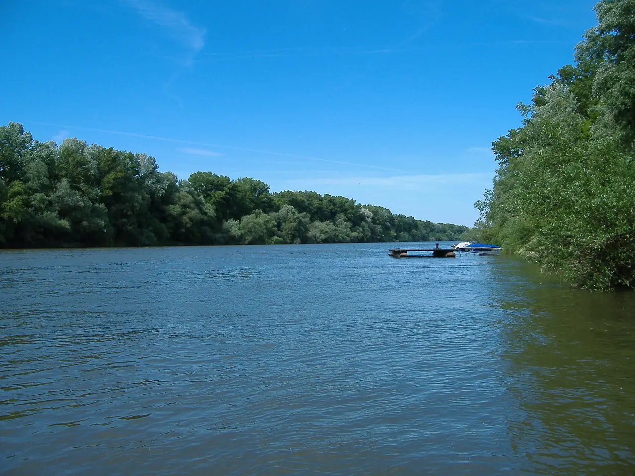
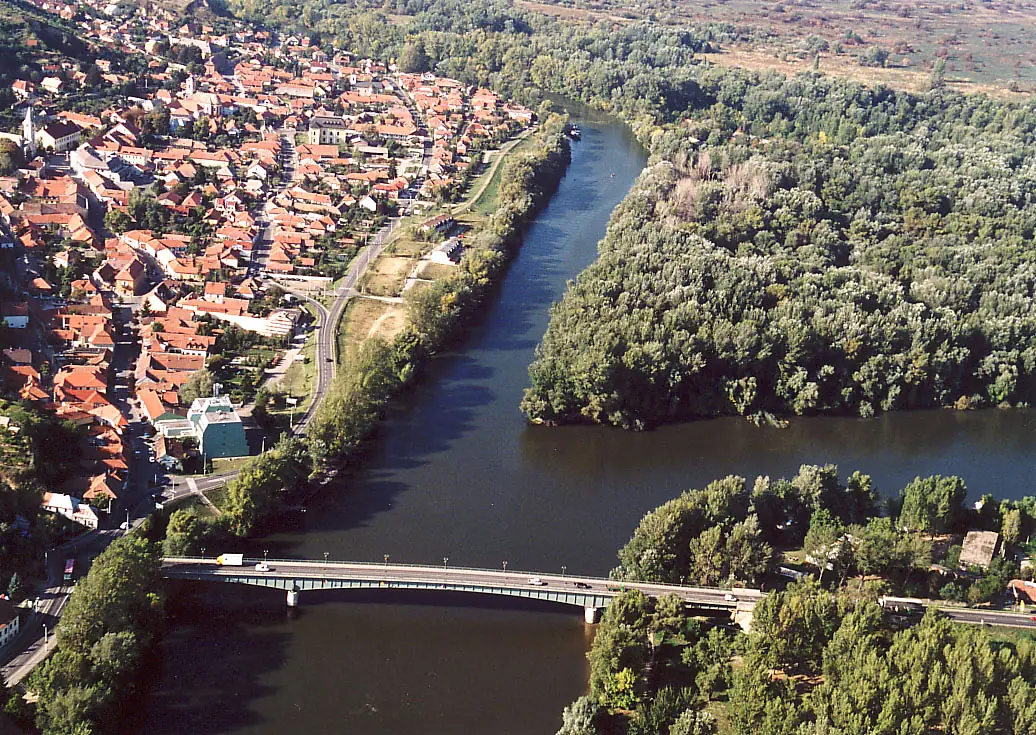
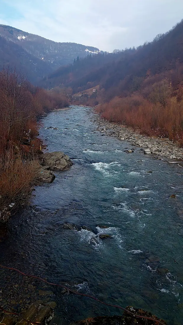
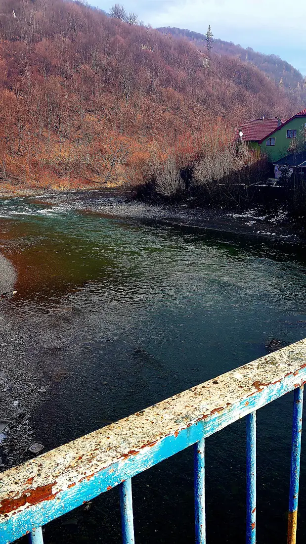
Tisza in pictures
Tributaries
Where it flows, and what flows into it
It flows into
DanubeRomania2,850 km5,400 m³/sTributaries (31)
Hungary803 km160 m³/sjoins at km 705SomeșHungary418 km120 m³/sjoins at km 206Bega RiverRomania256 km13 m³/sjoins at km 862SajóHungary229 km70 m³/sjoins at km 395ZagyvaHungary179 km9.5 m³/sjoins at km 546Körös RiverHungary93 km21 m³/sjoins at km 634Iza RiverRomania80 km17 m³/sjoins at km 56BodrogHungary67 km120 m³/sjoins at km 343Also: Vișeu River, Crasna, Tereblya, Teresva, Körös-ér, Rika, Borzsa, Aranca River, Tur River, Batar, Čik, Jegrička, Chorna Tysa, Bila Tysa, Kosivska River, Apshitsa, Bilyy, Shopurka River, Hejő, Boylova, Săpânța River, Baia River, Bicu River
 Germany
 Moldova
 Austria
Nearby
Rivers nearby
Serbia945 km1,700 m³/s36 km awayBega RiverRomania256 km13 m³/s5 km awayTimiș RiverSerbia359 km47 m³/s43 km awayDrinaSerbia346 km120 m³/s79 km awayGreat MoravaSerbia185 km230 m³/s76 km awayDrava Croatia720 km620 m³/s115 km awayBosutSerbia186 km17 m³/s74 km awayMureș RiverHungary803 km160 m³/s121 km away
Where these numbers come from
| Name, length, places | Wikidata (Q134350) · CC0 |
|---|---|
| Course, profile, basin | RiverATLAS v1.0 (HydroATLAS, Linke et al. 2019) · CC BY 4.0 — followed from the source to the mouth given by Wikidata |
| Flow | WaterGAP (RiverATLAS), 1971–2000 · CC BY 4.0 |
| Climate along the river | WorldClim (RiverATLAS), 1970–2000 · CC BY 4.0 |
| Towns, bridges, dams | Wikidata · CC0; GeoNames · CC BY 4.0 |
| Along the river | © OpenStreetMap contributors · ODbL |
| Images | EOX Sentinel-2 cloudless 2016 · CC BY 4.0; Wikimedia Commons |
| Our other atlases | Cascadyas, Lakeyas, Peakyas — Wikidata · CC0; © OpenStreetMap contributors · ODbL; GeoNames · CC BY 4.0; HydroLAKES · CC BY 4.0; NOAA OISST |
Every source and licence is on the data sources page.
The family
Do you prefer beaches, lakes, mountains, waterfalls, islands, rivers or canyons?
Same idea, other landscapes: field atlases built on open data, month by month, in seven languages.
 beaches
 Find your beach: sea temperature, sun and swimming month by month.Visit lakes
 Every lake on Earth: water temperature, ice, depth and the shore.Coming soonVisit mountains
 Every summit in 3D: summit weather, the 0 °C line, huts and trails.Visit waterfalls
 Every waterfall: height, flow month by month and when it roars.Coming soonVisit
  islands
 Every island from the sea up: size, sea temperature, ferries and 3D.Coming soonVisit
  rivers
 Every river from source to sea: the journey, the flow and the basin in numbers.You are here
 canyons
 Every canyon cut to scale: depth to the floor, rim and floor temperatures, trails and viewpoints.Coming soonVisit