River
Danube
2,850 km from source to mouth · 9 countries.

 Romania, Germany, Slovakia, Moldova, Bulgaria, Croatia, Hungary, Austria and SerbiaFlows into Black Sea1st longest in Romania
In numbers
Length
2,850km
Average flow
5,400m³/s
Basin
801,463km²
Drop
783m
from 780 m to -3 m
Countries
9
The journey
From source to mouth
2,850 km of river and 68 stops on the way: 45 towns and cities on its banks, dams, bridges and the tributaries that feed it.
- 0 kmBrigachat 780 m
- 20 kmBrigachtributary
- 20 kmBregtributary
- 21 kmRiedsee0.3 km²
- 31 kmAitrachtributary
- 85 kmLaucherttributary
- 90 kmAblachtributary
- 92 kmOstrachtributary
- 156 kmUlm130,288 people
- 195 kmLauingen11,604 people
- 199 kmDillingen an der Donau19,643 people
- 206 kmHöchstädt an der Donau6,910 people
- 225 kmDonauwörth20,024 people
- 242 kmBertoldsheimer Stausee1.2 km²
- 254 kmNeuburg an der Donau30,039 people
- 272 kmIngolstadt140,799 people
- 296 kmNeustadt an der Donau14,891 people
- 311 kmKelheim17,108 people
- 339 kmRegensburg151,517 people
- 383 kmStraubing49,061 people
- 410 kmHackerweiher0.3 km²
- 415 kmDeggendorf35,166 people
- 467 kmPassau53,523 people
- 549 kmLinz211,944 people
- 657 kmWachauUNESCO World Heritage
- 737 kmFloridsdorf162,779 people
- 739 kmVienna1,691,468 people
- 742 kmOld Danube1.2 km²
- 742 kmDonaustadt187,007 people
- 744 kmSimmering101,420 people
- 797 kmBratislava480,902 people
- 797 kmPetržalka112,118 people
- 819 kmŠamorín13,622 people
- 892 kmKomárno31,560 people
- 938 kmŠtúrovo9,221 people
- 997 kmÚjpest100,694 people
- 1,001 kmBudapest III. kerület123,723 people
- 1,001 kmBudapest XIII. kerület113,531 people
- 1,002 kmZugló130,000 people
- 1,005 kmBuda510,108 people
- 1,005 kmBudapest1,685,209 people
- 1,006 kmPest1,001,748 people
- 1,007 kmBudapest XI. kerület139,049 people
- 1,085 kmFelső-tó1.0 km²
- 1,194 kmRiha-tó0.7 km²
- 1,369 kmNovi Sad260,438 people
- 1,445 kmZemun155,591 people
- 1,450 kmBelgrade1,197,714 people
- 1,663 kmLake Đerdap119 km²
- 1,675 kmDrobeta-Turnu Severin79,865 people
- 1,778 kmBalta Mare1.3 km²
- 1,799 kmCalafat13,807 people
- 1,805 kmVidin33,127 people
- 1,851 kmLom15,429 people
- 2,030 kmSvishtov17,115 people
- 2,084 kmRuse120,282 people
- 2,088 kmGiurgiu54,551 people
- 2,195 kmSilistra26,470 people
- 2,228 kmLacul Oltina20 km²
- 2,375 kmLacul Sărat1.9 km²
- 2,381 kmBrăila154,686 people
- 2,396 kmBalta Cătușa0.3 km²
- 2,400 kmGalaţi217,851 people
- 2,439 kmLake Kahul89 km²
- 2,439 kmOzero Turke2.6 km²
- 2,449 kmLake Kartal9.8 km²
- 2,484 kmLake Ialpuh225 km²
- 2,508 kmKatlabuh60 km²
- 2,555 kmVylkove7,804 people
- 2,850 kmBlack Seaat -3 m
Water level along the river (RiverATLAS; the height is exaggerated). Towns: GeoNames and Wikidata; bridges, dams and tributaries: Wikidata.
Second-longest river in Europe
At the mouth it carries 5,433 m³/s on average: 2.2 Olympic pools every second. It drops from 780 m to -3 m, 0.3 m per kilometre on average. Its basin covers 801,463 km², about the size of MZ. 78.8 million people live in it. Highest water: from February to March and May. Dams and reservoirs hold back a large share of its water (10% of a year's flow).
Where to start
- ViennaLargest city on its banks · 1,691,468 people
- Vienna International Airport (VIE)Nearest airport with scheduled flights, 18 km from the cityCar hire at VIE airport (Vienna)Discover Cars · Affiliate link↗
- On the water939 ferry piers, marinas, boat rentals and boat ramps along the river (OpenStreetMap)
- Kayak and canoe47 put-ins and rapids mapped (OpenStreetMap)
- From May to SeptemberThe best months to visit
Danube, month by month
Highest water: from February to March and May
Best months to visit: from May to September.
From about 4,000 m³/s in the lowest month to 11,800 m³/s in the highest. An estimate: the monthly flow is modelled from the lowest and highest months of WaterGAP (RiverATLAS, 1971–2000) and the rain and snow along the river (WorldClim). Dams change the real rhythm. The chip is the average air temperature; below it, the month's rain.
Plan the trip
Plan the trip: boat trips, a bed by the river, a car
Some links above are affiliate links: if you book through them we may earn a commission, at no extra cost to you. It never changes what the data on this page says.
The basin
Danube: the basin in numbers
786,749 km² of land send their water to this river. This is what lives on it.
- 78.8millionpeople live in the basin
- 101/km²people per km²
- 457maverage altitude of the basin
- 742mmof rain a year (basin average)
- 8.8°Caverage air temperature
- 12%protected areas
- 0.6%covered by lakes
- 21km³held in reservoirs
What covers the basin
- 39% Forest
- 37% Cropland
- 18% Pasture
- 4% Towns and cities
RiverATLAS (HydroATLAS v1.0, CC BY 4.0): land cover, people, protected areas, glaciers and dams over the whole basin upstream of the mouth.
Along the river
Danube: what you find on the way
- 510WeirsZiegelhütte, Bronner Wehr, Wehr Sigmaringendorf and 507 more
- 136LocksKahnschleuse, Flutwehr, Bootschleuse Bittenbrunn and 133 more
- 35WaterfallsWasserbrunnen, Teufelsloch, Bockbach Wasserfall and 32 more
- 22Rapids
- 25Canoe put-insBeuron, Einstieg Rechtenstein, Einstieg Obermarchtal and 22 more
- 432Boat rampsBootsrampe der Wasserwacht, Slipanlage, Kanu Club Dillingen (Zeltplatz) and 429 more
- 281Ferry piersUlm (Saumarkt), Neu-Ulm (Edwin-Scharff-Haus), Metzgerturm and 278 more
- 194MarinasSegelkameradschaft Riedsee Hüfingen e.V., Steeganlage Airbus Sportgemeinschaft, DRCI - Donau-Ruder-Club Ingolstadt and 191 more
- 341River beachesInselbad, Badestelle Erbach, Kiesbank Badeplatz Wiblingen and 338 more
From OpenStreetMap, within 2.9 km of the river. Not mapped is not the same as not there.
Cross-checked with our atlases
Danube in our other atlases
What our sister atlases know about the waterfalls on this river, the lakes it flows through, the beaches at its mouth, the mountains where it rises and the islands off its mouth.
 16lakes on its wayLakeyas
 83mountains at the sourcePeakyas
 5islands off the mouthIslandyas
Lakes and reservoirs (16)
Lakes it flows through, by Lakeyas
- Bertoldsheimer Stauseekm 2511.2km²
- Old Danubekm 7681.2km²
- Lake Đerdapkm 1,721119km²
- Lacul Oltinakm 2,30520km²
- Lake Kahulkm 2,523 · 7 m deep89km²
- Lake Kartalkm 2,5339.8km²
- Lake Ialpuhkm 2,570 · 5 m deep225km²
- Katlabuhkm 2,59460km²
8 more on LakeyasLakeyas is coming soonOpen Lakeyas ↗
Mountains at the source (83)
Within 15 km of the source, by Peakyas
- Kandel11 km away · prominence 351 m1,241m
- Rohrhardsberg4.3 km away1,153m
- Brend1.7 km away1,149m
- Obereck3.4 km away · prominence 199 m1,178m
- Sattelhöhe11 km away1,216m
- Hörnleberg8.9 km away906m
- Schultiskopf4.7 km away1,077m
- P.10822.8 km away · prominence 86 m1,082m
75 more on PeakyasOpen Peakyas ↗
Islands off the mouth (5)
Within 30 km of the mouth, by Islandyas
- Popina Island6.9 km away1.0km²
- Island K8.6 km away0.6km²
- Limba Island1.6 km away
- Ankudinov Island16 km away
- Kubanu Island5.4 km away
Islandyas is coming soonOpen Islandyas ↗
From space
The source and the mouth, seen from orbit
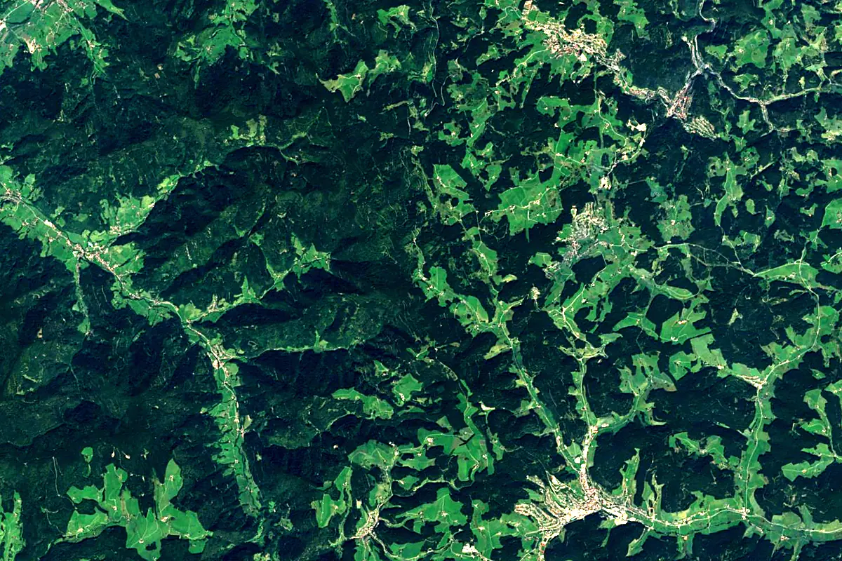
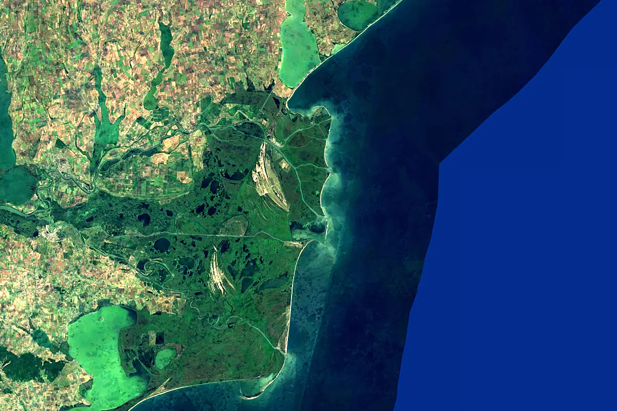
Sentinel-2 cloudless 2016 by EOX IT Services GmbH (contains modified Copernicus Sentinel data 2016), CC BY 4.0. The glowing line is the river as drawn by RiverATLAS.
Photos
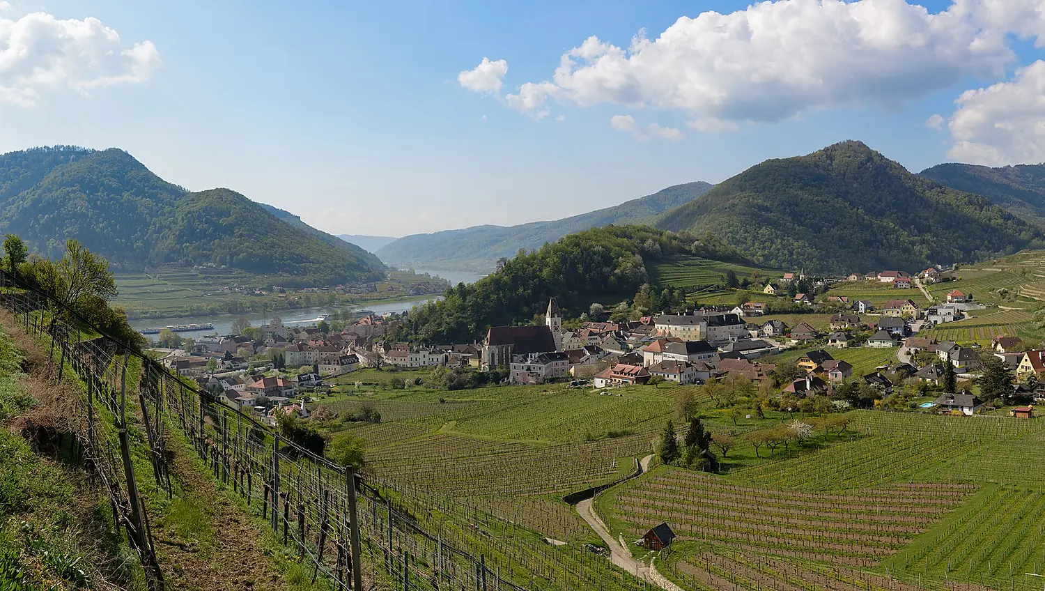
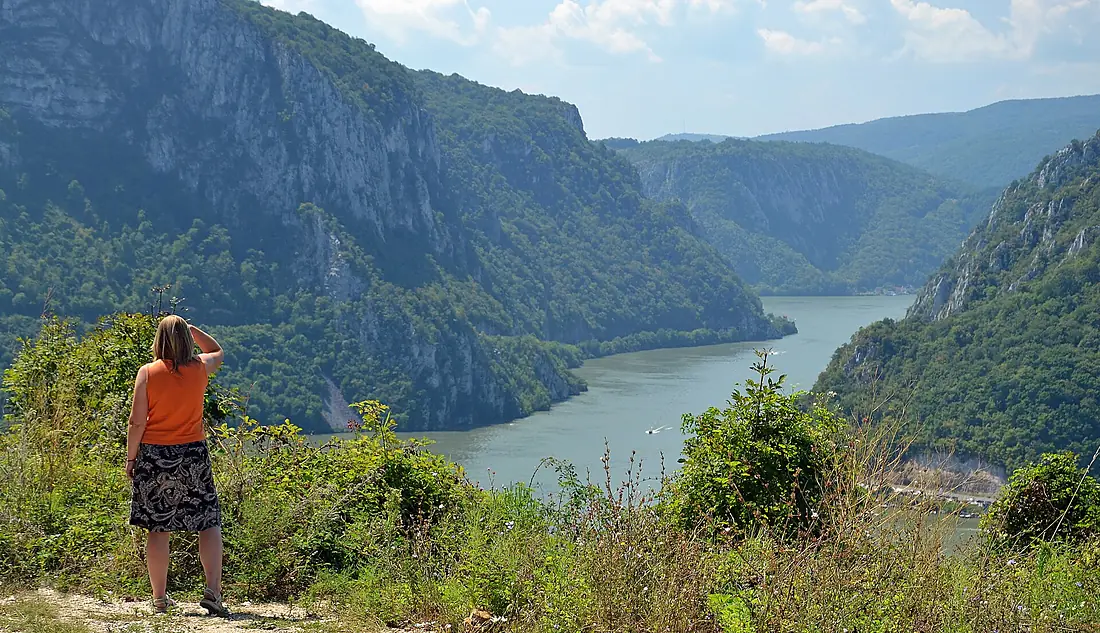
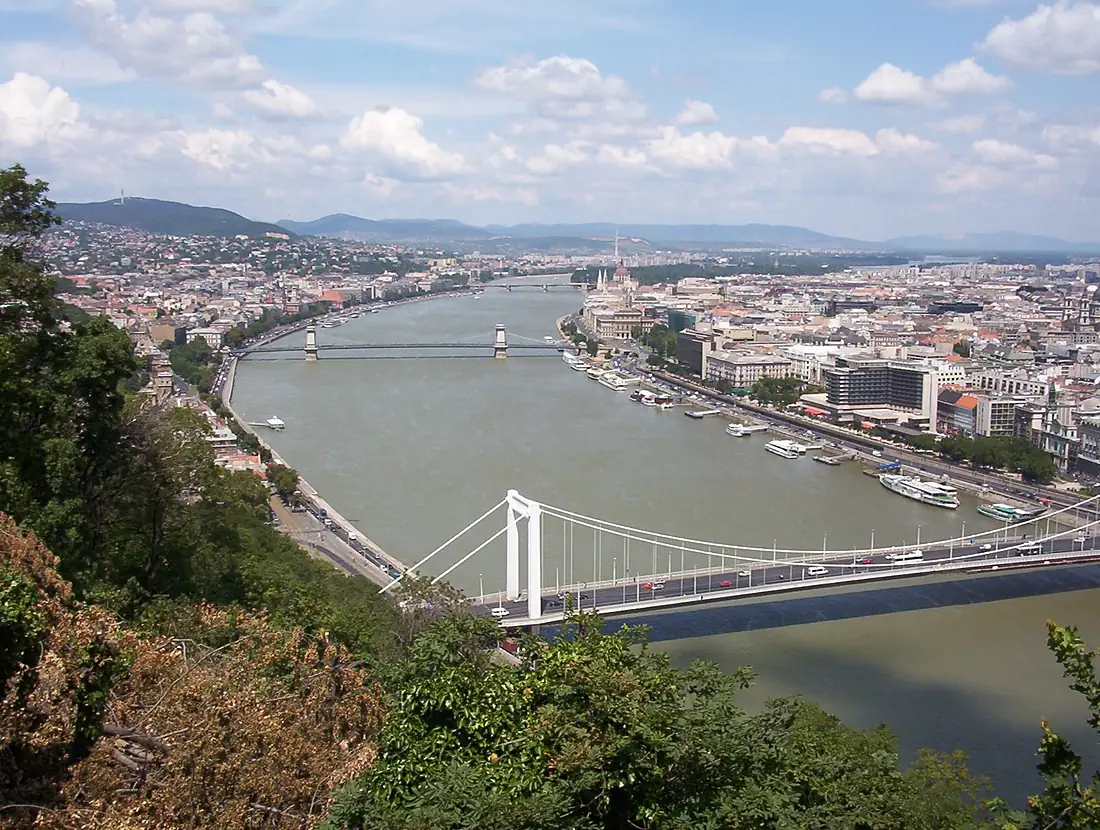
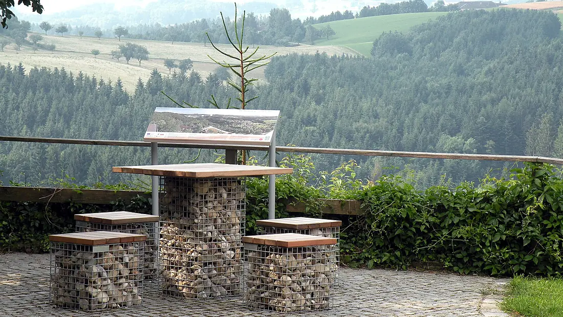
Danube in pictures
Tributaries
Where it flows, and what flows into it
Tributaries (225)
 Serbia966 km800 m³/sjoins at km 1,455PrutMoldova953 km120 m³/sjoins at km 2,500SavaSerbia945 km1,700 m³/sjoins at km 1,499Siret RiverRomania740 km230 m³/sjoins at km 2,479DravaCroatia720 km620 m³/sjoins at km 1,294Olt RiverRomania615 km170 m³/sjoins at km 2,051InnGermany517 km740 m³/sjoins at km 485VáhSlovakia433 km150 m³/sjoins at km 925Ialomița RiverRomania414 km70 m³/sjoins at km 2,393Morava
 Austria388 km110 m³/sIskarBulgaria368 km54 m³/sjoins at km 2,018Timiș RiverSerbia359 km47 m³/sjoins at km 1,514
Also: Regen, Brigach, Donaukanal, Ilz, Wörnitz, Nera River, Rusenski Lom, Vuka, Traisen, Abens, Günz, Mindel, Ogosta, Vils, Schwechat, Fischa, Kamp, Paar, Brenz, Karaš, Pek, Mlava, Vydrica, Blau
In the same basin
Serbia346 km120 m³/sMureș River Hungary803 km160 m³/sMurCroatia434 km170 m³/sBosna
 Bosnia and Herzegovina282 km140 m³/sSalzachGermany225 km250 m³/sKupaCroatia297 km280 m³/sSomeșHungary418 km120 m³/sUnaCroatia207 km200 m³/sDâmbovița RiverRomania286 km19 m³/sVrbasBosnia and Herzegovina240 km33 m³/s
Nearby
Rivers nearby
 Ukraine1,352 km310 m³/s123 km awayPrutMoldova953 km120 m³/s118 km awaySiret RiverRomania740 km230 m³/s131 km awayIalomița RiverRomania414 km70 m³/s157 km awayDnieperUkraine2,285 km1,700 m³/s251 km awayBuzău RiverRomania325 km28 m³/s154 km awayBârlad RiverRomania207 km9.0 m³/s175 km awayBâcMoldova155 km1.0 m³/s186 km away
Where these numbers come from
| Name, length, places | Wikidata (Q1653) · CC0 |
|---|---|
| Course, profile, basin | RiverATLAS v1.0 (HydroATLAS, Linke et al. 2019) · CC BY 4.0 — followed from the source to the mouth given by Wikidata |
| Flow | WaterGAP (RiverATLAS), 1971–2000 · CC BY 4.0 |
| Climate along the river | WorldClim (RiverATLAS), 1970–2000 · CC BY 4.0 |
| Towns, bridges, dams | Wikidata · CC0; GeoNames · CC BY 4.0 |
| Along the river | © OpenStreetMap contributors · ODbL |
| Images | EOX Sentinel-2 cloudless 2016 · CC BY 4.0; Wikimedia Commons |
| Our other atlases | Lakeyas, Peakyas, Islandyas — Wikidata · CC0; © OpenStreetMap contributors · ODbL; GeoNames · CC BY 4.0; HydroLAKES · CC BY 4.0; NOAA OISST |
Every source and licence is on the data sources page.
The family
Do you prefer beaches, lakes, mountains, waterfalls, islands, rivers or canyons?
Same idea, other landscapes: field atlases built on open data, month by month, in seven languages.
 beaches
 Find your beach: sea temperature, sun and swimming month by month.Visit lakes
 Every lake on Earth: water temperature, ice, depth and the shore.Coming soonVisit mountains
 Every summit in 3D: summit weather, the 0 °C line, huts and trails.Visit
  waterfalls
 Every waterfall: height, flow month by month and when it roars.Coming soonVisit islands
 Every island from the sea up: size, sea temperature, ferries and 3D.Coming soonVisit
  rivers
 Every river from source to sea: the journey, the flow and the basin in numbers.You are here
 canyons
 Every canyon cut to scale: depth to the floor, rim and floor temperatures, trails and viewpoints.Coming soonVisit