River
Bârlad River
207 km from source to mouth · Romania.
 RomaniaFlows into Siret River
In numbers
Length
207km
Average flow
9.0m³/s
Basin
7,220km²
Drop
161m
from 177 m to 16 m
Country
1
The journey
From source to mouth
207 km of river and 22 stops on the way: 21 towns and cities on its banks, dams, bridges and the tributaries that feed it.
- 0 kmSourceat 177 m
- 0 kmCotu Vameș3,168 people
- 20 kmIcuseşti4,648 people
- 34 kmNegri3,101 people
- 44 kmTraian4,662 people
- 55 kmBuhoci4,736 people
- 61 kmUngureni3,728 people
- 64 kmTamaşi6,330 people
- 69 kmNicolae Bălcescu10,140 people
- 76 kmGioseni3,243 people
- 91 kmPânceşti4,272 people
- 125 kmHomocea9,869 people
- 139 kmGohor3,154 people
- 144 kmPufeşti4,179 people
- 162 kmMunteni7,067 people
- 162 kmCosmeşti6,526 people
- 177 kmDrăgănești4,802 people
- 178 kmMovileni3,200 people
- 183 kmCorozel Rivertributary
- 189 kmSuraia7,770 people
- 194 kmBarcea5,074 people
- 205 kmIvești9,584 people
- 206 kmLieşti10,956 people
- 207 kmSiret Riverat 16 m
Water level along the river (RiverATLAS; the height is exaggerated). Towns: GeoNames and Wikidata; bridges, dams and tributaries: Wikidata.
River in Romania
At the mouth it carries 9.0 m³/s on average: an Olympic pool every 278 seconds. It drops from 177 m to 16 m, 0.8 m per kilometre on average. Its basin covers 7,220 km², about the size of PS. 2.2 million people live in it. Highest water: from April to May; lowest: from December to February. Dams and reservoirs hold back a large share of its water (28% of a year's flow).
Where to start
- LieştiLargest city on its banks · 10,956 people
- Bacău George Enescu International Airport (BCM)Nearest airport with scheduled flights, 111 km from the cityCar hire at BCM airport (Bacău)Discover Cars · Affiliate link↗
- From May to SeptemberThe best months to visit
Bârlad River, month by month
Highest water: from April to May
Lowest water: from December to February. Best months to visit: from May to September.
From about 43 m³/s in the lowest month to 600 m³/s in the highest. An estimate: the monthly flow is modelled from the lowest and highest months of WaterGAP (RiverATLAS, 1971–2000) and the rain and snow along the river (WorldClim). Dams change the real rhythm. The chip is the average air temperature; below it, the month's rain.
Plan the trip
Plan the trip: boat trips, a bed by the river, a car
Some links above are affiliate links: if you book through them we may earn a commission, at no extra cost to you. It never changes what the data on this page says.
The basin
Bârlad River: the basin in numbers
26,073 km² of land send their water to this river. This is what lives on it.
- 2.2millionpeople live in the basin
- 83/km²people per km²
- 633maverage altitude of the basin
- 645mmof rain a year (basin average)
- 6.9°Caverage air temperature
- 4%protected areas
- 0.4%covered by lakes
- 1.7km³held in reservoirs
What covers the basin
- 57% Forest
- 26% Cropland
- 18% Pasture
- 3% Towns and cities
RiverATLAS (HydroATLAS v1.0, CC BY 4.0): land cover, people, protected areas, glaciers and dams over the whole basin upstream of the mouth.
Along the river
Bârlad River: what you find on the way
- 4River beachesZamolxia, Tamasidava Nord, Tamasidava Sud and 1 more
From OpenStreetMap, within 2.0 km of the river. Not mapped is not the same as not there.
From space
The source and the mouth, seen from orbit
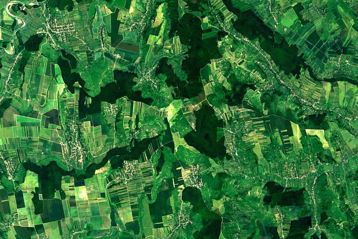
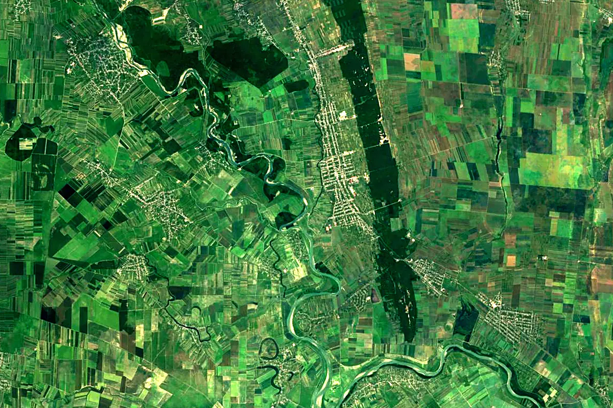
Sentinel-2 cloudless 2016 by EOX IT Services GmbH (contains modified Copernicus Sentinel data 2016), CC BY 4.0. The glowing line is the river as drawn by RiverATLAS.
Photos
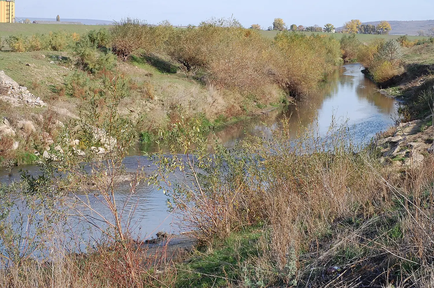
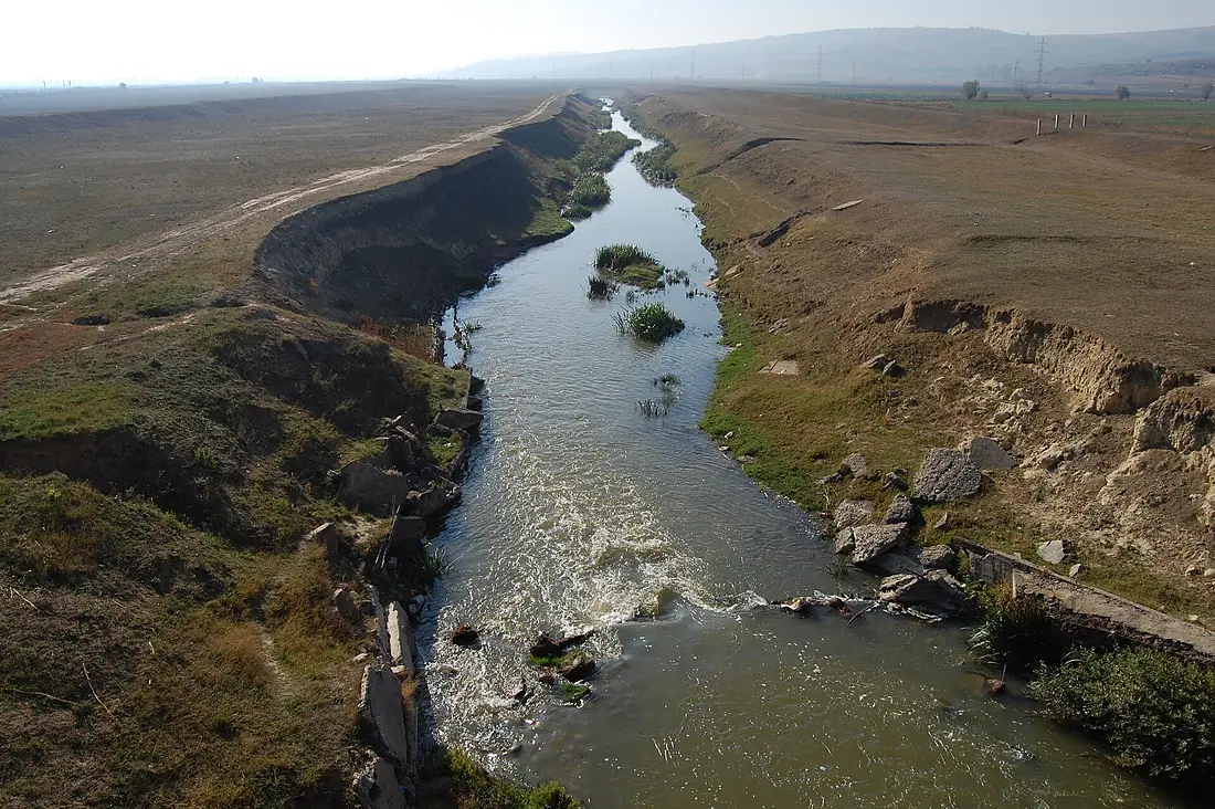
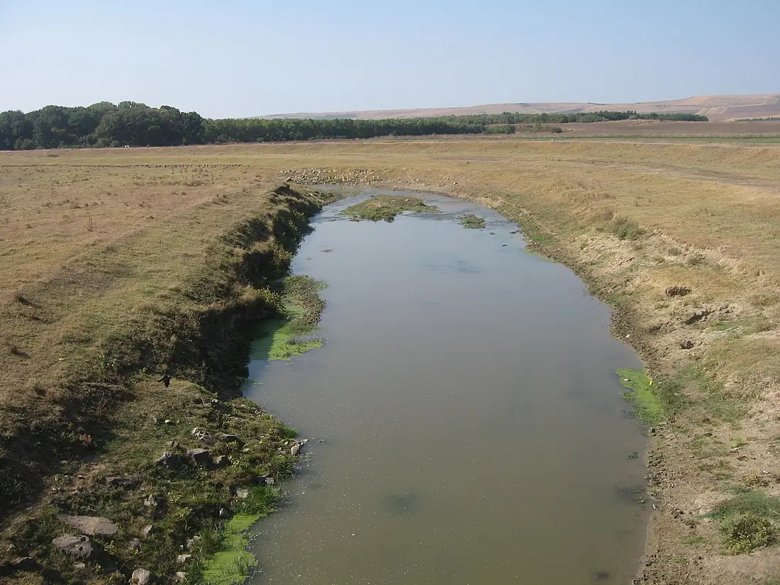
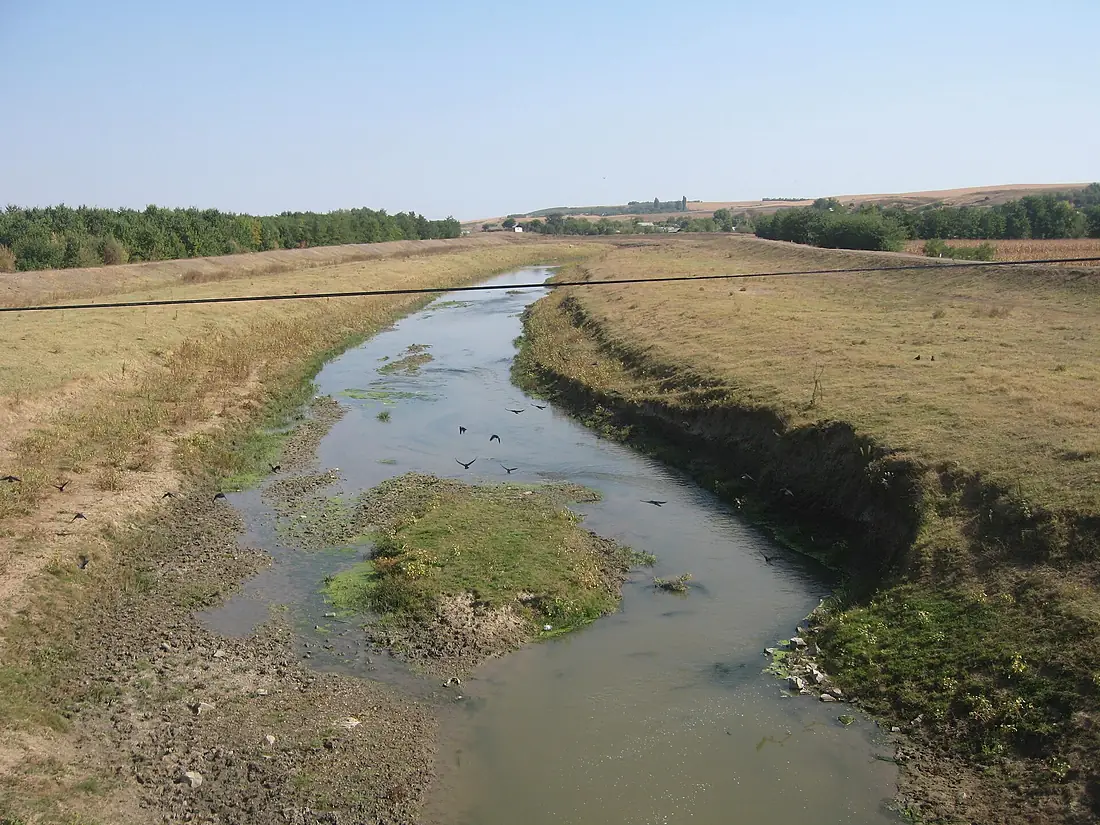
Bârlad River in pictures
Tributaries
Where it flows, and what flows into it
It flows into
Siret RiverRomania740 km230 m³/sTributaries (17)
Also: Berheci River, Tutova River, Vasluieț River, Crasna River, Durduc River, Bozieni River, Corozel River, Gârboveta River, Racova River, Pereschiv River, Jeravăț River, Horoiata River, Rebricea River, Sacovăț River, Simila River, Stemnic River, Tecucel River
 Serbia
 Croatia
 Germany
 Austria
Nearby
Rivers nearby
 Moldova953 km120 m³/s58 km awayBuzău RiverRomania325 km28 m³/s29 km awayDanubeRomania2,850 km5,400 m³/s175 km awayIalomița RiverRomania414 km70 m³/s105 km awayBistrița RiverRomania272 km66 m³/s106 km awayPrahova RiverRomania183 km28 m³/s130 km awayMoldova RiverRomania205 km32 m³/s149 km awayJijia RiverRomania275 km160 m³/s149 km away
Where these numbers come from
| Name, length, places | Wikidata (Q945287) · CC0 |
|---|---|
| Course, profile, basin | RiverATLAS v1.0 (HydroATLAS, Linke et al. 2019) · CC BY 4.0 — followed from the source to the mouth given by Wikidata |
| Flow | WaterGAP (RiverATLAS), 1971–2000 · CC BY 4.0 |
| Climate along the river | WorldClim (RiverATLAS), 1970–2000 · CC BY 4.0 |
| Towns, bridges, dams | Wikidata · CC0; GeoNames · CC BY 4.0 |
| Along the river | © OpenStreetMap contributors · ODbL |
| Images | EOX Sentinel-2 cloudless 2016 · CC BY 4.0; Wikimedia Commons |
Every source and licence is on the data sources page.
The family
Do you prefer beaches, lakes, mountains, waterfalls, islands, rivers or canyons?
Same idea, other landscapes: field atlases built on open data, month by month, in seven languages.
 beaches
 Find your beach: sea temperature, sun and swimming month by month.Visit
  lakes
lakes Every lake on Earth: water temperature, ice, depth and the shore.Coming soonVisit
  mountains
 Every summit in 3D: summit weather, the 0 °C line, huts and trails.Visit
  waterfalls
 Every waterfall: height, flow month by month and when it roars.Coming soonVisit
  islands
 Every island from the sea up: size, sea temperature, ferries and 3D.Coming soonVisit
  rivers
 Every river from source to sea: the journey, the flow and the basin in numbers.You are here
 canyons
 Every canyon cut to scale: depth to the floor, rim and floor temperatures, trails and viewpoints.Coming soonVisit