River
Weisse Elster
257 km from source to mouth · Germany and Czechia.

 Germany and CzechiaFlows into Saale
In numbers
Length
257km
Average flow
100m³/s
Basin
5,154km²
Drop
375m
from 448 m to 73 m
Countries
2
The journey
From source to mouth
257 km of river and 68 stops on the way: 30 towns and cities on its banks, dams, bridges and the tributaries that feed it.
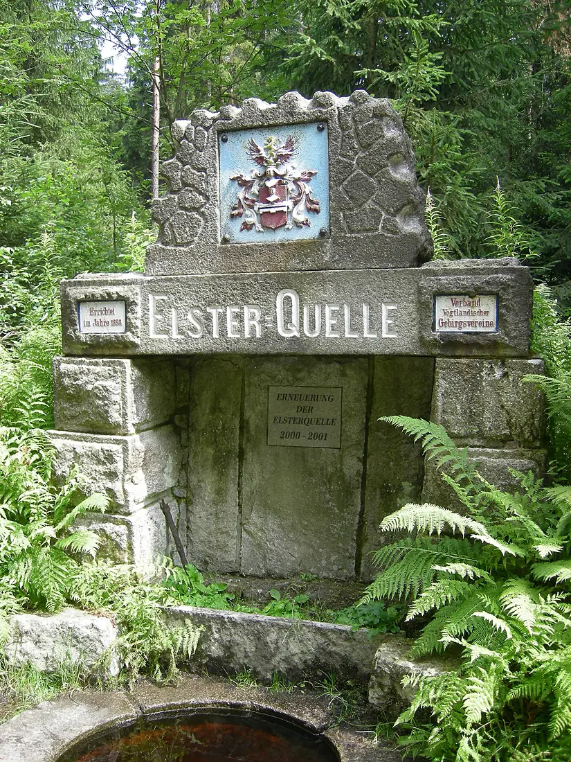
- 0 kmSourceat 448 m
- 0 kmBad Elster3,617 people
- 0 kmBadeplatz bridge
- 3 kmAdorf5,806 people
- 3 kmElster road bridge Adorf (B 283)
- 9 kmElster road bridge Rebersreuth
- 20 kmOelsnitz12,686 people
- 27 kmTalsperre Pirk1.2 km²
- 28 kmElster road bridge Magwitz
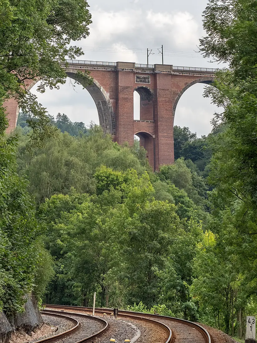
- 30 kmElster Viaduct
- 30 kmFeilebachtributary
- 34 kmElster footbridge at old manor Weischlitz
- 34 kmElster arch bridge Weischlitz
- 34 kmWeischlitz5,551 people
- 37 kmElster arch bridge Kürbitz
- 43 kmPanzerbrücke Plauen
- 45 kmGössel bridge
- 46 kmBlack footbridge Plauen
- 46 kmnew Elster bridge Plauen
- 46 kmAlte Elsterbrücke
- 46 kmPlauen64,893 people
- 48 kmHammerbrücke
- 56 kmTalsperre Pöhl3.3 km²
- 60 kmRentzsch mill road bridge
- 60 kmrailway bridge at Rentzsch mill
- 65 kmElsterberg5,153 people
- 74 kmPohlitz3,097 people
- 74 kmGreiz24,147 people
- 89 kmBerga3,869 people
- 96 kmWeida8,528 people
- 99 kmWünschendorf3,257 people
- 99 kmHistorische Holzbrücke Wünschendorf
- 106 kmLusan21,507 people
- 108 kmZwötzen4,537 people
- 109 kmDebschwitz10,540 people
- 111 kmHeinrichsbrücke
- 112 kmGera95,162 people
- 112 kmTextimasteg
- 113 kmUntermhäuser Brücke
- 113 kmUntermhaus4,858 people
- 114 kmStadtbahnbrücke
- 118 kmLangenberg3,719 people
- 124 kmBad Köstritz3,924 people
- 151 kmZeitz28,328 people
- 171 kmPegau4,759 people
- 173 kmGroitzsch7,607 people
- 182 kmSchnaudertributary
- 184 kmZwenkau8,905 people
- 192 kmElster reservoir Bösdorf0.5 km²
- 193 kmMarkkleeberg25,331 people
- 195 kmCospudener See4.2 km²
- 197 kmGroßzschocher9,269 people
- 200 kmKleinzschocher11,031 people
- 202 kmKönneritzbrücke
- 202 kmPlagwitz Bridge
- 203 kmPalmengartenwehr
- 203 kmPleißetributary
- 203 kmLeipzig615,932 people
- 204 kmZeppelinbrücke
- 207 kmGohlis45,924 people
- 208 kmParthetributary
- 221 kmSchkeuditz18,487 people
- 233 kmRaßnitzer See2.7 km²
- 239 kmWallendorfer See3.0 km²
- 247 kmSaale-Elster Viaduct
- 249 kmSchkopau3,060 people
- 250 kmRattmannsdorfer See0.9 km²
- 251 kmSchafbrücke
- 253 kmHalle (Saale)226,186 people
- 257 kmSaaleat 73 m
Water level along the river (RiverATLAS; the height is exaggerated). Towns: GeoNames and Wikidata; bridges, dams and tributaries: Wikidata.
River
At the mouth it carries 100 m³/s on average: an Olympic pool every 25 seconds. It drops from 448 m to 73 m, 1.5 m per kilometre on average. Its basin covers 5,154 km², about the size of TT. 3.2 million people live in it. Highest water: February, April and August. Dams and reservoirs hold back a large share of its water (19% of a year's flow).
Where to start
- LeipzigLargest city on its banks · 615,932 people
- Leipzig/Halle Airport (LEJ)Nearest airport with scheduled flights, 13 km from the cityCar hire at LEJ airport (Schkeuditz)Discover Cars · Affiliate link↗
- On the water49 ferry piers, marinas, boat rentals and boat ramps along the river (OpenStreetMap)
- Kayak and canoe14 put-ins and rapids mapped (OpenStreetMap)
- From May to SeptemberThe best months to visit
Weisse Elster, month by month
Highest water: February, April and August
Best months to visit: from May to September.
From about 46 m³/s in the lowest month to 200 m³/s in the highest. An estimate: the monthly flow is modelled from the lowest and highest months of WaterGAP (RiverATLAS, 1971–2000) and the rain and snow along the river (WorldClim). Dams change the real rhythm. The chip is the average air temperature; below it, the month's rain.
Plan the trip
Plan the trip: boat trips, a bed by the river, a car
Some links above are affiliate links: if you book through them we may earn a commission, at no extra cost to you. It never changes what the data on this page says.
The basin
Weisse Elster: the basin in numbers
17,802 km² of land send their water to this river. This is what lives on it.
- 3.2millionpeople live in the basin
- 181/km²people per km²
- 324maverage altitude of the basin
- 617mmof rain a year (basin average)
- 7.8°Caverage air temperature
- 26%protected areas
- 0.5%covered by lakes
- 0.6km³held in reservoirs
What covers the basin
- 19% Forest
- 43% Cropland
- 10% Pasture
- 9% Towns and cities
RiverATLAS (HydroATLAS v1.0, CC BY 4.0): land cover, people, protected areas, glaciers and dams over the whole basin upstream of the mouth.
Along the river
Weisse Elster: what you find on the way
- 137WeirsElsterwehr Greiz-Neumühle, Wehr Zoitzmühle, Elsterwehr Zwötzen and 134 more
- 4LocksSchleuse Cospuden, Saale and 2 more
- 7Waterfalls
- 2Rapids
- 12Canoe put-insWehr Clodramühle and 11 more
- 17Boat rampsSlipanlage Hafen Zwenkau, Hafen Pier 1, Bootskran and 14 more
- 5Ferry piersAnlegestelle Fahrgastschifffahrt, Touristischer Schifffahrtsbetrieb Anleger, Bistumshöhe and 2 more
- 8MarinasSportboothafen Anglerverband, Hafen Zöbigker, LSC Leipziger Seesportclub e.V. and 5 more
- 8River beachesHundestrand, FKK-Strand Helmsgrün, Oststrand and 5 more
From OpenStreetMap, within 1.9 km of the river. Not mapped is not the same as not there.
Cross-checked with our atlases
Weisse Elster in our other atlases
What our sister atlases know about the waterfalls on this river, the lakes it flows through, the beaches at its mouth, the mountains where it rises and the islands off its mouth.
 7lakes on its wayLakeyas
 34mountains at the sourcePeakyas
Lakes and reservoirs (7)
Lakes it flows through, by Lakeyas
- Talsperre Pirkkm 211.2km²
- Talsperre Pöhlkm 433.3km²
- Elster reservoir Bösdorfkm 1480.5km²
- Cospudener Seekm 150 · 55 m deep4.2km²
- Raßnitzer Seekm 1802.7km²
- Wallendorfer Seekm 1843.0km²
- Rattmannsdorfer Seekm 1920.9km²
Lakeyas is coming soonOpen Lakeyas ↗
Mountains at the source (34)
Within 15 km of the source, by Peakyas
- Háj u Aše6.3 km away · prominence 107 m757m
- Kapellenberg2.4 km away759m
- Wirtsberg8.7 km away664m
- Štítarský vrch11 km away716m
- Rabenberg14 km away719m
- Zelená hora14 km away641m
- Steinberg13 km away653m
- Hohe Wart im Fichtelgebirge9.3 km away613m
26 more on PeakyasOpen Peakyas ↗
From space
The source and the mouth, seen from orbit
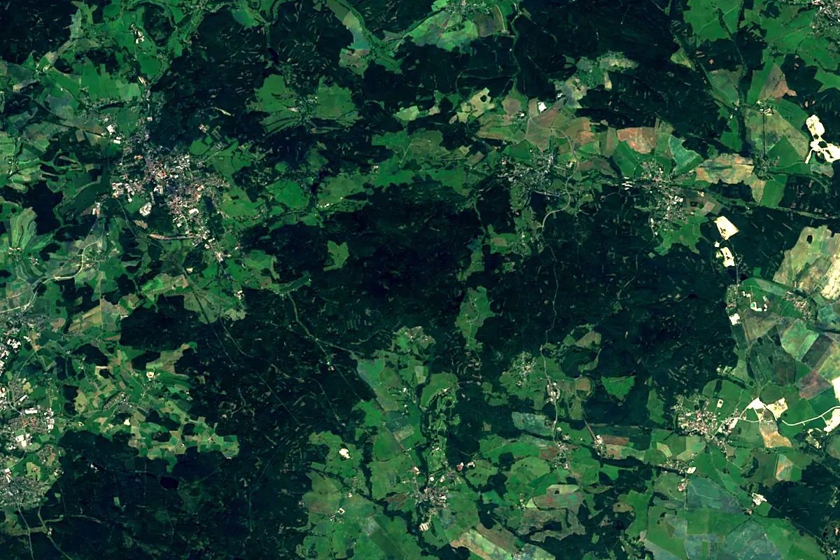
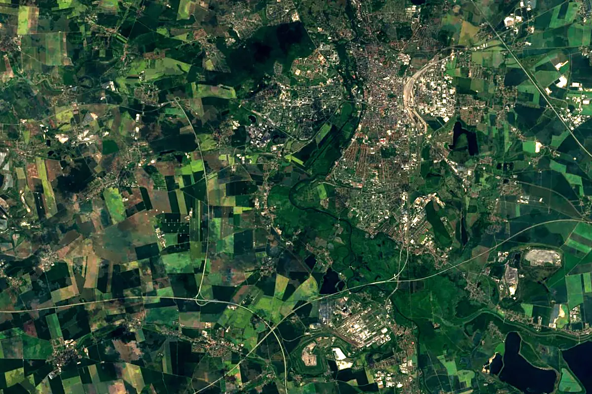
Sentinel-2 cloudless 2016 by EOX IT Services GmbH (contains modified Copernicus Sentinel data 2016), CC BY 4.0. The glowing line is the river as drawn by RiverATLAS.
Photos
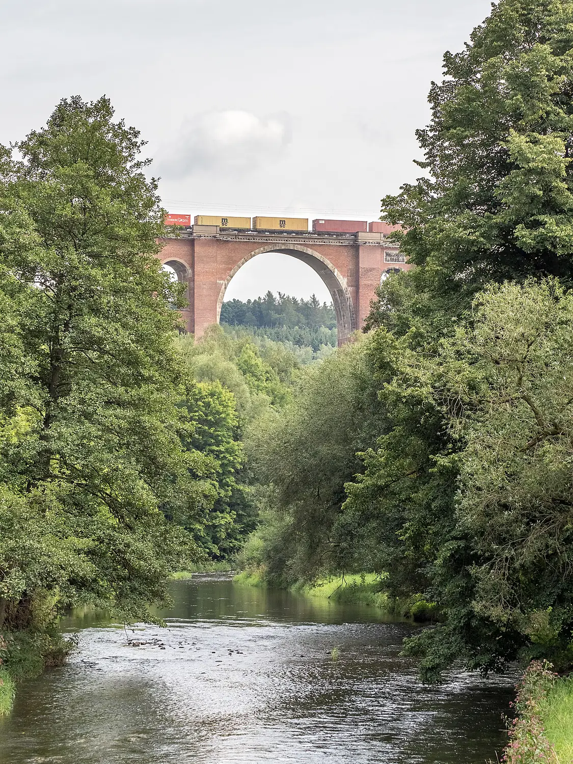
Weisse Elster in pictures
Tributaries
Where it flows, and what flows into it
It flows into
SaaleGermany413 km120 m³/sTributaries (20)
Also: Pleiße, Weida, Parthe, Göltzsch, Schnauder, Friesenbach, Trieb, Feilebach, Reide, Syrabach, Schwarzbach, Rosenbach, Pietzschebach, Ašský potok, Kaltenbach, Rödel, Görnitzbach, Würschnitz-Bach, Brahme, Mühlgraben
Nearby
Rivers nearby
Where these numbers come from
| Name, length, places | Wikidata (Q44729) · CC0 |
|---|---|
| Course, profile, basin | RiverATLAS v1.0 (HydroATLAS, Linke et al. 2019) · CC BY 4.0 — followed from the source to the mouth given by Wikidata |
| Flow | WaterGAP (RiverATLAS), 1971–2000 · CC BY 4.0 |
| Climate along the river | WorldClim (RiverATLAS), 1970–2000 · CC BY 4.0 |
| Towns, bridges, dams | Wikidata · CC0; GeoNames · CC BY 4.0 |
| Along the river | © OpenStreetMap contributors · ODbL |
| Images | EOX Sentinel-2 cloudless 2016 · CC BY 4.0; Wikimedia Commons |
| Our other atlases | Lakeyas, Peakyas — Wikidata · CC0; © OpenStreetMap contributors · ODbL; GeoNames · CC BY 4.0; HydroLAKES · CC BY 4.0; NOAA OISST |
Every source and licence is on the data sources page.
The family
Do you prefer beaches, lakes, mountains, waterfalls, islands, rivers or canyons?
Same idea, other landscapes: field atlases built on open data, month by month, in seven languages.
 beaches
 Find your beach: sea temperature, sun and swimming month by month.Visit lakes
 Every lake on Earth: water temperature, ice, depth and the shore.Coming soonVisit mountains
 Every summit in 3D: summit weather, the 0 °C line, huts and trails.Visit
  waterfalls
 Every waterfall: height, flow month by month and when it roars.Coming soonVisit
  islands
 Every island from the sea up: size, sea temperature, ferries and 3D.Coming soonVisit
  rivers
 Every river from source to sea: the journey, the flow and the basin in numbers.You are here
 canyons
 Every canyon cut to scale: depth to the floor, rim and floor temperatures, trails and viewpoints.Coming soonVisit