River
Spree
382 km from source to mouth · Germany.
 GermanyFlows into Havel6th longest in Germany
In numbers
Length
382km
Average flow
36m³/s
Basin
10,100km²
Drop
179m
from 204 m to 25 m
Country
1
The journey
From source to mouth
382 km of river and 68 stops on the way: 39 towns and cities on its banks, dams, bridges and the tributaries that feed it.
- 0 kmEbersbachat 204 m
- 0 kmNeusalza-Spremberg3,031 people
- 0 kmEbersbach8,952 people
- 0 kmNeugersdorf6,260 people
- 30 kmObergurig2,016 people
- 31 kmBautzen37,306 people
- 40 kmOlbasee0.5 km²
- 43 kmLöbauer Wassertributary
- 59 kmBärwalder See3.8 km²
- 66 kmSchwarzer Schöpstributary
- 81 kmStrugatributary
- 83 kmKleine Spreetributary
- 91 kmSpremberg20,900 people
- 103 kmSpremberg Reservoir6.0 km²
- 106 kmNeuhausen/Spree4,762 people
- 119 kmCottbus95,140 people
- 149 kmBurg (Spreewald)4,125 people
- 167 kmLübbenau/Spreewald15,729 people
- 180 kmBerstetributary
- 180 kmLübben (Spreewald)13,992 people
- 190 kmInselteich (Schlepzig)0.5 km²
- 192 kmSchlepzig602 people
- 207 kmNeuendorfer See2.6 km²
- 217 kmBlabbergrabentributary
- 218 kmGroßer Kossenblatter See1.6 km²
- 218 kmKleiner Kossenblatter See0.3 km²
- 235 kmSchwielochsee11 km²
- 245 kmBeeskow7,930 people
- 246 kmOelsetributary
- 276 kmDehmsee0.9 km²
- 286 kmFürstenwalde31,981 people
- 324 kmFlakensee0.6 km²
- 324 kmLöcknitztributary
- 324 kmDämeritzsee0.8 km²
- 334 kmMüggelsee7.0 km²
- 337 kmErpetributary
- 338 kmBerlin Köpenick59,561 people
- 339 kmSeddinsee6.0 km²
- 339 kmKöpenick67,148 people
- 339 kmDahmetributary
- 340 kmTreptow-Köpenick273,689 people
- 344 kmOberschöneweide23,638 people
- 348 kmKarlshorst28,206 people
- 349 kmFriedrichsfelde55,423 people
- 349 kmLichtenberg41,359 people
- 349 kmRummelsburg25,697 people
- 353 kmFriedrichshain-Kreuzberg290,386 people
- 354 kmOberbaum Bridge
- 354 kmTreptow50,000 people
- 354 kmFriedrichshain125,169 people
- 356 kmPrenzlauer Berg148,878 people
- 358 kmNikolaiviertel
- 358 kmNeuer Marstall
- 358 kmKreuzberg153,135 people
- 358 kmFormer Reichsbank building
- 358 kmMitte102,338 people
- 359 kmBerlin3,426,354 people
- 359 kmMuseum IslandUNESCO World Heritage
- 363 kmBezirk Mitte397,879 people
- 364 kmWedding85,275 people
- 365 kmMoabit81,021 people
- 365 kmSchöneberg122,658 people
- 369 kmCharlottenburg-Wilmersdorf343,592 people
- 369 kmCharlottenburg129,359 people
- 370 kmPanketributary
- 372 kmWestend41,328 people
- 377 kmSpandau245,197 people
- 377 kmWilhelmstadt40,463 people
- 377 kmHakenfelde31,327 people
- 382 kmHavelat 25 m
Water level along the river (RiverATLAS; the height is exaggerated). Towns: GeoNames and Wikidata; bridges, dams and tributaries: Wikidata.
River in Germany
At the mouth it carries 36 m³/s on average: an Olympic pool every 69 seconds. It drops from 204 m to 25 m, 0.5 m per kilometre on average. Its basin covers 10,100 km², about the size of LB. 2.6 million people live in it. Highest water: from March to May and December. Its dams hold back little of its water (8.8% of a year's flow).
Where to start
- BerlinLargest city on its banks · 3,426,354 people
- Berlin Brandenburg Airport (BER)Nearest airport with scheduled flights, 19 km from the cityCar hire at BER airport (Berlin)Discover Cars · Affiliate link↗
- On the water229 ferry piers, marinas, boat rentals and boat ramps along the river (OpenStreetMap)
- Kayak and canoe26 put-ins and rapids mapped (OpenStreetMap)
- From May to SeptemberThe best months to visit
Spree, month by month
Highest water: from March to May and December
Best months to visit: from May to September.
From about 27 m³/s in the lowest month to 58 m³/s in the highest. An estimate: the monthly flow is modelled from the lowest and highest months of WaterGAP (RiverATLAS, 1971–2000) and the rain and snow along the river (WorldClim). Dams change the real rhythm. The chip is the average air temperature; below it, the month's rain.
Plan the trip
Plan the trip: boat trips, a bed by the river, a car
Some links above are affiliate links: if you book through them we may earn a commission, at no extra cost to you. It never changes what the data on this page says.
The basin
Spree: the basin in numbers
9,592 km² of land send their water to this river. This is what lives on it.
- 2.6millionpeople live in the basin
- 277/km²people per km²
- 98maverage altitude of the basin
- 567mmof rain a year (basin average)
- 8.9°Caverage air temperature
- 33%protected areas
- 2.2%covered by lakes
- 0.1km³held in reservoirs
What covers the basin
- 34% Forest
- 29% Cropland
- 9% Pasture
- 9% Towns and cities
RiverATLAS (HydroATLAS v1.0, CC BY 4.0): land cover, people, protected areas, glaciers and dams over the whole basin upstream of the mouth.
Along the river
Spree: what you find on the way
- 831WeirsWehr, Spreewehr Uhyst, Schleifmühlenwehr and 828 more
- 87LocksBootsrutsche, Krabatschleuse, Bastianschleuse and 84 more
- 2Waterfalls
- 26Canoe put-insKanuanleger Hangelsberg "Unsal" and 25 more
- 46Boat rampsBootsrolle, Slipanlage - Spreeinsel, VKB Motorboot Slipanlage and 43 more
- 41Ferry piersSchmogrow Hafen lll, Personen-Fähre Leißnitz, Dampfer Anlegestelle and 38 more
- 68MarinasSpremberger Segelclub, Hafen Burg, Hagens Insel (Kahnfahrt) and 65 more
- 30River beachesNordstrand, FKK, Surfstrand (surfers' beach) and 27 more
From OpenStreetMap, within 1.8 km of the river. Not mapped is not the same as not there.
Cross-checked with our atlases
Spree in our other atlases
What our sister atlases know about the waterfalls on this river, the lakes it flows through, the beaches at its mouth, the mountains where it rises and the islands off its mouth.
 13lakes on its wayLakeyas
 95mountains at the sourcePeakyas
Lakes and reservoirs (13)
Lakes it flows through, by Lakeyas
- Bärwalder Seekm 50 · 50 m deep3.8km²
- Spremberg Reservoirkm 876.0km²
- Neuendorfer Seekm 1752.6km²
- Schwielochseekm 198 · 14 m deep11km²
- Dehmseekm 2330.9km²
- Dämeritzseekm 2740.8km²
- Müggelseekm 282 · 8 m deep7.0km²
- Seddinseekm 2866.0km²
5 more on LakeyasLakeyas is coming soonOpen Lakeyas ↗
Mountains at the source (95)
Within 15 km of the source, by Peakyas
- Czorneboh15 km away557m
- Kottmar0.5 km away582m
- Bieleboh12 km away497m
- Hochstein13 km away541m
- Breiteberg14 km away510m
- Rotstein13 km away455m
- Špičák9.0 km away · prominence 172 m544m
- Oberoderwitzer Spitzberg6.2 km away · prominence 125 m510m
87 more on PeakyasOpen Peakyas ↗
From space
The source and the mouth, seen from orbit
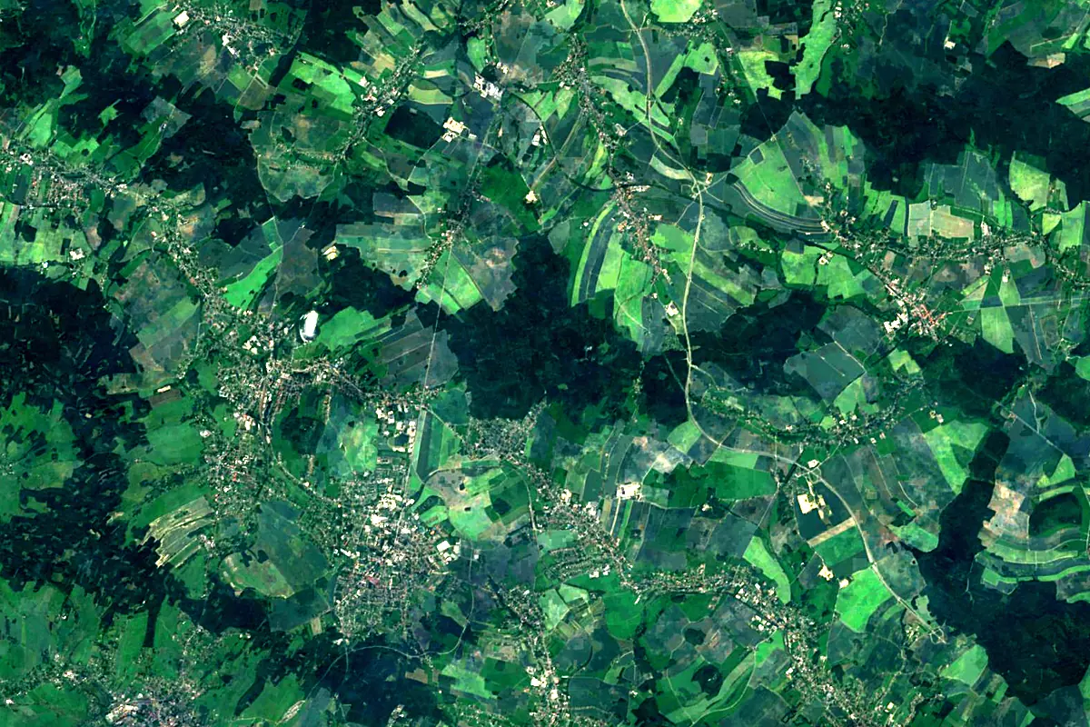
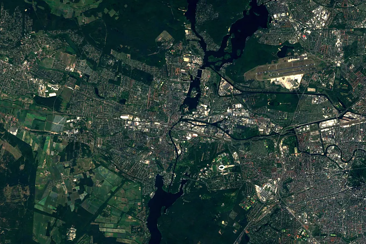
Sentinel-2 cloudless 2016 by EOX IT Services GmbH (contains modified Copernicus Sentinel data 2016), CC BY 4.0. The glowing line is the river as drawn by RiverATLAS.
Photos
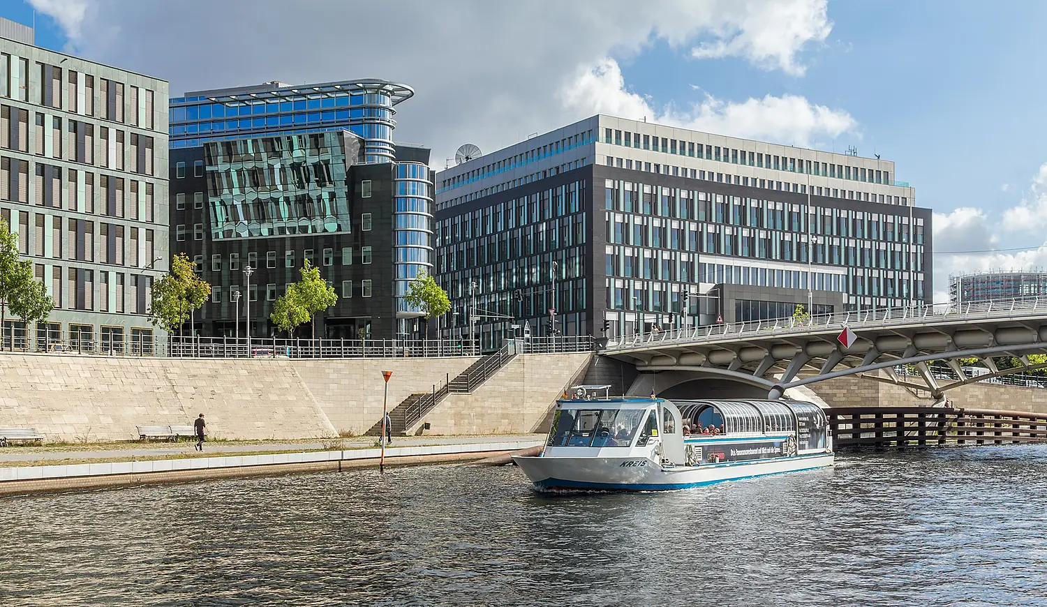
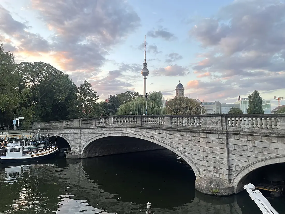
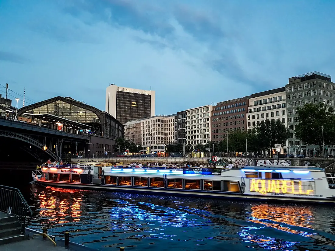
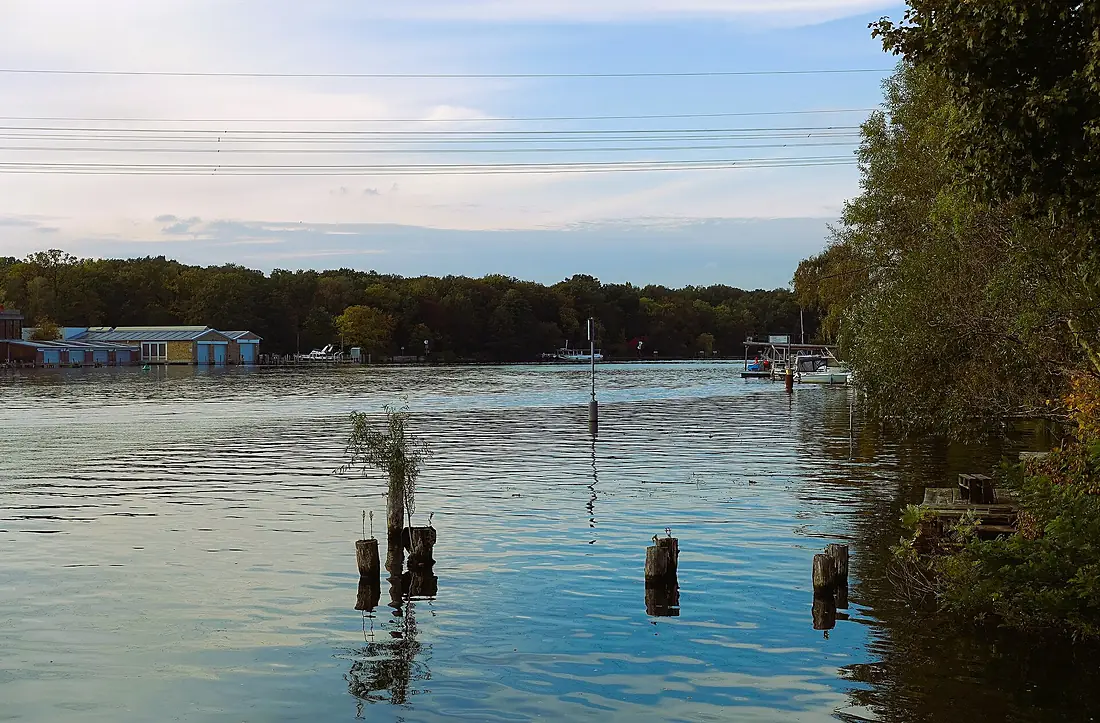
Spree in pictures
Tributaries
Where it flows, and what flows into it
It flows into
HavelGermany325 km89 m³/sTributaries (20)
Also: Dahme, Panke, Wuhle, Erpe, Berste, Schwarzer Schöps, Kleine Spree, Löbauer Wasser, Oelse, Struga, Löcknitz, Jiříkovský potok, Blabbergraben, Rožanský potok, Grützmachergraben, Roter Nil, Großes Fließ, Cunewalder Wasser, Kaltbach, Butterwasser
 Czechia
Nearby
Rivers nearby
 Poland808 km200 m³/s87 km awaySaaleGermany413 km120 m³/s108 km awayOderPoland854 km480 m³/s147 km awayLusatian NysaGermany254 km30 m³/s109 km awayBlack ElsterGermany179 km350 m³/s83 km awayMuldeGermany147 km65 m³/s100 km awayBóbrPoland272 km44 m³/s135 km awayNotećPoland388 km210 m³/s138 km away
Where these numbers come from
| Name, length, places | Wikidata (Q1684) · CC0 |
|---|---|
| Course, profile, basin | RiverATLAS v1.0 (HydroATLAS, Linke et al. 2019) · CC BY 4.0 — followed from the source to the mouth given by Wikidata |
| Flow | WaterGAP (RiverATLAS), 1971–2000 · CC BY 4.0 |
| Climate along the river | WorldClim (RiverATLAS), 1970–2000 · CC BY 4.0 |
| Towns, bridges, dams | Wikidata · CC0; GeoNames · CC BY 4.0 |
| Along the river | © OpenStreetMap contributors · ODbL |
| Images | EOX Sentinel-2 cloudless 2016 · CC BY 4.0; Wikimedia Commons |
| Our other atlases | Lakeyas, Peakyas — Wikidata · CC0; © OpenStreetMap contributors · ODbL; GeoNames · CC BY 4.0; HydroLAKES · CC BY 4.0; NOAA OISST |
Every source and licence is on the data sources page.
The family
Do you prefer beaches, lakes, mountains, waterfalls, islands, rivers or canyons?
Same idea, other landscapes: field atlases built on open data, month by month, in seven languages.
 beaches
 Find your beach: sea temperature, sun and swimming month by month.Visit lakes
 Every lake on Earth: water temperature, ice, depth and the shore.Coming soonVisit mountains
 Every summit in 3D: summit weather, the 0 °C line, huts and trails.Visit
  waterfalls
 Every waterfall: height, flow month by month and when it roars.Coming soonVisit
  islands
 Every island from the sea up: size, sea temperature, ferries and 3D.Coming soonVisit
  rivers
 Every river from source to sea: the journey, the flow and the basin in numbers.You are here
 canyons
 Every canyon cut to scale: depth to the floor, rim and floor temperatures, trails and viewpoints.Coming soonVisit