River
Vltava
430 km from source to mouth · Czechia.
 CzechiaFlows into Elbe1st longest in Czechia
In numbers
Length
430km
Average flow
150m³/s
Basin
28,000km²
Drop
578m
from 737 m to 159 m
Country
1
The journey
From source to mouth
430 km of river and 68 stops on the way: 20 towns and cities on its banks, dams, bridges and the tributaries that feed it.
- 0 kmBohemian Forestat 737 m
- 16 kmTeplá Vltavatributary
- 16 kmKalte Moldautributary
- 37 kmOlšinatributary
- 62 kmLipno Reservoir44 km²
- 78 kmWeir in Vyšší Brod
- 85 kmVětší Vltavicetributary
- 89 kmJílovické kaskády2 m
- 104 kmVodopády sv. Václava
- 108 kmHeřmanské vodopády
- 113 kmČeský Krumlov12,797 people
- 121 kmPolečnicetributary
- 121 kmJílecký potoktributary
- 130 kmKeltský vodopád4 m
- 150 kmČeské Budějovice97,231 people
- 153 kmWaterfall Krčínova
- 155 kmMalšetributary
- 158 kmDehtářský potoktributary
- 158 kmBezdrevský potoktributary
- 181 kmHněvkovice Reservoir1.4 km²
- 188 kmTýn nad Vltavou7,774 people
- 191 kmLužnicetributary
- 192 kmWater reservoir Kořensko0.5 km²
- 201 kmÚdražský vodopád
- 230 kmOtavatributary
- 256 kmOrlík Reservoir15 km²
- 265 kmLíšnický potoktributary
- 268 kmKamýk Reservoir0.3 km²
- 277 kmBrzinatributary
- 280 kmPirátský vodopád2 m
- 299 kmJavorový vodopád2 m
- 300 kmDrtinovy vodopády3 m
- 308 kmMěřínský vodopád10 m
- 313 kmSlapy Reservoir10 km²
- 314 kmTeletínské vodopády
- 317 kmKrňanský vodopád3 m
- 318 kmKletecký vodopád10 m
- 322 kmKocábatributary
- 325 kmHvozdnické vodopády3 m
- 327 kmSázavatributary
- 328 kmZahořanský potoktributary
- 331 kmBojovský potoktributary
- 335 kmVrané Reservoir0.8 km²
- 336 kmVrané nad Vltavou Dam
- 338 kmZvolské vodopády2 m
- 346 kmBerounkatributary
- 355 kmPrague 589,007 people
- 356 kmPrague 245,405 people
- 356 kmBotičtributary
- 357 kmSmíchov34,987 people
- 357 kmŠítkovský jez
- 357 kmNew Town21,941 people
- 357 kmWaterfall in Kinského zahrada
- 359 kmMalá Strana4,584 people
- 359 kmPrague 122,967 people
- 359 kmCharles Bridge
- 359 kmOld TownUNESCO World Heritage
- 359 kmPrague1,165,581 people
- 362 kmPrague 744,442 people
- 362 kmHolešovice37,664 people
- 363 kmKarlín12,261 people
- 365 kmPrague 8104,921 people
- 365 kmLibeň36,151 people
- 369 kmTroja Palace
- 370 kmPrague 6104,185 people
- 370 kmBubeneč21,989 people
- 370 kmDejvice23,401 people
- 371 kmRokytkatributary
- 396 kmKralupy nad Vltavou19,005 people
- 430 kmElbeat 159 m
Water level along the river (RiverATLAS; the height is exaggerated). Towns: GeoNames and Wikidata; bridges, dams and tributaries: Wikidata.
River in Czechia
At the mouth it carries 150 m³/s on average: an Olympic pool every 17 seconds. It drops from 737 m to 159 m, 1.3 m per kilometre on average. Its basin covers 28,000 km², about the size of GQ. 5.1 million people live in it. Highest water: from March to May; lowest: from December to February. Dams and reservoirs hold back a large share of its water (22% of a year's flow).
Where to start
- PragueLargest city on its banks · 1,165,581 people
- Václav Havel Airport Prague (PRG)Nearest airport with scheduled flights, 12 km from the cityCar hire at PRG airport (Prague)Discover Cars · Affiliate link↗
- On the water228 ferry piers, marinas, boat rentals and boat ramps along the river (OpenStreetMap)
- Kayak and canoe12 put-ins and rapids mapped (OpenStreetMap)
- From May to SeptemberThe best months to visit
Vltava, month by month
Highest water: from March to May
Lowest water: from December to February. Best months to visit: from May to September.
From about 130 m³/s in the lowest month to 570 m³/s in the highest. An estimate: the monthly flow is modelled from the lowest and highest months of WaterGAP (RiverATLAS, 1971–2000) and the rain and snow along the river (WorldClim). Dams change the real rhythm. The chip is the average air temperature; below it, the month's rain.
Plan the trip
Plan the trip: boat trips, a bed by the river, a car
Some links above are affiliate links: if you book through them we may earn a commission, at no extra cost to you. It never changes what the data on this page says.
The basin
Vltava: the basin in numbers
41,798 km² of land send their water to this river. This is what lives on it.
- 5.1millionpeople live in the basin
- 123/km²people per km²
- 475maverage altitude of the basin
- 674mmof rain a year (basin average)
- 7.3°Caverage air temperature
- 14%protected areas
- 0.6%covered by lakes
- 1.8km³held in reservoirs
What covers the basin
- 41% Forest
- 37% Cropland
- 12% Pasture
- 5% Towns and cities
RiverATLAS (HydroATLAS v1.0, CC BY 4.0): land cover, people, protected areas, glaciers and dams over the whole basin upstream of the mouth.
Along the river
Vltava: what you find on the way
- 132Weirsjez U Bílého mlýna, jez Herbertov, Větřní and 129 more
- 40LocksMyší díra, Kořensko, zdymadlo Štěchovice and 37 more
- 11WaterfallsVodopády sv. Wolfganga, Krňanský vodopád, Kletecký vodopád and 8 more
- 1Rapids
- 11Canoe put-insNová Pec, Vyšší Brod, České Budějovice - Meteor and 8 more
- 41Boat ramps
- 70Ferry piersHorní Planá - přívoz, Horní Planá, Bližší Lhota and 67 more
- 76MarinasMarina Lipno, Inge Boršov, Lannova loděnice and 73 more
- 5River beachespláž Horní Planá, Nudistická pláž Braník, Pískoviště and 2 more
From OpenStreetMap, within 2.2 km of the river. Not mapped is not the same as not there.
Cross-checked with our atlases
Vltava in our other atlases
What our sister atlases know about the waterfalls on this river, the lakes it flows through, the beaches at its mouth, the mountains where it rises and the islands off its mouth.
 16waterfalls on the riverCascadyas
 7lakes on its wayLakeyas
 40mountains at the sourcePeakyas
Waterfalls (16)
On the river, by Cascadyas
- Keltský vodopádkm 1044m
- Javorový vodopádkm 2392m
- Drtinovy vodopádykm 2393m
- Měřínský vodopádkm 24610m
- Krňanský vodopádkm 2533m
- Kletecký vodopádkm 25310m
- Hvozdnické vodopádykm 2593m
- Waterfall in Kinského zahradakm 285
8 more on CascadyasCascadyas is coming soonOpen Cascadyas ↗
Lakes and reservoirs (7)
Lakes it flows through, by Lakeyas
- Lipno Reservoirkm 50 · 25 m deep44km²
- Hněvkovice Reservoirkm 1441.4km²
- Water reservoir Kořenskokm 1530.5km²
- Orlík Reservoirkm 204 · 74 m deep15km²
- Kamýk Reservoirkm 213 · 14 m deep0.3km²
- Slapy Reservoirkm 249 · 58 m deep10km²
- Vrané Reservoirkm 267 · 10 m deep0.8km²
Lakeyas is coming soonOpen Lakeyas ↗
Mountains at the source (40)
Within 15 km of the source, by Peakyas
- Plechý / Plöckenstein10 km away · prominence 508 m1,379m
- Dreisesselberg11 km away1,333m
- Hochficht14 km away · prominence 321 m1,338m
- Bayerischer Plöckenstein11 km away1,362m
- Bobík11 km away · prominence 177 m1,265m
- Vysoký hřeben Nová Pec11 km away1,344m
- Knížecí stolec9.5 km away · prominence 434 m1,236m
- Špićák12 km away · prominence 188 m1,223m
32 more on PeakyasOpen Peakyas ↗
From space
The source and the mouth, seen from orbit
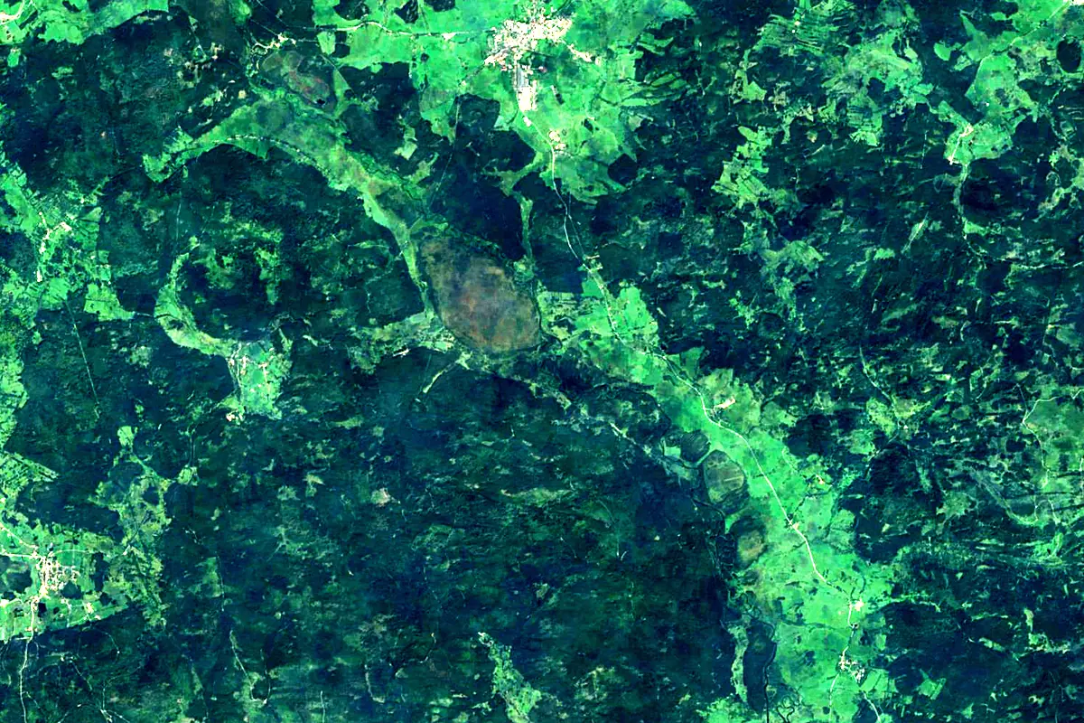
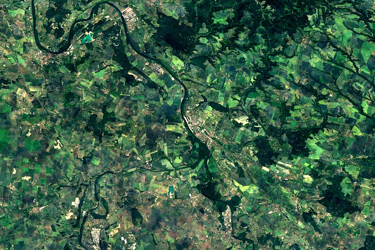
Sentinel-2 cloudless 2016 by EOX IT Services GmbH (contains modified Copernicus Sentinel data 2016), CC BY 4.0. The glowing line is the river as drawn by RiverATLAS.
Photos
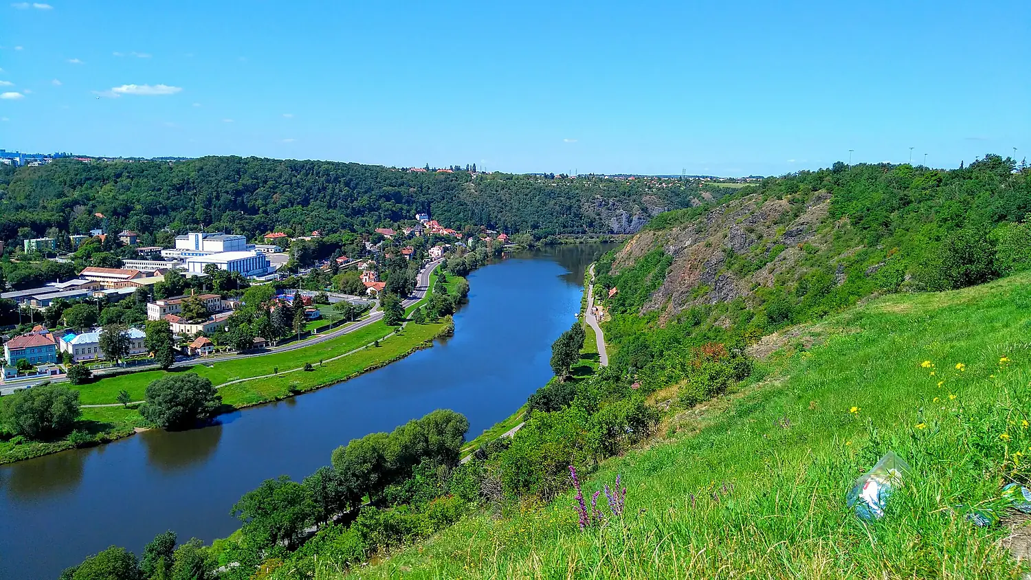
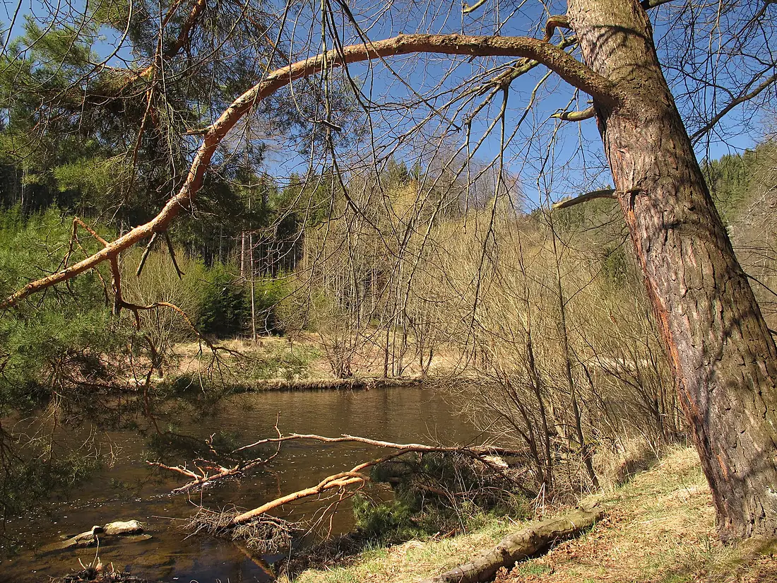
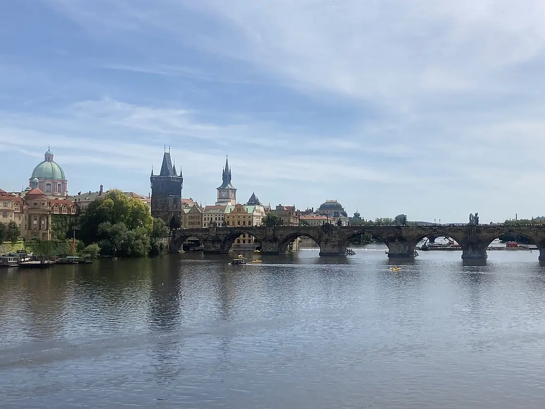
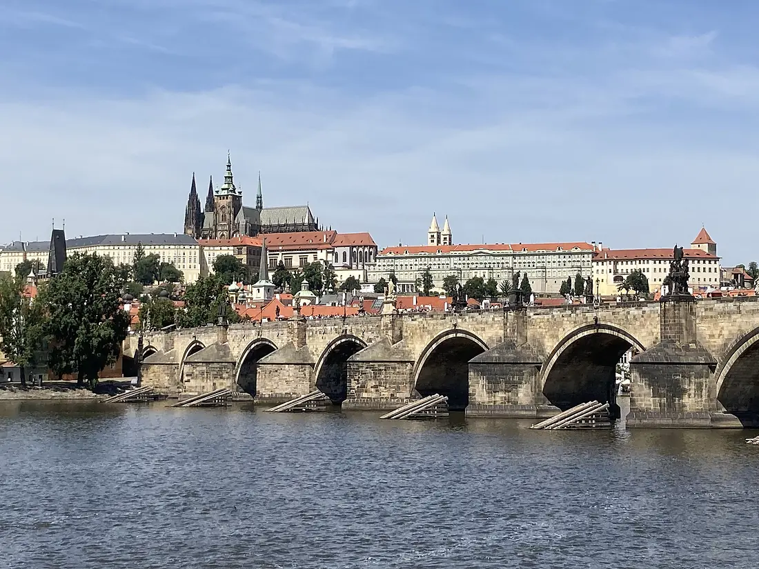
Vltava in pictures
Tributaries
Where it flows, and what flows into it
Tributaries (56)
Czechia226 km25 m³/sjoins at km 261LužniceCzechia208 km20 m³/sjoins at km 152BerounkaCzechia139 km150 m³/sjoins at km 276OtavaCzechia112 km26 m³/sjoins at km 183Also: Malše, Kalte Moldau, Kocába, Teplá Vltava, Botič, Rokytka, Brzina, Křemžský potok, Mastník, Bakovský potok, Hrejkovický potok, Zákolanský potok, Musík, Jílecký potok, Bezdrevský potok, Menší Vltavice, Polečnice, Bojovský potok, Volarský potok, Jezerní potok, Zahořanský potok, Litovicko-Šárecký potok, Brusnice, Dehtářský potok
 Germany
Nearby
Rivers nearby
Where these numbers come from
| Name, length, places | Wikidata (Q131574) · CC0 |
|---|---|
| Course, profile, basin | RiverATLAS v1.0 (HydroATLAS, Linke et al. 2019) · CC BY 4.0 — followed from the source to the mouth given by Wikidata |
| Flow | WaterGAP (RiverATLAS), 1971–2000 · CC BY 4.0 |
| Climate along the river | WorldClim (RiverATLAS), 1970–2000 · CC BY 4.0 |
| Towns, bridges, dams | Wikidata · CC0; GeoNames · CC BY 4.0 |
| Along the river | © OpenStreetMap contributors · ODbL |
| Images | EOX Sentinel-2 cloudless 2016 · CC BY 4.0; Wikimedia Commons |
| Our other atlases | Cascadyas, Lakeyas, Peakyas — Wikidata · CC0; © OpenStreetMap contributors · ODbL; GeoNames · CC BY 4.0; HydroLAKES · CC BY 4.0; NOAA OISST |
Every source and licence is on the data sources page.
The family
Do you prefer beaches, lakes, mountains, waterfalls, islands, rivers or canyons?
Same idea, other landscapes: field atlases built on open data, month by month, in seven languages.
 beaches
 Find your beach: sea temperature, sun and swimming month by month.Visit lakes
 Every lake on Earth: water temperature, ice, depth and the shore.Coming soonVisit mountains
 Every summit in 3D: summit weather, the 0 °C line, huts and trails.Visit waterfalls
 Every waterfall: height, flow month by month and when it roars.Coming soonVisit
  islands
 Every island from the sea up: size, sea temperature, ferries and 3D.Coming soonVisit
  rivers
 Every river from source to sea: the journey, the flow and the basin in numbers.You are here
 canyons
 Every canyon cut to scale: depth to the floor, rim and floor temperatures, trails and viewpoints.Coming soonVisit