River
Iguazu River
1,320 km from source to mouth · Argentina and Brazil.
 Argentina and BrazilFlows into Paraná River3rd longest in Argentina
In numbers
Length
1,320km
Average flow
1,700m³/s
Basin
62,000km²
Drop
774m
from 881 m to 107 m
Countries
2
The journey
From source to mouth
1,320 km of river and 38 stops on the way: 8 towns and cities on its banks, dams, bridges and the tributaries that feed it.
- 0 kmSerra do Marat 881 m
- 15 kmPinhais117,000 people
- 26 kmSão José dos Pinhais349,880 people
- 32 kmBelém Rivertributary
- 68 kmAraucária162,247 people
- 77 kmPassa Una Rivertributary
- 101 kmBalsa Nova13,395 people
- 130 kmCórrego Salto Caiacanga
- 253 kmSão Mateus do Sul46,705 people
- 290 kmPotinga Rivertributary
- 320 kmPaciência Rivertributary
- 358 kmIrineópolis10,285 people
- 380 kmTimbó Rivertributary
- 423 kmPorto União35,543 people
- 425 kmUnião da Vitória57,913 people
- 469 kmJangada Rivertributary
- 476 kmPalmital Rivertributary
- 504 kmIratinzinho Rivertributary
- 557 kmFoz do Areia Reservoir77 km²
- 617 kmIratim Rivertributary
- 750 kmCavernoso Rivertributary
- 804 kmSalto Santiago
- 852 kmDas Cobras Rivertributary
- 882 kmSalto Osório
- 904 kmChopim Rivertributary
- 924 kmGuarani Rivertributary
- 984 kmTormenta Rivertributary
- 1,038 kmCapanema Rivertributary
- 1,054 kmSalto Sampaio
- 1,057 kmSalto Faraday
- 1,104 kmFloriano Rivertributary
- 1,119 kmBenjamim Constant Rivertributary
- 1,134 kmSan Antonio Rivertributary
- 1,197 kmSalto Caniguá
- 1,226 kmSalto Cuatro Hermanas
- 1,248 kmSalto Irene
- 1,260 kmDevil's Throat
- 1,260 kmIguaçu Falls
- 1,266 kmTancredo Neves Bridge
- 1,320 kmParaná Riverat 107 m
Water level along the river (RiverATLAS; the height is exaggerated). Towns: GeoNames and Wikidata; bridges, dams and tributaries: Wikidata.
River in Paraná, Brazil
At the mouth it carries 1,746 m³/s on average: an Olympic pool every 1.4 seconds. It drops from 881 m to 107 m, 0.6 m per kilometre on average. Its basin covers 62,000 km², about the size of LV. 5.1 million people live in it. Highest water: from February to March and from October to November. Dams and reservoirs hold back a large share of its water (36% of a year's flow).
Where to start
- São José dos PinhaisLargest city on its banks · 349,880 people
- Curitiba-Afonso Pena International Airport (CWB)Nearest airport with scheduled flights, 3 km from the cityCar hire at CWB airport (Curitiba)Discover Cars · Affiliate link↗
- On the water53 ferry piers, marinas, boat rentals and boat ramps along the river (OpenStreetMap)
- Kayak and canoe2 put-ins and rapids mapped (OpenStreetMap)
- From April to May, from July to August and NovemberThe best months to visit
Iguazu River, month by month
Highest water: from February to March and from October to November
Best months to visit: from April to May, from July to August and November.
From about 1,400 m³/s in the lowest month to 2,200 m³/s in the highest. An estimate: the monthly flow is modelled from the lowest and highest months of WaterGAP (RiverATLAS, 1971–2000) and the rain and snow along the river (WorldClim). Dams change the real rhythm. The chip is the average air temperature; below it, the month's rain.
Plan the trip
Plan the trip: boat trips, a bed by the river, a car
Some links above are affiliate links: if you book through them we may earn a commission, at no extra cost to you. It never changes what the data on this page says.
The basin
Iguazu River: the basin in numbers
67,231 km² of land send their water to this river. This is what lives on it.
- 5.1millionpeople live in the basin
- 75/km²people per km²
- 799maverage altitude of the basin
- 1,695mmof rain a year (basin average)
- 17.2°Caverage air temperature
- 4%protected areas
- 0.7%covered by lakes
- 21km³held in reservoirs
What covers the basin
- 34% Forest
- 25% Cropland
- 19% Pasture
- 3% Towns and cities
RiverATLAS (HydroATLAS v1.0, CC BY 4.0): land cover, people, protected areas, glaciers and dams over the whole basin upstream of the mouth.
Along the river
Iguazu River: what you find on the way
- 2WeirsPCH Foz do Chopim
- 39WaterfallsCachoeira do Alemão, Cachoeira Linha do Tiro, Cachoeira Foz do Rio Tigre and 36 more
- 2RapidsCorredeiras do Faraday, Corredeiras da Vaca Branca
- 10Boat rampsEmbarcadero and 9 more
- 42Ferry piersPaula Pereira, Putinga, São Mateus do Sul and 39 more
- 1MarinasMarina Parque Histórico Iguassu
- 2River beachesparque aquático de Quedas do Iguaçu, Praia Artificial da Barra Bonita
From OpenStreetMap, within 2.3 km of the river. Not mapped is not the same as not there.
Cross-checked with our atlases
Iguazu River in our other atlases
What our sister atlases know about the waterfalls on this river, the lakes it flows through, the beaches at its mouth, the mountains where it rises and the islands off its mouth.
 10waterfalls on the riverCascadyas
 1lake on its wayLakeyas
 16mountains at the sourcePeakyas
Waterfalls (10)
On the river, by Cascadyas
- Salto Santiagokm 584
- Salto Sampaiokm 765
- Salto Faradaykm 768
- Salto Caniguákm 869
- Salto Cuatro Hermanaskm 890
- Salto Irenekm 906
- Iguaçu Fallskm 91582m
- Devil's Throatkm 915
2 more on CascadyasCascadyas is coming soonOpen Cascadyas ↗
Lakes and reservoirs (1)
Lakes it flows through, by Lakeyas
- Foz do Areia Reservoirkm 40477km²
Lakeyas is coming soonOpen Lakeyas ↗
Mountains at the source (16)
Within 15 km of the source, by Peakyas
- Mount Anhangava0.4 km away
- Conjunto Marumbi11 km away
- Pico do Anhangava0.4 km away
- Pico Pão de Loth2.3 km away
- Pico Caratuba9.1 km away
- Morro Pelado6.8 km away
- Pico do Sete11 km away
- Morro da Farinha Seca8.8 km away
8 more on PeakyasOpen Peakyas ↗
From space
The source and the mouth, seen from orbit
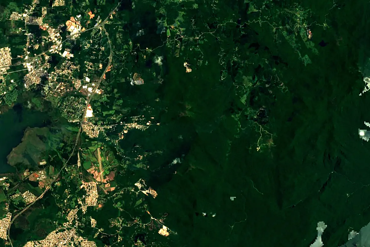
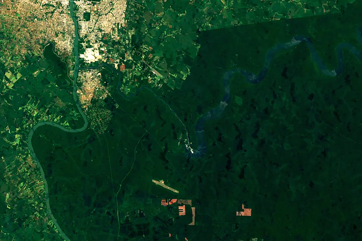
Sentinel-2 cloudless 2016 by EOX IT Services GmbH (contains modified Copernicus Sentinel data 2016), CC BY 4.0. The glowing line is the river as drawn by RiverATLAS.
Photos
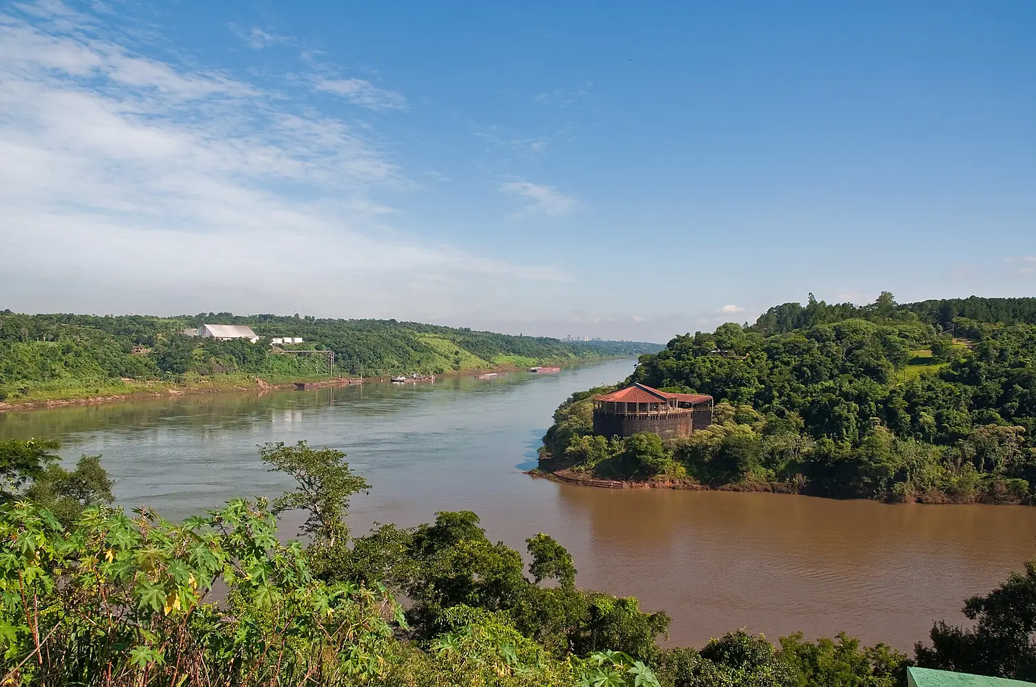
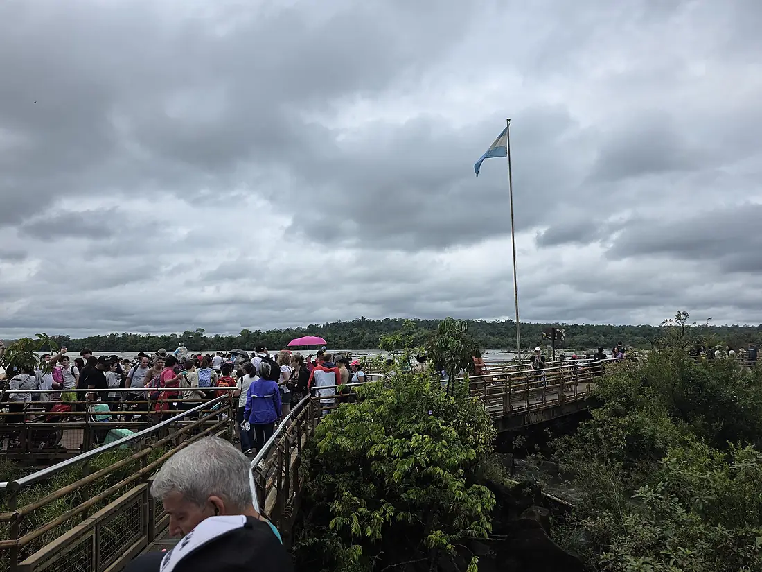
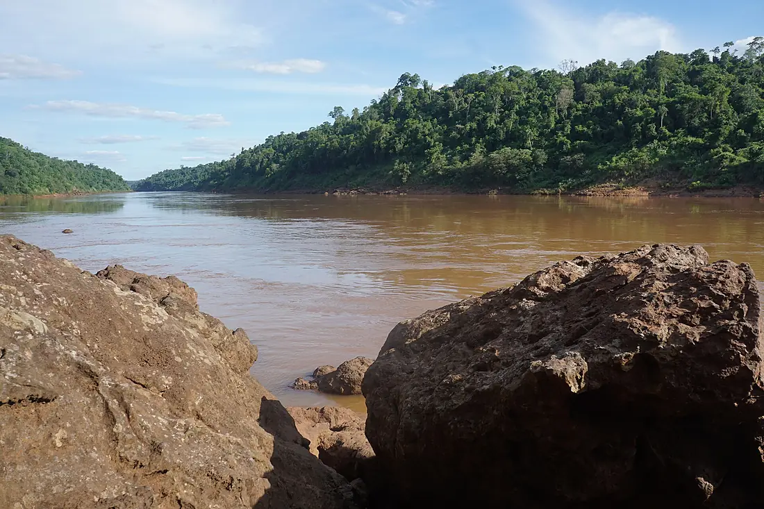
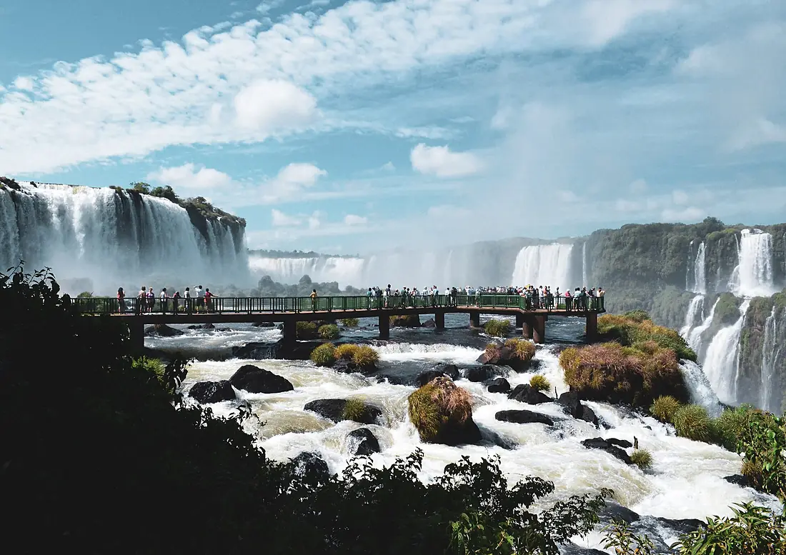
Iguazu River in pictures
Tributaries
Where it flows, and what flows into it
It flows into
Paraná River Uruguay4,880 km16,000 m³/s
Tributaries (35)
Also: San Antonio River, Chopim River, Jangada River, Timbó River, Negro River, Potinga River, Belém River, Benjamim Constant River, Capanema River, Cavernoso River, Das Cobras River, Floriano River, Paciência River, Palmital River, Tormenta River, Guarani River, Iratim River, Iratinzinho River, Butiá River, Capivara River, Claro River, Cotegipe River, Da Areia River, Das Marrecas River
In the same basin
Argentina2,621 km2.7 m³/sUruguay RiverUruguay1,790 km4.6 m³/sPilcomayo River Paraguay1,100 km200 m³/sBermejoParaguay1,060 km340 m³/sGrande RiverBrazil1,090 km2,000 m³/sTietê RiverBrazil1,150 km2,500 m³/sSalado RiverArgentina1,150 km15 m³/sParanaíba RiverBrazil900 km1,500 m³/sParanapanema RiverBrazil929 km1,200 m³/sApa RiverParaguay380 km130 m³/s
Where these numbers come from
| Name, length, places | Wikidata (Q191635) · CC0 |
|---|---|
| Course, profile, basin | RiverATLAS v1.0 (HydroATLAS, Linke et al. 2019) · CC BY 4.0 — followed from the source to the mouth given by Wikidata |
| Flow | WaterGAP (RiverATLAS), 1971–2000 · CC BY 4.0 |
| Climate along the river | WorldClim (RiverATLAS), 1970–2000 · CC BY 4.0 |
| Towns, bridges, dams | Wikidata · CC0; GeoNames · CC BY 4.0 |
| Along the river | © OpenStreetMap contributors · ODbL |
| Images | EOX Sentinel-2 cloudless 2016 · CC BY 4.0; Wikimedia Commons |
| Our other atlases | Cascadyas, Lakeyas, Peakyas — Wikidata · CC0; © OpenStreetMap contributors · ODbL; GeoNames · CC BY 4.0; HydroLAKES · CC BY 4.0; NOAA OISST |
Every source and licence is on the data sources page.
The family
Do you prefer beaches, lakes, mountains, waterfalls, islands, rivers or canyons?
Same idea, other landscapes: field atlases built on open data, month by month, in seven languages.
 beaches
 Find your beach: sea temperature, sun and swimming month by month.Visit lakes
 Every lake on Earth: water temperature, ice, depth and the shore.Coming soonVisit mountains
 Every summit in 3D: summit weather, the 0 °C line, huts and trails.Visit waterfalls
 Every waterfall: height, flow month by month and when it roars.Coming soonVisit
  islands
 Every island from the sea up: size, sea temperature, ferries and 3D.Coming soonVisit
  rivers
 Every river from source to sea: the journey, the flow and the basin in numbers.You are here
 canyons
 Every canyon cut to scale: depth to the floor, rim and floor temperatures, trails and viewpoints.Coming soonVisit