River
Paranapanema River
929 km from source to mouth · Brazil.
 BrazilFlows into Paraná River
In numbers
Length
929km
Average flow
1,200m³/s
Basin
101,739km²
Drop
393m
from 630 m to 237 m
Country
1
The journey
From source to mouth
929 km of river and 17 stops on the way: 4 towns and cities on its banks, dams, bridges and the tributaries that feed it.
- 0 kmSourceat 630 m
- 70 kmDas Almas Rivertributary
- 112 kmItapetininga Rivertributary
- 177 kmParanapanema19,395 people
- 259 kmTaquari-Guaçu Rivertributary
- 265 kmRepresa de Jurimirim374 km²
- 296 kmPiraju29,436 people
- 354 kmRepresa da Usina Chavante341 km²
- 358 kmItararé Rivertributary
- 413 kmSalto Grande9,050 people
- 413 kmPardo Rivertributary
- 501 kmDas Cinzas Rivertributary
- 630 kmReservatório Capivara407 km²
- 630 kmCapivara Dam
- 727 kmPirapó Rivertributary
- 744 kmTeodoro Sampaio22,173 people
- 787 kmCachoeira da Serra do Diabo
- 869 kmLagoa São Paulo1,205 km²
- 929 kmParaná Riverat 237 m
Water level along the river (RiverATLAS; the height is exaggerated). Towns: GeoNames and Wikidata; bridges, dams and tributaries: Wikidata.
River in Brazil
At the mouth it carries 1,198 m³/s on average: an Olympic pool every 2.1 seconds. It drops from 630 m to 237 m, 0.4 m per kilometre on average. Its basin covers 101,739 km², about the size of CS. 4.6 million people live in it. Highest water: from January to March; lowest: from August to September. It is heavily dammed: reservoirs can hold 78% of a year's flow.
Where to start
- PirajuLargest city on its banks · 29,436 people
- Bauru/Arealva–Moussa Nakhal Tobias State Airport (JTC)Nearest airport with scheduled flights, 119 km from the cityCar hire at MII airport (Marília)Discover Cars · Affiliate link↗
- On the water22 ferry piers, marinas, boat rentals and boat ramps along the river (OpenStreetMap)
- From May to SeptemberThe best months to visit
Paranapanema River, month by month
Highest water: from January to March
Lowest water: from August to September. Best months to visit: from May to September.
From about 900 m³/s in the lowest month to 1,600 m³/s in the highest. An estimate: the monthly flow is modelled from the lowest and highest months of WaterGAP (RiverATLAS, 1971–2000) and the rain and snow along the river (WorldClim). Dams change the real rhythm. The chip is the average air temperature; below it, the month's rain.
Plan the trip
Plan the trip: boat trips, a bed by the river, a car
Some links above are affiliate links: if you book through them we may earn a commission, at no extra cost to you. It never changes what the data on this page says.
The basin
Paranapanema River: the basin in numbers
101,739 km² of land send their water to this river. This is what lives on it.
- 4.6millionpeople live in the basin
- 45/km²people per km²
- 633maverage altitude of the basin
- 1,325mmof rain a year (basin average)
- 19.8°Caverage air temperature
- 4%protected areas
- 1.5%covered by lakes
- 29km³held in reservoirs
What covers the basin
- 11% Forest
- 24% Cropland
- 41% Pasture
- 2% Towns and cities
RiverATLAS (HydroATLAS v1.0, CC BY 4.0): land cover, people, protected areas, glaciers and dams over the whole basin upstream of the mouth.
Along the river
Paranapanema River: what you find on the way
- 2WeirsVertedouro Salto Grande
- 2WaterfallsCascata Véu de Noiva
- 9Boat rampsPorto Maringa and 8 more
- 12Ferry piersSanto Antonio do Paranapanema, Itambaracá, Florínea and 9 more
- 4River beachesPraia da Represa, Prainha de Itaí, Praia das Vacas and 1 more
From OpenStreetMap, within 2.4 km of the river. Not mapped is not the same as not there.
Cross-checked with our atlases
Paranapanema River in our other atlases
What our sister atlases know about the waterfalls on this river, the lakes it flows through, the beaches at its mouth, the mountains where it rises and the islands off its mouth.
 2waterfalls on the riverCascadyas
 4lakes on its wayLakeyas
 7mountains at the sourcePeakyas
Waterfalls (2)
On the river, by Cascadyas
- Salto Grandekm 346
- Cachoeira da Serra do Diabokm 650
Cascadyas is coming soonOpen Cascadyas ↗
Lakes and reservoirs (4)
Lakes it flows through, by Lakeyas
- Represa de Jurimirimkm 219374km²
- Represa da Usina Chavantekm 293341km²
- Reservatório Capivarakm 521407km²
- Lagoa São Paulokm 7191,205km²
Lakeyas is coming soonOpen Lakeyas ↗
Mountains at the source (7)
Within 15 km of the source, by Peakyas
- Serra do Sapateiro12 km away
- Serra do Azeite4.5 km away
- Morro Alto do Berrador14 km away
- Morro da Irara13 km away
- Serra do Guaraú6.0 km away
- Serra do Braço Feio3.9 km away
- Serra do Pinheiro8.4 km away
From space
The source and the mouth, seen from orbit
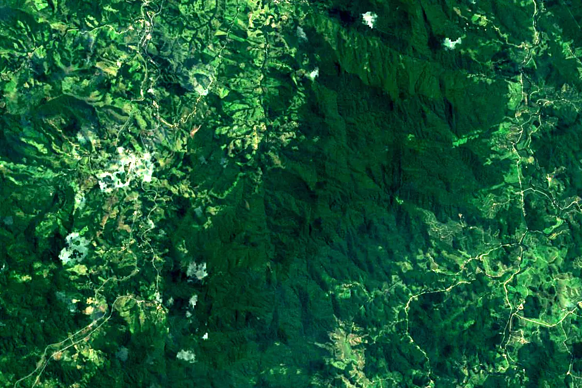
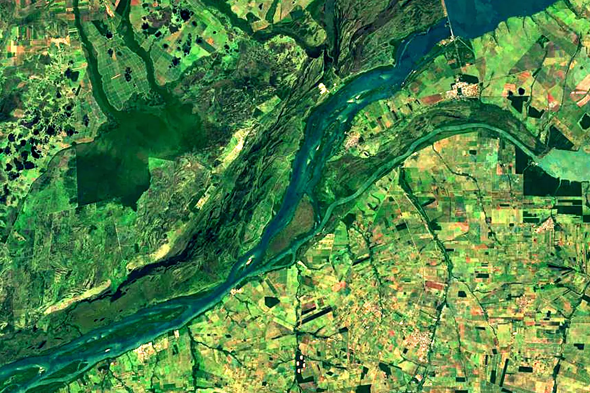
Sentinel-2 cloudless 2016 by EOX IT Services GmbH (contains modified Copernicus Sentinel data 2016), CC BY 4.0. The glowing line is the river as drawn by RiverATLAS.
Photos
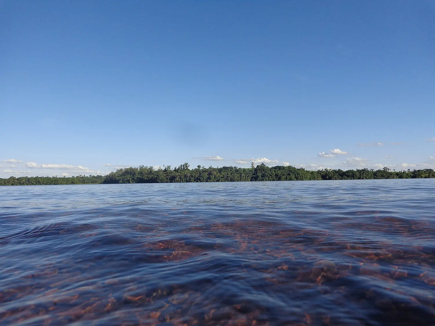
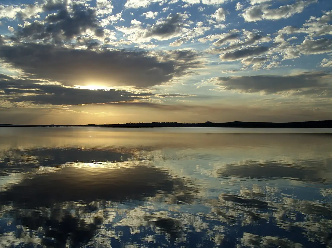
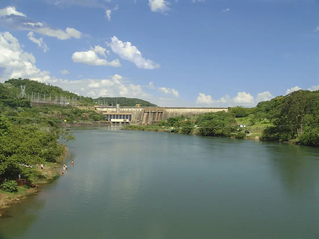
Paranapanema River in pictures
Tributaries
Where it flows, and what flows into it
It flows into
Paraná River Uruguay4,880 km16,000 m³/s
Tributaries (19)
Also: Tibagi River, Itararé River, Pirapó River, Das Cinzas River, Taquari-Guaçu River, Pardo River, Apiai-Guaçu River, Caiuá River, Capivara River, Das Almas River, Guareí River, Novo River, Itapetininga River, Guapiara River, Pari River, Santo Inácio River, Vermelho River, Taquaruçu River, Corvo River
In the same basin
 Argentina2,621 km2.7 m³/sUruguay RiverUruguay1,790 km4.6 m³/sIguazu RiverArgentina1,320 km1,700 m³/sPilcomayo River
 Paraguay1,100 km200 m³/sBermejoParaguay1,060 km340 m³/sGrande RiverBrazil1,090 km2,000 m³/sTietê RiverBrazil1,150 km2,500 m³/sSalado RiverArgentina1,150 km15 m³/sParanaíba RiverBrazil900 km1,500 m³/sApa RiverParaguay380 km130 m³/s
Where these numbers come from
| Name, length, places | Wikidata (Q607976) · CC0 |
|---|---|
| Course, profile, basin | RiverATLAS v1.0 (HydroATLAS, Linke et al. 2019) · CC BY 4.0 — followed along the river network from the point given by Wikidata |
| Flow | WaterGAP (RiverATLAS), 1971–2000 · CC BY 4.0 |
| Climate along the river | WorldClim (RiverATLAS), 1970–2000 · CC BY 4.0 |
| Towns, bridges, dams | Wikidata · CC0; GeoNames · CC BY 4.0 |
| Along the river | © OpenStreetMap contributors · ODbL |
| Images | EOX Sentinel-2 cloudless 2016 · CC BY 4.0; Wikimedia Commons |
| Our other atlases | Cascadyas, Lakeyas, Peakyas — Wikidata · CC0; © OpenStreetMap contributors · ODbL; GeoNames · CC BY 4.0; HydroLAKES · CC BY 4.0; NOAA OISST |
Every source and licence is on the data sources page.
The family
Do you prefer beaches, lakes, mountains, waterfalls, islands, rivers or canyons?
Same idea, other landscapes: field atlases built on open data, month by month, in seven languages.
 beaches
 Find your beach: sea temperature, sun and swimming month by month.Visit lakes
 Every lake on Earth: water temperature, ice, depth and the shore.Coming soonVisit mountains
 Every summit in 3D: summit weather, the 0 °C line, huts and trails.Visit waterfalls
 Every waterfall: height, flow month by month and when it roars.Coming soonVisit
  islands
 Every island from the sea up: size, sea temperature, ferries and 3D.Coming soonVisit
  rivers
 Every river from source to sea: the journey, the flow and the basin in numbers.You are here
 canyons
 Every canyon cut to scale: depth to the floor, rim and floor temperatures, trails and viewpoints.Coming soonVisit