River
Paraguay River
2,621 km from source to mouth · Argentina, Brazil and Paraguay.
 Argentina, Brazil and ParaguayFlows into Paraná River1st longest in Argentina
In numbers
Length
2,621km
Average flow
2.7m³/s
Basin
1,150,000km²
Drop
291m
from 333 m to 42 m
Countries
3
The journey
From source to mouth
2,621 km of river and 44 stops on the way: 17 towns and cities on its banks, dams, bridges and the tributaries that feed it.
- 0 kmSourceat 333 m
- 28 kmArenápolis10,747 people
- 145 kmBarra do Bugres29,576 people
- 307 kmCabaçal Rivertributary
- 308 kmCáceres95,339 people
- 351 kmJauru Rivertributary
- 605 kmUberaba Lake326 km²
- 627 kmLa Gaiba Lake98 km²
- 671 kmSão Lourenço Rivertributary
- 692 kmMandioré Lake145 km²
- 721 kmLagoa do Cachorro0.7 km²
- 880 kmCorumbá98,751 people
- 886 kmLadário21,522 people
- 926 kmTaquari Rivertributary
- 957 kmRio Negrotributary
- 984 kmMiranda Rivertributary
- 1,017 kmEurico Gaspar Dutra Bridge
- 1,323 kmFuerte Olimpo4,445 people
- 1,423 kmPorto Murtinho12,859 people
- 1,487 kmApa Rivertributary
- 1,681 kmAquidabán Rivertributary
- 1,724 kmConcepción45,068 people
- 1,739 kmYpané Rivertributary
- 1,802 kmMonte Lindo Rivertributary
- 1,855 kmJejuí Guazú Rivertributary
- 1,885 kmNegro Rivertributary
- 1,981 kmManduvirá Rivertributary
- 2,012 kmSalado Rivertributary
- 2,015 kmVilla Hayes49,328 people
- 2,024 kmConfuso Rivertributary
- 2,026 kmPuente Remanso
- 2,028 kmMariano Roque Alonso72,008 people
- 2,035 kmHéroes del Chaco Bridge
- 2,042 kmAsunción462,241 people
- 2,048 kmPilcomayo Rivertributary
- 2,055 kmLambaré126,377 people
- 2,064 kmVilla Elisa64,099 people
- 2,070 kmSan Antonio55,754 people
- 2,080 kmVilleta36,985 people
- 2,221 kmFormosa222,226 people
- 2,237 kmLaguna Oca4.4 km²
- 2,295 kmTebicuary Rivertributary
- 2,335 kmPilar32,810 people
- 2,343 kmBermejotributary
- 2,357 kmLaguna Timbó2.4 km²
- 2,621 kmParaná Riverat 42 m
Water level along the river (RiverATLAS; the height is exaggerated). Towns: GeoNames and Wikidata; bridges, dams and tributaries: Wikidata.
River of Argentina, Brazil and Paraguay
At the mouth it carries 2.7 m³/s on average: an Olympic pool every 926 seconds. It drops from 333 m to 42 m, 0.1 m per kilometre on average. Its basin covers 1,150,000 km², about the size of CO. 10.3 million people live in it. Highest water: from January to April; lowest: from August to September. No large dam holds it back: it is one of the world's free-flowing rivers.
Where to start
- AsunciónLargest city on its banks · 462,241 people
- Silvio Pettirossi International Airport (ASU)Nearest airport with scheduled flights, 12 km from the cityCar hire at ASU airport (Asunción)Discover Cars · Affiliate link↗
- On the water49 ferry piers, marinas, boat rentals and boat ramps along the river (OpenStreetMap)
- Kayak and canoe3 put-ins and rapids mapped (OpenStreetMap)
- From May to SeptemberThe best months to visit
Paraguay River, month by month
Highest water: from January to April
Lowest water: from August to September. Best months to visit: from May to September.
From about 4,000 m³/s in the lowest month to 7,300 m³/s in the highest. An estimate: the monthly flow is modelled from the lowest and highest months of WaterGAP (RiverATLAS, 1971–2000) and the rain and snow along the river (WorldClim). Dams change the real rhythm. The chip is the average air temperature; below it, the month's rain.
Plan the trip
Plan the trip: boat trips, a bed by the river, a car
Some links above are affiliate links: if you book through them we may earn a commission, at no extra cost to you. It never changes what the data on this page says.
The basin
Paraguay River: the basin in numbers
1,136,963 km² of land send their water to this river. This is what lives on it.
- 10.3millionpeople live in the basin
- 9/km²people per km²
- 503maverage altitude of the basin
- 1,055mmof rain a year (basin average)
- 22.9°Caverage air temperature
- 10%protected areas
- 0.3%covered by lakes
- 2.7km³held in reservoirs
What covers the basin
- 48% Forest
- 4% Cropland
- 41% Pasture
RiverATLAS (HydroATLAS v1.0, CC BY 4.0): land cover, people, protected areas, glaciers and dams over the whole basin upstream of the mouth.
Along the river
Paraguay River: what you find on the way
- 3Rapids
- 9Boat rampsCais do Porto, Poco Hilo and 7 more
- 27Ferry piersIlha Margarida, Porto Murtinho, Puerto Casado (Ex Puerto La Victoria) and 24 more
- 10MarinasMarina Barão, Marina de Cáceres, Porto Geral and 7 more
- 9River beachesPraia do Julião, Daveron, Prainha Municipal and 6 more
From OpenStreetMap, within 3.0 km of the river. Not mapped is not the same as not there.
Cross-checked with our atlases
Paraguay River in our other atlases
What our sister atlases know about the waterfalls on this river, the lakes it flows through, the beaches at its mouth, the mountains where it rises and the islands off its mouth.
 6lakes on its wayLakeyas
Lakes and reservoirs (6)
Lakes it flows through, by Lakeyas
- Uberaba Lakekm 539326km²
- La Gaiba Lakekm 55898km²
- Mandioré Lakekm 617145km²
- Lagoa do Cachorrokm 6420.7km²
- Laguna Ocakm 1,9944.4km²
- Laguna Timbókm 2,1012.4km²
Lakeyas is coming soonOpen Lakeyas ↗
From space
The source and the mouth, seen from orbit
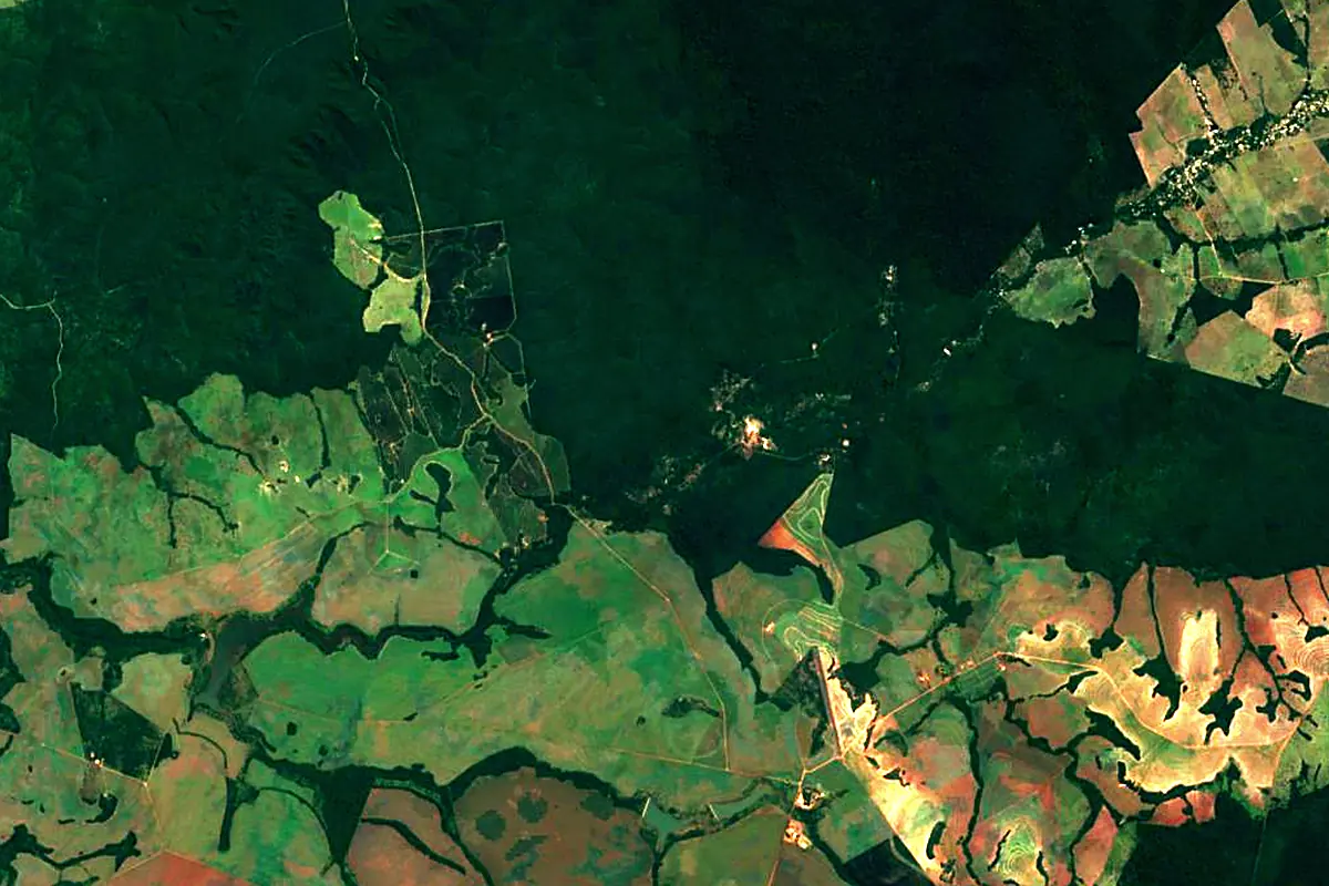
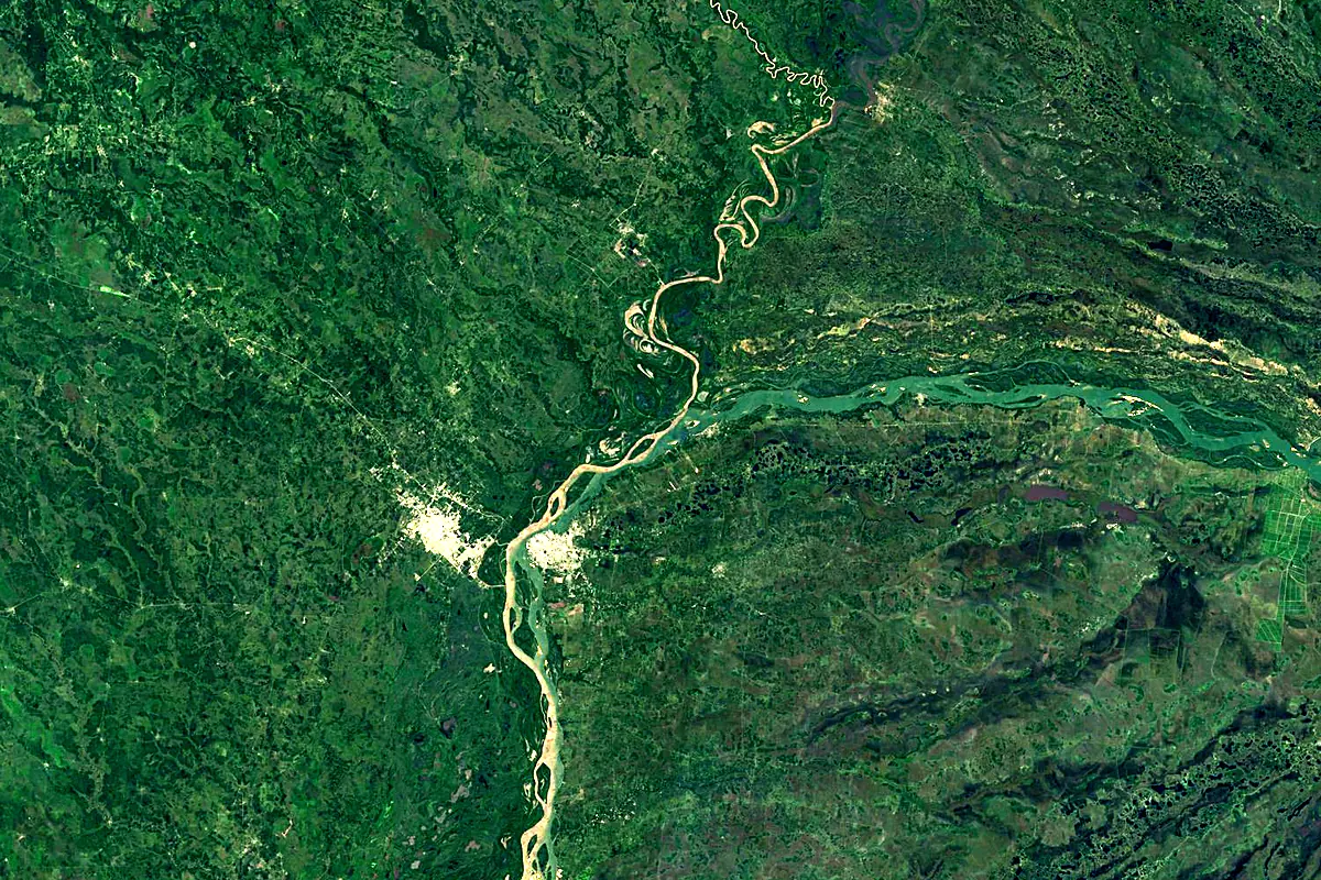
Sentinel-2 cloudless 2016 by EOX IT Services GmbH (contains modified Copernicus Sentinel data 2016), CC BY 4.0. The glowing line is the river as drawn by RiverATLAS.
Photos
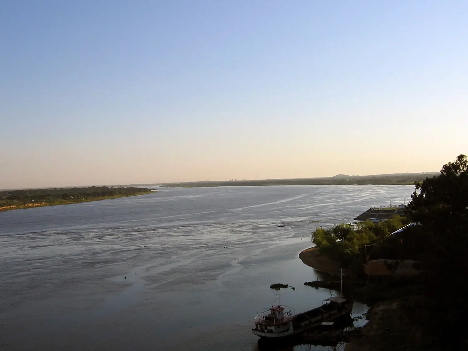
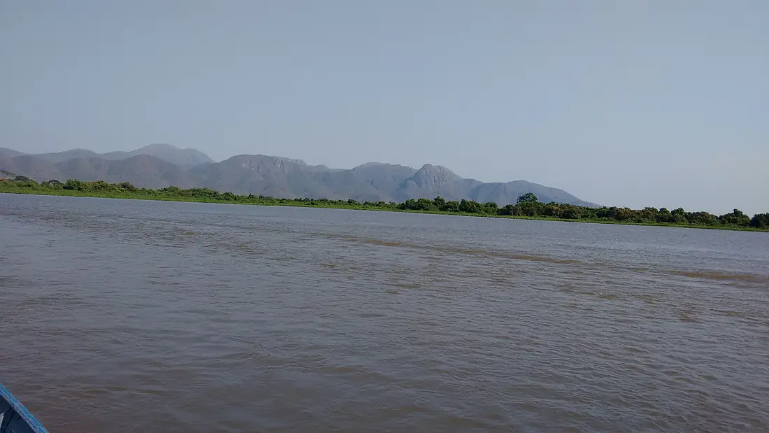
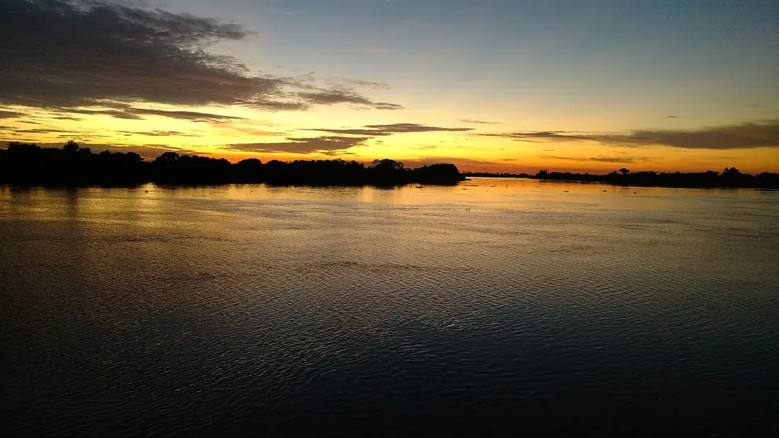
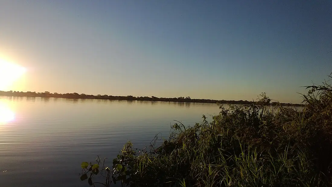
Paraguay River in pictures
Tributaries
Where it flows, and what flows into it
It flows into
Paraná River Uruguay4,880 km16,000 m³/s
Tributaries (37)
Paraguay1,100 km200 m³/sjoins at km 1,826BermejoParaguay1,060 km340 m³/sjoins at km 2,088Apa RiverParaguay380 km130 m³/sjoins at km 1,326Also: Cuiabá River, Tebicuary River, Miranda River, Manduvirá River, Taquari River, Jauru River, Salado River, Aquidabán River, Jejuí Guazú River, São Lourenço River, Nuevo Guadalquivir River, Confuso River, Ypané River, Rio Negro, Monte Lindo River, Mojotoro River, Cabaçal River, Amanguijá River, Jejuy River, Novo River, Paraguazinho River, Río de Oro, Tererê River, Verde River
Where these numbers come from
| Name, length, places | Wikidata (Q179396) · CC0 |
|---|---|
| Course, profile, basin | RiverATLAS v1.0 (HydroATLAS, Linke et al. 2019) · CC BY 4.0 — followed from the source to the mouth given by Wikidata |
| Flow | WaterGAP (RiverATLAS), 1971–2000 · CC BY 4.0 |
| Climate along the river | WorldClim (RiverATLAS), 1970–2000 · CC BY 4.0 |
| Towns, bridges, dams | Wikidata · CC0; GeoNames · CC BY 4.0 |
| Along the river | © OpenStreetMap contributors · ODbL |
| Images | EOX Sentinel-2 cloudless 2016 · CC BY 4.0; Wikimedia Commons |
| Our other atlases | Lakeyas — Wikidata · CC0; © OpenStreetMap contributors · ODbL; GeoNames · CC BY 4.0; HydroLAKES · CC BY 4.0; NOAA OISST |
Every source and licence is on the data sources page.
The family
Do you prefer beaches, lakes, mountains, waterfalls, islands, rivers or canyons?
Same idea, other landscapes: field atlases built on open data, month by month, in seven languages.
 beaches
 Find your beach: sea temperature, sun and swimming month by month.Visit lakes
 Every lake on Earth: water temperature, ice, depth and the shore.Coming soonVisit
  mountains
 Every summit in 3D: summit weather, the 0 °C line, huts and trails.Visit
  waterfalls
 Every waterfall: height, flow month by month and when it roars.Coming soonVisit
  islands
 Every island from the sea up: size, sea temperature, ferries and 3D.Coming soonVisit
  rivers
 Every river from source to sea: the journey, the flow and the basin in numbers.You are here
 canyons
 Every canyon cut to scale: depth to the floor, rim and floor temperatures, trails and viewpoints.Coming soonVisit