River
Tietê River
1,150 km from source to mouth · Brazil.
 BrazilFlows into Paraná River
In numbers
Length
1,150km
Average flow
2,500m³/s
Basin
150,000km²
Drop
539m
from 817 m to 278 m
Country
1
The journey
From source to mouth
1,150 km of river and 68 stops on the way: 40 towns and cities on its banks, dams, bridges and the tributaries that feed it.
- 0 kmSalesópolisat 817 m
- 30 kmRepresa do Rio Claro21 km²
- 62 kmMogi das Cruzes325,746 people
- 76 kmSuzano320,261 people
- 85 kmItaquaquecetuba369,275 people
- 92 kmItaim Paulista205,295 people
- 94 kmVila Curuca140,673 people
- 94 kmJardim Helena129,409 people
- 98 kmSão Miguel81,011 people
- 101 kmVila Jacui134,189 people
- 103 kmErmelino Matarazzo112,333 people
- 108 kmGuarulhos1,345,364 people
- 110 kmCangaiba141,172 people
- 115 kmVila Medeiros114,839 people
- 117 kmCabuçu de Cima Rivertributary
- 118 kmTatuapé98,601 people
- 118 kmVila Maria108,543 people
- 118 kmAricanduva Rivertributary
- 119 kmMooca80,880 people
- 120 kmBelem55,785 people
- 121 kmBrás38,750 people
- 123 kmVila Guilherme52,587 people
- 125 kmSão Paulo11,451,999 people
- 126 kmRepublica60,720 people
- 126 kmSantana115,689 people
- 128 kmSanta Cecilia80,972 people
- 128 kmCasa Verde80,536 people
- 129 kmTamanduateí Rivertributary
- 130 kmLimão82,373 people
- 131 kmPerdizes102,391 people
- 133 kmFreguesia do Ó137,240 people
- 134 kmLapa75,533 people
- 136 kmPirituba179,724 people
- 138 kmSao Domingos88,884 people
- 138 kmVila Leopoldina46,875 people
- 141 kmPinheiros Rivertributary
- 141 kmJaguare55,382 people
- 145 kmOsasco728,615 people
- 150 kmCarapicuíba386,984 people
- 153 kmCotia Rivertributary
- 154 kmBarueri316,473 people
- 165 kmSantana de Parnaíba163,787 people
- 227 kmCabreúva47,011 people
- 251 kmSalto141,111 people
- 254 kmJundiaí Rivertributary
- 295 kmPorto Feliz53,402 people
- 303 kmCachoeira Jacó
- 337 kmCachoeira do Bujuí
- 345 kmTietê37,663 people
- 362 kmCórrego Garcia
- 366 kmLaranjal Paulista26,261 people
- 372 kmCorredeira Matias
- 387 kmSorocaba Rivertributary
- 389 kmCapivari Rivertributary
- 458 kmPeixe Rivertributary
- 514 kmPiracicaba Rivertributary
- 610 kmJaú Rivertributary
- 615 kmBariri Reservoir44 km²
- 676 kmJacaré-Pepira Rivertributary
- 685 kmJacaré-Guaçu Rivertributary
- 702 kmIbitinga Reservoir92 km²
- 711 kmSão Lourenço Rivertributary
- 744 kmBatalha Rivertributary
- 816 kmDourado Rivertributary
- 831 kmReservatório Promissão511 km²
- 854 kmSalto do Avanhandava
- 892 kmReservatório Nova Avanhandava193 km²
- 892 kmNova Avanhandava Dam
- 1,057 kmTrês Irmãos Dam
- 1,150 kmParaná Riverat 278 m
Water level along the river (RiverATLAS; the height is exaggerated). Towns: GeoNames and Wikidata; bridges, dams and tributaries: Wikidata.
River in São Paulo, Brazil
At the mouth it carries 2,500 m³/s on average: 1.0 Olympic pools every second. It drops from 817 m to 278 m, 0.5 m per kilometre on average. Its basin covers 150,000 km², about the size of BD. 30.3 million people live in it. Highest water: February; lowest: from June to September. It is heavily dammed: reservoirs can hold 114% of a year's flow.
Where to start
- São PauloLargest city on its banks · 11,451,999 people
- Congonhas–Deputado Freitas Nobre Airport (CGH)Nearest airport with scheduled flights, 9 km from the cityCar hire at CGH airport (São Paulo)Discover Cars · Affiliate link↗
- On the water41 ferry piers, marinas, boat rentals and boat ramps along the river (OpenStreetMap)
- Kayak and canoe1 put-ins and rapids mapped (OpenStreetMap)
- From May to SeptemberThe best months to visit
Tietê River, month by month
Highest water: February
Lowest water: from June to September. Best months to visit: from May to September.
From about 420 m³/s in the lowest month to 1,700 m³/s in the highest. An estimate: the monthly flow is modelled from the lowest and highest months of WaterGAP (RiverATLAS, 1971–2000) and the rain and snow along the river (WorldClim). Dams change the real rhythm. The chip is the average air temperature; below it, the month's rain.
Plan the trip
Plan the trip: boat trips, a bed by the river, a car
Some links above are affiliate links: if you book through them we may earn a commission, at no extra cost to you. It never changes what the data on this page says.
The basin
Tietê River: the basin in numbers
72,168 km² of land send their water to this river. This is what lives on it.
- 30.3millionpeople live in the basin
- 420/km²people per km²
- 591maverage altitude of the basin
- 1,301mmof rain a year (basin average)
- 20.5°Caverage air temperature
- 21%protected areas
- 2.8%covered by lakes
- 34km³held in reservoirs
What covers the basin
- 10% Forest
- 24% Cropland
- 33% Pasture
- 9% Towns and cities
RiverATLAS (HydroATLAS v1.0, CC BY 4.0): land cover, people, protected areas, glaciers and dams over the whole basin upstream of the mouth.
Along the river
Tietê River: what you find on the way
- 31WeirsAçude do Córrego do Biri and 30 more
- 23LocksRio Tietê, Tietê River and 21 more
- 51WaterfallsCachoeira do Tobogã, Tobogã, Salto de Itu-Guaçu and 48 more
- 1Rapids
- 31Boat ramps
- 7Ferry piersBalsa Praia do Torres - Sabino and 6 more
- 3MarinasRio Bonito Campo e Náutica
- 5River beachesPrainha de Igaraçu do Tietê, Prainha de Itapuí, Praia do Juqueta and 2 more
From OpenStreetMap, within 2.3 km of the river. Not mapped is not the same as not there.
Cross-checked with our atlases
Tietê River in our other atlases
What our sister atlases know about the waterfalls on this river, the lakes it flows through, the beaches at its mouth, the mountains where it rises and the islands off its mouth.
 5waterfalls on the riverCascadyas
 5lakes on its wayLakeyas
Waterfalls (5)
On the river, by Cascadyas
- Cachoeira Jacókm 255
- Cachoeira do Bujuíkm 284
- Córrego Garciakm 305
- Corredeira Matiaskm 313
- Salto do Avanhandavakm 718
Cascadyas is coming soonOpen Cascadyas ↗
Lakes and reservoirs (5)
Lakes it flows through, by Lakeyas
- Represa do Rio Clarokm 2621km²
- Bariri Reservoirkm 51844km²
- Ibitinga Reservoirkm 59092km²
- Reservatório Promissãokm 698511km²
- Reservatório Nova Avanhandavakm 750193km²
Lakeyas is coming soonOpen Lakeyas ↗
From space
The source and the mouth, seen from orbit
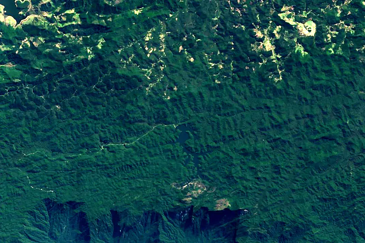
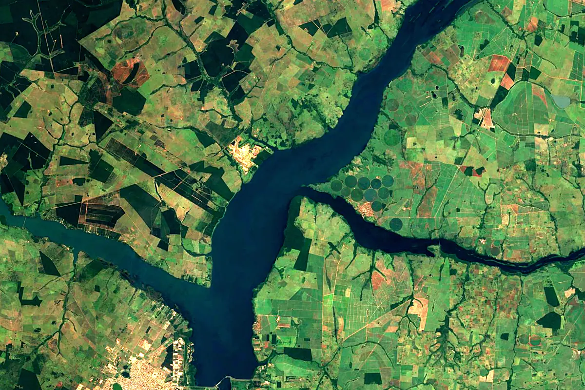
Sentinel-2 cloudless 2016 by EOX IT Services GmbH (contains modified Copernicus Sentinel data 2016), CC BY 4.0. The glowing line is the river as drawn by RiverATLAS.
Photos
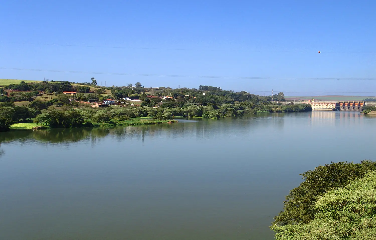
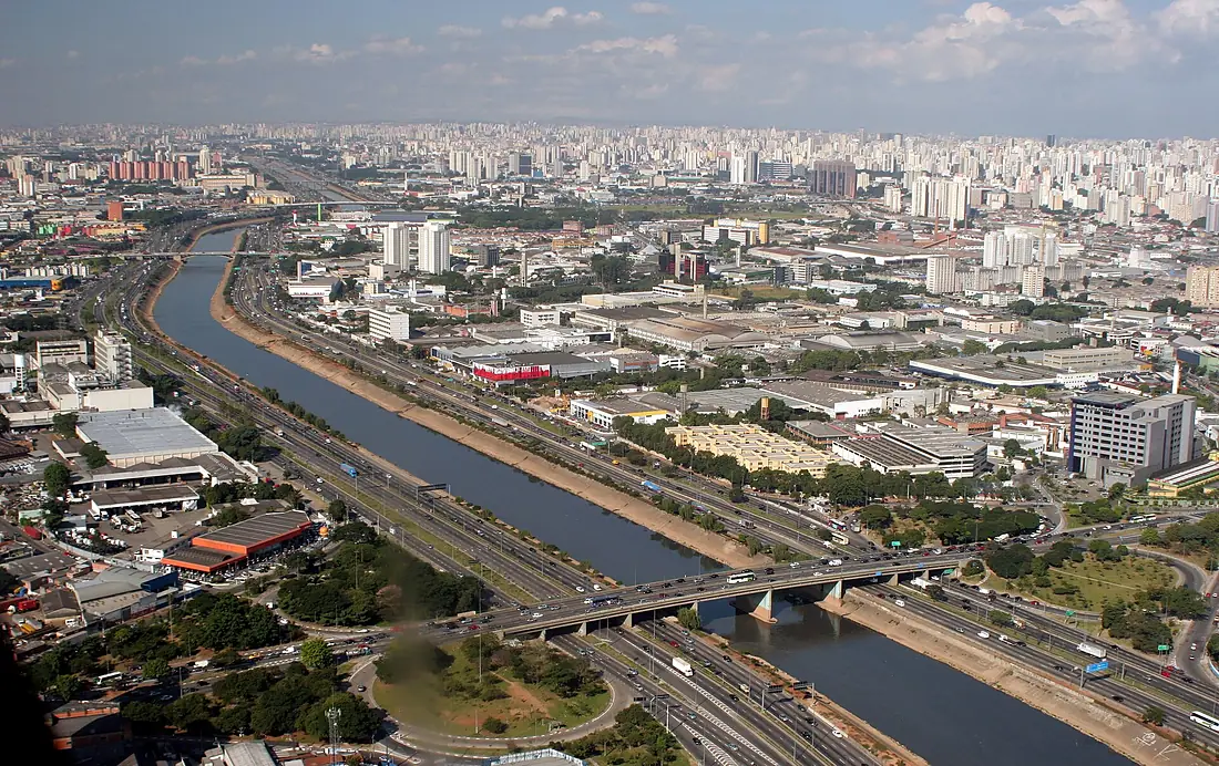
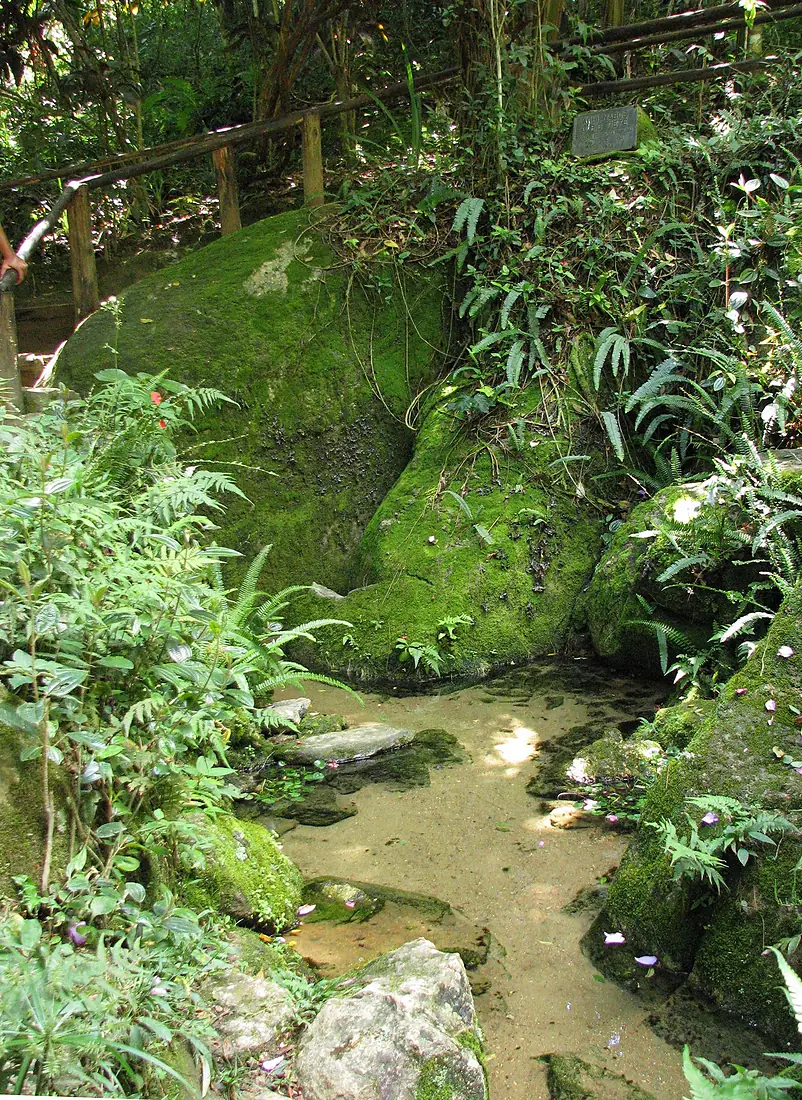
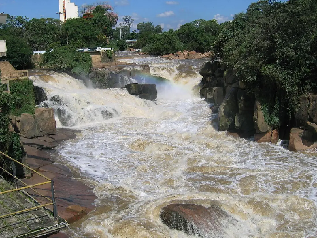
Tietê River in pictures
Tributaries
Where it flows, and what flows into it
It flows into
Paraná River Uruguay4,880 km16,000 m³/s
Tributaries (33)
Also: Pinheiros River, Piracicaba River, Tamanduateí River, Batalha River, Capivari River, Sorocaba River, Dourado River, Jacaré-Guaçu River, Jacaré-Pepira River, Avecuía River, Cotia River, Peixe River, São Lourenço River, Juqueri River, Jaú River, Jundiaí River, Alambari River, Araguá River, Aricanduva River, Cabuçu de Cima River, Claro River, Lençóis River, Ribeirão Barra Mansa, Capivara River
In the same basin
 Argentina2,621 km2.7 m³/sUruguay RiverUruguay1,790 km4.6 m³/sIguazu RiverArgentina1,320 km1,700 m³/sPilcomayo River
 Paraguay1,100 km200 m³/sBermejoParaguay1,060 km340 m³/sGrande RiverBrazil1,090 km2,000 m³/sSalado RiverArgentina1,150 km15 m³/sParanaíba RiverBrazil900 km1,500 m³/sParanapanema RiverBrazil929 km1,200 m³/sApa RiverParaguay380 km130 m³/s
Where these numbers come from
| Name, length, places | Wikidata (Q849539) · CC0 |
|---|---|
| Course, profile, basin | RiverATLAS v1.0 (HydroATLAS, Linke et al. 2019) · CC BY 4.0 — followed along the river network from the point given by Wikidata |
| Flow | WaterGAP (RiverATLAS), 1971–2000 · CC BY 4.0 |
| Climate along the river | WorldClim (RiverATLAS), 1970–2000 · CC BY 4.0 |
| Towns, bridges, dams | Wikidata · CC0; GeoNames · CC BY 4.0 |
| Along the river | © OpenStreetMap contributors · ODbL |
| Images | EOX Sentinel-2 cloudless 2016 · CC BY 4.0; Wikimedia Commons |
| Our other atlases | Cascadyas, Lakeyas — Wikidata · CC0; © OpenStreetMap contributors · ODbL; GeoNames · CC BY 4.0; HydroLAKES · CC BY 4.0; NOAA OISST |
Every source and licence is on the data sources page.
The family
Do you prefer beaches, lakes, mountains, waterfalls, islands, rivers or canyons?
Same idea, other landscapes: field atlases built on open data, month by month, in seven languages.
 beaches
 Find your beach: sea temperature, sun and swimming month by month.Visit lakes
 Every lake on Earth: water temperature, ice, depth and the shore.Coming soonVisit
  mountains
 Every summit in 3D: summit weather, the 0 °C line, huts and trails.Visit waterfalls
 Every waterfall: height, flow month by month and when it roars.Coming soonVisit
  islands
 Every island from the sea up: size, sea temperature, ferries and 3D.Coming soonVisit
  rivers
 Every river from source to sea: the journey, the flow and the basin in numbers.You are here
 canyons
 Every canyon cut to scale: depth to the floor, rim and floor temperatures, trails and viewpoints.Coming soonVisit