River
Svratka
174 km from source to mouth · Czechia.
 CzechiaFlows into Thaya6th longest in Czechia
In numbers
Length
174km
Average flow
27m³/s
Basin
7,113km²
Drop
347m
from 511 m to 164 m
Country
1
The journey
From source to mouth
174 km of river and 68 stops on the way: 40 towns and cities on its banks, dams, bridges and the tributaries that feed it.
- 0 kmSourceat 511 m
- 0 kmČeský Herálec877 people
- 0 kmStone bridge in Herálec
- 17 kmJimramov1,207 people
- 34 kmÚdolní nádrž Vír I1.4 km²
- 36 kmBystřicetributary
- 39 kmVodopád u přehrady Vír 210 m
- 42 kmTresenský potoktributary
- 49 kmUjčovské vodopády2 m
- 51 kmLískovecké vodopády2 m
- 53 kmHodonínkatributary
- 56 kmNedvědice1,330 people
- 58 kmČernvír138 people
- 58 kmwooden bridge over the Svratka river in Černvír
- 63 kmVodopád Křeptovského potoka
- 67 kmBorač349 people
- 69 kmVrbské vodopády4 m
- 71 kmVodopády Kalského potoka2 m
- 72 kmDolní Loućky1,111 people
- 75 kmBesénektributary
- 75 kmNedvědičkatributary
- 75 kmLoučkatributary
- 76 kmPředklášteří1,469 people
- 78 kmTišnov9,270 people
- 85 kmLubětributary
- 91 kmVeverská Bítýška2,842 people
- 99 kmRozdrojovice1,089 people
- 102 kmBrno Reservoir1.3 km²
- 103 kmBrno Dam
- 103 kmKníničky1,066 people
- 104 kmBystrc24,655 people
- 107 kmKomín7,228 people
- 107 kmMedlánky5,195 people
- 107 kmKomín Weir
- 108 kmKrálovo Pole24,212 people
- 108 kmJundrov4,379 people
- 109 kmŽabovřesky19,387 people
- 110 kmKamenný mlýn Weir
- 111 kmKohoutovice11,597 people
- 112 kmNový Lískovec9,622 people
- 113 kmStarý Lískovec11,538 people
- 113 kmBohunice13,671 people
- 115 kmBrno402,739 people
- 115 kmBrno střed86,685 people
- 117 kmČernovice6,692 people
- 118 kmBrno-jih7,594 people
- 122 kmPřízřenice Weir
- 122 kmPonávkatributary
- 124 kmChrlice3,121 people
- 126 kmModřice5,755 people
- 127 kmSvitavatributary
- 128 kmRebešovice1,092 people
- 130 kmRajhradice1,579 people
- 131 kmRajhrad4,113 people
- 132 kmBobravatributary
- 133 kmHolasice1,422 people
- 136 kmBlučina2,040 people
- 137 kmVojkovice1,190 people
- 139 kmŽidlochovice3,676 people
- 139 kmHrušovany u Brna3,545 people
- 139 kmLitavatributary
- 142 kmŽabčice1,664 people
- 145 kmNosislav1,375 people
- 149 kmVelké Němčice1,886 people
- 154 kmUherčice1,120 people
- 158 kmVranovice2,460 people
- 162 kmMiroslavkatributary
- 167 kmMušov Reservoir6.1 km²
- 168 kmJihlavatributary
- 174 kmThayaat 164 m
Water level along the river (RiverATLAS; the height is exaggerated). Towns: GeoNames and Wikidata; bridges, dams and tributaries: Wikidata.
River in Czechia
At the mouth it carries 27 m³/s on average: an Olympic pool every 92 seconds. It drops from 511 m to 164 m, 2.0 m per kilometre on average. Its basin covers 7,113 km², about the size of PS. 1.3 million people live in it. Highest water: from March to May and July; lowest: from January to February. Dams and reservoirs hold back a large share of its water (24% of a year's flow).
Where to start
- BrnoLargest city on its banks · 402,739 people
- Brno-Tuřany Airport (BRQ)Nearest airport with scheduled flights, 8 km from the cityCar hire at BRQ airport (Brno)Discover Cars · Affiliate link↗
- On the water32 ferry piers, marinas, boat rentals and boat ramps along the river (OpenStreetMap)
- Kayak and canoe1 put-ins and rapids mapped (OpenStreetMap)
- From May to SeptemberThe best months to visit
Svratka, month by month
Highest water: from March to May and July
Lowest water: from January to February. Best months to visit: from May to September.
From about 20 m³/s in the lowest month to 130 m³/s in the highest. An estimate: the monthly flow is modelled from the lowest and highest months of WaterGAP (RiverATLAS, 1971–2000) and the rain and snow along the river (WorldClim). Dams change the real rhythm. The chip is the average air temperature; below it, the month's rain.
Plan the trip
Plan the trip: boat trips, a bed by the river, a car
Some links above are affiliate links: if you book through them we may earn a commission, at no extra cost to you. It never changes what the data on this page says.
The basin
Svratka: the basin in numbers
11,740 km² of land send their water to this river. This is what lives on it.
- 1.3millionpeople live in the basin
- 112/km²people per km²
- 436maverage altitude of the basin
- 635mmof rain a year (basin average)
- 7.8°Caverage air temperature
- 6%protected areas
- 0.4%covered by lakes
- 0.4km³held in reservoirs
What covers the basin
- 24% Forest
- 57% Cropland
- 10% Pasture
- 4% Towns and cities
RiverATLAS (HydroATLAS v1.0, CC BY 4.0): land cover, people, protected areas, glaciers and dams over the whole basin upstream of the mouth.
Along the river
Svratka: what you find on the way
- 98WeirsJez Přízřenice, jez and 96 more
- 1Locksstavidlo Jarošovského náhonu
- 10WaterfallsVírský vodopád and 9 more
- 1Rapids
- 11Boat ramps
- 13Ferry piersVeverská Bítýška, Skály, Mečkov and 10 more
- 3Marinas
- 1River beaches
From OpenStreetMap, within 1.8 km of the river. Not mapped is not the same as not there.
Cross-checked with our atlases
Svratka in our other atlases
What our sister atlases know about the waterfalls on this river, the lakes it flows through, the beaches at its mouth, the mountains where it rises and the islands off its mouth.
 6waterfalls on the riverCascadyas
 3lakes on its wayLakeyas
 44mountains at the sourcePeakyas
Waterfalls (6)
On the river, by Cascadyas
- Vodopád u přehrady Vír 2km 2810m
- Ujčovské vodopádykm 362m
- Lískovecké vodopádykm 372m
- Vodopád Křeptovského potokakm 46
- Vrbské vodopádykm 504m
- Vodopády Kalského potokakm 522m
Cascadyas is coming soonOpen Cascadyas ↗
Lakes and reservoirs (3)
Lakes it flows through, by Lakeyas
- Údolní nádrž Vír Ikm 25 · 66 m deep1.4km²
- Brno Reservoirkm 74 · 24 m deep1.3km²
- Mušov Reservoirkm 122 · 4 m deep6.1km²
Lakeyas is coming soonOpen Lakeyas ↗
Mountains at the source (44)
Within 15 km of the source, by Peakyas
- Žákova hora1.5 km away810m
- Bohdalec11 km away801m
- Kopeček7.6 km away822m
- Buchtův Kopec9.9 km away · prominence 124 m813m
- Pohledecká Skála10 km away813m
- Šindelný vrch4.3 km away · prominence 107 m806m
- Křovina Sněžné-Samotín4.2 km away830m
- Křivý javor1.7 km away823m
36 more on PeakyasOpen Peakyas ↗
From space
The source and the mouth, seen from orbit
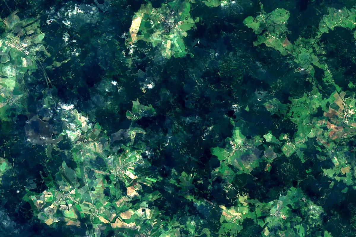
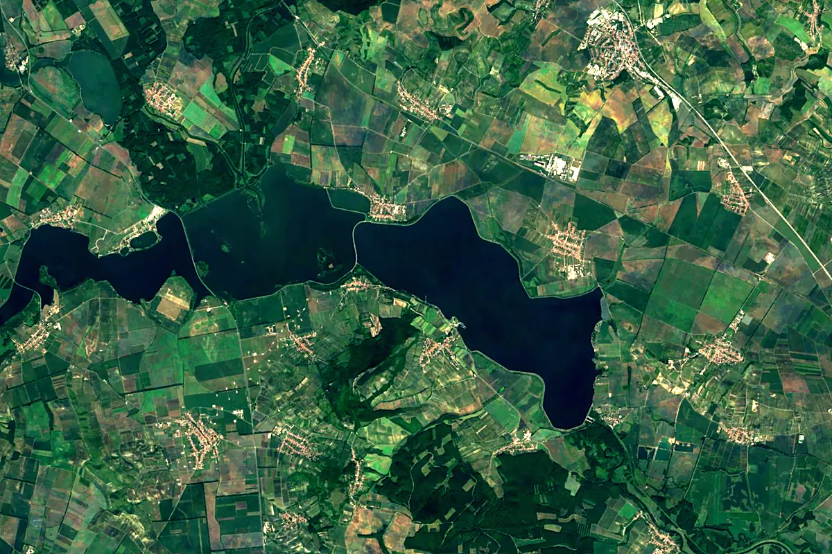
Sentinel-2 cloudless 2016 by EOX IT Services GmbH (contains modified Copernicus Sentinel data 2016), CC BY 4.0. The glowing line is the river as drawn by RiverATLAS.
Photos
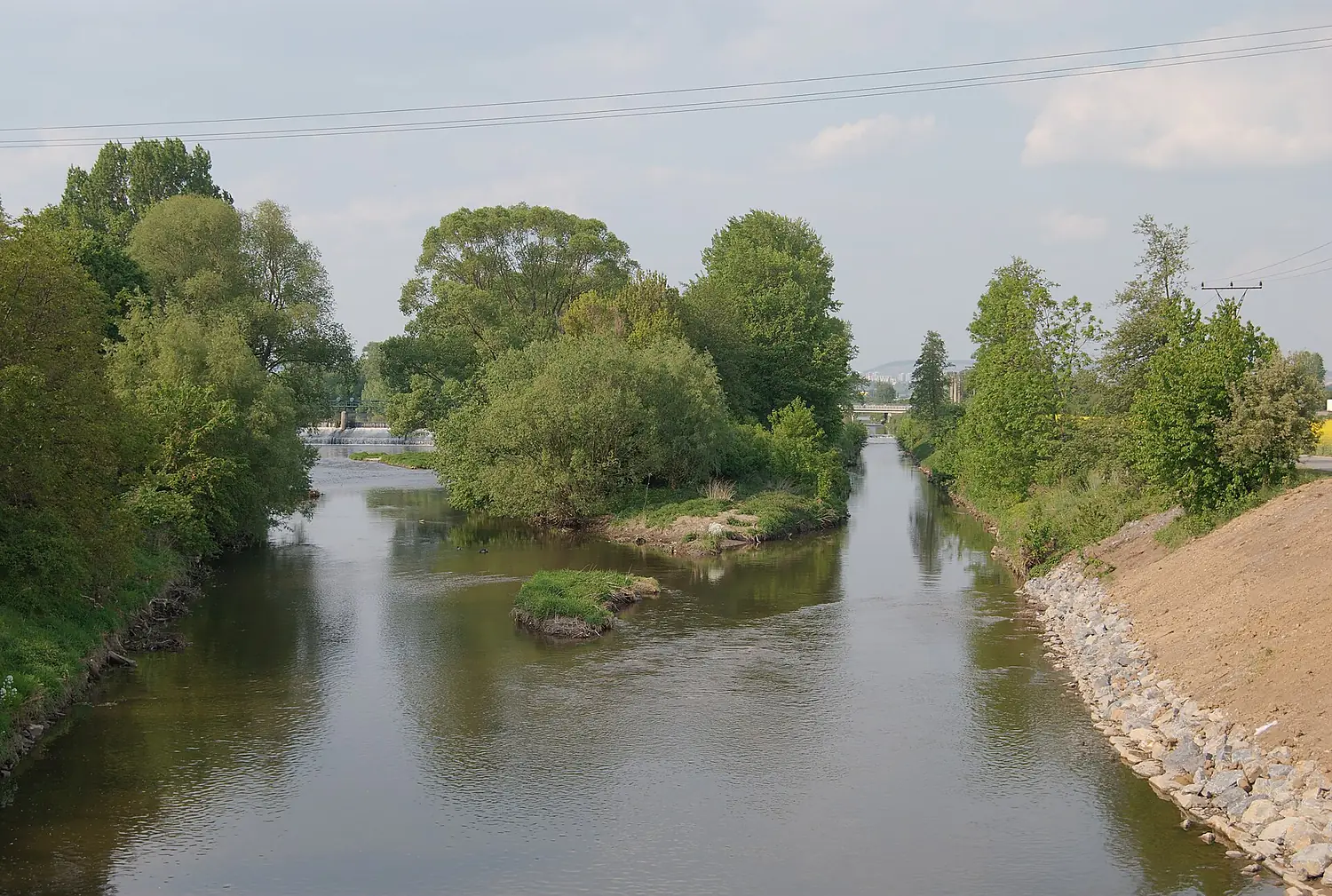
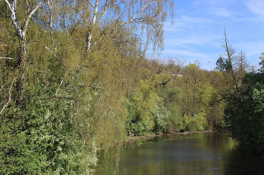
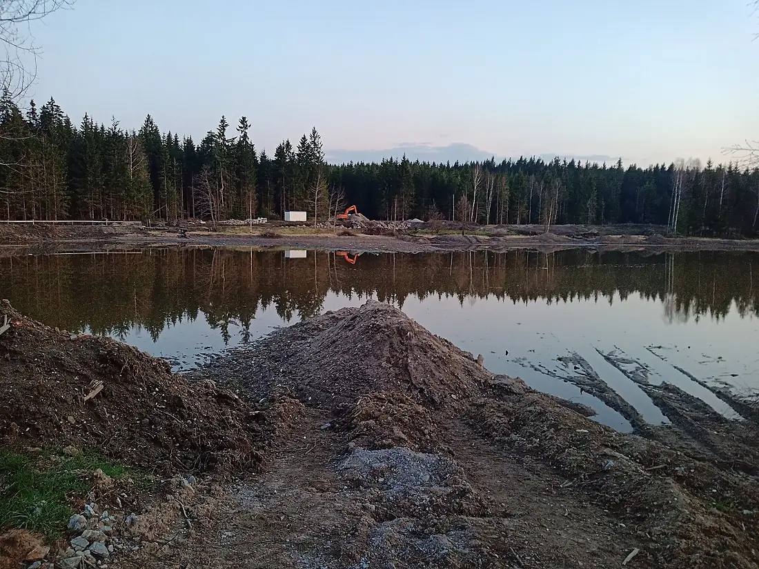
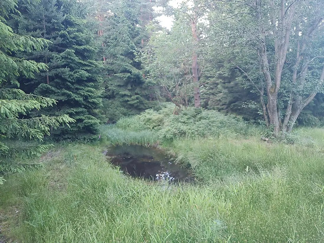
Svratka in pictures
Tributaries
Where it flows, and what flows into it
It flows into
Thaya Austria235 km52 m³/s
Tributaries (21)
Also: Litava, Loučka, Nedvědička, Bobrava, Hodonínka, Fryšávka, Bystřice, Besének, Veverka, Lubě, Tresenský potok, Miroslavka, Ponávka, Šatava, Kohoutovický potok, Vrbovec, Leskava, Ivanovický potok, Kuřimka
 Romania
 Serbia
 Croatia
 Germany
 Moldova
Nearby
Rivers nearby
 Hungary
 Slovakia
Where these numbers come from
| Name, length, places | Wikidata (Q45254) · CC0 |
|---|---|
| Course, profile, basin | RiverATLAS v1.0 (HydroATLAS, Linke et al. 2019) · CC BY 4.0 — followed from the source to the mouth given by Wikidata |
| Flow | WaterGAP (RiverATLAS), 1971–2000 · CC BY 4.0 |
| Climate along the river | WorldClim (RiverATLAS), 1970–2000 · CC BY 4.0 |
| Towns, bridges, dams | Wikidata · CC0; GeoNames · CC BY 4.0 |
| Along the river | © OpenStreetMap contributors · ODbL |
| Images | EOX Sentinel-2 cloudless 2016 · CC BY 4.0; Wikimedia Commons |
| Our other atlases | Cascadyas, Lakeyas, Peakyas — Wikidata · CC0; © OpenStreetMap contributors · ODbL; GeoNames · CC BY 4.0; HydroLAKES · CC BY 4.0; NOAA OISST |
Every source and licence is on the data sources page.
The family
Do you prefer beaches, lakes, mountains, waterfalls, islands, rivers or canyons?
Same idea, other landscapes: field atlases built on open data, month by month, in seven languages.
 beaches
 Find your beach: sea temperature, sun and swimming month by month.Visit lakes
 Every lake on Earth: water temperature, ice, depth and the shore.Coming soonVisit mountains
 Every summit in 3D: summit weather, the 0 °C line, huts and trails.Visit waterfalls
 Every waterfall: height, flow month by month and when it roars.Coming soonVisit
  islands
 Every island from the sea up: size, sea temperature, ferries and 3D.Coming soonVisit
  rivers
 Every river from source to sea: the journey, the flow and the basin in numbers.You are here
 canyons
 Every canyon cut to scale: depth to the floor, rim and floor temperatures, trails and viewpoints.Coming soonVisit