River
Chusovaya
735 km from source to mouth · Russia.
 RussiaFlows into Kama
In numbers
Length
735km
Average flow
220m³/s
Basin
47,600km²
Drop
257m
from 361 m to 104 m
Country
1
The journey
From source to mouth
735 km of river and 37 stops on the way: 3 towns and cities on its banks, dams, bridges and the tributaries that feed it.
- 0 kmBolshoe Chusovskoeat 361 m
- 25 kmZapadnaya Chusovayatributary
- 60 kmRaskuishkatributary
- 78 kmVerkhnemakarovskoye Vodokhranilishche12 km²
- 79 kmKungurkatributary
- 109 kmVolchikhinskoye Vodokhranilishche30 km²
- 113 kmRevda61,785 people
- 127 kmPervouralsk133,600 people
- 139 kmBilimbayevskiy Prud1.1 km²
- 142 kmBilimbaevkatributary
- 152 kmCheremshatributary
- 163 kmBolshoy Shishimtributary
- 197 kmTrekatributary
- 197 kmBolshaya Sibirkatributary
- 215 kmStaroutinsk Reservoir4.3 km²
- 241 kmTavolzhankatributary
- 246 kmNotikhatributary
- 282 kmVolegovkatributary
- 290 kmBolshaya Rechkatributary
- 292 kmSulyomtributary
- 314 kmMezhevaya Utkatributary
- 338 kmKashkatributary
- 338 kmEkvatributary
- 363 kmSerebryankatributary
- 379 kmKyntributary
- 421 kmSylvitsatributary
- 439 kmBolshaya Svadebnayatributary
- 470 kmKumyshtributary
- 487 kmKoyvatributary
- 528 kmChusovoy50,205 people
- 532 kmUsvatributary
- 543 kmLysvatributary
- 649 kmVetlyanatributary
- 680 kmSylvatributary
- 694 kmVasilyevkatributary
- 698 kmChusovskoy Bridge
- 700 kmChusovskoy Railway Bridge
- 703 kmKama Reservoir1,585 km²
- 735 kmKamaat 104 m
Water level along the river (RiverATLAS; the height is exaggerated). Towns: GeoNames and Wikidata; bridges, dams and tributaries: Wikidata.
River in Perm Krai, Chelyabinsk and Sverdlovsk Oblasts, Russia
At the mouth it carries 222 m³/s on average: an Olympic pool every 11 seconds. It drops from 361 m to 104 m, 0.3 m per kilometre on average. Its basin covers 47,600 km², about the size of BT. 1.6 million people live in it. Highest water: from April to June; lowest: from December to March. No large dam holds it back: it is one of the world's free-flowing rivers.
Where to start
- PervouralskLargest city on its banks · 133,600 people
- Koltsovo Airport (SVX)Nearest airport with scheduled flights, 55 km from the city
- On the water19 ferry piers, marinas, boat rentals and boat ramps along the river (OpenStreetMap)
- From June to AugustThe best months to visit
Chusovaya, month by month
Highest water: from April to June
Lowest water: from December to March. Freezing months (average below −4 °C): from November to March. Best months to visit: from June to August.
From about 71 m³/s in the lowest month to 1,600 m³/s in the highest. An estimate: the monthly flow is modelled from the lowest and highest months of WaterGAP (RiverATLAS, 1971–2000) and the rain and snow along the river (WorldClim). Dams change the real rhythm. The chip is the average air temperature; below it, the month's rain.
Plan the trip
Plan the trip: boat trips, a bed by the river, a car
Some links above are affiliate links: if you book through them we may earn a commission, at no extra cost to you. It never changes what the data on this page says.
The basin
Chusovaya: the basin in numbers
46,812 km² of land send their water to this river. This is what lives on it.
- 1.6millionpeople live in the basin
- 36/km²people per km²
- 298maverage altitude of the basin
- 648mmof rain a year (basin average)
- 1.0°Caverage air temperature
- 6%protected areas
- 0.9%covered by lakes
What covers the basin
- 80% Forest
- 14% Cropland
- 4% Pasture
- 1% Towns and cities
RiverATLAS (HydroATLAS v1.0, CC BY 4.0): land cover, people, protected areas, glaciers and dams over the whole basin upstream of the mouth.
Along the river
Chusovaya: what you find on the way
- 11Weirs
- 4Waterfalls
- 1Boat ramps
- 15Ferry piers
- 3Marinas
- 4River beaches
From OpenStreetMap, within 2.2 km of the river. Not mapped is not the same as not there.
Cross-checked with our atlases
Chusovaya in our other atlases
What our sister atlases know about the waterfalls on this river, the lakes it flows through, the beaches at its mouth, the mountains where it rises and the islands off its mouth.
 5lakes on its wayLakeyas
 7mountains at the sourcePeakyas
Lakes and reservoirs (5)
Lakes it flows through, by Lakeyas
- Verkhnemakarovskoye Vodokhranilishchekm 6412km²
- Volchikhinskoye Vodokhranilishchekm 9030km²
- Bilimbayevskiy Prudkm 1141.1km²
- Staroutinsk Reservoirkm 1764.3km²
- Kama Reservoirkm 576 · 29 m deep1,585km²
Lakeyas is coming soonOpen Lakeyas ↗
Mountains at the source (7)
Within 15 km of the source, by Peakyas
- Gora Lysaya4.1 km away486m
- Gora Bol'shoy Kamen'8.0 km away
- Gora Smertel'naya13 km away
- Gora Kruglaya10 km away
- Gora Naporova8.9 km away
- Gora Kozlinaya2.7 km away
- Gora Karabayka7.9 km away
From space
The source and the mouth, seen from orbit
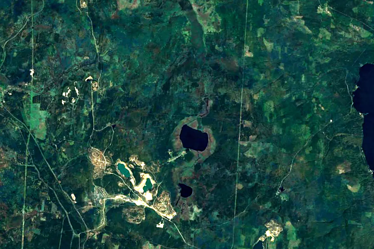
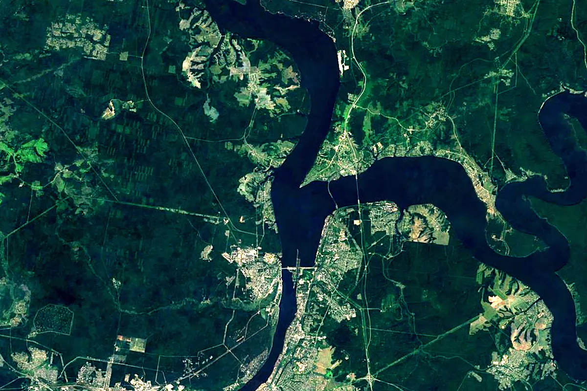
Sentinel-2 cloudless 2016 by EOX IT Services GmbH (contains modified Copernicus Sentinel data 2016), CC BY 4.0. The glowing line is the river as drawn by RiverATLAS.
Photos
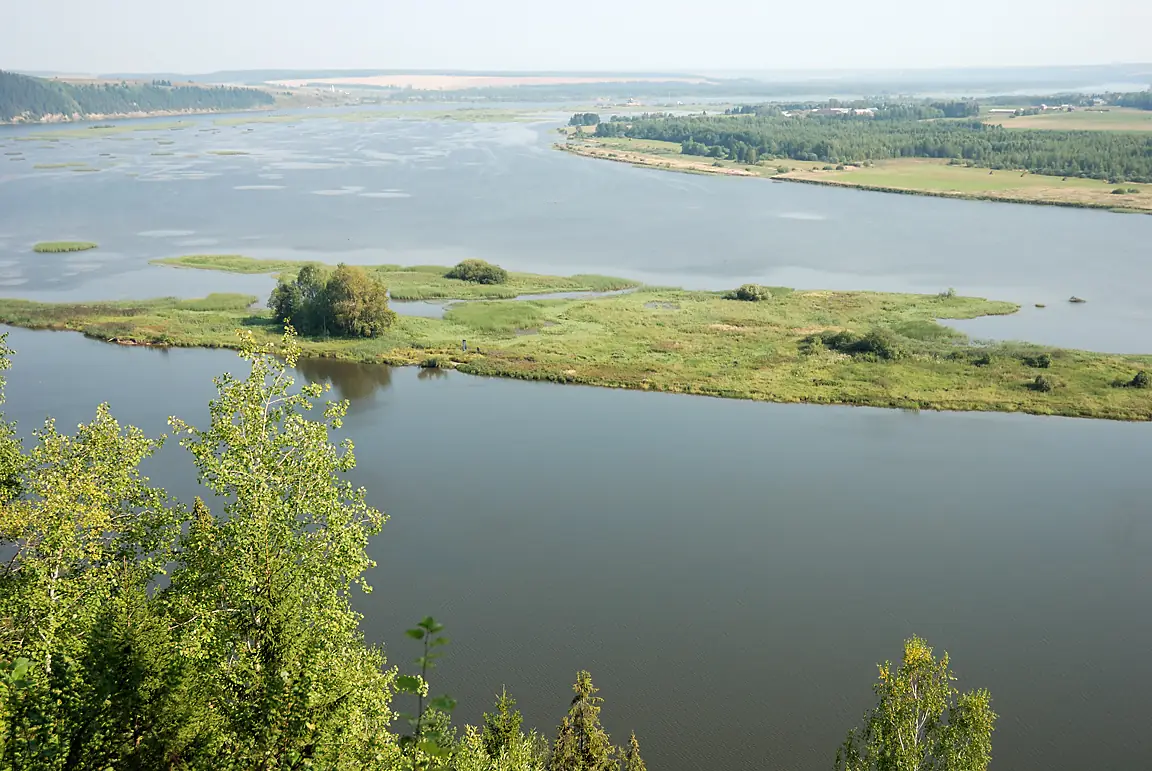
Chusovaya in pictures
Tributaries
Where it flows, and what flows into it
It flows into
KamaRussia1,805 km4,100 m³/sTributaries (58)
Also: Sylva, Serebryanka, Usva, Koyva, Lysva, Severushka, Kyn, Mutnaya River, Sulyom, Bolshoy Shishim, Zapadnaya Chusovaya, Shalashnaya, Vasilyevka, Revda, Notikha, Raskuishka, Volegovka, Ekva, Bolshaya Sibirka, Bitimka, Bilimbaevka, Ponysh, Bolshaya Svadebnaya, Bolshaya Bedka
Where these numbers come from
| Name, length, places | Wikidata (Q756091) · CC0 |
|---|---|
| Course, profile, basin | RiverATLAS v1.0 (HydroATLAS, Linke et al. 2019) · CC BY 4.0 — followed from the source to the mouth given by Wikidata |
| Flow | WaterGAP (RiverATLAS), 1971–2000 · CC BY 4.0 |
| Climate along the river | WorldClim (RiverATLAS), 1970–2000 · CC BY 4.0 |
| Towns, bridges, dams | Wikidata · CC0; GeoNames · CC BY 4.0 |
| Along the river | © OpenStreetMap contributors · ODbL |
| Images | EOX Sentinel-2 cloudless 2016 · CC BY 4.0; Wikimedia Commons |
| Our other atlases | Lakeyas, Peakyas — Wikidata · CC0; © OpenStreetMap contributors · ODbL; GeoNames · CC BY 4.0; HydroLAKES · CC BY 4.0; NOAA OISST |
Every source and licence is on the data sources page.
The family
Do you prefer beaches, lakes, mountains, waterfalls, islands, rivers or canyons?
Same idea, other landscapes: field atlases built on open data, month by month, in seven languages.
 beaches
 Find your beach: sea temperature, sun and swimming month by month.Visit lakes
 Every lake on Earth: water temperature, ice, depth and the shore.Coming soonVisit mountains
 Every summit in 3D: summit weather, the 0 °C line, huts and trails.Visit
  waterfalls
 Every waterfall: height, flow month by month and when it roars.Coming soonVisit
  islands
 Every island from the sea up: size, sea temperature, ferries and 3D.Coming soonVisit
  rivers
 Every river from source to sea: the journey, the flow and the basin in numbers.You are here
 canyons
 Every canyon cut to scale: depth to the floor, rim and floor temperatures, trails and viewpoints.Coming soonVisit