River
Vyatka
1,314 km from source to mouth · Russia.
 RussiaFlows into Kama
In numbers
Length
1,314km
Average flow
890m³/s
Basin
129,000km²
Drop
156m
from 202 m to 46 m
Country
1
The journey
From source to mouth
1,314 km of river and 68 stops on the way: 1 towns and cities on its banks, dams, bridges and the tributaries that feed it.
- 0 kmYarsky Districtat 202 m
- 37 kmOmutnaya Rivertributary
- 43 kmBolshaya Biseratributary
- 46 kmBelayatributary
- 65 kmFilippovkatributary
- 72 kmBolshaya Ozernitsatributary
- 72 kmMedvedevkatributary
- 82 kmTavolzhankatributary
- 89 kmLenevkatributary
- 116 kmBolshaya Lekmatributary
- 130 kmBartyomkatributary
- 162 kmGremyachkatributary
- 185 kmPloskatributary
- 197 kmElgatributary
- 209 kmSumchinatributary
- 213 kmPodrezchikhatributary
- 233 kmBebekhatributary
- 235 kmChyornaya Kholunitsatributary
- 251 kmSolonayatributary
- 276 kmKobratributary
- 298 kmVoblovitsatributary
- 322 kmEfanovkatributary
- 330 kmIvantsovkatributary
- 357 kmOrlovitsatributary
- 362 kmTurunkatributary
- 383 kmOzernitsatributary
- 395 kmLetkatributary
- 411 kmPlesnitsatributary
- 418 kmSverchikhatributary
- 439 kmBelaya Kholunitsatributary
- 443 kmUzhegovitsatributary
- 461 kmPukachtributary
- 465 kmCheptsatributary
- 485 kmBolshaya Prosnitsatributary
- 511 kmNikulinkatributary
- 513 kmKirov507,155 people
- 517 kmSandalovkatributary
- 547 kmLyulchenkatributary
- 547 kmMedyankatributary
- 550 kmChakhlovitsatributary
- 558 kmOzero Berëzovaya Kur'ya1.6 km²
- 561 kmVelikayatributary
- 575 kmBystritsatributary
- 578 kmKhvoshchevitsatributary
- 596 kmZinginkatributary
- 625 kmKholunitsatributary
- 643 kmPogiblitsatributary
- 660 kmMolomatributary
- 699 kmVishkil'tributary
- 712 kmYazilnitsatributary
- 769 kmKishkiltributary
- 786 kmShizhmatributary
- 810 kmPizhmatributary
- 830 kmSuvodtributary
- 837 kmIshetkatributary
- 879 kmBolshaya Sitmatributary
- 912 kmLudyanatributary
- 916 kmBaysatributary
- 921 kmVoyatributary
- 932 kmKaydolotributary
- 936 kmBuytributary
- 939 kmYurtiktributary
- 939 kmOzero Shirokiy Arkul'1.3 km²
- 958 kmTuluzkatributary
- 967 kmUrzhumkatributary
- 976 kmMaziktributary
- 991 kmMaksankatributary
- 1,024 kmOzero Pizh0.3 km²
- 1,059 kmOzero Kur'ya (lanaw sa Rusya, Kirovskaya Oblast', lat 56,63, long 50,68)0.7 km²
- 1,314 kmKamaat 46 m
Water level along the river (RiverATLAS; the height is exaggerated). Towns: GeoNames and Wikidata; bridges, dams and tributaries: Wikidata.
River in Udmurtia, Kirov Oblast, and Tatarstan, Russia
At the mouth it carries 890 m³/s on average: an Olympic pool every 2.8 seconds. It drops from 202 m to 46 m, 0.1 m per kilometre on average. Its basin covers 129,000 km², about the size of NI. 1.9 million people live in it. Highest water, with the snowmelt: from April to July; lowest: from January to March. No large dam holds it back: it is one of the world's free-flowing rivers.
Where to start
- KirovLargest city on its banks · 507,155 people
- Pobedilovo Airport (KVX)Nearest airport with scheduled flights, 21 km from the city
- On the water17 ferry piers, marinas, boat rentals and boat ramps along the river (OpenStreetMap)
- From June to AugustThe best months to visit
Vyatka, month by month
Highest water: from April to July
Lowest water: from January to March. Freezing months (average below −4 °C): from November to March. Melting snow makes up much of its water. Best months to visit: from June to August.
From about 140 m³/s in the lowest month to 3,200 m³/s in the highest. An estimate: the monthly flow is modelled from the lowest and highest months of WaterGAP (RiverATLAS, 1971–2000) and the rain and snow along the river (WorldClim). Dams change the real rhythm. The chip is the average air temperature; below it, the month's rain.
Plan the trip
Plan the trip: boat trips, a bed by the river, a car
Some links above are affiliate links: if you book through them we may earn a commission, at no extra cost to you. It never changes what the data on this page says.
The basin
Vyatka: the basin in numbers
128,694 km² of land send their water to this river. This is what lives on it.
- 1.9millionpeople live in the basin
- 15/km²people per km²
- 165maverage altitude of the basin
- 612mmof rain a year (basin average)
- 2.4°Caverage air temperature
- 2%protected areas
- 0.1%covered by lakes
What covers the basin
- 62% Forest
- 28% Cropland
- 7% Pasture
- 1% Towns and cities
RiverATLAS (HydroATLAS v1.0, CC BY 4.0): land cover, people, protected areas, glaciers and dams over the whole basin upstream of the mouth.
Along the river
Vyatka: what you find on the way
- 4Weirs
- 3Waterfalls
- 10Ferry piers
- 6Marinas
- 7River beaches
From OpenStreetMap, within 2.5 km of the river. Not mapped is not the same as not there.
Cross-checked with our atlases
Vyatka in our other atlases
What our sister atlases know about the waterfalls on this river, the lakes it flows through, the beaches at its mouth, the mountains where it rises and the islands off its mouth.
 4lakes on its wayLakeyas
Lakes and reservoirs (4)
Lakes it flows through, by Lakeyas
- Ozero Berëzovaya Kur'yakm 4941.6km²
- Ozero Shirokiy Arkul'km 8311.3km²
- Ozero Pizhkm 9070.3km²
- Ozero Kur'ya (lanaw sa Rusya, Kirovskaya Oblast', lat 56,63, long 50,68)km 9370.7km²
Lakeyas is coming soonOpen Lakeyas ↗
From space
The source and the mouth, seen from orbit
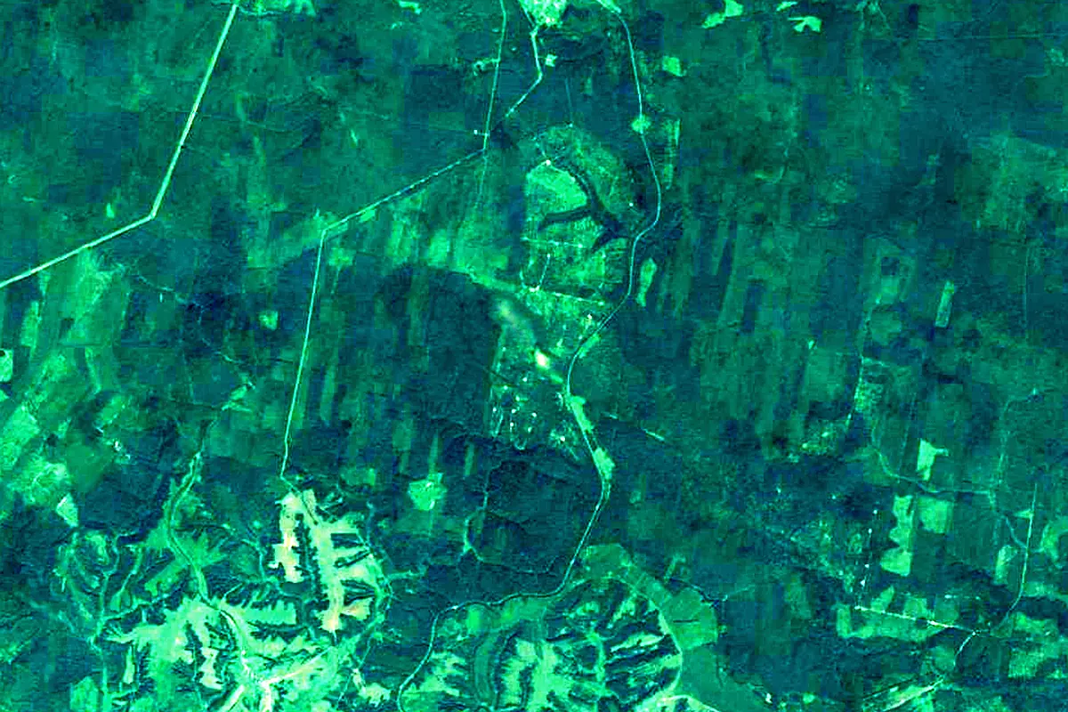
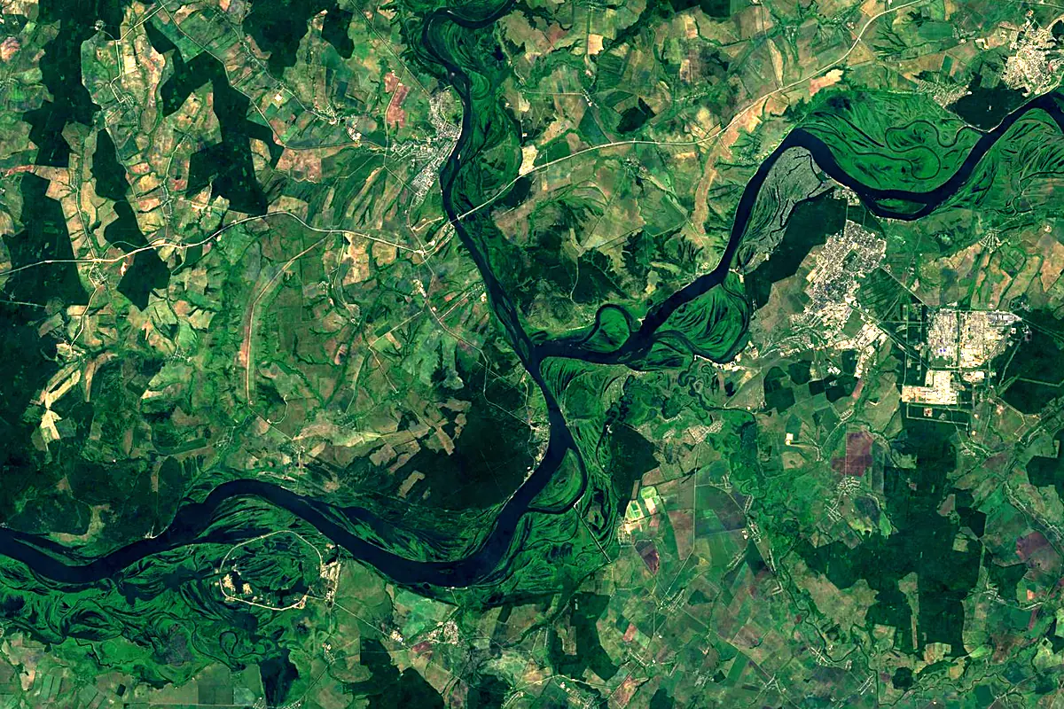
Sentinel-2 cloudless 2016 by EOX IT Services GmbH (contains modified Copernicus Sentinel data 2016), CC BY 4.0. The glowing line is the river as drawn by RiverATLAS.
Photos
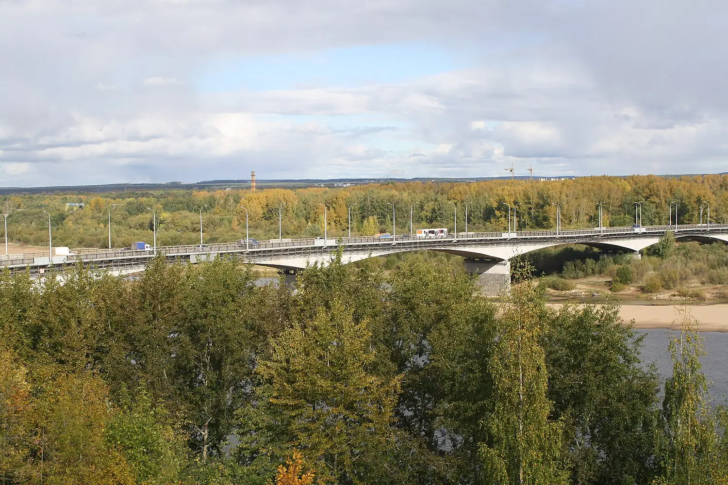
Vyatka in pictures

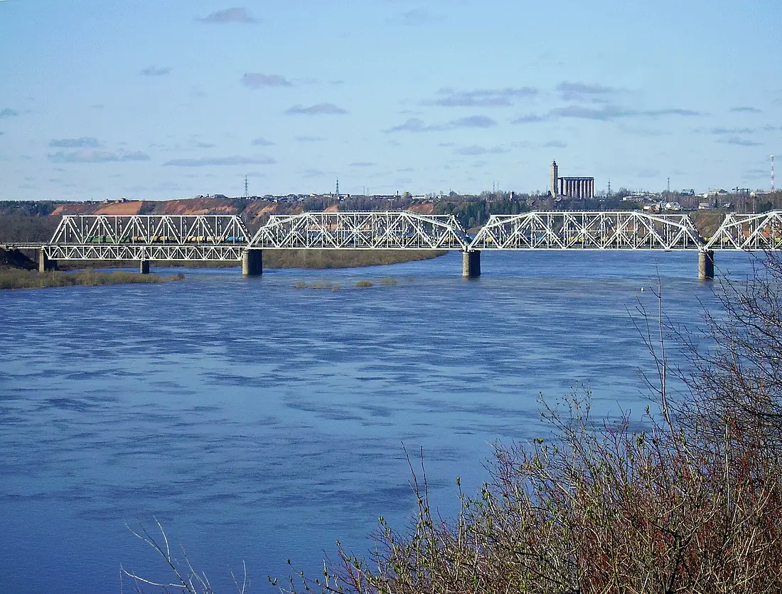
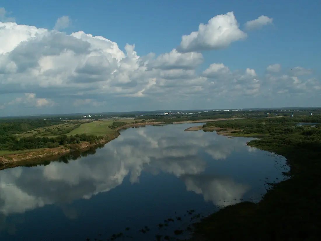
Tributaries
Where it flows, and what flows into it
It flows into
KamaRussia1,805 km4,100 m³/sTributaries (137)
Also: Kilmez, Pizhma, Moloma, Kobra, Belaya Kholunitsa, Letka, Voya, Shoshma, Urzhumka, Burets, Strugovaya, Pyzhman River, Omutnaya River, Yazilnitsa, Kholunitsa, Kishkil, Voblovitsa, Baysa, Uzhegovitsa, Oshtorma, Bebekha, Suvod, Burtechka, Ishetka
Nearby
Rivers nearby
Where these numbers come from
| Name, length, places | Wikidata (Q192495) · CC0 |
|---|---|
| Course, profile, basin | RiverATLAS v1.0 (HydroATLAS, Linke et al. 2019) · CC BY 4.0 — followed from the source to the mouth given by Wikidata |
| Flow | WaterGAP (RiverATLAS), 1971–2000 · CC BY 4.0 |
| Climate along the river | WorldClim (RiverATLAS), 1970–2000 · CC BY 4.0 |
| Towns, bridges, dams | Wikidata · CC0; GeoNames · CC BY 4.0 |
| Along the river | © OpenStreetMap contributors · ODbL |
| Images | EOX Sentinel-2 cloudless 2016 · CC BY 4.0; Wikimedia Commons |
| Our other atlases | Lakeyas — Wikidata · CC0; © OpenStreetMap contributors · ODbL; GeoNames · CC BY 4.0; HydroLAKES · CC BY 4.0; NOAA OISST |
Every source and licence is on the data sources page.
The family
Do you prefer beaches, lakes, mountains, waterfalls, islands, rivers or canyons?
Same idea, other landscapes: field atlases built on open data, month by month, in seven languages.
 beaches
 Find your beach: sea temperature, sun and swimming month by month.Visit lakes
 Every lake on Earth: water temperature, ice, depth and the shore.Coming soonVisit
  mountains
 Every summit in 3D: summit weather, the 0 °C line, huts and trails.Visit
  waterfalls
 Every waterfall: height, flow month by month and when it roars.Coming soonVisit
  islands
 Every island from the sea up: size, sea temperature, ferries and 3D.Coming soonVisit
  rivers
 Every river from source to sea: the journey, the flow and the basin in numbers.You are here
 canyons
 Every canyon cut to scale: depth to the floor, rim and floor temperatures, trails and viewpoints.Coming soonVisit