River
Iza River
80 km from source to mouth · Romania.
 RomaniaFlows into Tisza
In numbers
Length
80km
Average flow
17m³/s
Basin
1,293km²
Drop
274m
from 531 m to 257 m
Country
1
The journey
From source to mouth
80 km of river and 24 stops on the way: 22 towns and cities on its banks, dams, bridges and the tributaries that feed it.
- 0 kmSourceat 531 m
- 0 kmMoisei8,877 people
- 11 kmVişeu de Sus15,349 people
- 13 kmVișeu de Mijloc3,223 people
- 17 kmVişeu de Jos5,201 people
- 28 kmRuscova5,183 people
- 31 kmLeordina2,537 people
- 36 kmCrasna Vișeului2,011 people
- 37 kmPetrova2,664 people
- 41 kmBistra4,330 people
- 48 kmValea Vișeului1,754 people
- 54 kmPolonsko-Kuziiskyi Waterfall2 m
- 58 kmLuh1,985 people
- 59 kmLunca la Tisa1,030 people
- 62 kmBocicoiu Mare4,400 people
- 63 kmVelykyy Bychkiv9,255 people
- 65 kmCrăciunești1,525 people
- 69 kmTisa1,322 people
- 70 kmMara Rivertributary
- 75 kmBila Tserkva3,024 people
- 76 kmSolotvyno8,632 people
- 77 kmVadu Izei2,794 people
- 77 kmSighetu Marmaţiei40,653 people
- 79 kmIapa1,600 people
- 80 kmSarasău2,444 people
- 80 kmTiszaat 257 m
Water level along the river (RiverATLAS; the height is exaggerated). Towns: GeoNames and Wikidata; bridges, dams and tributaries: Wikidata.
Tributary of the Tisa River in Romania
At the mouth it carries 17 m³/s on average: an Olympic pool every 151 seconds. It drops from 531 m to 257 m, 3.4 m per kilometre on average. Its basin covers 1,293 km², about the size of MQ. 251,000 people live in it. Highest water: March; lowest: from December to February and October. No large dam holds it back: it is one of the world's free-flowing rivers.
Where to start
- Sighetu MarmaţieiLargest city on its banks · 40,653 people
- Maramureș International Airport (BAY)Nearest airport with scheduled flights, 44 km from the cityCar hire at IFO airport (Ivano-Frankivsk)Discover Cars · Affiliate link↗
- From May to SeptemberThe best months to visit
Iza River, month by month
Highest water: March
Lowest water: from December to February and October. Freezing months (average below −4 °C): January. Best months to visit: from May to September.
From about 18 m³/s in the lowest month to 260 m³/s in the highest. An estimate: the monthly flow is modelled from the lowest and highest months of WaterGAP (RiverATLAS, 1971–2000) and the rain and snow along the river (WorldClim). Dams change the real rhythm. The chip is the average air temperature; below it, the month's rain.
Plan the trip
Plan the trip: boat trips, a bed by the river, a car
Some links above are affiliate links: if you book through them we may earn a commission, at no extra cost to you. It never changes what the data on this page says.
The basin
Iza River: the basin in numbers
4,670 km² of land send their water to this river. This is what lives on it.
- 251,000people live in the basin
- 54/km²people per km²
- 903maverage altitude of the basin
- 815mmof rain a year (basin average)
- 5.7°Caverage air temperature
- 36%protected areas
What covers the basin
- 91% Forest
- 4% Cropland
- 25% Pasture
- 3% Towns and cities
RiverATLAS (HydroATLAS v1.0, CC BY 4.0): land cover, people, protected areas, glaciers and dams over the whole basin upstream of the mouth.
Along the river
Iza River: what you find on the way
- 2Waterfalls
From OpenStreetMap, within 1.6 km of the river. Not mapped is not the same as not there.
Cross-checked with our atlases
Iza River in our other atlases
What our sister atlases know about the waterfalls on this river, the lakes it flows through, the beaches at its mouth, the mountains where it rises and the islands off its mouth.
 1waterfall on the riverCascadyas
 4mountains at the sourcePeakyas
Waterfalls (1)
On the river, by Cascadyas
- Polonsko-Kuziiskyi Waterfallkm 522m
Cascadyas is coming soonOpen Cascadyas ↗
Mountains at the source (4)
Within 15 km of the source, by Peakyas
- Pietrosul Rodnei14 km away2,303m
- Rebra15 km away2,104m
- Buhăescu Mare15 km away2,059m
- Pietrosul14 km away
From space
The source and the mouth, seen from orbit
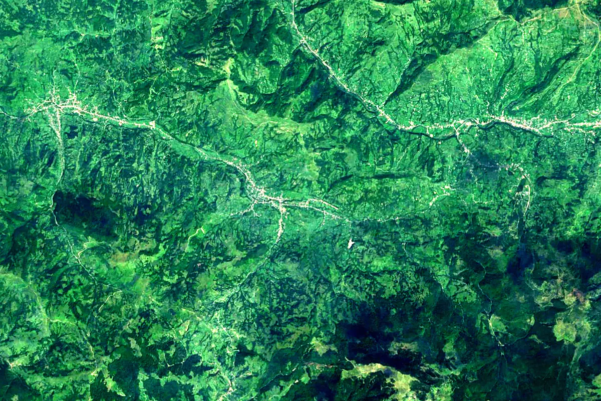
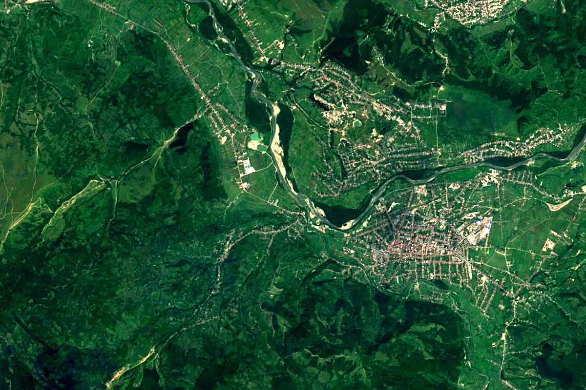
Sentinel-2 cloudless 2016 by EOX IT Services GmbH (contains modified Copernicus Sentinel data 2016), CC BY 4.0. The glowing line is the river as drawn by RiverATLAS.
Photos
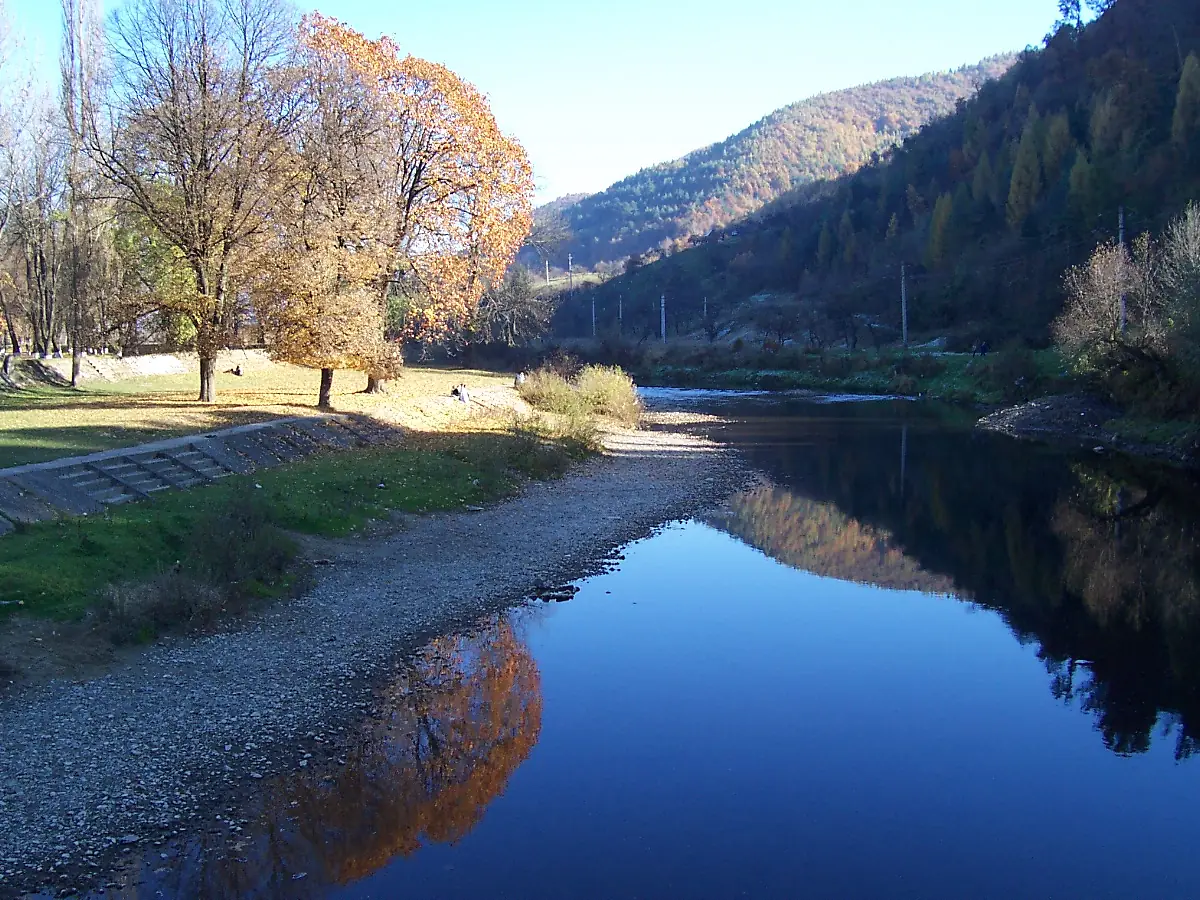
Iza River in pictures
Tributaries
Where it flows, and what flows into it
It flows into
Tisza Serbia966 km800 m³/s
Tributaries (18)
Also: Mara River, Bistrița River, Baicu River, Băleasa River, Șieu River, Ronișoara River, Șugău River, Ieud River, Râul Satului, Râul Vălenilor, Salta River, Slătioara River, Valea Caselor River, Valea Iepii, Valea Morii River, Valea Muntelui River, Râul Porcului, Valea Carelor River
 Croatia
 Germany
 Moldova
 Austria
Nearby
Rivers nearby
 Hungary418 km120 m³/s114 km awaySomeșul MicRomania80 km21 m³/s89 km awayUzh River
 Slovakia127 km33 m³/s156 km awayCheremosh River
 Ukraine80 km27 m³/s141 km awayLatoricaSlovakia182 km37 m³/s161 km awayLaborecSlovakia129 km540 m³/s161 km awayStryi RiverUkraine232 km45 m³/s162 km awayOndavaSlovakia146 km21 m³/s161 km away
Where these numbers come from
| Name, length, places | Wikidata (Q786845) · CC0 |
|---|---|
| Course, profile, basin | RiverATLAS v1.0 (HydroATLAS, Linke et al. 2019) · CC BY 4.0 — followed from the source to the mouth given by Wikidata |
| Flow | WaterGAP (RiverATLAS), 1971–2000 · CC BY 4.0 |
| Climate along the river | WorldClim (RiverATLAS), 1970–2000 · CC BY 4.0 |
| Towns, bridges, dams | Wikidata · CC0; GeoNames · CC BY 4.0 |
| Along the river | © OpenStreetMap contributors · ODbL |
| Images | EOX Sentinel-2 cloudless 2016 · CC BY 4.0; Wikimedia Commons |
| Our other atlases | Cascadyas, Peakyas — Wikidata · CC0; © OpenStreetMap contributors · ODbL; GeoNames · CC BY 4.0; HydroLAKES · CC BY 4.0; NOAA OISST |
Every source and licence is on the data sources page.
The family
Do you prefer beaches, lakes, mountains, waterfalls, islands, rivers or canyons?
Same idea, other landscapes: field atlases built on open data, month by month, in seven languages.
 beaches
 Find your beach: sea temperature, sun and swimming month by month.Visit
  lakes
lakes Every lake on Earth: water temperature, ice, depth and the shore.Coming soonVisit mountains
 Every summit in 3D: summit weather, the 0 °C line, huts and trails.Visit waterfalls
 Every waterfall: height, flow month by month and when it roars.Coming soonVisit
  islands
 Every island from the sea up: size, sea temperature, ferries and 3D.Coming soonVisit
  rivers
 Every river from source to sea: the journey, the flow and the basin in numbers.You are here
 canyons
 Every canyon cut to scale: depth to the floor, rim and floor temperatures, trails and viewpoints.Coming soonVisit